| Report Type | Full |
| Peak(s) |
Peak Seven - 13,682 feet Peak Six - 13,712 feet Peak Five - 13,291 feet Peak Four - 13,415 feet The Heisspitz - 13,268 feet Graystone Peak - 13,503 feet Peak Eight - 13,252 feet Storm King Peak - 13,753 feet Peak One - 13,599 feet Peak Nine - 13,404 feet |
| Date Posted | 09/14/2023 |
| Date Climbed | 09/01/2023 |
| Author | k_fergie |
| Additional Members | Sbenfield |
| Counting Our Way Through the Wemi |
|---|
|
Balsam Beatdown: 08/31/2023 - 09/04/2023 After climbing Peak Two and Peak Three from Elk Creek with my dad and Justin (thatOneMonoskier) on a "rest" day during my Colorado Trail thru hike with Dad, I decided that another trip to the Wemi was a necessity. And ASAP. Fortunately, we smashed the CT way faster than I thought we would, and I was able to reclaim some time off work, so Steve and I began plans for a Labor Day weekend trip. Steve and I have recently been scoping out peaks on the "Least Climbed" and "Lowest" 13er lists, so we settled on hitting a bunch of peaks out of the Tenmile/Noname dividing ridge via a basecamp of Balsam Lake. Balsam Lake seemed like a good base camp to hit these seldom climbed peaks, but to also throw in some other interesting ones like Nine, Eight, and some bicents as well. I did very little research, so definitely could've missed stuff, but I didn't find too many TRs of people camping at Balsam for these ones. I've been wanting to check the area out for a while and settled on just figuring out the logistics on-site. Plan set. Get to Balsam Lake, figure things out from there with no phone service. Great plan, the best of plans, I've been told that everyone wishes they made such good plans like me, so many details, everyone loves the plan. How hard could it be? Foreshadowing... Steve is much more responsible in doing his research and pulled some GPX tracks for us (the John Kirk and Nephi tracks from LoJ) to supplement my hastily hand drawn lines that we had no idea if they'd go or not. For that, I am thankful. 
We elected for the Beartown approach over coming in from Molas via Vestal/Trinity pass or something even more arduous like shwacking up Tenmile, Noname, or Ruby from the Animas. I have relayed my two experiences on the Beartown road into this thread. But in general, its really not that difficult of a TH drive if you're okay doing ~0.75 - 1.25 mi of road walking and a 2-hr drive each way from Silverton, just long and tedious; 3/6 difficulty by this site's road grading system to ~11.2k on the Beartown road. A single 4/6 obstacle to get to ~11.3k where I have parked twice. Solid 5/6 to get all the way to Hunchback Pass TH. We were planning on 4 nights/5 days, taking the leading Th/F off from work before the long Labor Day weekend with up to ~14 peaks in our sights. The weather forecast was not looking great for the whole trip, but not too bad either. Mountain forecast (optimistic) was calling for just rain most of the day Sat and Sun. Weather.gov (pessimistic) was calling for a monsoon push with rain, snow, and lightning Fri-Mon. Ehh, we'll see how it goes. 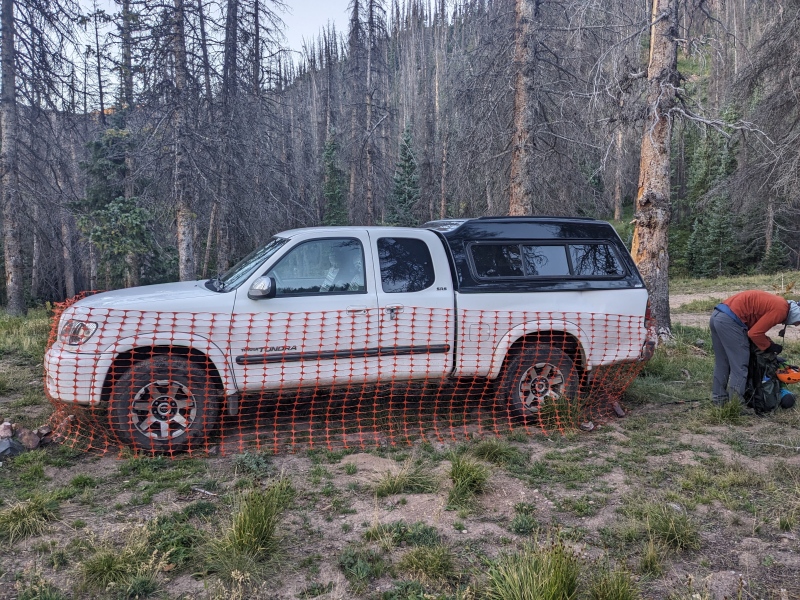
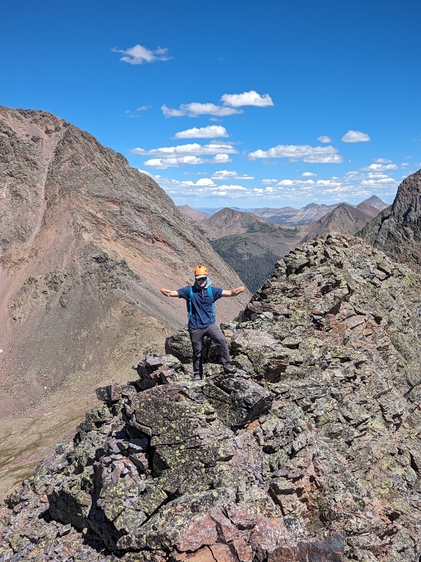
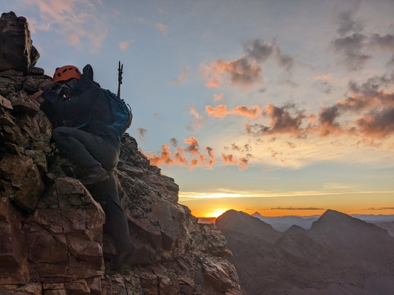
Day 1: Pack in and Bonus With significant motivation and heavy packs, we left Silverton around 4:20am Thursday, reached my parking spot at ~11.3k on the Beartown road around 6:20am, and set off for Hunchback pass via the CDT. The trail is nice and goes smoothly. Soon enough, we reached the area to turn off to head up Stormy Gulch. We had heard of there being a climbers trail up this on the north side of Trinity creek, but never really found much. Game trails led us too high up the hillside on the north side of Trinity creek. Heading back down to the creek never yielded much. Either way, the bushwhack was not too bad. In the common camping meadow, we found two backpacks hanging in a tree, no people. Odd. We continued up to Silex Lake via the steep headwall. From there, talus hopping brought us up to the Eight/Storm King saddle around noon. With today being the predicted best weather day of the trip, we elected to begin with some appetizer bonus peaks. Leaving packs at the pass, we made quick work of Storm King Peak. There was a surprisingly good trail up half of the ridge. Once entering the gully, the suckfest began. Nasty loose rock made for some good swimming up to the ridge where the rock improved for a short scramble to the summit. Nothing like some freestyle mountain swimming. Meh climb, great views, but hell, its there, gotta climb it. The exposure on the north side is impressive. A near-vertical 2k foot cliff down to Trinity lake. 

With a desire for something better, we set our sights on Peak Eight, a newly LiDAR minted peak, upgraded from soft-ranked, just across the way. At the pass we ran into a group of four backpackers, our only other encounter until the pack-out. Balsam seems much less visited than the Vestal basin to the north and the Ruby/Noname ones to the south. The little gully to ridge climb looked much better than Storm King. It was. An excellent class three climb up the climber's right side of the gully led to an even better class three jaunt west across the ridge to the summit. The gully would've gone at loose class 2, much less preferable. The drop-offs on either side were steep, so the ridge was fun and airy. Neither SK or Eight had a register. From up on Eight and Storm King, we plotted our hitlist for the next couple days. Can't beat the views from the Grenadiers. 
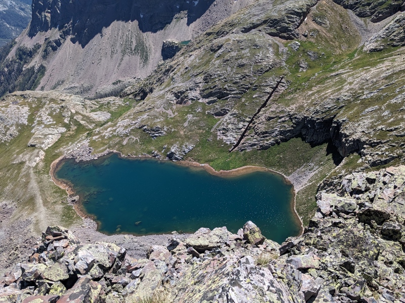
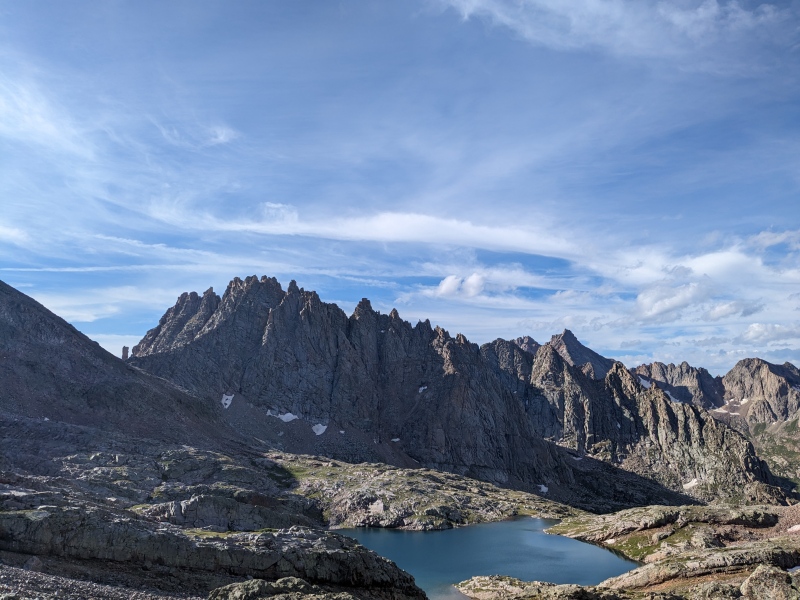
We headed back down to our packs at the SK/Eight saddle and then made our way towards Balsam. Coming down the last steep headwall, we finally found a climbers trail on the north side of the creek, this was a lifesaver. We set up camp at a nice little spot near the inflow, next to a cascading slab waterfall into Balsam Lake. The lake is extremely blue, even more than many of the others in the Wemi, but not quite as blue as Ice Lake, breathtaking up close. I'm glad we selected this spot as a basecamp. I had not done any tarp camping in quite some time and I was excited to give it a go on this trip, and it worked great. My dad took the ultralight tent after the CT since he is looking to hit some PCT sections soon. My other tents are very heavy (car camp + 4-season) and I was not too inclined to carry either on this trip. 

Day 1 ended up being about 13mi, 5.1k ascent, 4.9k descent. Day 2: Seven, Six, Five, Four, The Heisspitz This string of peaks is what we came for. Four, Five, and The Heisspitz are some of the least climbed 13ers in Colorado, all with less than 50 recorded ascents on this site and 70 on LoJ. We were determined to get them all, even if it took all 5 days. Fortunately, we got them all today, here's how it went. Our plan was to get up giga early and top out on Peak Seven at sunrise, then play the weather by eye from there. Yesterday, we spotted a nice gully leading up to Seven's north ridge from the Eight-Seven lake and decided that was the best way to get there. We left camp, marched back up the drainage, and filled up on water at the outflow waterfall coming from the Eight-Seven lake. I was really feeling like crap in the morning. The early starts with a jump in sleep altitude have really been dragging me down the past couple of years (open to recs. I did just fine on the CT likely because changes in sleep elevation were gradual over those three weeks. And we slept in most days). At the top of the gully when we gained the north ridge of Seven, we took a little breather because it was still dark. I recall telling Steve something along the lines of "50-50 on whether I puke, but guaranteed I'm getting to the top." Basically as I said that, a morning cloud began raining in the Balsam drainage and giving the Western Grenadiers a nice little shower. We also got brushed by the side of the mini storm, getting hit with a touch of rain and a few bits of graupel. Great, things aren't looking good for the giga day we planned on attempting. 
Nevertheless, the north ridge of Seven looked super fun with its stacked slabs and magnificent quartzite. With a little more light from the sunrise coming, we set off and enjoyed some great class 2+ and class 3 scrambling for 600 vert to the summit. Good thing the climbing was enjoyable, if it was slippery, shifty talus, I was definitely gonna lose my breakfast. 
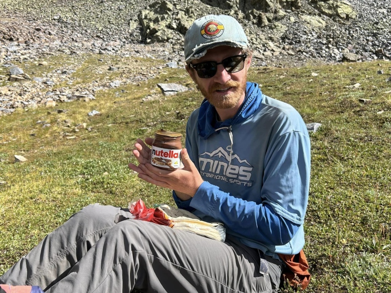
Sunrise splashed over RGP and The Guardian shortly after we left Seven's summit, and some of the early morning clouds were beginning to clear, things were looking up. Steve had done some research and indicated that my plan, or lack thereof, of going ridge direct would be a little spicy and that other parties have dropped to either the Leviathan or Balsam sides to bypass some cruxy ridge climbing. Sounds good to me, my stomach needs much less spice, in fact, no spice, negative spice plz, given its current state. We went down to the Six/Seven saddle and dropped to the north down a supremely loose gully until we hit a supremely loose bench of scralus that would rise back up underneath Six's summit. We roughly followed the Kirk GPX from LoJ. This was heinous, but it certainly worked fine and was not difficult per se, just tedious. The ridge above us was definitely full of towers and extremely exposed climbing. Soon enough, we were back on the ridge proper and most of the way to Six. With some awake time and a little sunshine, I was feeling much better. The wispier, friendly morning clouds were continuing on their way out, and we could both sense the weather window was going to allow for continued passage. There were some more fluffly clouds slowly building in the distance, but we had a solid amount of time. On Six, we decided that Five and likely Four would be doable before weather returned. It was time to punch it. From here on out, I took basically no pictures. Side note, this talus/scree/scralus stuff really was tedious, slow, and demoralizing. It was chunky, bigger (baseball to small watermelon sized) blocks more like talus. Good enough to really bite your ankles like a little pesky chihuahua. But, it all moved like scree; you plunged in and "2-steps up, 1-step back" through it like scree. Scree surfing through a sea of piranhas. The worst of both worlds. Nice stuff, 10/10, thx. 
With the incredibly crappy scralus we encountered dropping low between Six and Seven, I took the reigns and voted for a ridge-direct, economy class, non-stop flight over to Five. This worked out well, the ridge from Six to Five was generally excellent class 2/3 movement and we made great time to Five. 

Feeling full of myself, having selected a good way between Six and Five with no prior research, I decided to that we should double-down and go ridge direct from Five to the Five/Four saddle. This was a mistake. We made our way steeply (right off the bat) down the NW ridge of Five, with extreme exposure to descender's right/NE and quickly encountered some difficult 4th/low 5th class downclimbing. It was a series of ledges along the W face, minorly inset like a gully. It was hard to tell where we were exactly, but each tricky downclimb was getting us closer to easier terrain that was visible below. It was steep enough that my phone's GPS was very inaccurate and no help at all for the micro-terrain. We cautiously made it through a handful of pitches of this, but we got stopped by a particularly tricky 15 foot pitch. I could tell that we were at the last pitch of class 5 before hitting easier terrain, but it was a particularly spicy one that would likely involve some overhang on the downclimb due to a bulge. What to do? We were so close, but a fall here would be very problematic to say the least. Weather was also beginning to build and we really want to get to the Heisspitz. It was a difficult decision, but Steve made the right call that we needed to climb back up to easier terrain and find another way through these cliff bands. Even the Nephi squad (the only GPX track we had for this area) completely bypassed all of the north/west side of Five, by a very wide margin. We climbed back up a hundred or so feet and I spied a more friendly looking ledge system heading southwest, splitting the difference between our failed descent and the Nephi track that went way far out of the way. I went to go check it out, and this one went with only one class 4/4+ downclimb, although I still had to make my way basically to flat ground to be sure, the terrain here was challenging to route-find through. Thank goodness. I'm glad Steve has a level head and that we were getting out of there and onwards. The rest of the climb to Four was pretty uneventful. Some scralus, some good scrambling, you know the deal. 
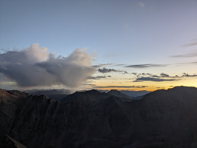
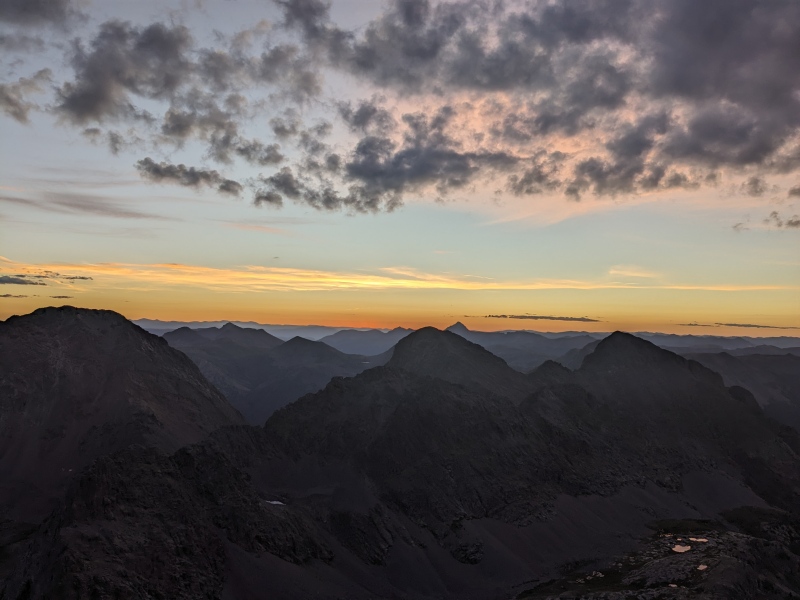
Definitely more clouds were building up by now due to my route-finding delays. It was pretty clear that we were going to at least get threatened by some rain later in the day, but it was not yet imminent. We pushed on to The Heisspitz, ol' Heissy, determined to finish off the whole dividing ridge. The Heisspitz has two summits that are nearly identical in elevation. The climbing to the first (eastern-most) one from Four was great class 2/3/optional 4. It was not known to us at the time, but this one has been deemed 1 foot higher than the NW one by LiDAR. The 14ers.com pre-LiDAR one was previously accepted as higher by a foot or two. LoJ (and I) recommends climbing both because they are very close and both have summit cairns to potentially interfere with the LiDAR. Both have registers. Getting from the SE summit to the NW one was properly tricky, at least the way we did it. Getting there involved a stiff section of class 4/low 5 with some hefty exposure, more or less taking ridge direct. On our way back, we thought we could maybe travel lower on the Noname side and avoid the sketchy downclimb that we would have to do because we climbed up it. It was a doable downclimb we knew we could do if we had to, but I was still somewhat shell-shocked from our Downclimb Adventure on Five, so we looked for an alternative the the Nephi track went towards. We were able to successfully avoid our crux section, but couldn't traverse around the cliffs as far as we wanted, without dropping pretty far off the ridge into the Noname side. We spied a reasonable looking upclimb back to the ridge that if we could get to, knew was good class 3 the rest of the way along the ridge. We walked up to this 15 foot section and I started making my way up. It was trickier than expected, an awkward left leaning off-width crack that was not super deep and opening-flared. With some gusto (and tasteful swearing), we topped out and made our way over the SE summit and towards the Heissy/Four saddle, our drop point back to the Balsam/Tenmile drainage, elated to have ran the whole ridgeline today. 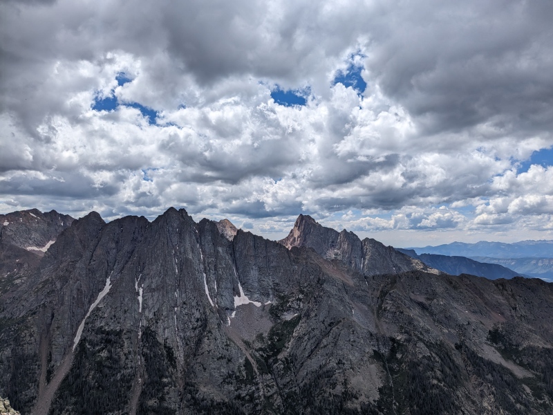
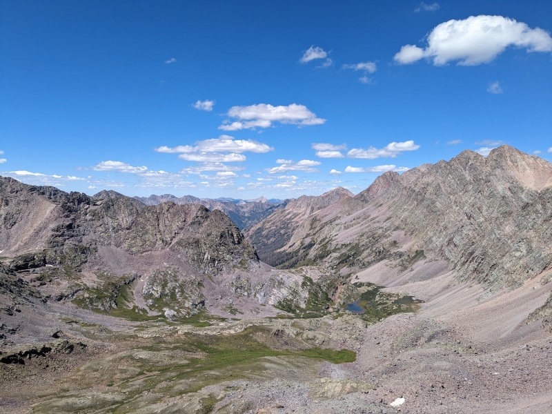
At this point weather had built and it was threatening to rain. We had both ran out of water some time ago. it was time for Power Saving mode. Since, as far as we could tell, no one had posted a TR about returning to Balsam from here, it was time to try my made up route, which involved cutting across the several basins NE back towards Balsam Lake. But staying high up in the hanging valley. The hanging valley had a few steep, steep slide paths down to Tenmile creek, and many more cliffs. I wasn't sure anything along this steep bench would go down to Tenmile, I was sure if anything did it would be pretty nasty. I did know that the bench smoothed out close to the north spur of Six right near the outlet side of Balsam Lake, so that was our target. The numerous 150-300ft climbs into each new basin were grueling after a long day, but we eventually made it to a climbers trail leading off the hanging valley, near the north ridge of Six, down to Balsam lake. We heard some thunder to our west, near Graystone/Electric/Arrow and got a few little spritzes of rain, but overall made it back to camp unscathed by weather. 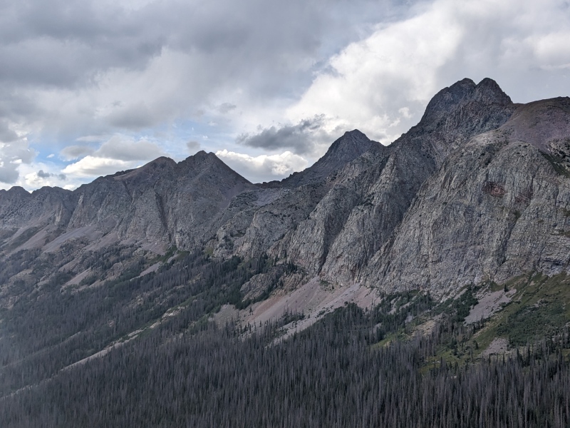
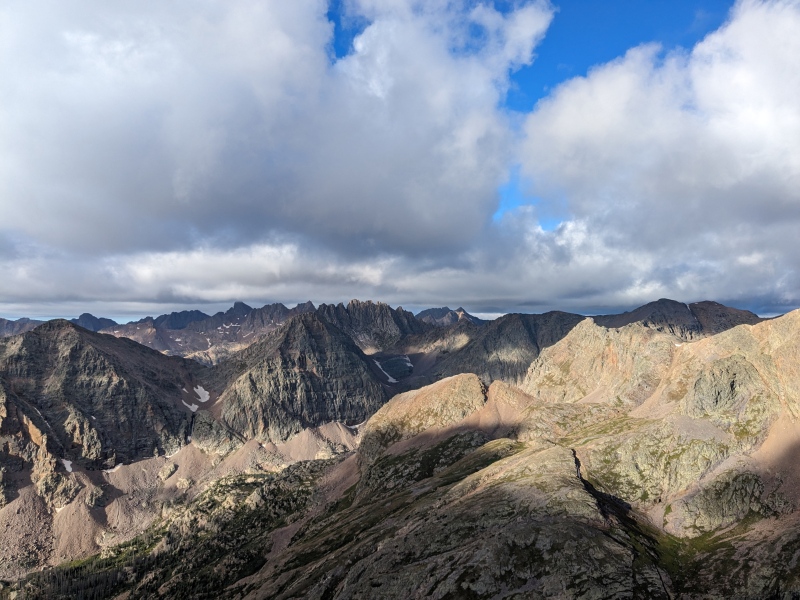
This was a long day, but an excellent one. We were incredibly happy to have gotten all of our "must have" peaks in the first two days. Celebrations of a double-dinner were in order. Given that 0% of the day was on trail or even on easy terrain, the effort we put in felt much heartier than the stats. My watch logged 12mi, 5.5k vert, and 5 ranked peaks (2 bicents) for the day, but the track is completely wacko in the steep terrain around Five and Heissy. The Nephi one was as well, for that matter, which made route finding more fun. It gave a rough idea of where to go, but there is no way we took the same route through much of the steep stuff. Day 3: Graystone Peak Another pre-dawn wakeup, another day flying an untested route. Today, we were planning on making an ascending traverse along Vestal's south slopes, cutting up to Arrow Lake, and then climbing Graystone Peak. A full group knockout would also include Pin Point (unranked), Garfield B, and Electric B. The prior day, we surveyed the big avalanche paths and cliffs that run down Vestal/Arrow into Tenmile creek. Looking through the topo, we determined that one of them does not end in a cliff and could be climbed to Arrow Lake, to then join in with the usual route up Graystone, granting access to this group of peaks from Balsam Lake. Not wanting to bushwhack down Tenmile creek in the dark then climb the entirety of the avalanche path, we also theorized that a high traverse just underneath the large cliff bands would likely have a game trail and be much better. It looked like it would work from across the valley. 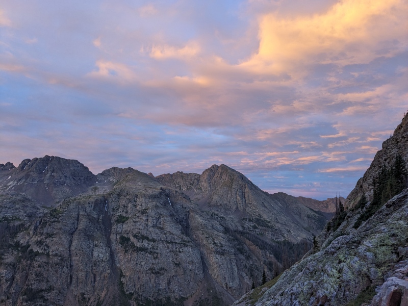
Leaving camp and beginning the ascending traverse, things started out quite annoying. Sidehilling on steep, loose talus, mixing in some steep class 2+ grass and brambles for variety. A decent little pre-dawn rain shower to take things up a notch, typical Wemi. However, as we got closer to the cliff band, a fairly decent game trail was located, speeding up progress dramatically. We got to our ascent gully and made out way up to Arrow Lake at a good clip due to less quartzite talus and more shale/grass. 
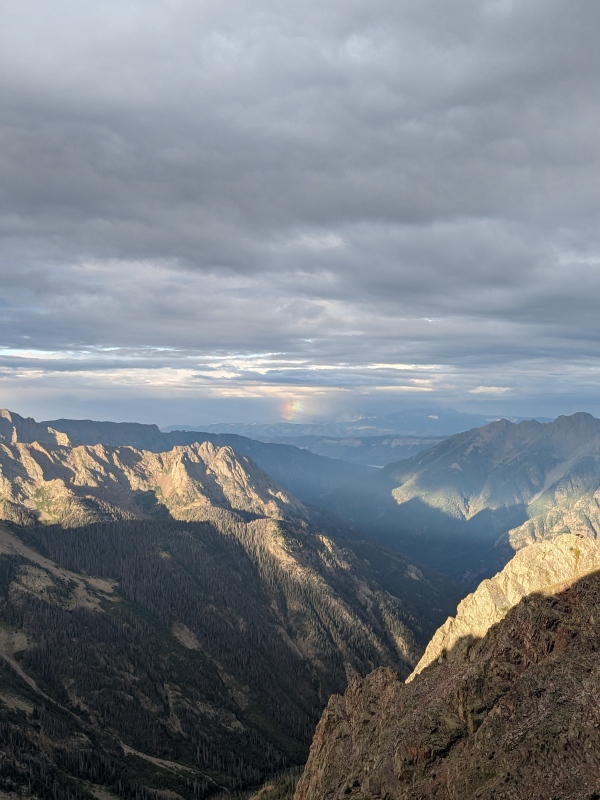
The climb up the east ridge of Graystone was a fun little scramble. Could be kept at class 3, but there were some more difficult fun little variations towards the top. We got to see another rainstorm miss us and put on a good show with multiple rainbows, an excellent peak backdrop. At the top, it looked like a pocket of rain was coming right for us, so we decided that after yesterday's beatdown that it was OK to call today a rest day and skip Garfield and Electric. We reasoned that it wouldn't even be considered orphaning those peaks because there were two of them and they are usually done from Vestal basin anyways, right? We watched a bunch of people top out on Vestal, and it turns out it was likely Nicholas and his dad (I forget their 14ers usernames), plus some others, before they continued on to do the Trinity traverse. I have photos of you guys on the summit by the way, text me if you want them. We hurried on out of there and missed most of the rain/sleet, making it back to camp rather quickly, stopping to gather up some wild raspberries of course. Time for a nap. 
Stats for the day were 7 mi and about 2.4k vert. Day 4: Peak Nine and Camp Move Peak Nine looked like it was going to be a fun, spicy one from our previous days climbing Eight and Seven. I made sure to build up a little tolerance during the dinner prior, gotta stay prepared, ya know. Prior research indicated that the best route on Nine is to find a well-cairned ledge system and traverse along the SW face, cliffs on either side, until uphill progress is possible via class 4 moves to get onto the SE ridge. From there, it is reportedly a fun class 3/4 ridge to the summit. We had GPX tracks from Nephi and John Kirk for this one. The annotated picture in Furthermore's report was the most helpful. If things went well, we were also going to try to tag on Silex and The Guardian afterwards. 
Early rise, up the familiar basin in the dark to the Eight/Nine saddle. We were a little early, as it was still fairly dark out, so we meandered down to the ledge along Nine's SW face and ate some snacks and took in the views of Jagged, Leviathan, and Vallecito. Once the sun hit, we decided we ought to get moving. The ledge was not bad, just loose, but very wide. Also very well cairned. The worst part was not knowing when to turn up into easier terrain. We got to where the Kirk and Nephi tracks made a beeline for the ridge. It looked like difficult class 4 at best, likely low-mid 5th. Solid black slope angle shading on Caltopo for a few topo lines, so at least 120 feet of high stakes climbing. Black shading is steeper than any of the flatirons which all go at low-mid 5th. Good uphill climbing, would be touchy coming back down. However, we could tell we were still a little ways off from where Furthermore indicated to leave the ledge, so we continued along the ledge, around another corner or two, following fewer cairns at this point. 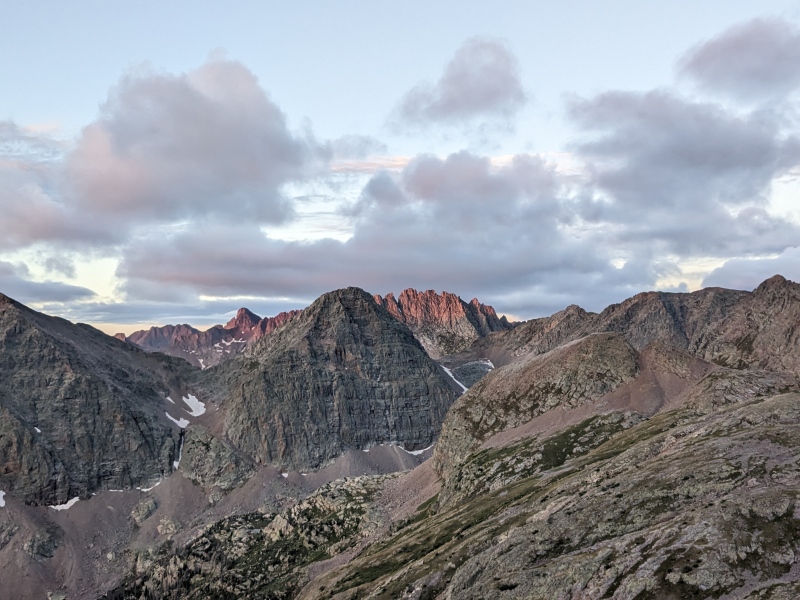

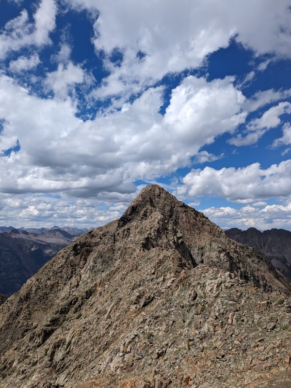
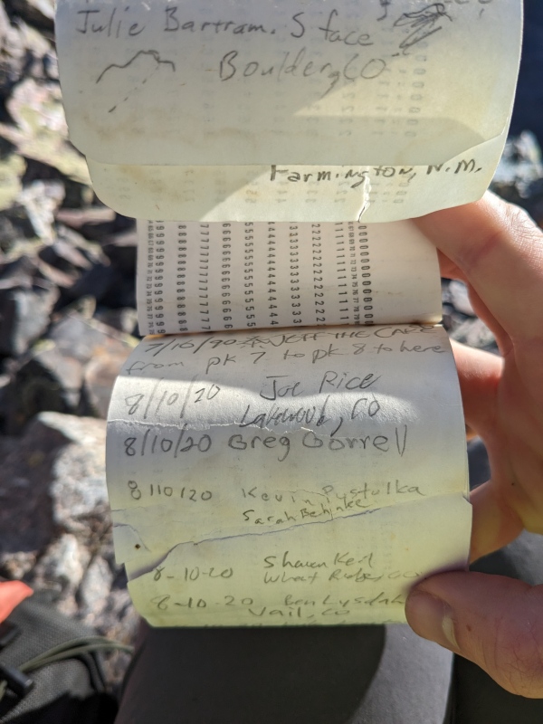
We got near the end of the ledge system and turned uphill, relieved to find a very simple class 3/3+ gully leading to the ridge. All I can say for beta on this peak is that one should go all the way to the end of the ledge system. Turning up to the ridge from there is so obvious that you can't miss it. Don't be tempted to leave the ledge and gain the ridge too early. Excited to not have to do more sketchy downclimbing this trip, we made quick work and got up to Nine's SE ridge. The ridge was some great class 3/4 scrambling with significant exposure and knife-edginess and sublime views on all sides. The summit register was a Mike Garratt one placed in 1987, I just learned, two days before he finished the 13ers. There was an odd gap of over 30 years between entries (1990-2020), does anyone have any thoughts of why that could be? I find it hard to believe that no one climbed or signed into the register for 30 years, particularly because many finished the 13ers between the two dates. The final 1990 entry and first 2020 entry were next to each other, and it did not appear that there were missing pages. 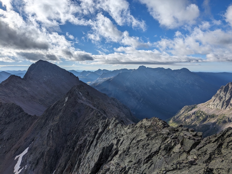
There was some minor cloud development so we took some time and strategized our afternoon and next morning plans. We could push hard and get Silex and The Guardian this afternoon. Or, we could move camp this afternoon to Stormy Gulch, cut off some of tomorrows pack-out distance, and set ourselves up to be able to exit the trip by climbing up and over Peak One and White Dome. We elected to go with the second option, leaving Silex and The Guardian for another Wemi excursion, and began making moves towards Stormy Gulch. The camp move was a little dicey as we heard some rumbling thunder and got rained on while packing up camp, but we were lucky enough to make Storm King/Eight pass through a nice weather window and somehow completely avoid getting rained on, or zapped, while hiking back out. I think I'm going to try out Steve's thunder mitigation technique next trip: wear headphones. No thunder if you can't hear it. We set up camp at about 11.7k next to Trinity creek after a quick 2-hour portage. This was a great spot minus a few deer that antagonized us all night. 
Day 5: Peak One, White Dome, and Pack-Out Yesterday we did some fast math and surmised that it was only an extra ~500ft of gain to get back to the car via climbing up and over One and White Dome rather than bushwhacking down to Vallecito, then climbing up and over Hunchback pass again. The choice was obvious. We both needed these bicentennials, and for me it would mean I got Peaks One through Nine this summer. The bushwhack in Stormy was not bad even though we never found much of a trail, but it wasn't particularly inspiring, either. We got up early because we wanted to get back to Silverton at a reasonable time Monday afternoon. As we had been out for a while, and I had a flight at 8am Tuesday out of Denver for work that would really screw me if I managed to miss. What we did not account for in assessing the effort level required for each of our options was how thick the willows would be going up Trinity creek. They were pretty gnarly to thrash through given we had our full packs. In any case, we eventually got above them and were treated to a nice sunrise. We took a break (I took a break and took some time lapses because the clouds were looking good and moving fast this morning) and got ready for our ridge climb back home. There was not much to note on the Peak One ridge. Mostly class 2, with some fun little sections of class 3. Not an issue with the bigger packs. The situation was largely the same over to White Dome, although it was pretty trash rock near the One/White Dome saddle. 
I placed a register on White Dome, let me know if it gets water-logged, and I'll stop placing that style. From here, we had a quick descent towards Kite Lake, then trail, oh sweet trail, all the way to the car. It had been many days since we could even see a constructed trail. The north ridge/east face of White Dome has a band of cliffs that make passage and contouring down to the Kite Lake area a little tricky. Be mindful of the cliffs. Here, I found a washing machine sized teetering block that was ready to go and hurt someone. Perched above a bench, 7k-10k lbs, even just putting my hand on it, it moved significantly, not exaggerating by saying a marmot could push this block over, an accident waiting to happen. The runout was clear, so I gave it a small push and off it went (not more than 20 feet). I did not expect it, but this caused another uphill block, that was not even touching the one I moved, of similar size to go as well. Instinct kicked in and I made it out of the way only getting moderately racked on my knee. All clear, but man, that was dumb. The rest of the walk out was uneventful. We smashed trail back to the car with the goal of getting into Silverton by 2pm so that I could get at least a little sleep before my 8am work flight. Had to only fight off 4 Texas Mobility Scooters and a circle jerk of like 11 Jeeps; not bad for a great weather Labor Day. Stoney Pass was also relatively traffic-light, which I was grateful for. Day 5 Stats: 7.25mi, 2.8k ascent, 3.2k descent back to the car parked at 11.3k on the Beartown road. What a great trip, as ones into the Weminuche always are. Can't wait to head back. With 5 days, 4 nights we were able to tag up 11 ranked peaks, 5 of them bicentennials. We spoke to a total of two parties (Day 1 and Day 4), seeing only two more up on Vestal from some distance away. We later learned that Heather and squad tagged Five? through Heissy the day after we did. I haven't seen too many reports of climbers using Balsam as a base camp, but we felt it was pretty good, so I figured I'd do a writeup of what we did. I think it would also be a great basecamp to do Vestal and friends if you weren't going to climb Wham and were looking for seclusion. I later heard that Vestal basin was completely out of previously established campsites at the height of the weekend and that folks had to get creative. Thumbnails for uploaded photos (click to open slideshow): ")
")
")
")
")
")
")
")
")
")
")
")
")
")
")
")
")
")
")
")
")
")
")
")
")
")
")
")
")
")
")
")
")
")
")
")
|
| Comments or Questions | ||||||
|---|---|---|---|---|---|---|
|
Caution: The information contained in this report may not be accurate and should not be the only resource used in preparation for your climb. Failure to have the necessary experience, physical conditioning, supplies or equipment can result in injury or death. 14ers.com and the author(s) of this report provide no warranties, either express or implied, that the information provided is accurate or reliable. By using the information provided, you agree to indemnify and hold harmless 14ers.com and the report author(s) with respect to any claims and demands against them, including any attorney fees and expenses. Please read the 14ers.com Safety and Disclaimer pages for more information.
Please respect private property: 14ers.com supports the rights of private landowners to determine how and by whom their land will be used. In Colorado, it is your responsibility to determine if land is private and to obtain the appropriate permission before entering the property.


