| Report Type | Full |
| Peak(s) |
Pigeon Peak - 13,977 feet Turret Peak - 13,837 feet Glacier Point - 13,710 feet Peak Eighteen - 13,474 feet Windom Peak - 14,089 feet Sunlight Peak - 14,061 feet |
| Date Posted | 09/18/2023 |
| Modified | 09/19/2023 |
| Date Climbed | 08/30/2023 |
| Author | cloudkicker |
| Ruby via Chicago as told by the okayest hiker in the world |
|---|
|
Ruby Basin via Chicago Basin As Told by the World’s Okayest Hiker™ Itinerary: Day 1 (8/30) - Train from Durango to Needleton, hike up Needle Creek, camp in Chicago Basin (11,100ft), warm-up hike up Columbine Pass SCROLL DOWN TO THE “LEAVING CHICAGO BASIN” SECTION IF YOU ONLY WISH TO READ ABOUT THE TRAVERSE TO RUBY BASIN & PIGEON/TURRET! Intro Colorado’s Centennial 13ers are bound to become ever more popular in the coming years. As more people complete their Colorado 14ers lists, they’ll be eyeing the next list to tackle. The Centennials list is a natural and common next step in one’s mountain climbing career. Everyone knows how difficult the four technical Centennials are (Jagged, Vestal, Dallas, Teakettle). Their routes are well documented with plenty of pictures, videos, and opinions out there about the class 5 sections on those peaks. It’s also well known that Cathedral Peak & Thunder Pyramid are safest when climbed in spring snow with crampons & ice axe. These are universally considered the six hardest Centennials on the list. Perhaps less known are the hazards that are present on Pigeon & Turret via Ruby Basin via Chicago Basin. Many who are familiar only with the Chicago Basin approach and its 14er climbs may be led to underestimate the climbing routes on these nearby Centennials. Here’s where I come in. I’m writing this trip report to offer my perspective of perhaps the most dangerous non-technical Centennial 13er, Pigeon Peak, using a hazardous approach that is nonetheless an attractive option for multiple reasons. The appeal of checking off multiple Centennials on a Chi Basin trip makes it likely that Twin Thumbs Pass & Ruby-Noname Pass will be used in greater frequency by backpackers in coming years. Demigods & Mortals This website contains scores of valuable trip reports, many of which are written by the strongest mountain climbers in Colorado. These climbers are the demigods of Colorado’s climbing community. Like the titans of mythology, they are consistently able to push harder, farther, and faster than everyone else. Many of them are not only gifted climbers, but also gifted storytellers, able to recap their journeys and provide important beta in a vivid way through this website’s trip reports. You know who you are. Currently, there are a growing number of reports on this site from climbers whose limits far exceed mine. My report exists to outline a more realistic itinerary aimed for the rest of us, without glossing over the hazards that exist on the route. Here are a few examples of trip reports you can find on this site:
Let me get to the point by admitting this. I am a mere mortal, and I know my limits. The demigods out there are capable of doing amazing things amazingly fast and somehow being safe while doing it. I am also pretty good at what I do, but it takes me longer to do it, and that’s okay. You don’t have to be the fastest when climbing dangerous mountains, you just have to climb them in the safest way you can. My hope is that this trip report will provide value to those who are less equipped for a day hike from Purgatory and more equipped to do a 4-5 day backpacking trip from Needleton. This report is for those who know their limits and are at peace taking the mortals’ way. The mortals’ way will still lead you to “the essence of the mountaineering experience” as Roach so described Pigeon Peak in his guidebook. 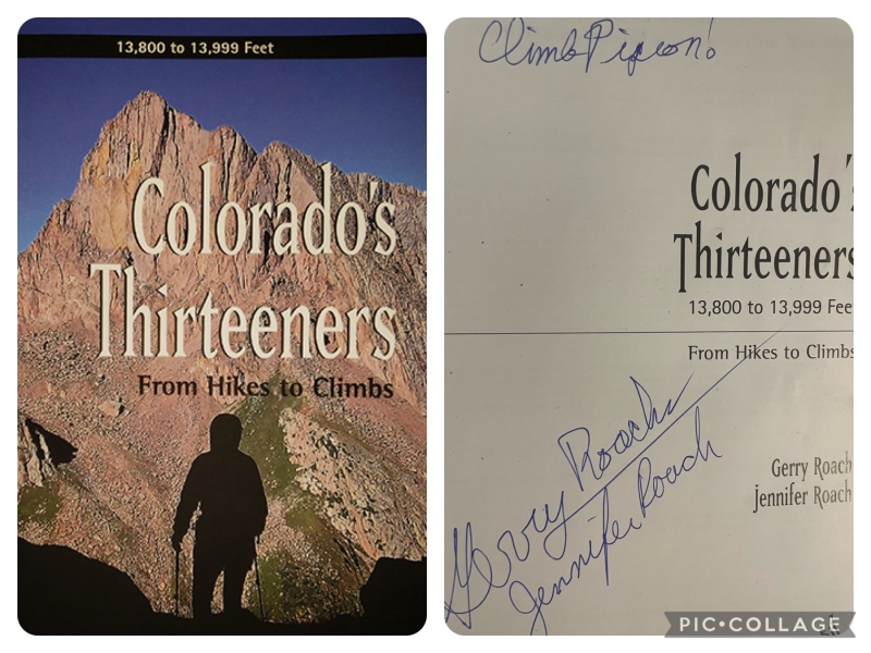
With a mere 15 13ers under my belt at the time, I knew little to nothing about the peak that was on the cover. Days 0 & 1: Burglars & Bubble Gum My partners Katherine & Lindsay were already in Durango late Tuesday, sitting down for dinner at some fancy undisclosed place. It was Taco Tuesday so I rolled through the Santy’s drive thru in Pagosa Springs for fish tacos and a churro (best quick eats in Pagosa!). I was running ahead of schedule, but I already had the address and door code for the place we would be staying. Kat had pulled some strings with a work colleague, securing a free night for us at this colleague’s ranch below Lemon Lake just east of Durango. I drove right for the ranch from Pagosa, arriving about an hour before Kat & Lindsay. I pulled up to the ranch, a multi-building creekside property with a couple of cabins along with a fully renovated 2 story barn-turned-man cavern/living space. Entering the passcode, I walked in and set a couple of bags down. Suddenly, the burglar alarm screamed at me deafeningly. To make matters worse, the security keypad on the wall did not recognize the only passcode I was given. Oh dear. I worried that the cops would show up and detain me. The landline phone rang. I spoke with Kat’s colleague who was somewhere in New Mexico. I shouted through the racket that I was a friend of Kat’s. I could barely hear him due to the blaring and also the landline cutting in and out. I could only make out some of what he spoke to me. He advised Wi-Fi calling and provided me the password so that I could call him back from my iPhone. I stepped outside and called him back. He informed me that the building we would be staying in was not this cabin I was inadvertently burglarizing, but actually the renovated barn next door. I received further instructions from him and successfully relocated to the Bougie Barn. This was my name for it, at least. Inside was 4bd/2ba, a full bar, two kitchens, a laundry room, pool hall, giant TV, and football jerseys mounted on the walls. Kat & Lindsay arrived a little later. We all joked about the evening’s events as we settled into the beautiful and massive space of the Bougie Barn. Kat made a FaceTime call to her colleague and we were finally able to convince him that I am a friend and not a burglar. A full 7 hours of sleep later (!!!) I found myself in my car in Durango, yawning through the Starbucks drive-thru for some coffee and breakfast. I spent some time in the City Market lot getting my shit together before meeting with Kat & Lindsay again. It all went by like clockwork. No trains were missed in the making of this trip. Kat & Lindsay had grabbed some McMuffins from the McDonalds next to the Durango train station. Hence, our trio now had a name: Team McMuffin. 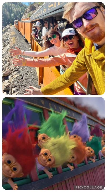
The train ride went by as smoothly as a narrow-gauge train ride can. That is to say, bumpy. Full of the usual awesome views along the Animas, but more or less uneventful. We were in our Gondola seats at 7:30am, the train departed at 8am, and we reached Needleton around 10:45am. At Needleton, all the backpackers rushed around frantically on the platform, as is the norm at this train stop. First sorting out packs from the pile, then making final adjustments before everyone would begin the 6.5 mile stroll up to Chicago Basin (or other destinations). 
(moron that later) After crossing the bridge, we hid some frosty beverages (canned margs and a beer) in the cold waters of the Animas River to be waiting for us on our return. I am not sure if this violates LNT but I have seen it done multiple times on my prior Chicago Basin trips. Let me just say the river stash of frosty bevs is a genius, genius move. And we were off! A ton of people have documented the Chicago Basin approach up Needle Creek, along with all four 14er routes. If you’re reading this, you’ve probably done at least one trip to Chicago Basin already. I’ll spare most of the details and let your memories or other reports fill in the rest. The Needle Creek trail is the most bomber approach trail in the Weminuche Wilderness. We tackled the entire approach in 3.5 hours, with a 5-10 minute “packs come off” break every 2-2.5 miles. 3.5 hours is slower than some, but the fastest I’ve ever done it, and the strongest I’ve ever felt doing it. Lindsay and I both agreed that the most optimal sites in Chicago Basin are the ones highest in the basin, closest to the Twin Lakes/Columbine Pass junction. So we ended up choosing a site near 11,100ft, hiker’s left of the trail and only 0.5 miles from the Twin Lakes junction, with streams for filtering water only 2 minutes away from camp. The three of us settled in, set up our tents, filtered water, and enjoyed a late lunch. I was feeling tired already and more than a little flushed from the intensity of the day’s sun. Kat made the wise choice to spend the remainder of day 1 resting at camp and getting ready for the next day’s summits. Lindsay, however, wanted to do a day hike somewhere up high for sunset, and she didn’t want to go alone. She had hauled up her fancy mirrorless camera and tripod for this trip and wanted to put it to work. I had brought my mirrorless in 2019 so I understood completely. I really didn’t want to let her down. She & I already had Jupiter, and since Kat was the only one needing Jupiter that option was eliminated. I steered her away from summit options altogether. It was already 5pm and though we could’ve hiked down in the dark I didn’t want to be making dinner at 10pm ahead of a 3:30am alarm. We picked a sunset hike up on Columbine Pass. I got my day pack ready and we hit the trail again. An hour up the trail, it occurred to me what a terrible mistake it was for me to try hiking further that day. I hadn’t listened to my body at all. Above treeline I hit the wall massively with some combination of fatigue, dehydration, and sun poisoning. I sheepishly apologized to Lindsay and told her I had to bail and focus on hydrating and replenishing electrolytes. I think she understood, but I definitely let her down. She didn’t want to hike down alone in the dark and I couldn’t blame her, so she turned around shortly after me. To make matters worse, the sun was still glaring down on us, preventing good mirrorless camera picture opportunities. The oof levels were off the charts. Turns out, this is what biting off more bubble gum than you can chew feels like. It had been a few years since my last time biting off too much. This was a tough but necessary reminder as to my limits, and what it feels like to go too far. Some people are capable of getting a summit immediately after arriving in Chicago Basin, even from Purgatory. More power to you. Next time I go I think I’ll opt to rest and enjoy the beauty of the basin, and get my peaks on other days. Day 2: An Inside-the-Park Home Run The plan: I would hike 2 of the 14ers with Team McMuffin, then I’d break off solo to grab some nearby 13ers. The 3:30am alarm came all too quickly, as is the norm for alarms in Chicago Basin. We were off hiking at 4am. We made decent time up the headwall trail and arrived at the lakes right at blue hour. I gave Kat the dealer’s choice since this was her first Chicago Basin trip. She opted for Sunlight & Windom to get the most tricky ones done at the earliest part on the nicest day in the forecast. Eolus is my favorite and I really wanted to show them the airy ridge direct route up the big E, but all 4 are so much fun that you really can’t go wrong. 
It appears that trail crews have done extensive work on the route leading up into Sunlight’s red gully. I also seem to remember the gully being way more loose my last time on this mountain, going so far as to rename it the wRetchED gully. Either the uptick in traffic on Sunlight recent years has sent the worst of the loose rock off the route, or I’ve done a lot of stuff that was way more loose since then and it’s no biggie anymore. Probably a little of both. Going up Sunlight felt like a breeze on this trip. 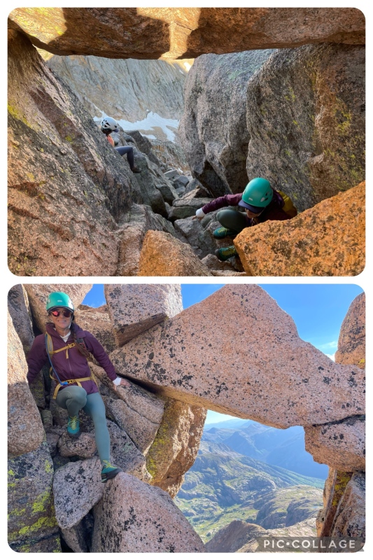
The scrambling between the top of the gully and the summit area on Sunlight was still mostly just as fun as before. We did take a slight variation and ended up on more loose terrain for about 7 minutes. We also climbed a class 4 section that we realized on the way down that we didn’t need to do, some ways below and left of the lower rock window (pic above) 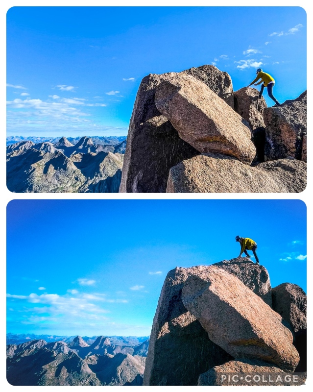
Not much to note coming down Sunlight or over to Windom. I will maintain that there’s a few class 3 moves on Windom that warrant a route difficulty upgrade from Difficult 2 to Class 3. If it is in fact Class 2, it’s the most fun Class 2 14er out there. 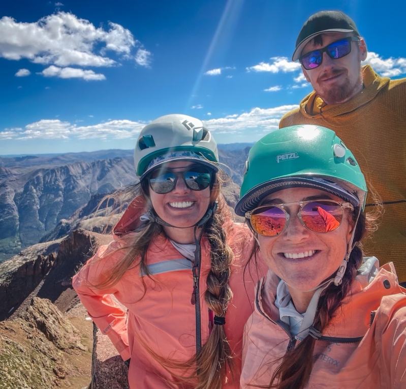

While on the summit of Windom, I got a text from my brother who happened to be doing the Little Bear-Blanca traverse solo that day. He informed me of a safe arrival on Blanca’s summit. This was great news and I sent him a congratulatory text before we headed down. At the Windom saddle, we reached the point that I would break away from Kat & Lindsay. Kat entered the trip with no plans to go for the 14er Grand Slam, but the weather was so nice and storms were nowhere to be found, so why not? They made their way on down heading over for Eolus. Meanwhile, I remained on the ridge eyeing the route up to my first 13er, Peak Eighteen. There are multiple trip reports already to detail the short and sweet route up Peak Eighteen. Supranihilest’ s TR outlines the class 4 ridge direct route, while Daway’s TR outlines the class 3 ledge route on the face below and left of the ridge. If you want details on how these are climbed go ahead and read through both reports. I opted for the Daway Way since I was solo and I don’t always choose the spiciest route when I’m solo. The climbing was fun but much of it was exposed or on steep grassy shelves which translates to no fall zone. I was fully dialed in for the hour or so it took me to reach the summit of Peak Eighteen. No mistakes allowed. 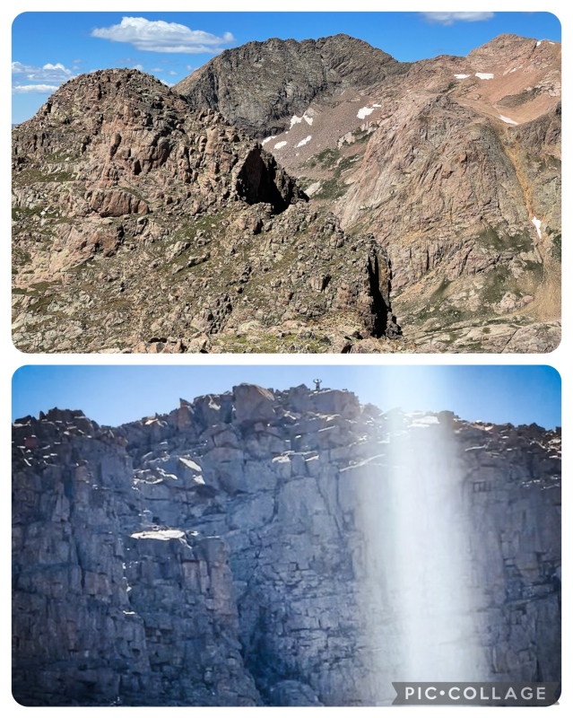
B: Kat gets a cool pic of me hollering down from the top of Peak Eighteen. After returning from Daway’s Way, I elected to take a sketchy gully down off the ridge and back to the main trail. I knew it was only 250ft at most and felt confident that whatever suck I found in the gully would be short lived. The trail was not far below. This gully is probably less fun to climb up, so if Peak Eighteen is your sole or first objective of the day I’d recommend accessing it from the Windom saddle and over the mellow ridge bump. The bottom most 80ft of the gully had a small snowfield, and it was at a mellow enough angle for me to risk a non-ice axe glissade. On my way down to Twin Lakes, I still wasn’t sure whether I wanted to do Peak Eleven or Glacier Point. Peak Eleven is a climb I’ve been wanting for 4+ years now. But after Peak Eighteen, I felt spent with the scrambling. Compared to a walk-up, it takes a lot more mental energy to focus on not falling on a spicy route. And so I chose Glacier Point instead, leaving Peak Eleven for the next day, opting for a longer grunt but less brain power needed for Glacier Point. 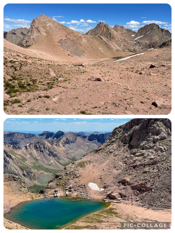
B: The coolest hidden lake that can only be seen from Glacier Point. Again, Glacier Point’s route has been well documented already. I recommend Supranihilest’s route in the same TR as his Peak Eighteen route. Up the Eolus trail before breaking away below N. Eolus, descending mellow terrain northwest of the hidden lake before hiking across the small face to the ridge. 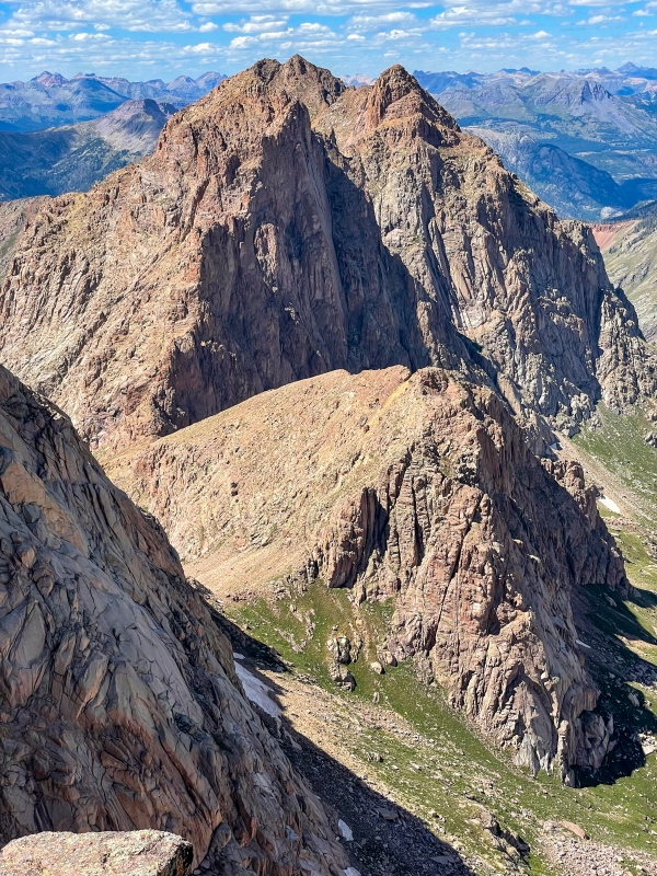
I didn’t stay long on Glacier Point. I was eager to get back to the Eolus trail and see if I could glimpse the rest of Team McMuffin on Eolus. As I reached the main trail I spotted them puzzling out the lowest part of the ledges, slightly off route. So I called over to them from afar and beckoned to the spot I knew they missed. Apparently, some dudes coming down had told them “stay way lower than you think”. Lindsay had already done Eolus, along with all the Centennials, and is beyond expert level on all 14ers at this point, but these dudes’ advice had left them disoriented for a few minutes. They backtracked, found the route, and continued on their way. I hollered a “Good job!” and headed on back to camp, all my energy spent at this point. 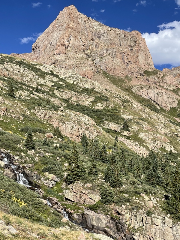
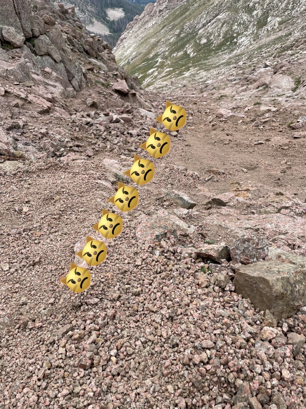
Kat & Lindsay made it back to camp right as I was cooking my 2nd dinner, and we discussed the day a little bit. We reveled in the successes of our separate 4 packs; them with the Chi Basin 14er Grand Slam, and me with my Inside-the-Park Home Run. They expressed an intention to hike out to the train the next day, returning to Durango on Friday instead of Sunday. I gave them my blessing and promised I wouldn’t be too loud taking down camp at dawn. After dinner we exchanged hugs, I promised them I’d be safe, and all 3 of us promptly hit the hay, wiped from a huge day. Thus concludes Team McMuffin’s journeys together, and the breaking of the fellowship was at hand. Day 3: Leaving Chicago Basin WARNING: ALL ROUTE LINES IN THE REST OF THE REPORT ARE APPROXIMATE. ANGRY CAT EMOJI = KITTY LITTER SECTIONS 
Morning of day 3 was rough. I woke up at 5:30am and it took me 2 hours to take down camp and be on my way. In my defense, it rained for 20 minutes right at dawn killing all motivation I had to break down camp. Standing up, I realized I was way more sore than I have been all summer. By that point in summer I had already climbed over 50 peaks above 12k since April, with 25 in July alone, so this level of soreness was not fun to endure. Note to the other okayest hikers out there… climbing 4 peaks, and the next day moving camp up and across the passes over to Ruby, is a very tall order. If the Centennial, Jupiter, is your only objective on the Chicago Basin side before the backpack traverse, then it becomes more manageable even in 4 days instead of 5. Again, let me repeat. Know your limits. Twin Thumbs Pass, Upper Noname Basin, and Ruby-Noname Pass are dangerous places with a heavy backpack when experiencing high levels of soreness and fatigue. At 7:30am I was on my way up the trail, grumpy and exhausted, and the day had only just begun. A rootin’ tootin’ family of 8 (?!?!?) kept trying to play leap frog with me up the headwall trail, and all I wanted was to drag my feet and take my sweet time without drawing attention to all my sweat and body odor. My plan was to wash up a little in Ruby Basin, but I just wasn’t there yet and I didn’t want to hike up exhausted while being closely observed by 8 giddy people the whole way. This family of 8 was so busy enjoying the sights on presumably their first Chi Basin trip, that they would hike faster than me, then take a break for pics letting me get ahead, then hike faster catching up to me again. I eventually had to break out rude hiker mode, informing the family that the forecast called for storms as early as 11am and rain as early as 9am. They got the memo and moved on. I took a stupid long break to give them distance ahead of me for the rest of the way to the lakes. I finally arrived at the lakes at 9:30am, 2 whole hours after leaving camp. I was dragging ass. 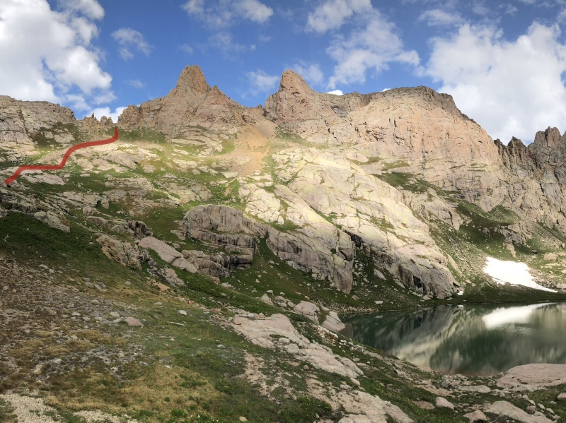
My initial plan was to drop my backpack halfway up Twin Thumbs Pass, climb Peak Eleven with my electrolyte drink in my pocket, and return for my pack then traversing over the passes. Unfortunately, I had to punt Peak Eleven… again… due to lack of energy and some worry that it would be storming on me during the worst sections in the two pass backpacking traverse. Fresher legs and a clear forecast can get this done. Tacking on Peak Eleven to the start of the backpacking traverse is pretty feasible. As for me, I had reached my limits already on this trip, and it was only day 3 of 5. I reached the top of the pass at 13,200ft around 10am. The Twin Lakes side is fairly easy although it does get a little steep near the top. 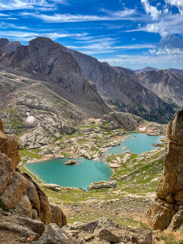
Alright… now for the Noname side of Twin Thumbs Pass. I had heard a thing or two of its reputation. Lindsay specifically told me “that part sucked” the night before. I knew there was a little class 3 at the top but was vague on specifics. I had also read a report from a pair of hikers three weeks before, one of which had slipped on a snowfield crossing and had an uncontrolled slide of 250ft. No bueno. 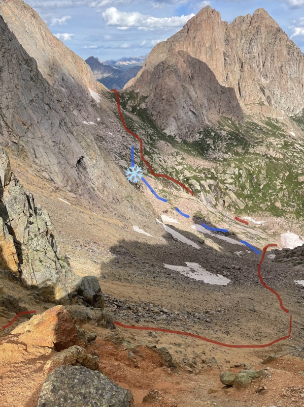
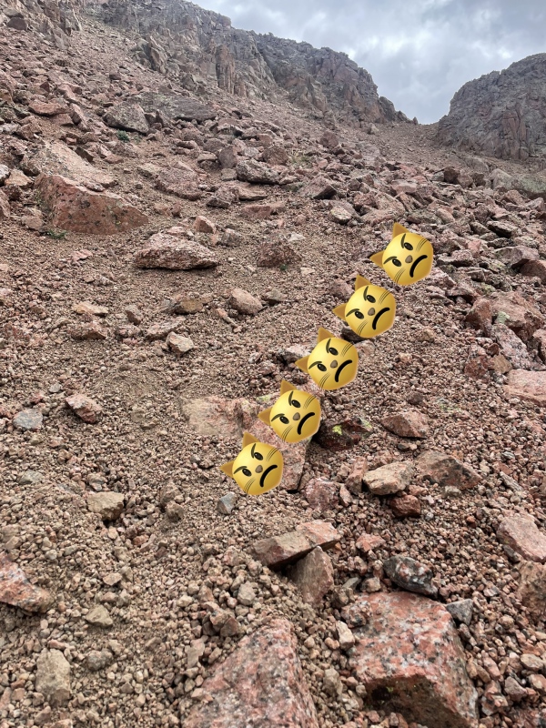
The blue line is the higher route that most will take, but the lower route avoided a steep snow crossing. I can report that the top of Twin Thumbs Pass is dangerous specifically because of the kitty litter lining the steps above and around a 15ft cliff band. Lindsay had advised me to face in and down climb the cliff directly, but with the bulk hanging off my backpack I just didn’t have it in me to pivot around and do that. I felt like a moron. My helmet, bear canister, tent bag, and sleeping pad were all affixed to the outside of my 15L daypack which was zipped to its 40L counterpart. On a bomber trail like Needle Creek, one can hike up with such a sloppy ensemble of externally attached items and not get punished for it. This was different and far more difficult than any backpacking I had ever done. I slowly moved to the far side of the cliff band, inching towards the end of a faint switchback. As I stepped forth, some kitty litter beneath my feet caused me to lose my balance and I slipped, teetering precariously over the edge. The bulk of my pack had shifted, dragging me down and right towards the drop. If I hadn’t caught myself, I might have fallen and died. This spot isn’t exposed, but the bulk could have caused me to flip and land on my neck or head. I barely stopped myself and I backed up (thank you trekking pole!!). Only a few inches away from the danger in the situation, I concentrated all my energy on staying balanced. I maneuvered my backpack off my back and slowly lowered it to my feet. I detached my daypack and most of the bulk, put my helmet on, and scurried on down 100ft carrying half my gear to safer terrain below. Then I doubled back up to the switchback and up the kitty litter death step to collect the rest of my pack. IF YOU ARE PREPARED, your gear for the whole trip will fit more neatly inside your backpack and you won’t have so much bulk hanging off compromising your balance on difficult class 3 backpacking sections. IF YOU ARE PREPARED, you will bring a partner and some paracord or a sling, at which point you can remove your packs and lower them down the 15ft cliff band, one person at the bottom waiting to grab each pack and place it down safely. If you are solo like I was, it’s more tricky. 
This traverse really wasn’t fun at all. I ended up falling twice on the kitty litter further below the pass, but on slightly more forgiving terrain. A few cuts and scrapes and a terrible mood made me one unhappy camper. I was solo and exhausted and had narrowly avoided a catastrophic fall above 13k. 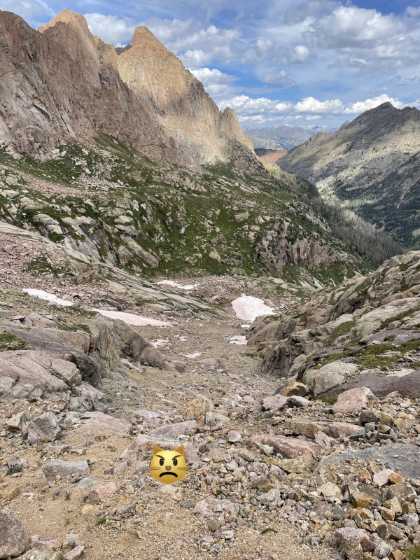
At the base I banged a left below cliffs, across the base of the bigger steeper gully & snowfield, up the grassy slabs, rejoining the normal route, then on to Ruby-Noname Pass. 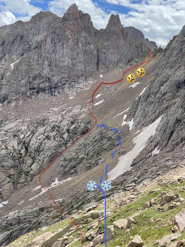
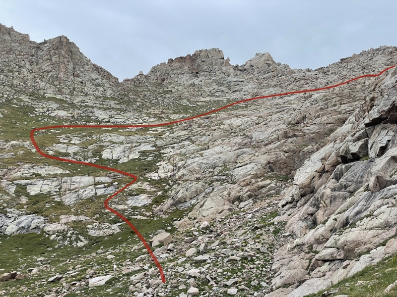
My spirits began to lift the moment I escaped the scree gullies returning upwards onto the grassy slabs near Ruby-Noname Pass. It hadn’t rained yet and I had survived the most dangerous backpacking moments of my life. I knew there would be difficulties ahead, but the worst of it was behind. I reached the top of Ruby-Noname Pass at high noon, took a snack break, watched some goats in the basin below, and all was well again. 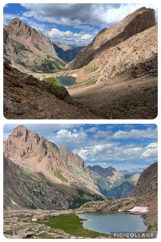
B: The route bangs a sharp right past the lake in order to skirt above giant cliffs down into the basin. 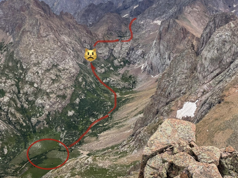
There is some broken/faint trail and an occasional cairn between pass and meadow. 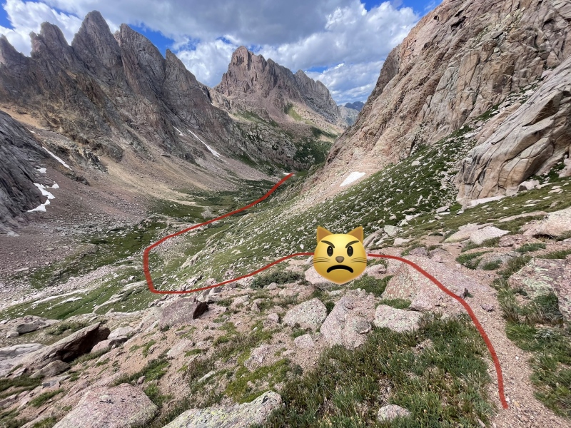
There is some difficult and steep terrain as you descend into Ruby Basin. Namely, more descending on steep kitty litter “trail” in which you’re likely to slip and need to be on guard to catch yourself. Eventually, the steepness recedes and the route mellows out. After which it becomes a game of finding the faint trail through scattered boulders, grass, slabs, and those infamous Ruby Basin willows. Ruby Creek makes its first beautiful appearance here. Finally at 2pm, 6.5 hours later, I reached Camp Luscious, so named after Roach’s description of this as the “luscious meadow” at 11,600ft. I would’ve called it lush personally, but luscious is too good. Camp Luscious is the most logical base camp for a Ruby Basin ascent of Pigeon & Turret, as it lays right at the base of the 1500ft 0.7mi slope to the saddle. 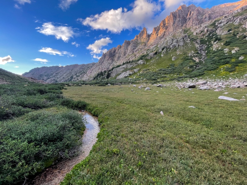
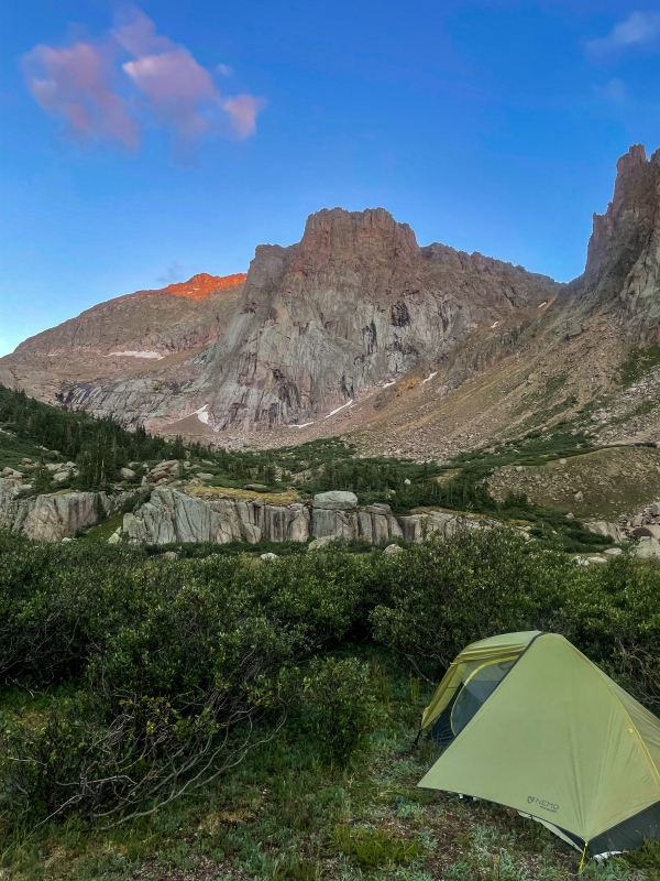
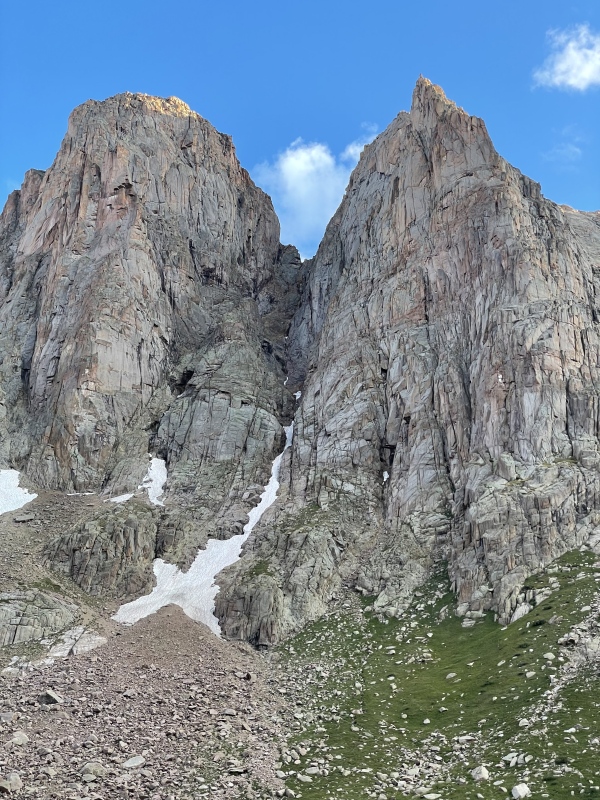
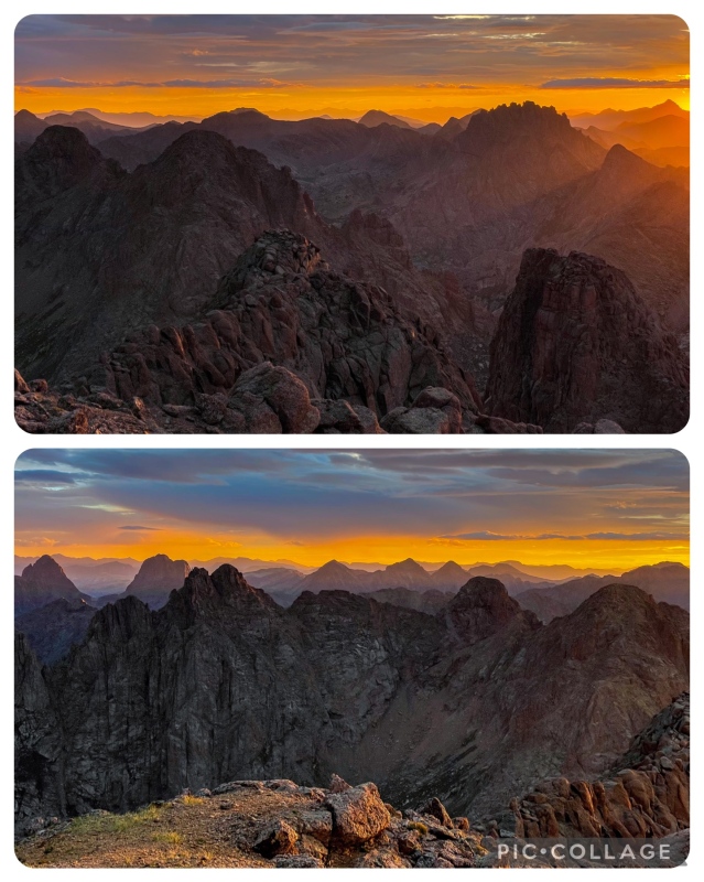
At 4pm, long after I put up my tent, it finally rained. The family of 8 probably laughed in my direction when those 11am storms I warned about never rolled through. I laid in my tent as it rained, daydreaming about the one that got away (Peak Eleven… sigh). I spent probably an hour studying Roach’s descriptions of the routes on Pigeon & Turret. The rain let up in time for dinner, and before I knew it the sun set and hiker’s midnight had come. I quickly fell into a deep sleep. Day 4: Turret & Pigeon 4am came and I was up and at it for the 4:30am start. Thankfully I was way less sore than the day before. The first 1500ft in 0.7 miles to the Pigeon & Turret saddle would be quite the warm-up. Upon leaving Camp Luscious I found myself employing a technique I learned during a 3 month stay in Washington in 2021… the veggie belay. I completed several peak scrambles in the North Cascades in which the terrain was both very steep and thick with vegetation (trees, roots, bushes). The only way up or down is to grab onto the vegetation and h o i s t. This technique came in handy in that first few hundred feet of gain, in which the infamous willows of Ruby Basin grew thickly obscuring the faint climber’s paths on the steep slope. This may be the only time I have ever been excited to fight through willows, dusting off the veggie belay skills I haven’t used since Washington. In daylight from camp you can see the beginning of the main climbers path up into the willows. The least thick willows are on the left side above the lower cliffs but below the higher ones. The easiest way winds upwards left towards the base of the upper cliffs, then right again. Eventually the willows give way to steep tundra and then the rest of the way to the saddle is through a large rock glacier that makes the Longs Peak boulder field look like a kindergarten playground. It is easy to lose your way rock hopping through the moraine, but there are sometimes cairns, and with enough moonlight the outline of the saddle ahead and above should point you in the right direction. As I slowly moved up the rock glacier, it began to lightly rain. This concerned me as I didn’t want to be on Pigeon in rain. Luckily, 5 minutes later it stopped and I continued. My first taste of kitty litter for the day gave me a moment of grief on the final slope near the saddle, but then I arrived. On the saddle at 6am sharp. It started raining again. I quickly took my pack off and threw my Gore-Tex shell on. The saddle has a direct line of view to the town of Silverton. Most climbers will have cell phone signal here. I checked NOAA and it said nothing about rain or storms before 11am… classic. I fired off a text message to Kat letting her know I was waiting out some rain but still hopeful my summit bids would work out. I waited 10 long minutes on the saddle, and then it stopped! There is some debate as to whether you should go for Pigeon or Turret first. I highly recommend Turret first and starting at zero dark thirty for the sunrise summit bid, and to get the easier one out of the way first. This also makes the 800ft re-gain on the wrap-around less daunting at the end. Turret’s route from the saddle is fairly simple, and I used Roach’s guide along with ample cairns to navigate its upper slopes. As you get higher, the rocks become more solid, making for fun class 2+ along with some simple class 3 options at your discretion. 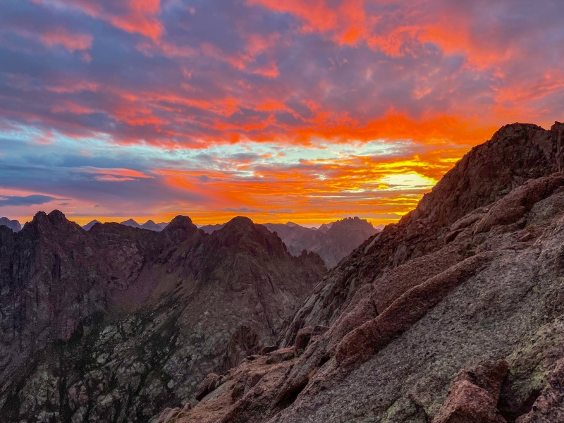
The colors peaked at 6:35am and I hauled ass the rest of the way to the summit of Turret Peak, arriving at 6:45am. 


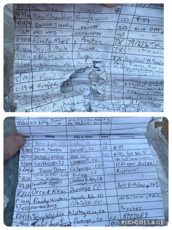
A close partner of ours on her trip commented “Idk but never again”. Fitting. I stayed about 20 minutes soaking in the sun, signed in and quickly munched a summit snack, and then I was on my way down again. Back to the saddle and 13,100ft. I checked the weather again, no changes. The clouds looked gloomy but no worse. I texted Team McMuffin letting them know I would be continuing on to Pigeon. The one good thing I can say about Pigeon Peak’s dreaded wrap-around is it’s easily divided into two parts giving you tangible targets: First, you leave the saddle on steep grass and broken trail with some rubble, aiming for the notch at 12,780ft. 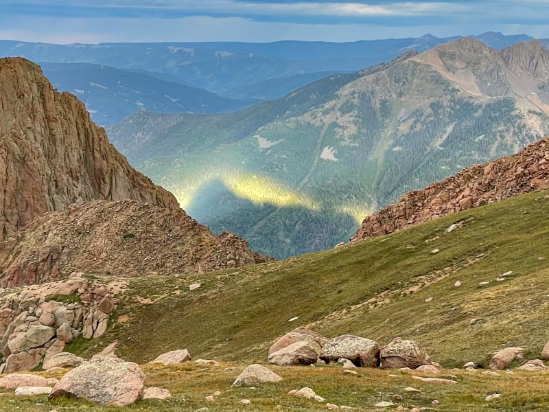
Then, from the 12,780ft notch you poke your way down the steep kitty litter field back to grass, completing the wrap around at 12,400ft. 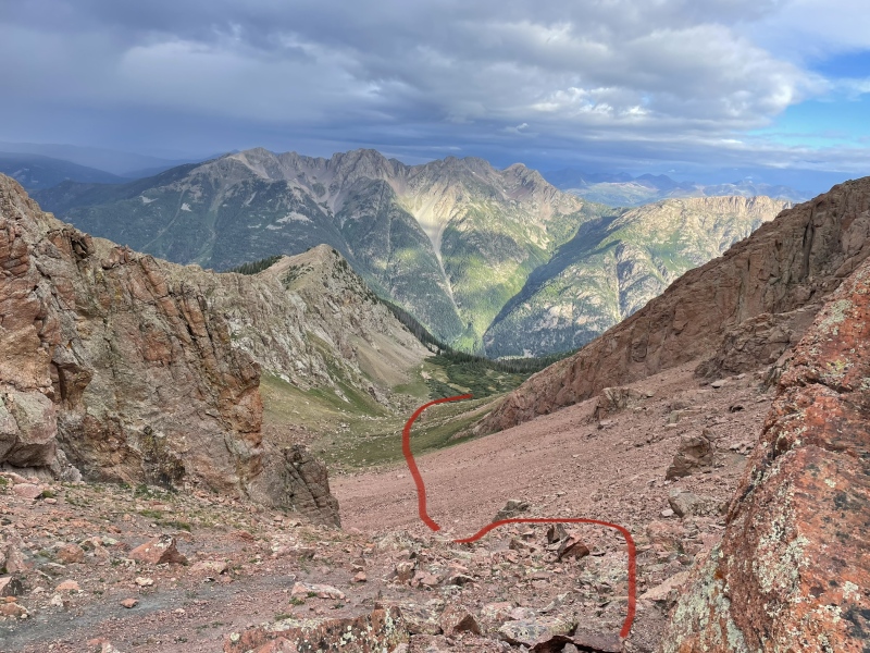
I watched as some young goats navigated impossibly steep cliffs hundreds of feet above and to the right of me. I took a wide berth away from their vicinity to avoid being near any rockfall. 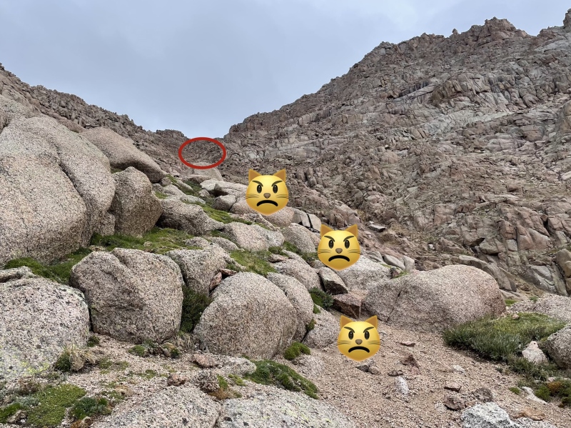
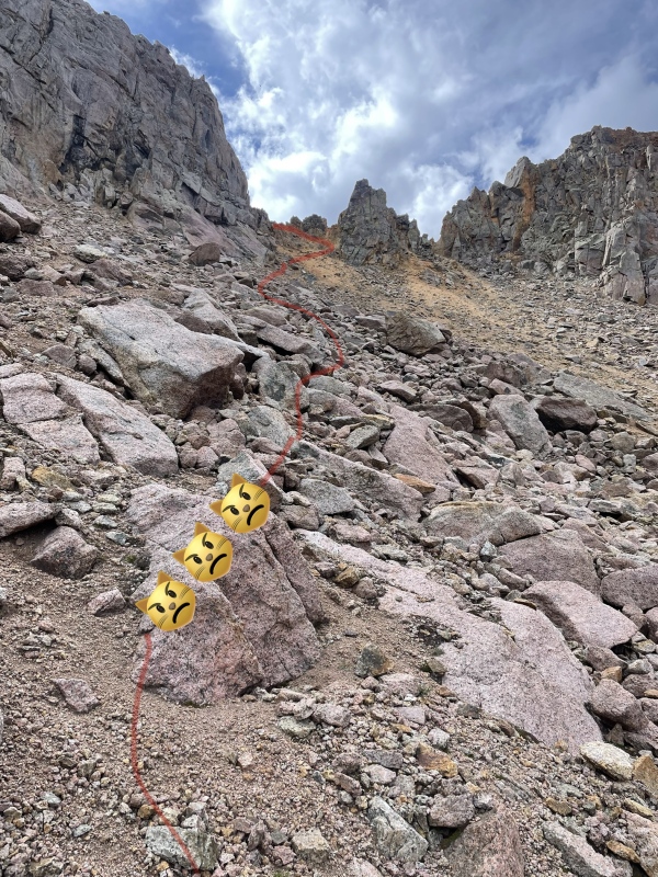
Broken/faint trail loaded with kitty litter becomes apparent on Pigeon’s steep slopes. Compared to every part of this summit climb up to this point, the 1500ft between the summit and the base of the SW slopes is the most difficult and dangerous. It’s steep most of the way and much of the footing, at least to the scramble near the top, is on that awful kitty litter. If you’re with partners, be extra vigilant in avoiding rockfall through here, although most of the rock that will come sliding down is just the kitty litter shifting beneath your every step. 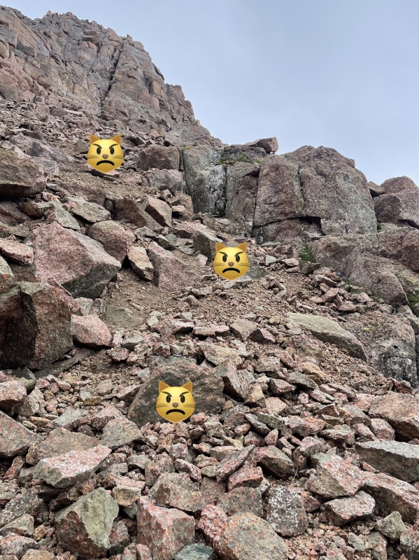
I don’t have specifics regarding the exact route I took on the last few hundred feet of scrambling to the summit. It has a lot of nice cairns and it zig zags a lot. Be sure and look down every time you climb up something, so that you can more easily recognize the descent route, since a lot of the terrain near the top of the mountain looks the same. There is a lot of loose class 5 terrain lurking nearby for those who venture off route. I got off route once by wandering too far to the right about halfway up the scramble, but I was able to easily backtrack and find the left turn I missed, locating the next cairn atop a grassy ramp. 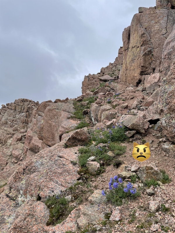
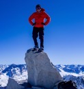
I reached Pigeon Peak’s summit at 10am sharp. I was stressing about the weather the entire way up, but the weather held. 
I stayed less than 5 minutes on the summit of Pigeon before heading down, opting to take a summit-length break below the no-fall scramble section instead. 2.5 miles east of the Needleton stop, and more than 5000ft above the train tracks, I sat quietly at 13500ft listening to the haunting sound of the train’s whistle as it approached Needleton. (15 second video below) It took me longer to descend to the lower wrap-around terminus than it took climbing up it. This is seriously one of the most unpleasant sections in all the Centennials. The best way I can describe it is there’s a lot of controlled falling that takes place down the kitty litter. Your entire way down will consistent primarily of slipping, sliding, butt scooting, crab walking, flailing, and stopping yourself above mini cliffs until you reach the slabs and grass at the base of the 1500ft SW Slopes. Take your time to descend this mountain safely. Luckily, the storms had once again not arrived at 11am as the forecast had predicted. That 1500ft slope on Pigeon is probably a complete nightmare in the rain. It was already noon when I returned to the short reprieve of easy trail at 12,400ft which marks the lower end of the wrap-around. Clouds looked pretty gnarly so I wasted little time completing the lower half of the wrap-around and then the upper half. I returned to the 13,100ft saddle at 12:50pm. Once again I texted Kat letting her know I was safely through the worst of it, and then I pressed on down the initial rock glacier and veggie belayed on back down to camp. 
I returned to camp right at 2pm. I love it when a tough climb goes smoothly, like clockwork. Now I could finally revel. I had safely climbed Pigeon & Turret solo, achieving my greatest Centennial milestone thus far. These were my 87th and 88th summits of the 105 highest mountains in Colorado. (I am choosing to make my Centennial journey the 105 highest to include the 2 Centennial classics that are now updated to be Bicentennials, Dallas and Teakettle). 
Not much to talk about for the remainder of night 4 other than there was a lot of fist pumping and some yelling in excitement that I got it done. The weather cleared up and the sunset was stellar that night with 3 hours of calm skies and pretty colors leading up to dusk. This was the icing on a sweet cake. Strangely enough, despite the difficulties and awfulness behind me and still ahead of me… I had already begun to dream of a return to Ruby Basin to climb Animas, Monitor, Peak Thirteen, and (some day, after I level up) Peak Fifteen. Day 5: Find Your Way Home One of the most appealing elements of the Chicago Basin to Ruby Basin itinerary is you don’t have to hike up the Ruby Creek approach. The Ruby Creek approach still sucks coming down, but way less than if you did it both ways, especially if you’re coming from Purgatory. It’s a mere 4.5 miles from the Needleton bridge to Camp Luscious, but it’s a notoriously tough 4.5 miles. The Needle Creek approach is 2 miles longer yet it’s hours faster to hike up Needle Creek due to the bomber trail. While you can safely use route descriptions from the Roach book and 14ers.com for much of this trip, a GPX file for the Ruby Creek approach is highly recommended, especially for first time goers. It can be very easy to lose the trail on the Ruby Creek approach. The trail often loses itself as there are several places where avalanche debris and deadfall have wiped out the original course requiring new less trodden bypasses around fallen trees. By 8:30am, I had eaten breakfast, packed everything up, and said goodbye to Camp Luscious. It was time to find my way home. The willows are the thickest in between Camp Luscious and the cliffs above Ruby Lake. Immediately upon leaving the meadow you’ll want to find the trail into the willows, and stay on it the best you can. Eventually the willows give way to forest, and round a corner you will find the first view of Ruby Lake (10,800ft) below you. 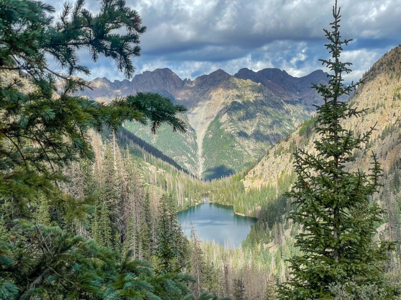
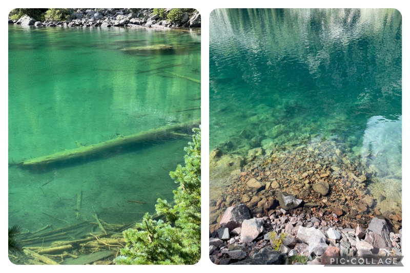
This was my least favorite section of the entire way out. Worse than the willows even. It felt like it took forever to get to the shore of the lake. The trail is very faint and broken in between the cliffs and the lake. I lost the trail two or three times, finding myself performing sketchy crossings over deadfall on steep terrain. My Garmin watch had just enough juice left that I was able to load up the GPX file and correct my course. I arrived at the lake at 10am and rock hopped along the northern shoreline to the vacant campsites at the west end of the lake. 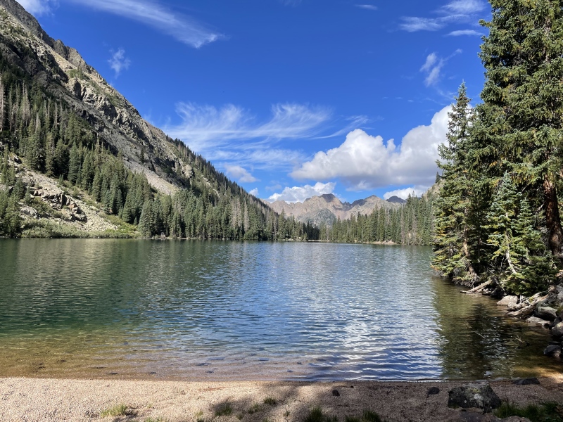
I had expected an hour from Camp Luscious to the lake and it took me 1.5 due to the route finding. I took a short break with my pack off and sat for a minute wondering if I had given myself enough of a buffer to reach Needleton in time for the train. I quickly set off again, stopping for a minute to snap a pic at Ruby Pond before continuing. 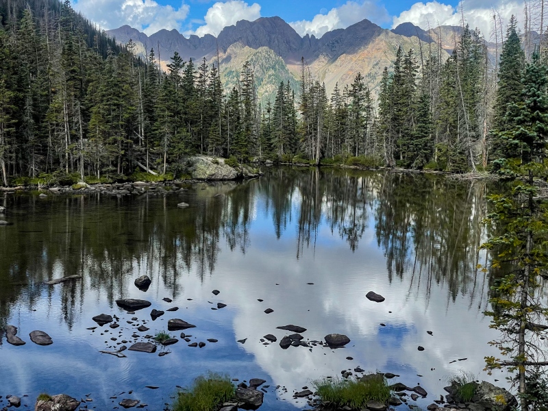
The forested miles in between Ruby Pond and the 200ft re-ascent section (above and away from the creek) went all right. The worst of it was an army crawl underneath some particularly nasty deadfall, and some of the external bulk on my backpack snagged leaving me stuck for a moment or two. Otherwise, I was in a great mood. I became lost for about 5 minutes again but I was making great time now so it didn’t really matter anymore. 
I took my next break at the junction for the Ruby Creek approach/N. Pigeon approach “trail” which is roughly 30ft west of the aspen tree with the columbine carving. Two climber dudes approached me huffing and puffing up the steep trail. These were the first people I had seen since the family of 8 more than 48 hours ago! They informed me of their plans to take the N. Pigeon Creek approach for Pigeon & Turret. I pointed the way up the ridge line next to me and wished them luck as they kept going. The next section (down to the N. Pigeon Creek crossing) was the steepest section since the cliffs above the lake. I fell (again) and endured another annoying deadfall instance obscuring the steep trail. I reached the camper’s meadows Roach describes in Jagged Peak’s Noname Creek approach, and I knew I was close to the river. Before I knew it, the roar of the flow of the Animas was ever present. And then I was at the Needleton bridge, and it was 1pm. I had left Camp Luscious 4.5 hours earlier. I was pleased to see Team McMuffin’s stash of frosty bev’s still hiding in a nook of the river bank, with one mango margarita and one nut brown ale left to take full command of my attention. I cracked open a drink and took shoes and socks off soaking my legs and feet in the frigid waters of the Animas River. Several other climbing parties mulled about on the opposite river bank occupying the excess time in the manner of their choosing before the train arrived. The train finally arrived at 3:10pm, just as I was beginning to get hangry. I immediately made for the concessions car and secured a bean burrito and a Ska Blonde Ale as my third and final frosty beverage. 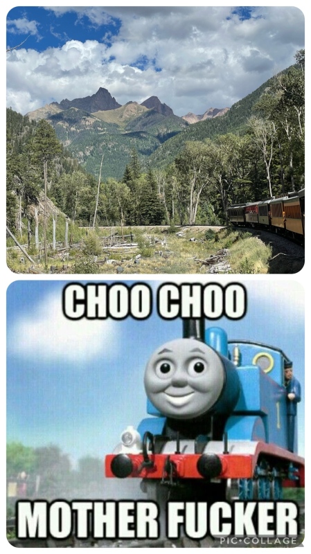
The train ride back to Durango always feels longer than the way up, but we eventually made it back. I grabbed my pack from the pile next to the freight car at the depot, returned to my trusty Xterra sitting quietly in the shade of the station parking lot, and bolted for dinner, beginning a meandering trip back home shortly after. What I Learned
Thumbnails for uploaded photos (click to open slideshow): ")
")
")
")
")
")
")
")
")
")
")
")
")
")
")
")
")
")
")
")
")
")
")
")
")
")
")
")
")
")
")
")
")
")
")
")
")
")
")
")
")
")
")
")
")
")
")
")
")
")
|
| Comments or Questions | ||||||||||||||||||||||||||||||
|---|---|---|---|---|---|---|---|---|---|---|---|---|---|---|---|---|---|---|---|---|---|---|---|---|---|---|---|---|---|---|
|
Caution: The information contained in this report may not be accurate and should not be the only resource used in preparation for your climb. Failure to have the necessary experience, physical conditioning, supplies or equipment can result in injury or death. 14ers.com and the author(s) of this report provide no warranties, either express or implied, that the information provided is accurate or reliable. By using the information provided, you agree to indemnify and hold harmless 14ers.com and the report author(s) with respect to any claims and demands against them, including any attorney fees and expenses. Please read the 14ers.com Safety and Disclaimer pages for more information.
Please respect private property: 14ers.com supports the rights of private landowners to determine how and by whom their land will be used. In Colorado, it is your responsibility to determine if land is private and to obtain the appropriate permission before entering the property.