| Report Type | Full |
| Peak(s) |
Torreys Peak - 14,272 feet |
| Date Posted | 09/19/2023 |
| Date Climbed | 08/08/2023 |
| Author | Ed_Groves |
| Senior Moments on Kelso Ridge |
|---|
|
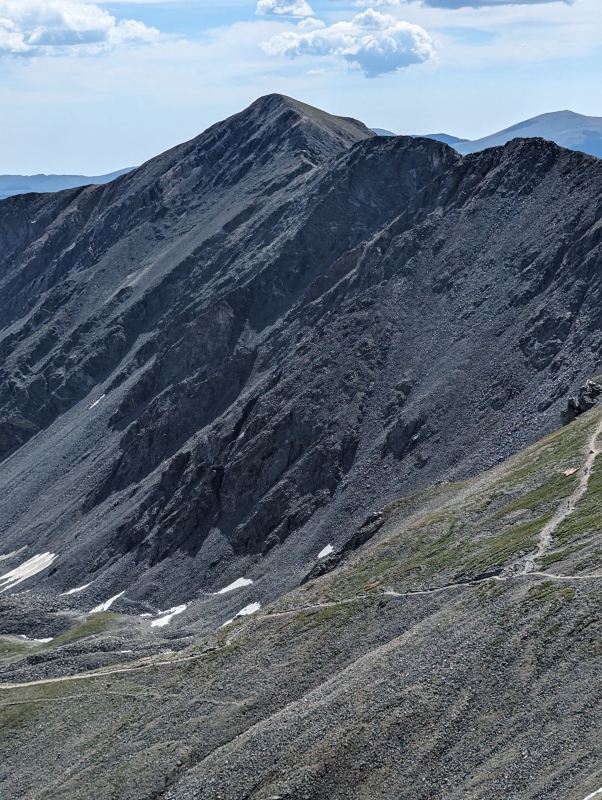
Prologue On July 21st, 2020, I hiked to Grays Peak with the intention of also completing Torreys Peak on the same hike. However, circumstances dictated my path that day as my wife decided to wait for me at approximately 13,200 feet on the way up to Grays. I offered to go back down with her but she stated that this was my first 14er and she didn't want to take that away from me. I proceeded to complete Grays but I didn't want to leave her any longer than necessary, so I descended back down the mountain leaving Torreys for another day. Tuesday, August 8th, 2023, was that other day and I decided I would do the orphaned peak via Kelso Ridge for more class 3 experience. Additionally I had recruited a friend the same age as I, with some class 3 experience, to hike the peak with me. While I had completed some class 3 routes and some smaller sections of class 3, I still considered my experience as minimal, and at 62, I thought it wise to have a partner. I also had intentions to do the Sawtooth as well as the Halo route on Holy Cross during the week. However, once again circumstances interfered. My hiking partner, John, decided after much research that while he had climbed Longs Peak a couple of times it had been a few years and Kelso Ridge seemed quite intimidating. He also bailed on the Sawtooth. Rather than let John hike by himself all week, we split up the Sawtooth doing both Bierstadt and Evans by the standard routes respectively on Thursday and Friday. This did not leave a day for the Halo route so it was removed from our itinerary. We also climbed Mt Edwards on day one - Monday, and for Tuesday I did Kelso Ridge solo while John climbed Grays and Torreys via the standard route. As I saw it, bailing was not an option for me. I couldn't see proceeding to more difficult climbs if I couldn't do Kelso Ridge. (Senior Moment #1 - Thinking a guy who had hiked Longs 15 plus years ago would be game for more intense class 3 hiking.) Kelso Ridge Ascent On the day of the hike we arrived at the Grays Peak Trailhead at approximately 4:40 AM. There were quite a few people already there, but a number of parking spaces were still available. We gathered our gear and started the hike around 4:50. Rather than encumber readers with a description of the first section of trail, I will just state that the beginning is a mild grade with good trail through willows and the last of the tree line. 
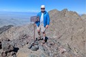
At approximately 1.8 to 1.9 miles we reached the right turn for the Kelso Ridge trail. I decided to down a scrumptious Clif Bar before proceeding and John took a picture of me by the cairn. I asked John if he was getting one last pic of me before I met my demise. (Senior Moment #2 - Thinking a Clif Bar is scrumptious.) 
After finishing the Clif Bar and drinking some fluids I hiked toward the ridge. I am always impressed by the grandeur of these ridge sections before I reach them. To the untrained eye they look insurmountable, but once on the ridge the terrain begins to look more navigable. I was so intent on reaching the ridge I passed by the old mine shaft and was quite a few yards beyond it before I realized I had passed it. From the ridge saddle, as I gazed upon the route ahead all I could think of was going forward . . . . going forward . . . . the mine shaft be damned. (Senior Moment #3 - Failing to get a photo of the classic Kelso Ridge mine shaft.) 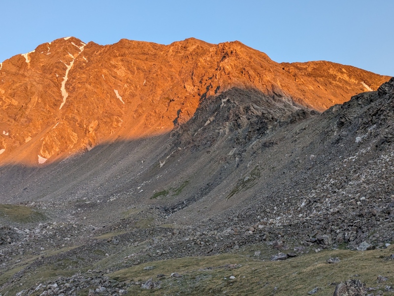

With my trusty 14ers.com route information and photos downloaded on my phone and at the ready, I proceeded to pass the initial towers of rock on the right and quickly came to the first short class 3 section. It looked very manageable and was definitely well within my abilities. I removed my jacket and hat, placed them in my pack, and I began the climb, but about halfway up I reached a point where I couldn't seem to find a good handhold within easy grasping distance. I used the basic mantel technique to get me up to the next ledge where I was able to find plenty of holds and complete the climb. 
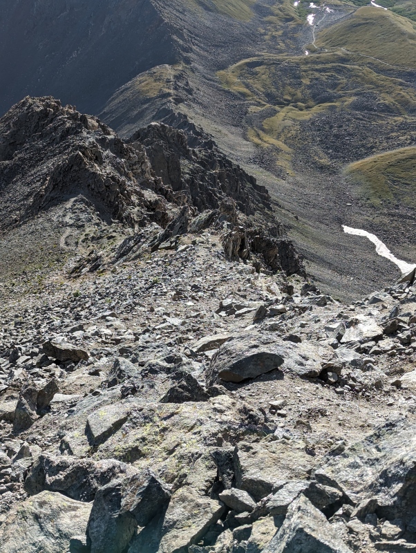
The next section was a mess of loose class 2 and 2+ as I followed the route while dropping to the right now and then, and continued to proceed toward the next class 3 section. At a couple of points during the hike after dropping down for these class 2 bypasses, I would use rock to climb back up rather than try to walk up the steep, loose stuff to get back to the ridge apex. When I was near the top of the ridge the views were beautiful, with Grays and the Steven's Gulch basin on the left, and other mountains to the right. 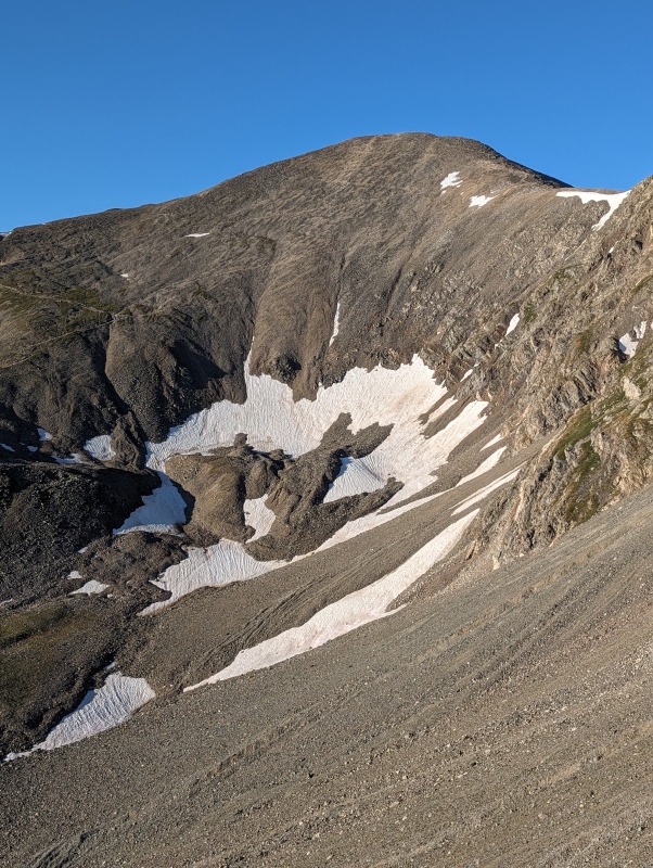
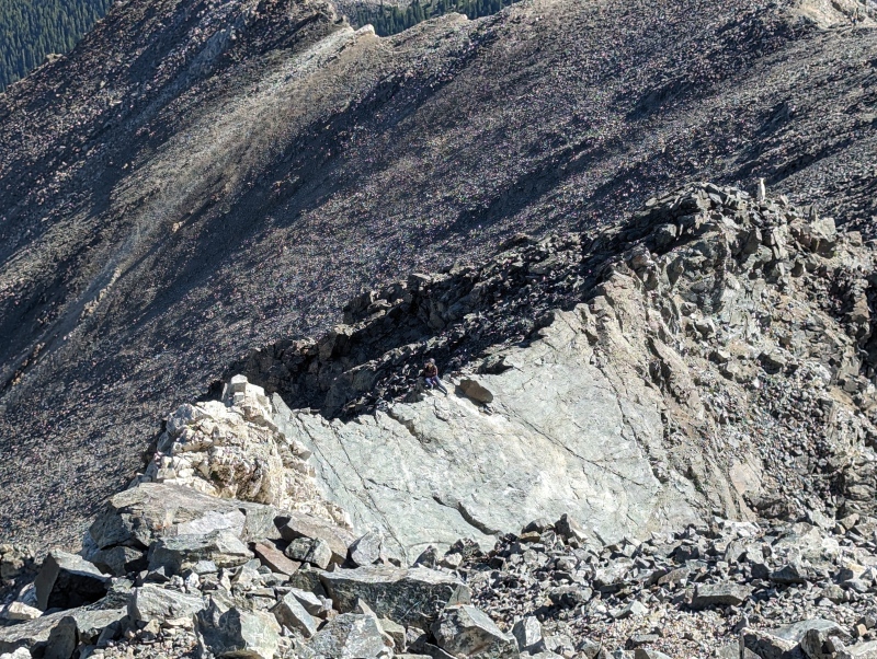
I eventually reached the bottom of the ascent to the next section of class 3, the "white wall," and decided to take a break for water. I had not seen anyone since taking the cutoff to Kelso Ridge, but a younger hiker named Blake had caught up with me by now. We chatted for a while and then I suggested that he proceed first because I knew he would be faster than I. I allowed him to get a bit ahead to avoid any possible rock fall, and then I began the ascent. While somewhat longer, I thought the white wall section was fairly benign as well, except for a small section where I climbed in an angled crack and my backpack was hanging on the rock on one side of the crack. This crack area was located just before I came out below the white rock and made a right turn to ascend up and over it, per the route instructions on this site. 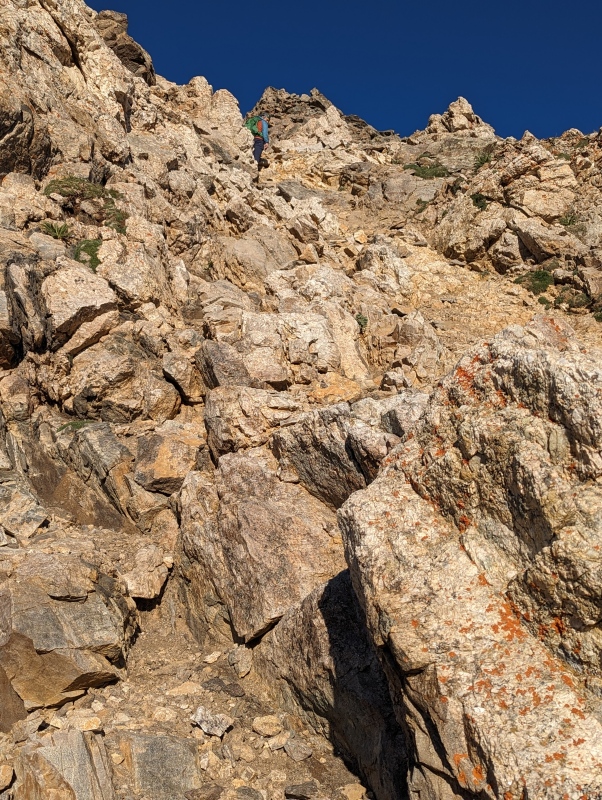

After the white wall, I encountered an extended section of loose and, at times, steep class 2/2+ once again. In my opinion, this stuff is the true crux of this route for me. All hikers are different. On this route, I was aware of exposure in a few spots and it prompted me to be cautious, but I never felt a fear of any kind. I was able to proceed through those exposed sections at a consistent pace. But the loose, steep stuff was just plain tiring and I did not enjoy it like I did the class 3 sections. This was only my second day in Colorado on this trip so I am sure that was part of it. By the time I was getting near the third class 3 section, I needed another break for water and some energy. I gave John a call to gauge his progress on the standard route for Grays/Torreys but I was unable to reach him. 


I could see there weren't many bumps left on the ridge before the last summit pitch so I knew I was getting close to the third class 3 section just before the knife's edge. As I approached the section where the route goes to the left of the ridge my young friend, Blake, popped up on the other side of a hump probably 100 yards ahead of me and mentioned something about going left from what I could make out. It seemed that perhaps he was looking out for the old man behind him. I knew I was going to go left but I appreciated his effort to confirm the route for me. It was in this area where I was the least comfortable with the route. I reached a section with some loose and angled rock which, to me, didn't match the pics on 14ers.com and I knew I didn't want to miss the route back up to the ridge. I analyzed this area for a minute and the route above me definitely looked like it should go all the way to the top but it seemed to traverse sideways halfway up which didn't seem right to me. However, the path I was considering looked just too good to pass up so I went for it. After climbing up over the loose stuff, traversing across the mid-section, and then climbing straight up from there I popped out on top of the ridge again. From what I could tell, I think I went up a tad early resulting in the traversal of the mid-section over to the area which is possibly portrayed in the 14ers.com pics. But I couldn't tell for sure from my perch above the angled rocks. At this point the path dropped down slightly to the right of the ridge and the knife's edge came into view. (Senior Moment #4 - Failure to take a pic of the third class 3 section.) 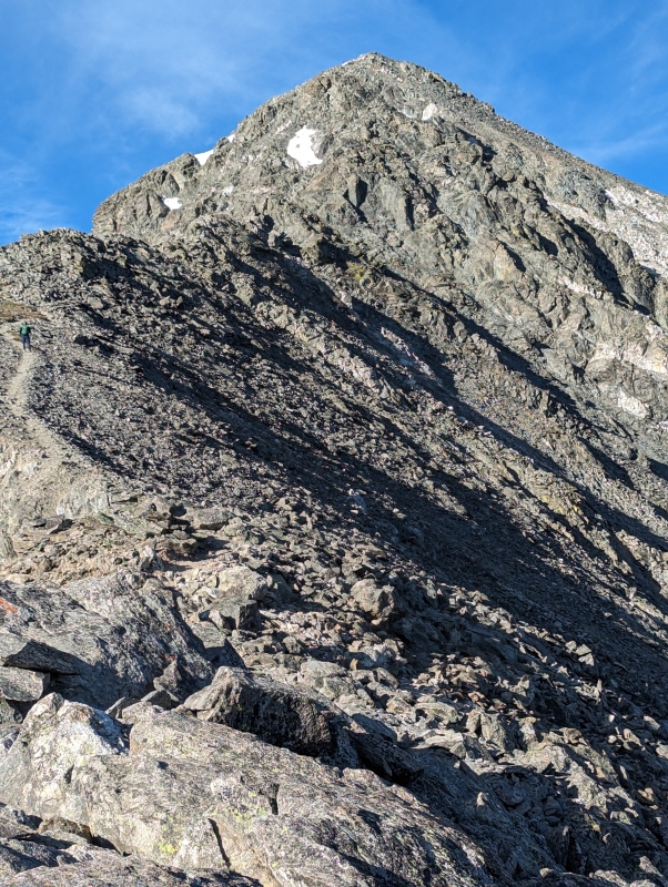
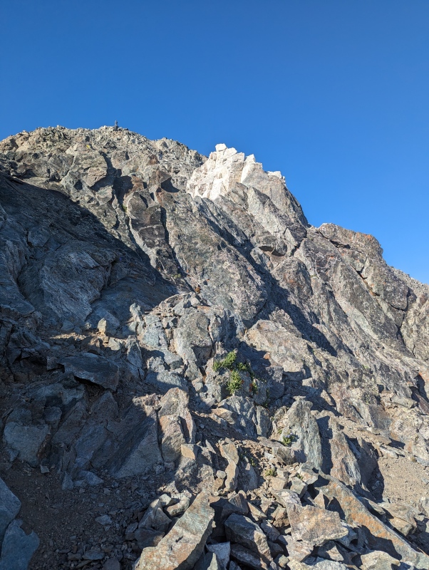
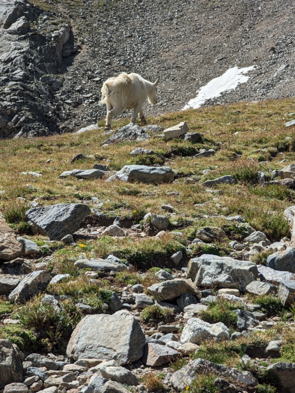
I climbed up to the beginning of the knife's edge and looked for footholds to walk along the edge while holding on to the apex. While there was one hold here or there in the first third of this section I didn't find any on the last portion. I ended up straddling it on the last half to complete the move over to the white rock. Once I reached the white rock I worked my way around to the right and down maybe 10 feet or so to a ledge. As I started to traverse the ledge, a Rocky Mountain Goat started to cross from the other side. We both stopped and looked at each other for what seemed an interminable moment. Then the goat moved up a bit higher and crossed just above my head. I was quite fascinated that the goat was able to gain purchase on the rock above me. It was one of the coolest moments I have encountered so far in the Rockies. Once I reached the other side, I could see the last pitch up to the summit. And there was Blake almost at the top still quite a few yards ahead of me. All that was left was to climb another ugly, loose, steep stretch of class 2, my nemesis for this route. I made the climb and soon I was at the summit, where I discovered that my buddy John had still not reached Torreys. 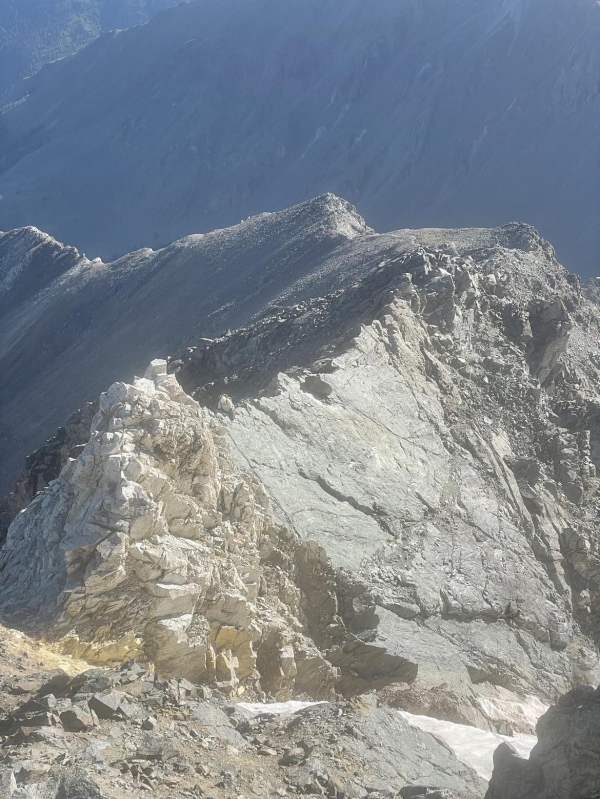


After about 15 to 20 minutes at the top, my buddy, John, trudged to the summit from the Grays Peak side. He was elated to get both 14ers out of the way. I had thought about doing Grays again from the saddle, but since John and I were both pretty tired and I had already completed Grays, we decided to descend to the trailhead. We ate some grub, drank some fluids, and took a few more pics. 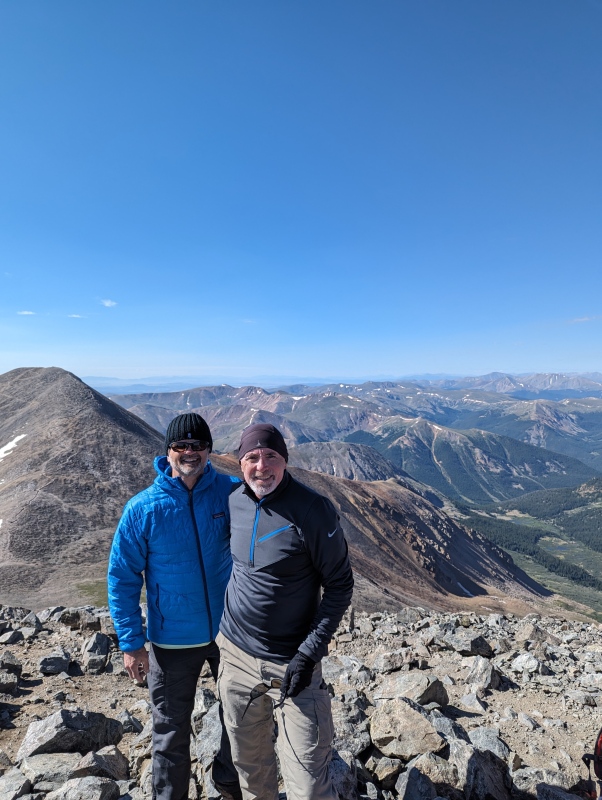
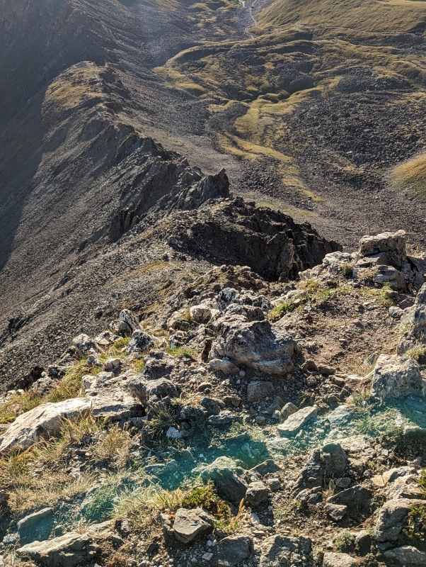
The Descent Once we started the descent I kept looking over at Kelso Ridge, attempting to take a photo that would reveal some of its ups and downs and ins and outs. But none of the photos I took did any justice to its heaps of majestic rock and the nuance of its exposed precipices. Along the way we were regaled with more Rocky Mountain Goats, as well as views of Mount Edwards, which we had ascended as a warm-up on the previous day. The wind had not died down and we watched a gust of wind turbulently grab an uphill hiker's hat and blow it far into the basin. He and his family appeared to be in shock that the wind could be so strong. With the uphill portions of the hike behind us, we enjoyed the pleasant satisfaction of completing our goals for the day. 

Epilogue I concluded that I needed additional practice handling loose, steep class 2 because that was more of an issue for me than any of the class 3 climbing. Approximately a month after this hike, I did a number of Sawatch Range peaks that gave me a great deal of loose class 2 practice and I noticed an improvement in my strategies to handle such terrain, both up and down. As for the senior moments, by definition, all of my moments in the mountains are now senior moments. :-) Kelso Ridge was a fun climb and I would do it again, although I would probably want to be more acclimatized on the next go round. It was my favorite hike for the summer of 2023. Thumbnails for uploaded photos (click to open slideshow): ")
")
")
")
")
")
")
")
")
")
")
")
")
")
")
")
")
")
")
")
")
")
")
")
")
")
")
")
|
| Comments or Questions | ||||||
|---|---|---|---|---|---|---|
|
Caution: The information contained in this report may not be accurate and should not be the only resource used in preparation for your climb. Failure to have the necessary experience, physical conditioning, supplies or equipment can result in injury or death. 14ers.com and the author(s) of this report provide no warranties, either express or implied, that the information provided is accurate or reliable. By using the information provided, you agree to indemnify and hold harmless 14ers.com and the report author(s) with respect to any claims and demands against them, including any attorney fees and expenses. Please read the 14ers.com Safety and Disclaimer pages for more information.
Please respect private property: 14ers.com supports the rights of private landowners to determine how and by whom their land will be used. In Colorado, it is your responsibility to determine if land is private and to obtain the appropriate permission before entering the property.