| Report Type | Full |
| Peak(s) |
Aiguille du Midi (12,605') Mer de Glace (5,470') Grand Balcon Nord (7,817') Glacier de la Pendants (9,068') |
| Date Posted | 09/19/2023 |
| Modified | 10/12/2023 |
| Date Climbed | 08/05/2023 |
| Author | jfm3 |
| French Alps Training Camp Part 2: Mer de Glace-Plan du Aiguille Loop and Aiguille du Midi |
|---|
|
French Alps Training Camp Part 2: Mer de Glace-Plan du L'Aiguille Loop, Aiguille du Midi and Bochard-Glacier de la Pendants Loop August 5-7, 2023 Chamonix, France Part 1 of the report is in my profile. Saturday August 5: Today I ran a route that started at my hotel, ascended to the Montenvers train station and dropped down onto Mer de Glace (https://www.chamonix.net/english/leisure/sightseeing/mer-de-glace). From the glacier, I climbed back up to the far northeast end of the Mont Blanc massif and followed the Grand Balcon Nord route (https://elevation.alpsinsight.com/france/chamonix-grand-balcon-nord-trail-run/) to the mid-mountain Aiguille du Midi tram station. I then dropped back to Chamonix to finish the loop. Strava: https://www.strava.com/activities/9589903385. This contains the GPS track, elevation/heart rate/time data and more additional photos. The report is the same on Strava as it is here. 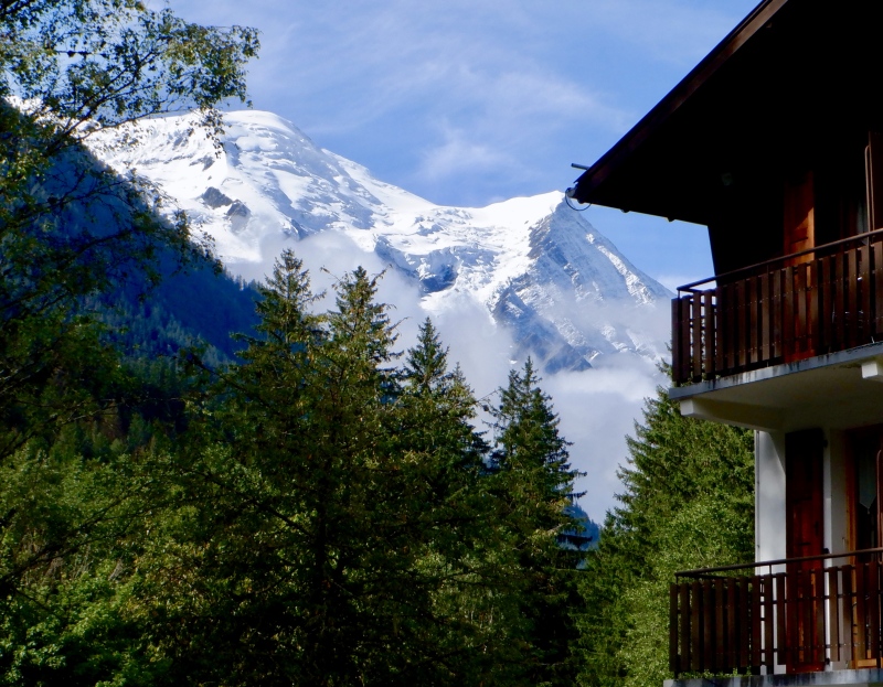
This route was slightly underwhelming. Hard to say that in a place with such extreme terrain and scenery, but it was yet another day with low clouds that obscured the views of the high mountains. I also thought there would be some easy glacier travel, but I was on dry ground the whole way. I took the short ice axe and shoe crampons with me but they stayed in my pack all day. I had a later start, since the whole route was on foot from the hotel. The breakfast buffet is quite simple- lots of bread, some jelly and 2 kinds of prosciutto. I’ve had better, but it’s enough when supplemented with some fruit from the grocery store. 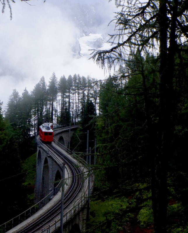
The sun was out briefly as I left the hotel. Mt. Blanc and the Aiguille du Midi summit were visible way up in the sky. It took 90 minutes to climb to the Montveners train station. The trail was entirely in the trees so there wasn’t much to see. It was also significantly less steep than the last 2 days, which was a relief for my legs. The temp was in the 50s and it was humid, making for an unpleasant combination of a lot of sweat while also being somewhat cold. I wore my pants and windbreaker for most of the day. 
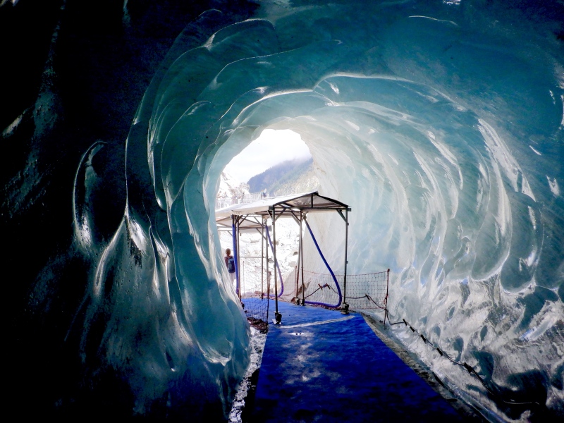
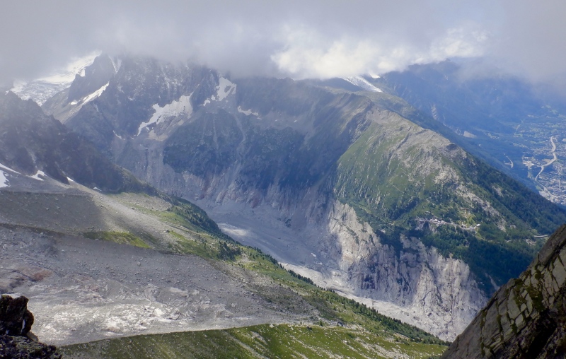
I arrived at the Montveners train station to see a mass of humanity getting off the train and heading for the chairlift down to Mer de Glace. I instead went for the trail and started descending as the sun came out. The total drop to the glacier was about 800 feet. Most of that ice thickness has been lost in the last 200 years. The lower half of the descent was on a system of stairs & ladders bolted to the side of the moraine. The Grotte de Glace was disappointing. It’s a very small cave carved into the surface of the glacier. I thought I’d be able to go out on the glacier a ways, but all the ice was covered in moraine chunder. No thanks. 
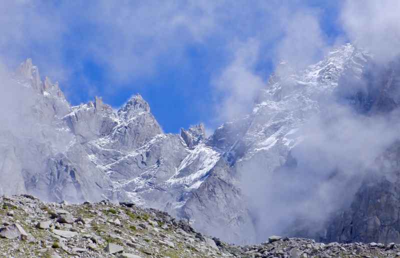
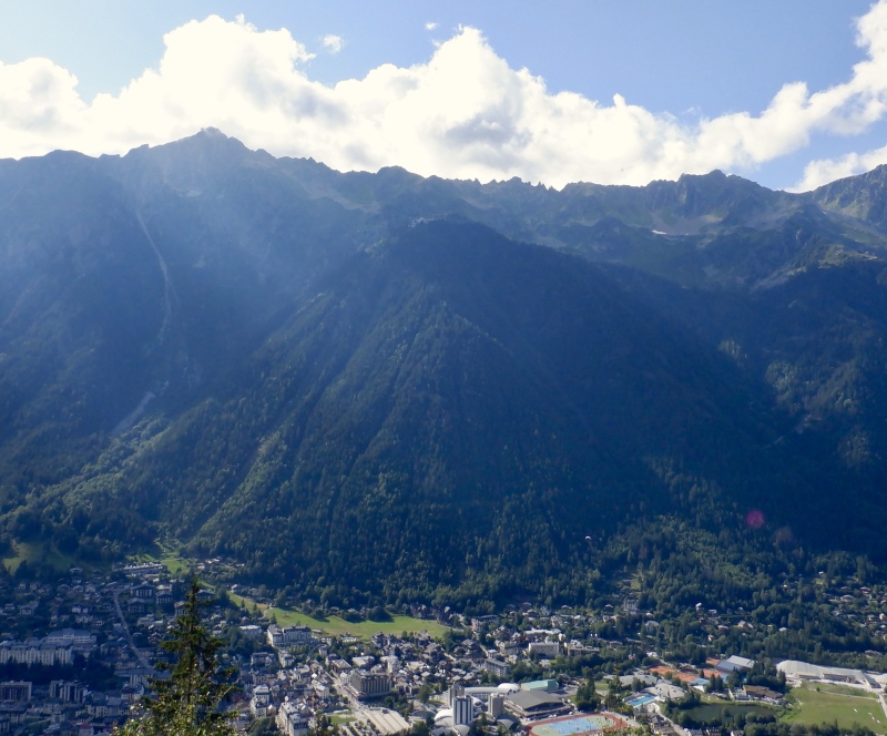
I got hot on the climb back to Montveners. The sun was still out, giving good views of the Dru & Vert Aiguilles and the larger terrain up the Mer de Glace valley. As I ascended the ridge the clouds dropped and the temperature plunged 10 degrees. I was usually hot or cold today with the constantly shifting weather. The climb wound up through the clouds, devoid of scenery. I finally reached the top, turned the corner onto the Grand Balcon Nord route and suddenly saw Chamonix 4,000’ below, partially screened by the fog. 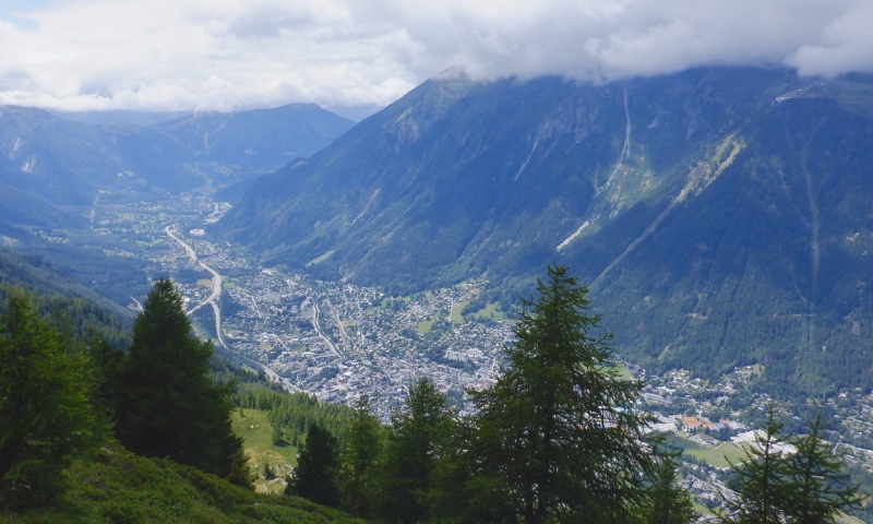
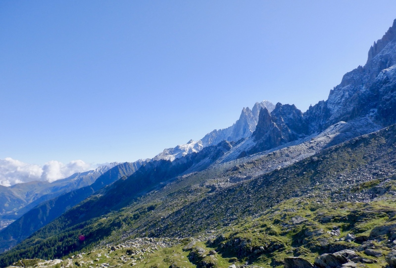
The clouds stayed high on the whole traverse to the Aiguille du Midi tram station so I finally got some scenery down the valley. Some of the lower Aiguilles were visible for a few moments when the clouds shifted but I still couldn’t see any of Mt. Blanc. The trail was crowded with people going both directions. I descended a ways, then detoured back up on the Aiguille du I’M approach trail. This wasn’t really worth the effort, since all the high peaks were covered. The trail was steep with junk footing, especially on the way down. 20 more minutes on the main trail brought me to the Lac Bleu split. Sure, let’s do more vert. 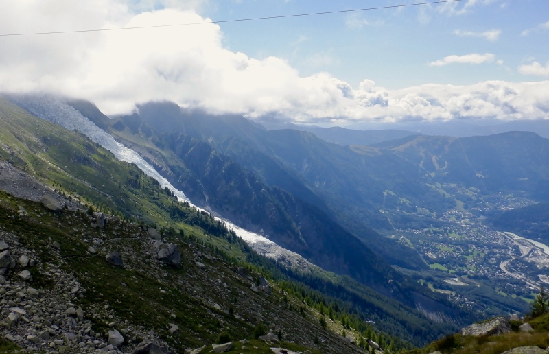
It took just a few minutes to reach the lake. I knew the huge faces of the Aiguilles were just above but the clouds blocked all the views. I checked the GPS and saw a trail leading to the edge of the Pelerins Glacier. Perhaps there would be enough ice to use the spiky gear for a few minutes. I hiked to the edge of the moraine as some sun filtered through the clouds to the west. Once glance confirmed my suspicions- the whole thing was moraine rock and dust, with no exposed ice anywhere close to the trail. I sat there for awhile, watching the Aiguille du Midi trams ascend and descend through the cloud layer. The changing tension of the cables indicated when one was about to exit the clouds. I was only 4,000’ above town but the rolling route contained a lot of vert and the drop back to the valley was steep. Time to get back on the trail. 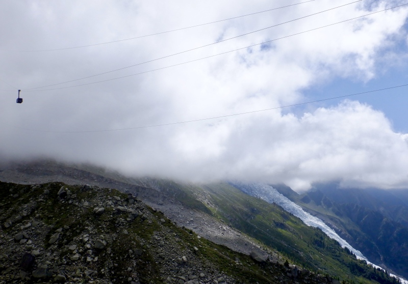
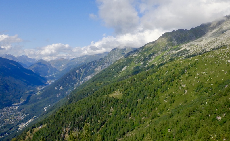
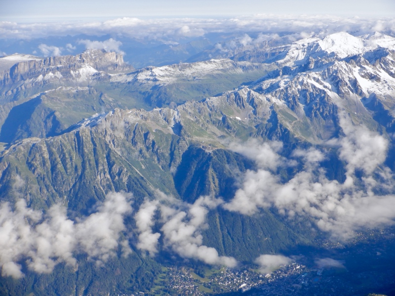
It took about 1.5 hours to descend back to town. I dropped over the edge of the shelf and took off my long layers, then steadily cruised down the absurdly steep forested switchbacks. The glaciers on the Dome du Gouter were visible and I warmed up quickly in the direct sunlight. I utilized a creek crossing to cool off. There isn’t much running water here- no lakes or water troughs and very few creeks. Water is much more plentiful in the Swiss Alps. Despite being directly above town, it took awhile to descend all the way to the valley. There is a lot of vert here. I eventually reached the pavement and ran slowly through town back to the hotel. Portions of the route towered above me in the afternoon light. 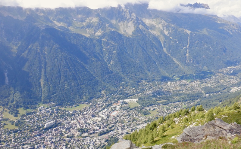
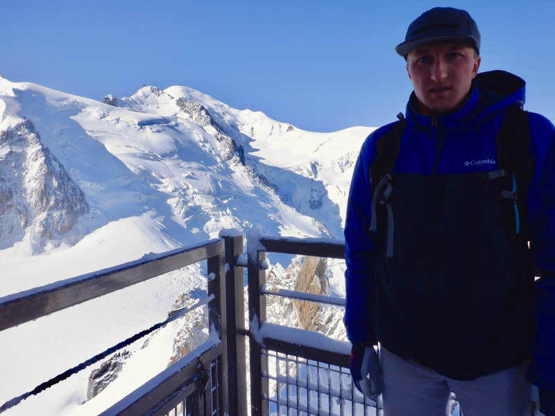
I ate dinner at Casa Valerio, an upscale Italian place, tonight. After checking the weather forecasts and Chamoniarde condition reports, I decided to push my Mont Blanc climb to next week. There's no point in going up there while it's storming. It's dangerous, plus I wouldn't be able to see anything. Sunday August 6: I took today completely off from training. I spent some time on the computer uploading photos and continuing to write the reports for Strava, then figured out transportation and schedule logistics for the next several days. I ate lunch at Irish Coffee and got more small souvenirs at several of the shops around town. Dinner was at Cafe Valentino. This is now the 4th country I've been to in the Alps and the restaurant options are similar from place to place. The portions are large and it's easy to get a variety of food. On this trip I took my water bottle everywhere and usually drank from that. It would be way too expensive to pay for half a gallon at every meal, and I can't survive on just red wine and coffee. Monday August 7: This morning I took the cable car from Chamonix to the top of Aiguille du Midi. Tickets: https://www.montblancnaturalresort.com/en/aiguille-du-midi. The tram operation can be shut down due to high winds or storms at the summit, but on a clear day this is probably the most spectacular sightseeing outing in the Alps. Strava: https://www.strava.com/activities/9602281556. The Strava entry has many more photos. 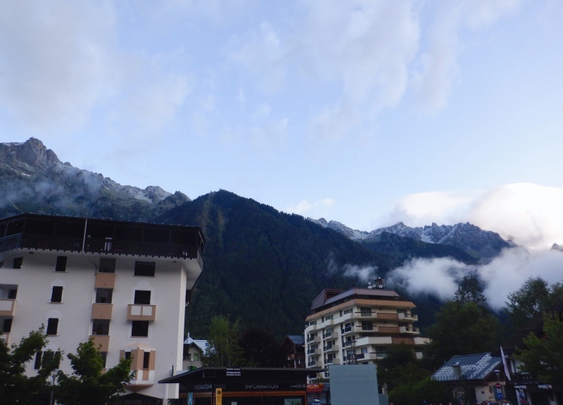
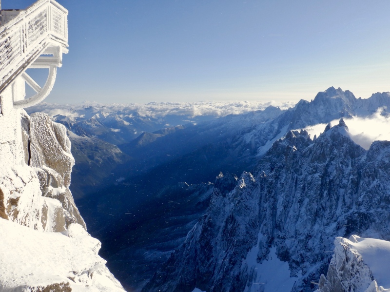
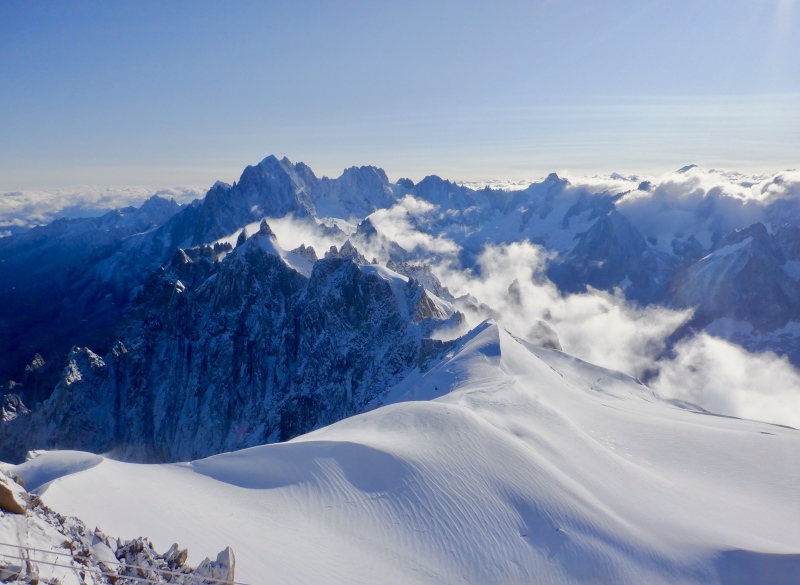
The weather finally cleared and the scenery from the summit was astounding. I arrived at the lift station to find all the gondolas delayed while the crews cleared snow off the summit station. The summit was visible from town and there were several people wandering around with mountaineering gear, so I figured the upper portion was open. I waited around for 40 minutes as the clouds rapidly cleared off the high peaks. 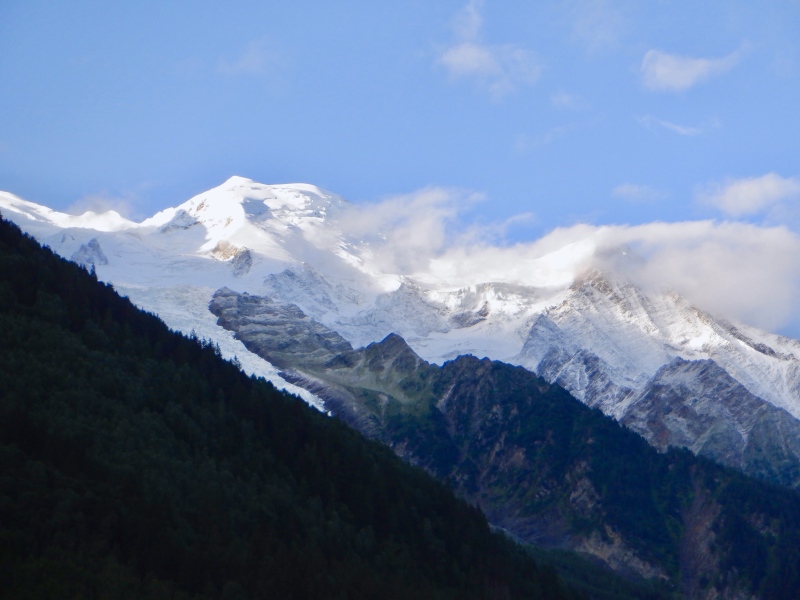
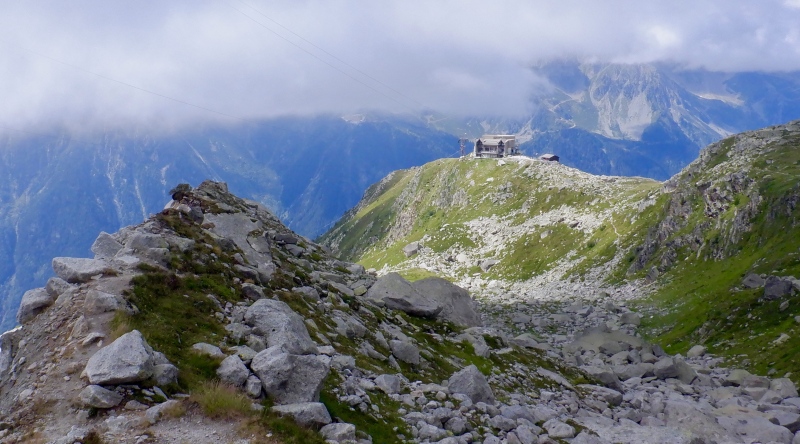
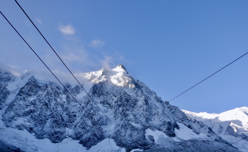
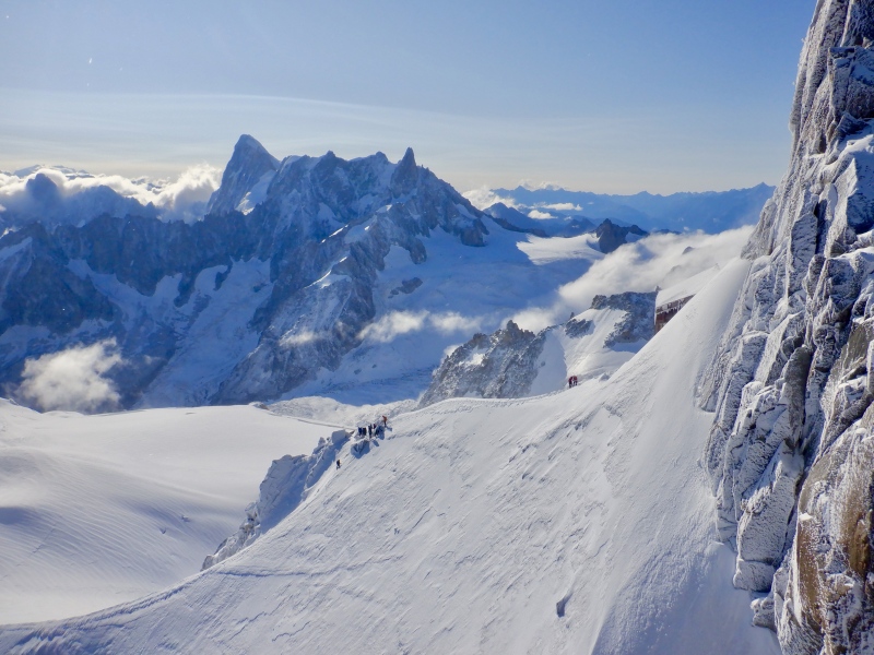
Once the trams started spinning, the ascent was fast. The first portion up the slope I descended 2 days ago was very steep. These trams are always disconcerting. It’s odd to be traveling upward so quickly while suspended by just a cable. The surroundings were even more vertical at the Plan du L’Aiguille station. All the scenery I didn’t see on Saturday was visible, and the Aiguilles were plastered with fresh snow and rime ice. The second tram was almost spooky. 2 km of free-hanging cable going straight up is quite a feat of engineering. I put on both jackets before stepping out of the shelter of the lift station. 
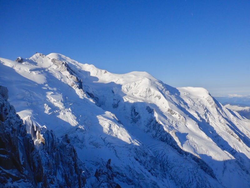
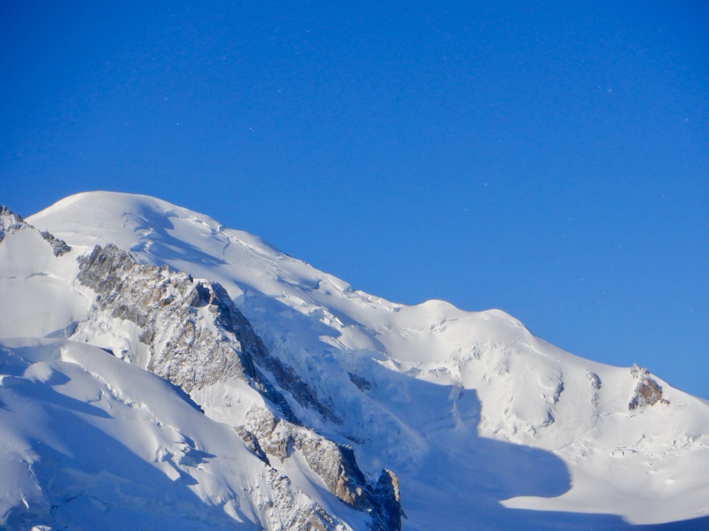
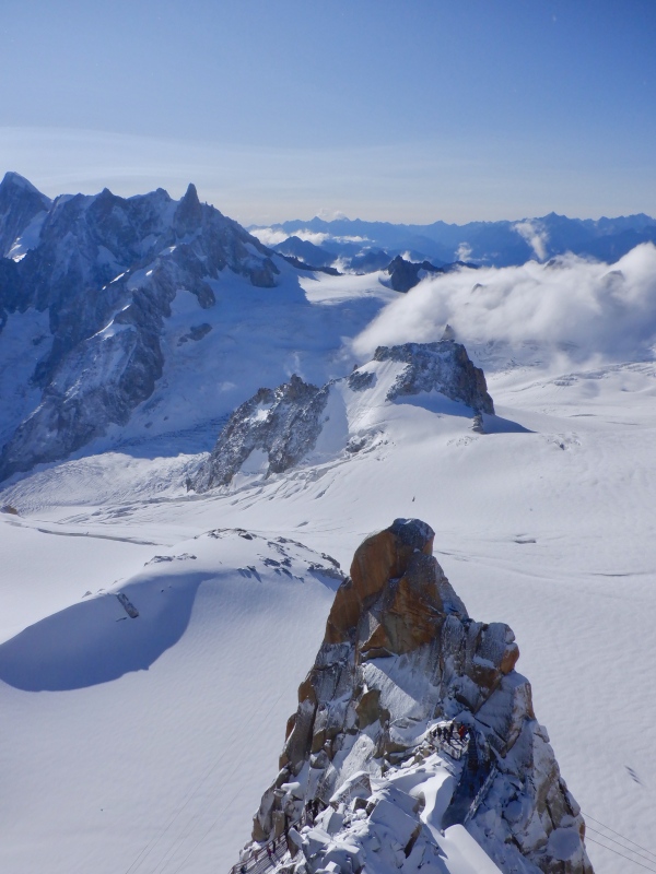
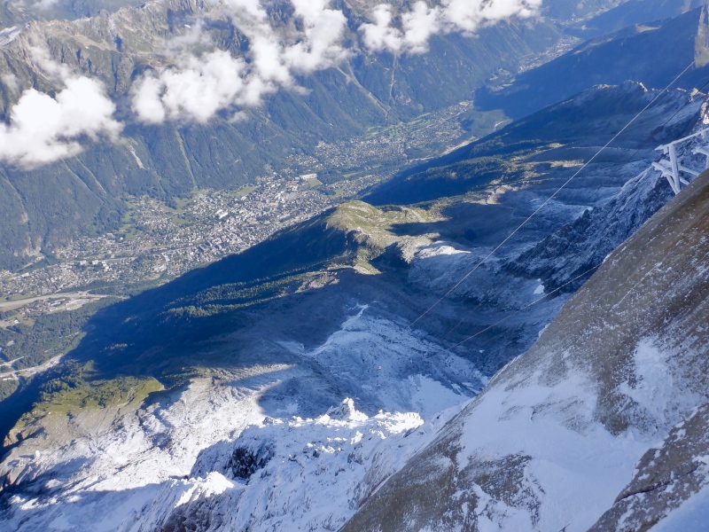
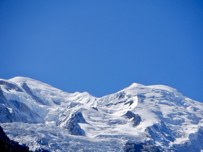
It was about 15 degrees with some wind at the top. I spent over an hour on all the observation decks, taking pictures and looking through the binoculars. Chamonix was 9,000’ directly below, seemingly on a different planet. All of the routes I ran earlier in the week were visible, almost in their entirety. The razor-sharp ridge of the Aiguilles stretched to the east, still covered in shadow. The best scenery was south & west. Grandes Jorasses loomed across the glaciers, its north face cutting a wall in the sky. The lift cables of the Mt. Blanc panorama were just visible stretching across the blinding white Valle Blanche toward Italy. And then there was Mt. Blanc, at eye level to the west. I carefully scanned the upper ridge with the binoculars, seeing climbers between Gouter & Vallot. Am I really going to be up there in 2 days, at this altitude and in these conditions? 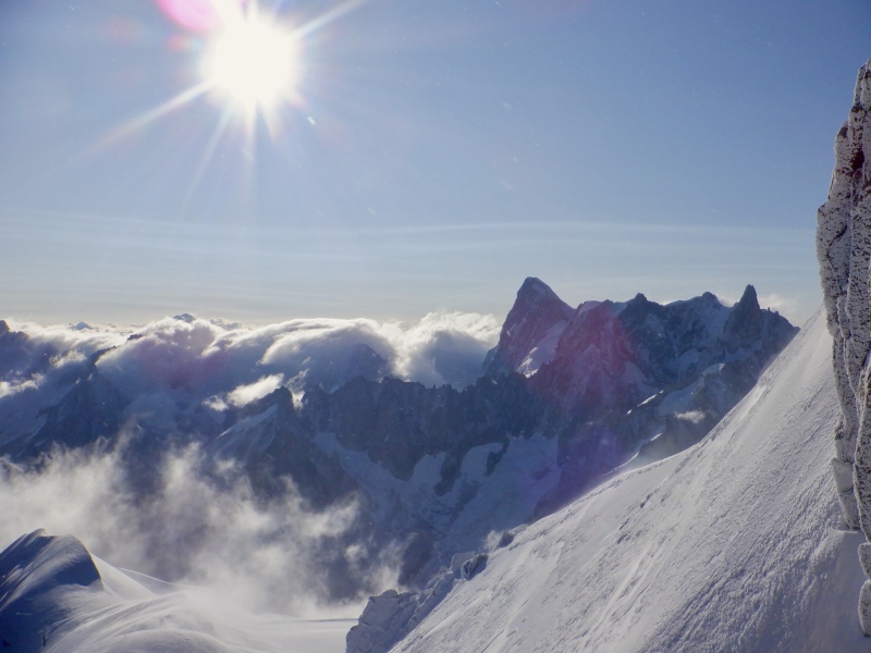
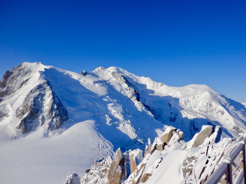
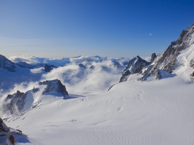
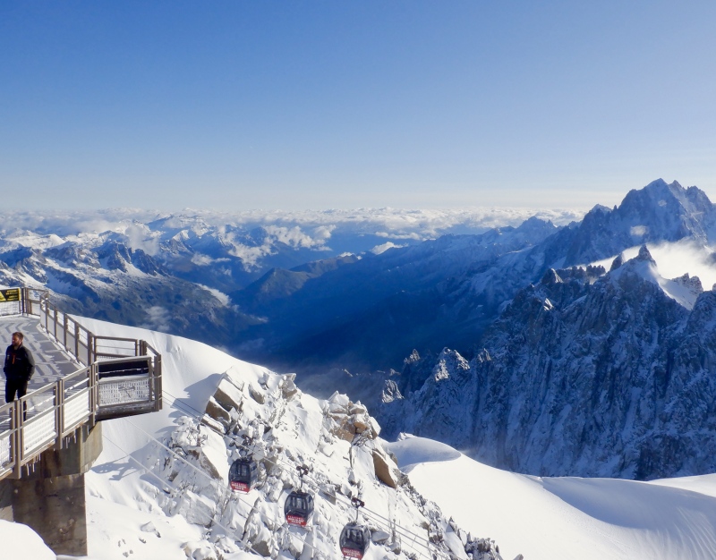
I went back inside to see the day’s climbers gearing up at the tunnel exit, then went back to the terrace to watch the groups descend the ridge below the summit. It’s steep & exposed, and the wind was blowing the fresh snow off the arete. A track was soon chopped out and within minutes paths were being traced to the Cosmiques Hut and out across the glacier expanse. I watched a few trams come and go, appearing suddenly in the sky on the way up and fading into oblivion on the descent. After a few more minutes looking at Mt. Blanc, trying to convince myself I’d be alright up there, I got on the tram back to town. 
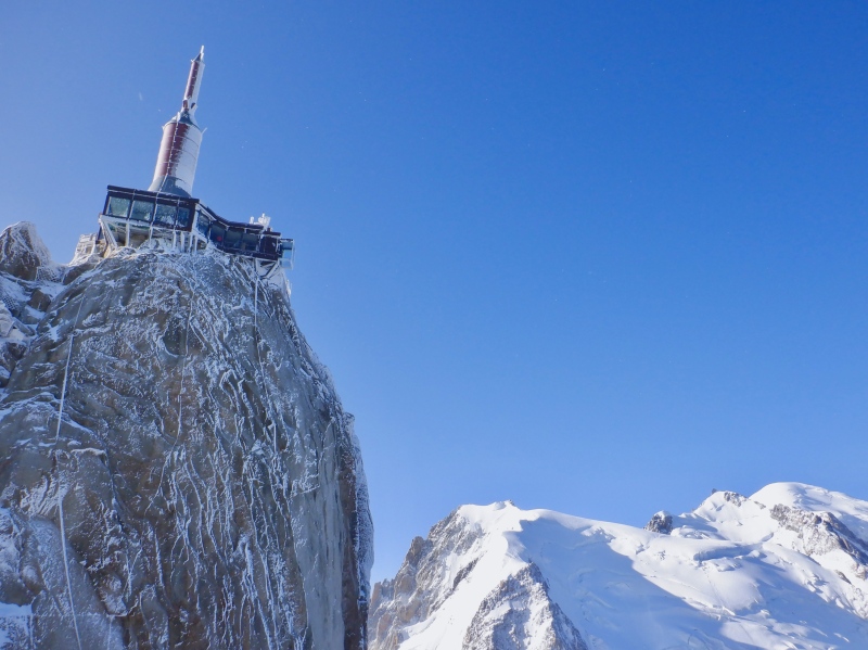
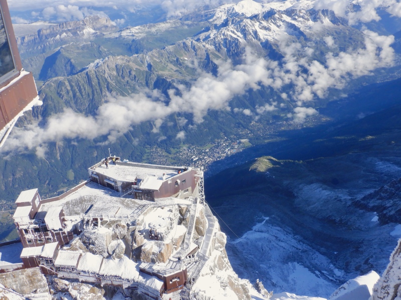
The descent was fast. The initial drop into free space out of both stations was a strange sensation. The scenery glided by as the valley floor rose up from below. The weather was much more pleasant in town when I stepped off the tram. This was significantly more impressive than both Jungfraujoch in Wengen and Klein Matterhorn in Zermatt. What a place. 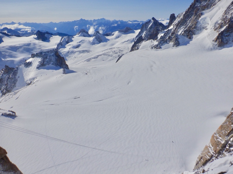

I had a small lunch at the cafe in the Aiguille du Midi tram station. The schedule rearranging over the last few days left time for only a short outing this afternoon. I wanted to do something on the Aiguille Vert massif, and get on a glacier before the Mt. Blanc climb, so I concocted a short loop above Argentiere. I got back to the hotel, packed up the gear and took the bus to the Grands Montets stop in Argentiere. A quick payment for a roundtrip ticket on the Plan Joran tram and I was on my way up, watching 2,800’ of forested hill melt away below me. Strava: https://www.strava.com/activities/9602230102. This entry has a few more photos and the usual GPS, elevation, heart rate & time data. 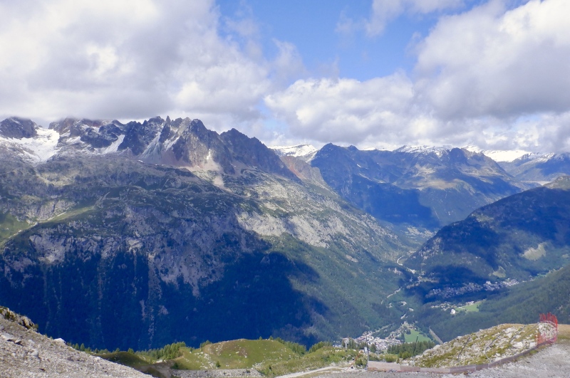
I didn’t have a real route in mind, but I knew I wanted to get on a glacier and that the last tram down to Argentiere was at 5 PM. I checked the map and started up one of the ski trails. Clouds covered the upper mountain but most of the Grands Montets Glacier was visible. I steadily climbed up the trail and was 2,000’ up the hill when I reached the clouds. I saw a snowfield and the fairly low-angle terrain of the Pendants Glacier and figured that would do for some traction-enhanced travel. I took a break, put on the crampons & ice axe and set off across the ice. 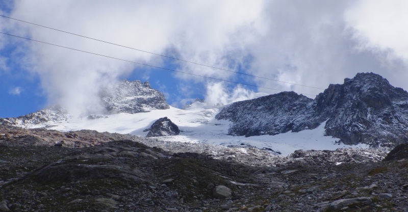
The glacier traverse was a mix of old snow and snow-covered ice. The clouds started a few hundred feet higher and the view down to Argentiere was excellent. Even thought it wasn’t difficult or exciting, I enjoyed having crampons on my feet. The fresh snow gave good grip and made a few short rock crossings much easier. There was some rockfall potential from the tall ridge above me but I didn’t see or hear anything come down. The sounds of heavy machinery echoed from somewhere near the upper Grands Montets lift station. No matter how improbable or remote, there is always construction equipment perched at some ridiculous location in the Alps. 
The ice got steeper toward the end of the traverse and I took extra care with my footing. I reached the edge of the lower glacier and checked the map. A trail back to the tram was below me, so I took off the crampons and started down 400’ of moraine. I picked a fairly good line and never ended up in anything too loose. It was still a slow and tedious descent, as moraines tend to be. It took me just 20 minutes to descend 1,200’ back to the tram. I ran slowly at first, but then checked the time and realized I could eliminate 30 minutes of waiting for the bus if I moved fast. I dashed down the hill, dodged some hikers and got directly on the tram. The very steep drop down the mountain was even worse than the big tram this morning. It’s such a strange sensation. I got off the tram and sprinted to the bus, arriving 1 minute before it did. Good timing. 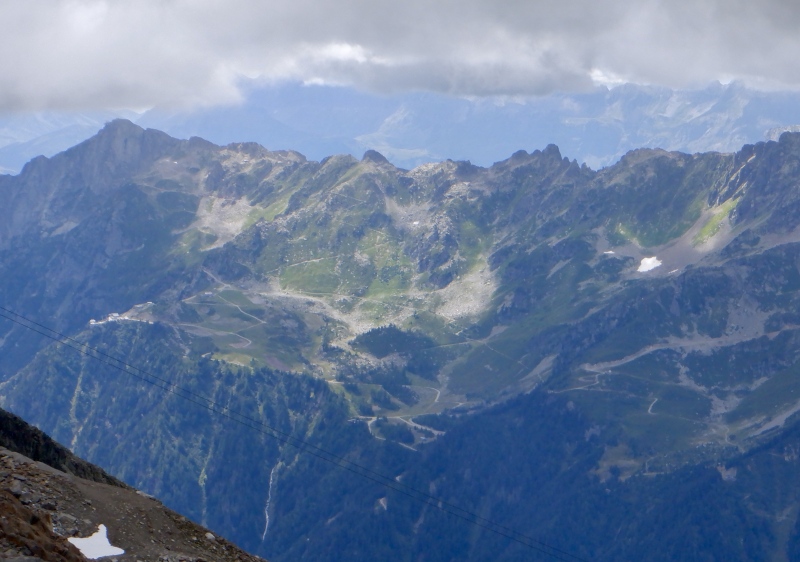
I went to Le Bartavel for dinner tonight, then spent the evening preparing for the Mont Blanc climb. I packed gear, put route notes in my phone, loaded the GPS routes into my watch, checked weather & condition reports and planned the transportation, hiking and climbing schedules for the next 2 days. Part 3 of this report will be entirely devoted to Mont Blanc. Thumbnails for uploaded photos (click to open slideshow): ")
")
")
")
")
")
")
")
")
")
")
")
")
")
")
")
")
")
")
")
")
")
")
")
")
")
")
")
")
")
")
")
")
")
")
")
")
")
")
")
")
")
")
|
| Comments or Questions |
|---|
|
|
Caution: The information contained in this report may not be accurate and should not be the only resource used in preparation for your climb. Failure to have the necessary experience, physical conditioning, supplies or equipment can result in injury or death. 14ers.com and the author(s) of this report provide no warranties, either express or implied, that the information provided is accurate or reliable. By using the information provided, you agree to indemnify and hold harmless 14ers.com and the report author(s) with respect to any claims and demands against them, including any attorney fees and expenses. Please read the 14ers.com Safety and Disclaimer pages for more information.
Please respect private property: 14ers.com supports the rights of private landowners to determine how and by whom their land will be used. In Colorado, it is your responsibility to determine if land is private and to obtain the appropriate permission before entering the property.

