| Report Type | Full |
| Peak(s) |
McClellan Mountain - 13,594 feet |
| Date Posted | 09/26/2023 |
| Modified | 05/19/2024 |
| Date Climbed | 09/20/2023 |
| Author | the_hare |
| McClellan the Fauxrteener |
|---|
|
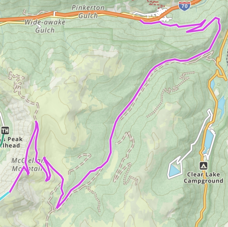
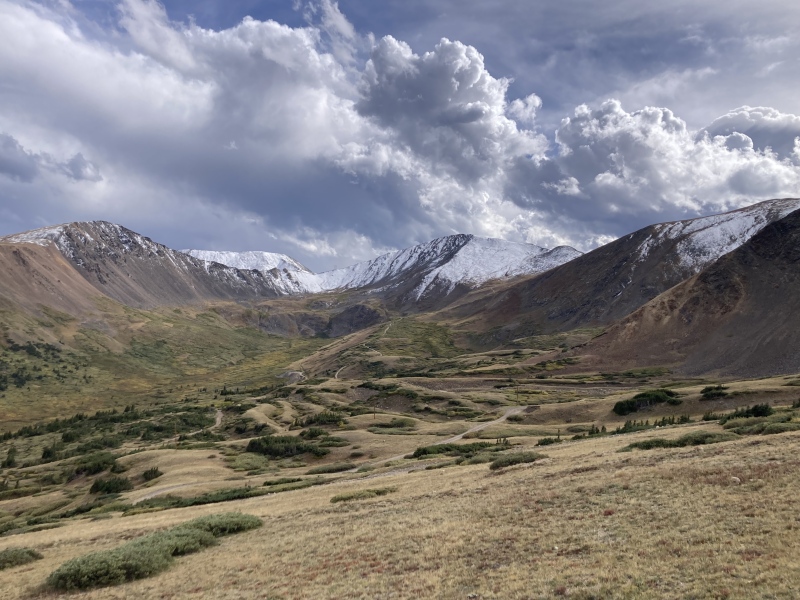
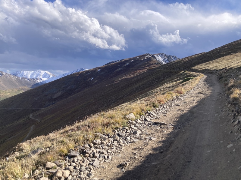
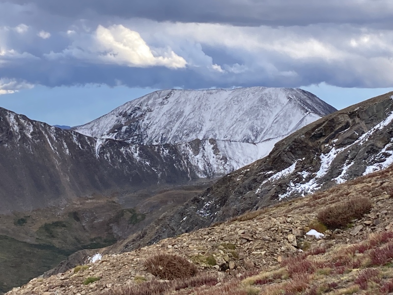
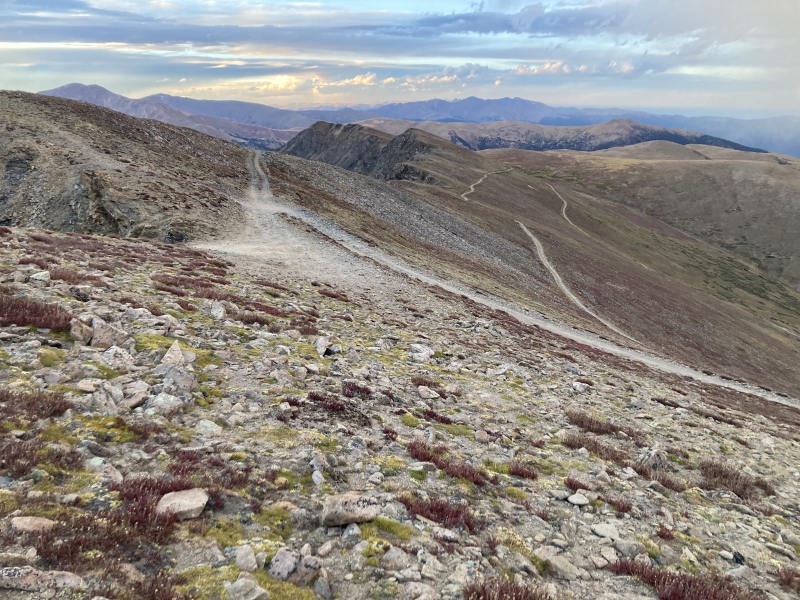
McClellan Mtn. from Silver Plume via Argentine Central Railway road 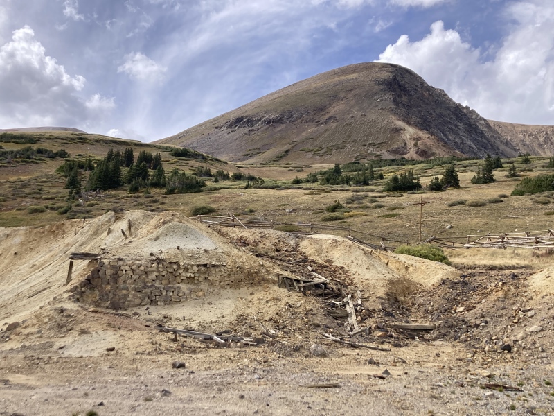
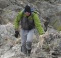
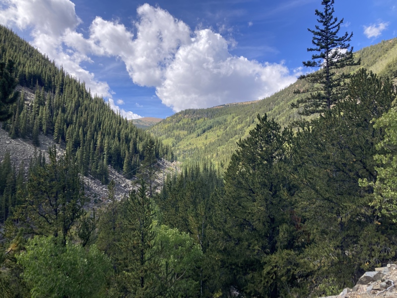
McClellan Mountain used to be a 14er--sort of. In the first decades of the 1900s this actually unranked Stevens Gulch 13er was advertised as a 14er at 14,007 ft. This trip report from resident 14ers historian goregalore first turned me on to this faux-rteener and the history behind its aggressively rounded elevation. Mining tycoon Edward Wilcox first commissioned the Argentine Central Railroad from Silver Plume to the tiny mining town of Waldorf in 1905. He soon extended the line to a mine further up McClellan's slopes and then to its ridgeline with Stevens Gulch. Silver Plume's tourism industry was burgeoning at the time with its Georgetown Loop railroad and aerial tramway up to Pendleton Mountain. Wilcox was hoping to cash in on this by converting the Argentine Central to a passenger sightseeing train. Unfortunately, business trouble forced him to sell the railway to a capital syndicate including the then-governor of CO & mayor of Denver in 1909. They planned on extending the line to the top of Grays Peak ("elev. 14,441") and build a resort at the summit, hence one of the names of the train: Gray's Peak Route. The syndicate couldn't bring the business out of the hole, however, and sold it after only a few years. Decreasing mining output, the rise of the automobile, and the pressures of World War I in the late 1910s led to the abandonment and final removal of the railway in 1920. A 1909 article in The Rocky Mountain News describes the view from the top in words as lofty as its supposed elevation: "The panorama from Mount McClellan or Gray’s peak is one of matchless grandeur and sublimity. In every direction tower America’s most gigantic granites—in all 106 peaks of ponderous size are visible, some of them in Wyoming and others near the Utah line. 'Denver, the beautiful,' appears far to the east, while away beyond it stretch the rolling plains. One-sixth of the entire state of Colorado is spread before the enraptured gaze—probably the most immense sweep of vision anywhere obtainable." The article later describes an "ice palace" near the summit, likely a nook dug into the jagged west face covered in ice crystals. I thought this history made the 13-mile now hiking trail/Jeep road up to McClellan a unique route to try. Since it was this long and gently sloped I figured I'd try to arrive there like the tourists of old: on wheels, borrowing my girlfriend's mountain bike. I started off from the end of a dirt road in Silver Plume, switchbacked up the forested hillside to Pavilion Point, then continued around through Leavenworth Gulch up to Waldorf. After a few more alpine hairpin turns and a short walk up the ridge I, too, found myself at this acclaimed summit. 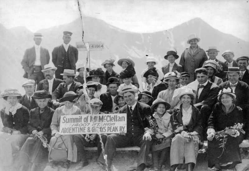
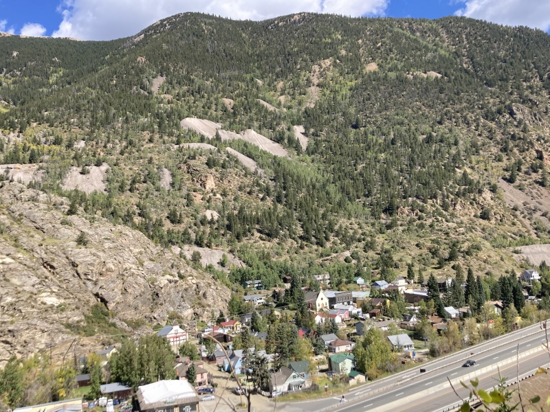
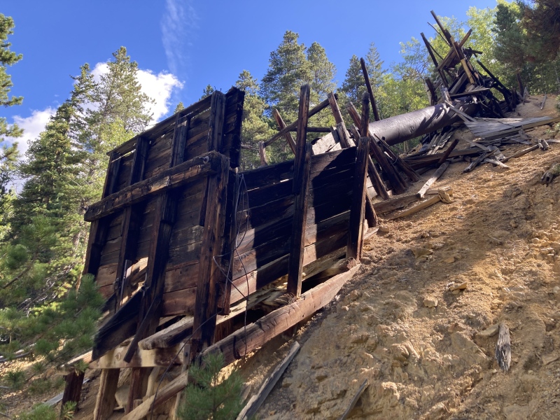
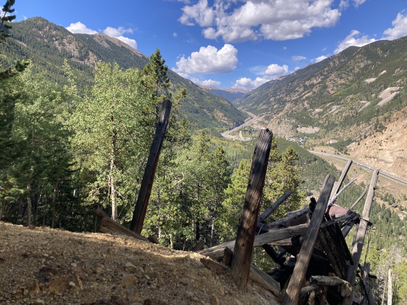
There's space for a few cars along the graded dirt road right at the trailhead and many more a bit further back down the road. Although the way up Leavenworth Gulch from the Guanella Pass byway is 4x4-friendly, this side is closed to motor access. Going up the old railroad grade meant that the climb would be gentle but relentless, so I kept it in low gears and cruised casually up the trail. Young aspens now encroached on the old track, their leafy crowns showing the season's first signs of fall. At times they opened up the view into the valley below, revealing charming sights of Silver Plume. I passed under the loading zone of some old mine chutes; there looked to be several more ruin sites on paths branching off the main trail. Slowly I rose above the din of I-70, the roaring rush of 18-wheelers yielding to the calming rustle of the forest. Suddenly, a loud wooooOOOOOOOOO punctuated the stillness from below. The whistles from the Georgetown Loop train, Silver Plume's surviving tourist attraction, provided welcome fodder for the imagination as they reverberated up the hillside. After a few more blasts, the staccato chugging of the train resounded through the valley, its tempo nearly matching my pedaling on the bike. I envisioned the excitement of the Gray's Peak Route passengers multiplying with each foot climbed, peering through the foliage to see what they could see and eagerly gazing straight ahead into the beckoning tunnel of trees. As these locomotive sounds echoed up the mountainside, I considered how the trail itself was its own sort of echo: no longer present are the original tracks and ties, but the path cut into the hillside persists and continues to guide the journeys of future travelers. 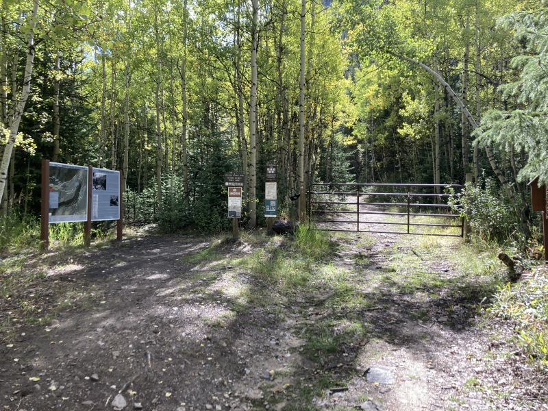

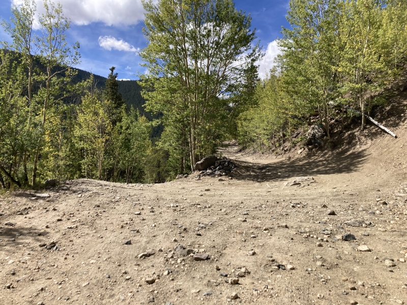
Eventually I reached Pavilion Point, a lookout on the east ridge of Leavenworth Mountain that still holds ruins of its former resort days. This area is significantly more trodden as it's the turn-around point for a 4x4 accessible spur from the Guanella Pass road. After overlooking Georgetown and the Clear Creek basin to the north, I rode along the long stretch of 4x4 road into Leavenworth Gulch. It was a little downhill at first after coming from Pavilion Point, but it quickly resumed the slow and steady upward grade. There were some forks but the right path was clear: stay to the most-used road contouring up the gulch going slightly uphill. I continued passing through tunnels of changing aspens which often broke to reveal miles-long vistas of the whole length of the valley. I figured I wouldn't find much water along the road since the creek ran far beneath, but at about 10,520 ft I discovered a nice flowing inlet from a large gully above. I stopped to check out the small waterfall it produced as it ran through a culvert and out the other side. 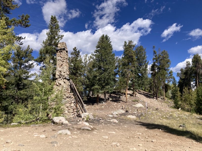
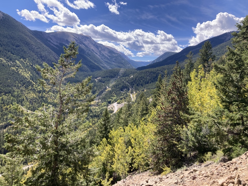
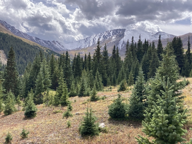
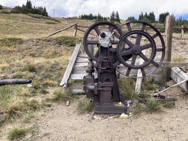
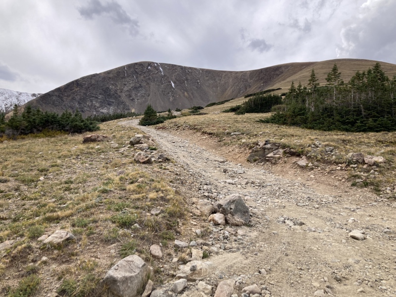
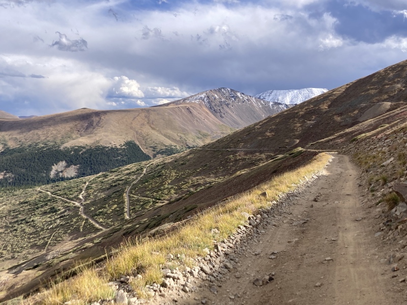
After a long ways the trees became sparser and the mountain views widened. I was excited to see the gorgeous snow-laden slopes of Argentine Peak and its neighbors! McClellan finally appeared to the west as well, its rugged calved-off eastern cirque adding some teeth to its otherwise unassuming prominence. The ruddy willows in the creek bed painted some delightful fall color in the mountain scenery. I noted a couple more water-filling streams running under or over the road as well in this area. Eventually I arrived at the Waldorf mining site which had wide-open views of the surrounding mountains. There were some interesting ruins of an old stone structure and even some sort of cog machine that still turned. This area definitely warrants exploration, but there's plenty more mining history to see along the rest of the road up. 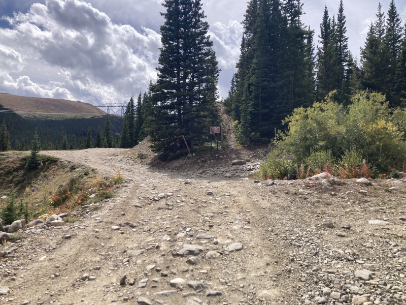

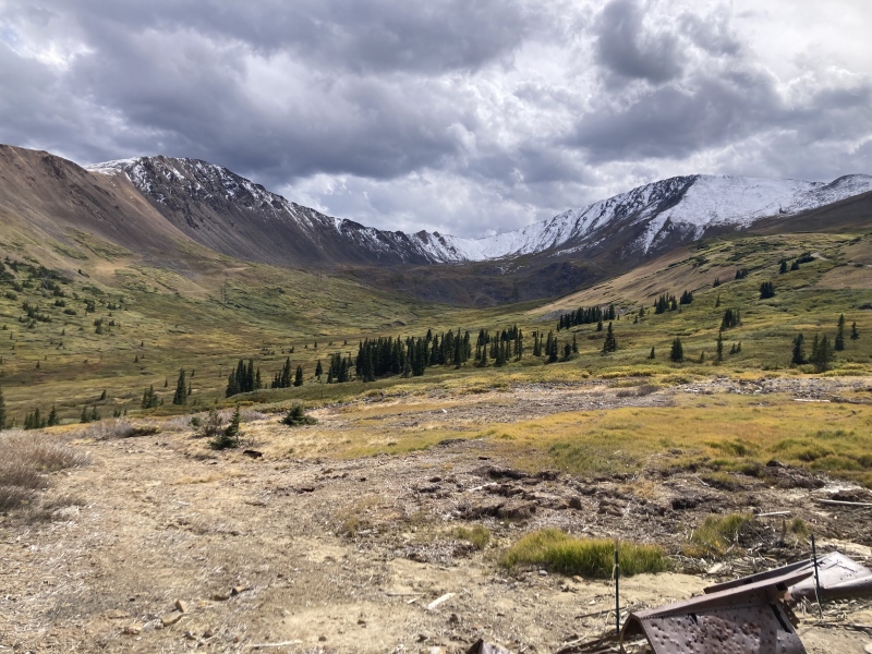
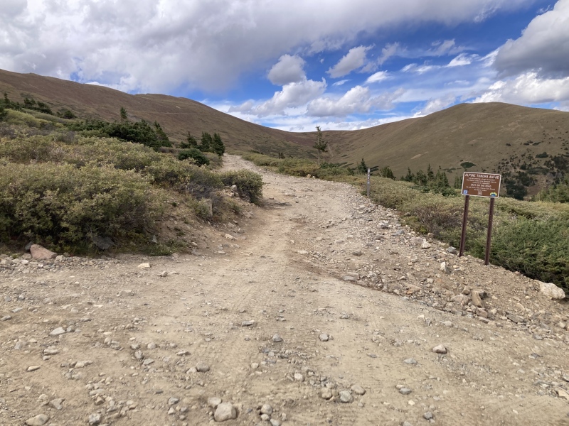
After my brief stay in Waldorf I continued up the winding road to the ridge. Partway up the first switchback I noticed a low-angle NE shoulder coming off McClellan towards my direction. I was about done with the mountain bike at this point--I was sore from riding and wasn't quite getting the speed I wanted this far in the ride. I stashed the bike and tried hiking up the slope, but my legs heavily protested at this. I checked the elevation gain I would need to reach the summit from here--1700 ft, nothing to sniff at! After resting and eating some much-needed snacks, I tried hiking up again but my legs still weren't having it. I reconsidered getting back on the bike again--I realized what I really needed was the food I just ate, not a complete break from the bike, and I still had all day to keep pedaling. I wasn't in any hurry to be back in Denver early to deal with evening traffic, either. I knew good and well, too, that a 1700 ft trudge up a ridge would be a grueling effort in itself and I might get there around the same time the long way by bike anyway. Convincing myself, I hopped back in the saddle and rolled steadily up the road. The remaining long four switchbacks seemed to go by quickly as I focused on my breathing. Even though pedaling up a shallow grade in low gear was easy on my leg muscles, it was more cardio-heavy than hiking and thus was a lot harder to accomplish at elevation. I was rewarded with my change of heart on the way up with some fantastic new perspectives of the basin's features. 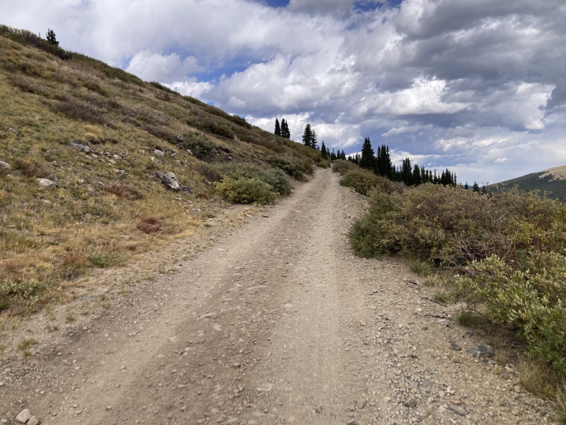
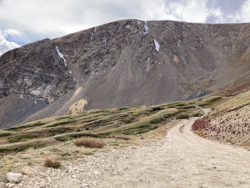
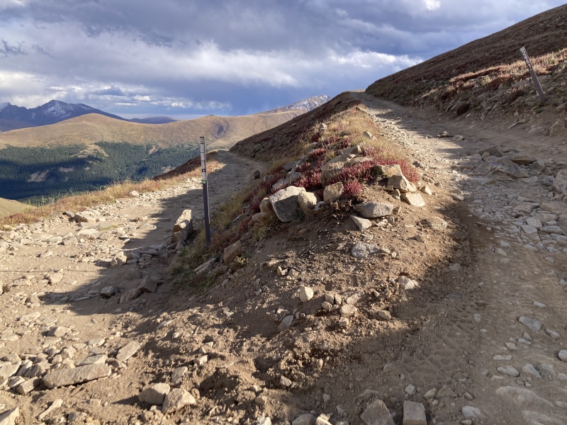
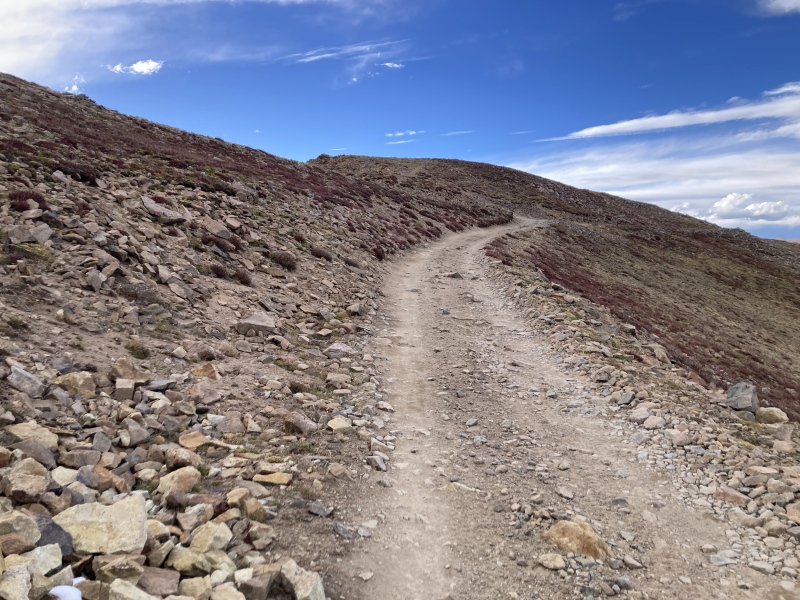
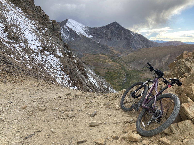
Finally I reached the end of the Argentine Central line! The view of Grays & Torreys across Stevens Gulch looked magnificent. Now it was time to complete the last 0.5 mi & 500 ft stroll to the summit. Once again my legs complained about hiking uphill and I considered just giving it up and being satisfied with biking the whole Gray's Peak Route. The thought of claiming a "former" 14er for a summit, however, helped me overcome the pain and keep pushing. I continued approaching along the ridge among dusky red tundra plants and some scattered cairns. After only a little ways the discomfort in my legs subsided and I could enjoy the Stevens Gulch sights in peace. 
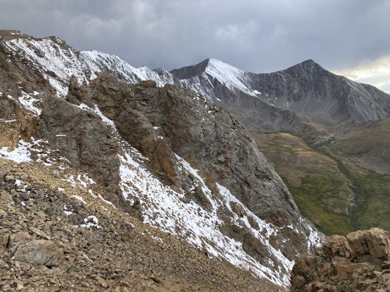


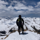
Soon enough the shallow rolling ridge flattened out to the broad summit of McClellan Mountain, I had made it! I wasn't quite sure what point was the true summit--I saw one jutting overlook to the south that looked taller, but when I arrived there the area I came from was definitely higher. I figured the sorry wind shelter on the low bulge near the middle of the plateau served to mark its true peak. I took a few pictures of the surrounding mountains at golden hour and then hurried off the summit. Some heavy snow squalls had just blown through the Silver Dollar Lake basin to the south over Guanella pass and already some wispy curtains of snow were drifting into Stevens Gulch--I still had a several miles to roll before I was off the mountain! As I descended I saw the most incredible sight just before sunset to the east--a large wedge of pale green light shone on the clouds over a far-off hill! I tried taking pictures of this but the cold summit wind kept shutting my phone down. When I got the camera to pull up it wouldn't focus, and even then the pictures I took didn't save. I'm still so bummed I couldn't capture that! I figured it was similar to the "green flash" phenomenon or some green clouds I saw reported somewhere over the Great Plains recently--perhaps the low-lying clouds and snow at sunset refracted the setting sun's light in between Grays & Torreys into a green hue. I couldn't find any other specific examples of this online. At least I did get a cool photo saved of the shadows of Grays and Torreys projected onto the clouds to the east. Below that I can only see the faint waning remnant of that green beam. Oh well--that isn't the first ineffable marvel I couldn't snag a photo of in the mountains, and it likely won't be the last either! Sometimes it feels better that way, like an intimate secret shared only with me by the mountains that day. 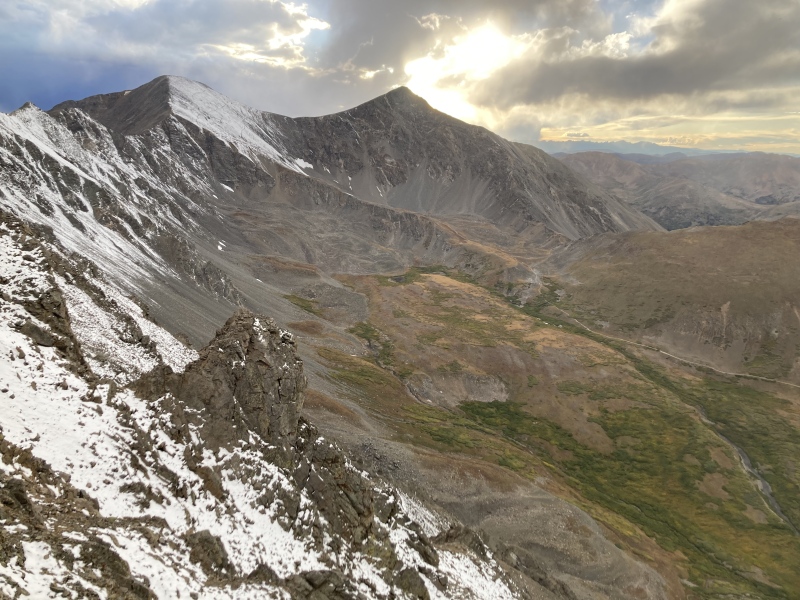

I quickly made my way back to my bike through the sprinkling of snow. Here's where my wheels became my real advantage: I rode the whole 13 mi back to my car in only 2 hours when it had taken me 8 to reach the top of the road! I stopped a few times on the upper switchbacks to take in the entire sky turning pink with the fading daylight. I had to pull out my headlamp before I reached Waldorf and kept my nose down avoiding rocks the rest of the way down. Thankfully I only flew over my handlebars and faceplanted into the dirt once! The stars looked magnificent above Pavilion Point and the slow march of car lights below on I-70 was oddly soothing to see, especially without the road noise. Aspen trunks whizzed past me in my headlamp as I descended the final switchbacks back to Silver Plume. 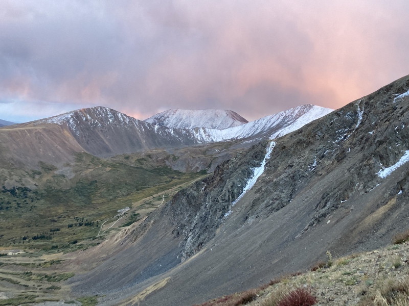
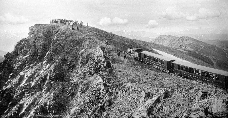
After packing up the bike and heading back down the short dirt road, I found myself near the point of bursting into tears. I figured I hadn't really been able to process all the sights that I had been gifted on the mountain that day while jostling my way down the road in the dark. The snow-robed slopes, low-lying clouds, autumnal flora, and sunset timing all orchestrated a magnificent experience that still impresses upon me. It all truly illustrated the "Colorful Colorado" moniker: the maroon tundra fronds, orange willow phalanx, yellow aspen fringes, jade light pillar, cobalt squall clouds, and the last enclaves of purple wildflowers accented by white bands of fall's first frost and black rock drawn from the heart of the mountain. These vivid, lasting memories made the last stanza of a 1907 poem about the Gray's Peak Route posted at the trailhead especially resonant, even despite the erroneous elevation: "A wonderful trip, you will agree, Unfortunately I later realized I had forgotten to look around for an acclaimed natural feature--the ice cave, or whatever's left of it, near the end of line! I really appreciate this description of it in one of the articles linked above: "The subterranean ice palaces on Mount McClellan easily rank with the greatest of Colorado’s wonders. [...] Tradition maintains they are the site of a cidevant mine, deserted by men, and we find it perfected by Nature, the sorceress. Dense masses of crystals crowd every inch of granite wall and roof. The brilliant rays of electric lights are caught as if by millions of diamonds, and reflected again and again. The flash of fire to fire, a million times multiplied. Is heightened by perfect networks of the most delicate crystals of elfin tracery and lace. As these coruscations sparkle and leap from fantastic shapes in frieze and fresco, springing into fountains of living fire before the entranced gaze, they constitute a scene of supreme lovelinesss which no pen can describe." Sounds like it would be worth a visit for next time! P.S.: Who is McClellan Mountain named after? General George McClellan ran opposed to Lincoln in 1864 on the Democratic party ticket, promising to outperform the Lincoln administration in the Civil War. General Sherman's military success during his March to the Sea, however, garnered favor for Lincoln's campaign and helped him pull through to win the election. A mountain south of Silver Plume along McClellan Mountain's ridge is named after McClellan's running mate, Pendleton. 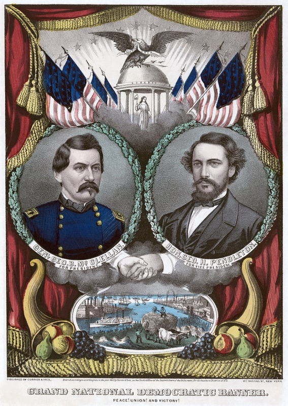
GPX route is approximate. Elevation gain looks pretty off due to some "static" in the route: Thumbnails for uploaded photos (click to open slideshow): ")
")
")
")
")
")
")
")
")
")
")
")
")
")
")
")
")
")
")
")
")
")
")
")
")
")
")
")
")
")
")
")
")
")
")
")
")
")
|
| Comments or Questions | ||||||||||||
|---|---|---|---|---|---|---|---|---|---|---|---|---|
|
Caution: The information contained in this report may not be accurate and should not be the only resource used in preparation for your climb. Failure to have the necessary experience, physical conditioning, supplies or equipment can result in injury or death. 14ers.com and the author(s) of this report provide no warranties, either express or implied, that the information provided is accurate or reliable. By using the information provided, you agree to indemnify and hold harmless 14ers.com and the report author(s) with respect to any claims and demands against them, including any attorney fees and expenses. Please read the 14ers.com Safety and Disclaimer pages for more information.
Please respect private property: 14ers.com supports the rights of private landowners to determine how and by whom their land will be used. In Colorado, it is your responsibility to determine if land is private and to obtain the appropriate permission before entering the property.