Download Agreement, Release, and Acknowledgement of Risk:
You (the person requesting this file download) fully understand mountain climbing ("Activity") involves risks and dangers of serious bodily injury, including permanent disability, paralysis, and death ("Risks") and you fully accept and assume all such risks and all responsibility for losses, costs, and damages you incur as a result of your participation in this Activity.
You acknowledge that information in the file you have chosen to download may not be accurate and may contain errors. You agree to assume all risks when using this information and agree to release and discharge 14ers.com, 14ers Inc. and the author(s) of such information (collectively, the "Released Parties").
You hereby discharge the Released Parties from all damages, actions, claims and liabilities of any nature, specifically including, but not limited to, damages, actions, claims and liabilities arising from or related to the negligence of the Released Parties. You further agree to indemnify, hold harmless and defend 14ers.com, 14ers Inc. and each of the other Released Parties from and against any loss, damage, liability and expense, including costs and attorney fees, incurred by 14ers.com, 14ers Inc. or any of the other Released Parties as a result of you using information provided on the 14ers.com or 14ers Inc. websites.
You have read this agreement, fully understand its terms and intend it to be a complete and unconditional release of all liability to the greatest extent allowed by law and agree that if any portion of this agreement is held to be invalid the balance, notwithstanding, shall continue in full force and effect.
By clicking "OK" you agree to these terms. If you DO NOT agree, click "Cancel"...
TLDR: Shavano to Missouri along the Nolan's 14 route over three days. Didn’t make it all the way to the fish hatchery as originally planned but had a great adventure and look forward to getting back out there again!
The Nolan’s 14 route has inspired me for years, even before I moved to Colorado. I read trip reports, looked at maps, and listened with interest to the various interviews when people set new FKTs on the route. So when I moved to Colorado in 2020 I knew it would be a long term goal of mine to finish the route. Now an “official” sub-60 hour finish is a different thing, but I’ll worry about that part later... Last year I adopted two cats and named one Nolan as inspiration (and because his original name was Angel, super lame). I was signed up to run my first 100 mile ultramarathon this year and planned to pair that with scouting sections of the Nolans route as preparation for an attempt in 2024. My 100 miler ended up getting canceled, so on somewhat short notice I changed my plan to doing a Slowlans (aka backpacking the Nolan’s route over several days without worrying about the 60 hour goal) as a way to scout the full route in preparation for next year. I had done all the Sawatch 14ers except La Plata by various generally on-trail routes and scouted a couple sections, but a fair bit of the route would be new to me. I had some flexibility in my schedule and decided to just get out there and see how it went and learn what I could.
I do want to make note of and give thanks for Justin Simoni’s excellent Slowlans: Backpacking Nolan’s 14 guide. He provides a ton of great info and best of all, an extensive Caltopo map that really helped my own trip planning and was used during my hike. I was giving myself four days based on my schedule and Justin conveniently has a four day itinerary I used as my target. I knew this would be a challenge and was open to the chance that I’d either fall short or stretch it out into a fifth day.
This report is stupidly long (especially for an incomplete hike), but will hopefully be useful for others interested in a Slowlans/Nolans trip. It’s been a big project of mine so I had a lot of thoughts.
My boy Nolan. Feeling inspired?!
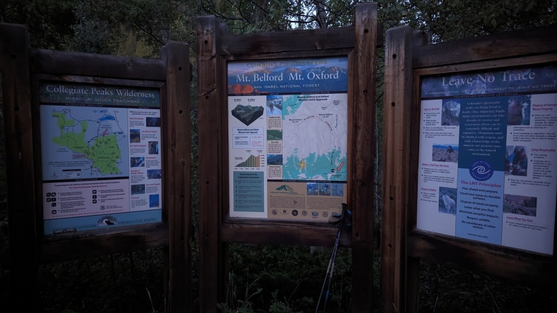
Day 1 - Shavano, Tabeguache, Antero
Stats - 24.2mi, 18h8m, 12,400ft gain/8,400ft loss
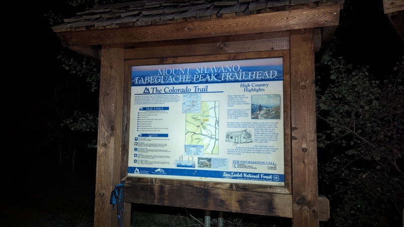
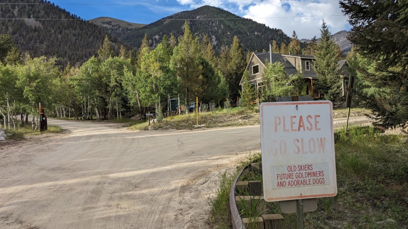
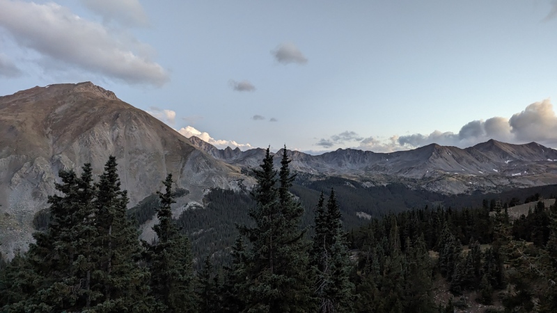
In the interest of hoping to get decent sleep before my hike I spent the night in a hotel in Salida, starting from the Shavano/Tabeguache trailhead shortly after 5:30am. This meant I only needed a headlamp for a short time before the sky began to lighten as I made my way up the newly redone lower section of the trail. I’d only done Tab/Shav once before via the Jennings Creek route, but the standard route is pretty hard to screw up and is quite nice. Thanks CFI! The way up was uneventful, but I can see why the upper section is the next big trail project for them. Weather was great with light clouds, low wind, and comfortable temperatures.
Start of routeSunrise heading up Shavano
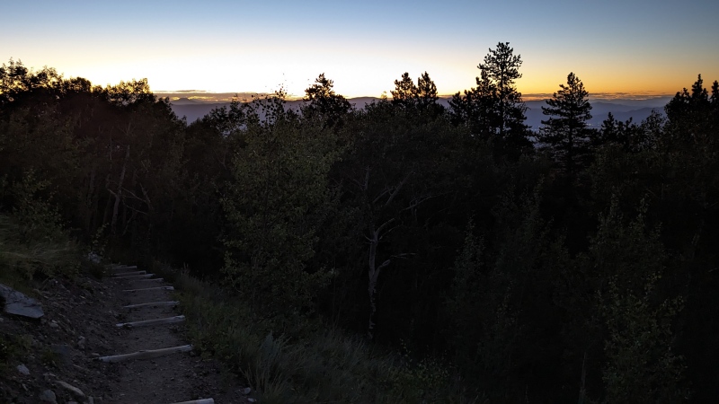
Tabeguache summit with nice weather
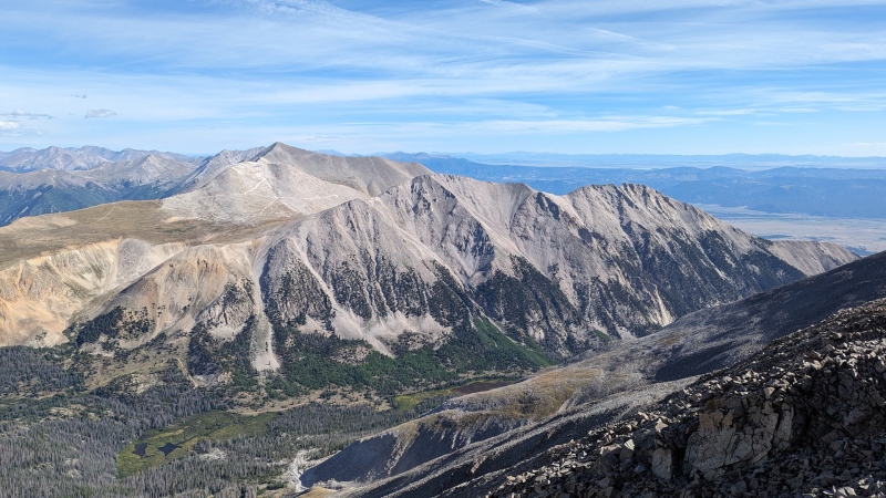
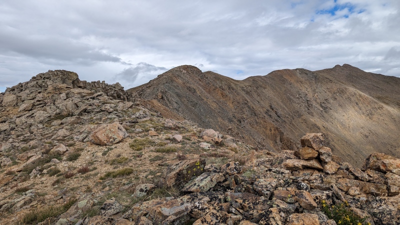
Antero is clearly visible across Browns Creek to the north, with roads criss-crossing the slope. The descent is fairly steep and tedious. I slipped on a loose rock about halfway and visions of an embarrassingly short Slowlans flashed through my head on my way down. I fell on my ass and my carbon fiber pole bent surprisingly far, but both were intact as I collected myself and continued (tentatively) boulder hopping down the slope.
Looking across to Antero from the post-Tab saddle
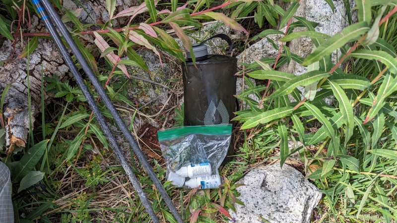
At Browns Creek I took my first extended break and refilled water. After I realized how much time I was spending using a Katadyn BeFree to filter into a larger container on previous trips I used Aquamira chemical treatment on this trip and was pretty happy with the system. I had a 2.5L reservoir in my backpack and water sources are quite frequent on the Nolan’s route. My approach was to fill that container and then when running low to fill a 2L HydraPak Seeker soft bottle and allow that to treat while I kept moving (manufacturer suggests 30 minutes with cold water), then transfer to my reservoir when that ran out. This is still a multi-step process vs other methods, but seemed to work fairly well. While the chemical treatment had minimal flavor it did seem to tint my reservoir slightly yellow, which seemed like a fair trade.
Water treatment at Browns Creek
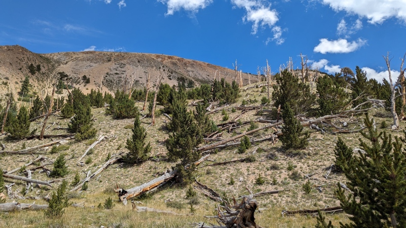
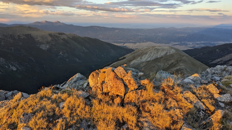
Ascending from Browns Creek towards Antero I unintentionally took a slightly different route than Justin’s map shows. It was probably just as good and I can compliment myself for not constantly checking my GPS instead of calling it a mistake. This section also sent me through one of my favorite climate zones, the mix of live and dead trees just at the edge of treeline. At the top of the initial climb I stopped for a store brand s’mores poptart and saw but was able to avoid crossing paths with a couple 4x4s as I made my way up the summit of Antero.
Up towards Antero
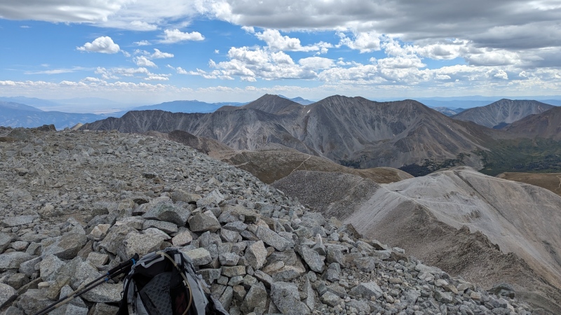
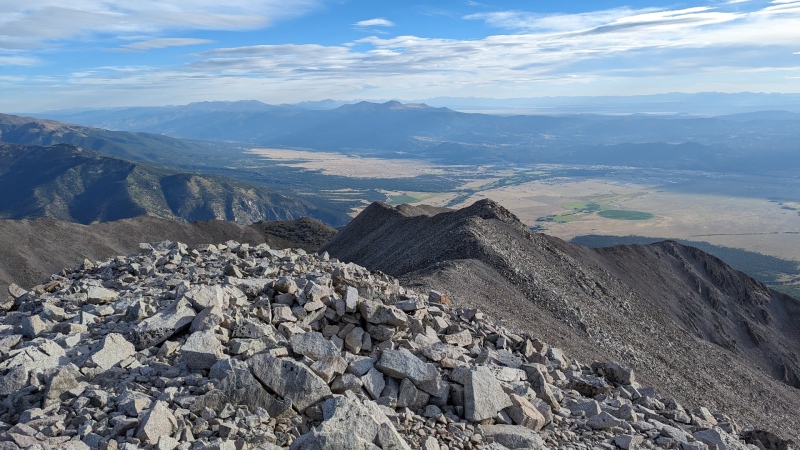
The Antero summit was the first spot that gave me a real perspective on the scope of the Nolan’s route as I was able to see Tab/Shav to the south, Princeton to the north, many of the other peaks beyond off to the horizon. I recorded some Deep Thoughts in a voice memo, got hailed on very lightly, and began the long descent.
Tab/Shav from Antero summitPrinceton from Antero summit
Between Antero and CR162 I encountered few hikers but a number of 4x4s passing or camping along the route. Baldwin Creek provided another good water stop and I was happy I managed to cross without getting my feet wet. Next was passing through the small town of Alpine, including the old timey cemetery with wooden grave markers at the end of town. Better than a big cleared lawn I suppose. The trail that goes east above Alpine and then north up the drainage is helpfully and surprisingly well defined, though I’m not really sure why it’s there.
Entering AlpineAlpine cemeteryTrail leaving Alpine and starting the climb to Princeton
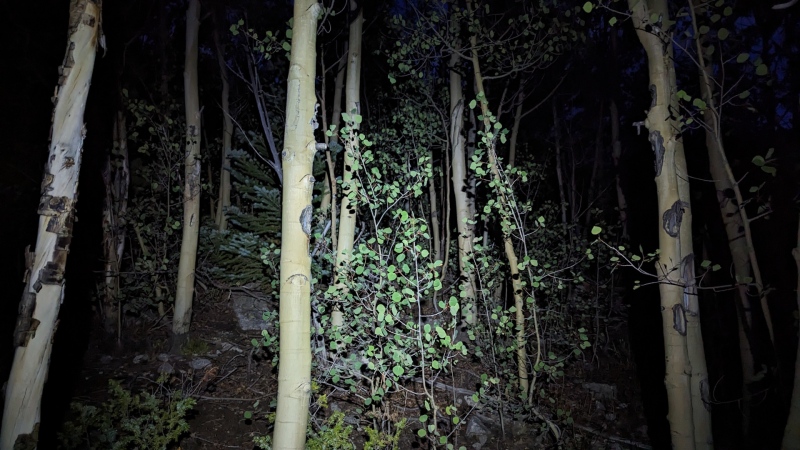
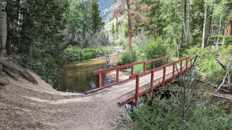
I crossed the flowing stream around 10,800ft, stopping for water since it was getting late and I knew I might not have another chance until the next morning. A stretch of bushwhacking followed and somewhere around the time I turned my headlamp on I also caught a branch and ripped a 5” hole in the thigh of my pants. I patched it as best I could with some gear tape, though this proved only temporary.
Bushwhacking by headlampAbove treeline going up Princeton
Justin’s guide calls this section the “Highly Exposed/Committing/Class 3 Crux” so it wasn’t ideal to be doing it for the first time by headlamp at the tail end of a long day. My original goal was to get over Princeton, but that seemed increasingly unlikely as my ascent pace slowed and midnight approached. Once on the ridge proper I began feeling fatigued enough that I started looking for a suitable bivy spot. This turned out to be a challenge as this was the narrowest/rockiest/most exposed ridge of the route. It’s not objectively particularly difficult, but I was quite tired and it seemed that every place I considered to settle in for the night was either too rocky and uneven or risked me rolling off the ridge in my sleep. It was clear I wasn’t going to make it down the other side of Princeton without going through the night and was unsure of the terrain between me and the bump at 13,971, so I finally found a clear and flat place to bivy a little after 11pm at around 13,600ft. Feeling pretty worn out, I put on nearly all of my clothing, forced down some calories, and closed my eyes without setting a morning alarm.
Day 2 - Princeton, Yale
Stats - 19.8mi, 14h17m, 6,300ft gain/9,700ft loss
Morning on the SW ridge of Princeton
After sleeping as late as possible, I awoke to one of the most spectacular mornings and campsites I’ve ever experienced. I would have felt more accomplished had I spent the night somewhere north of Princeton, but this was a more than fair trade. I also saw in the light that the remaining section of ridge was quite easy and my concerns the night before about encountering some unexpectedly difficult scrambling section were unfounded. Such is the benefit of scouting (which I suppose this trip itself was).
I was surprised to have the summit of Princeton to myself even on a holiday weekend, but wasn’t complaining. The descent towards Maxwell Creek is fairly steep talus that is difficult to move quickly on, but I eventually made it down and encountered the spotty trail that gradually became the remnants of an old dirt road and finally joined the Colorado Trail. I tried to make the most of this, but was feeling quite tired and wasn’t moving as quickly as I wanted even on this relatively flat terrain. Here I also realized that a bit of gear tape was no match for the lateral stretching on my torn pants and added the couple safety pins I had to help hold things together, knowing it was a partial and temporary fix at best (and those pants were expensive!).
Beginning the descent from Princeton
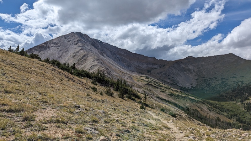
I topped up my water from Middle Cottonwood Creek before taking a longer break at the Avalanche Trailhead, enjoying such luxuries as a vault toilet and brushing my teeth. From there to the summit of Yale is the longest sustained climb of the route, so it wasn’t a great sign that I felt worn out as soon as I started up the trail. I was already behind schedule for the day, my legs felt dead, and I was getting out of breath much more frequently than the day before. Trailhead to summit took me five hours, about the same time it took me to do the same route last winter in full snow. The whole climb was a slog that had me doubting the rest of the trip. I knew I wouldn’t get too much farther that day and began considering potential alternatives and bailouts.
Middle Cottonwood CreekSlowly starting my way up Yale’s east ridgeThe view to the north from most of the way up Yale
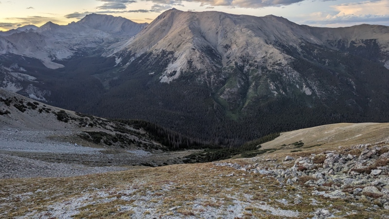
I figured I didn’t have to decide everything all at once, but would at least keep things simple tonight by sleeping at North Cottonwood Creek and seeing how I felt the next morning. This would have the advantages of being relatively low (about 10,400’) and an easy water supply so I could hopefully get decent sleep and catch up a bit on hydration. The alternative would have been to start up Columbia and sleep somewhere between there and Harvard, which seemed pretty dumb given how my body was feeling. Creekside it is!
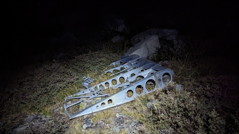
With gravity finally on my side I did begin to feel a bit better as I began descending Yale and tried to make up a little time as the sun rapidly approached the horizon. On my way down the ridge I made sure to hit UN 13,105 rather than crossing the slope below it to avoid orphaning a 13er, only to realize when I got home that it wasn’t actually a ranked summit. The descent to North Cottonwood Creek is steep, but the talus wasn’t any worse than elsewhere on the route. Along the way I spotted plane wreckage mentioned in other reports, apparently a Douglas VC-47A which crashed in 1956 (“It is believed that the accident was the consequence of a controlled flight into terrain”).
Sun setting on the way down from YaleTop of descent gully from Yale with Columbia and Harvard in the backgroundA section of wing, one of many scattered pieces of wreckage
The grassy transition zone between the talus and treeline was rather slippery due to the steep slope, I’d hate to do it when the grass was wet. Getting from treeline down to the creek ended up being the most annoying part of my trip. I took a small drainage just west of the one Justin indicates and followed it directly down. I have no idea if other ways are better, but it’s hard to recommend this one. It was very steep, narrow, and had a trickle of flowing water. While it never cliffed out like I was worried it might, I did have to lower myself with the help of tree branches or drop several feet a number of times in ways that were a little sketchy when tired and carrying a pack. Next time I’ll certainly try to stay further east and cross the slope rather than pretending I’m a water droplet following the path of least resistance.
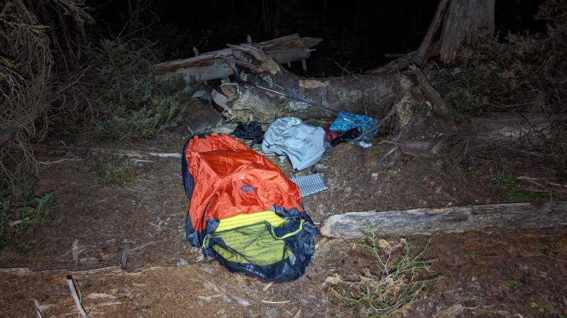
Finally the slope began to level out. Unfortunately the final obstacle of the night was the large jumble of downed trees that made progress extremely slow, with the constant risk of slipping on logs or getting stabbed by branches sticking up in all directions. At one point I emerged into a clearing with a spectacularly clear and bright view of the stars. I wanted to bed down there to enjoy the sky, but the downed trees and other bushes meant there wasn’t a good spot to set up. Plunging back into the trees I finally found a clear area of flat and soft ground. If I couldn’t have a nice view at least I could listen to the noise of the creek as I forced down as much food and water as reasonably possible before closing my eyes.
Night two campsite
Day 3: Columbia, Harvard, Oxford, Belford, Missouri
Stats - 20.5mi, 22h30m, 10,600ft gain/11,300ft loss
I started day three not really knowing what my goal was. I knew at this point I was too far behind schedule after only doing two peaks the day before to finish the whole route. Do I take it easy or try to finish strong? Go home early or add another day? I decided to just get moving and see how I felt after at least getting down Harvard.
After gingerly crossing North Cottonwood Creek on a log I began the climb up Columbia’s south slope along the minor ridge. At a couple points below treeline I spotted footsteps of what I liked to think were other recent Nolan’s folks, which gave me a little comfort. I even came across an established bivy site right around treeline, which seemed a little odd given that you’d probably be much more comfortable a few hundred feet lower among the trees as I had done. The steep slope becomes increasingly rocky and solid as you gain elevation,eventually joining with the main ridge and summit trail. Here I saw about a dozen people including a couple cheery but rather worn out looking dogs at the summit.
Columbia close to joining the trailDog friend on Columbia summit
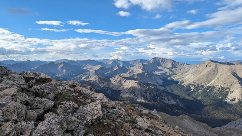
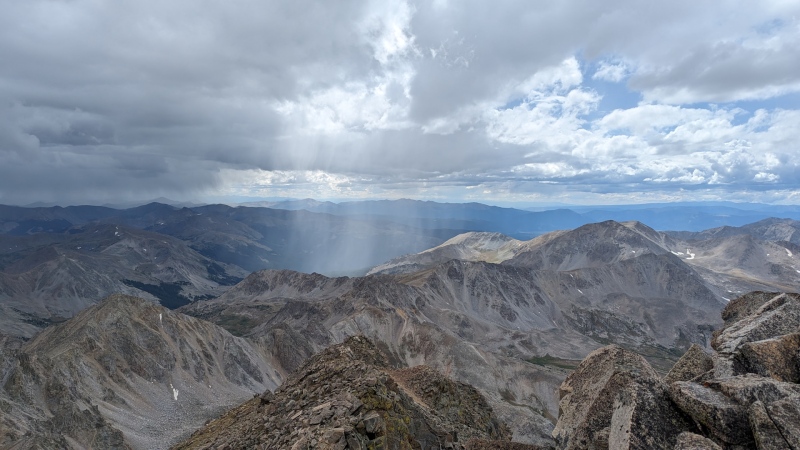
The way down Columbia was somewhat tedious and the crossing to Harvard felt very slow considering the short distance. Picking my way through the boulders and occasionally finding a cairn became rather frustrating by the end and while it’s a place I can hopefully make up time in the future if I find a better line, it may just be an unavoidably slow section. As I finally reached the east slope of Harvard I could see weather coming my way. The storms were small and isolated, but I began hearing thunder and seeing rainfall, with light rain and hail occasionally briefly falling on me as well. Most of this passed through the valley to the east, which I was grateful for. My legs and lungs were feeling much better than the day before and having to stop for lightning would have been a difficult choice to make. Eventually I reached the summit of Harvard, which provided excellent views of the storms passing by.
Passing isolated showers from Harvard
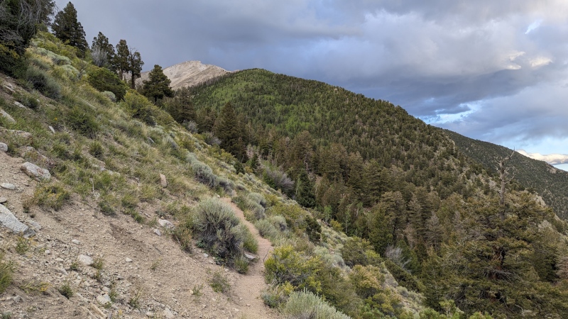
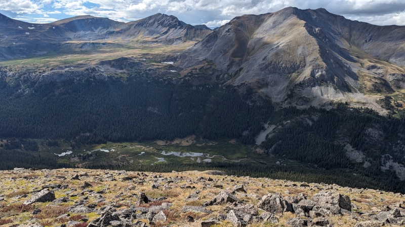
From the summit of Harvard the way down was a section I hadn’t had a chance to scout before, and had looked a little difficult as seen from Oxford on previous hikes. Thankfully it turned out to be easier than expected. The upper section is fairly moderate and rocky class 2, with the lower section getting steeper and looser, but never complicated. I also had my only significant wildlife sighting of the trip in this section, a family of mountain goats.
Pine Creek on the way down Harvard
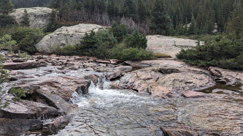
At treeline there isn’t really an obvious route and as always it feels frustratingly slow dealing with substantial vegetation compared to a nice tundra slope. I had previously scouted a way down to Pine Creek from Oxford and wanted to join up with that line. I was some distance west of that point and decided the simplest method was just to take the easiest line I could find through the trees, cross the creek, join the trail, and take that east until reaching my old line up Oxford. Pine Creek was flowing strong and wide, so rather than risk a fall rock hopping or log balancing I just found a shallow spot and waded right through the water.
Pine Creek
Once across and on Pine Creek Trail I had to make a decision. It was only about 7pm so stopping now would make for an even shorter day than the previous one and feel like a bit of a failure. Continuing on the other hand was rather commiting at this point in the route. At a minimum I’d be doing Oxford and Belford and sleeping somewhere after Elkhead Pass. I knew I wasn’t going to finish the whole Nolan’s line on this trip due to a combination of time limitations, fatigue, and other more minor excuses like the growing hole in my pants and my extra battery pack dying after putting out half the charge it was supposed to. After a nice break I was feeling fairly good and decided to give it a final “Nolan’s-worthy” effort by tagging Oxford, Belford, and Missouri before exiting at the Missouri Gulch TH.
I was able to follow my old line up Oxford without too much difficulty, which was quite steep in places but rarely got into dense vegetation. I emerged above treeline in time to get a nice final view of Harvard to the south and soon had to turn on my headlamp. From here it’s a technically easy but rather mind numbing grind up a long talus slope. When I finally reached the summit I was greeted with strong wind gusts and much colder temperatures than I had dealt with so far. I threw on a jacket but didn’t want to stop long enough to put on my other extra layers, instead just balling my hands in the palms of my inadequate gloves and moving as quickly as possible back on trail, hoping things would eventually settle down.
Looking back at HarvardThe slog up Oxford as night approachesOxford summit register
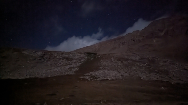
Getting from Oxford to Belford took much longer than seemed reasonable for the distance as fatigue and frustration began to rise. On the positive side, while there were more clouds than the night before, the stars were still quite impressive and the moon was incredibly bright, enough that it cast a shadow by itself when I turned off my headlamp. I finally reached the summit of Belford and took a break from the wind among the rock formations to get a good snack and finally put on my base layers to get warm enough.
Misleading picture that nonetheless shows that the moon was very brightBelford summit marker
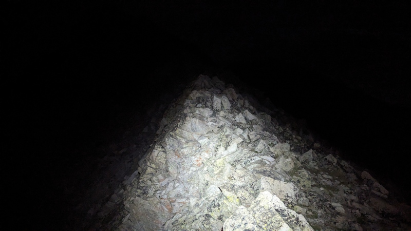
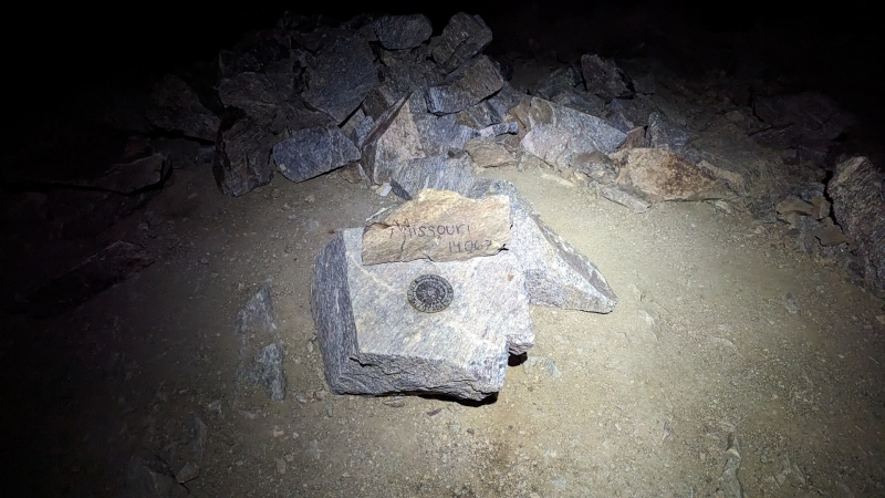
I had always planned on taking the Elkhead Pass bypass rather than Missouri’s east ridge and midnight sixteen-plus hours into my day was no time to change my mind. While I’m curious about that variation, many successful Nolan’s finishers have gone around it so it’s probably not worth the hassle. At what seemed like a reasonable spot once down the pass I cut west across the large meadow at the base of Missouri. The 700’ climb up to the ridge took more short breaks than I’d like to admit, but once there and heading up the ridgeline I soon found myself on the summit of my final peak for this trip.
Another misleading low light mode photo, this time the ridge to MissouriPeak 10/14 for the route, but 10/10 for me this time
As anyone who has done the NW ridge of Missouri can probably tell you, it seems to go on for much longer than it is even when going downhill, especially at this point in a long day. I began obsessively checking my GPS in part to make sure I hadn’t missed the turn to the switchbacks east to the Missouri Gulch Trail, but also just because I was getting irritated I wasn’t there yet. I finally found the turn, made the equally slow descent down the switchbacks, and rejoined the main trail.
Partway down the trail I began seeing headlamps slowly moving uphill, the first people I’d seen since the summit of Columbia, which felt like ages ago. The trail became quite busy, though I was the only one going down rather than up. Several people commented on how I was going down when it wasn’t even light yet. I always feel a little awkward in these situations because if I tell them why it sounds like bragging, or at a minimum requires more explanation than I had the energy for. Instead I settled for just telling people I started early and they could sort out what that might mean for themselves if they cared (they didn’t).
As a final bit of (very modest) excitement as I approached the trailhead my headlamp flashed to indicate the battery was almost dead. The race was on! Of course I was carrying two spare batteries, but who wants to stop and swap batteries this close to the end of a hike? I reached the Missouri Gulch TH shortly before my battery died and shortly before sunrise made the whole thing irrelevant anyway. While 10/14 peaks was obviously short of my original goal to do the entire line I was pretty satisfied with how things finished.
Of course just reaching a trailhead I didn’t even originally intend to finish at meant my journey wasn’t actually over. My car was still at the Tab/Shav TH. Prior to my hike I had reached out to a number of Colorado Trail shuttle drivers to try and arrange a ride back to my car, but only one even replied to say they weren’t available. I had given several hitchhikers rides up and down roads to trails this summer, so it was time to put karma to the test.
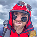
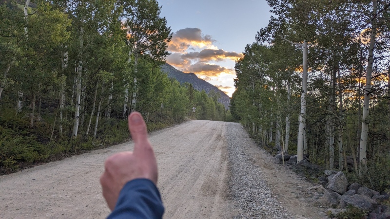
I smelled bad, but tried to look friendly
Unsurprisingly, morning isn’t the best time to get a ride going away from the trailhead, but after two miles of walking down CR390 a couple in a Sprinter van picked me up. They were vaguely aware of Nolan’s 14 so we chatted about that and other things until they dropped me off in Buena Vista. I was tired of eating my packed food but needed calories and water, so was happy to find a diner for a breakfast burrito.
I ordered a breakfast burrito covered in green chilies and biscuits and gravy. I got a breakfast burrito covered in gravy. Close enough.
From there I walked to the grocery store for some chocolate milk, which turned out to be a good move since I was almost out of water but assumed (wrongly) that I wouldn’t need much the rest of the way back. Just a block south from the grocery store another Sprinter van picked me up, this time a couple and their two kids. They were going to the Princeton hot springs so it wasn’t a long ride, but every bit helps. From there I began walking the shoulder of 285 and after about 15 minutes a Subaru with a bike on the back stopped for me (I’m beginning to notice a pattern in who gives rides!). They were able to take me all the way to the 285/CR140 junction, I was in the home stretch now. Within a couple minutes a pickup truck stopped for me. What luck! I told them I was trying to get back to the Tab/Shav TH and they seemed to know exactly what I was talking about and were happy to help as far as they were going in that direction. This is where my luck ran out. I was grateful for their help and don’t mean to be negative, but they had a different idea of where I was going than I did. I was exhausted and not paying attention, so it wasn’t until they dropped me off that I realized I was 1.5mi past the turn to CR250. Feeling somewhat dejected, I turned around and walked back the way I just came, making the turn up the final road section to my starting point.
I was hoping the holiday weekend would work in my favor, but very few cars drove by in either direction, with most going the other way. None stopped, my hitchhiking karma had indeed run out. At some point two random dogs showed up and ran back and forth up the road with me for a couple miles. While I was happy to have the company nearly 30 hours into my day, I was also annoyed that somebody let their dogs run off like that but couldn’t do anything about it. Eventually a pickup truck approached and slowed by me. A possible ride? Nope, a BLM worker summoned to find the loose dogs. I reported they were just up ahead and told him where I was going. He offered to help, but said he was only allowed to drive as far as the BLM/USFS property boundary, which was visible less than a quarter mile ahead. I thanked the federal bureaucracy and continued onward by foot.
Free dog
Because I naively expected not to need it I hadn’t carried much water since I left BV and had been nursing a single liter since then. This ran out while still a couple miles from my car as I approached the hottest part of the day on the dusty and exposed road. Finally and anticlimactically (as these things usually end) I reached the mostly empty trailhead having done a bonus 8.5mi/2,000ft since the formal end of my hike at the Missouri Gulch TH early that morning. Thankfully I always keep water in the car. After a lot of water, a handful of wet wipes, and some clean clothes I started the drive home, interrupted by several naps along the way in the interest of safety.
Final thoughts
While part of me was disappointed to not finish the full route, overall I’m quite satisfied with how it went. I saw most of the route, dealt with and managed some challenges, and had a very memorable experience. In hindsight I could have stayed out another day to at least get Huron and La Plata before trying to hitch from CO82, but there was always going to be some uncertainty with the return leg of the trip. My gear worked out well other than the unfortunate rip in my pants and a battery charger not performing like it should. I had planned four days of food and so finished with plenty left over, as well as not always eating all my planned food each day. I’m not sure if I didn’t eat enough or brought too much, it can be tricky on trips like this when you need lots of steady calories but don’t want to weigh yourself down too much. I liked using Aquamira for water purification, although by the end one of the dropper bottles was leaking from the sides as I tried to squeeze out the right number of drops from the bottle.
Even a Slowlans is a big challenge, and certainly puts in perspective what it takes to get an official Nolan’s 14 finish. Having seen most of the course now it feels both more doable and harder depending on my mood. The route has been pretty well dialed over the years, so the line I followed was all quite reasonable in isolated chunks. The challenge of course is putting it all together at once while moving fast enough! Once the snow melts out early next season I’ll get out there to scout the missing pieces, train hard, and see about doing the full line next summer/fall!
My GPS Tracks on Google Maps (made from a .GPX file upload):
Awesome job, no doubt you will get the whole thing done in one go next year.
I was curious about the gear you took. It looks like you operate in the mode of going light and fast which is the same way I prefer.
Can you give a quick snapshot of your gear? The sleeping bag etc...
I'm more of a long-ass day hiker than a backpacker so my gear isn't as dialed as it could be, but I try to be efficient where I can.
Pack: Arcteryx Aerios 45 - Solid overall design and I picked it because of the fairly light weight, capacity, fairly comfortable, and pocket layout. Minor quibbles are the straps can squeak a bit which gets annoying, has a a hanger for a reservoir but no sleeve so it moves around internally, and I wish it had an outside stash pocket.
Sleeping bag: Some Mountain Hardwear 35* bag I got years ago, don't remember the model - Packs fairly small and light but probably room for improvement, high end bags are just very expensive! I also use a bag liner just to keep things clean because I'm way too lazy to wash my sleeping bag.
Pad: Thermarest X-lite - Not cheap but light and small, pretty happy with it.
Shelter: OR Helium Bivy - Somebody elsewhere asked about the bivy so I'll just copy and paste that response: "Honestly I'm a wimp who doesn't do that many multi-day trips ("Why carry heavy sleeping gear? I'll just hike twice as far instead!") so I've only spent about 10 nights in this bivy and don't have extensive experience with it. Through a combination of planning and luck I've never used it in snow or more than a short drizzle of rain. I definitely experienced some condensation towards the feet on a couple nights, which can be somewhat mitigated by keeping the head open (assuming conditions allow). Obviously of course you also have to plan to protect your pack from weather overnight since you can't keep it inside with you, although ultralight 1P tents won't have room for a pack either. When I'm doing easy stuff and don't have to worry about weight/size as much I just use a 2P tent solo to make things more comfortable. Because I don't actually do that many proper overnights my sleep system isn't as dialed as I'd like it to be. There are ultralight 1P tents that are probably similar in weight, or doing the whole tarp thing. I just wanted something as simple and bulletproof as possible that would give me maximum flexibility with a small footprint. Since I'm often using this on long ridge traverses I wanted something that didn't require staking out since that's not always an option in the terrain I'm sometimes sleeping in. It's certainly not the most comfortable option, but it gets the job done well enough."
That's the "big three" on gear, anything else you are curious about? Other stuff was BD Distance Carbon Z pole
Great effort! Andrew and I really enjoyed reading your report and cant wait to see you piece things together for a full attempt. Youre going to be great whenever the time is right for a finish! Awesome job, and what a great accomplishment! Thanks for taking us on your journey!
I know you are dedicated when you name your cat after the route! And yeah its one of those things you might not think aboutbut even after you bail there is a lot of work to be done! Nice work, and honestly Im a little jealous that spot you bivvyed at on Princeton looked spectacular!
And you learned a lot. And we all learn a lot too by reading your report. Nice job regardless of how close or how far you went from the goal (whichever term you prefer to use is a glass half full glass half empty opinion). A matter of a few days and we might have crossed paths on a trail -as a modest peak traverse day hiker in my case- or on a road... but I would have been one of the Subies with a bike carrier giving you a ride if I had met you with your thumb up on the road but I was already on my way out of state back home then (so it wasn't me).
Caution: The information contained in this report may not be accurate and should not be the only resource used in preparation for your climb. Failure to have the necessary experience, physical conditioning, supplies or equipment can result in injury or death. 14ers.com and the author(s) of this report provide no warranties, either express or implied, that the information provided is accurate or reliable. By using the information provided, you agree to indemnify and hold harmless 14ers.com and the report author(s) with respect to any claims and demands against them, including any attorney fees and expenses. Please read the 14ers.com Safety and Disclaimer pages for more information.
Please respect private property: 14ers.com supports the rights of private landowners to determine how and by whom their land will be used. In Colorado, it is your responsibility to determine if land is private and to obtain the appropriate permission before entering the property.


")
")
")
")
")
")
")
")
")
")
")
")
")
")
")
")
")
")
")
")
")
")
")
")
")
")
")
")
")
")
")
")
")
")
")
")
")
")
")