Download Agreement, Release, and Acknowledgement of Risk:
You (the person requesting this file download) fully understand mountain climbing ("Activity") involves risks and dangers of serious bodily injury, including permanent disability, paralysis, and death ("Risks") and you fully accept and assume all such risks and all responsibility for losses, costs, and damages you incur as a result of your participation in this Activity.
You acknowledge that information in the file you have chosen to download may not be accurate and may contain errors. You agree to assume all risks when using this information and agree to release and discharge 14ers.com, 14ers Inc. and the author(s) of such information (collectively, the "Released Parties").
You hereby discharge the Released Parties from all damages, actions, claims and liabilities of any nature, specifically including, but not limited to, damages, actions, claims and liabilities arising from or related to the negligence of the Released Parties. You further agree to indemnify, hold harmless and defend 14ers.com, 14ers Inc. and each of the other Released Parties from and against any loss, damage, liability and expense, including costs and attorney fees, incurred by 14ers.com, 14ers Inc. or any of the other Released Parties as a result of you using information provided on the 14ers.com or 14ers Inc. websites.
You have read this agreement, fully understand its terms and intend it to be a complete and unconditional release of all liability to the greatest extent allowed by law and agree that if any portion of this agreement is held to be invalid the balance, notwithstanding, shall continue in full force and effect.
By clicking "OK" you agree to these terms. If you DO NOT agree, click "Cancel"...
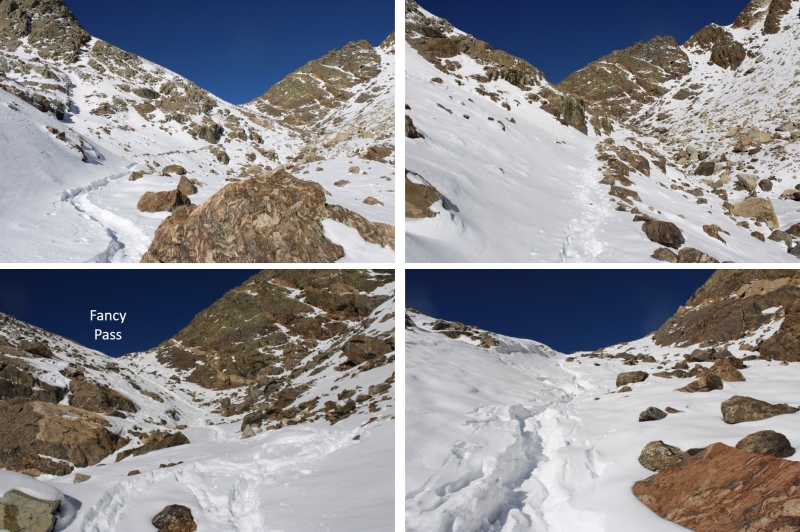
Note: I carried my snowshoes the entire way just in case I needed to trench, but I was pleasantly surprised to find it already done. Thank you to yaktoleft13 for trenching the route the previous day!
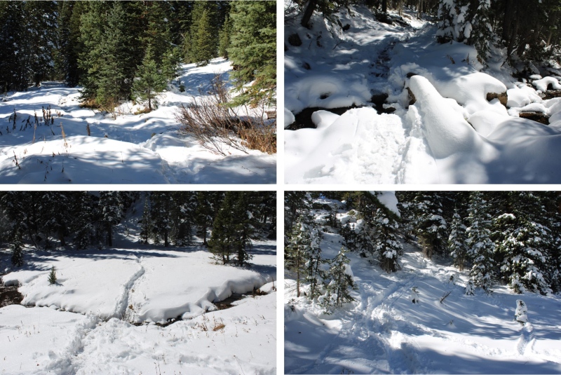
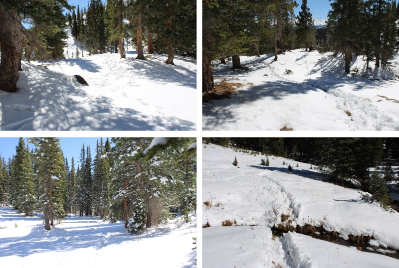
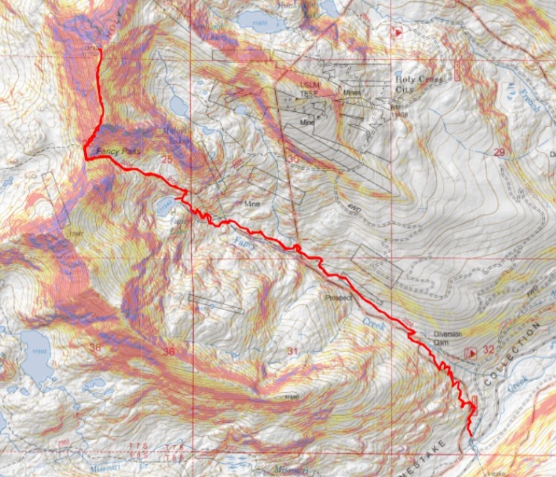
I arrived at the Fancy Lake trailhead and was on the trail at 6:30am. The drive in was on a 2WD dirt road, easily accessible except for the last 2 miles, which had a couple of inches of snow still on the ground. Luckily, enough vehicles had driven through the snow and there were bare spots to still keep this a 2WD road. The beginning of the trail is obvious. The trailhead has clean bathrooms and plenty of parking.
I followed Fancy Lake Trail 2006 for 3.3 miles northwest to Fancy Lake. This is a class 1 trail and easy to follow. There was a nice footbridge at the crossing over Fancy Creek.
I sat and admired Fancy Lake for a bit, as it was a beautiful day
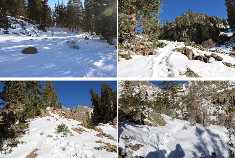
From the lake I turned and headed east, to continue following the trail to Fancy Pass.
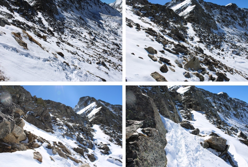
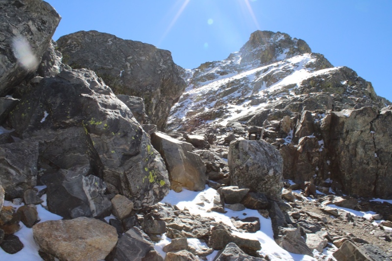
It was a total of 4.25 miles from the trailhead to Fancy Pass. At the pass, I dipped down to avoid the class 3 section, then gained the ridge as quickly as I could.
The downclimb to avoid the class 3 section was easy, class 2 (there might even be a trail here in summer)
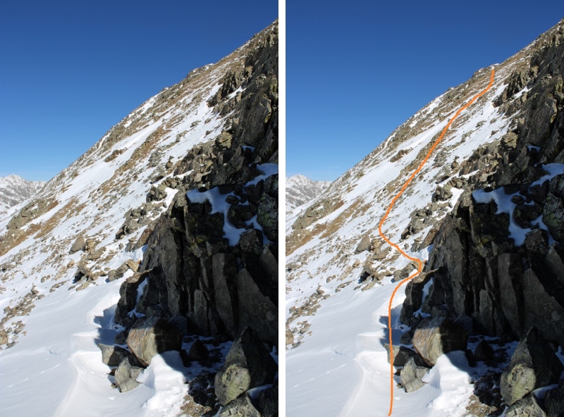
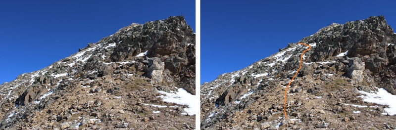
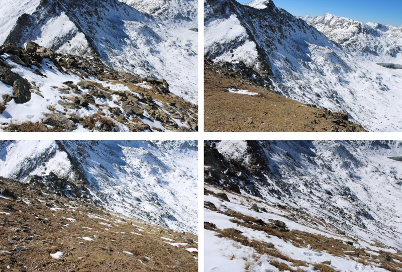
Ascending the ridge was quite steep on tundra
While ascending to the ridge, I did my best to avoid the rock outcroppings
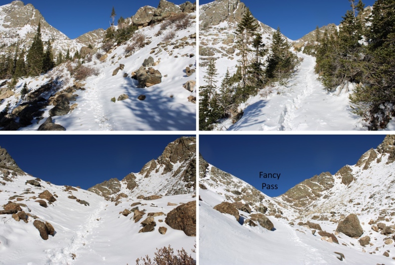
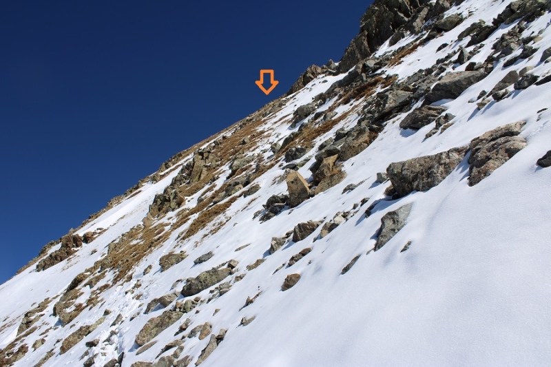
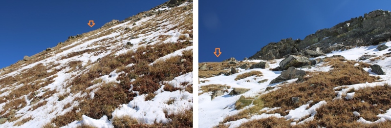
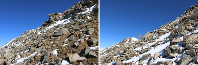
Here you can see the first false summit. I aimed for the ridge to gain this point.
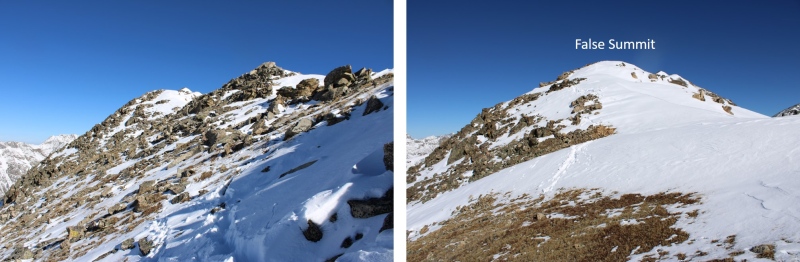
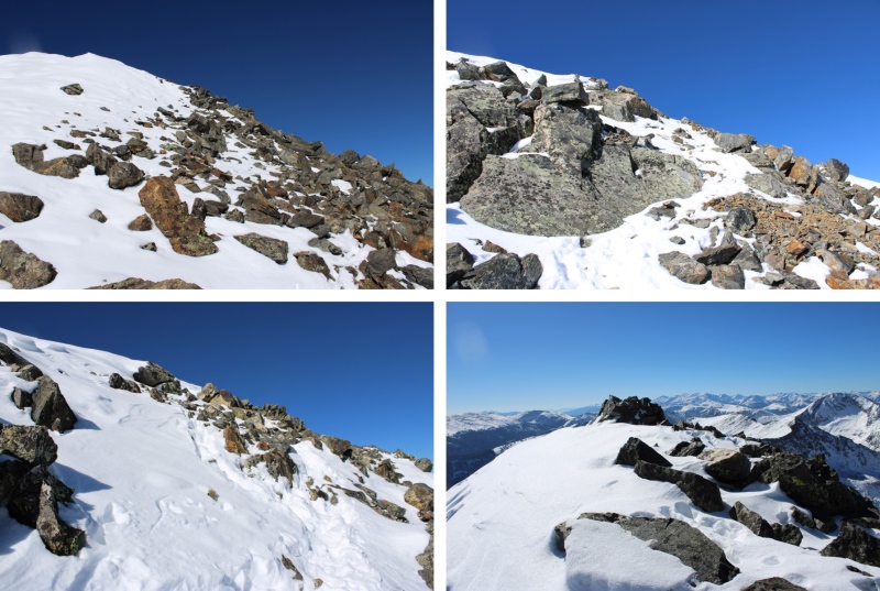
From this point on, it was a ridge hike north. A long, class 2 ridge hike.
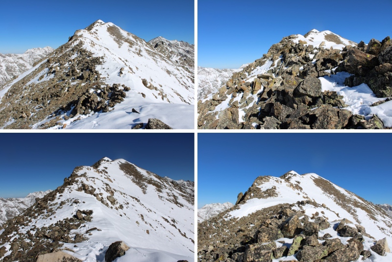
Here are some pictures of the ridge
At the base of the summit, I went right to avoid the snow
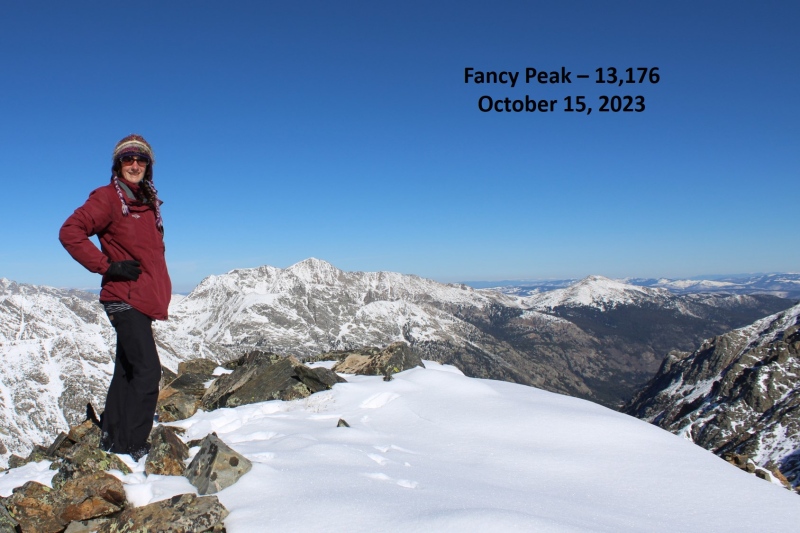
Then easily gained the peak
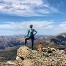
I summited Fancy Peak at 10:45am
Fancy Peak:
Here’s a look back down the ridge
This was an out and back hike for me, so I retraced my steps back to the ridge
Then followed the ridge south
This was my descent route back to Fancy Pass
Back at Fancy Pass, I followed the trail east back to Fancy Lake
Then I followed the trail southeast back to the trailhead
I made it back to the trailhead at 1pm, making this a 9.69 mile hike with 3208’ of elevation gain in 6 hours, 30 minutes.
On to the next trailhead!
Thumbnails for uploaded photos (click to open slideshow):
Hiked the full Fancy Pass Missouri Lakes Loop counterclockwise back in September and on the western end near the end of the loop there is a massive avy debris field
Anyone know when that slide occurred?
From the summit of Fancy Peak I guess that's Holy Cross you're looking at there?
Caution: The information contained in this report may not be accurate and should not be the only resource used in preparation for your climb. Failure to have the necessary experience, physical conditioning, supplies or equipment can result in injury or death. 14ers.com and the author(s) of this report provide no warranties, either express or implied, that the information provided is accurate or reliable. By using the information provided, you agree to indemnify and hold harmless 14ers.com and the report author(s) with respect to any claims and demands against them, including any attorney fees and expenses. Please read the 14ers.com Safety and Disclaimer pages for more information.
Please respect private property: 14ers.com supports the rights of private landowners to determine how and by whom their land will be used. In Colorado, it is your responsibility to determine if land is private and to obtain the appropriate permission before entering the property.


")
")
")
")
")
")
")
")
")
")
")
")
")
")
")
")
")
")
")
")
")
")
")
")
")
")
")
")
")
")
")
")
")
")
")
")