Download Agreement, Release, and Acknowledgement of Risk:
You (the person requesting this file download) fully understand mountain climbing ("Activity") involves risks and dangers of serious bodily injury, including permanent disability, paralysis, and death ("Risks") and you fully accept and assume all such risks and all responsibility for losses, costs, and damages you incur as a result of your participation in this Activity.
You acknowledge that information in the file you have chosen to download may not be accurate and may contain errors. You agree to assume all risks when using this information and agree to release and discharge 14ers.com, 14ers Inc. and the author(s) of such information (collectively, the "Released Parties").
You hereby discharge the Released Parties from all damages, actions, claims and liabilities of any nature, specifically including, but not limited to, damages, actions, claims and liabilities arising from or related to the negligence of the Released Parties. You further agree to indemnify, hold harmless and defend 14ers.com, 14ers Inc. and each of the other Released Parties from and against any loss, damage, liability and expense, including costs and attorney fees, incurred by 14ers.com, 14ers Inc. or any of the other Released Parties as a result of you using information provided on the 14ers.com or 14ers Inc. websites.
You have read this agreement, fully understand its terms and intend it to be a complete and unconditional release of all liability to the greatest extent allowed by law and agree that if any portion of this agreement is held to be invalid the balance, notwithstanding, shall continue in full force and effect.
By clicking "OK" you agree to these terms. If you DO NOT agree, click "Cancel"...
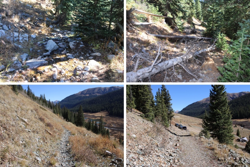
I started this hike from the Bandora Mine site. There’s room for about 3 or 4 vehicles to park at this trailhead.
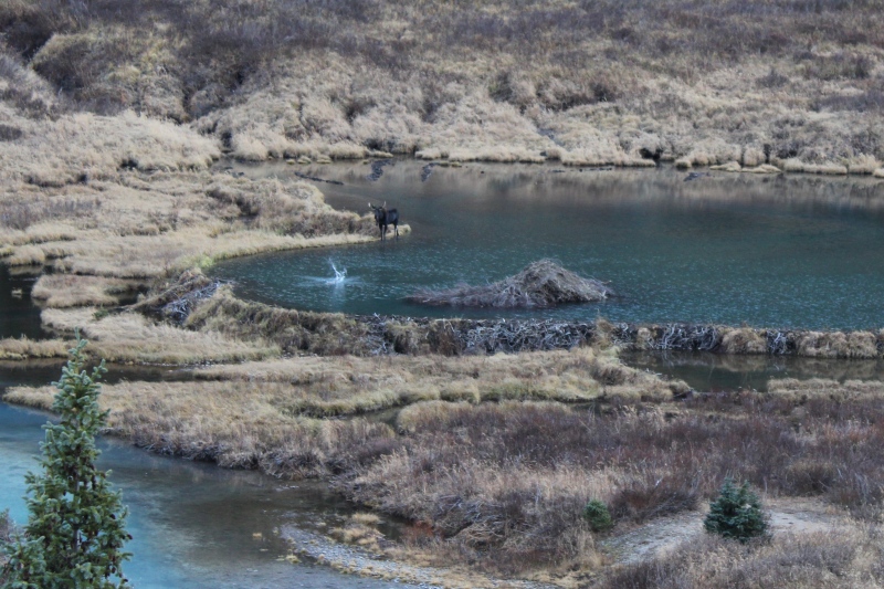
The day before I saw a beaver tail-splash a coyote. Last night I saw that same beaver tail-splash a moose. This guy means business!
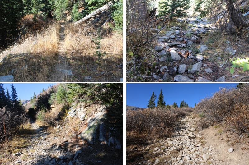
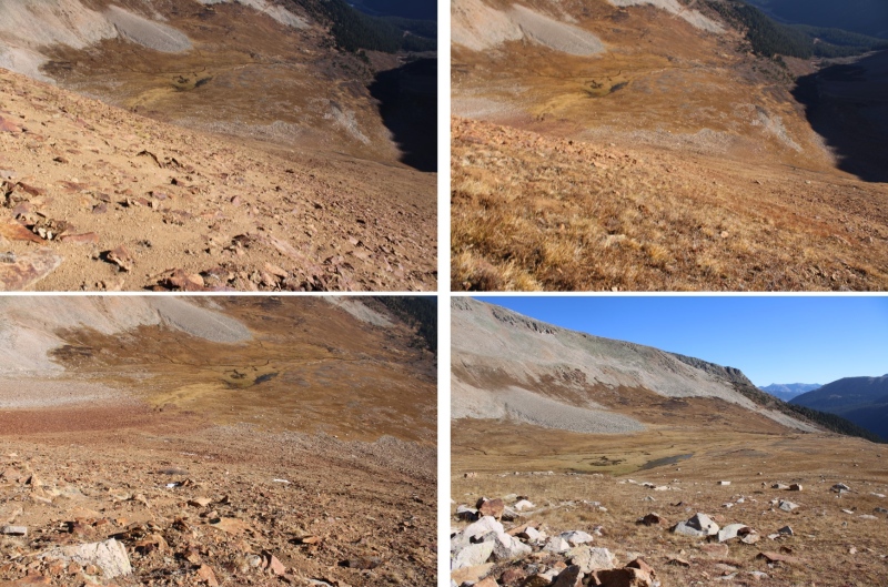
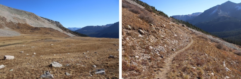
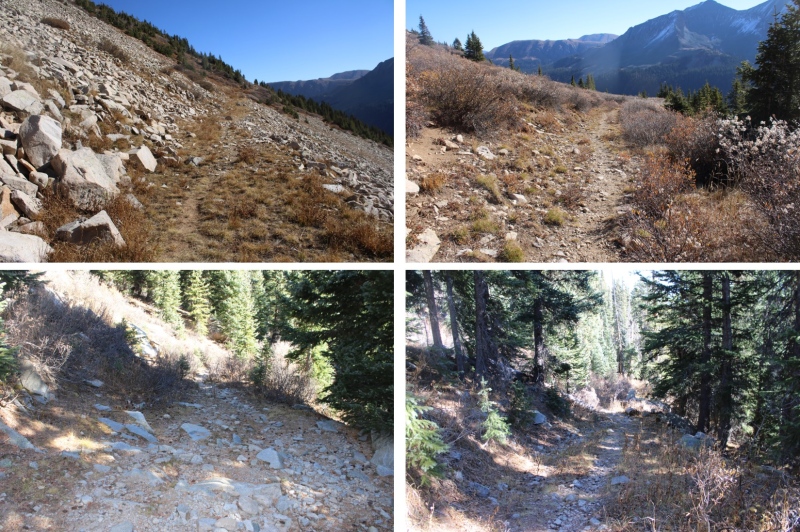
I was on the trail at 6:15am the next morning. I took the trail to Lake Hope, which started just to the south of the parking area.
I took this class 1 trail southwest to treeline, which was about 1.75 miles.
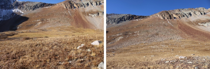
At treeline, I could clearly see V9
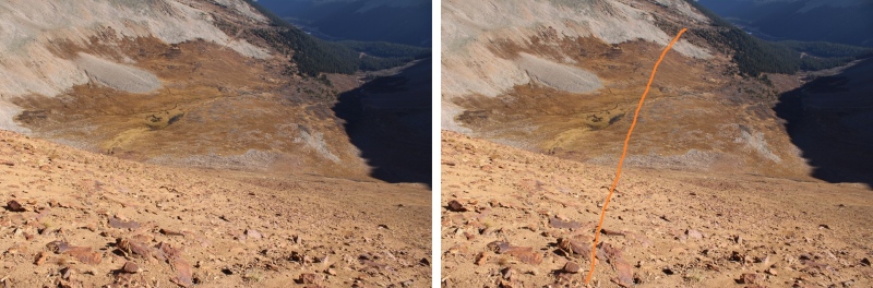
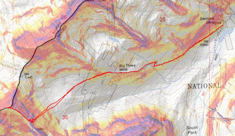
This is the overall route I took to the ridge
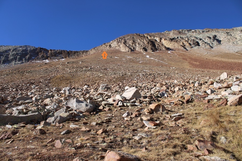
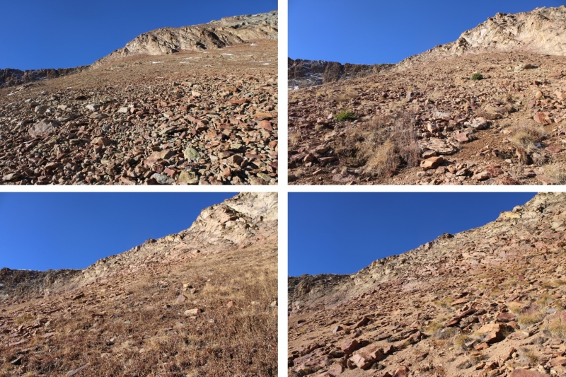
With careful route finding, this can all be kept at class 2+. First, I headed down the basin to the base of the slope.
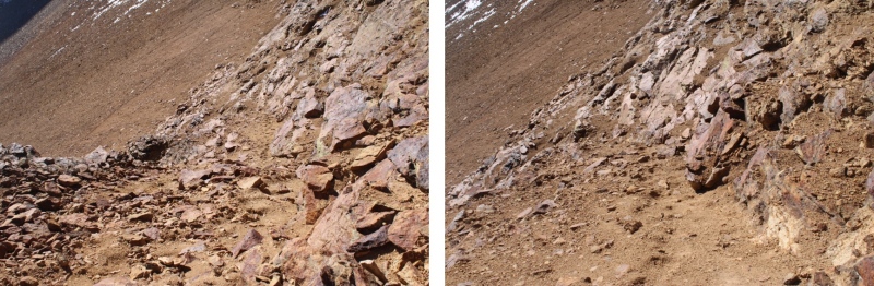
From there it was 730’ of elevation gain up rocky talus to the rocky area just below the ridge. Microspikes helped for traction.
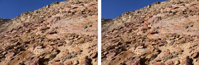
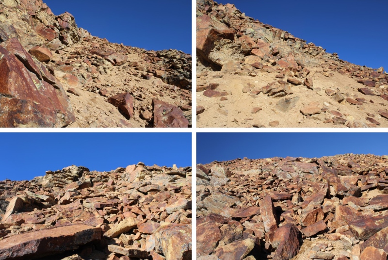
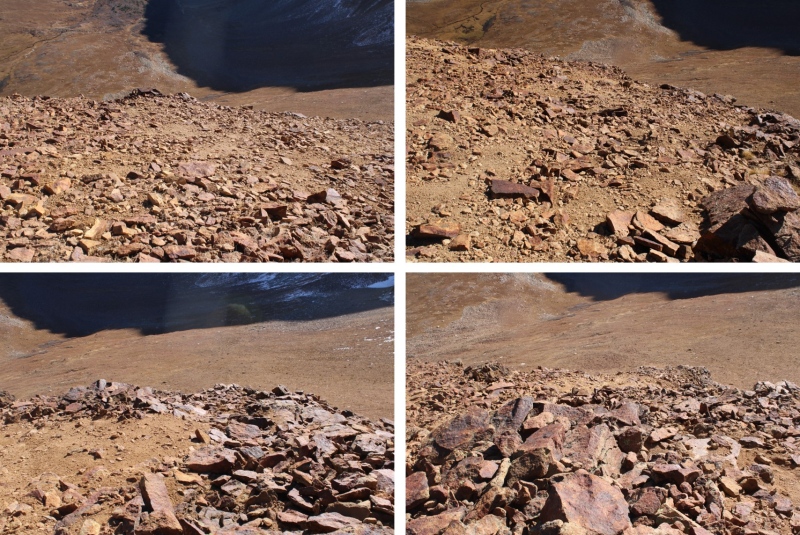
This is where it becomes choose your own adventure. The goal is to gain the ridge. There’s a lot of class 3 scrambling options to gain the ridge, but I was able to keep it class 2+ by finding lines of scree on the rocks to use. The scree was mostly sand on top of rocks, but it gave me traction to use and a path to follow. Initially I started going straight up, following the scree
I noticed a scree ramp to my right, and took that until it ended.
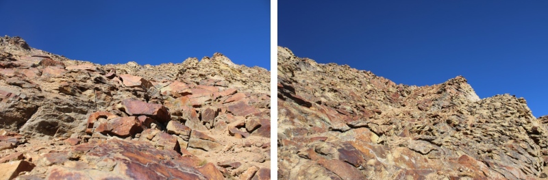
Once it ended, I turned left and followed scree paths to the ridge
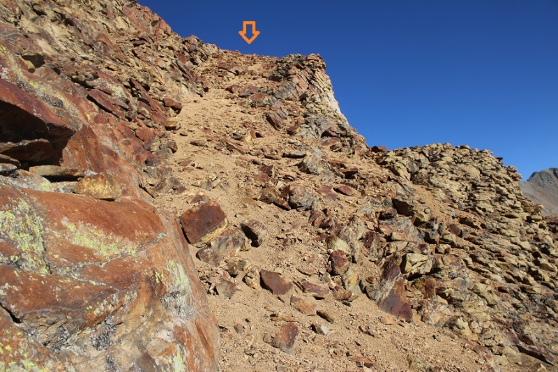
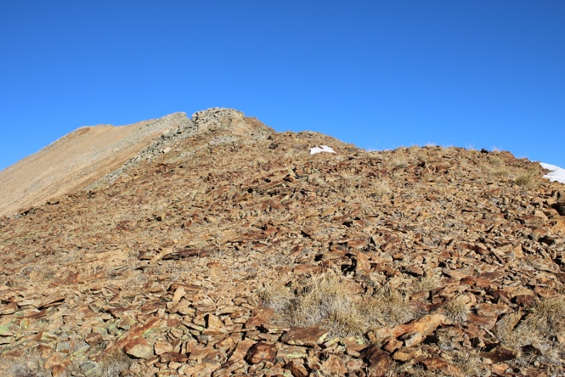
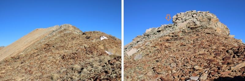
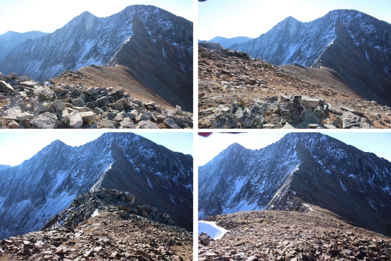
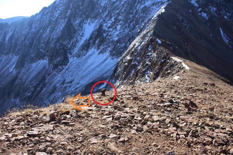
Once on the ridge, I put a small cairn to indicate where I should descend on my way back. I turned right and saw the summit of V9 to the northwest
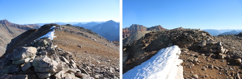
It was an easy class 2 ridge hike on talus to get there.
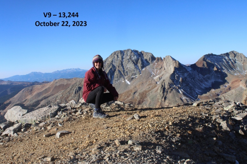
I wasn’t sure where the actual summit was, as it’s rather flat with several “bumps” that all look to be the same height. So I walked all around each of what looked like the highpoints and took a video from the middle. I summited V9 at 8:45am
V9:
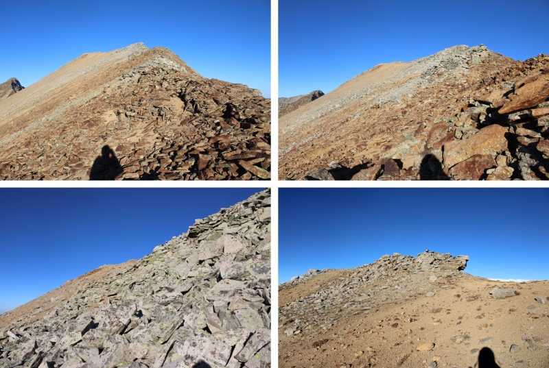
This was an out and back hike for me, so I made my way back down the ridge to where I’d placed my cairn.
At the cairn I turned left, and headed back towards the scree ramp
I followed the ramp until it ended
And then followed scree trails to the base of the rocks
Next I made my way down the slope and back to the Lake Hope Trail
Back on the trail, I followed it northeast back to the Bandora Mine
I made it back to the Bandora Mine at 10:45am, making this a 6.96 mile hike with 2657’ of elevation gain.
On to the next trailhead!
Thumbnails for uploaded photos (click to open slideshow):
So you didn't go to the saddle between V8 and V9 at all over the weekend? Might have been wise. I did V8 from the saddle last year and it was the loosest slope I have ever been on. I thought it was worse than T10. And the reports say going up V9 from the saddle is worse. This looks like a good alternative.
Friday I hiked up to the pass to look at the conditions, and didn't like them on either side. Not too much snow, but what was on V9 was sugary, and V8 looked like a lot of rock work. I thought there had to be better ways :)
Caution: The information contained in this report may not be accurate and should not be the only resource used in preparation for your climb. Failure to have the necessary experience, physical conditioning, supplies or equipment can result in injury or death. 14ers.com and the author(s) of this report provide no warranties, either express or implied, that the information provided is accurate or reliable. By using the information provided, you agree to indemnify and hold harmless 14ers.com and the report author(s) with respect to any claims and demands against them, including any attorney fees and expenses. Please read the 14ers.com Safety and Disclaimer pages for more information.
Please respect private property: 14ers.com supports the rights of private landowners to determine how and by whom their land will be used. In Colorado, it is your responsibility to determine if land is private and to obtain the appropriate permission before entering the property.


")
")
")
")
")
")
")
")
")
")
")
")
")
")
")
")
")
")
")
")
")
")
")
")
")
")
")
")
")
")
")


