| Report Type | Full |
| Peak(s) |
South Lookout Peak - 13,420 feet "V 5" - 13,164 feet "V 2" - 13,319 feet "V 4" - 13,541 feet US Grant Peak - 13,778 feet Houghton Mountain - 13,059 feet Tuttle Mountain - 13,208 feet Hanson Peak - 13,462 feet Pilot Knob - 13,746 feet Golden Horn - 13,789 feet |
| Date Posted | 11/04/2023 |
| Modified | 01/24/2024 |
| Date Climbed | 08/23/2023 |
| Author | Dobsons |
| San Juan Trip 2023 - Ice Lake Area Peaks plus |
|---|
|
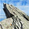
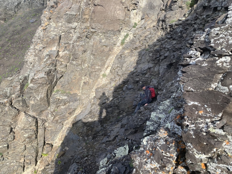
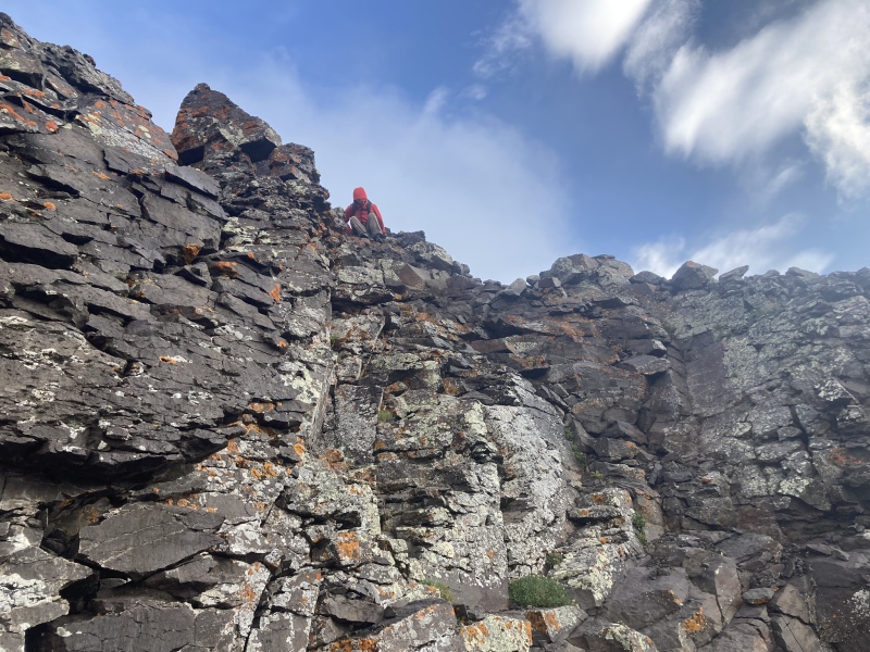
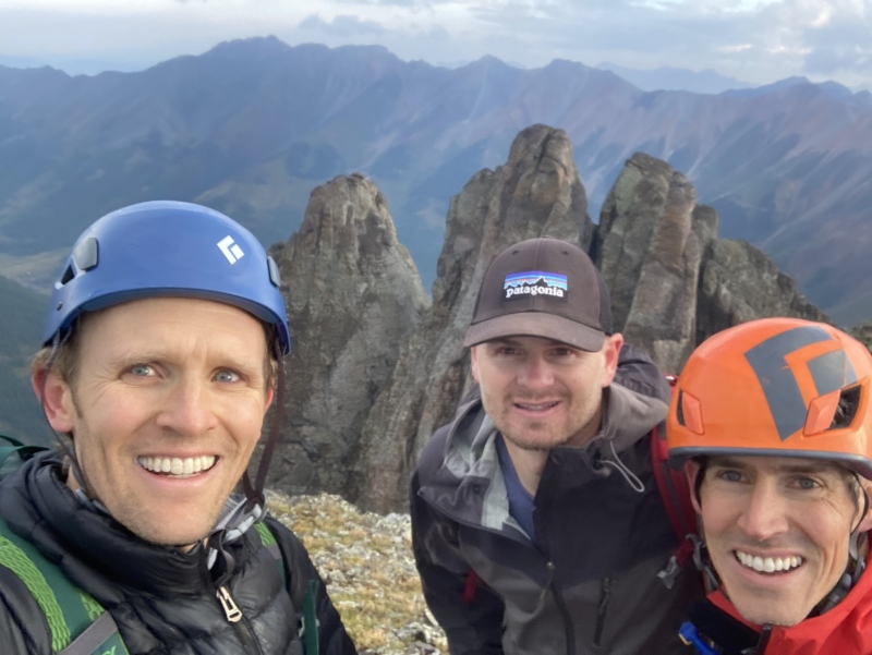
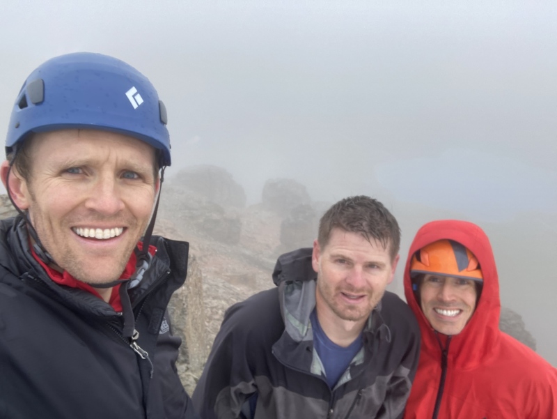
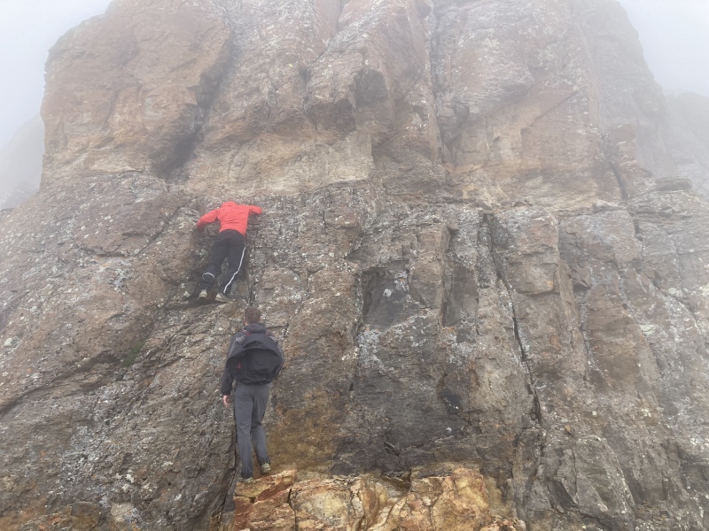
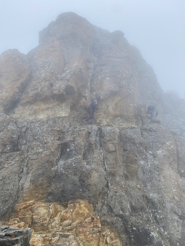
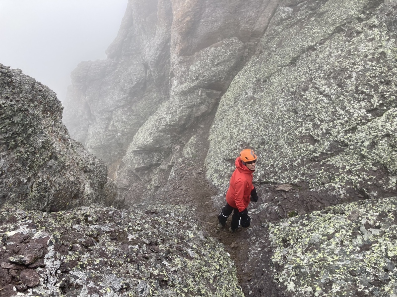
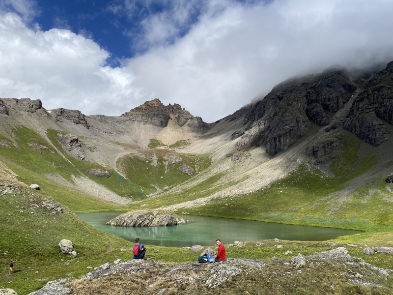
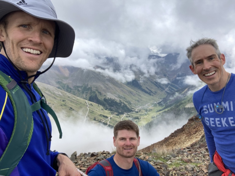
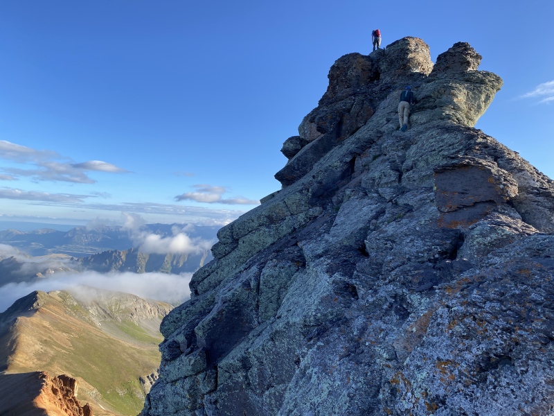
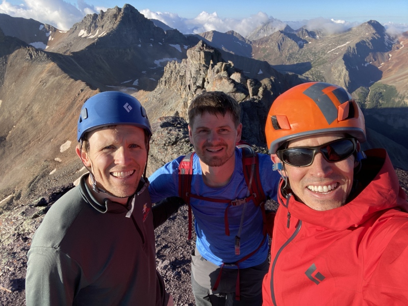
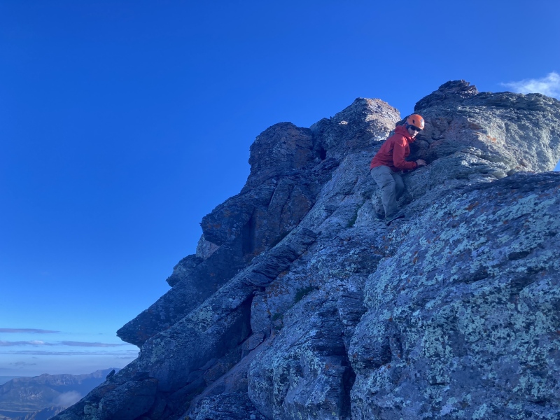
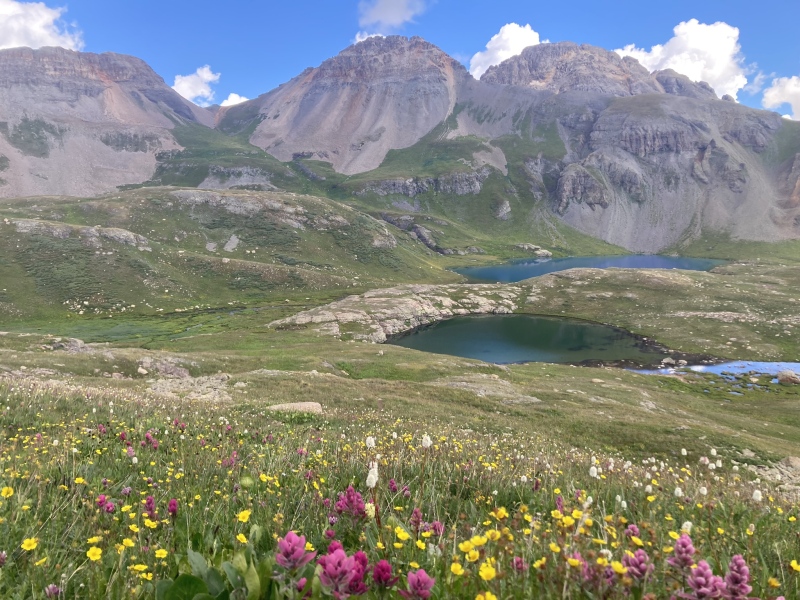
San Juan Annual Mountain Climbing Trip 2023 Climb dates – August 23-26th Members – Me (Corey), Luke, and Brent Intro – I’ve written several trip reports of our med school mountain climbing reunion over the years. I do this as much for my memory’s sake as anything, but I hope they are helpful to some. Brent, Luke, and I have teamed up for these trips and it has been great to get back together with these dudes at least once yearly to climb some peaks and reconnect. We had originally planned to go into the Weminuche wilderness for Vestal via wham ridge, Arrow, and the Trinities. However, this basin has become somewhat of my white whale of climbing as I have now planned on climbing these peaks three separate times without success. Once, Brent and I got stormed off Vestal’s wham ridge by an early 7AM storm and salvaged a summit via the standard route but we weren’t able to summit Arrow or the Trinities due to weather. Last year we planned on going to Vestal basin but a substantial monsoonal surge turned us to other objectives that did not require a long backpack. This year, once again as the trip approached it became obvious that a deep Weminuche backpack trip could be very, very wet and likely was not in the cards. Hurricane Hillary, a once in a century California hurricane, made land fall a few days prior to the trip and this set up a significant monsoonal pattern for the San Juans to start the exact day that we planned on backpacking in. We called an audible a few days before the trip and rented a hotel in Silverton to have a chance to dry out between climbs and see what we could pull off in day trips from Silverton. With the post Hillary forecast looking terrible when we started the drive down from Grand Junction I was wondering if we would be successful at climbing anything at all. Amazingly, it turned out to be one of our most successful trips yet! Day 1 – August 23, 2023, South Lookout Peak and V5 – Whenever I plan a trip with Brent and Luke I try to plan harder peaks mainly because Brent and Luke are such strong climbers and they are always game for anything. South Lookout had been on my list of “difficult” peaks for a while so I was hoping we could climb it before the weather hit in earnest. We drove down the night before and slept in a pull out on one of the many switchbacks on the clear creek road. Unfortunately, any delay in the rain didn’t occur and we woke at 4AM to heavy rain and it continued to rain steadily until 5AM when we finally decided to start our day. With it raining hard we actually retreated down the road thinking we would try a walk up 13er around Silverton as it rained. However, on the drive down clear creak road the rain lightened and we decided we would go ahead back up to Clear Lake and just hike up towards South Lookout and see what happened. I must admit I thought as we left the lake there was nearly zero chance we would summit the peak on this morning. However, as we climbed up the rain completely stopped and the clouds started to open enough to see some of the local peaks and soon, we were cresting the ridge looking at the upper difficulties of the peak with weather clearing slightly rather than worsening. With the weather giving us a window of no rain and slightly breaking clouds we pressed forward into the difficulties. I was really wondering if the rock would be dry enough but when we got to the scramble things were surprisingly grippy so we continued to move forward. The hardpan down trending traverse was quite soft and more enjoyable than some reports I had read about which was one benefit we had from the rain. I felt that upper South Lookout definitely lived up to it’s reputation in terms of danger and difficulty. We took the initial lower gully one at a time as the rock fall danger initially is significant. Luke and Brent attacked a likely class four route directly up the gully to the easier rib above the difficulties while I zigged and zagged a bit more using a ledge to climbers right of the gully about half way up the gully to a slightly easier finish to the rib. I felt I kept the climbing to a stiff class 3 but it was certainly loose and exposed. I was surprised how quickly the difficulties passed and once to the easy rib above the difficulties the final summit pyramid is very close. This final obstacle was more difficult climbing, harder 4th class in my opinion, but much more solid and enjoyable then the initial looser scrambling. Before we knew it, we topped out of the dihedral and were standing on a summit I had long thought about. I was somewhat amazed that we were on top of South Lookout especially considering the weather earlier in the morning. We were elated to at least have one summit under our belt in less then ideal weather and we had no clue how fortunate we would be the entire week despite the difficult weather. After enjoying the summit for a bit we downclimbed the difficulties delicately. I do think South Lookout Peak is very formidable. It’s not a peak I would repeat routinely due to the loose nature of the initial ~150 vertical feet of climbing. It is loose and exposed but it actually ended up being a bit easier than I expected which often happens as I build a peak up in my head over the years. It is definitely a worthy and beautiful objective but also has an element of danger for sure. Once during the climb of the rotten gully a larger rock was dislodged and plummeted down the mountain. I would definitely not recommend having two people on the lower scramble at a time. After we were past the difficulties of the down climb, we quickly made our way down the grassy slopes back down to the road. South Lookout Peak is unique in how easy it is to approach but how potentially dangerous the last 200 vertical feet are. The weather was still holding at Clear Lake so we decided to give V5 a go. We followed an old mining road a decent amount of the way up V5 leaving from just below and east of the lake and then attacked the peak head on. We ended up getting into some decent class 3 scrambling before we found the easier ascent gully which led to a pleasant walk to the summit in the clouds. Fortunately, the clouds dissipated while we were on the summit and we were treated with amazing views of the local peaks and Ice Lakes area which we would have the good fortune of exploring more in the coming days. After V5 we made our way to Silverton as it rained off and on the rest of the day, happy to have a roof over our heads! Stats for the day – 5.2 miles and 2,946 feet of elevation gain according to strava. Strava map link below South lookout and v5 with Brent and Luke on San Juan med school reunion trip | Run | Strava 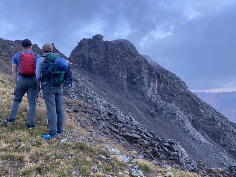

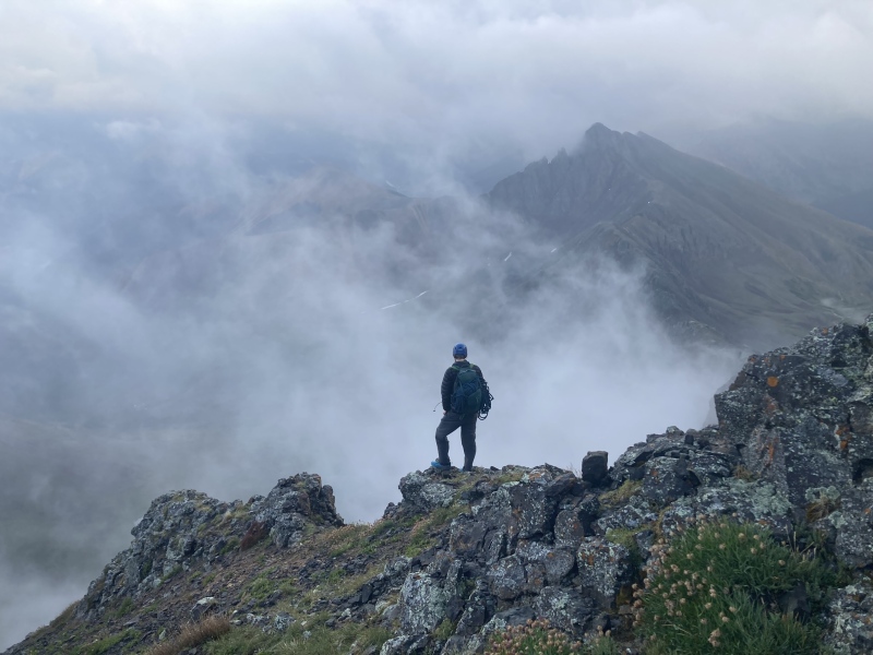
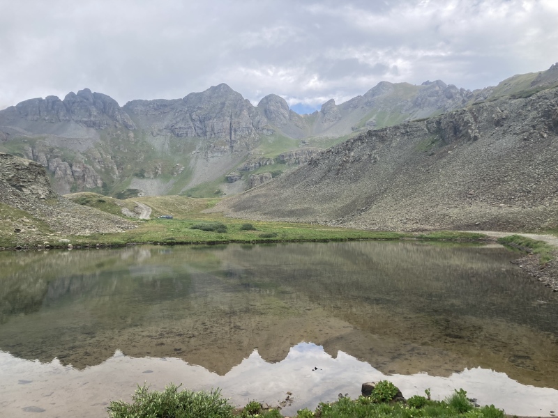


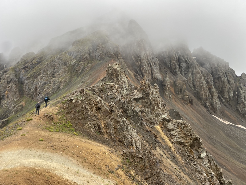
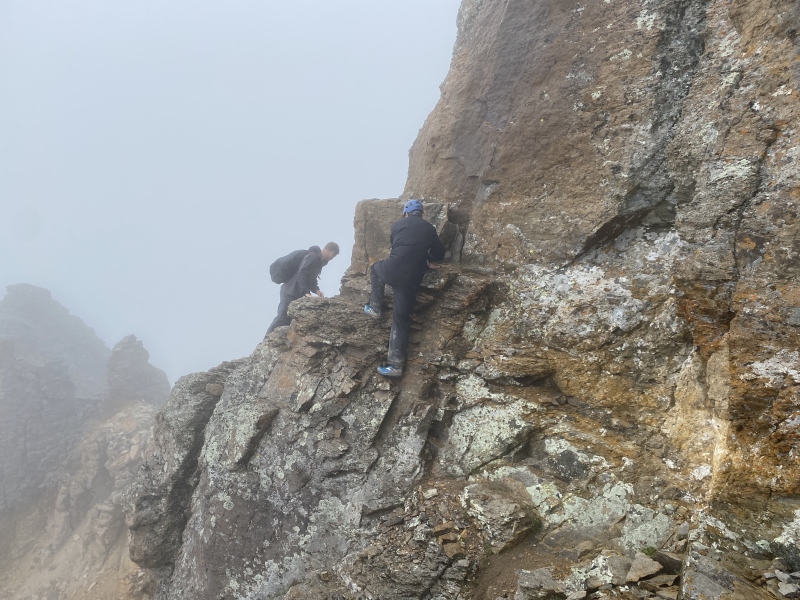
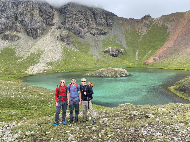
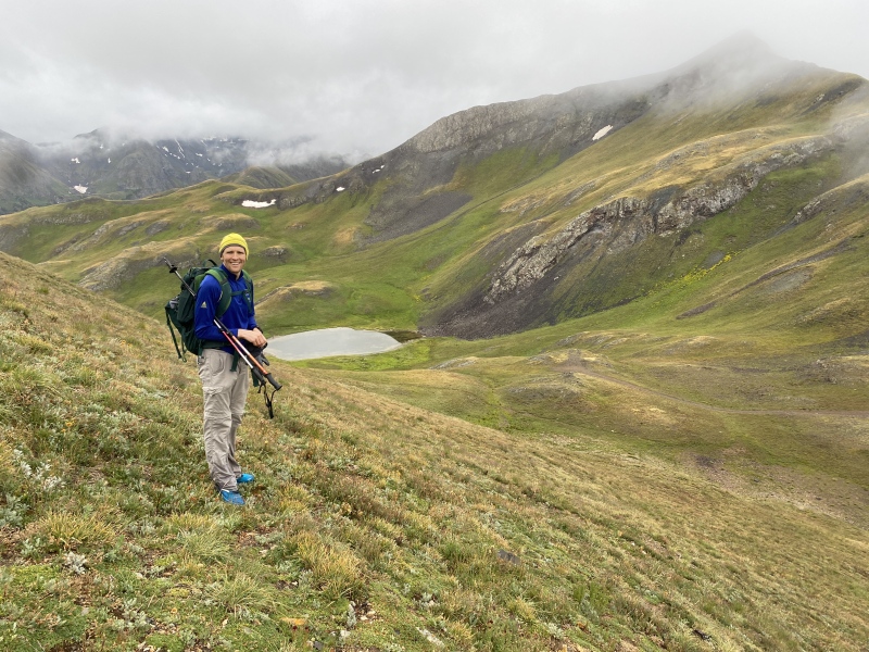
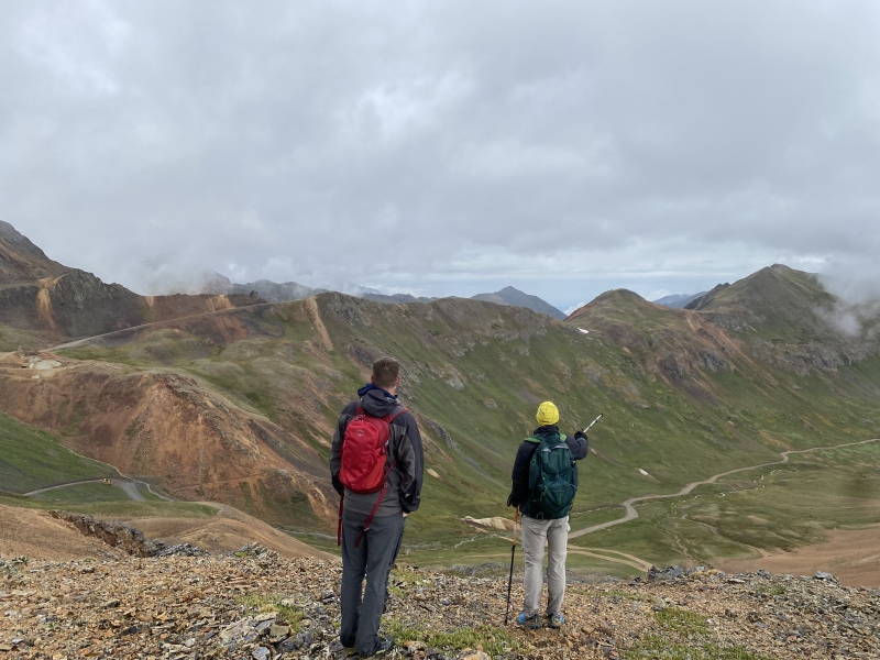
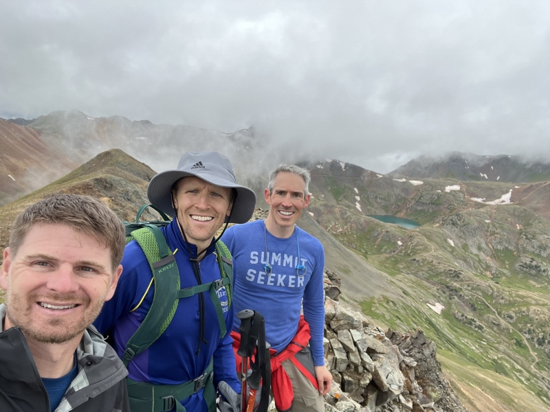
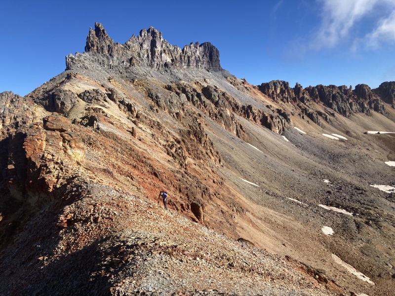
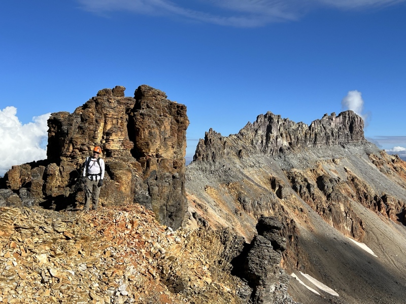
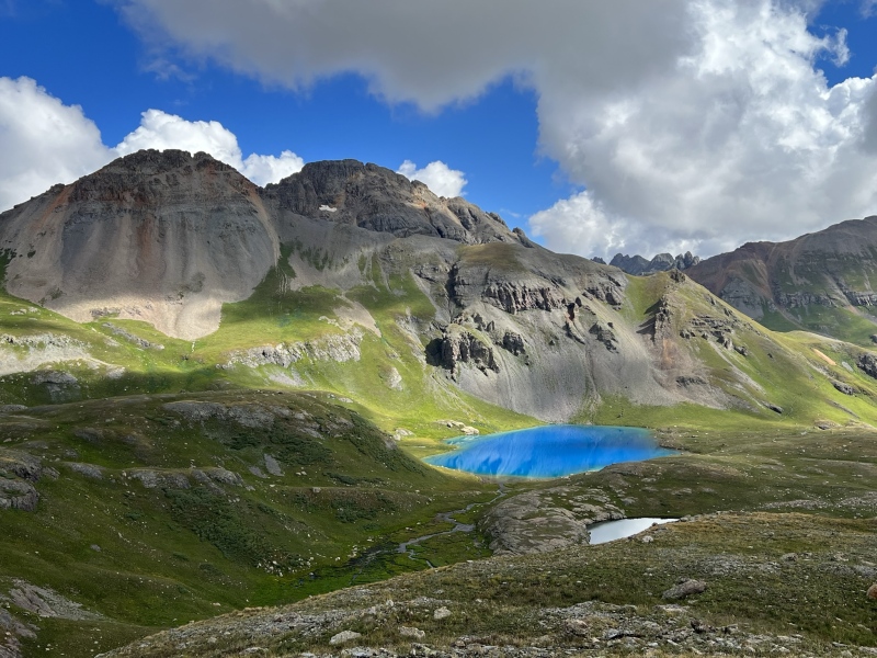
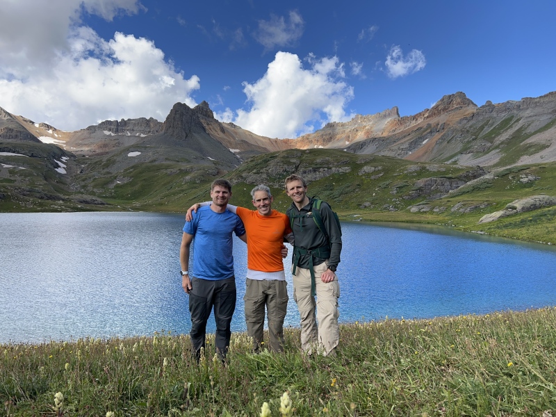
Day 2 – August 24, 2023 - V2, V4, and US Grant Peak The weather forecast continued to be brutal with rain potential early and heavy thunderstorms late. The one good thing about cloud cover early in the morning is often it can decrease uplift and delay thunderstorm building so we again planned to head up into the clouds and see how things went. I had always been excited to see island lake as a Hardrock 100 fan and was excited to see the peaks above the lake and US Grant had always been a peak I had looked forward to. We drove up from our cozy hotel and started a bit after 5AM. We started the hike in a drizzle and took the island lake cut off trail from the main ice lakes trail a bit past the 2 mile marker. We followed the gorgeous trail to the lake and the lake did not disappoint. It has to be one of my favorites in the state. Unfortunately, at this point it was raining fairly decently but we continued up towards Swamp pass and then took the west ridge to V2. The actual summit of V2 is hard to determine where it is especially in the clouds so we actually ended up following the ridge a way past the summit and came back to the summit cairn and the register once we were certain we had passed the top. It continued to rain hard and we were getting cold. We were happy to be on a summit but a bit bummed to not have many views and it seemed like our day likely would end with V2. On the hike down from V2 we amazingly bumped into several mountain bikers on the trail down V2. We initially spotted some people in the saddle of south lookout and V2 while we were climbing V2s west ridge. I did not notice bikes however initially but the fog was fairly thick. I figured they were climbing V2 from the Clear Lake side. However, on our decent of V2 it ended up being mountain bikers and somehow all of the sudden they were on our ridge. I have no clue how they got from where we first spotted them to the west V2 ridge as the cross-hilling looked heinous and steep especially with bikes. There must be a sneak of some sort and I suppose they likely hiked a bike but it was a very unique experience and something I completely did not expect to see bikers out in a morning like this especially at 7 AM in a thick fog and rain. One was in just normal biking shorts. I was wondering if I was hallucinating as I saw the bikers initially. They took off flying down to Island Lake before we were able to learn who these demigods where and from where in the world they had come and where they were going. Those were some studs to be biking at that time in the morning and in those conditions up near 13000 feet to say the least. Seeing them tough out a crazy morning for alpine biking I think encouraged us to keep pressing onwards a bit. After the most unexpected run in to other humans I had experienced in the mountains in a while we made our way to island lake. Amazingly as we descended, we started to warm up a bit and the rain stopped. At Island Lake we looked up at the US Grant and V4 saddle and decided we would forge on and try to warm up and hike up to the saddle and see if things went. At the saddle both summits were completely in the clouds, but we followed the standard route up V4 to the summit in the clouds. In the clouds we struggled to tell which rock tower was the summit, so we climbed several ultimately feeling that the first tower was the tallest. The only downside was not having views of this spectacular place. We descended back to the saddle and started up into the upper difficulties of US Grant peak. The peak seemed like a bit of a maze on the ascent in the clouds but we rather quickly navigated our way through the sandy gullies to the infamous class four step and ledge traverse. I have seen some people call this step class 5 and some class 3. I think this 10 foot section up to the traverse ledge was definitely class 4 in my estimation as the down climb of the step seemed more engaged than usual class 3. The ledge traverse was awesome and very stable. It may not have seemed as exposed in the fog. We turned left after the ledge traverse and took the easy gully to the summit amazed to have summited 3 peaks on the day. We climbed out of the cloud soup back to the saddle after reversing the ledge traverse and class 4 10 foot downclimb. From the saddle we descended to island lake where we took a break and enjoyed the lake for while. At the lake the clouds receded enough to give us great views of V4 but the summit of US Grant Peak remained elusive the entire day. The hike out was spectacular seeing terrain we didn’t see on the climb and and we were amazed at how many hikers were on the lower trail on the way out. Stats on the day – 10.7 miles with 5,453 feet of elevation gain - strava link below for map and stats 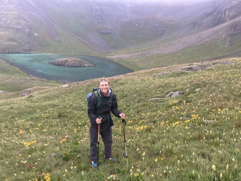

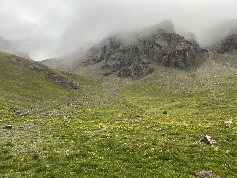

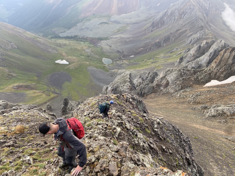
Day 3 – August 25, 2023, Point 13,075, Hanson Peak, Tuttle and Houghton Mountains The clouds, early rain, and monsoon moisture was still in the forecast so we decided to attack some easier walk up peaks for a little respite on the trip on day 3. We felt looking at the map that this could make a nice loop from animas forks with no technical difficulties. This turned out to be just the case and these 4 peaks link up wonderfully on a very nice clockwise loop. We started just above the Frisco mill near Animas Forks. We followed CR 9 all the way up the initial valley and you can follow the jeep road nearly to the summit of point 13,075. Near the summit of 13,075 we left the road shortly and followed grass practically to the summit once again in the clouds. From there we headed back to the jeep road for a bit and used an old jeep/mining road up Hansen peak to a talus slope to gain the south ridge of Hansen for an easy talus walk up summit. From Hansen we angled for the pass between Hansen and unranked California Mountain and then dropped straight down through some loose talus to CR 19. This decent was steep and very loose talus slope. It was wonderful for a scree ski but ascending would be difficult so if others were to repeat the loop I would recommend the clockwise fashion to not have to climb this slope. From C19 we walked on the road for about 100 yards before starting an ascending traverse to Tuttle peak which was a pleasure stroll on mostly grass to the summit. By the time we reached Tuttle the clouds had broken a bit for our best views of the day. From Tuttle the ridge to Houghton is straight forward awarding a nice 4th summit of the day with a glorious alpine loop. From Houghton one can head south slightly on the ridge we used for ascent and then drop straight down to the road on grass the entire way back to the car. There is nothing technical or difficult about this loop but it was an absolute pleasure stroll I would highly recommend. Stats – 9.68 miles with 3,934 feet of elevation gain 

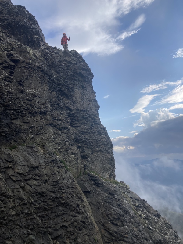
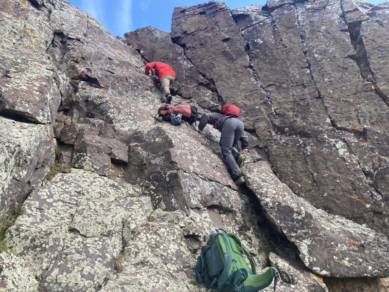
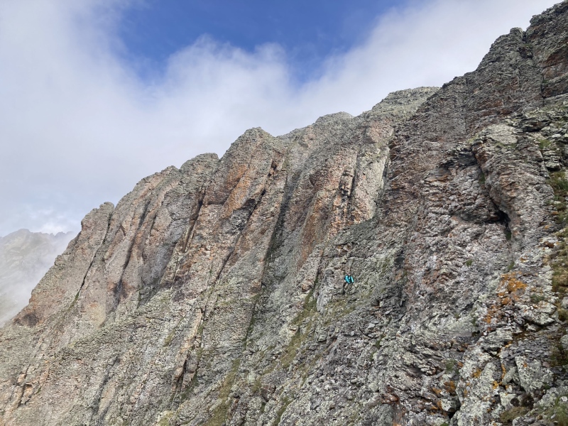
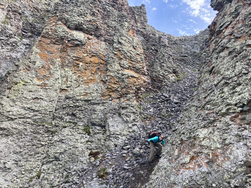
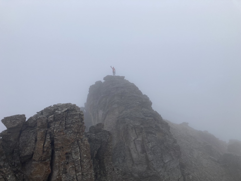
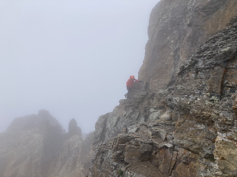
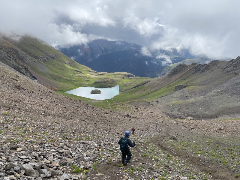
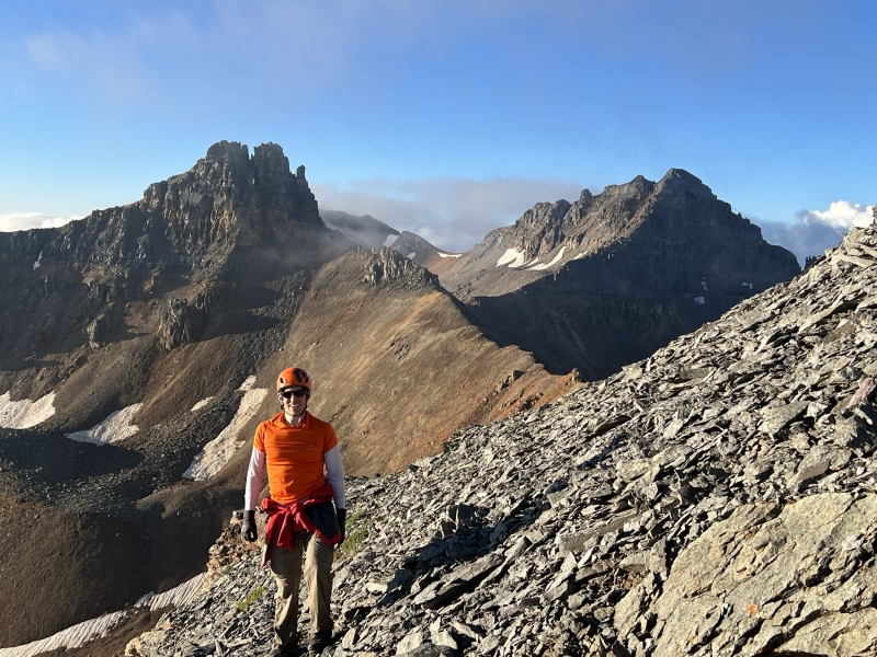
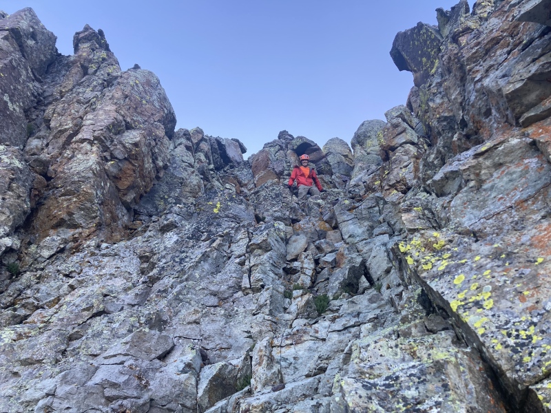
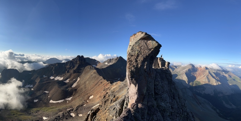
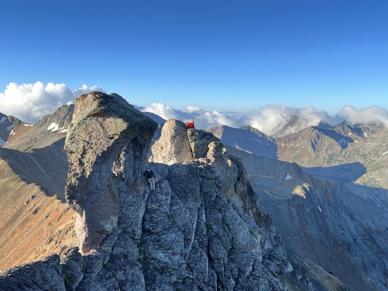
Day 4 – August 26, 2023, Pilot Knob and Golden Horn After 3 straight days of hiking into and out of the clouds and intermittent early morning rain we finally had a day with clearer skies forecast at least in the AM. We decided to head in for pilot knob and golden horn (I had previously done vermillion) hoping to finally see in all its glory the peaks and country we had climbed during the first few days of the trip when the clouds limited the views. We started even a bit earlier as the thunderstorms were scheduled for noon and left the car about 4:45AM. The hike up to Ice Lake went wonderful and the views of Pilot Knob from the lake are stunning. It’s obvious why this area is so popular and it was my first time seeing it in its full summer glory (my first trip was a snow climb of Vermillion about a decade prior). Pilot Knob was another of the peaks that I had looked forward to for some time but was a bit nervous about the final traverse around the tower to the summit due to the exposure and no-mistakes-allowed terrain. Having children I struggle more and more with these exposed moves as the only thing that really matters is coming home to my family. After reading several reports and after considering bringing a rope to protect the top exposed traverse of Pilot Knob we ultimately decided we would be comfortable on it without the rope. From Ice Lakes the climb up to the north of the summit tower of Pilot Knob is obvious. We climbed the scree filled gully and slope up towards the tower. This is at times a two steps forward one step backward affair but we did make it to the tower without event and had our first views of the Wilsons and Lizard Head for the trip. (Brent and I were absolutely blessed to climb Lizard Head on our San Juan trip last summer so it was fantastic seeing it again) The traverse on the west side of the tower took a bit longer then I expected but the ascent class three gully is obvious when you see it as nothing earlier seems even remotely inviting for upward travel without a rope. The class three gully climb was enjoyable. I had been expecting the exposure of the final moves around the tower but was impressed at the ridge once we reached it and the exposure on both sides for several hundred feet of travel to the final crux. This is a special place and I think it is definitely up there as one of my favorite 13ers so far. The final tower traverse was very exposed and down slanting towards the abyss so it definitely requires every ounce of attention. I read somewhere else that Pilot Knob’s crux is class 3 climbing but with class 4 exposure and I would agree. On the ascent (actually downclimbing the crux) it seemed every bit of class 4 but on the decent on the way back (upclimbing the crux) after the summit it seemed like fairly reasonable class 3 because you just aren’t staring directly out into the abyss. We enjoyed the summit for a while really soaking up the views and enjoying mostly blue skies. It’s an amazing summit and nice to get a respite from the exposure of the climb. We then retreated the exact same way we came. After we finished the down climb to easier ground we decided to traverse back to the north side of Pilot Knob rather then heading directly to Golden Horn. I had read several reports of people heading directly to Golden Horn and not a single one of them seemed to enjoy the looseness of the talus on the traverse. So, we decided to retrace our steps to the bottom of the initial gully climb at the bottom of the approach. The scree surfing here was wonderful on the decent and it was nice to “earn our turns” after the more arduous ascent. From the bottom of the scree slope and gully we could tell the reclimb up to the saddle between Golden Horn and Pilot knob would be very simple and it turned out great. From the saddle there are mild difficulties easily bypassed angling to just above the Vermillion and Golden Horn saddle. From there the final ridge of the trip was enjoyable and we had fun climbing both towers of Golden Horn as we weren’t certain which was tallest. Golden Horn might be one of the most impressive 13ers with easiest way to climb it. It’s certainly up there at least. The dramatic views over to Pilot Knob and down to Ice Lake basin were an amazing way to end the trip. Our decent off Golden Horn was fantastic and we enjoyed some of the old mining sites and cool rocks then rejoined the hordes of people at Ice Lake. I decided to count the people on the way out of the trail and lost count somewhere over 200 people. So… Ice Lake has been discovered for some time but the peaks above still lead to some enjoyable solitude. In a fitting end to our trip, it started raining and thundering right as we reached the car. The drive home of course included a Montrose Wendy’s stop which has become our tradition. Then the monsoonal moisture surge had one last laugh on the trip when I got stuck in Glenwood Canyon driving back to Eagle for 3 hours as the interstate flash flooded. I was bummed by this as I was so ready to see my wife and boys but tried to make the best of it and had a memorable time cooking ramon right on the hood of my jeep in the middle of the interstate. Stats on the day – 13 miles with 4,698ft of gain. As I can only include one GPX I included the one from this day on the map. 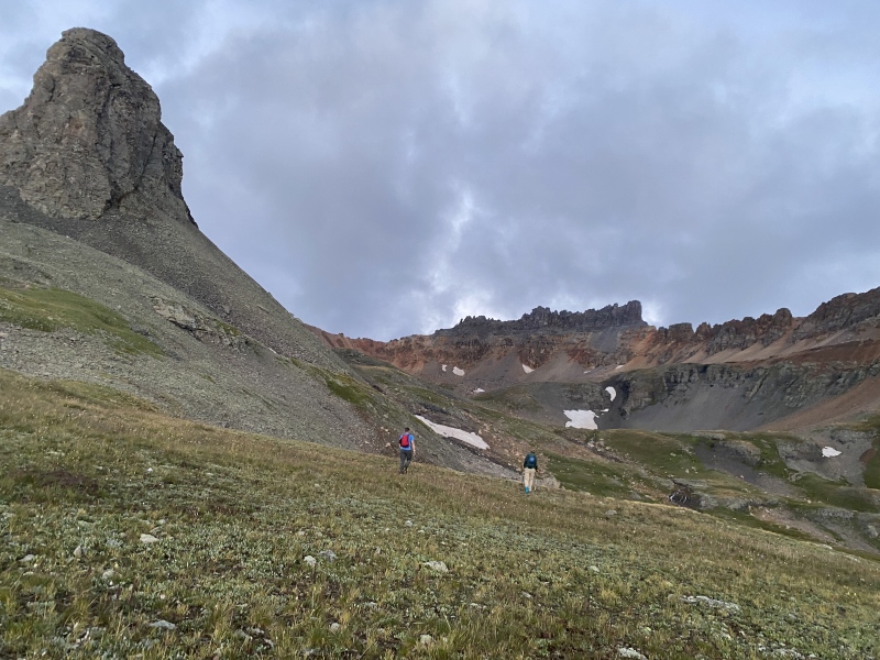


Final thoughts Thank you to our wives and children who allow us to go on these adventures yearly! I am still somewhat amazed at how fortunate we were to summit 11 peaks on this trip despite the significant monsoon forecasts and the effects of Hurricane Hillary. Sometimes you have to just forge forward despite a forecast and see what happens while being willing to turn if need be. That being said we were still very fortunate on this trip to get the summit success that we had. I had looked forward to these peaks (especially US Grant, South Lookout and Pilot Knob) for some time and they didn’t disappoint. It’s such an amazing part of our state and Pilot Knob is an absolute show stopper in my opinion. Climbing mountains, like life, is best shared. I am so fortunate to have the friends I have to climb these peaks with. Thanks Luke and Brent for the adventures! I continue to thank God, my Lord and savior Jesus, for the opportunity and health to pursue these mountains enjoying his amazing creation. As a physician I routinely see people that have health issues that make climbing mountains not even remotely a possibility. I am so thankful every time I go out for the opportunity to hike and see these amazing places. Thanks for reading and I look forward to our San Juan climbing trip in 2024! Hopefully Vestal basin at last will allow for a successful trip of it’s amazing peaks in the coming year. Thumbnails for uploaded photos (click to open slideshow): ")
")
")
")
")
")
")
")
")
")
")
")
")
")
")
")
")
")
")
")
")
")
")
")
")
")
")
")
")
")
")
")
")
")
")
")
")
")
")
")
")
")
")
")
")
")
")
")
")
")
|
| Comments or Questions | ||||||||||||
|---|---|---|---|---|---|---|---|---|---|---|---|---|
|
Caution: The information contained in this report may not be accurate and should not be the only resource used in preparation for your climb. Failure to have the necessary experience, physical conditioning, supplies or equipment can result in injury or death. 14ers.com and the author(s) of this report provide no warranties, either express or implied, that the information provided is accurate or reliable. By using the information provided, you agree to indemnify and hold harmless 14ers.com and the report author(s) with respect to any claims and demands against them, including any attorney fees and expenses. Please read the 14ers.com Safety and Disclaimer pages for more information.
Please respect private property: 14ers.com supports the rights of private landowners to determine how and by whom their land will be used. In Colorado, it is your responsibility to determine if land is private and to obtain the appropriate permission before entering the property.