| Report Type | Full |
| Peak(s) |
Iron Nipple - 13,502 feet "Huerfano Peak" - 13,837 feet |
| Date Posted | 11/21/2023 |
| Date Climbed | 10/07/2023 |
| Author | Tim A |
| Additional Members | samgockel |
| A Lot of Lounging along the Huerfano Headwaters |
|---|
|
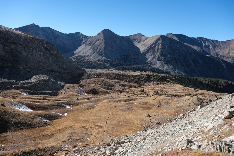
There are more than enough TRs on this pair of peaks (and a complete route description) that providing more beta on this route isn't really necessary, but the pictures may be worth sharing. I normally climb solo and when I have a partner, they generally just snap a few pictures with their phone on the summit, so climbing with another photographer made for a real treat with comparing compositions and settings and just getting some rare pictures of myself in the hills. Sam and I met near Two Medicine Pass in Glacier National Park a few summers ago as I was coming down off Grizzly Peak. We both had cameras strapped to our backpacks and between photography and chatting about GNP summits we became friends in about ten minutes. Thanks to FB, I knew he moved to Pueblo recently so reached out to set up some Sangres climbs this fall. After a long workday and longer drive up from West Texas, I rolled into Gardener at 11pm and picked him up for the additional hour-long drive up the Huerfano valley, settling into camp around midnight. Normally we're both into 2am starts for the good light, but I was completely spent so we opted to sleep-in and wakeup at 4am instead. The Mt. Lindsey trail is a study in contrasts. The first few miles are mostly flat and cut a straight line through boggy forest and open meadow. When it begins gaining elevation at the talus field though, it feels more like a use-trail than a developed 14er trail. Big steps on heavily eroded slopes. There was some swearing here and bewilderment that there wasn't a single switchback to moderate the grade. Steeps like this though generally don't last long because you put on the vert so rapidly. Eventually the grade moderates as it parallels the stream in a series of short waterfalls to gain the upper basin. We were in a hurry to be in a good vantage point to catch alpenglow on the northeast wall of Blanca/Ellingwood but the 5am start didn't provide enough time. We caught the leftover golds working down the face. 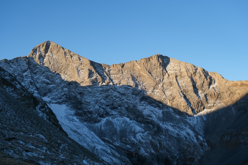
Given we'd driven up in the dark, our first view of the lower Huerfano valley took place at the same time. 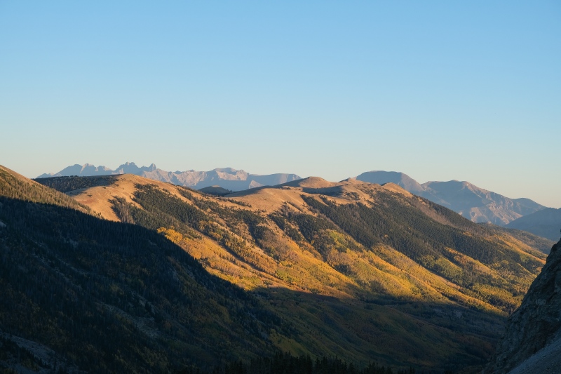
From this spot near treeline, we hung out and ate second breakfast for an hour. On shorter days like this with camp nearby it's really relaxing to just enjoy the views and the crisp autumn air and not be hustling to squeeze more peaks out of a given day. 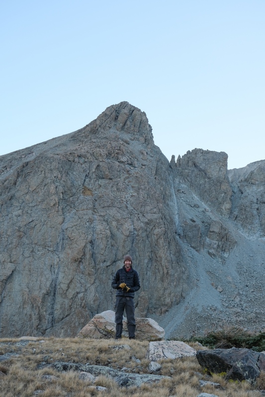

A blustery wind eventually motivated us to start moving again, so we chugged up the grassy rib towards the Lindsey/Nipple saddle. A few bighorn sheep were grazing along this stretch. 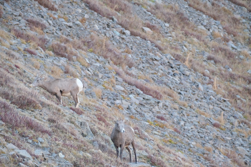
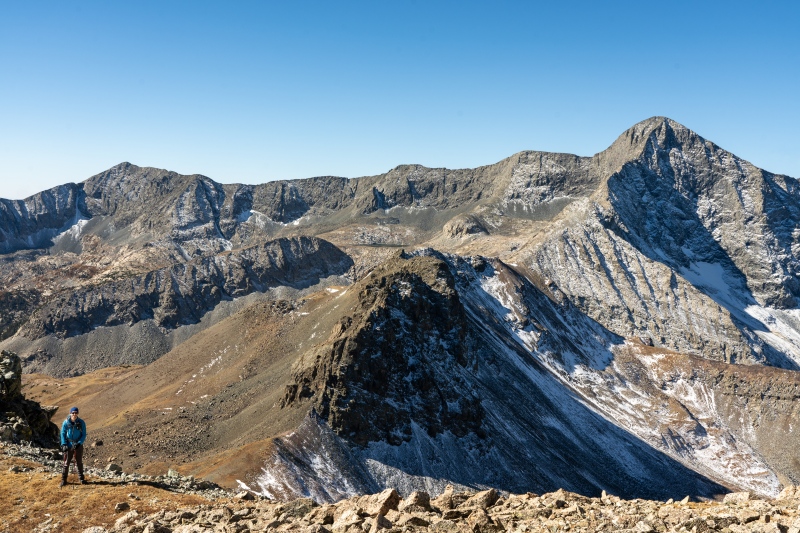
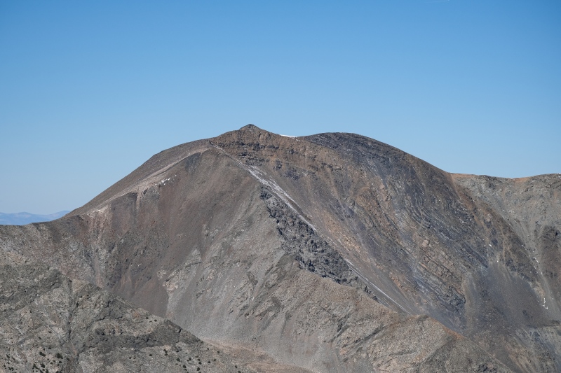
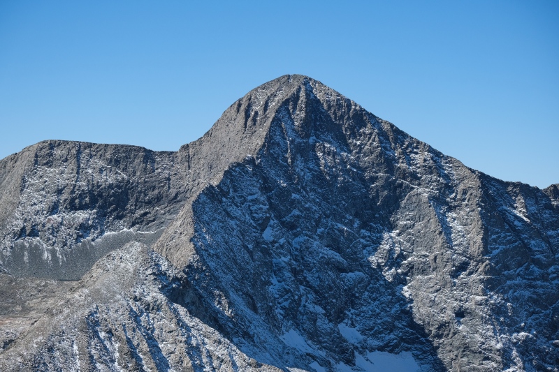
The dominant "peak" on the part of the approach is Huerfanito, which, with it's dozens of towers and buttresses, looks like a gothic castle. The angle of the sun this late in the year produced some cool splotches of light on the apron below it's north face as sunlight passed through small gaps in the towers off it's eastern side. We debating tacking on this summit on our way back but couldn't see a way to reach it without crossing to it's south side which would be on private property, and recent TRs on this site indicated the ranch staff down there have their eyes up for people doing that. We opted to skip it for now and come back with some stable spring snow and climb it from the north side. It's not like this is a part of Colorado one doesn't want to revisit. 
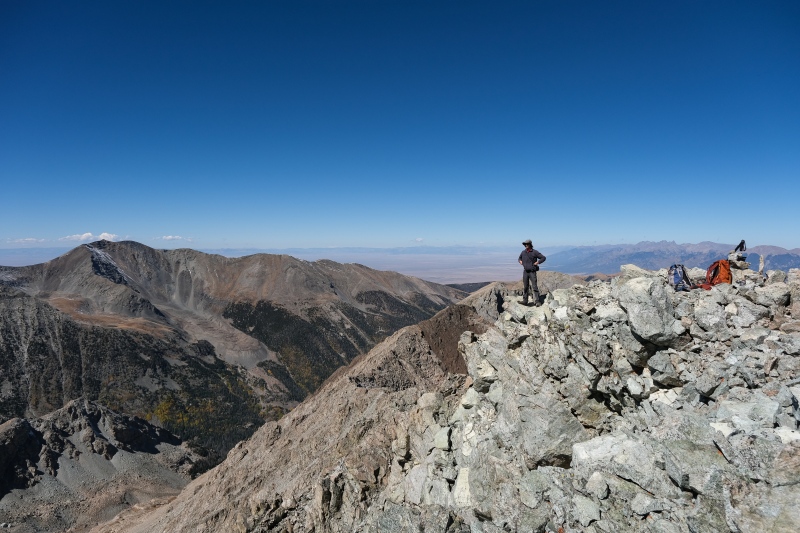
About a hundred feet below the Lindsey/Nipple saddle the views open up to the south towards the Winchell Lakes and Hamilton Peak. We got here about the time the sun rose above Lindsey and the wind dropped off completely. The warmth and views were too good to not drop our packs and have a third breakfast here as well as photograph the clouds roiling behind Hamilton and the dozen or so bighorn sheep who were running past us in ones and twos to rejoin the herd further down-valley. We ended up hanging out here nearly two hours, in part to get timelapses of the Hamilton cloud-show and because the day was so calm and quiet and there was no rush to move on. 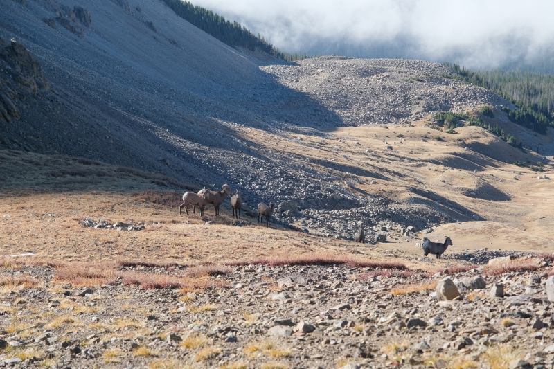

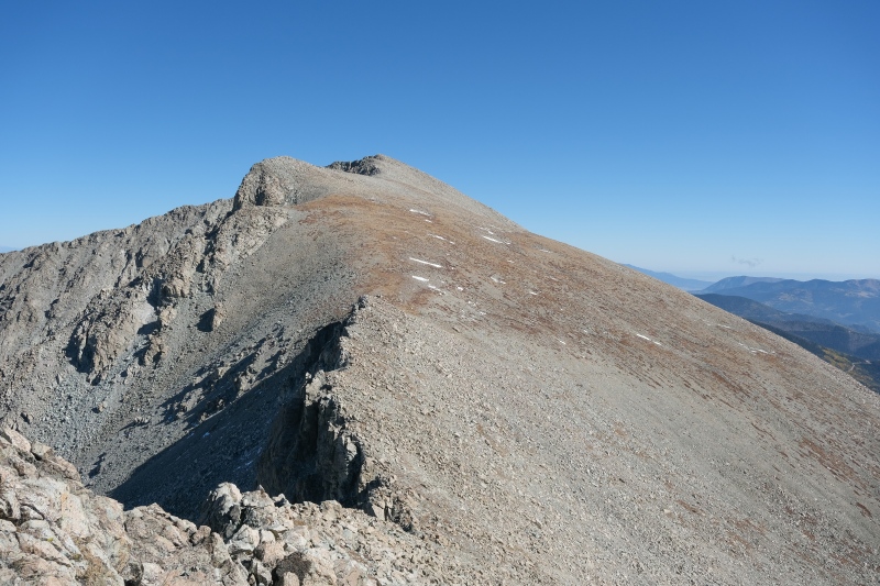
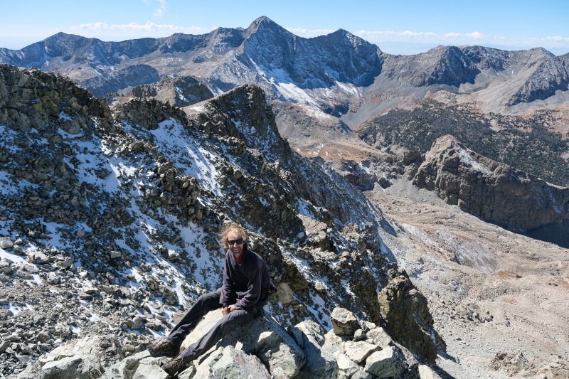
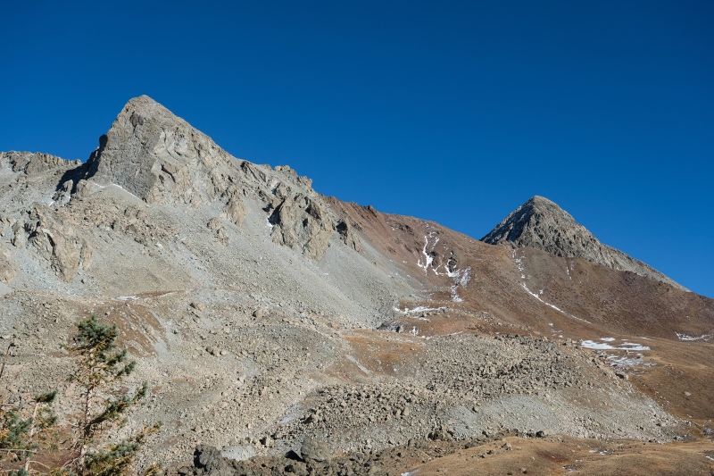
Satisfied with some quality lounging, we continued up the final hundred feet to the Lindsey saddle with the Nipple, and from there, finished the short hike up towards the summit pitch. 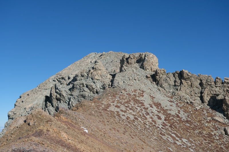

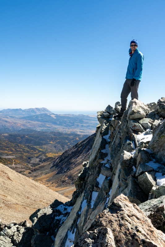
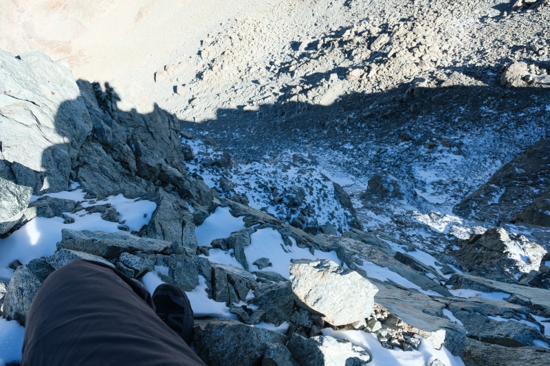
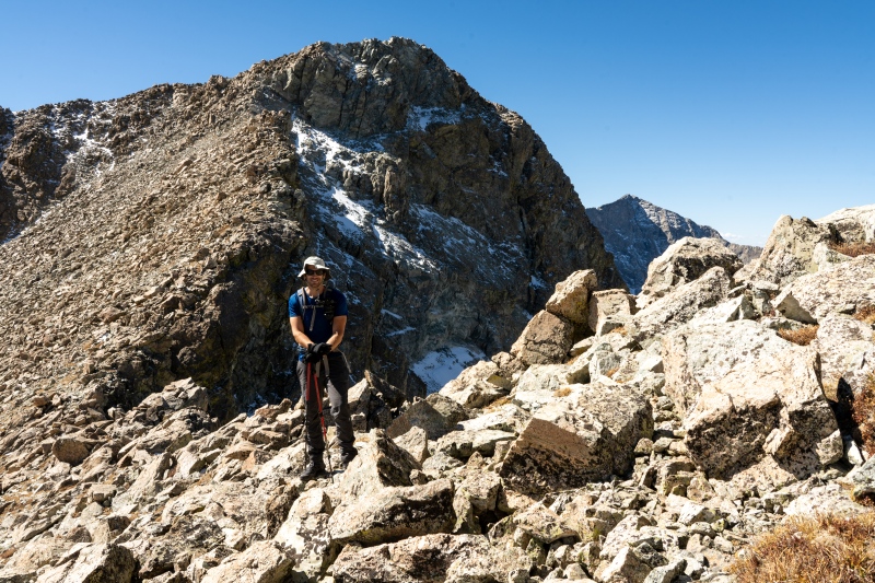
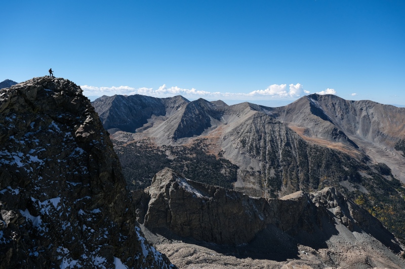
The last hundred feet or so to the summit of Iron Nipple were exactly the "fun scamper" Roach describes, and were the highlight of the day in terms of terrain. The ridge narrows before forming a mini-knife's edge with some puckering exposure off the north side, which at this time was covered in snow and ice. One can drop further to the south a bit to avoid this terrain but we opted to go directly over the knife and enjoy a little adventure on an otherwise relaxing day in the hills. For anyone concerned about it, there's video of us crossing it in the youtube link above. It might make a decent "test" for someone considering upgrading to class-3 routes to see what they're made of in a very chill place with an obvious bypass. 
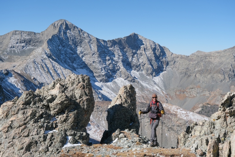


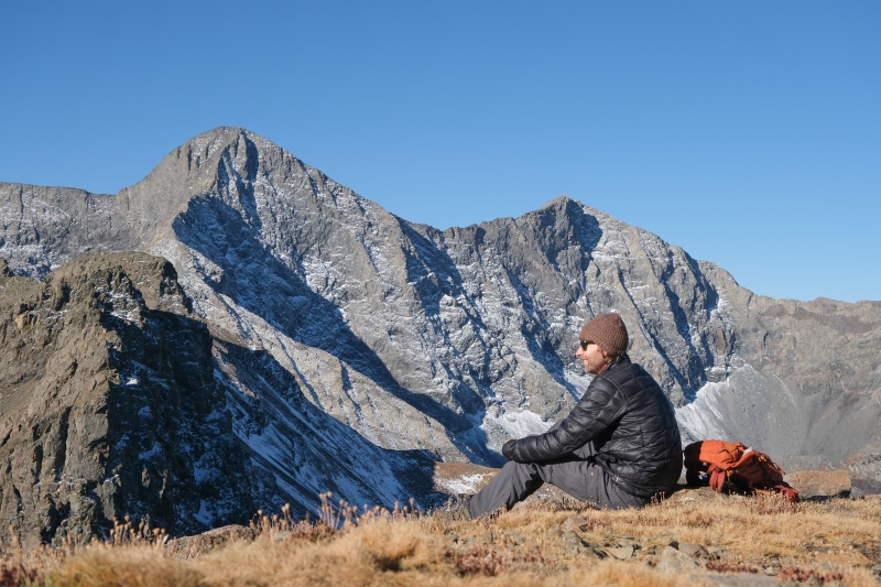
A surprisingly small summit block was crowded when the other party of three arrived. We exchanged pictures and pleasantries and they mentioned they were considering Huerfanito for the way back. We told them we'd also considered it but opted to do it another day given the ranch issues south of the little peak, and they opted to head further east to Huerfano like we'd shortly do. But first, another hour-long break enjoying a mild, windless day with great views. 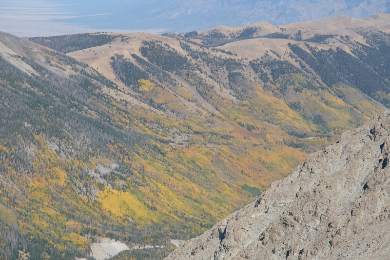
There's something about being on summits that don't have wind that just entices one to hang around longer. A previous trip a few weeks prior I'd basically just tagged Herard and Medano because the wind was so uncomfortable that hanging out up there was not an option. We lingered on the Nipple for around an hour and watched the party of three make the tedious tundra walk over to Huerfano before dropping down and heading the same way. As the sun moved further westwards we figured the light wouldn't get any better towards the Blanca group so the time to enjoy the views and pictures was the present. 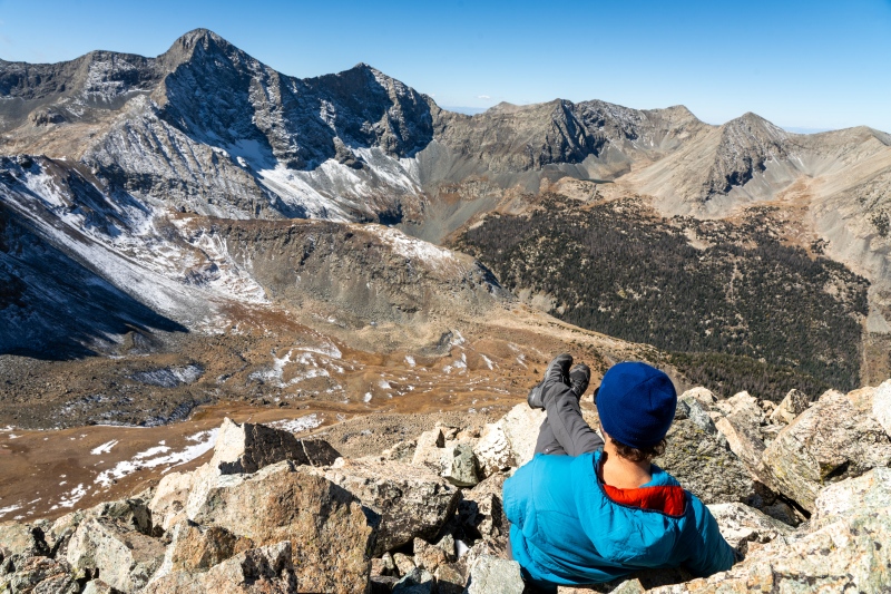

The walk over to Huerfano goes pretty fast. At this point, despite the multiple naps, fatigue from a short night of real sleep was catching up to me so I slowed down, but on as beautiful a day as this, there was no hurry. Huerfano's summit did have a graceful curving ridgeline which made for some nice panoramic pictures looking back towards the 14ers. 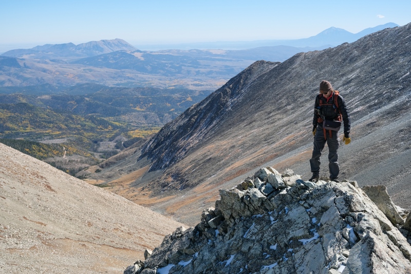
Lindsey, which from the upper Huerfano basin looks like a steep glacial horn, looks pretty neutered the further east you hike. Amazing what a slightly different vantage point can do to your respect for a mountain. 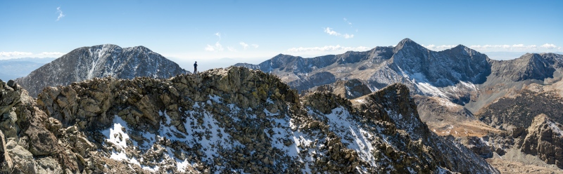
Waiting as late into the afternoon as we had to be up here, the light was pretty good looking East down into the wet valley. 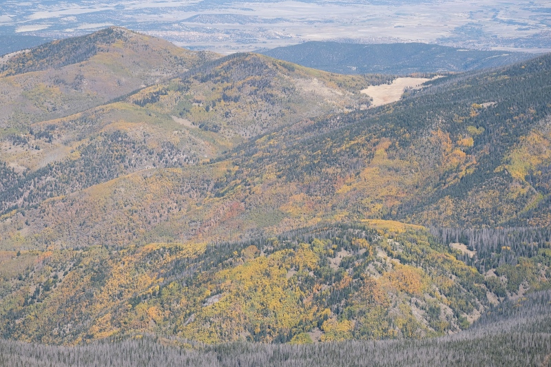


We'd been expecting to run into the trio of climbers we'd met on the Nipple at some point heading back, but our first time seeing them again they were quite a ways along the nasty looking ridge over to UN13555. I'd been tempted to add that to this trip but the pics from Jay351's TR from it after a snowstorm from a previous October made too good a case for it to be climbed separately in snow so Huerfano was our last stop for this day. Given how late in the afternoon it was and that we both wanted to take some pictures in the lower valley of the aspens, we only spent a few minutes on Huerfano before heading back down. We did make one additional stop before reaching Iron Nipple again, with Sam wandering over to a prominent false summit of Huerfano. This little spit of rock had more character than the true summit of Huerfano. 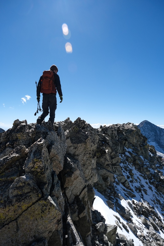
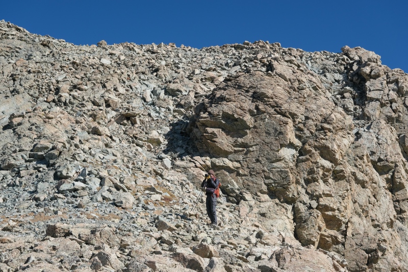
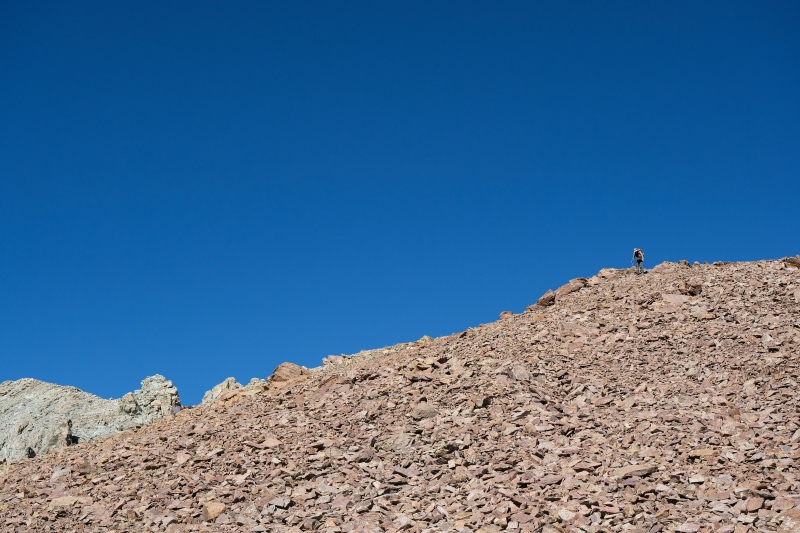
We bypassed below Iron Nipple and scampered across a tedious talus slope. 
From midway up the Nipple, we dropped back down to the Lindsey/Nip saddle and then to the upper basin. Sam is a chemistry professor and so stopped often to look at minerals. 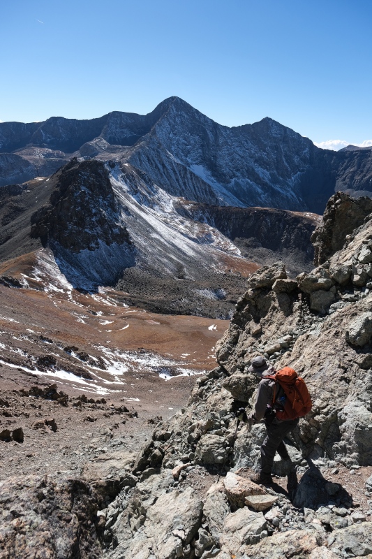


We spotted a mine opening back below treeline and crossed the creek to go investigate it. 
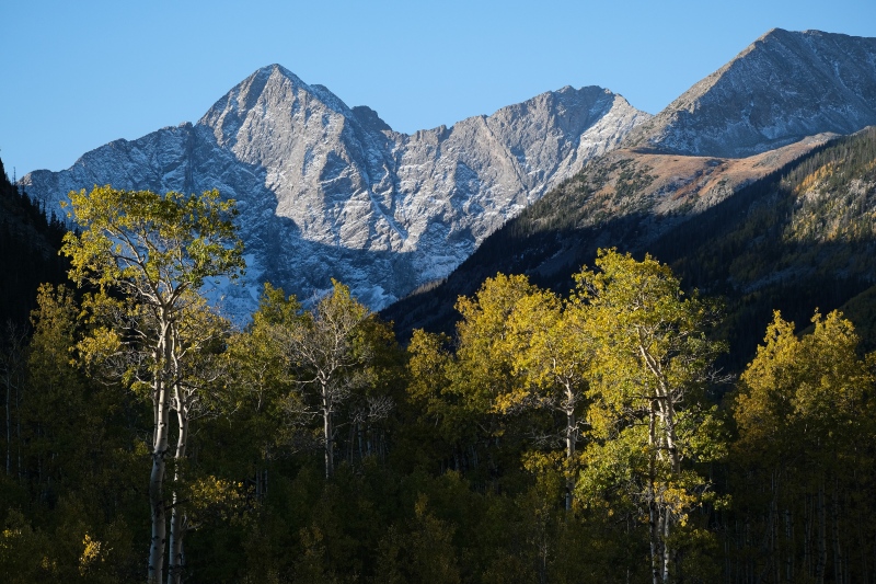
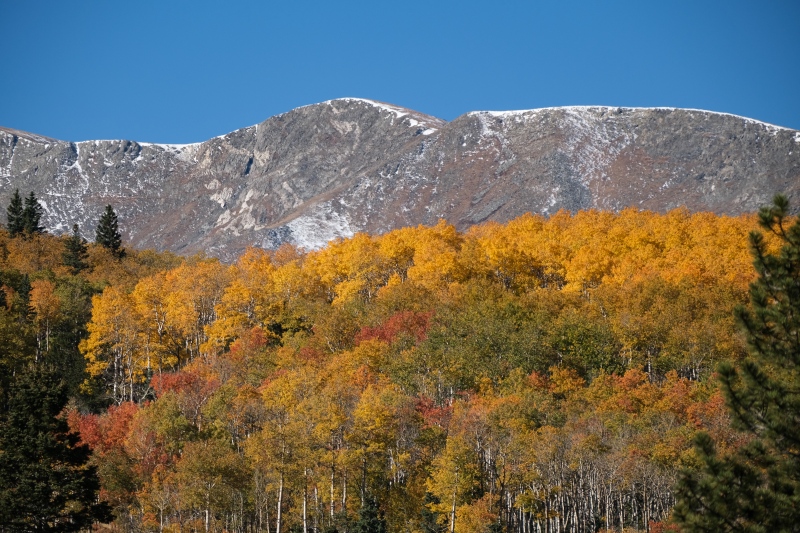
The path goes back maybe 100 feet through a few turns before abruptly dead-ending. I'm not sure how far I'd have been willing to follow it had it gone further. We ended up back at the trailhead after the sun had already passed below California peak, so the pictures of the aspen had to wait. Here's a few from the area a few days later. 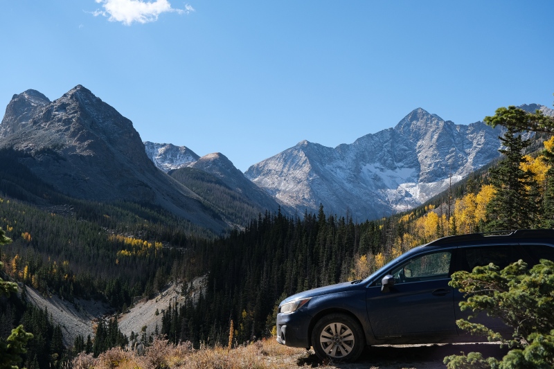
And a final telephoto shot of Blanca's Gash Ridge from Iron Nipple. 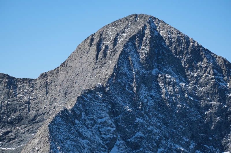
I was very content with a moderate day where we spent as many hours lounging in scenic spots as we did actually moving on our feet. For the ambitious, a linkup adding Pt. 13,555 from the north and Huerfanito to the west on the way out would make for an efficient peakbag. I've seen quite a few basins in Colorado that I'm content to not visit again, but this area isn't one of them. Late spring, when the higher-angle sun more fully illuminates a snow covered Blanca/Ellingwood wall at sunrise, seems like a good time to come back for one of those guys. Thumbnails for uploaded photos (click to open slideshow): ")
")
")
")
")
")
")
")
")
")
")
")
")
")
")
")
")
")
")
")
")
")
")
")
")
")
")
")
")
")
")
")
")
")
")
")
")
")
")
")
")
")
")
")
")
")
")
")
")
")
|
| Comments or Questions | ||||||
|---|---|---|---|---|---|---|
|
Caution: The information contained in this report may not be accurate and should not be the only resource used in preparation for your climb. Failure to have the necessary experience, physical conditioning, supplies or equipment can result in injury or death. 14ers.com and the author(s) of this report provide no warranties, either express or implied, that the information provided is accurate or reliable. By using the information provided, you agree to indemnify and hold harmless 14ers.com and the report author(s) with respect to any claims and demands against them, including any attorney fees and expenses. Please read the 14ers.com Safety and Disclaimer pages for more information.
Please respect private property: 14ers.com supports the rights of private landowners to determine how and by whom their land will be used. In Colorado, it is your responsibility to determine if land is private and to obtain the appropriate permission before entering the property.