| Report Type | Full |
| Peak(s) |
Unnamed 13577 - 13,577 feet |
| Date Posted | 12/02/2023 |
| Modified | 12/03/2023 |
| Date Climbed | 10/08/2023 |
| Author | Tim A |
| Lily Lake Peak North |
|---|
|
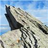
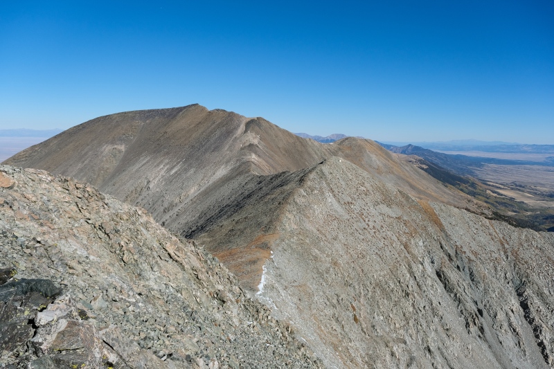
Gerry Roach describes Huerfano Basin as one of Colorado's most spectacular. After enjoying it's East side peaks on Saturday 10/7 my climbing buddy Sam and I planned to do the Lily Lake bowl traverse on Sunday 10/8 to pick up the two unnamed 13ers north of Ellingwood. This used to involve less effort before Lidar moved the summit from 13,660, a point west of 13,577, further south to 13,656. Bill has left both points on the map on this site but the more southern point that I thought Lidar declared to be the highest point of the ridge is labeled unranked while the other two are ranked. Before the climb, my soapbox. I remember names more than numbers and I assume most of humanity does the same. I've had some stunning days (including this one) on peaks that don't merit a name and then my memories of climbs on them blend together to be "that unnamed peak near Indy Pass" or "that unnamed peak near xx 14er." If Finnback Knob gets a name, these three peaks with far better views deserve real names too, and this trip report is my motion that they be named Lily Lake Peak North (13,577), LLP West (13,660) and LLP South (13,656). These peaks have some of the most stunning views in all of Colorado and deserve at the very least some unofficial names. 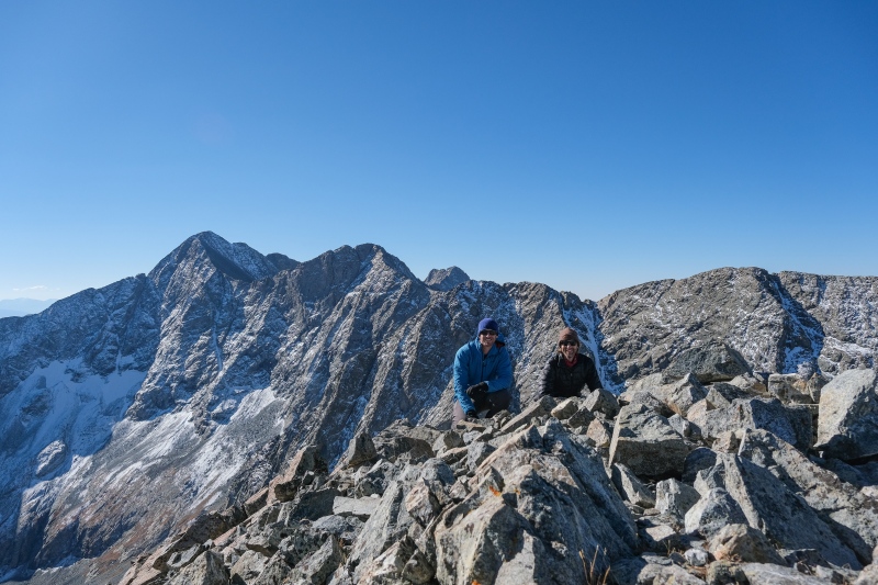
Sam and I normally are into stupid-early starts for sunrise summits but we weren't sure how obvious the talus scramble up to the bowl above Lily Lake would be in the dark, so we opted to take in sunrise from the trail up to the lake where it gets closest to the massive east wall of Blanca and Ellingwood. We miscalculated the time it would take to get there though, and started from the trailhead around 3am and moved too quickly. We reached treeline around 5am where the wind picked up a bunch and forced us to figure out our next moves. We definitely couldn't wait around for sunrise (expected around 7am) in the perfect grassy meadow just above treeline in those winds without being absolutely miserable in the cold, so the choices were to continue up to the lake and start climbing in the dark, or drop back down to treeline to get some protection from the wind. Looking at the map, it appeared the views of sunrise on the Blanca East wall would be restricted from the lake because it sits slightly inside the bowl and quite a bit further west. As much as we wanted to keep moving and make the most of our easy progress to this point, photographing that wall with alpenglow on it was really desirable, so we opted to play it safe to ensure we'd be in a good location for dawn and dropped a few hundred feet back down below treeline and found some slight wind protection where we would sit around and shiver for 90 minutes waiting for the light. 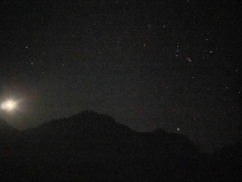

When I'm packing for a day-hike in summer, I don't pack the ten-essentials that would be necessary to be comfortable on an unplanned bivy, because the nights aren't cold enough (or long enough) to kill a person in Colorado in July (usually). I don't bring fire, and I don't bring a bivy sack. I do pack a down parka that most hikes never gets worn because it's too warm. My risk/weight-of-pack equation gets harder to balance in fall and spring, because I don't want to weigh myself down with a full winter camping kit to survive a freezing bivy if a lighter pack can let me move faster and get back to the car before there's a problem. I always wonder how bad an unplanned bivy would be with minimal gear, and I got a very small taste of that sitting around shivering in the breeze for an hour and a half below Lily Lake on this rather mild October morning. Temperatures at the trailhead were in the high 20s that morning at 3am, so I assumed we were just dealing with mid to low-20s up here. I threw on my down parka and softshell jacket over my nano-air and still found myself shivering a bit, though it never got so bad that getting up every 20 minutes to pace around couldn't warm me back up. My toes and fingertips never got numb, but it was definitely an uncomfortable and slow passage of minutes sitting around up there. Sam somehow found the warmth to take a nap for an hour wearing fewer layers than me. Around 615am the moonlit face of Blanca started to glow blue from the eastern twilight and we started taking pictures nonstop for the next 2 hours. This is memorable spot to be for sunrise and we regretted nothing about choosing to stay here for it in the cold. 


Between Sam and I, there are hundreds of pictures of the slight gradations of color change on that wall from 6-8am. I'd like to come back in spring when the sun rises further north and the face is covered in snow to photograph it again without Gash ridge casting a long shadow along the face. Around 8am we figured we maybe had enough pictures and continued up the trail towards Lily Lake. There's a fantastic campsite in the grassy meadow above treeline that would be a great spot to spend time doing astrophotography or a nightscape timelapse of the stars over the Blanca wall. We ran into a couple who camped there and despite the cold they were all smiles after watching the sunrise on the face. Their plan was just to hike up to the lake for breakfast before heading down. At this point that sounded pretty attractive to me but I kept my thoughts to myself and carried on up the trail. 

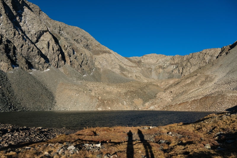
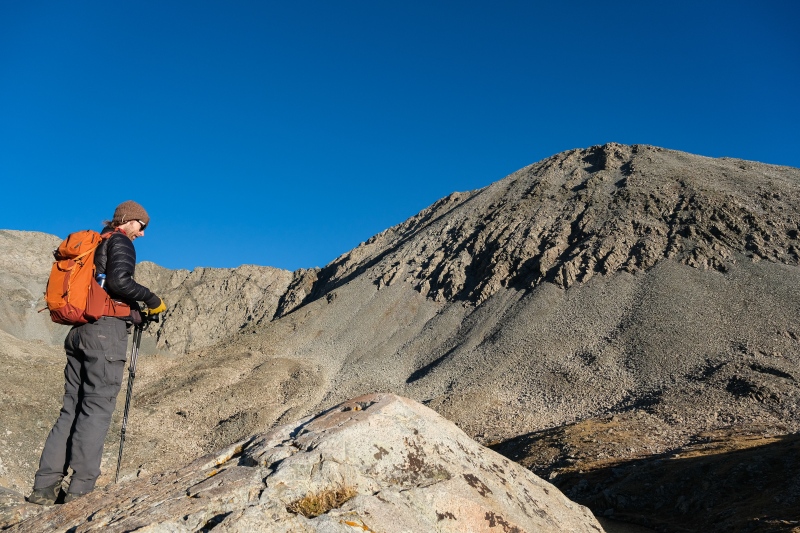
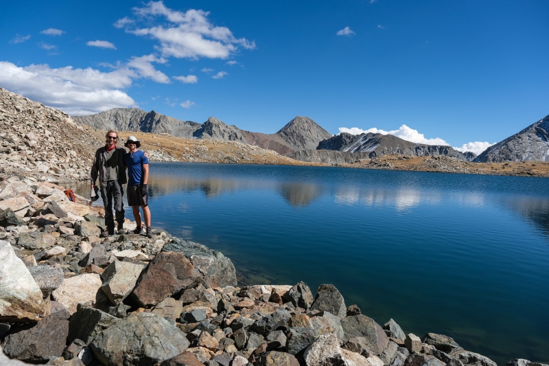
Maybe it was the previous day's hike on Huerfano/Iron Nipple or maybe it was the unplanned shiver-stop waiting for sunrise or perhaps it was the view of the heinous talus slope up to LLP North, but once at the lake, my energy levels just plummeted. The wind had blasted us pretty consistently from treeline to the lake and wasn't letting up here, and no matter how many of Dot's Pretzels I shoved down my face, I couldn't find my second wind. This is when having a climbing partner to talk you through the low times comes most in handy. Sam was feeling strong AF still (probably from his treeline nap) and his positive vibe and "let's just get a little closer to see if it looks different" attitude pushed me further up the bowl on mounds of talus to see that yes, the slope would suck, but wasn't close to the worst I've done (looking at you, San Miguels). We talked a bit about circumnavigating the entire bowl (twice, to get back down) to bag both peaks and decided that if we couldn't manage a full collection of Lily Lake Peaks, we'd be content settling just for the north peak. Wild Wanderer recently posted a report of an ascent route up the bowl from the far western end of it, but finding it from above to descend it without having climbed it first seemed like it could lead to getting cliffed out, so the safe play would be to walk all the back to the north side of the bowl after bagging all three points and that seemed like too much talus at this point for one day. 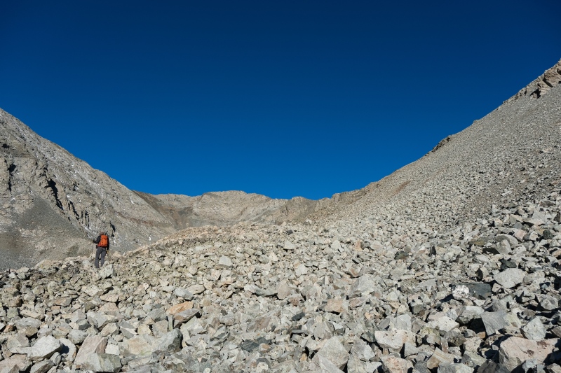

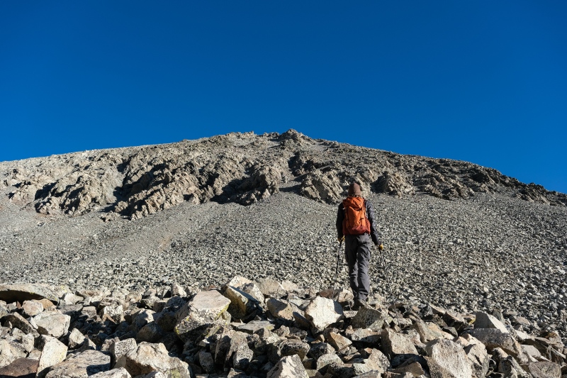
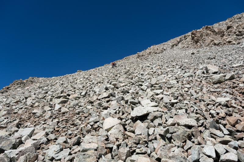
Once we actually started working up the talus, it (as so often happens) wasn't as horrible as it looked. My second wind or maybe just the increasingly good views brought renewed energy to my tired legs and we made steady progress up the slope. 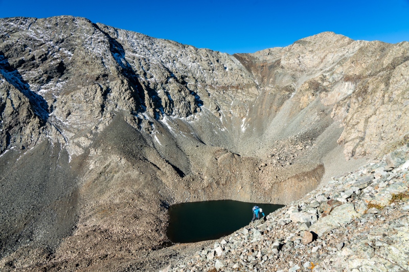

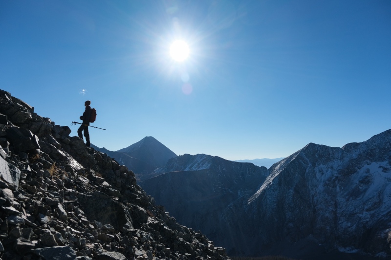
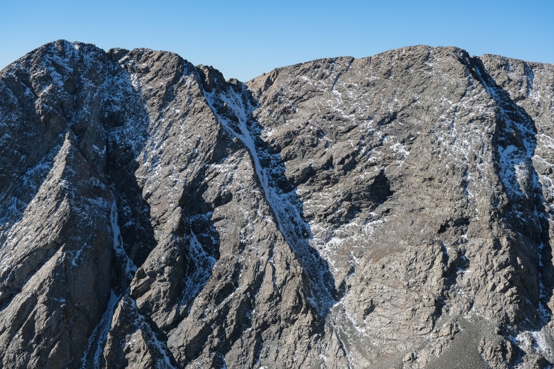
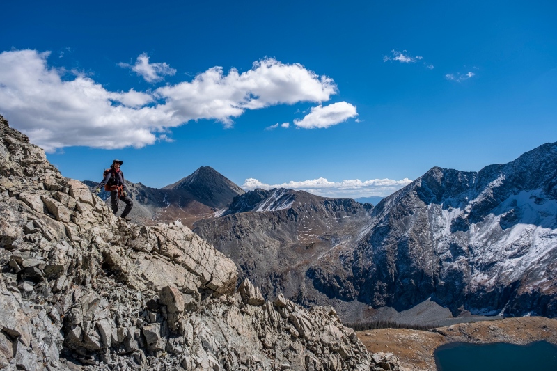
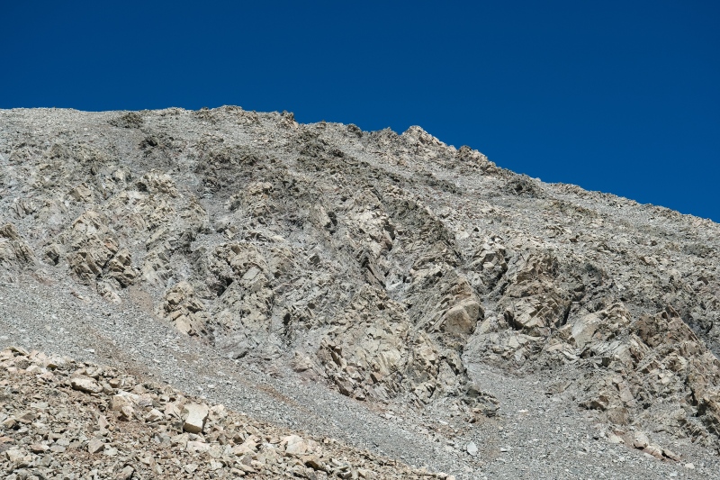
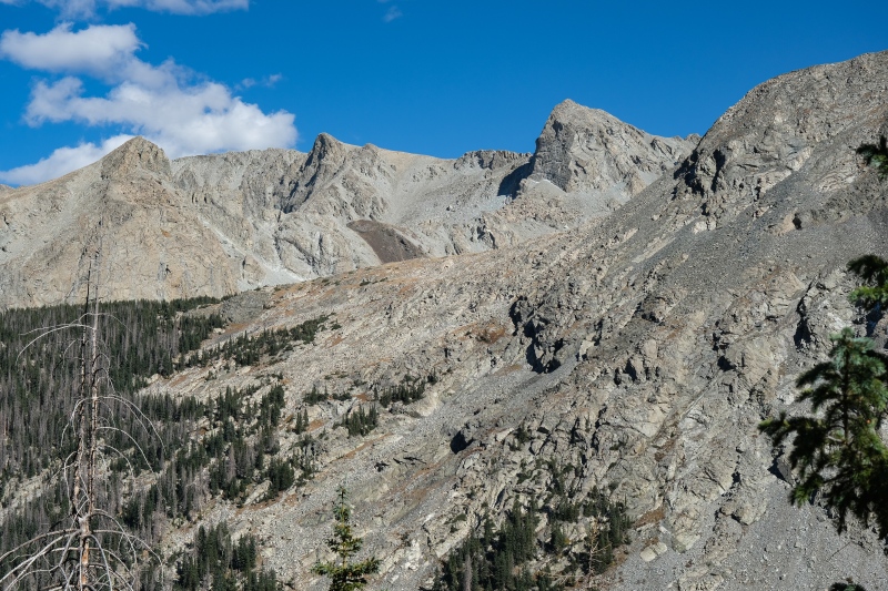
Sam has climbed California Peak from Zapata and was stunned that this slope up and over LLP North is considered the standard route to bag it. I was dreading the descent down this slope but to this point hadn't started any rockslides or lost my footing even once, so again, it wasn't as terrible as it appeared. If you'd done a few talus slopes off-trail you kind of develop a sight for picking short lines through this kind of slope that are more stable than the surrounding terrain, and so we zig-zagged up the mound and sweated out over a thousand feet of gain to land on the ridge just short of the summit of LLP North. 


The views from this spot of the Como group are preposterous. The east side of that group is all big walls. 
The summit of LLP North featured no wind at all, and we were tired enough that we contented ourself with another type-1 day of mostly lounging around and enjoying the warmth of a mid-October day as opposed to bagging the other points. 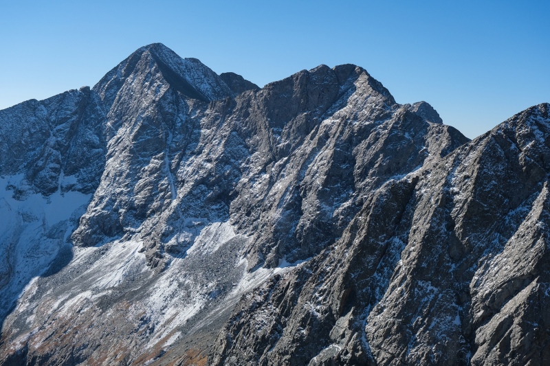


We lingered up there a few hours enjoying the views and the changing lightscape. After maybe 2 hours we spotted a lone climber coming up the slope to LLP North and she was hauling ass and absolutely crushing it. We talked to her briefly on the summit. She was up there (again) to get the new Lidar-summit of LLP South. She claimed she was moving slow and feeling terrible because she's had too much to drink at OktoberFest the previous evening. Always humbling to encounter the uber-fit in the mountains who seem to be indefatigable even on their self-professed worst days. I'd get a few pictures of her cruising both directions around the bowl later in the afternoon. Sam and I wanted to leave time (and daylight) to take pictures of the aspens around the trailhead and lower in the valley, so we headed down around lunchtime. The sun, now in the western-half of the sky, was properly illuminating the Lindsey/Huerfano/Nipple group and they make for a stunning backdrop to this area. 

Despite our best efforts, we couldn't stay on the exact line of our ascent headed down, but this worked out as we wandered through some fun scramble-sections that featured more stable rock and cool photo opportunities. My dread of most of the morning evaporated as I found myself sincerely enjoying the downclimb on this talus slope amongst the ribs of class 2+ and 3. 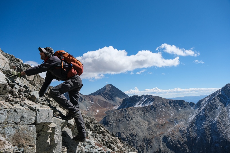


Once back at the lake, it was too warm and too photogenic to not lounge around at least briefly before heading down to photograph the aspens. 
The hike back down the trail in the warm afternoon went as quick as it can when two hobbyist photographers want to stop every 20 feet to take pictures of the slightly different angles and light. 


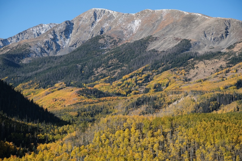
We made it back to the trailhead to find it surprisingly crowded with leaf-peepers. I would end up staying an extra day into Monday to take pictures of the aspens and across the entire span of Monday, I didn't see more than 2 people driving either up or down the road to Lily Lake. The views of aspens out here are arguably as good as those I'd seen driving the much more crowded Last Dollar Road a few falls ago, and it was a pleasure to be able to enjoy them in the quiet. I hesitate to recommend this area for fall foliage as I like it being as quiet as it is, but I doubt this TR on a climbing website will lead to it becoming more overrun than Maroon Lake or Last Dollar Road. 


Spending a day on the east side of the Huerfano Valley bagging as many of the four 13ers over there (Huerfano, Iron Nipple, Huerfanito, Huerfana) as you want, and then spending the following day on the west side bagging the Lily Lake group makes for what Roach would no doubt describe as a very pleasant Tour de Huerfano River Valley. I'll be back here for Lindsey if it opens back up in my lifetime and for the other LLP 13ers. The south peak (the new Lidar one) in particular looks like it probably has the best views of the Como group from the east side. Thumbnails for uploaded photos (click to open slideshow): ")
")
")
")
")
")
")
")
")
")
")
")
")
")
")
")
")
")
")
")
")
")
")
")
")
")
")
")
")
")
")
")
")
")
")
")
")
")
")
")
")
")
")
")
")
")
")
")
")
")
|
| Comments or Questions | |||||||||||||||
|---|---|---|---|---|---|---|---|---|---|---|---|---|---|---|---|
|
Caution: The information contained in this report may not be accurate and should not be the only resource used in preparation for your climb. Failure to have the necessary experience, physical conditioning, supplies or equipment can result in injury or death. 14ers.com and the author(s) of this report provide no warranties, either express or implied, that the information provided is accurate or reliable. By using the information provided, you agree to indemnify and hold harmless 14ers.com and the report author(s) with respect to any claims and demands against them, including any attorney fees and expenses. Please read the 14ers.com Safety and Disclaimer pages for more information.
Please respect private property: 14ers.com supports the rights of private landowners to determine how and by whom their land will be used. In Colorado, it is your responsibility to determine if land is private and to obtain the appropriate permission before entering the property.