| Report Type | Full |
| Peak(s) |
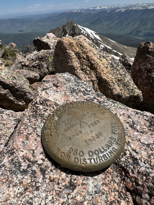
Keller Mountain - 13,080 feet "East Thorn" - 13,340 feet "Mt. Silverthorne" - 13,361 feet |
| Date Posted | 06/17/2024 |
| Date Climbed | 06/15/2024 |
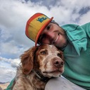
| Author | Camden7 |
| Keller & Thorn |
|---|
|
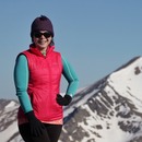
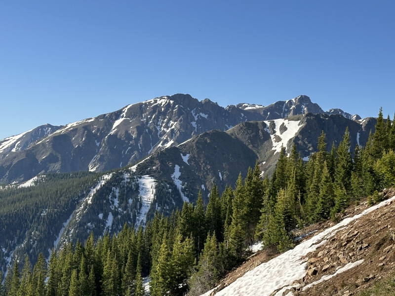
With a chance to get out for the weekend and knowledge of the dwindling snowpack, I wanted to get into the Gore for a little more snow climbing. Ever since having to abandon Keller and Silverthorn when I did the Grand Traverse to Valhalla & Snow (during school last fall, just exhausted and couldn't rally for a 9k vertical day) I had wanted to go back for these two peaks. As it was Fathers Day weekend, my climbing partner was an easy choice. Dad and I set our sights on the north couloir of East Thorn for Sunday, and with the less favorable forecast on Saturday we figured we would do something short and easy. We debated skiing Homestake but worried that too much snow had melted and we would have to carry skies for most of the day, so we ended up settling on Keller. Keller was my 178th CO 13er, and Silverthorne my 179th. Saturday, June 15: Keller Mountain - East Ridge
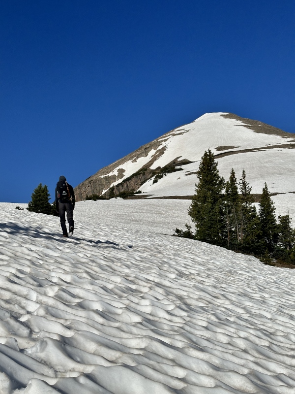
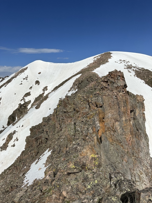
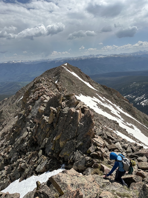
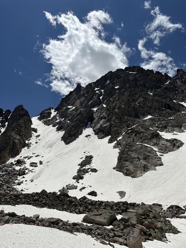
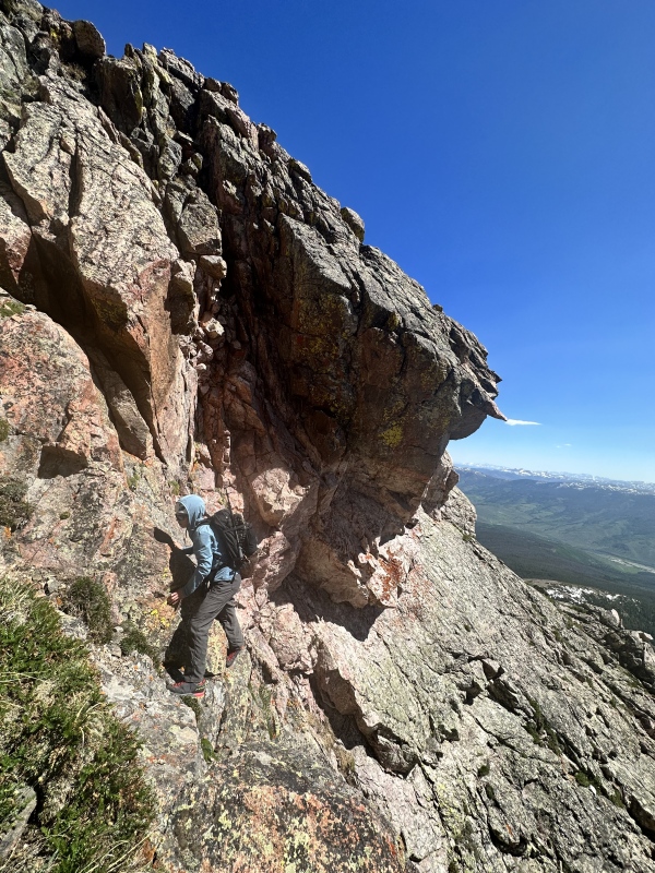
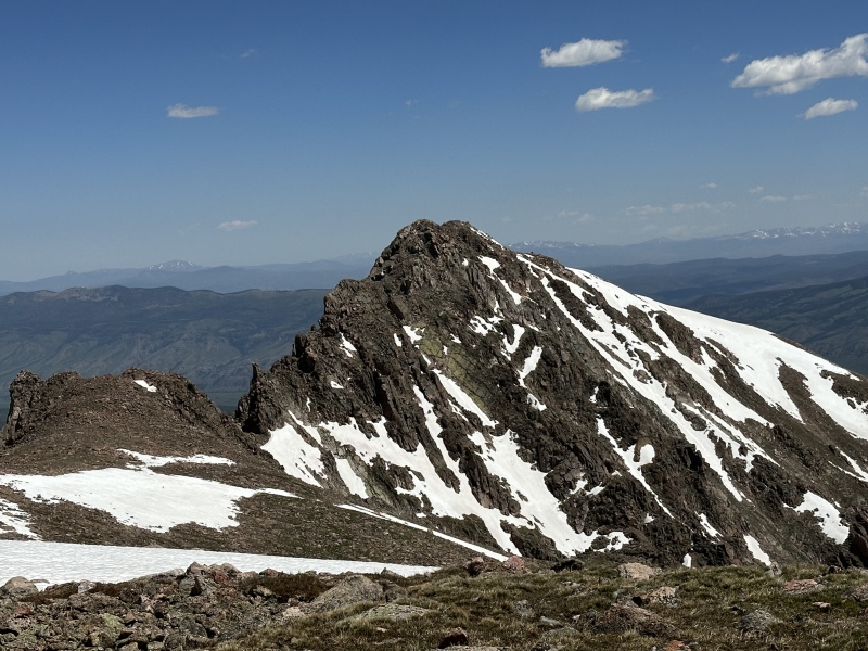
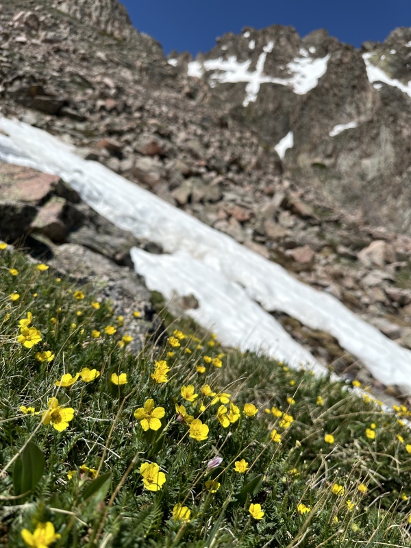
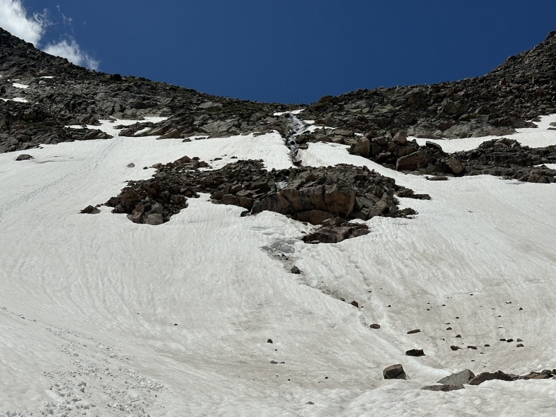
Wanting something short and easy with the forecast for pm thunderstorms, we decided to enjoy a very relaxing day on Keller. The route is supposedly class 3+ and a challenging scramble, but I felt that this was really inflated. I would say that Keller is the easiest 13er in the Gores (excluding Jacque, which isn't really part of the Gores), simply because the TH is high, the access on a good trail, and the scrambling very easy. I would judge the east ridge to be one of the best beginner scrambles close to Denver. It is very straightforward, and provides a lot of fun scampering on reasonably stable rock, without serious route-finding challenges, exposure, or difficult climbing. In this regard, it is quite different from many other Gore ridges, but otherwise it is very similar: some loose rubble, harder climbing with better rock on the crest, easier but looser climbing to the sides, and huge views the entire time. The view from Keller's summit is one of the best I have seen in the Gore. I highly recommend this route. On a prime Saturday we saw no one except for the few people walking their adorable dogs and slightly-less-adorable fussing children within a quarter mile of the trailhead We rolled in to North Rock Creek TH Friday night and were surprised to see at least 100 people camped in there, seemed like an event or something? We nabbed a small spot close to the TH and got our packs ready for the following morning. Knowing Keller would be a short one, we slept in (relatively speaking) and started walking at 6:00. The Rock Creek Trail has not seen any maintenance yet this year but there were only 5 or 6 downed logs across the trail in the quick 2 miles to the Boss Mine. After setting a casual pace, we stopped shortly before the mine after 40 minutes, and abandoned the trail for an old mining/logging road that switchbacked up the face towards the lower east ridge of Keller. As far as off-trail travel in the Gores goes, this is remarkably easy and fast. After climbing 700 ft up the slope past a number of crumbling log cabins, old cans, and other mining waste, we reached the gentle ridge about 20 minutes after leaving the trail. The mosquitoes had been present from the TH up to here, but then they got BAD. I think they had just hatched as the snow line was climbing and they are ravenous. Absolutely limit your time between 10,000 and 11,500 ft right now, they are vicious! (Don't even think about camping at those elevations until late July). An old road/trail leads up the gradual ridge and makes the going a bit easier, but there is a bit of deadfall and we soon started having to dodge patches of snow. At 11,200 the snow got a lot deeper so we switched over to boots (from approach shoes) and began the rather arduous post-hole up to treeline. The small bowl on the east ridge of Keller from 11,800 to 12,600 was still snow-filled, and poorly consolidated. It took about an hour and 20 mins to get from where we reached the treed ridge at 10,700 to where the broad ridge narrows into an actual crest at 12,600, including a long stop to change footwear, and a fair bit of slow post-holing. In dry conditions I imagine it would take 45-60 minutes at most. The ridge from there to the summit undulates quite a bit but it is best to stay directly on the ridge crest. We elected to switch back to approach shoes for all the rock-hopping, and found a mostly dry route all the way to the summit. The ridge has a couple notable features. getting up and down Point 12,860 is easy class 1+ boulders. As you begin ascending the triangular Point 12,940, the ridge narrows and offers easy class 2 travel about 15 ft below on the south side, or some gratuitous class2+/3 directly on the crest. My favorite portion of the ridge was descending from Point 12,940, where one could keep it at class 2, but the crest was once again very enjoyable class 3-. The supposed crux of the ridge is near the saddle between 12,940 and Keller's final false summit. A few towers and notches appear problematic. On the way up Keller I chose to stay religiously on the ridge crest the entire way. Two downlcimbs, and one in particular, were class 4, but the exposure was always manageable and most of the terrain was class 3. On the way back I stayed shortly below the ridge crest below the crux towers and was able to keep it to class 2+ on very stable blocks. Definitely not a class 3+ ridge unless you want it to be. Some people have mentioned that the old road on the ridge near 10,800 leads all the way down to the Gore Range Trail, and may be a better alternative to going via the Boss Mine. This might have been the case in the past, but this winter's strong winds caused some large scale blowdown events that have effectively closed this old road as a viable option. Going via the Boss Mine is now at least 15 minutes faster each way, and a whole lot easier, up or down. I got tired of counting somewhere around 200 logs across the old road. Seriously, I don't recommend it. 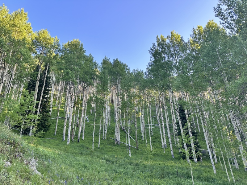


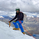
Sunday, June 16: East Thorn - North Couloir/East Ridge
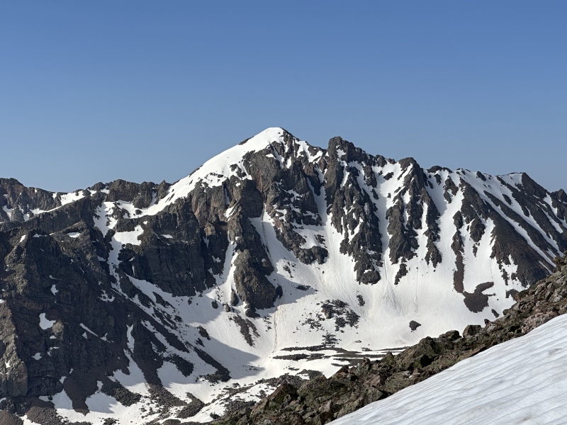
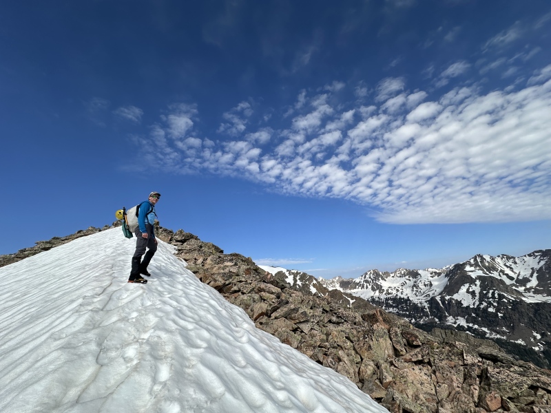
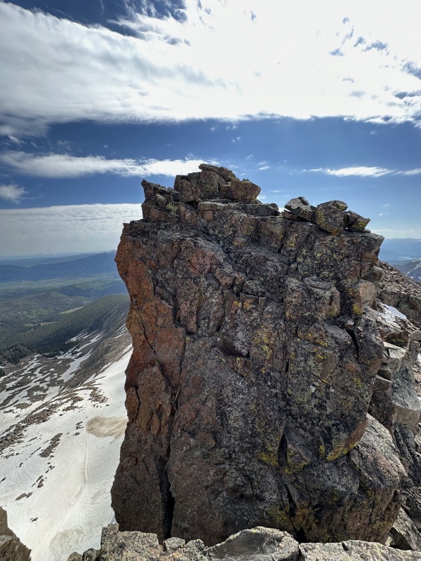
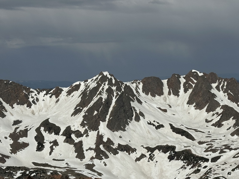
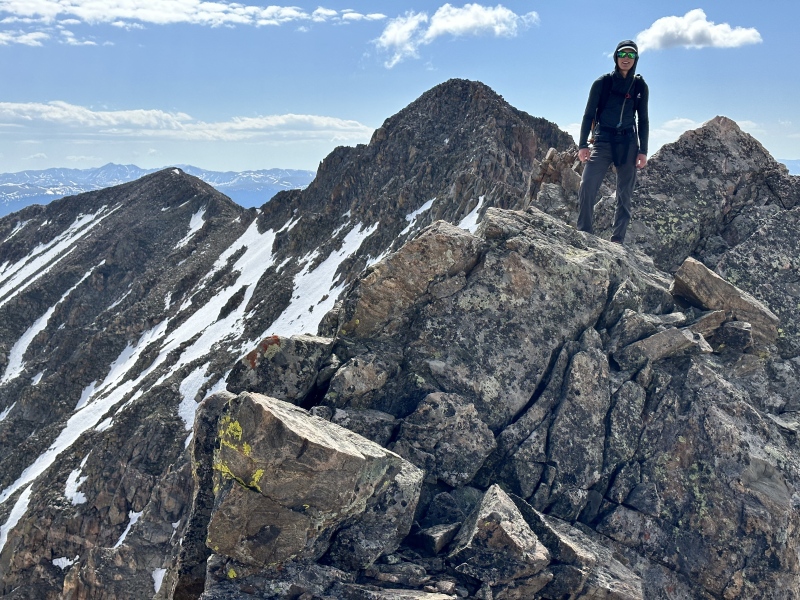
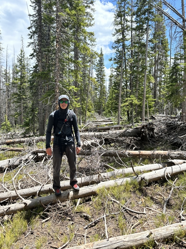
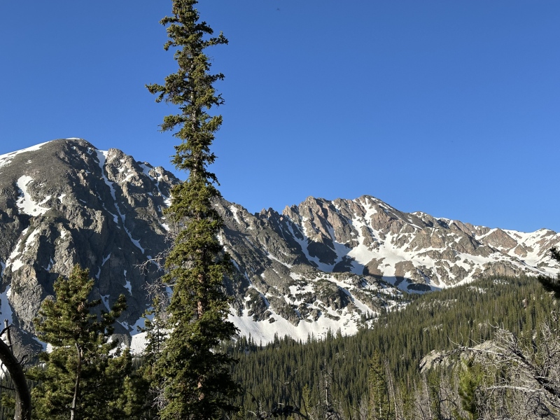
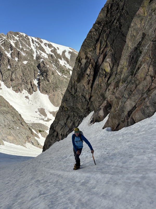
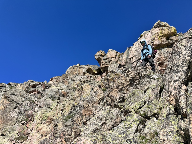
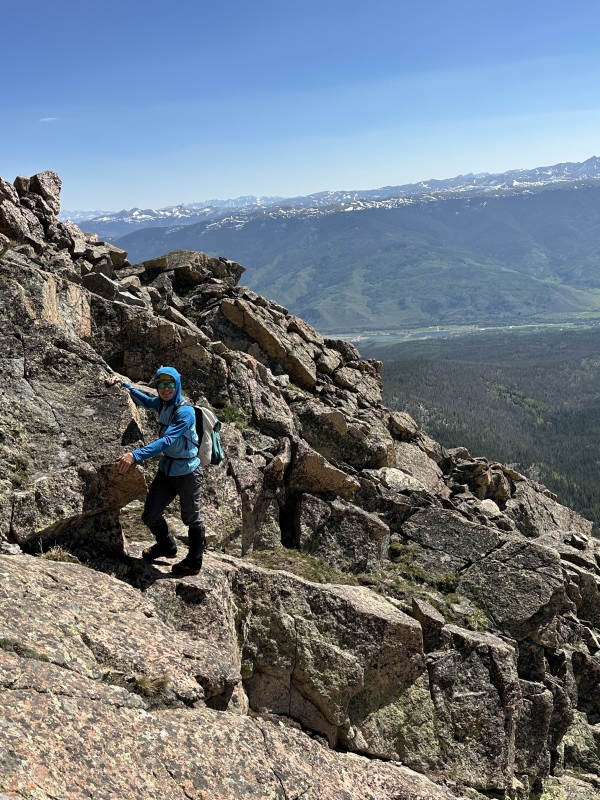
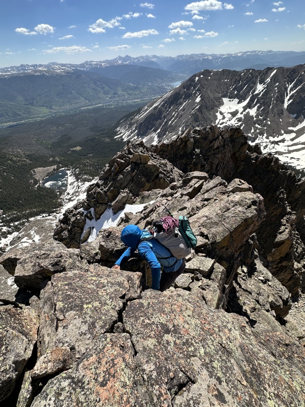
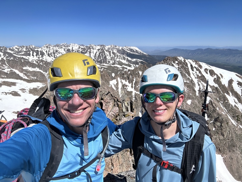
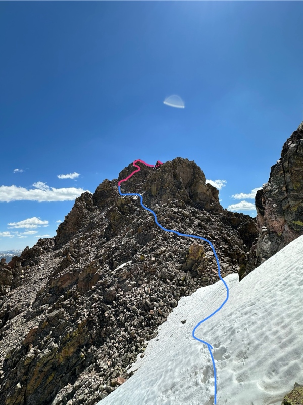
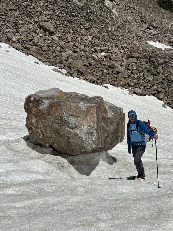
Because overnight parking is forbidden (and supposedly actually enforced) at the Willowbrook TH, located amongst the growing exurbs of Summit, we had to camp elsewhere than drive in in the morning. We started walking at 5:04 am, just as civil twilight dawned on a long summer day. From the TH, we took an immediate right onto the Ditches Trail (vandalized to say "Bitches Trail") and followed it 0.55 miles northwest to a junction at 9,270 where we turned left onto the North Willow Creek Trail. It is amazing the sheer amount of work Summit County has put into cleaning up the beetle-killed and subsequently blown down lodgepole pines. The woodpiles are unsightly but the forest floor is cleaned in a way that seems far more suitable to wildlife and young trees making a recovery. After 0.75 miles on the North Willow Creek Trail, we entered the wilderness and reached the Gore Range Trail at 9,590. Here, this spring's maintenance ends. The deadfall doesn't. The next 1.5 miles on the Gore Trail was a slow and arduous journey through downed logs. Dad was starting to come down with a cold, and we both felt unusually slow. The rope, light rack, harnesses, and other technical gear in our packs made things even slower. Amazingly, while we were up high, some Good Samaritan had cut 10 or 15 of the smaller logs and a few of the more bothersome branches, and on the exit I counted a much more manageable 81 downed trees across this section of trail. From the junction at 10,300, we turned southwest onto the Willow Lakes Trail. This trail was steeper and had much less deadfall, but the mosquitoes were more problematic at this elevation. 1.7 miles later we reached the Salmon Lake Trail turnoff. We crossed paths with a friendly party that must have started very early; they had backed off of What Big Eyes You Have after deciding they needed more rock pro. I hadn't laid eyes on it before and it sure is a beautiful couloir to look at. It was mostly continuous and didn't look too steep, so I was honestly surprised it was roped terrain, but it is so hard to tell from far away. Some of the steep lines on Red were falling out of condition, but wow did they look fun! As soon as we started climbing towards Salmon Lake we began encountering deep snowdrifts across the trail and lots of running snowmelt. At 11,320 the lake came into view and the trail dropped down to it. The forest floor became fully snow-covered. 4.9 miles in we left the trail and climbed southwest through the forest until meeting the creek at 11,430. Here, we reached freeze line and enjoyed very supportive snow in the basin as we worked our way up to 11,800 ft below the ramparts of East Thorn. At a casual 38-45°, the North Couloir is a very easy snow climb and one of the gentlest snow routes in the Gores. It is deeply inset and stays firm late into the day, BUT is very exposed to dangerous rockfall, so it is wise to be out of it by mid morning. Once reaching the ridges we put away our tools (one each) and crampons and began the scramble up East Thorn's east ridge. The ridge is convoluted and rather poorly defined, with easier class 2+ terrain to the south side, and class 3 closer to the ridge. Because of snow lingering in the weaknesses, we had some unavoidable 3rd class and snow crossings, but otherwise this section of the ridge would be very easy. At a large tower, the ridge changes direction slightly and a few 3rd class moves become less optional. Here we could see that the remainder of the route was dry, so we switched back to approach shoes and scampered up to the summit. Seeking better rock, I found myself on a good amount of 3rd and maybe a little 4th, but class 2+ options with short 3rd class moves seemed available at the cost of rock quality. The exposure is minimal and the route-finding on this route is fairly easy, but in the spirit of the eastern Gore, I won't dissect it. It would be hard to get off-route. Near the summit is the crux, where the moderate terrain deposits you on a tower immediately below the summit. The best scrambling of the day is from here to the summit. This is what we brought the rope for, where reports ranged from 4th to low 5th with "serious exposure" and we feared that any lingering snow could shut us down if we didn't have a rope. There was no lingering snow... all that extra weight for nothing. The final section includes some narrow (but somehow not very exposed) sections of ridgeline, up to 3rd class, and one block that looks easily avoidable at first but proves to be steep-sided. The easiest line is the 4th class ledges on the right, but there is a lot of loose rubble. An awkward squeeze-chimney on the left is the safest option, but annoying with a pack and not all that fun. We chose to tackle the tower directly via a clean chimney/crack system with very solid rock. About 12 ft high and minimally exposed, with very solid holds, but steep. I would say low 5th for sure. This obstacle deposits you within a few steps of the summit; "Well equipped for lounging." We couldn't find a register, but we relaxed for a while. What a great summit! The descent of East Thorn's west side starts with very fun class 3 and quickly relents to class 2 talus. It is much easier than advertised, and the only move anywhere near to 4th class was to bypass some lingering snow. The South side of the ridge is reportedly easier, but it was windy so we stayed on the north side and it never exceeded class 3 with very solid rock. I know some parties have repelled here, and short of Andean rime-coating caused by 100% humidity, extreme cold, and 50 mph wind, I don't see any scenario in which it is safer to rap than downclimb; too much stuff to knock down with a rope. The half mile slog to Silverthorne was still pretty snowy, and was plastered with goat tracks and scat, but none of the beasts. Tons of ptarmigan and pikas though. Once again, no summit register. The wind really picked up so we dropped down a bit to have a snack before continuing down. Mt. Silverthorne is so lame compared to its eastern summit; someone ought to lop of the top 22 ft of it so East Thorn becomes the ranked summit. The standard route was a miserable descent with deep and fast-melting snow adorning the ledges of the eastern bowl, and a number of runoff waterfalls consuming the easiest lines. After finding myself cliffed out and way too lazy to climb back up and around, I down climbed a few low 5th class steps, probably the toughest climbing of the day. I suppose a little 5th class is to be expected of any class 2 descent route in the Gores. A rock the size of a sprinter van had managed to come tumbling onto the snow at the base of the face at some point in the past week or so, leaving a 6 ft deep gouge through the snowy hillside and a crater where it first struck the snow. That would have been fun to watch. The remainder of the descent to the lake went smoothly, and soon we only had 5 miles and a 94 logs between us and the trailhead. Dad was now feeling quite sick (Happy Fathers Day!), the mosquitoes were relentless, and the temperature in the upper 70s (miserably and unseasonably hot for the subalpine), but we eventually made it out just in time to pick up Mom from a weekend of mountain-biking in Breck, and a enjoy the result of some high IQ I-70 driver deciding their text message was more important than their safety; a 3 hr drive home from Silverthorne. Dad slept while I drove. I promise I didn't flip off any of the drivers using the exit and on ramps to try and get home 9 seconds faster and delaying everything further by causing an extra merge. Well ok, maybe just one. 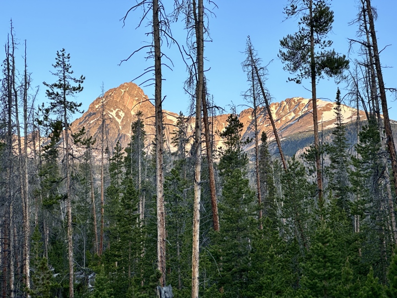


Thumbnails for uploaded photos (click to open slideshow): ")
")
")
")
")
")
")
")
")
")
")
")
")
")
")
")
")
")
")
")
")
")
")
")
")
")
")
")
")
")
")
")
")
")
")
")
")
")
")
")
")
")
")
")
")
")
")
")
")
")
|
| Comments or Questions | ||||||||||||
|---|---|---|---|---|---|---|---|---|---|---|---|---|
|
Caution: The information contained in this report may not be accurate and should not be the only resource used in preparation for your climb. Failure to have the necessary experience, physical conditioning, supplies or equipment can result in injury or death. 14ers.com and the author(s) of this report provide no warranties, either express or implied, that the information provided is accurate or reliable. By using the information provided, you agree to indemnify and hold harmless 14ers.com and the report author(s) with respect to any claims and demands against them, including any attorney fees and expenses. Please read the 14ers.com Safety and Disclaimer pages for more information.
Please respect private property: 14ers.com supports the rights of private landowners to determine how and by whom their land will be used. In Colorado, it is your responsibility to determine if land is private and to obtain the appropriate permission before entering the property.