| Report Type | Full |
| Peak(s) |
Horseshoe Mountain - 13,918 feet Peerless Mountain - 13,356 feet |
| Date Posted | 06/17/2024 |
| Modified | 06/19/2024 |
| Date Climbed | 06/13/2024 |
| Author | dlew8470 |
| Flatlander vs. Two Mosquitoes |
|---|
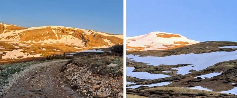
ROUTE: Horseshoe Mountain – East Slopes / Peerless Mountain – South Slopes Stats (Both Peaks): Round-trip distance: 8.4 Miles Total Elevation Gain: 2475 ft. Date Hiked: 06/13/2024 TRAILHEAD The 2WD trailhead for the Horseshoe/Peerless route is at the intersection of Fourmile Creek Road (CR-18) and FR-603 (Silver Horseshoe Drive) at 11,600 ft., about 10.7 miles from U.S. 285 and 0.7 miles above the Leavick Mill site. Fourmile Creek Road is usually passable for most vehicles. My rental car had a ground clearance of 4.9 inches, and I was able to make it above the Leavick site with slow and careful driving. The 4WD trailhead is 0.5 miles up FR-603 at a small parking area on a corner. ROUTE DETAILS: The routes for Horseshoe and Peerless are identical from the trailhead to the saddle. The standard route follows FR-603 from Fourmile Creek Road to the Horseshoe/Peerless saddle (13,200 ft.), 0.2 miles south of Peerless Mountain and 0.8 miles north of Horseshoe Mountain. To ascend Horseshoe from the saddle, turn left (south), find the trail and follow it to the long flat summit ridge. For Peerless Mountain, head right (north) locate the path up and follow to the summit. Return to the saddle and go back the way you came. 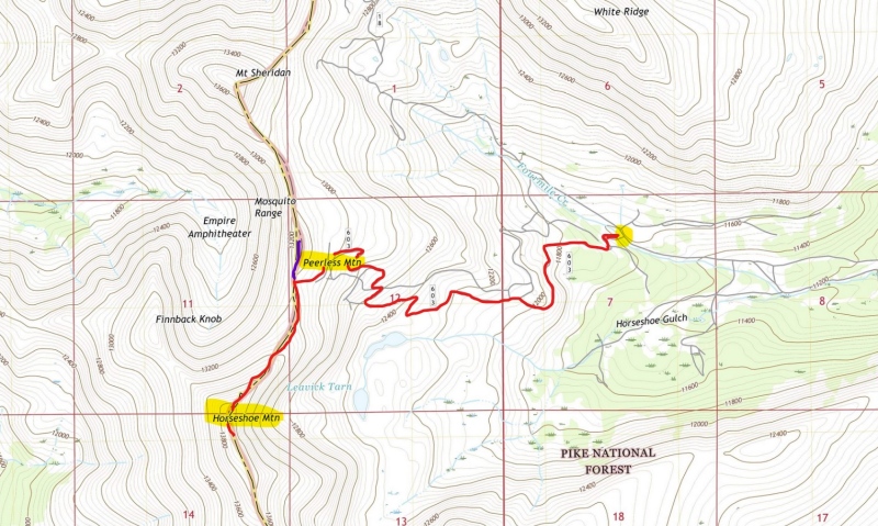
TRIP PLANNING NOTES I was visiting Colorado for a conference during the second week of June and decided on the Mosquito Range and the combination of Horseshoe Mountain and Peerless Mountain. Scheduling a hike in mid-June put it square in the uncertain transition period between spring and summer conditions and this was especially true with the extensive snowfall this season. I am an experienced hiker, and well acquainted with snow in general as a New Englander; however, nearly all my hiking experience has been in snowless conditions. Horseshoe Mountain/Peerless Mountain combination is a Class 1 to 1+ hike on moderate terrain. Recognizing my lack of experience on alpine snow combined with my flatlander acclimation prompted me to select something simple and straightforward to test my ability with lower overall risk. LOGISTICAL CONSIDERATIONS The biggest obstacle for a flatlander like me was allowing enough time to adjust to the altitude. I spent 2 nights at 6000' and an additional evening in Fairplay 9800'. The hike was scheduled on my 4th day in Colorado, which allowed me to do 3 short hikes at increasing altitudes. EQUIPMENT I brought MICROspikes, ski poles with baskets, and gaiters, in addition to the 10 Essentials of Hiking. THE HIKE I stepped off at 5:40 AM. The weather began with cool temperatures under mostly clear skies, The road maintained a moderate grade and was punctuated by snow drifts. It is difficult to estimate the precise ratio of bare trail to snow, so I will use the analogy of a TV show relative to commercials. The dirt segments were markedly longer, but the snow interrupted the route periodically, and sometimes lasted longer than expected. At 0.60 miles there was a significant sloping drift that dropped 100 feet off the edge of the road bank. 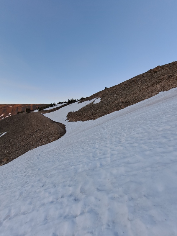
I broke out my MICROspikes and crossed the still-firm snow without incident. Horseshoe came into view at just under 1.0 miles and 12,000 ft. 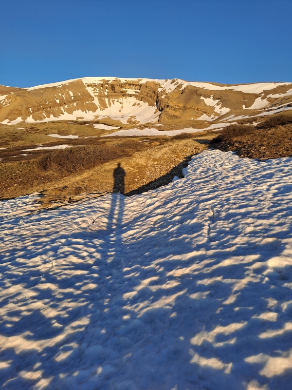
At 1.6 miles, the trail reached the steeper slopes to the saddle, and began to zig-zag its way up. I soon came upon some mining ruins, with the skeleton of a mining structure complete with a hanging piece of thin metal flashing that rattled in the wind. There was also a snow-covered entrance to a mine, and what looked to be a metal tank car or trailer resting in the snow. 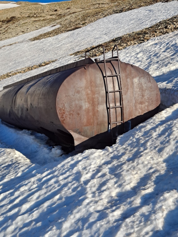
Above the mine, the hike turned into a “pick your own adventure” type of outing. There was more than one mining road running through the area, and snow drifts covered the junction of these roads in a couple of spots, making the route even less certain. I went around the snow patches, crossed them if they held my weight, or cut directly up the slope and omitted sections of road altogether. As I approached the saddle, I encountered a snow band that extended down from just below or at the crest of the ridge, and contoured the ridge for some distance in both directions. Since the ground was covered there was obviously no road to follow, and no way around the snow but to climb through it. I observed a small cornice extending from the right side to the center of Peerless Mountain.
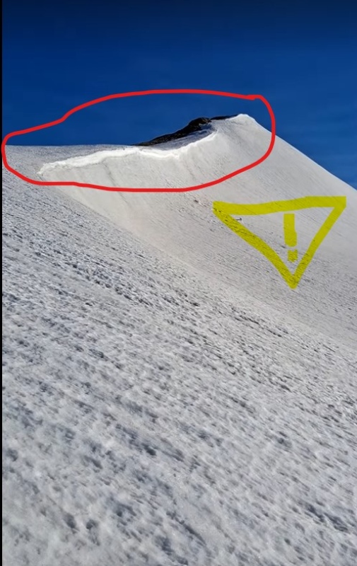
I also saw some footprints to the left of the cornice. 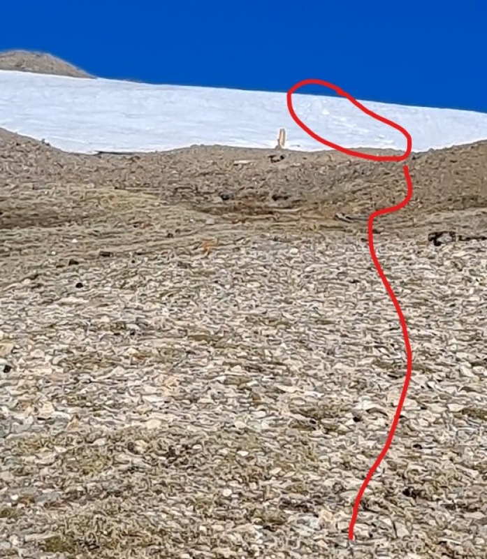
The footprints looked promising as a route up, but after reading about cornices on the Mt. Sherman standard route, and the wet avalanche alerts from the previous weekend, I wanted to investigate a possible alternative route through shallow snow and bare rock on a moderate slope 80 feet to the left. 
This proved to be an optical illusion, as the slope was much steeper than it first appeared, and I wasn’t comfortable ascending it with spikes and poles. I decided to follow the footprints, which appeared to have both human and animal tracks in the same postholes. The slope was moderate and the snow was not too deep. 
I reached the saddle at 7:25 AM, observing the magnificent view westward over Leadville toward the Sawatch Range. 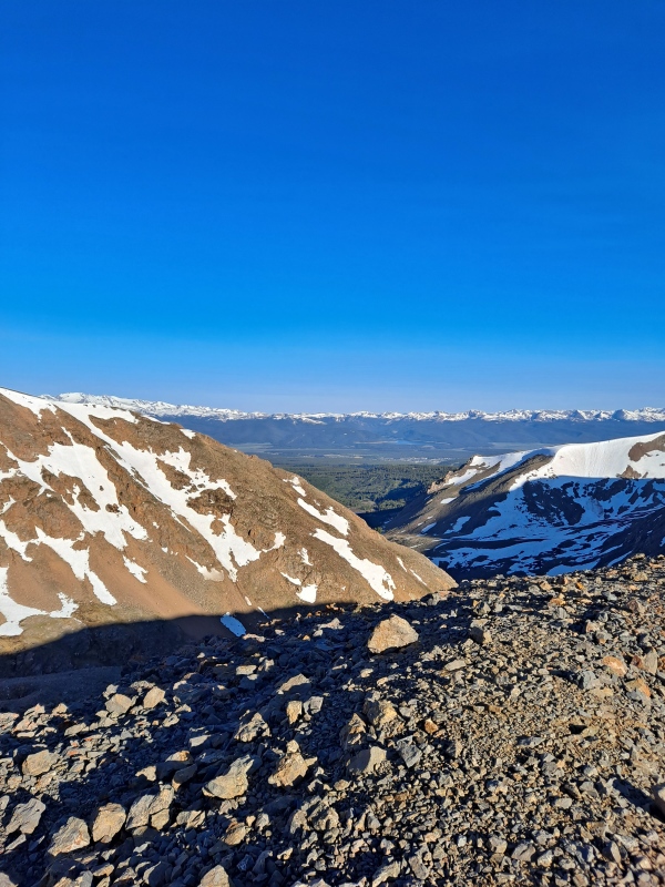
I found the trail for Horseshoe and plodded my way up . 
I encountered another unavoidable snowband just below the ridge crest and observed a set of footprints in the dead center of the ridge. 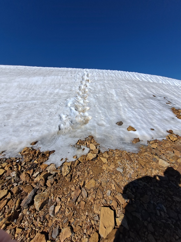
I ascended to the summit ridge and made sure to turn around and note the location so I could find it on the descent. I reached the summit at 8:40 AM. 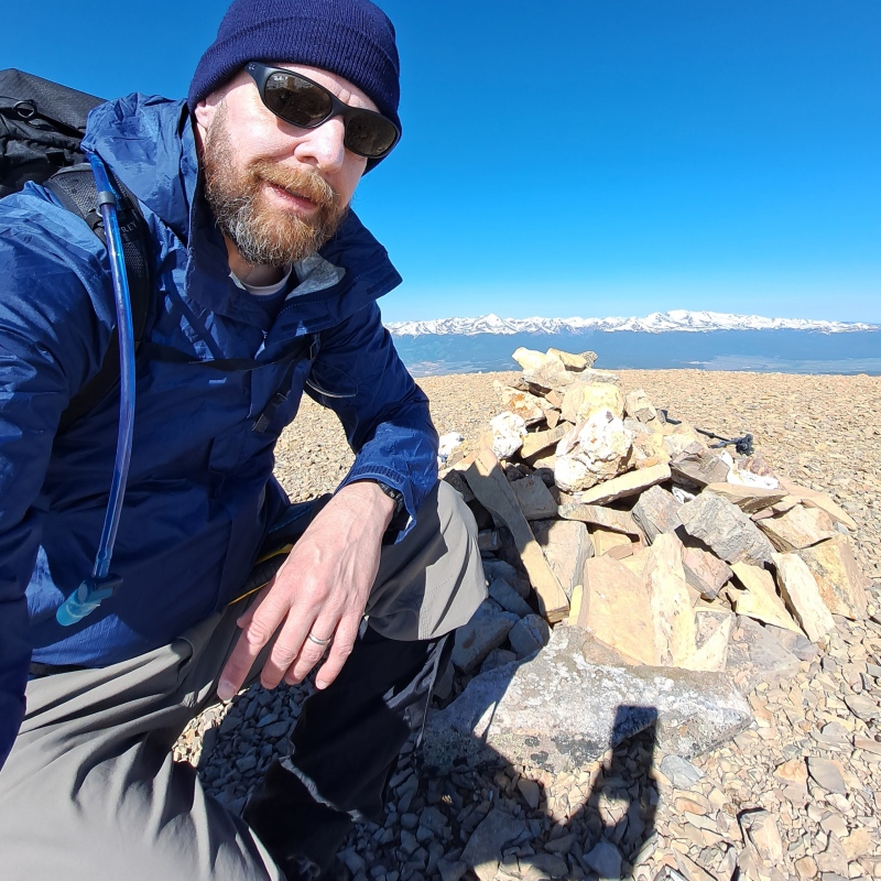
The views were very fine in all directions, especially the wide sweep of Sawatch, from Holy Cross to Princeton and beyond. I made a side excursion to the improbable and half-intact mountain shack located 400 yards southeast of the summit on the ridge crest. It is amazing to me that any part of it is still standing after all this time. 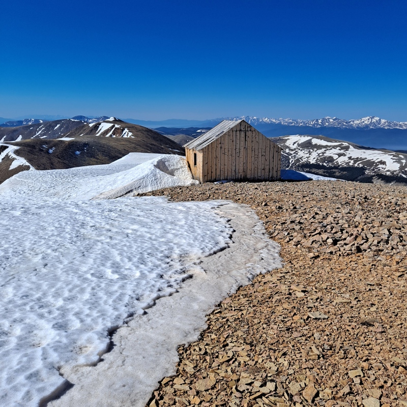
I left the summit of Horseshoe just after 9:00 AM. The descent was easy, and I trail-ran for a couple of stretches. I made it back to the saddle and continued up to Peerless. The trail was moderately steep, but short, and free of snow. 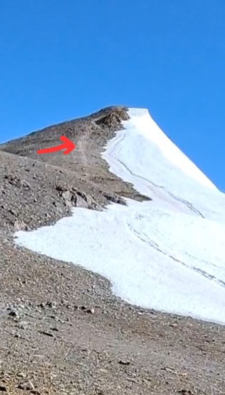
Food was foremost on my mind at this point, and upon reaching Peerless summit at 9:40 AM, took time to refuel and rehydrate. The sky remained mostly clear, with no storm clouds in sight. 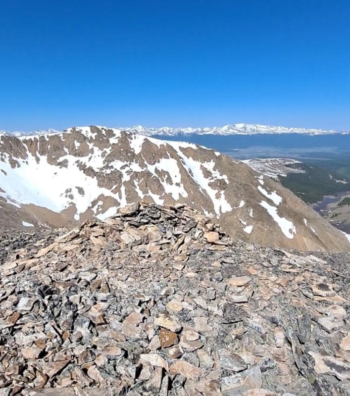
I departed Peerless around 10:00 AM and returned to the saddle, seeking the footprints that led me safely up the slope. My recollection was faulty, however, as I pictured them to be more toward the center of the saddle, rather than 0.2 miles from Peerless. I reviewed my pictures from the ascent and realized I was too far to the right (south), so I doubled back, found the prints, and descended. The temperature had warmed considerably throughout the morning, and the snow patches were in varying states of softness. I employed my “choose your own adventure” strategy in reverse and did not need to utilize MICROspikes again until returning to the sloping snow drift at 0.6 miles from the trailhead. I attempted to cross without traction, but the snow was now slushy, and my feet kept sliding, so I donned my spikes and had no issues crossing. 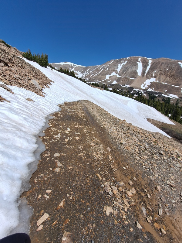
I arrived back at the trailhead at exactly 12:00 PM. Note: I was the only person on the route for the duration of the hike. TRIP REVIEW Overall, the hike was a successful one. I was able to face the obstacles I encountered and correct any mistakes I made. I learned the importance of turning around and taking note of landmarks at crucial transition points so I can easily locate them on the return trip. As a result of this experience, I have decided to improve my knowledge and skills related to traveling on snow by taking an elementary winter mountaineering class and avalanche training. The route was moderate, and that is precisely what I wanted based on my fitness level, the altitude, and the lingering snow. The views were spectacular, and I had it all to myself! What more could I ask for? Thumbnails for uploaded photos (click to open slideshow): ")
")
")
")
")
")
")
")
")
")
")
")
")
")
")
")
")
|
| Comments or Questions | ||||||
|---|---|---|---|---|---|---|
|
Caution: The information contained in this report may not be accurate and should not be the only resource used in preparation for your climb. Failure to have the necessary experience, physical conditioning, supplies or equipment can result in injury or death. 14ers.com and the author(s) of this report provide no warranties, either express or implied, that the information provided is accurate or reliable. By using the information provided, you agree to indemnify and hold harmless 14ers.com and the report author(s) with respect to any claims and demands against them, including any attorney fees and expenses. Please read the 14ers.com Safety and Disclaimer pages for more information.
Please respect private property: 14ers.com supports the rights of private landowners to determine how and by whom their land will be used. In Colorado, it is your responsibility to determine if land is private and to obtain the appropriate permission before entering the property.