| Report Type | Full |
| Peak(s) |
Truchas Peak 13,106 Middle Truchas Peak 13,071 North Truchas Peak 13,029 |
| Date Posted | 06/18/2024 |
| Date Climbed | 06/16/2024 |
| Author | Dayute |
| Truchas Peaks Combo Dayhike from Cowles NM |
|---|
|
I was looking for a lesser traveled chance to stretch my legs and I found it with the Truchas Peaks. I rolled down I25 from Golden CO and found myself in Pecos NM in no time. It was a very easy drive that loops south around the Sangres and then enters the Santa Fe National Forest from the south. Pecos was small but large enough to have a Dairy Queen and a few chain dollar stores. From Pecos it was about a 20 mile paved drive in to Jack's Creek campground where I was hoping to find a walk up campsite. No luck, the place was jammed with every pullout along the creek on the way up filled with families. The actual trailhead was next to the Equestrian camping area so I parked there and stealth camped in my truck topper. This area was very large and had about a dozen different groups with trailers, horses, and a few campers. It was spread out enough and the trailhead parking far enough away that I felt fine in the back of the truck. The large number of horses made me feel a little more secure as well after reading all the reports of vandalism from Borrego Mesa and Quemado Falls. I slept soundly with surprisingly little noise, bathroom was clean as well. I managed to forget an alarm and didnt wake up until 6am but woke up feeling good. From Jack's Creek Equestrian camping I took Beatty's trail for about 2.5 and then took a left on Jack's creek. These lower trails had a fair amount of horse traffic so they were in decent condition and the down trees that plague the area have mostly been removed. 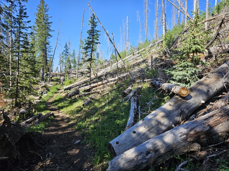
Another 2 miles down Jack's Creek trail until I got to actual Jack's Creek. The crossing here was easy and there were a few campsites scattered up the next half mile of trail that follows the creek. Another few miles to Pecos Baldy lake, there was a sign marking camping closure closer to the lake but back up the trail there were a few occupied campsites. At the trail junction near Pecos Baldy I picked up the Skyline trail and then after another half mile ditched Jack's creek to climb Trailrider's Wall on Skyline. Finally after 8+ miles I got my first views of the Truchas Peaks. 
From here I followed Skyline up onto Trailriders Wall where I followed it to the base of Truchas. 
Towards the base of Truchas there was a crossroads where Skyline continued towards Truchas Lakes and Jose Vigil came in from the west. From here there was no trail up to the next section of trees but the Cairns were easy to follow. There was a clear trail leading through the trees and then once above treeline a choose your own adventure path of trail segments and easy class 2. 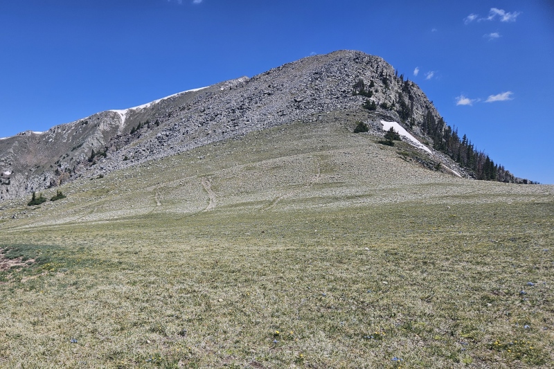
The trail segments on the SW face all angled towards about 12,800' on the west ridge, once on the ridge it was a gentle grass walk to the summit. From the Summit of Truchas I had a great view of the rest of the trail. The trail down from Truchas and up Middle Truchas was clear and easy. Adding West Truchas here wouldn't have been tough but for some reason I wasnt interested, if I hadnt slept in maybe. Middle Truchas ended up being a gem of a summit. Huge chunks of beautiful quartz and what appeared to be millions of pounds of silver glitter. 
Up until this point the trail had been a cakewalk. The downclimb from Middle to the saddle with North changed that. I went right of the ridge into a mess of loose junk. Lots of scree surfing. It had a real broken hand pass feel but surprisingly very little sand and ball bearing mess so was a little more pleasant. I was super happy to be sliding down this stuff instead of climbing up it. 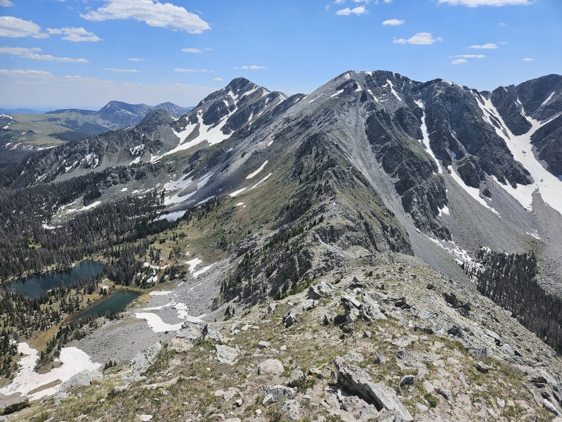
After emptying my shoes out on the saddle the last peak of the day stood in front of me. There is a fun little class 3 wall right at the saddle. 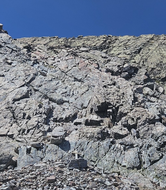
The climb was short and easy with solid holds. There may be a class 2 line in there but I kind of just went straight up and over. From there it was an uneventful ridge walk to the summit. I returned to the saddle and then started back. I downclimbed from the saddle down to Truchas lake. From here I could have taken Skyline back up the ridge and gone back the way I came. I decided to take Upper Azul down to Jack's Creek thinking I could get cute and avoid some elevation gain. Terrible decision. I wasted a good two hours fighting a maze of downed trees with segments of trail that lasted 25 feet max. It was obvious no one but a handful of suckers like myself had been back there in years. I eventually gave up and just took Lower Azul back to Trailrider's wall. Once back on Skyline and back on top of Trailrider's Wall it was a breeze back to the trailhead. Made it back to the truck in moderate darkness. My gps said 27.9 miles and 6,926 in elevation gained but some of that could be shaved off by taking Skyline straight up from Truchas Lake. It was a long but fun day with only a little misery in the woods. I felt good enough the next day to hit Wheeler and Walter on the way home. Thumbnails for uploaded photos (click to open slideshow): ")
")
")
")
")
")
")
")
|
| Comments or Questions | |||
|---|---|---|---|
|
Caution: The information contained in this report may not be accurate and should not be the only resource used in preparation for your climb. Failure to have the necessary experience, physical conditioning, supplies or equipment can result in injury or death. 14ers.com and the author(s) of this report provide no warranties, either express or implied, that the information provided is accurate or reliable. By using the information provided, you agree to indemnify and hold harmless 14ers.com and the report author(s) with respect to any claims and demands against them, including any attorney fees and expenses. Please read the 14ers.com Safety and Disclaimer pages for more information.
Please respect private property: 14ers.com supports the rights of private landowners to determine how and by whom their land will be used. In Colorado, it is your responsibility to determine if land is private and to obtain the appropriate permission before entering the property.