Download Agreement, Release, and Acknowledgement of Risk:
You (the person requesting this file download) fully understand mountain climbing ("Activity") involves risks and dangers of serious bodily injury, including permanent disability, paralysis, and death ("Risks") and you fully accept and assume all such risks and all responsibility for losses, costs, and damages you incur as a result of your participation in this Activity.
You acknowledge that information in the file you have chosen to download may not be accurate and may contain errors. You agree to assume all risks when using this information and agree to release and discharge 14ers.com, 14ers Inc. and the author(s) of such information (collectively, the "Released Parties").
You hereby discharge the Released Parties from all damages, actions, claims and liabilities of any nature, specifically including, but not limited to, damages, actions, claims and liabilities arising from or related to the negligence of the Released Parties. You further agree to indemnify, hold harmless and defend 14ers.com, 14ers Inc. and each of the other Released Parties from and against any loss, damage, liability and expense, including costs and attorney fees, incurred by 14ers.com, 14ers Inc. or any of the other Released Parties as a result of you using information provided on the 14ers.com or 14ers Inc. websites.
You have read this agreement, fully understand its terms and intend it to be a complete and unconditional release of all liability to the greatest extent allowed by law and agree that if any portion of this agreement is held to be invalid the balance, notwithstanding, shall continue in full force and effect.
By clicking "OK" you agree to these terms. If you DO NOT agree, click "Cancel"...
I really wish I would have linked up this peak with PT 13164 when I did it in 2019, but then it wasn’t a known ranked 13er. In any event, today was a long day, so I was getting an early start so I could drive back home for work the next morning.
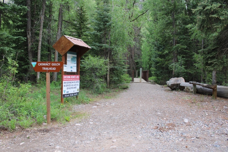
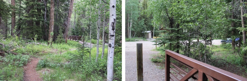
I parked at the Cataract Gulch Trailhead and was on the trail at 3:30am. The trailhead has several parking spaces, dispersed campsites, and bathrooms.
The trailhead is clearly marked, and easy to find.
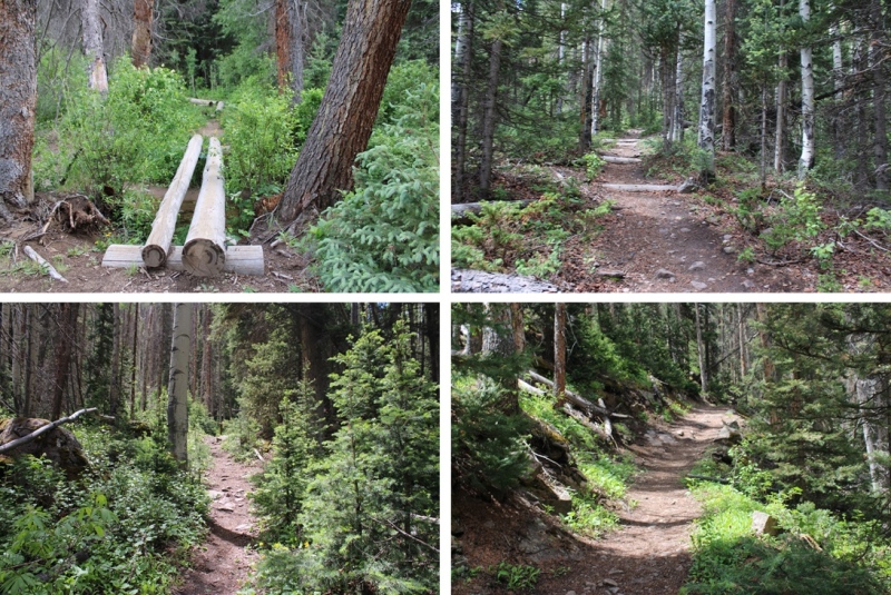
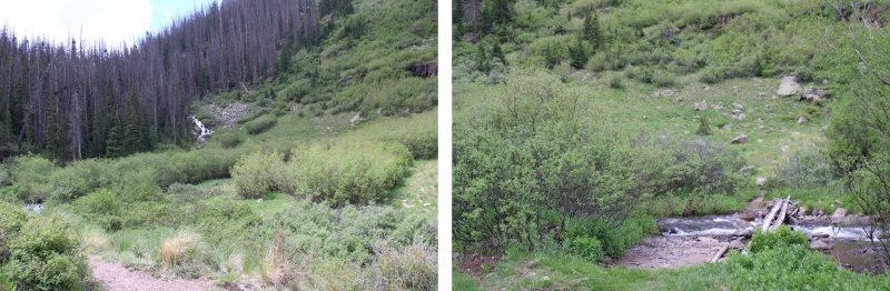
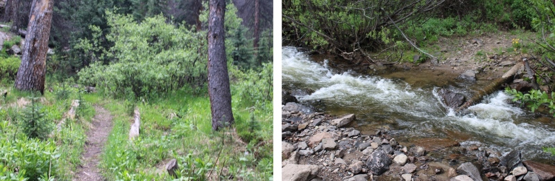
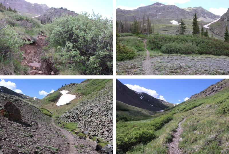
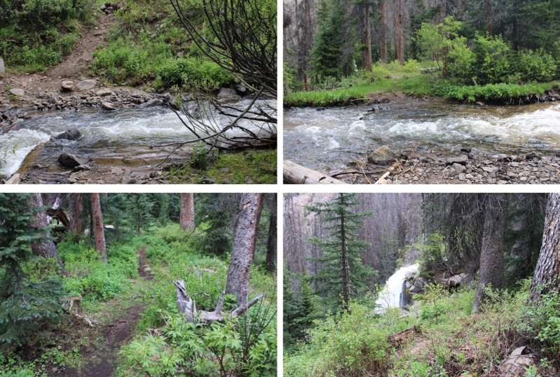
I followed the class 1 Cataract Gulch Trail south, towards Cataract Gulch.
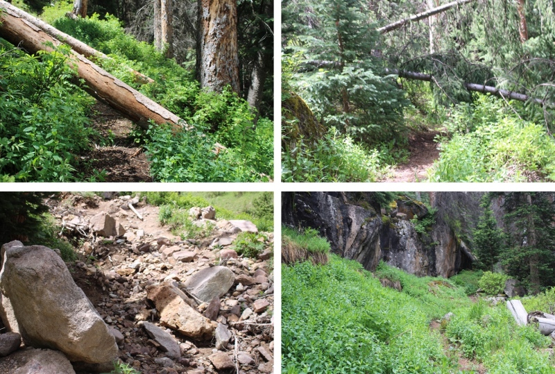
There were several downed trees on the trail, but it was easy to navigate.
Just before reaching the waterfall about 2.5 miles up the trail, I crossed the creek on a couple of logs.
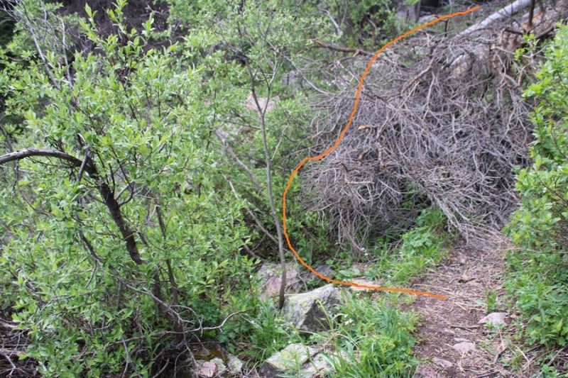
This is where many people get lost. I headed up the slope, and there was a large tree blocking the path. I went left, navigated willows and some boulders, then regained the trail.
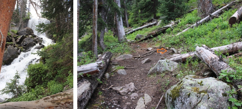
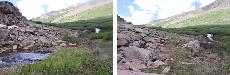
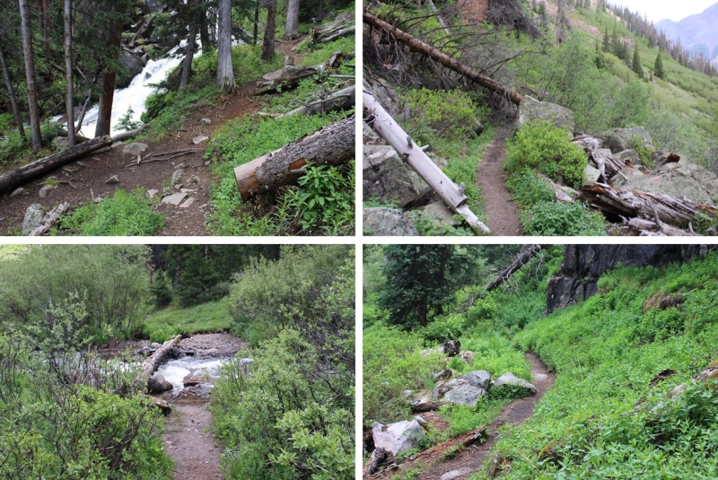
I could now see the waterfall clearly. A lot of people continue straight here, towards the waterfall, following the social trails. Instead, look for a trail to the right that goes up and behind the waterfall.
Next, to cross the creek. I crossed directly above the waterfall. Probably about 10 feet from where it drops off. At night I knew where to cross because there are little reflecting circles on the trees across from the water that glow when you shine your flashlight across them. The water was running high today, and I didn’t want to go over the edge, so I crossed carefully. The water was up just past my knees.
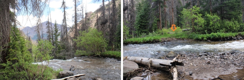
I picked up the trail on the other side, and quickly came to a second creek crossing.
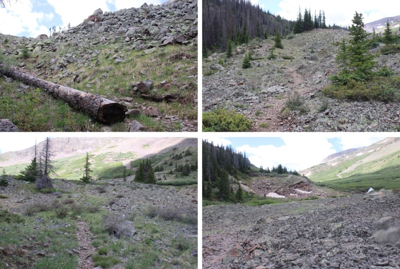
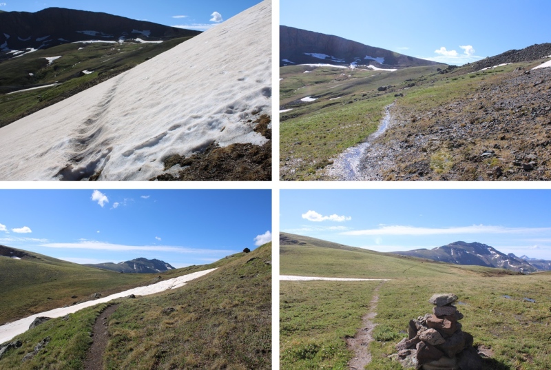
I picked up the trail again on the other side, and ascended through a cairned, rocky area.
This led me to my final creek crossing of the morning.
I crossed the creek one more time, and picked up the trail on the other side. It led me up and around to the left, behind boulders and through a small canyon.
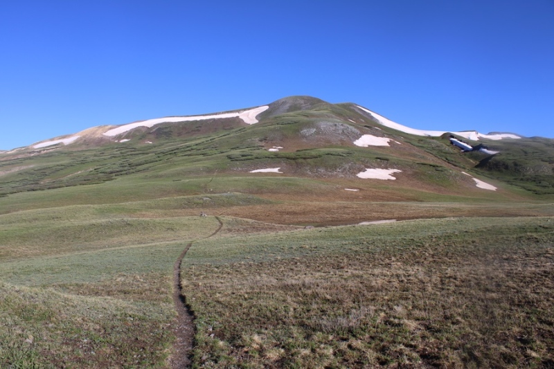
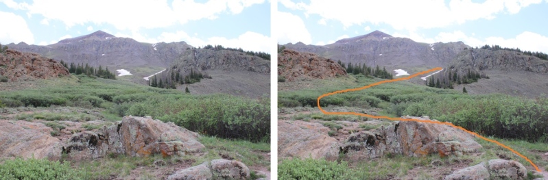
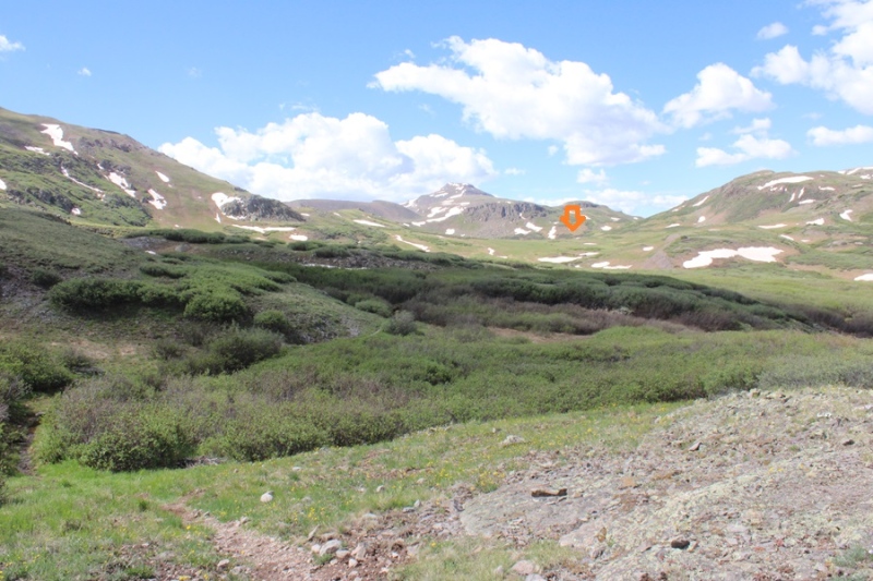
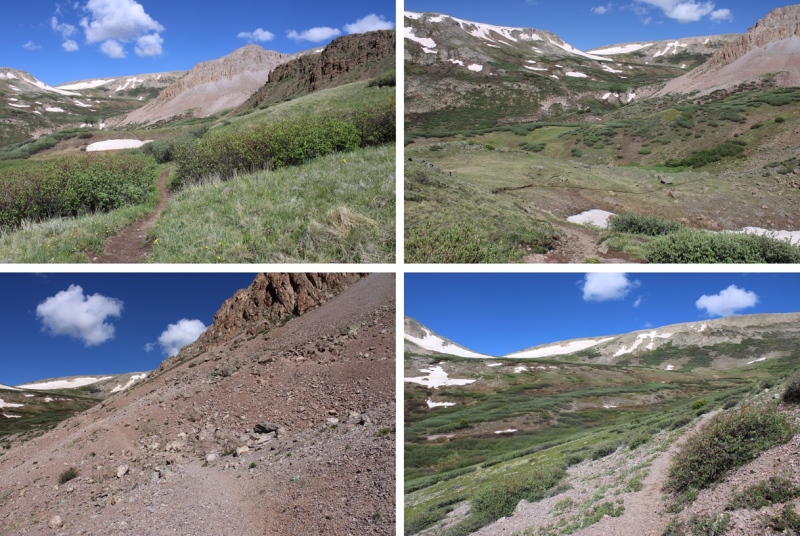
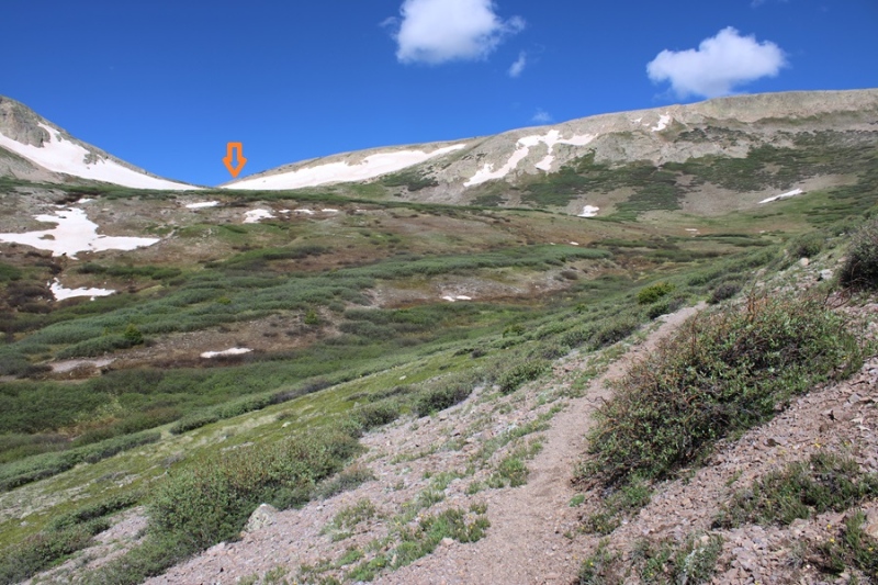
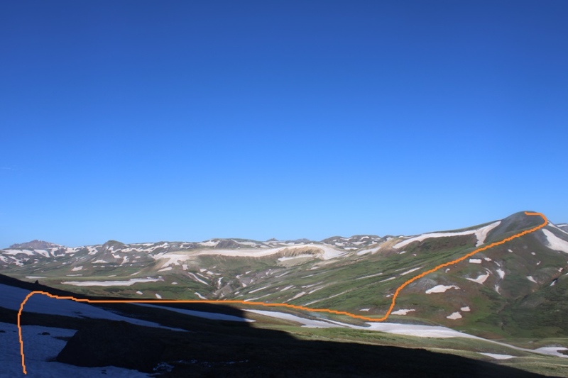
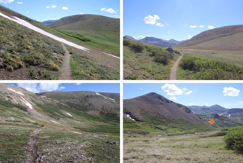
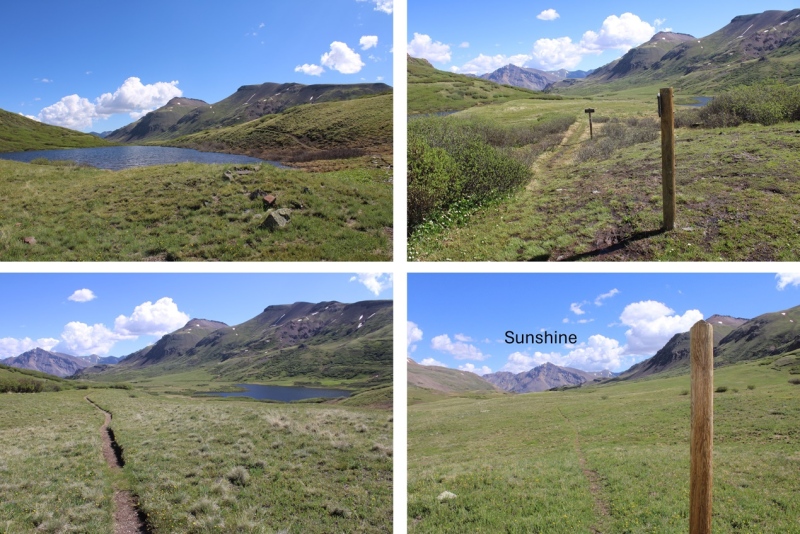
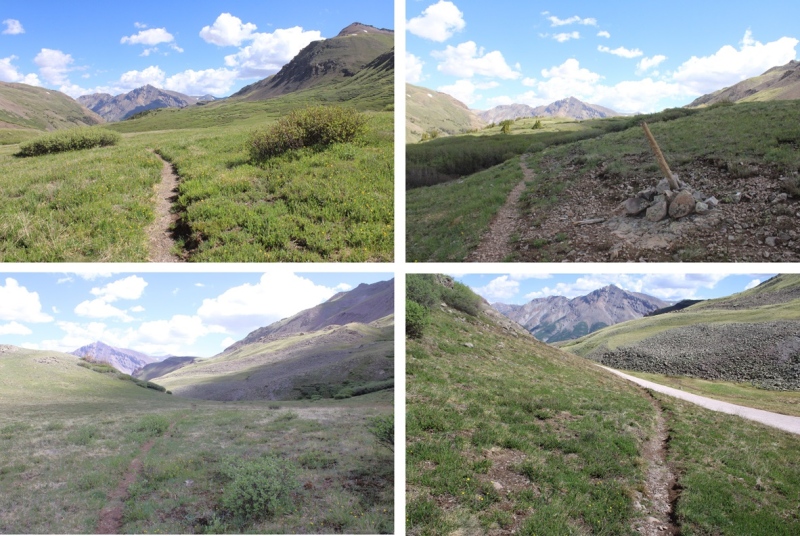
I was now headed south towards Cataract Lake. There’s a pretty good trail here, but every once in a while it gets overgrown. The trail slopes slightly downward as it goes across the tundra and through the willows. There are posts to help guide you if you lose the trail. I was headed here:
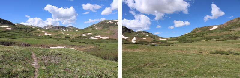
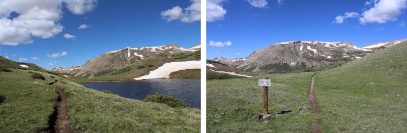
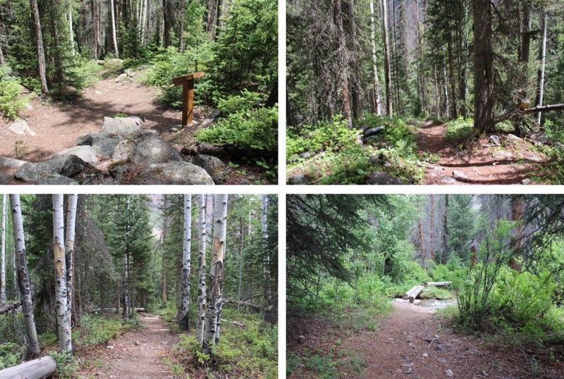
I passed Cataract Lake to my left, and a small lake to my right. Here the trail picked up with the Colorado Trail, and I followed it right, west, towards Cuba Gulch.
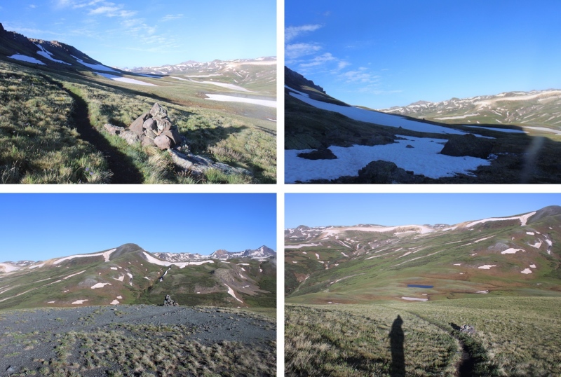
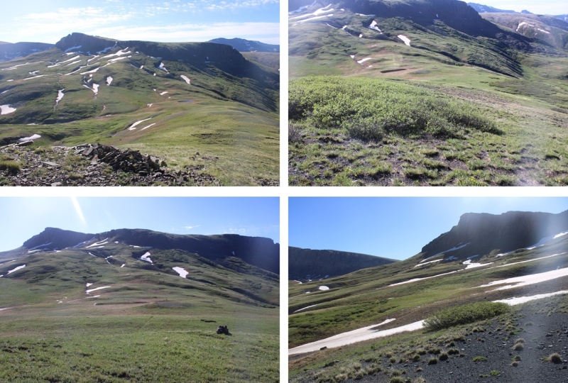
I stayed on the Colorado Trail (East Fork Middle Pole Trail) for most of the rest of the hike. Here are some pictures of the trail.
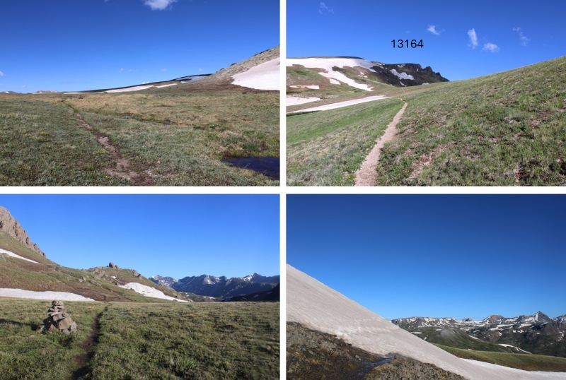
The trail meanders it’s way to a saddle:
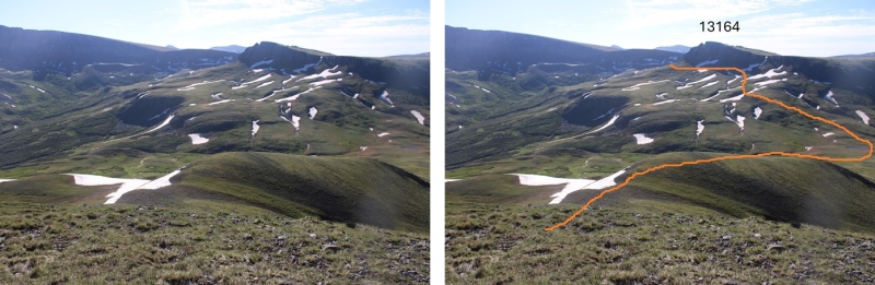
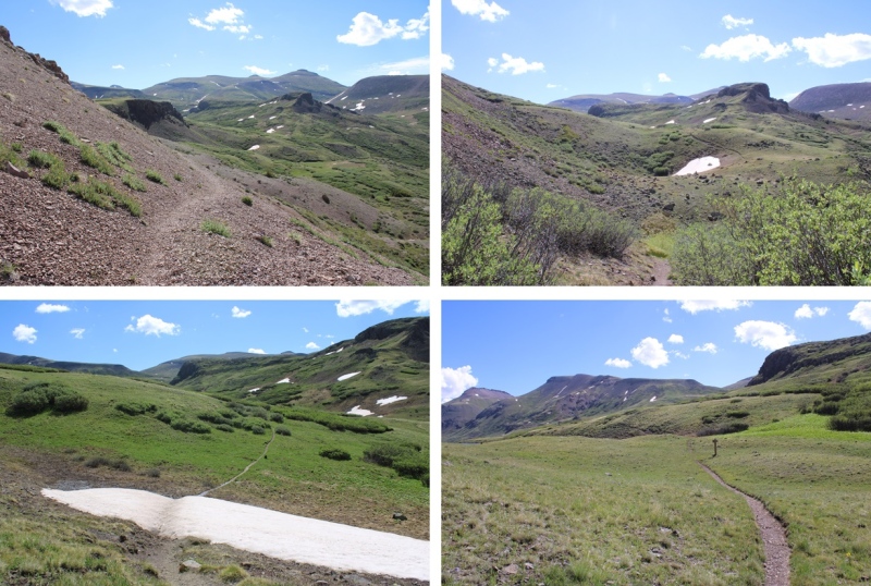
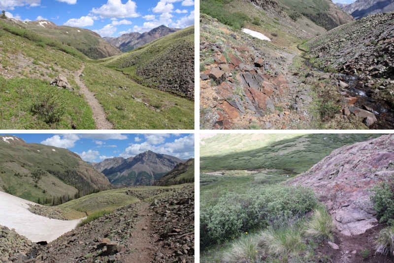
I skirted around the north side of 13164, navigating through a could of ice patches.
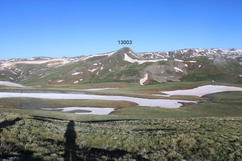
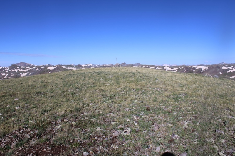
Now on the north side of 13164, I could see 13003 to the west.
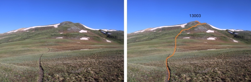
I stayed on the Colorado Trail until I hit the saddle of 13164 and 13003, losing about 500’ of elevation, then left the trail and took the tundra covered ridge to the summit. This is the route I took.
I made my way to the saddle
Then hiked the ridge to the summit
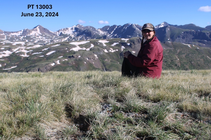
I summited PT 13003 at 8:15am
PT 13003:
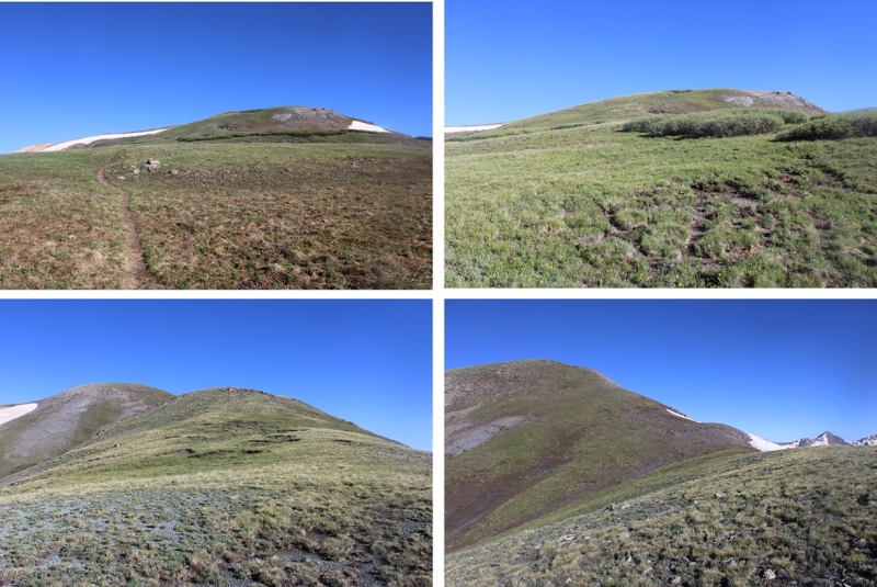
This was an out and back hike for me, so I turned around and retraced my steps. Here’s my route back down the saddle, skirting around the left side of PT 13164, following the Colorado Trail.
I then continued following the trail as it wound back to the Cataract Gulch Trail
Past the lakes and through the upper basin, I kept following the trail, aiming for Sunshine Peak to the north.
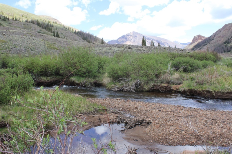
I crossed the creek
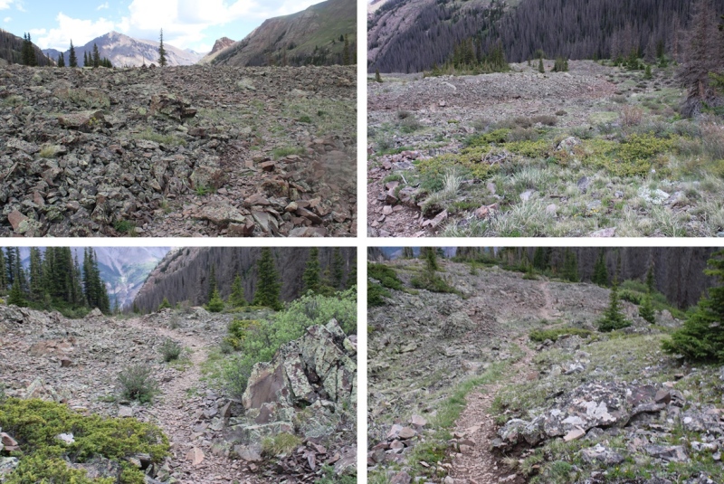
Then descended through the rocky basin
I crossed the creek twice more, and then followed the trail back down around the waterfall and back to the trailhead.
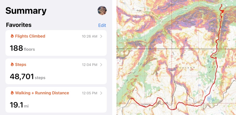
I made it back to the trailhead at 12pm, making this a 17.1 mile hike with 4750’ of elevation gain in 8.5 hours. Note: My Strava glitched about 2 miles into this hike, so I drew in my route for this peak on the topo map. This was easy because most of the route was on a trail, so it auto populated. My phone and watch gave me 19.1 miles for the hike, but I got 17.1 miles when I drew the map in CalTopo.
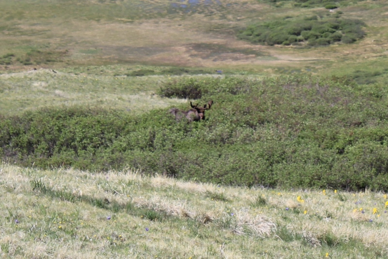
Also, every time I’ve been to Cataract Gulch I’ve seen moose. Today was no exception.
On to the next trailhead!
Thumbnails for uploaded photos (click to open slideshow):
I've been up that trail about a dozen times and only seen moose once, but that time was in the middle of the night. My friend and I popped through some willows and a couple big bulls were about 25 feet from us. They didn't seem too interested, but we bushwacked a pretty wide circle around them just to be extra respectful
Caution: The information contained in this report may not be accurate and should not be the only resource used in preparation for your climb. Failure to have the necessary experience, physical conditioning, supplies or equipment can result in injury or death. 14ers.com and the author(s) of this report provide no warranties, either express or implied, that the information provided is accurate or reliable. By using the information provided, you agree to indemnify and hold harmless 14ers.com and the report author(s) with respect to any claims and demands against them, including any attorney fees and expenses. Please read the 14ers.com Safety and Disclaimer pages for more information.
Please respect private property: 14ers.com supports the rights of private landowners to determine how and by whom their land will be used. In Colorado, it is your responsibility to determine if land is private and to obtain the appropriate permission before entering the property.

")
")
")
")
")
")
")
")
")
")
")
")
")
")
")
")
")
")
")
")
")
")
")
")
")
")
")
")
")
")
")
")
")
")
")
")
")
")
")
")
")
")
")


