| Report Type | Full |
| Peak(s) |
Cleveland Peak - 13,404 feet |
| Date Posted | 06/27/2024 |
| Date Climbed | 06/25/2024 |
| Author | Russ58 |
| Cleveland from Little Sand Lake, the second highest snake in North America |
|---|
|
Kenny and I decided to climb Cleveland Peak but were interested in making it an easy summit day. We were not sure what the trail conditions would be like so we allowed ourselves two days to get from the Music Pass TH to Little Sand Creek Lake. Our plan for the first day was to hike to the junction of Little Sand Creek and Sand Creek trails (6 miles, gain 780' lose1670'). Our plan on day 2 was to hike to Little Sand Creek Lake (3.6 miles, 2600' gain). We knew that the trail would be good over Music Pass but were unsure of how the Sand Creek Trail would be. 
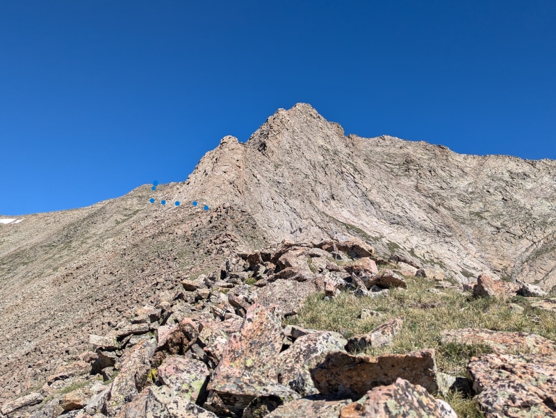
To our pleasant surprise except for 5 stream crossings in the last two miles (each required knee deep wading) the trail was in excellent condition . We reached the junction of Little Sand Creek at around 11:00 AM and decided to push on. We were again surprised to find the trail to be in excellent condition with numerous log cuts or cairns marking the way until a steep gulley with moderate dead tree fall at 10900'. At this point across the valley to the south is an impressive avalanche path that knocked down trees for about 100 yards 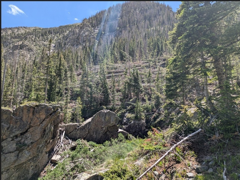
The route is to go up the gulley. At the top of the gulley is a cairn (~11030'). The trail switch backs at the cairn and is again defined by frequent log cuts and occasional cairns. If you go more than 200 yards with out a log cut or cairn, you are off route. At 11200' you will come to a clearing with willows in the center. Follow the obvious path to the willows. The path through the willows is away from the cliff and is not that bad. 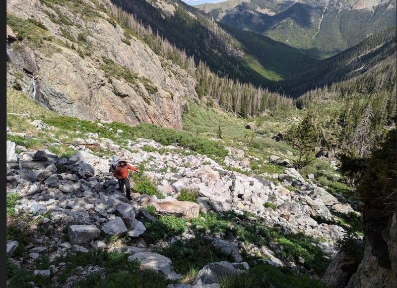

After the clearing the trail is obvious and reaches a ridge line then drops down to a meadow with a stream crossing at 11670'. Just before the stream crossing is a sign that states "no camping within 300' of lakes". It was 5:00 PM so we decided to set up camp. On our summit day we got off route and hiked up to the lower Little Sand Creek Lake. We climbed up the steep NE face to the ridgeline at 12789' and followed the ridge line until it became the southeast ridge of Cleveland Peak 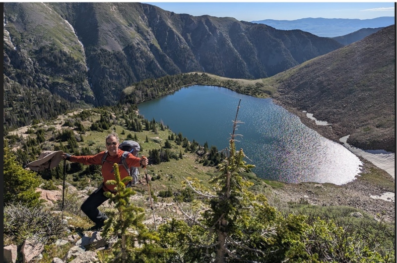
The best route for peak bagging is the route we descended by the upper Little Sand Creek Lake. It is what is shown on the map. The SE Ridge looked unpassable at about 12800' so we traversed East across several exposed class 2 slabs to a southern face with multiple lines to the South West ridge of Cleveland . 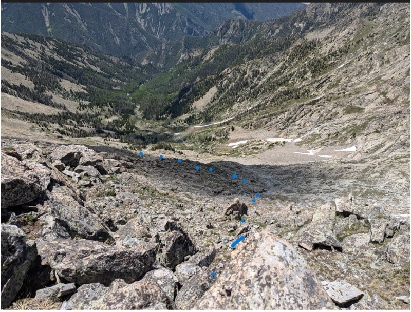
Once the ridgeline was gained it was just 500' of class 2 knife edge to the summit. Kenny gained the ridgeline shortly after I did. However it took him forever to walk the 500' to the summit. 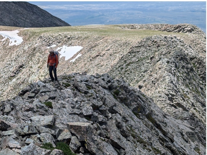
The reason was shortly after gaining the summit he saw a snake. Yes, a snake at 13220'. According to Google snakes are not found above 10,000' in the USA. There is a Mexican rattle snake that has been found as high as 14000', but nothing else in North America is even close. This is either a new species or it is the "Furthermore" or "Wild Wanderer" of it's sub species. Hopefully it will slither over to Crestone Needle to be the highest snake in North America. 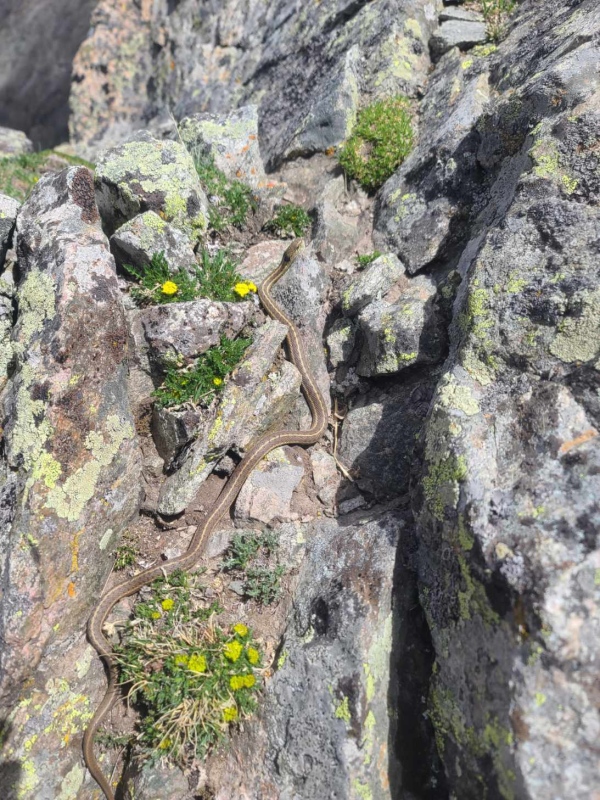
At the summit were great views of Crestone and Crestone Needle. 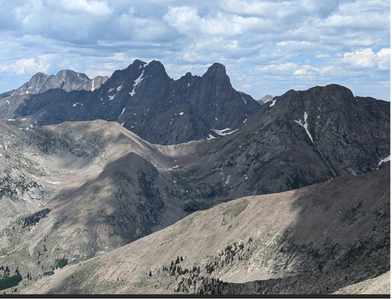
Our descent retraced our steps to the SE ridge. We then left the ridge at 12700' and descended to upper Little Sand Creek Lake. The trail was usually well marked and cairned. The best route starting from the campsite is to hike to the saddle immediately south of the stream crossing. In the saddle is a very large cairn. Follow the cairns uphill, it is rarely more than 200' of spacing between the cairns on the trail to the upper lake. Thumbnails for uploaded photos (click to open slideshow): ")
")
")
")
")
")
")
")
")
")
")
")
")
|
| Comments or Questions |
|---|
|
|
Caution: The information contained in this report may not be accurate and should not be the only resource used in preparation for your climb. Failure to have the necessary experience, physical conditioning, supplies or equipment can result in injury or death. 14ers.com and the author(s) of this report provide no warranties, either express or implied, that the information provided is accurate or reliable. By using the information provided, you agree to indemnify and hold harmless 14ers.com and the report author(s) with respect to any claims and demands against them, including any attorney fees and expenses. Please read the 14ers.com Safety and Disclaimer pages for more information.
Please respect private property: 14ers.com supports the rights of private landowners to determine how and by whom their land will be used. In Colorado, it is your responsibility to determine if land is private and to obtain the appropriate permission before entering the property.

