Download Agreement, Release, and Acknowledgement of Risk:
You (the person requesting this file download) fully understand mountain climbing ("Activity") involves risks and dangers of serious bodily injury, including permanent disability, paralysis, and death ("Risks") and you fully accept and assume all such risks and all responsibility for losses, costs, and damages you incur as a result of your participation in this Activity.
You acknowledge that information in the file you have chosen to download may not be accurate and may contain errors. You agree to assume all risks when using this information and agree to release and discharge 14ers.com, 14ers Inc. and the author(s) of such information (collectively, the "Released Parties").
You hereby discharge the Released Parties from all damages, actions, claims and liabilities of any nature, specifically including, but not limited to, damages, actions, claims and liabilities arising from or related to the negligence of the Released Parties. You further agree to indemnify, hold harmless and defend 14ers.com, 14ers Inc. and each of the other Released Parties from and against any loss, damage, liability and expense, including costs and attorney fees, incurred by 14ers.com, 14ers Inc. or any of the other Released Parties as a result of you using information provided on the 14ers.com or 14ers Inc. websites.
You have read this agreement, fully understand its terms and intend it to be a complete and unconditional release of all liability to the greatest extent allowed by law and agree that if any portion of this agreement is held to be invalid the balance, notwithstanding, shall continue in full force and effect.
By clicking "OK" you agree to these terms. If you DO NOT agree, click "Cancel"...
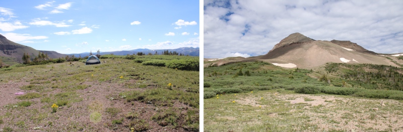
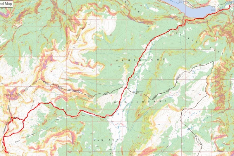
Note: there’s a long approach for these peaks, so I decided to make this a backpacking trip. I found a great basecamp for the Rio Grande Pyramid 13ers (and others). The approach is about 10 miles and 3100’ of elevation gain, coming from Thirtymile Campground. The approach can be found here.
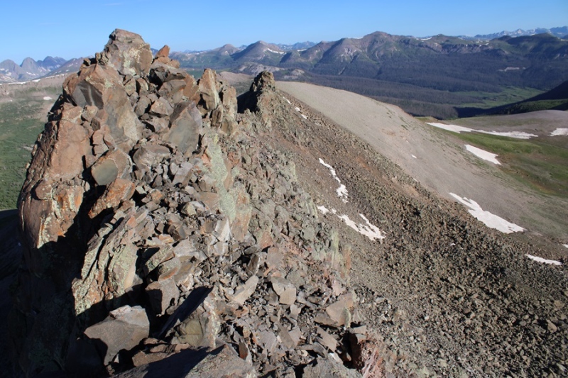
I’d hiked up to 12210’ the day before, summited some peaks, and spent the night at my camping spot, so I was able to get up early and refreshed the next morning to hit the trail at 5:30am.
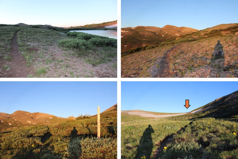
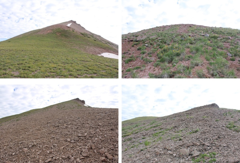
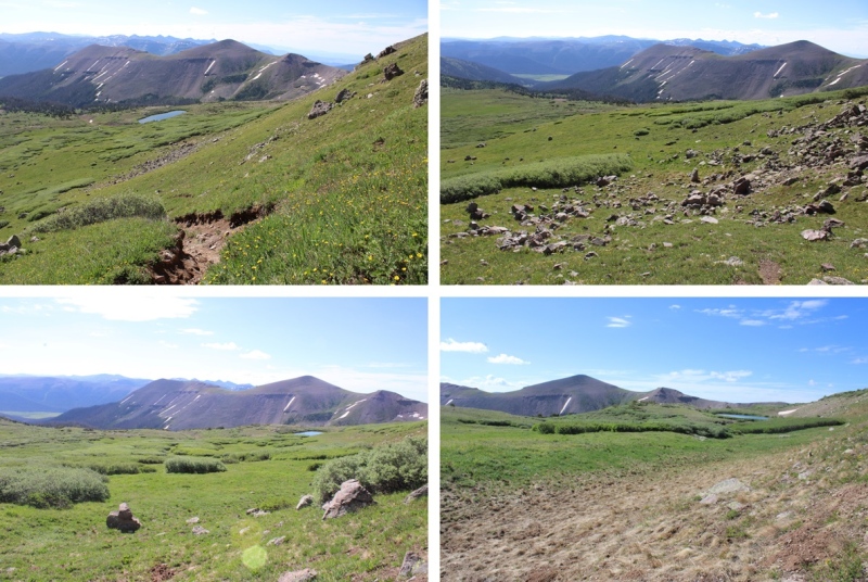
This time, I was heading southwest on the Continental Divide Trail.
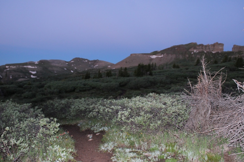
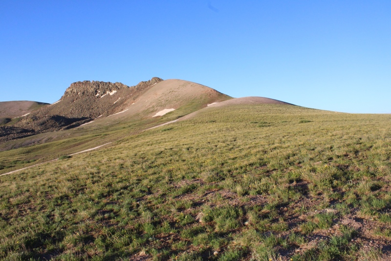
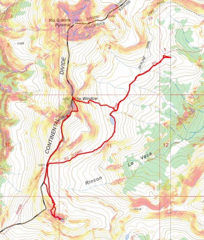
This trail was easy to follow, and well established. I followed it for just under 2.5 miles to the saddle of 13022 and Window Peak.
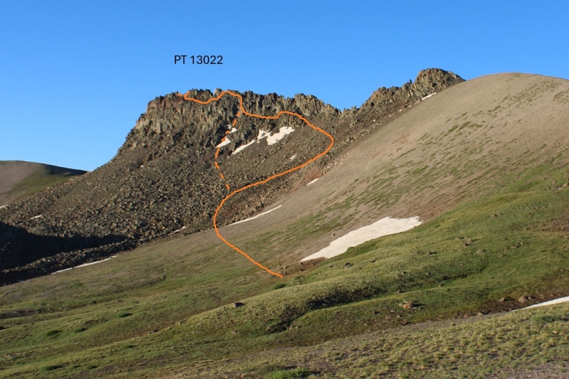
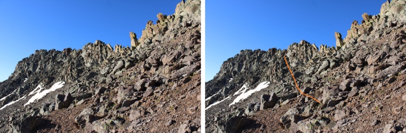
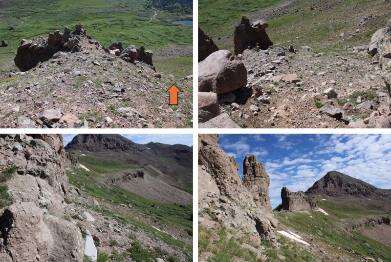
From the saddle I turned left and headed towards PT 13022. I did not follow the saddle, but instead cut across to the rocky basin.
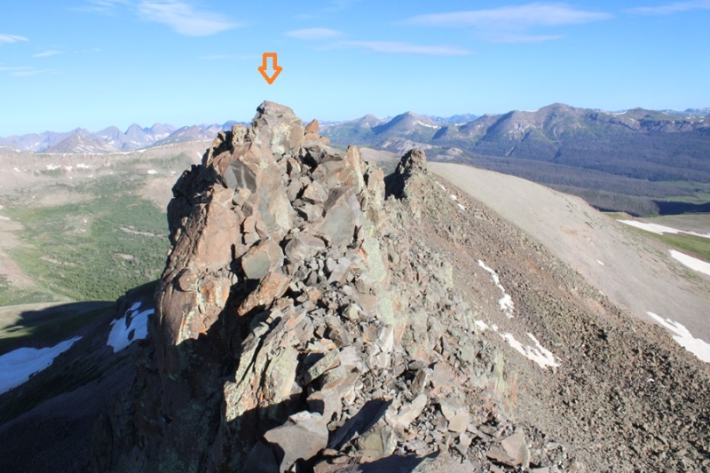
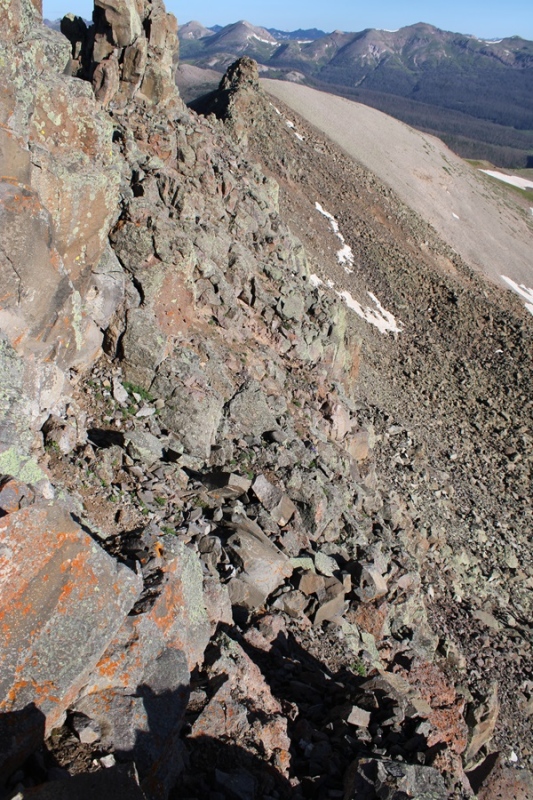
There wasn’t a trail here to the summit, and it looks like a viable route changes from season to season due to rockslides, etc. This is the basic route I took to the summit, and back down. The solid line is the route I took up, the dotted line is the route I took down. I’d recommend taking the route I took down both ways. The climbing here was class 4. In fact, I saw a (very old) anchor set up along my route, so people at one point at least used ropes to descend.
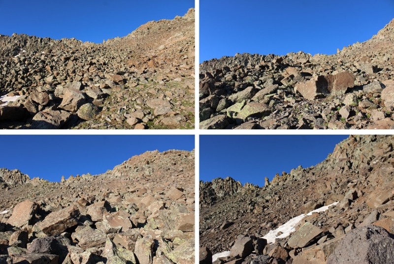
First, I made my way up the rocky basin.
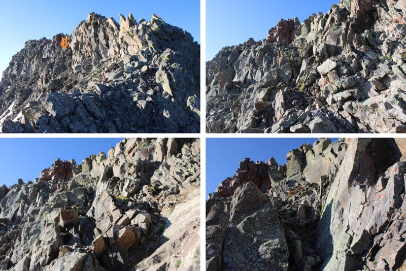
Then I headed towards and up this rocky ramp
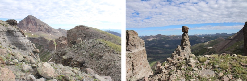
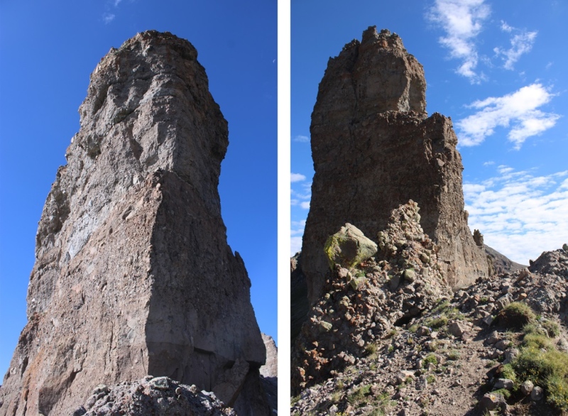
At the top of the ramp is where it really got interesting. There were a few cairns here, but as I said earlier, it looks as if the route changes. I scrambled my way up to the ridge, had about 20 feet of ridge climbing, then had to descend to find a viable route east.
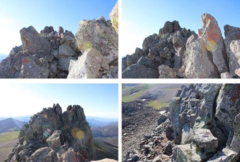
Ahead of me there was a rock perched atop a spire that looked like a cairn, and I assumed this was the summit. Here is where I was aiming.
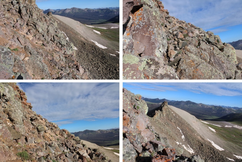
I did my best to follow game trails and cairns where I could find them, staying below the ridge, doing my best not to fall down the loose gullies, making my way east. Yes, there were times I had to crawl around rocks with serious exposure to avoid climbing the ridge. I did not feel the ridge ‘went’.
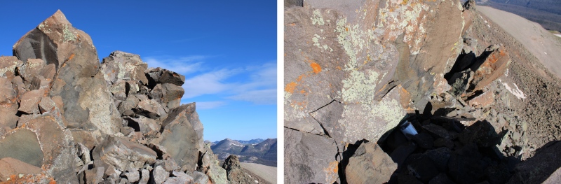
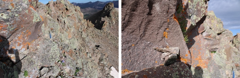
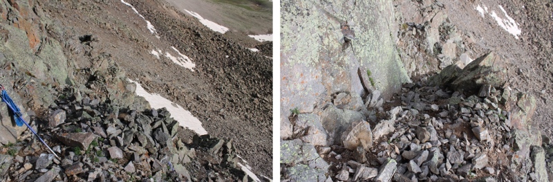
Here’s that anchor I was talking about
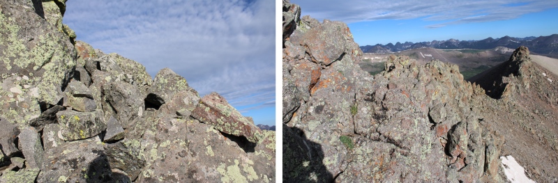
I kept aiming for the cairn
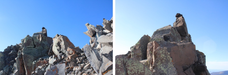
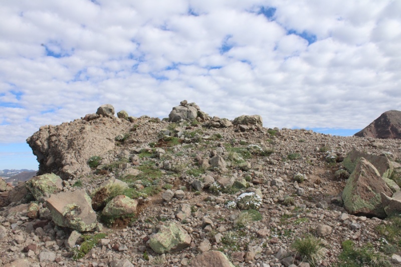
I made it to the cairn, scrambling up some class 4 rock to get there, sat and took a video.
I turned and looked to the west, and it seemed as if the point just a few yards away was higher, so I scrambled my way over there as well.
When I got there, I found a summit register (which I couldn’t open) so I’m guessing it’s the true summit, although both points looked to be of equal height.
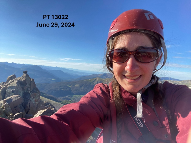
I summited PT 13022 at 7:30am
PT 13022:
Now to make my way down. On my climb up I had a better view of the mountain, and found a gully I thought looked safer to descend. I downclimbed from my perch and started out by heading back the same way I’d summited, west.
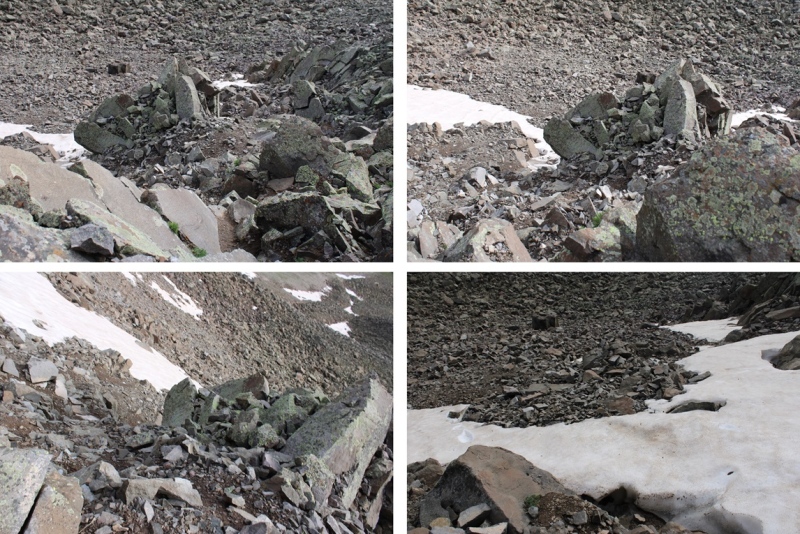
Hey look! A cairn!
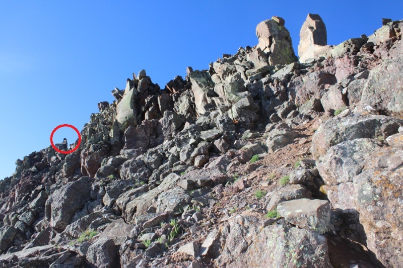
Just for perspective, here’s a photo of where I left my trekking pole. I scrambled around this rock to get back there. If you look closely, you can see a cairn on the rock to the left of the trekking pole. This was the crux of the route for me, both in and out.
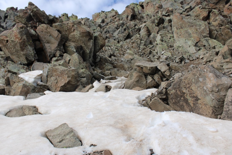
I continued west, found a gully that looked stable-adjacent, and headed down.
Here’s looking back up at the gully I descended
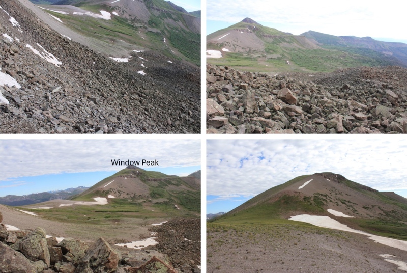
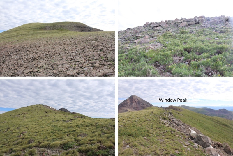
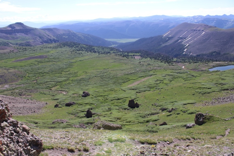
And now to head back down the rocky basin and make my way back to the saddle with Window Peak.
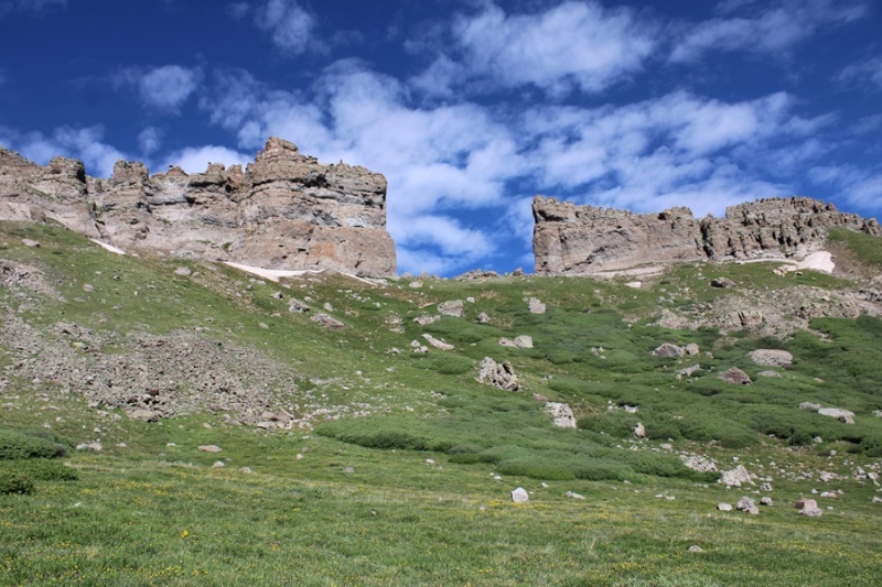
Window Peak isn’t ranked, but I needed an easy win, so I headed north, and followed the grassy slopes, which changed to rocky slopes, to the summit of Window Peak
There was a bit of a false summit here, so I just kept following the ridge
There were also some pretty cool rock formations along the way
I summited Window Peak at 8:50am
Window Peak:
I wanted to hike to the actual window, so I continued north along the ridge, descended a grassy gully until I was at 12900’, and then traversed north to The Window.
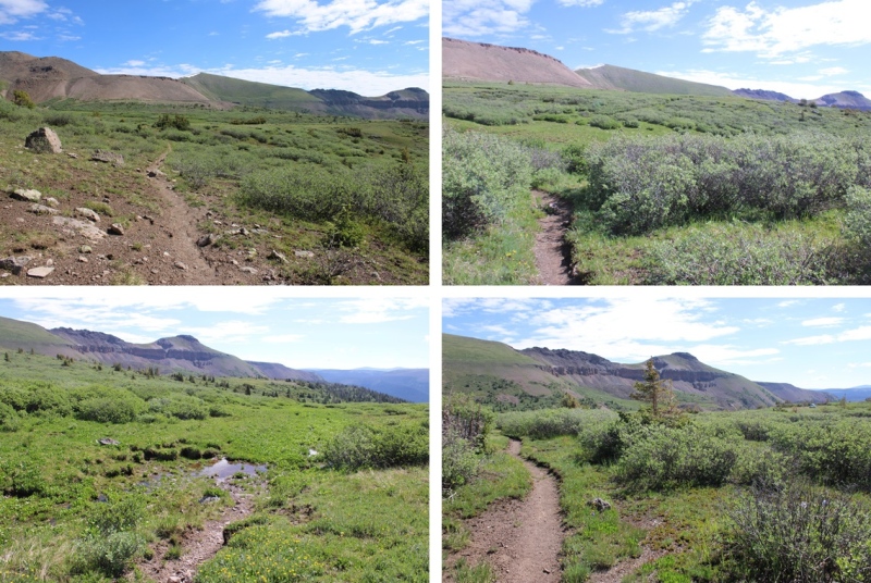
Now to head back to my campsite. This was actually fairly easy. There was a solid trail that descended from The Window, which eventually went away. I followed the trail as far as I could, then just aimed east for the Continental Divide Trail, which I could see located by the pond in the distance.
Here’s a view of Window Peak
And my route back to the trail
Back on the Continental Divide Trail, I followed it northeast back to my campsite.
I made it back to my campsite at 9:45am. This was a 6.88 mile hike with 1471’ of elevation gain from my campsite at 12210’.
On to the next trailhead!
Thumbnails for uploaded photos (click to open slideshow):
Been looking for one of your trip reports. I've always wanted to get into this area and hope to get there some day. I've seen the window from a distance and would like to walk through it.
Thank you for the report on the base camp at ~12,200'! We used it for Rio Grande Pyramid a few weeks ago, so I'll vouch that the base camp is good.
I just want to add that the "small creek" just past the "sandy area" is indeed your last chance for a water source (~0.5mi before the base camp). It was a solid water source, though (at least in August 2024).
Caution: The information contained in this report may not be accurate and should not be the only resource used in preparation for your climb. Failure to have the necessary experience, physical conditioning, supplies or equipment can result in injury or death. 14ers.com and the author(s) of this report provide no warranties, either express or implied, that the information provided is accurate or reliable. By using the information provided, you agree to indemnify and hold harmless 14ers.com and the report author(s) with respect to any claims and demands against them, including any attorney fees and expenses. Please read the 14ers.com Safety and Disclaimer pages for more information.
Please respect private property: 14ers.com supports the rights of private landowners to determine how and by whom their land will be used. In Colorado, it is your responsibility to determine if land is private and to obtain the appropriate permission before entering the property.


")
")
")
")
")
")
")
")
")
")
")
")
")
")
")
")
")
")
")
")
")
")
")
")
")
")
")
")
")
")
")
")
")
")
")
")
")
")
")
")
")