Download Agreement, Release, and Acknowledgement of Risk:
You (the person requesting this file download) fully understand mountain climbing ("Activity") involves risks and dangers of serious bodily injury, including permanent disability, paralysis, and death ("Risks") and you fully accept and assume all such risks and all responsibility for losses, costs, and damages you incur as a result of your participation in this Activity.
You acknowledge that information in the file you have chosen to download may not be accurate and may contain errors. You agree to assume all risks when using this information and agree to release and discharge 14ers.com, 14ers Inc. and the author(s) of such information (collectively, the "Released Parties").
You hereby discharge the Released Parties from all damages, actions, claims and liabilities of any nature, specifically including, but not limited to, damages, actions, claims and liabilities arising from or related to the negligence of the Released Parties. You further agree to indemnify, hold harmless and defend 14ers.com, 14ers Inc. and each of the other Released Parties from and against any loss, damage, liability and expense, including costs and attorney fees, incurred by 14ers.com, 14ers Inc. or any of the other Released Parties as a result of you using information provided on the 14ers.com or 14ers Inc. websites.
You have read this agreement, fully understand its terms and intend it to be a complete and unconditional release of all liability to the greatest extent allowed by law and agree that if any portion of this agreement is held to be invalid the balance, notwithstanding, shall continue in full force and effect.
By clicking "OK" you agree to these terms. If you DO NOT agree, click "Cancel"...
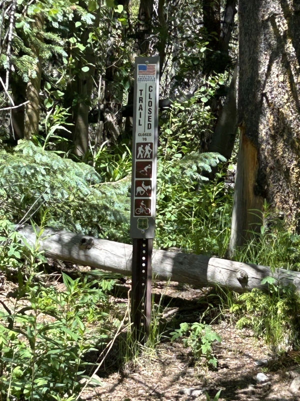
The drive up the Jennings Creek is def 4WD. I have a Tacoma TRD. For reference it is not as bad as South Colony Lakes (Humboldt) or 277 Baldwin Creek (Antero). There is no "Tabeguache" trail marker. You just need to use GPS and track 3.8 miles from the camp ground. If you are alone, like I was, it's hard to 4WD AND look for the trail marker. I passed it and had to come back about 100 yds. The picture from the route information is best you'll get. https://www.14ers.com/route.php?route=tabe3w There is a marker in the woods barely visible from the road.
Trail Marker barely visible from the road.
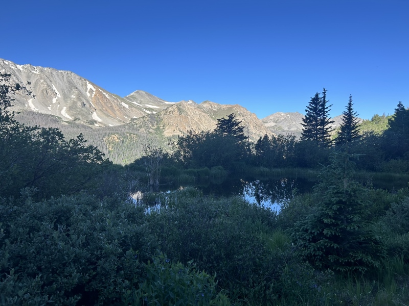
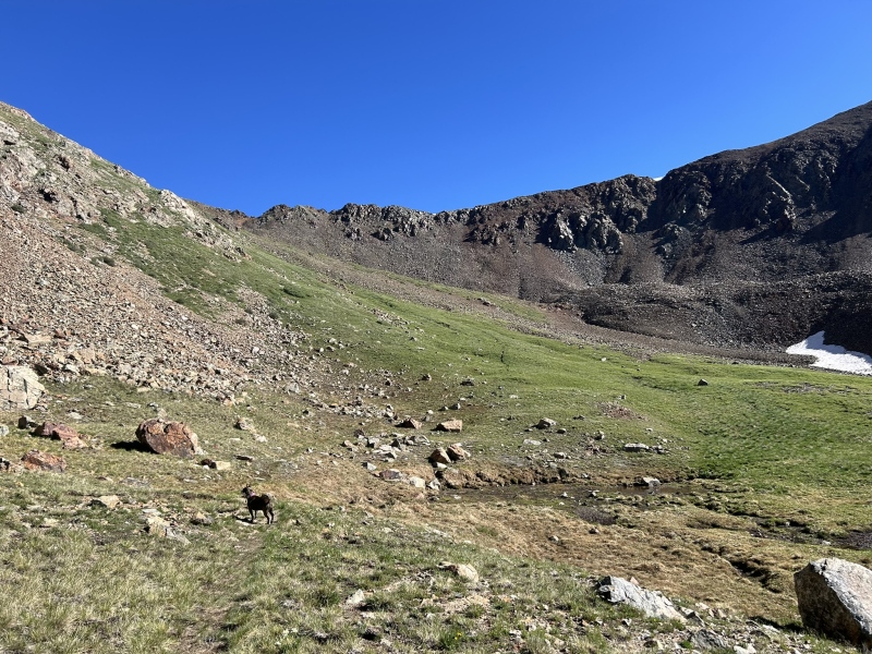
The trail through the trees is dim, but visible. Reminds me of doing a 13er. Once you reach the top, the tarn is right there you cannot miss it or the left turn up Jennings Creek
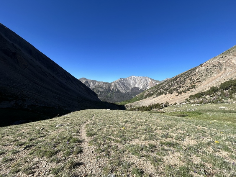
TarnStart of trail up Jennings Creek
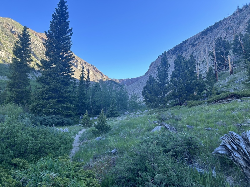
The trail up Jennings Creek comes and goes, but your destination is pretty obvious. Once you get high enough you will see a path in the left corner of the canyon.
Jennings Creek trail
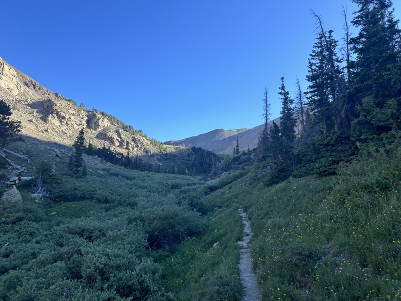
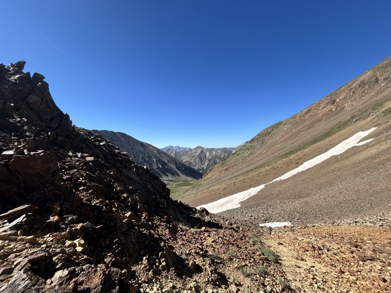
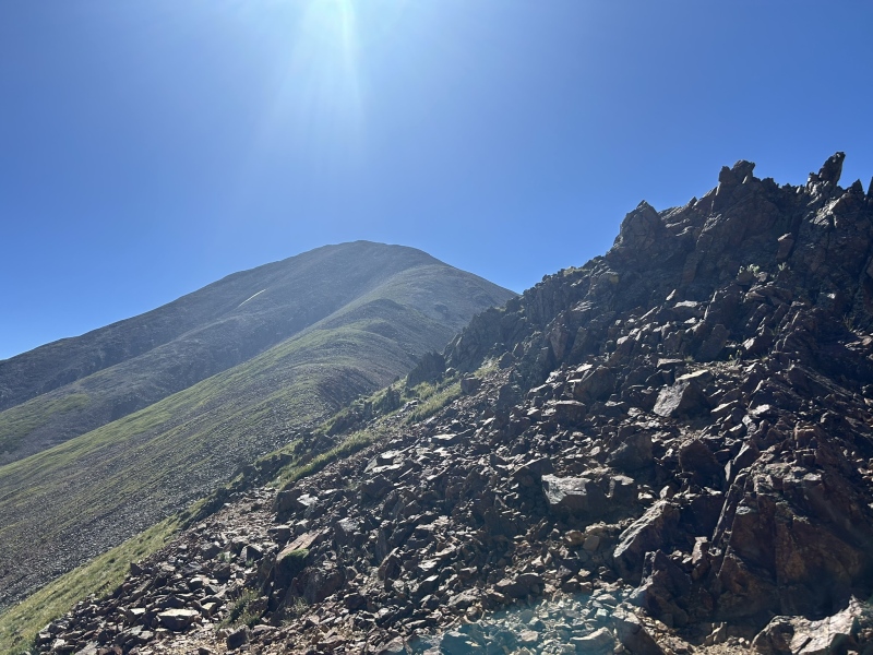
Looking back as you near the ridgeLooking forward. Trail up to ridge is straight up to left.
The trail up the ridge is very loose. Poles were very helpful.
On the ridge looking back at the loose trail up.First view looking North over the the ridge.Looking up at 13,936
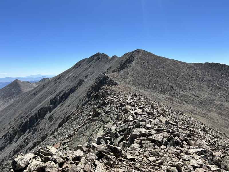
The entire trek across the ridge is mostly loose scree or talus. There are a few place where the talus is stable, but it is the exception. There are lots of ups and downs but of course going out is mostly up. I really noticed how loose it was coming back. Poles are very helpful. Also, the ridge has cliffs on the left (going out) and talus fields on the right. I generally stayed right. There is no trail on the ridge. Just bits and pieces.
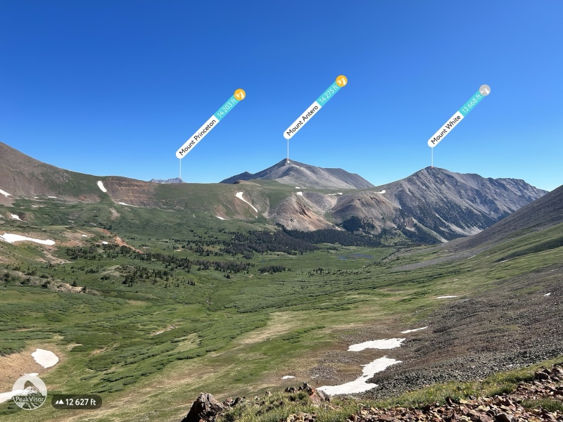
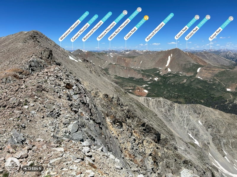
From saddle after 13,936 forwardSummit looking North
When you are coming back, it is very easy to get disoriented and start, inadvertently, to head Southwest or into McCoy gulch. There are so many ups and downs you'll forget which one is the 13,936. And you can see trails running down and out both of the ridges that you need to bypass. Fortunately, my Garmin kept me on track. I think this is why the route description has so much emphasis on going back the same way you came out - not because you are a daredevil, but because it is easy to screw it up. I think as a rule, know that you must stay right. You cannot go too far to the right. You'd eventually start climbing Carbonate - pretty sure know one does that accidentally!
On the way back looking Northwest
My dog and I took 7:45 minutes round trip. 4 hours up, 3:45 back down. My garmin-measured/strava-corrected shows 10.46 miles, 4081ft. The first and last 2.8 miles is very easy. The ridge, 2.5 miles each way, is not.
My GPS Tracks on Google Maps (made from a .GPX file upload):
Thumbnails for uploaded photos (click to open slideshow):
Comments or Questions
Caution: The information contained in this report may not be accurate and should not be the only resource used in preparation for your climb. Failure to have the necessary experience, physical conditioning, supplies or equipment can result in injury or death. 14ers.com and the author(s) of this report provide no warranties, either express or implied, that the information provided is accurate or reliable. By using the information provided, you agree to indemnify and hold harmless 14ers.com and the report author(s) with respect to any claims and demands against them, including any attorney fees and expenses. Please read the 14ers.com Safety and Disclaimer pages for more information.
Please respect private property: 14ers.com supports the rights of private landowners to determine how and by whom their land will be used. In Colorado, it is your responsibility to determine if land is private and to obtain the appropriate permission before entering the property.

")
")
")
")
")
")
")
")
")
")
")
")
")

