| Report Type | Full |
| Peak(s) |
Amherst Mountain - 13,164 feet Organ Mountain - 13,040 feet "Peak Twenty Two" - 13,107 feet Sheep Mountain - 13,073 feet |
| Date Posted | 07/08/2024 |
| Date Climbed | 07/04/2024 |
| Author | WildWanderer |
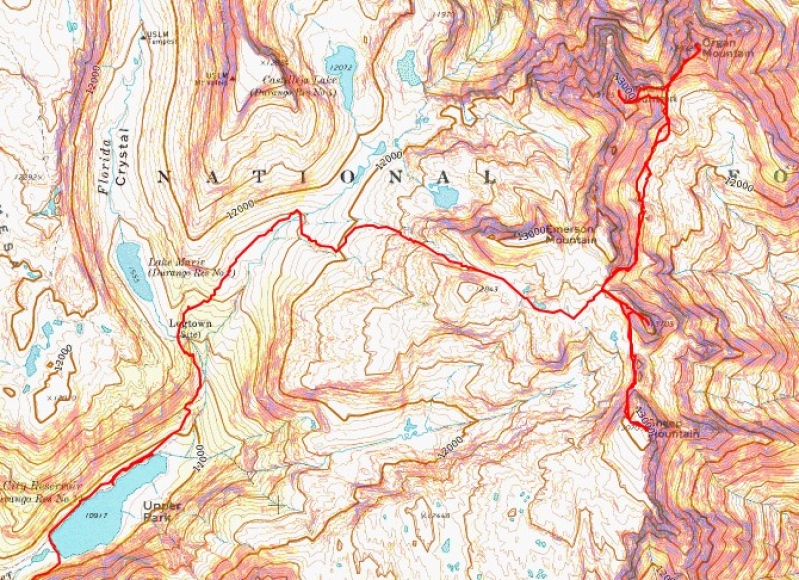
| From Endlich Mesa Trailhead |
|---|
|
Amherst Mountain – 13164, Organ Mountain – 13,040, Peak Twenty Two – 13107, Sheep Mountain – 13,073 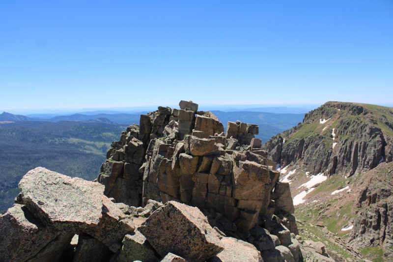
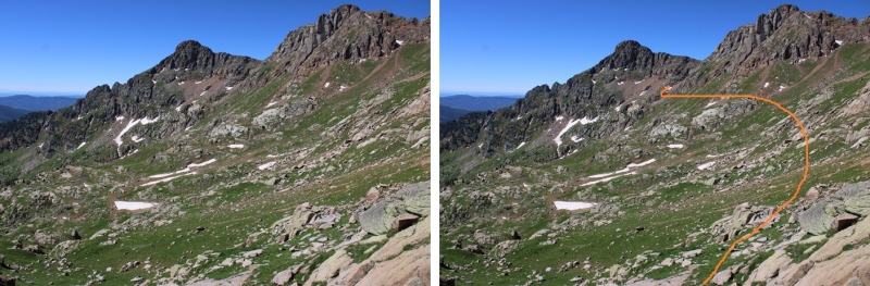
RT Length from Endlich Mesa Trailhead: 28.2 miles Elevation Gain from Endlich Mesa Trailhead: 7263’ RT Length from City Reservoir: 13.5 miles Elevation Gain from City Reservoir: 4495’ The approach to the saddle between Emerson and Peak Twenty Two is a total of 11 miles and 3250’ of elevation gain from Endlich Mesa Trailhead and City Reservoir. You can view the approach to the saddle here. From the saddle of Emerson and Peak Twenty Two, I continued following a scree-filled game trail northeast skirting the east side of Emerson, losing 450’ of elevation as I wound my way towards an upper basin. 
Here you can see Amherst and Organ 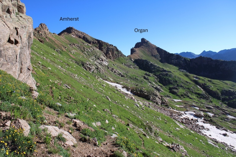
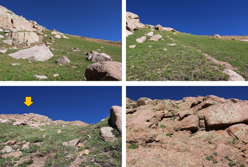
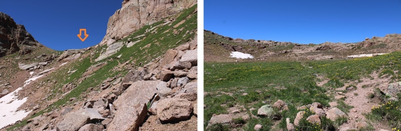
I continued following this trail until I kind of lost the trail, then stayed at about 12400’ of elevation as I made my way towards this gully 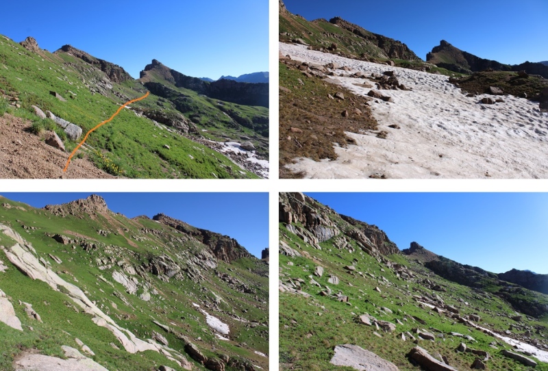
I aimed for this gully, and ascended it. 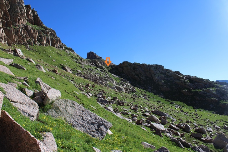

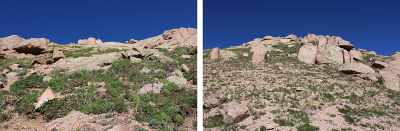
At the top of the gully I could see the saddle between Amherst and Organ. You can aim for the saddle, or just turn left and ascend Amherst. I aimed left, and ascended 800’ on very steep tundra terrain, which eventually gave way to rocky class 2 terrain. 
At the top of this rocky area I looked right, and it looked like the area to the right was higher than I was, so I continued following the ridge north. 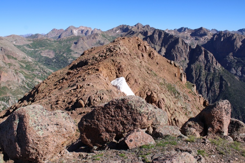
But when I got to the other side, it looked like where I had been was the highpoint, so I headed south back to the other side. 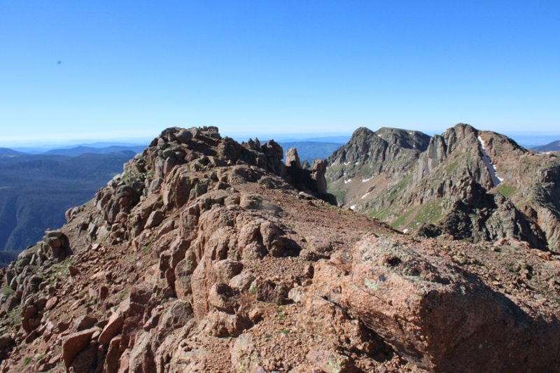
My altimeter gave both points equal height, and there wasn’t a summit register, so I’m not entirely sure which is the true summit. There was what you could call a cairn on the first summit. In any event, they are both easy to tag. 
I summited Amherst Mountain at 9am 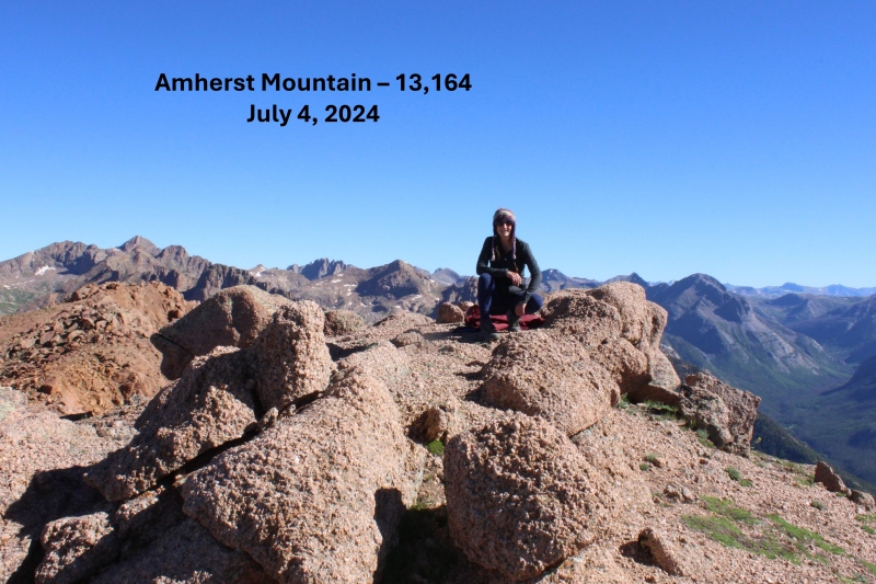
Amherst Mountain:
From the summit I could see Organ Mountain to the northeast 
It looked like it would be a simple ridge hike, so I headed down to the Amherst/Organ saddle. 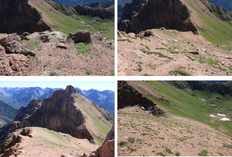
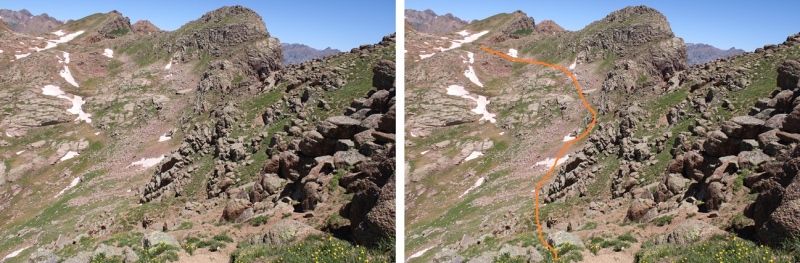
From the saddle, this is the route I took to the summit, aiming for the ramp to the right. This initial part was all class 2 on either scree or tundra 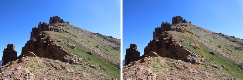
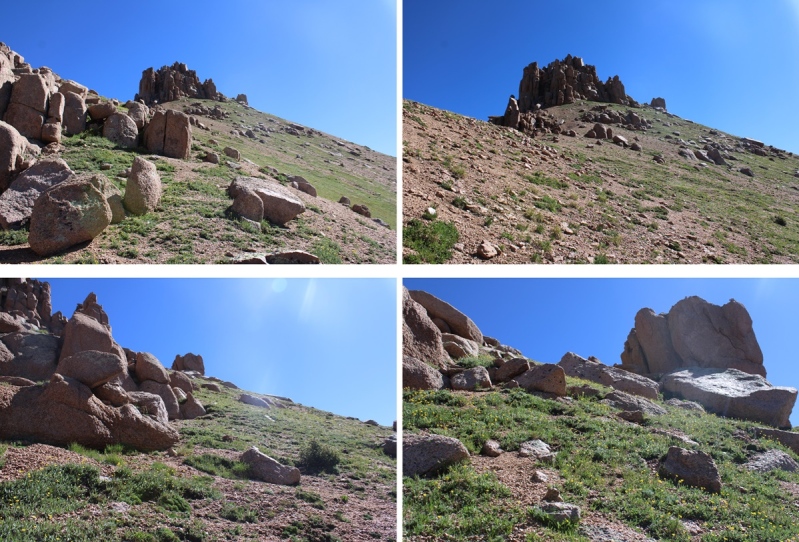
Once reaching the top of the ramp however, it became choose your own adventure, with some short class 3 climbing included at the very end. I hopped over a few rocks, and could see the summit boulder to the north. Climbing this was class 3, and a little airy, but easy access was found to the right of the summit block. 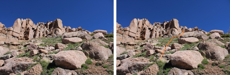
The summit block 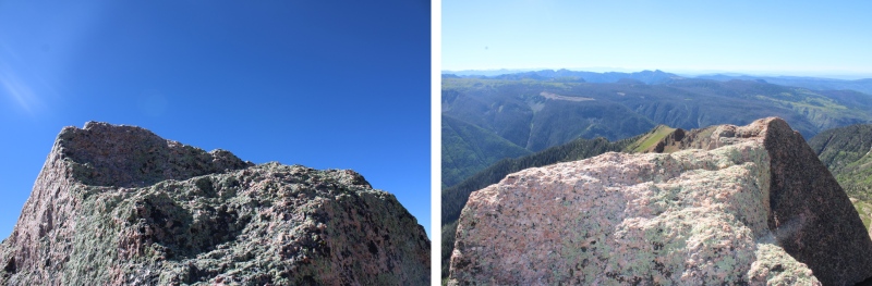
I summited Organ Mountain at 10am 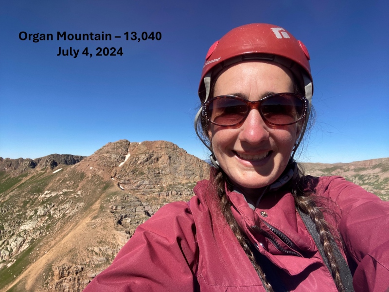
Organ Mountain:
I turned around and headed back down to the Amherst/Organ saddle. 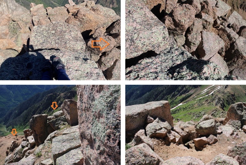
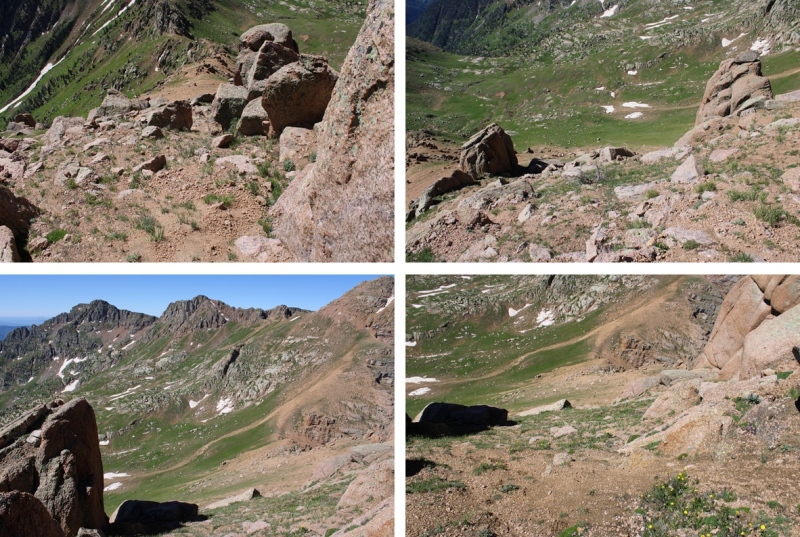
From the saddle of Amherst/Organ I made my way back over this gully, then descended to around 12400’ as I wound my way back around the basin and up to the saddle of Emerson/Peak Twenty Two. 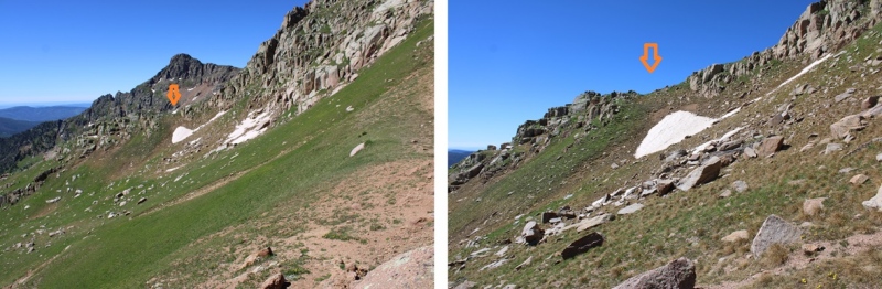

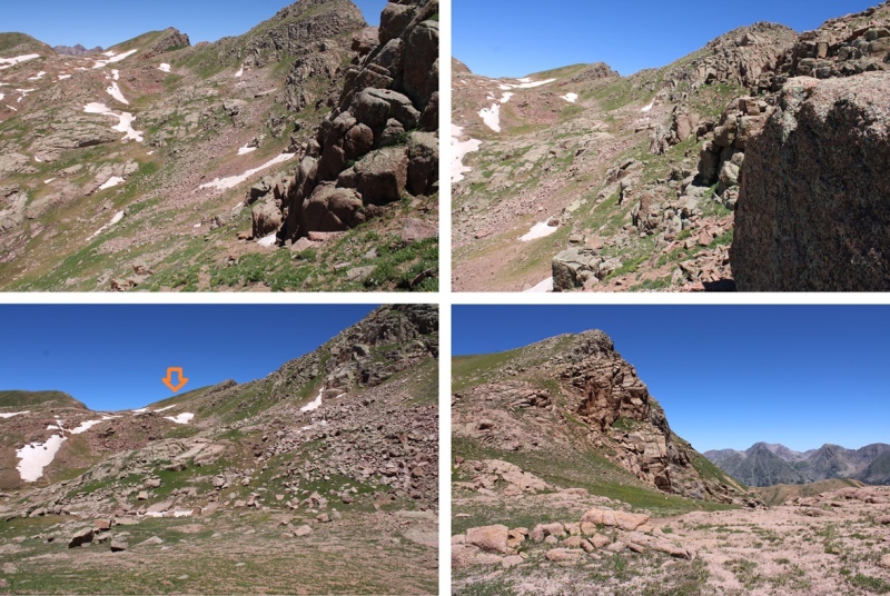
Now to head over towards Peak Twenty Two. From the saddle, I turned left and headed southeast towards Peak Twenty Two. I bypassed most of the ridge, and instead took a grassy gully towards the summit. Here’s the overall route I took to gain the summit. 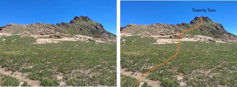
This part was easy. I just followed the tundra line up the ridge. 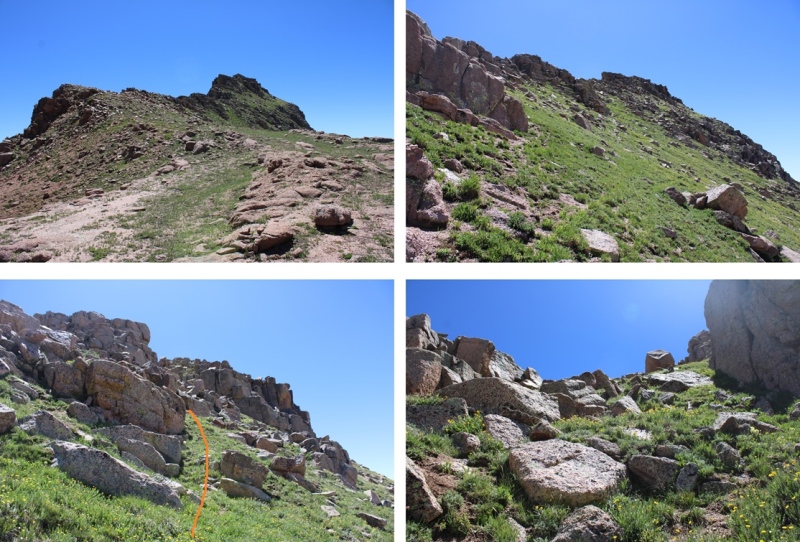
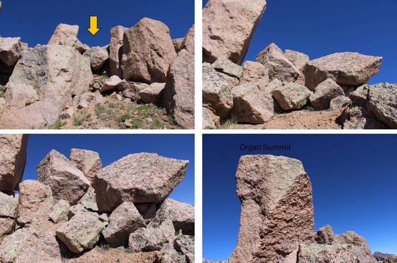
At the top of the tundra I thought I’d be at the peak, but I turned right and could see a rocky formation in front of my. I descended a few feet to the right, and skirted the rocky area. 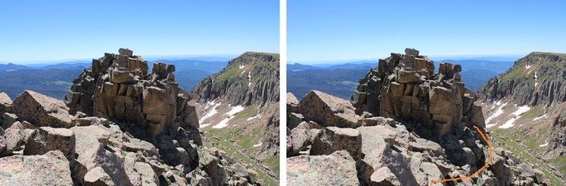
I then found a ramp and climbed up. 
This is where it became class 3, or maybe class 4 depending on which route you take. There are two more rocky ramps you can ascend. One to the right, and one to the left. I looked at both, and liked the one on the left better. They were both very exposed and required scrambling, but the one on the left felt “less” exposed. Here’s the ramp I took: 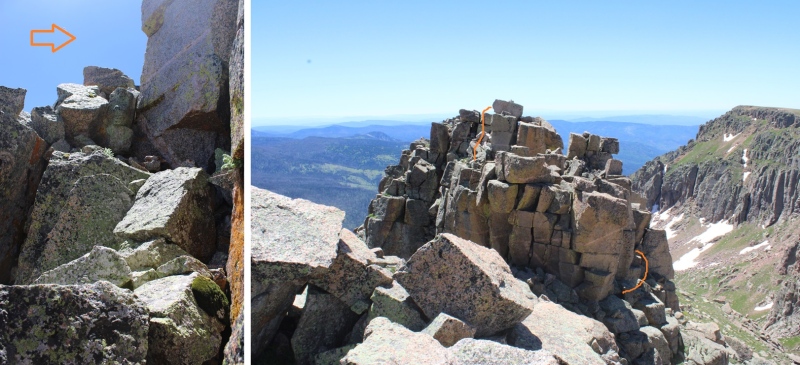
I summited Peak Twenty Two at 11:45am 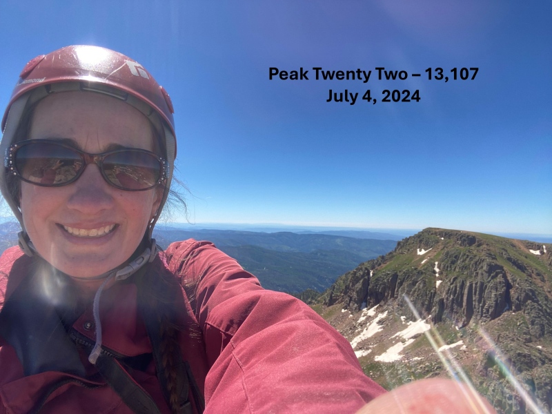
Peak Twenty Two:
I could see sheep mountain to the south, but first I was going to need to descend the way I’d come and head back towards the grassy access ramp. 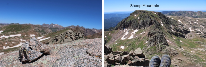
I gingerly left the summit, and headed back towards the grassy ramp. 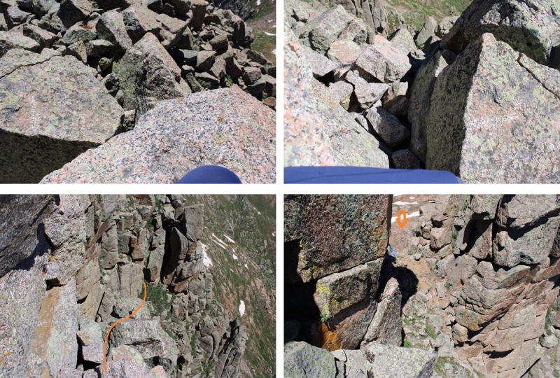
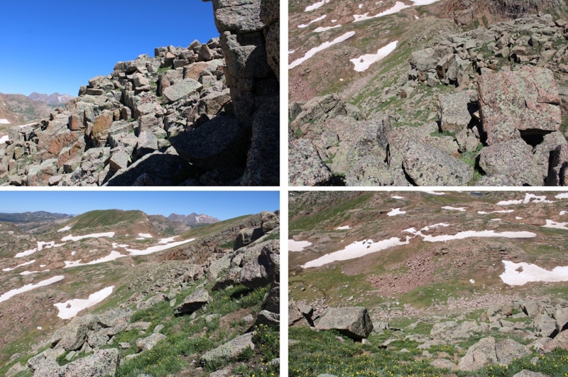
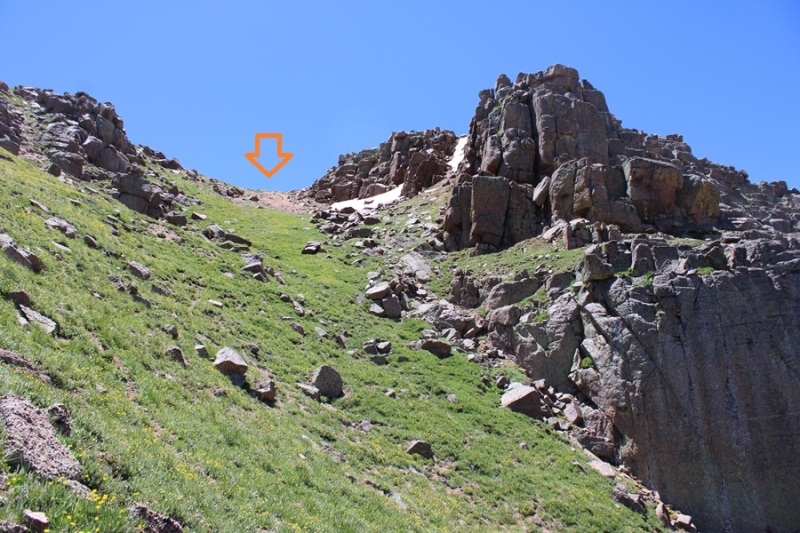
When I’d descended to about 12800’ I turned left and headed south towards Sheep Mountain. This peak was much easier to ascend, all class 2, with a few game trails thrown in. This is the route I took to gain the ridge: 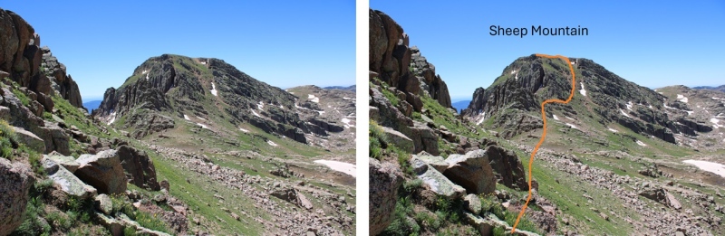
And some step by step pictures, first heading south along the tundra, then looking for a grassy ramp. 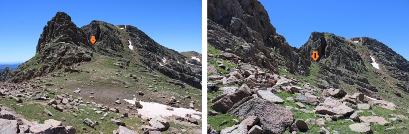
I then dropped a little in elevation, and gained the gully to the ridge. 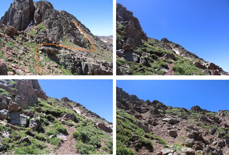
Once on the ridge, it was very flat. I aimed east and up towards the summit. 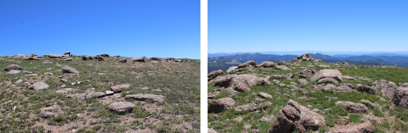
I summited Sheep Mountain at 12:30pm 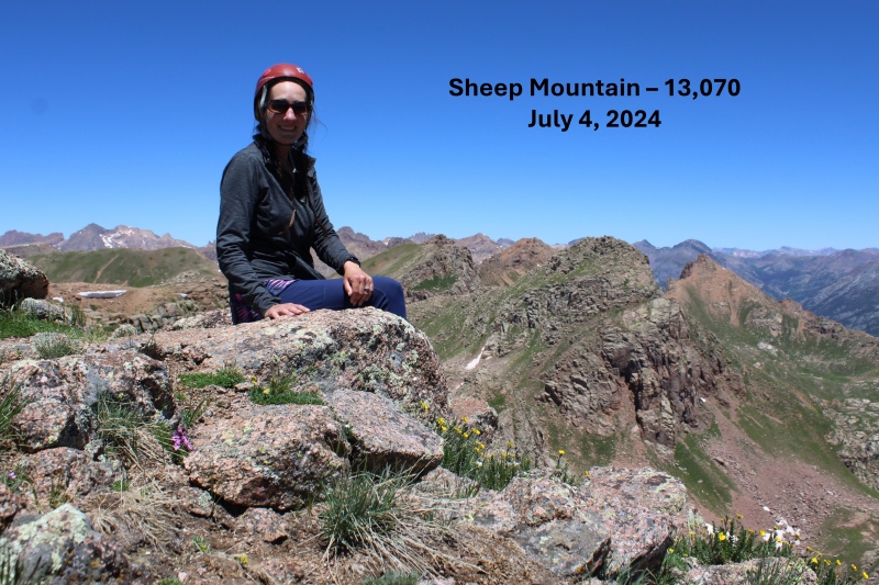
Sheep Mountain:
Now to head back to the Emerson/Peak Twenty Two saddle. I descended back down the gully, then headed north towards the saddle. 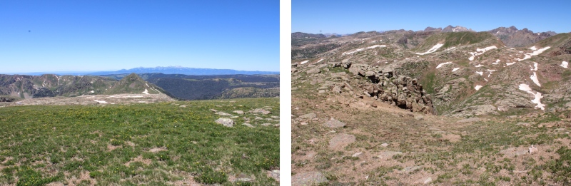
Round trip from the Emerson/Peak Twenty Two Saddle to Amherst, Organ, Peak Twenty Two, Sheep, and back to the saddle was 6.57 miles with 2550’ of elevation gain. From City Reservoir, it was 13.5 miles with 4495’ of elevation gain. 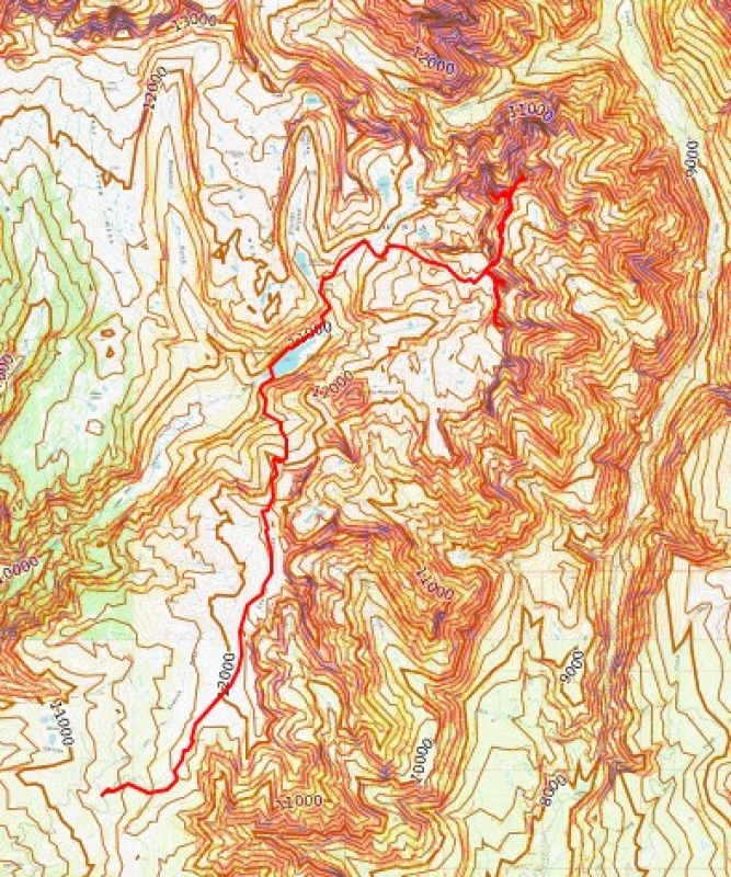
Thumbnails for uploaded photos (click to open slideshow): ")
")
")
")
")
")
")
")
")
")
")
")
")
")
")
")
")
")
")
")
")
")
")
")
")
")
")
")
")
")
")
")
")
")
")
")
")
")
")
")
")
")
")
")
")
")
")
|
| Comments or Questions |
|---|
|
|
Caution: The information contained in this report may not be accurate and should not be the only resource used in preparation for your climb. Failure to have the necessary experience, physical conditioning, supplies or equipment can result in injury or death. 14ers.com and the author(s) of this report provide no warranties, either express or implied, that the information provided is accurate or reliable. By using the information provided, you agree to indemnify and hold harmless 14ers.com and the report author(s) with respect to any claims and demands against them, including any attorney fees and expenses. Please read the 14ers.com Safety and Disclaimer pages for more information.
Please respect private property: 14ers.com supports the rights of private landowners to determine how and by whom their land will be used. In Colorado, it is your responsibility to determine if land is private and to obtain the appropriate permission before entering the property.

