| Report Type | Full |
| Peak(s) |
Darley Mountain - 13,275 feet Engineer Mountain - 13,225 feet Seigal Mountain - 13,281 feet |
| Date Posted | 07/23/2024 |
| Date Climbed | 07/19/2024 |
| Author | WildWanderer |
| From CR 20 MM 15 below Engineer Pass |
|---|
|
Darley Mountain – 13,275, Engineer Mountain – 13,225, Seigal Mountain – 13,281 
RT Length: 11.44 miles Elevation Gain: 3236’ I decided to park off CR 20 just part MM 15 on the side of the road. I could have camped at Golconda Mining Complex, but since I only needed a parking spot, not a campsite, I decided to park here. 
I was up and on the trail at 5:30am. I began by following the road towards Engineer Pass. This is a 4WD road, but easy to follow. From my parking spot, it was about 2.75 miles to Engineer Pass. 

Just before reaching the pass, and just as the sun was rising, I came upon a herd of about 500 sheep. 
They all moved and baa’d as I hiked past them, towards Engineer Pass. 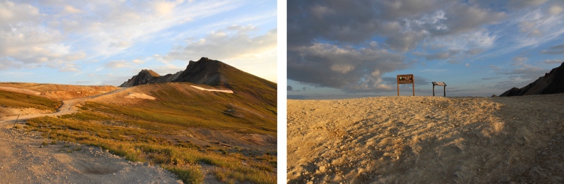
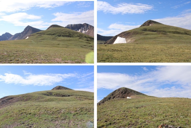
My first peak of the day was Darley Mountain. From Engineer Pass, I turned right, and headed north along the ridge towards Darley. This was all class 2, but full of loose scree and choss. Oh, and several false summits. I stuck to the ridge. Here are some pictures of the ascent. 
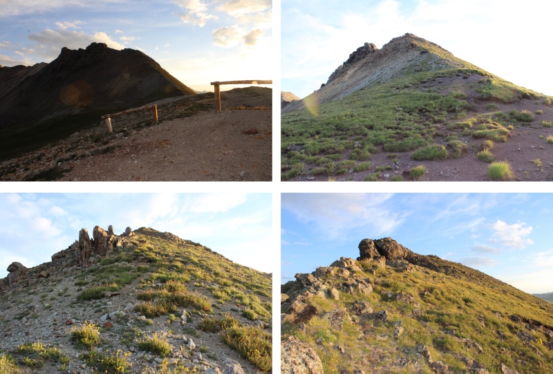
At the first false summit, I stuck to the right, following the ridge on game trails. There were game trails all the way to the summit. 
From here, you can see the next false summit. I continued following the ridge. 
And now, the next false summit. This was much the same as I’d encountered before, and I kept following the class 2 ridge. This is probably the biggest false summit of the peak. 

This is where it gets interesting. This is all still class 2, but very loose scree and chossy. Microspikes helped here, especially on the way down. There are plenty of game trails to follow here. Also, this isn’t quite the summit yet. Here’s the route I took, following the ridge to get there. 

You’re going to want to summit this blob, but it’s not the true summit. The true summit is to the left/northeast. There are game trails here to follow as well, mostly sticking to the ridge direct, but a few go to the right, and are obvious. 

The last bit was rocky, but still class 2 
I summited Darley Mountain at 7am 
Darley Mountain:
I turned around, and headed back to the Darley/Engineer saddle, using the same route to descend as I had to ascend. 
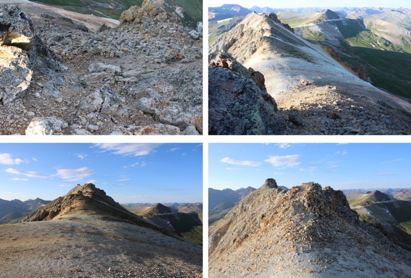


Safely back at Engineer Pass, now I wanted to summit Engineer Mountain. I continued following the 4WD road southwest, as it continued to ascend in elevation to a junction. 

At 12970’ I turned left, and followed a very steep 4WD road (closed to 4WD vehicles) east towards the summit. The summit has a class 2 boulder, no more than 5 feet wide. 

I summited Engineer Mountain at 8am 
Engineer Mountain:
To the southeast is Seigal Mountain 
I could see a dirt road in the distance, and headed south to this road. When on the road, I followed it east to the Engineer/Seigal saddle, descending about 460’ . 
Once at the saddle, I followed the road southwest up the ridge, but eventually the road ended and a slight trail began that ended as well. It was a class 2 tundra walk to the summit, fairly straightforward. It got a bit rocky at the very end, still class two, with a tundra workaround to the right. Here are some pictures of the route to the summit of Seigal. 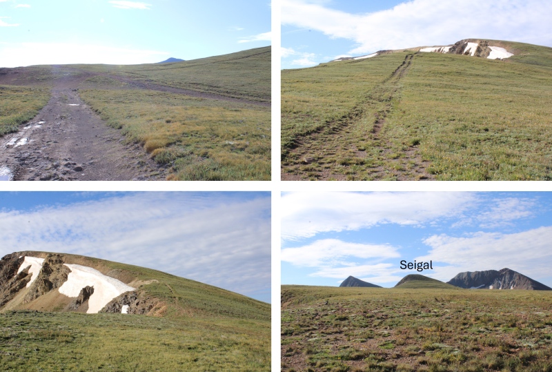

I summited Seigal Mountain at 9am 
Seigal Mountain:
I was making this a kind of loop, so I headed back down to the Engineer/Seigal saddle. 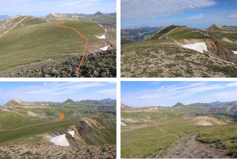
At the saddle, I headed a little further north, and found this road that topo maps said would lead me east towards Schafer Gulch. 
I followed this road, and yes, it led me in the correct direction, but what maps couldn’t tell me was this was an old mining road that hadn’t been used in years. So many years much of the road was destroyed due to avalanches or rockslides and due to the road being “closed” to vehicles, much of the road is now grass and flowers. However, enough of the road was intact for me to figure my way down. I headed east, following the road when I could, heading towards the obvious 4WD road in the distance paralleling Schafer Gulch when I couldn’t. 

If you lose the road, you can just head east on the tundra until you reach the 4WD road. It’s steep, but it doesn’t cliff out here. 
I was now on a solid 4WD road, and followed it north back towards CR 20, turning left at a junction where right went to someone’s dwelling. 
I crossed Henson Creek, and followed the road through Golconda Mining Complex back to CR 20 
Then followed CR 20 northwest towards my truck. 
I made it back to my parking spot at 10:30am, making this a 11.44 mile hike with 3236’ of elevation gain in 5 hours 
On to the next trailhead! Thumbnails for uploaded photos (click to open slideshow): ")
")
")
")
")
")
")
")
")
")
")
")
")
")
")
")
")
")
")
")
")
")
")
")
")
")
")
")
")
")
")
")
")
")
")
")
")
")
")
")
")
")
|
| Comments or Questions |
|---|
|
|
Caution: The information contained in this report may not be accurate and should not be the only resource used in preparation for your climb. Failure to have the necessary experience, physical conditioning, supplies or equipment can result in injury or death. 14ers.com and the author(s) of this report provide no warranties, either express or implied, that the information provided is accurate or reliable. By using the information provided, you agree to indemnify and hold harmless 14ers.com and the report author(s) with respect to any claims and demands against them, including any attorney fees and expenses. Please read the 14ers.com Safety and Disclaimer pages for more information.
Please respect private property: 14ers.com supports the rights of private landowners to determine how and by whom their land will be used. In Colorado, it is your responsibility to determine if land is private and to obtain the appropriate permission before entering the property.

