| Report Type | Full |
| Peak(s) |
Treasury Mountain - 13,469 feet Treasure Mountain - 13,535 feet |
| Date Posted | 08/24/2024 |
| Date Climbed | 08/03/2024 |
| Author | Mitchman98 |
| Theres Treasure Everywhere |
|---|
|
Treasury Mountain and Treasure Mountain 25 Miles, 7200ft Gain, 12 Hours Backstory For several years, I've been intrigued by Treasure and Treasury Mountains outside Marble. They dominate the view to the south as you drive down the Lead King Loop from Arkansas Mountain towards the Geneva Lake trailhead, are highly notable from the Elk 14ers, and the Crystal Mill and the marble quarry sit at their base. For years, my family has been four-wheeling out of Marble up to Lead King Basin, the Crystal Mill, and Devil's Punchbowl. My dad says this is where he learned to four-wheel drive with his mom back in the 70's, and it's his favorite area of the state. I always struggled with how I wanted to hike these peaks, as there are a couple ways you could do them:
I really wanted to do both peaks together, but knew whatever way I took, it would be an long, hard day. In 2018, I tried to mountain bike with a friend up to the Paradise Divide and hike up to at least Treasury Mountain from a base camp at the bottom of Lead King Basin, but my friend lost all of his water and the road was way rougher than I anticipated, so we turned around just above Devil's Punchbowl. This year, I'm racing the Imogene Pass run, the Pikes Peak Marathon, and hopefully doing Rim2Rim2Rim in the Grand Canyon if I'm still able to walk after those. I wanted some big days in the mountains to get ready for those races. This area came to mind to me early in the summer, and with my grandfather planning on coming out the first weekend of August, and my dad planning on taking us up to the Crystal Mill that weekend. I devised a big loop in Caltopo encircling the whole Treasure Mountain massif, going clockwise from Marble, that was estimated at around 28 miles and ~9000ft of gain. We would be driving to the Mill on Sunday, August 4th, so I decided on Saturday the 3rd to hike my Treasure Mountain loop. 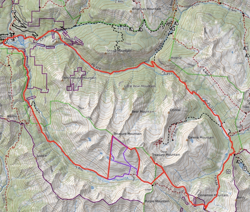
In the week leading up to the planned date, my grandfather pushed back his trip to Colorado a couple weeks, so the family four-wheeling trip was pushed back of course. I stuck to my plan of August 3rd, since NOAA was forecasting a 20% chance of storms after noon, which felt a little dicey but doable to me, and who knew if the weather would be better of worse two weeks further out. My dad, knowing it was a big day for me, offered to drive me up to Crystal and/or down from the quarry. Not wanting to risk having to bail because of storms, and happily taking out some road walking miles, and even saving myself an hour (or giving myself an extra hour of sleep), I took up his offer for a ride to Crystal. So I expected around a 21-22 mile day, with ~7500ft of gain, based on reducing my Caltopo map by the mileage and elevation gain from Marble to Crystal. We agreed on a 3am wake-up time, with the goal of having me start around 4am. Friday afternoon, August 2nd, I left from work in Colorado Springs just before 4pm. I didn't encounter too much traffic, and made it to my family's cabin in Marble at 8:30pm. I chatted with the neighbors, had some dinner, and fell asleep around 9:30. My dad arrived just before midnight. 3am came around, and we quickly packed the cars and were on our way. We shuttled my car down to the old Marble Mill Site, then we drove in my dad's Jeep up to Crystal. I scarfed down a few bars as breakfast and got up to speed on using the walkie-talkie we were going to try and use to coordinate a pickup from the quarry if I needed it or if I had an emergency, since there's no cell reception in Marble. The Hike Begins We made it to the far end of Crystal just after 4am. I shouldered my bag, turned on my headlamp, and set off into the dark at 4:10am. In the first minute, I got spooked by a deer running away in the bushes. Great start. I feel like I'm getting more scared of the dark the older I get. It didn't help that it was practically a new moon, so it was extra dark. I radio in to my dad every few minutes to test out the range, but lose contact with him after just over a mile. At 1.5 miles, I recognize I'm almost to Devils Punchbowl, with the way the cliffs drop to the road from the north/east and the rockiness of the road. I cross the bridge over the Crystal River, ascend around the corner, and higher and farther than I'd ever been on this road. 2.5 miles in, at 4:50am, the road levels out, and I have to cross the Crystal River here. It's cold and slippery going barefoot, and almost knee-deep, but it goes without too much of an issue. A few minutes later, I have to cross another stream, which, while shorter and shallower, felt colder and more unbearable than the Crystal crossing. A half mile later, 3 miles in, I cross over a culvert, and suddenly the road smooths out, the elevation gain stops, and I find myself at the bottom of Schofield Park. I take a moment to take some very early morning light pictures in this stretch. I see a couple headlights in the distance of people driving down Schofield Pass, presumably to the West Maroon trailhead. As I make further progress and the sky brightens, I make better sense of where I am, and where I will end up. 
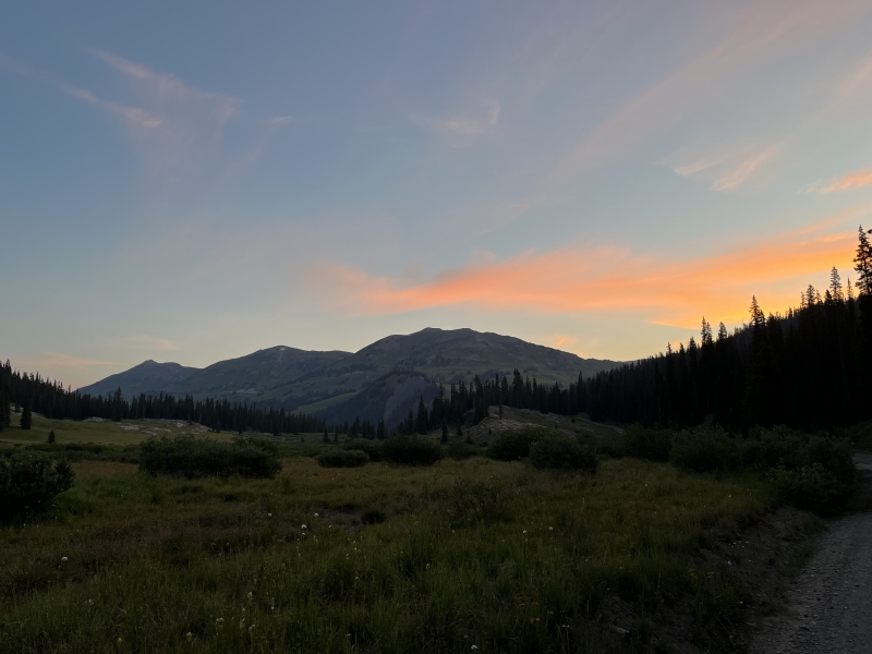
I made a sharp right turn just before Schofield Pass and start up the valley towards Paradise Divide. The sun begins to rise here, with the smoke in the air making the wispy clouds extra orange and pink. I note the skyline of Treasury Mountain that I'd be hiking up soon. The Maroon Bells begin to peek out from over the ridges. The wildflowers must be near peak. It's simply magical, and getting better every minute. 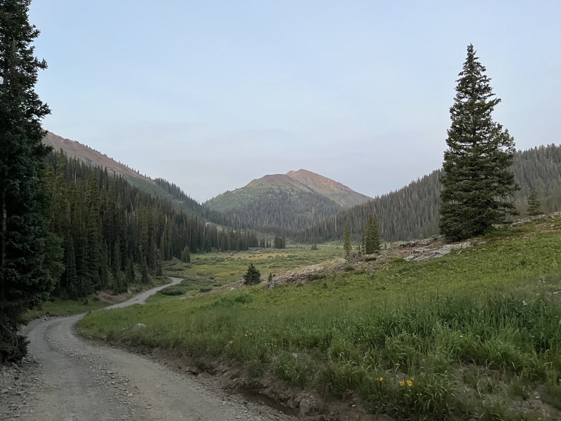
I get passed by the first truck of the day just below the summit of Paradise Divide, and make it there at about 6:40am, almost 8 miles into my day. There was a very nice reflection pond there. What a cool spot to camp at, I bet! 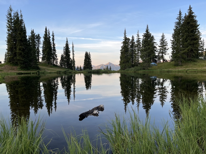
I continued up to the start of the Yule Pass trail. I suppose this used to be an old mule road, as there are parts that would be wide enough for a cart, and it has a fairly gentle grade. Other parts have begun to be reclaimed by the mountain as the gullies across it erode and thin the old road. 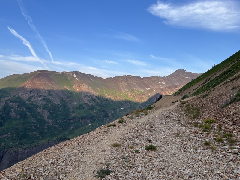
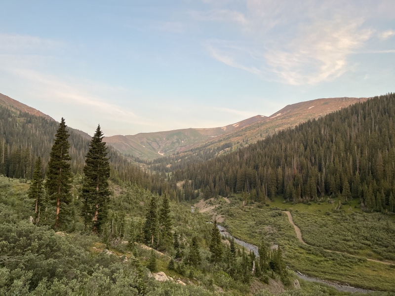
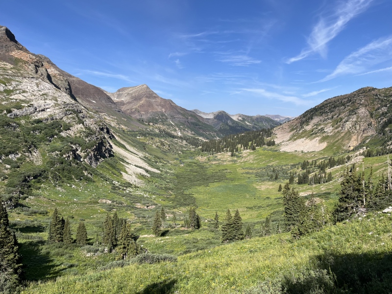
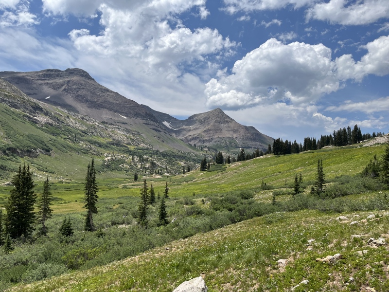
I round the corner on Cinnamon Mountain, and I see the view that inspired me to head this way. What an amazing valley up to Yule Pass! 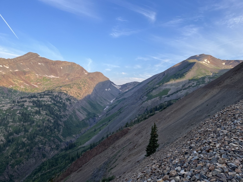
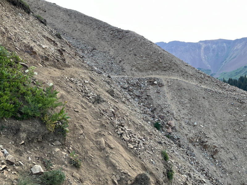
Shortly after the road passes under the Cinnamon-Treasury saddle, I took a faint social trail up the ridge, and generally followed that all the way up. There was some bushes and scree switchbacks, but nothing dense or loose. 

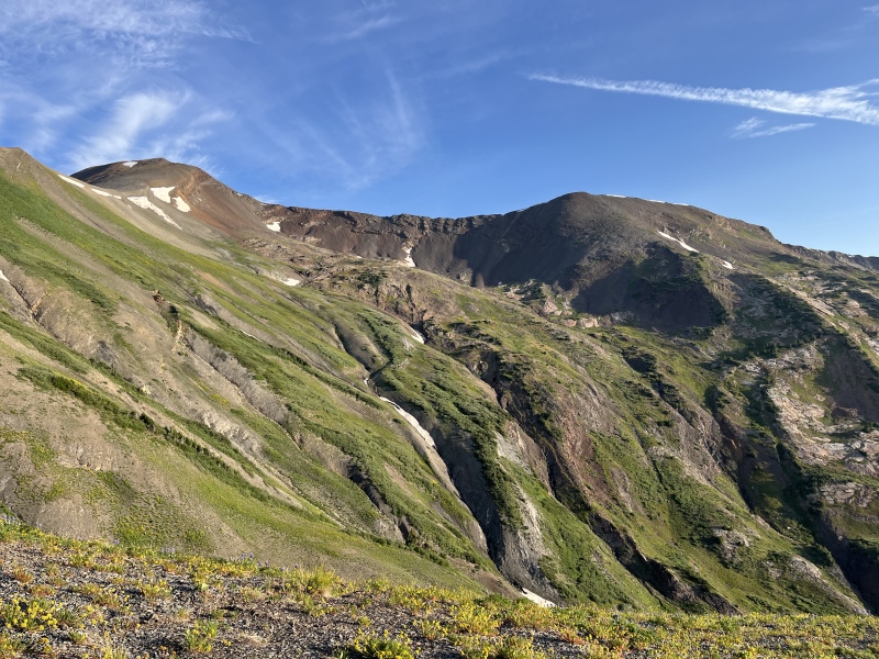
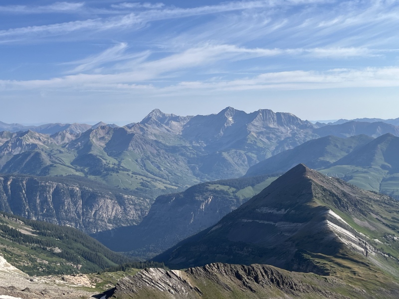
As I get higher, the views just get better and better. Even though the smoke in the air diminished the view a bit, it made for some cool layering effects of the silhouetted ridges. There's a flatter area before another long scree uphill to the false summit. 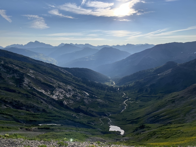
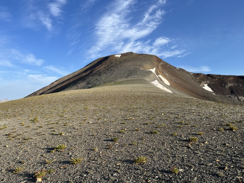
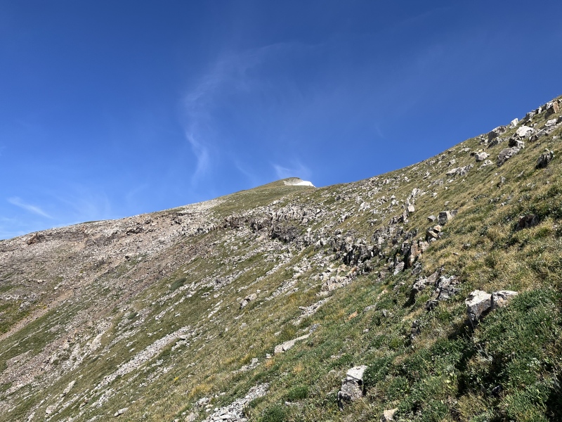
I reach the massive false summit plateau of Treasury. If it wasn't so rocky, you could hold several football games up here. 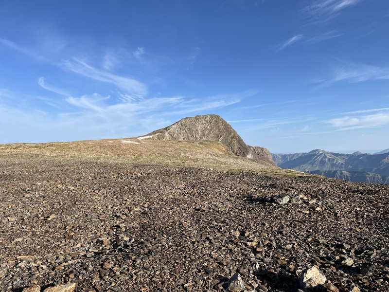
I make my way across the plateau to probably the hardest rock moves of the day, following angled slabs up the ridgeline. Plenty of exposure to the right, but plenty of options to the left if the slabs and exposure are too much. It's no more than class 2. 

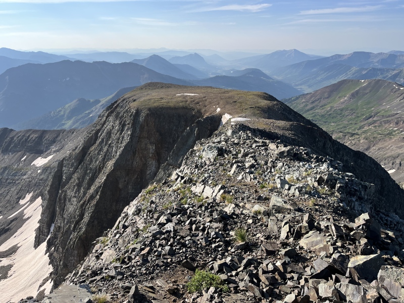
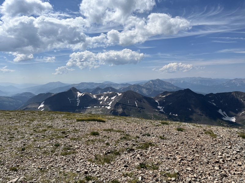
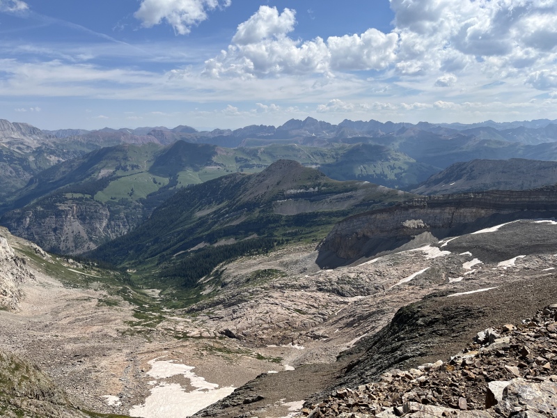
I arrived on the summit at 8:10am, 4 hours and over 10 miles into the adventure. Fantastic views of all the Elk mountains, Raggeds, and West Elks! This was what I came here for! A dream come true to be seeing all these mountains from this angle. 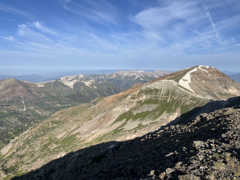
I had some snacks, then ventured north a little ways to check out the mining cable descent. It looked absolutely awful. Unsafe. Uncool. Unfun. I didn't want to get myself into a dangerous situation this far out, and that slope, solo or not, was just asking for trouble. I was 90% convinced I wouldn't take that route before this trip, now I was 100% convinced. 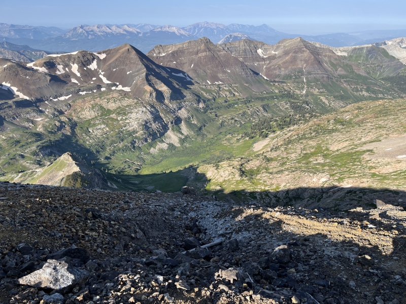
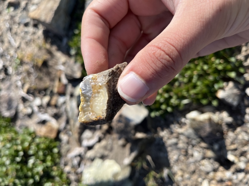
I went back up to the summit, but found some neat treasures along the way! 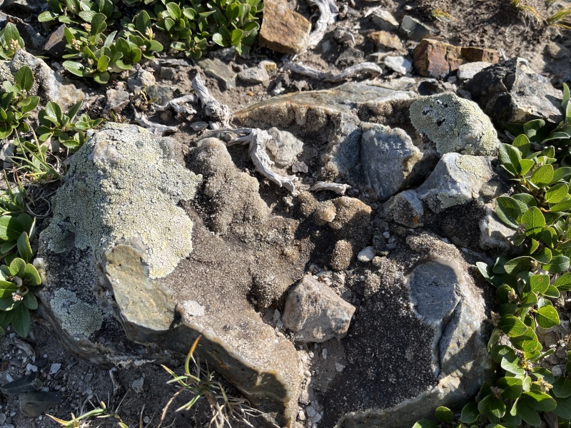
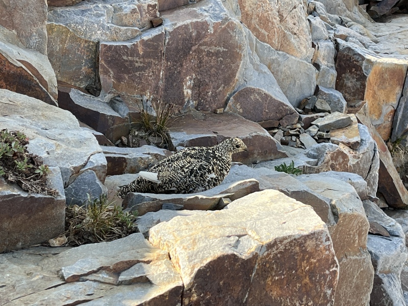
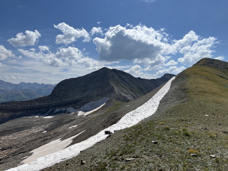
I started back down the way I'd come up at around 8:40am. I had Supranihilist's gpx track, and roughly followed that down to Yule Pass, though a little higher than he did. There was some gross loose talus along the way, but it wasn't the worst, being fairly low-angle. I spooked a ptarmigan at one point, which then spooked me when it flew up into my face, trying to get away! Sorry if anyone heard me scream up there. 
I ended up at a small saddle just north of the true Yule Pass. Here, the wildflowers really started to take off, as I descended the slope to the trail and followed it to the Yule Lakes social trail. i noticed at the junction that the Yule Lakes trail was noticeably more beat down and easy to follow than the Yule Pass/Yule Creek trail below it... 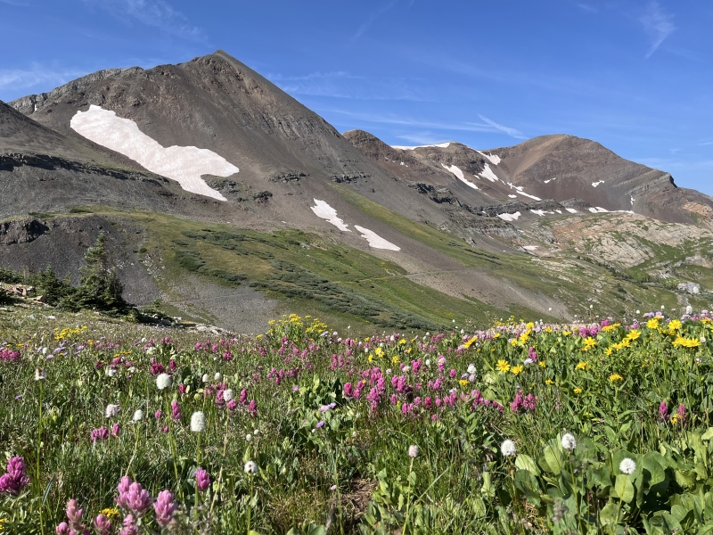
I stopped after a short ascent at a nice picnic boulder to evaluate the weather and had more snacks. It's almost 2000' of gain from here to the summit of Treasure Mountain. It was 10am, the weather was still good, and there were no puffy clouds yet. Upward I go! 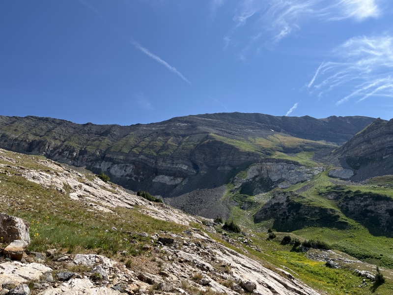
Just a couple minutes later, I came across one of my worst nightmares: 6+ foot high, trail-encroaching, flowering plants, with bees buzzing in all the flowers. 
Some background about me: I am afraid of bees and wasps and all that. Even though the sting is more of an annoyance than anything really threatening, it's hard to not imagine bees being the evil bees from Donkey Kong Country. But the tall, flowering plants, it's not all about the bees in them. I had nightmares growing up where flowers, usually dandelions, would eat me alive. Traumatizing stuff. There was a vase of orchid flowers at my grandparent's house in Florida that I would not walk past because it brushed my shoulder one time and I thought it was going to eat me. I had class pictures moved in Elementary school because I'd have to stand near a dandelion. I've had bad experiences with all the tall flowers and plants towering over me in Lead King Basin. Corn and Sunflower fields too! Just eugh, I'd rather not touch flowers and tall plants if I don't have to. I've gotten better about shorter, up to knee-high flowers. I won't go picking them or touch the flower itself, but I can pick up a bouquet of roses for my mom from King Soopers (barely) and walk through most wildflowers along trails in the mountains. But these flowers? Just a bit too much. I spent a few minutes hyping myself up, then bashed through them as quickly as I could. I was not eaten alive. Hooray! Hopefully I wouldn't have to repeat that on the way down. I followed the occasional cairn and trail segment up and along the bench until I got to the small basin Supranihilist had gone up. Most people go up to the true saddle with Treasury and over an extra hump to get to Treasure, but I was confident in Supra's description and route that this bowl wouldn't be too crazy to ascend. It wasn't so bad at all! There was a bit of talus in the middle, and some rather steep grass at the top, but it was totally doable. 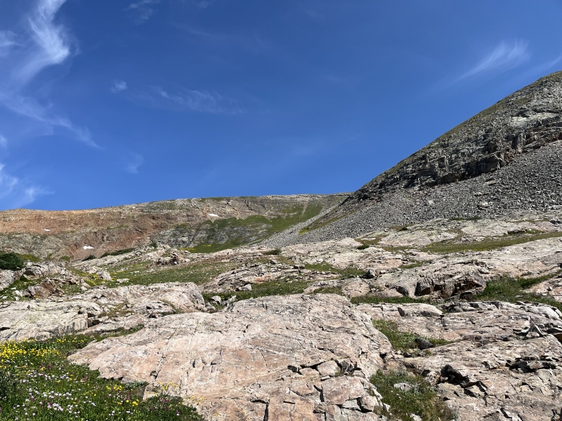
I popped up at the saddle with the hump and another false summit of Treasure Mountain. I happened to pop up right behind a group of two and their husky mix, and spotted another group of two up ahead. After not seeing anyone since Paradise Divide, it was shocking to see four people here, all of the sudden! 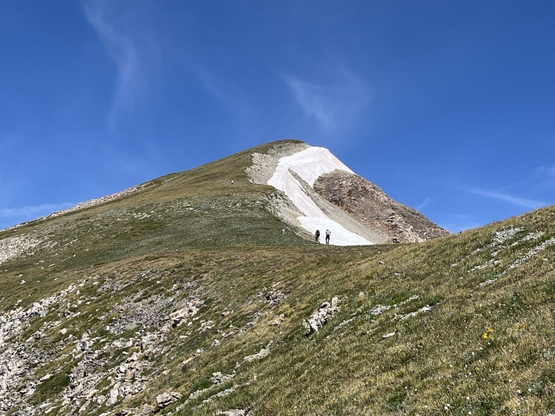
The clouds were starting to get puffy, but it looked like they were a ways off from becoming threatening. I continued up to the summit, summiting at about 11:15am. Yes! I'd summited the Treasures! But being 15 miles into my day, there was still a long way to go to Marble. I started to think my caltopo estimate was a bit on the short side. 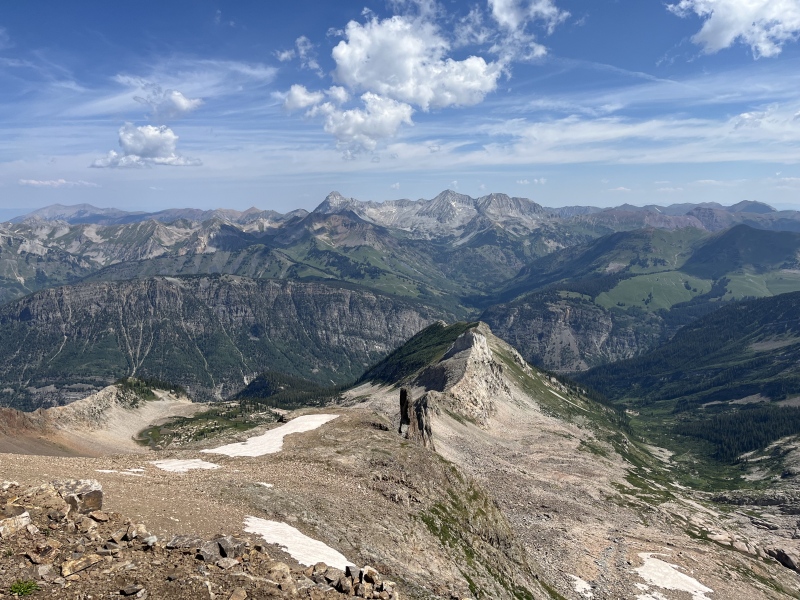
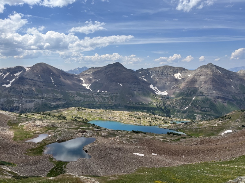
The two with the husky had camped at Yule Lakes the night before, and were curious about the route I took up. The other two on the summit, Ivey and Lynn, were just dayhiking Treasure Mountain from Crested Butte, and asked about how I got over from Treasury. I texted my parents, and tried to radio my dad, but instead got walkie-talkie traffic from people mountain biking at Mt. Crested Butte! Ivey and Lynn were talking about dropping directly off the summit to Yule Lakes. I really did want to see them, so I asked if I could join them down. We set off slightly east from the summit, then headed straight south. The bowl opened up, and we could see the largest lake below! It was a very nice turquoise shade. We stayed to the right/west side of the bowl, following grass, flowers, and mostly stable talus down. There were even some baby ptarmigans hanging out in the bowl. I might've preferred my more grassy way from my way up for going down, but would've added some extra distance to get to the lake. After we got to the upper lake, we started heading more east to avoid some cliffs above the larger lake. With some very mild bushwhacking, we ended up at what we assumed must've been the other group's campsite on the east side of the lake. 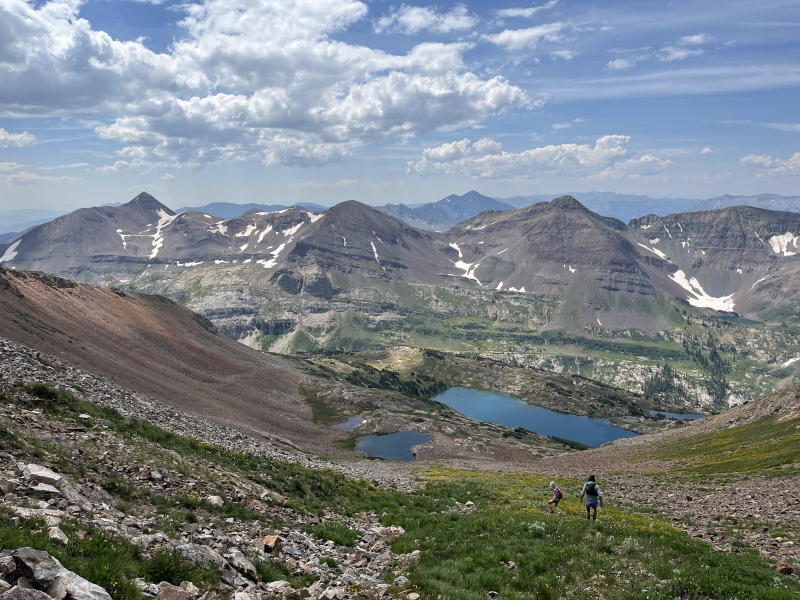
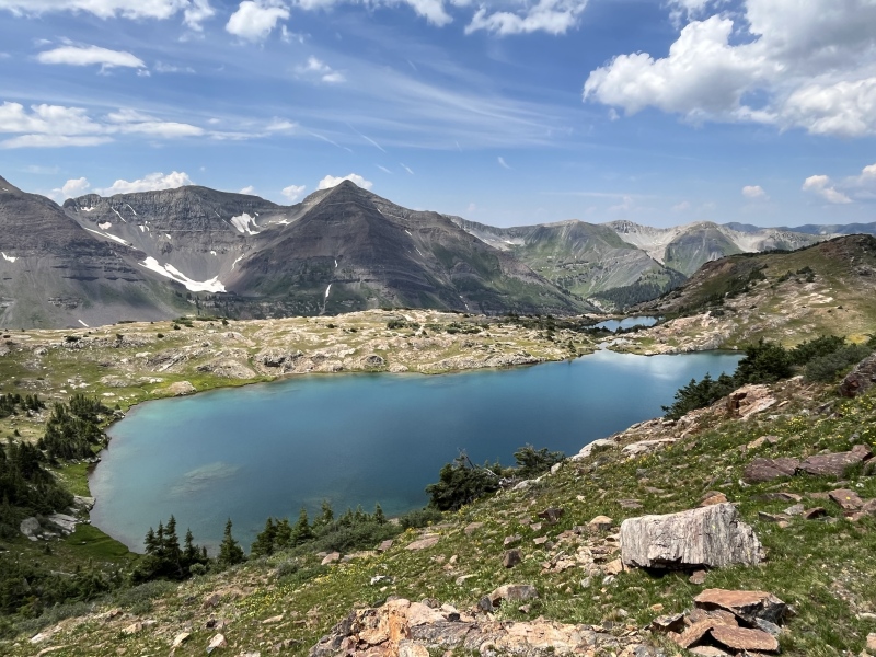
We went down to the lake shore and relaxed there for a little. What a pretty lake! I'd definitely come back here just for the lake! 
After drying off and some more snacks, we noticed the other group and their husky descending to the lake the way we'd come down. I hope they made it down safely, that can't have been easy for the dog. We left a short message by their tent, then found our way back to the social trail back towards Yule Pass. 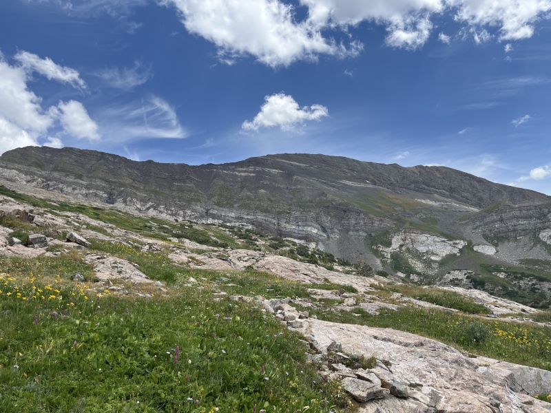
Ivey had hiked to the Yule Lakes before, and knew that there weren't many decent spots to drop down to Yule Creek early. But there was one spot, thankfully a ways before my nightmare bush from earlier. We also found another hiking couple trying to find their way towards the lake, and helped set them on the right path. I split ways, wished Ivey and Lynn a safe trip back to CB, and started heading down a pretty steep grass slope. I could see the Yule Creek trail below me, but also a sea of willows that the trail seemed to disappear in and emerge out the other side. 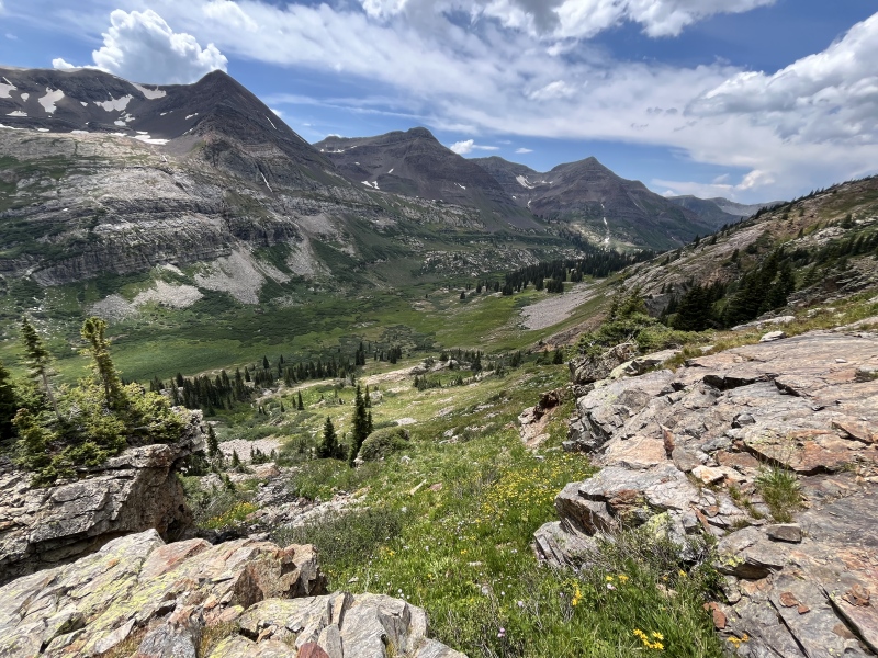
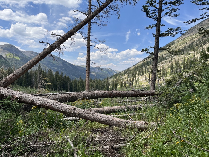
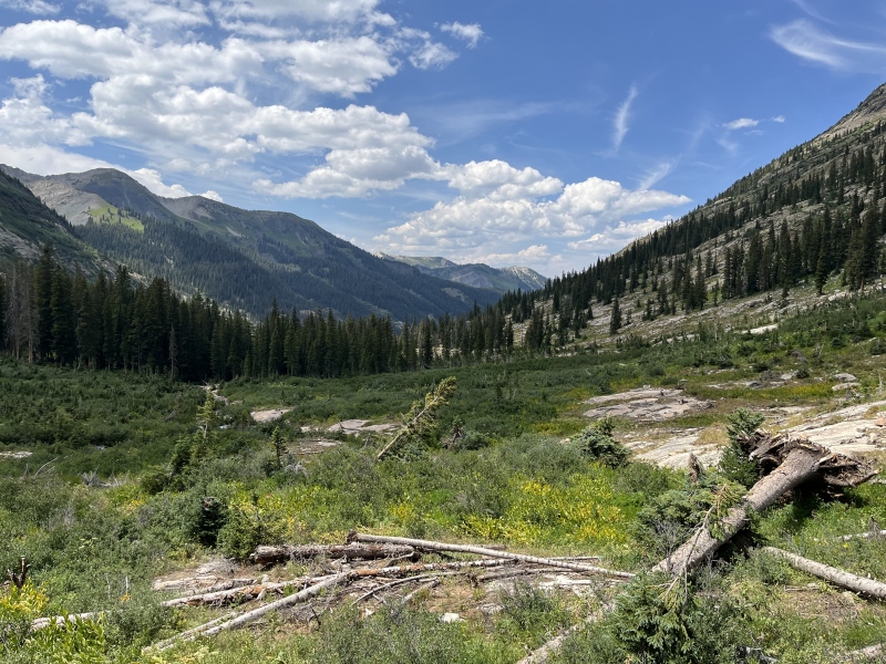
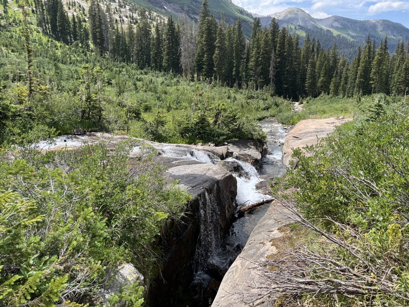
I made it down to the trail, followed it for a moment, and then lost it immediately after crossing a small stream. Ok, not too big of a deal, I'll contour just above the willows and meet up with the segment I saw from above exiting the other side. Some mildly tall plants, but nothing crazy. I got to the trail, and looking back across the willows, I saw a group further down in them, seemingly trying to fight their way through. I yelled asking if they needed any help, but I couldn't yell loud enough for them to hear me. Well, it was 1pm, and I thought, maybe I could still make it to the quarry trailhead by 2pm. That possibility quickly faded as the trail, being not often-traveled, was overgrown, sometimes with tall flowery plants, more often with thick, tall willows, and occasionally a mess of fallen trees. I lost the trail several times heading down, especially when I'd have to hop over some trees, and suddenly the trail would be gone in a sea of willows. I had heard this part of the trail was a bit overgrown, but I was not expecting this much overgrown. Unfun. It was a neat basin, with waterfalls coming off from the 12ers to the south and some cool cascades on Yule Creek itself, but it was mentally trying. This was made harder too by seeing the quarry bypass upclimb around the corner at the "end" of the valley, looking very far away, and was very demoralizing with the slow pace through the willows. 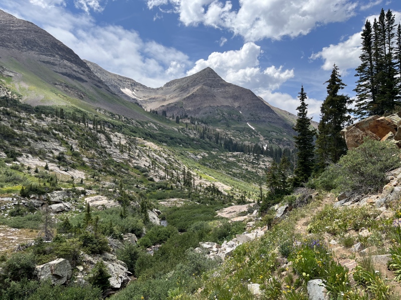
After some fumbling with my GPS, dropping it and losing it for a few minutes in the willows, finding the trail for a few minutes, losing it again, and finding it over and over again, unsuccessfully trying to radio my dad to tell him I'd be at the quarry later than 2pm, and one more scary tall flowery plant bash, I made it to the stream crossing needed to get to the trail for the quarry bypass. It was still a bit too high to rock hop, so I had to cross it barefoot. The shale in this stream was extra slippery and unstable, but my feet welcomed the cold water after 20 miles on foot. It was now past 3pm, and I still had a short climb, a steep descent, and likely a few miles of running down the quarry road back to town. This was not a 20 mile day, it would likely be almost a marathon. Oof. I was very glad I took the ride from my dad to Crystal this morning, or I'd be looking at a 31+ mile day. 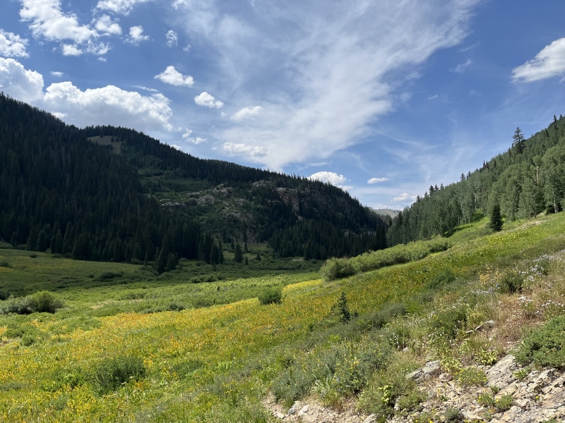
The climb up the quarry bypass felt hard, but eased up somewhat quickly. The view looking back up Yule Creek was neat, I guess. I met a couple up here who offered to give me a ride back to town if I needed it. I told them I was okay for now, but if I got to the quarry trailhead and wasn't feeling it, I'd wait for them and take them up on it. Thankfully, the trail was a lot less overgrown and better defined here, so my moving speed increased greatly. I dropped out by the quarry trailhead maybe just past 3:30pm, 22.2 miles into the day. I radioed my dad again, but no response. I felt beat, but not all dead. I mustered my pack onto my shoulders one more time and started jogging down the road. It was just steep enough I didn't have to force my legs to move, and not so steep I was ever pulling back on my speed down it. It's been maybe 15 years since I was last up this road, so it was cool seeing the valley from this perspective for the first time in a long time. 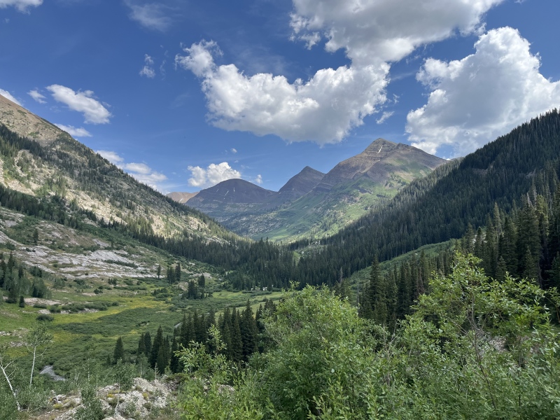
The couple from earlier passed me with about a half mile to go, and offered a ride again, but we both knew I was so close to town and I was doing alright, so I turned it down. I arrived at my car at the Marble Mill Site at 4:10pm, 12 hours after starting. I'd done it! I hiked both Treasury and Treasure Mountains, and got to see the Yule Lakes! And now I needed food, water, and electrolytes. I drove over to Slow Groovin' BBQ, got some wifi at the Marble Hub across the street to get and send messages that I was okay. My dad had ended up doing a Jeep tour for the afternoon, so I thought that was why I couldn't reach him. I also coordinated with a friend about meeting up for Harvard and Columbia the next day (which ended up just being a hike to Bear and Kroenke Lakes for me, while he did the peaks. I was destroyed). I refueled, happened to see one of the cabin neighbors from the night before at the restaurant, and caught my dad driving by at about 5:45. He swung back by a little bit later, and I had a little more food while we recapped our days to each other. His walkie-talkie ran out of batteries, which is the main reason I hadn't been able to get ahold of him. We headed back up to the cabin, packed my overnight stuff back into my car, and I headed out to Buena Vista. 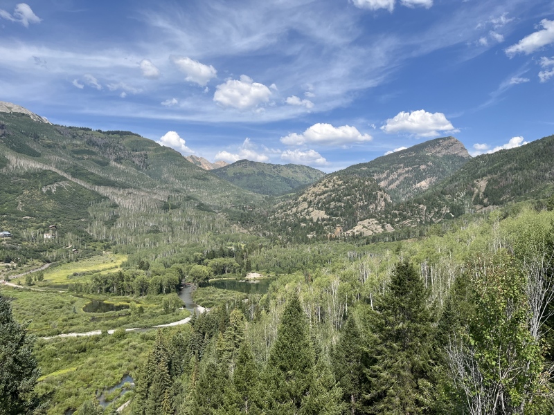
Overall, it was a great hike. Quite the adventure. I wouldn't hike up or down Yule Creek between the lakes social trail and the quarry bypass without being prepared for that bushwhack and losing the trail. It's not the absolute worst ever, but it is one of the bushwhacks of all time indeed. I definitely see the allure of the relative ease of hiking these peaks from the Crested Butte side, from Paradise Divide. Definitely stop by Yule Lakes if you have the time to, they're well worth it in my opinion. Thumbnails for uploaded photos (click to open slideshow): ")
")
")
")
")
")
")
")
")
")
")
")
")
")
")
")
")
")
")
")
")
")
")
")
")
")
")
")
")
")
")
")
")
")
")
")
")
")
")
")
")
")
")
")
")
")
")
")
")
")
|
| Comments or Questions | |||
|---|---|---|---|
|
Caution: The information contained in this report may not be accurate and should not be the only resource used in preparation for your climb. Failure to have the necessary experience, physical conditioning, supplies or equipment can result in injury or death. 14ers.com and the author(s) of this report provide no warranties, either express or implied, that the information provided is accurate or reliable. By using the information provided, you agree to indemnify and hold harmless 14ers.com and the report author(s) with respect to any claims and demands against them, including any attorney fees and expenses. Please read the 14ers.com Safety and Disclaimer pages for more information.
Please respect private property: 14ers.com supports the rights of private landowners to determine how and by whom their land will be used. In Colorado, it is your responsibility to determine if land is private and to obtain the appropriate permission before entering the property.


