Download Agreement, Release, and Acknowledgement of Risk:
You (the person requesting this file download) fully understand mountain climbing ("Activity") involves risks and dangers of serious bodily injury, including permanent disability, paralysis, and death ("Risks") and you fully accept and assume all such risks and all responsibility for losses, costs, and damages you incur as a result of your participation in this Activity.
You acknowledge that information in the file you have chosen to download may not be accurate and may contain errors. You agree to assume all risks when using this information and agree to release and discharge 14ers.com, 14ers Inc. and the author(s) of such information (collectively, the "Released Parties").
You hereby discharge the Released Parties from all damages, actions, claims and liabilities of any nature, specifically including, but not limited to, damages, actions, claims and liabilities arising from or related to the negligence of the Released Parties. You further agree to indemnify, hold harmless and defend 14ers.com, 14ers Inc. and each of the other Released Parties from and against any loss, damage, liability and expense, including costs and attorney fees, incurred by 14ers.com, 14ers Inc. or any of the other Released Parties as a result of you using information provided on the 14ers.com or 14ers Inc. websites.
You have read this agreement, fully understand its terms and intend it to be a complete and unconditional release of all liability to the greatest extent allowed by law and agree that if any portion of this agreement is held to be invalid the balance, notwithstanding, shall continue in full force and effect.
By clicking "OK" you agree to these terms. If you DO NOT agree, click "Cancel"...
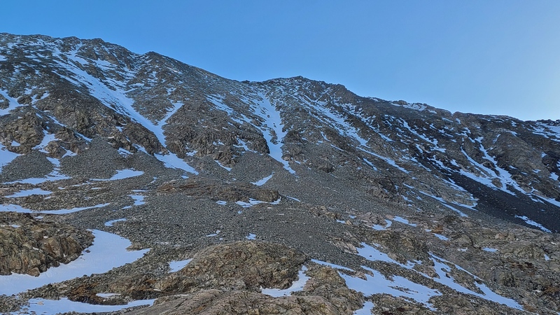
There aren't many opportunities for good snow climbs in the Sangre, so I'm always on the lookout for one. I'd already done the thirteeners to the north pre-LiDAR, so when LiDAR demoted previously ranked Point 13,654 and moved the summit south along the ridge I wanted to try something different. Some gullies on the southwest flank of the peak looked promising so I waited until conditions were good in the Sangre, which is typically earlier than other ranges, and went for it.
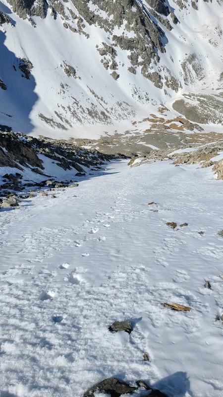
I'll spare you the details of the South Zapata Creek trail, considering there's already tons of reports for the other peaks in the area that describe it. I hadn't chosen any particular gully before I started so I just scoped them when I neared South Zapata Lake. Some looked better than others. I ended up taking pretty much the farthest and highest viable gully as the rest were already too melted out. It too was getting thin - a few more days and I think parts of it would have been melted out.
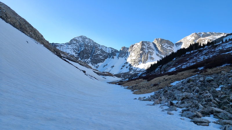
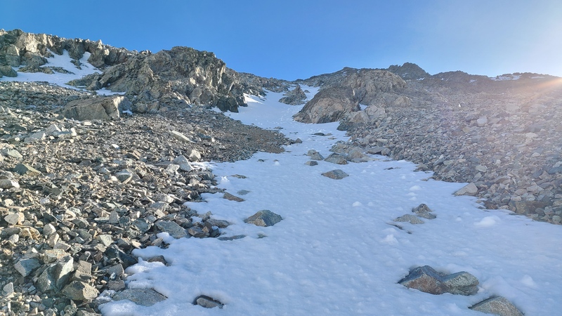
Nearing South Zapata Lake with Ellingwood Point on left.The gully I climbed up.Partway up and already thin.
The gully twisted and turned occasionally, and had some scrambling on loose rock, but thank god for the snow - this route would probably be horrible dry, if it even worked at all.
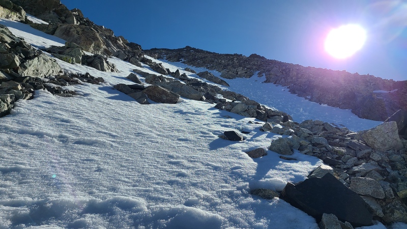
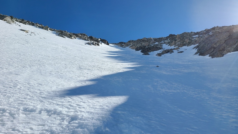
Loose junk mid-gully.Better snow in the upper half to third.Looking down most of the gully.
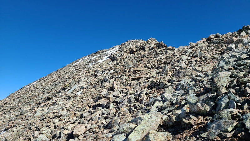
All told I got something like 900 vert out of the gully before it dried near the ridge.
Ugly but relatively short-lived.
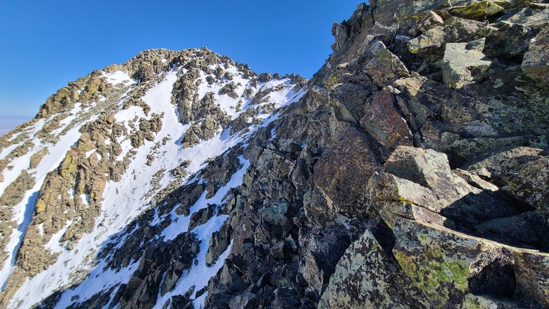
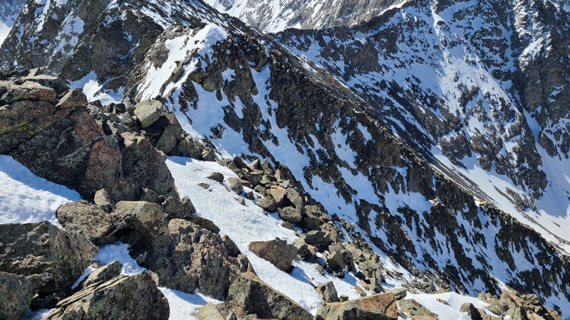
I took off my crampons here and traipsed across the awful, loose talus to a small point where the route became snowy but solid Class 3. I was too far from my crampons now so I just scrambled carefully with no traction.
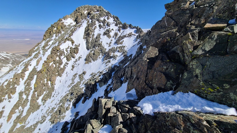
Start of the scramble, which was sustained Class 3 traversing to the summit.Looking back towards the gully (not visible but it's in between the foreground and background slopes; taken on descent.)Another shot towards the summit with my tracks visible in center and below the ridge. (Taken on descent.)Looking back to the start of the scramble, tracks traversing across snow. (Taken on descent.)
The views from this lofty spot were spectacular, as expected.
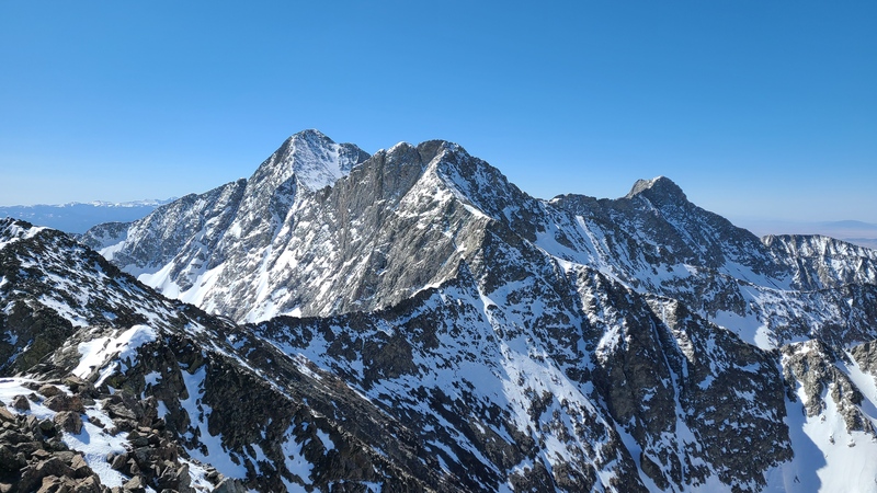
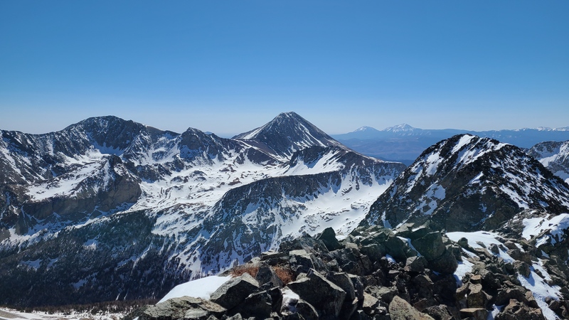
Blanca, Ellingwood, and Little Bear.Lindsey.
My time on the summit was short since it was hotter than hell and I wanted to get down before the snow followed. The scramble back to the gully was slow but once I got my crampons back on I zipped down the gully to the lake, back to the dry trail and down to the trailhead.
All told this route worked better than expected. A week or two earlier would have been even better; keep that in mind if you take this snowy Sangre alternative!
Statistics
Climbers: Ben Feinstein (myself) Trailhead: Zapata Falls
Total distance: 12.31 miles Total elevation gain: 4,891feet Total time: 7:53:59 Peaks: one ranked thirteener
Point 13,656
Splits:
Starting Location
Ending Location
Via Time (h:mm:ss)
Cumulative Time (h:mm:ss)
Rest Time (m:ss)
Zapata Falls Trailhead
Point 13,656
4:30:48
4:30:48
3:38
Point 13,656
Zapata Falls Trailhead
3:19:33
7:53:59
Trip End
My GPS Tracks on Google Maps (made from a .GPX file upload):
Nice route! The ridge direct in winter for all the 13ers sucked. Sucked so bad I bailed into the California basin on the way back. This route bypasses all the suckage.
It might even be a safe route in winter despite the high slope angle due to the aspect. Definitely a good way to avoid doing the ridge twice in proper conditions, anyway.
I did the C2 twice when it was dry. I think that means I am doubly the idiot! LOL! Doing any of those gullies in snow looks like the ONLY way to go.
Nice report!
Caution: The information contained in this report may not be accurate and should not be the only resource used in preparation for your climb. Failure to have the necessary experience, physical conditioning, supplies or equipment can result in injury or death. 14ers.com and the author(s) of this report provide no warranties, either express or implied, that the information provided is accurate or reliable. By using the information provided, you agree to indemnify and hold harmless 14ers.com and the report author(s) with respect to any claims and demands against them, including any attorney fees and expenses. Please read the 14ers.com Safety and Disclaimer pages for more information.
Please respect private property: 14ers.com supports the rights of private landowners to determine how and by whom their land will be used. In Colorado, it is your responsibility to determine if land is private and to obtain the appropriate permission before entering the property.

")
")
")
")
")
")
")
")
")
")
")
")
")