| Report Type | Full |
| Peak(s) |
Mt. Shavano - 14,230 feet Tabeguache Peak - 14,158 feet Mt. Antero - 14,271 feet Mt. Princeton - 14,200 feet Mt. Yale - 14,200 feet Mt. Columbia - 14,075 feet Mt. Harvard - 14,424 feet Mt. Oxford - 14,158 feet Mt. Belford - 14,202 feet Missouri Mountain - 14,071 feet |
| Date Posted | 08/20/2024 |
| Date Climbed | 08/15/2024 |
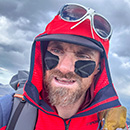
| Author | vermontster |
| Nolans 14 thru hike (aka slowlans heavy) |
|---|
|
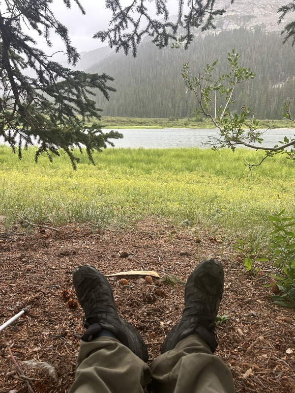
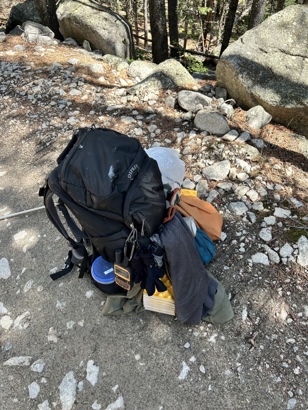
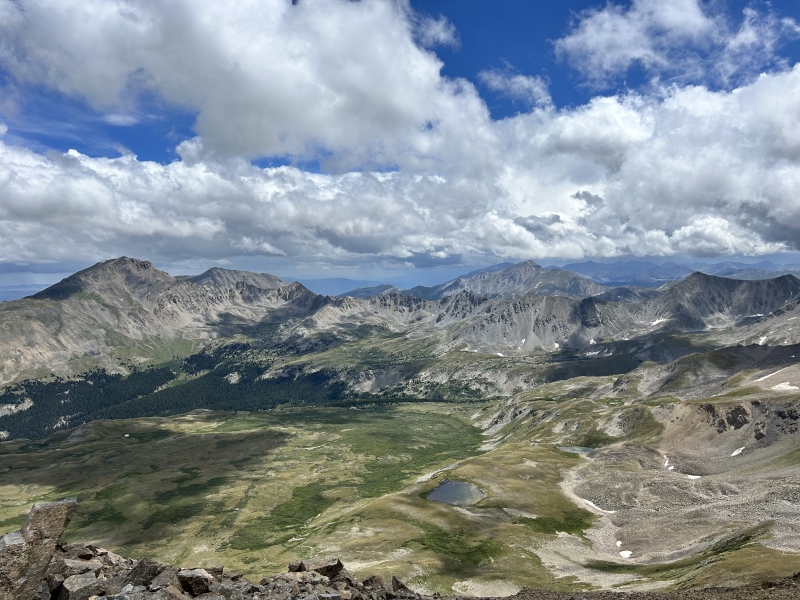
Last week I finished solo thru hiking the Nolan's 14 line in 149 hours. I got some good advice from threads on this forum so I'll add my 2c. I'm really only a climber and had never done a thru hike or any kind of backpacking more than a few days. I really just like to climb and scramble, which is what made Nolans appealing to me. I set out looking for a week-ish long romp through the Sawatch hoping for lots of bushwhacking and scrambling, and man did I find it. What an epic line. Gear: I like to be comfy when camping and with it being August expected bad weather. I brought the whole kit and caboodle minus a stove-- 2p tent, 15deg bag, pad, 3 pair socks, lots of layers, battery banks etc. I used a smartwater w/ filter and had a 2L bladder. I filled up my 55L pack, never weighed it but an uncomfortably heavy base weight for what I was after. Thought it would be a cool challenge to do a heavy Nolan's hike as I hadn't seen anyone complete one successfully. I am calling this style SLOWLANS HEAVY. Don't think I would recommend it, more on that later. I should also point out I used a gpx track I found on https://slowlans.longmayyourange.com/ that Justiner has been working on so I didn't get too off track. Thanks! I didn't really use much of the rest of the guide as I wanted some of the adventure of finding my way but in retrospect it turns out I followed the Nolans line almost exactly, so +1 for it being a good resource. In that respect, I'll attach my gpx track below in caltopo form (its too big for the native 14ers attachment). Day 1: Shavano, Tabeguache My driver dropped me about 6 mi short of the shavano trailhead due to understandable concerns over the dirt road and his low-clearance car. I didn't make it to the trailhead until around 12:30pm. At this point I knew there was really only hope in doing 2 of the 3 peaks I wanted to complete that day. To make matters worse, it rained the entire time I was on the mountain from there on out. I had never seen such low clouds and persistent rain- it felt like a spring day in new england, not colorado. Needless to say my entire person was waterlogged along with all my belongings. Mercifully, there was never (or rarely) thunder and I was able to bag shav and tabe without much incident, aside from one of my poles breaking grrrrrr 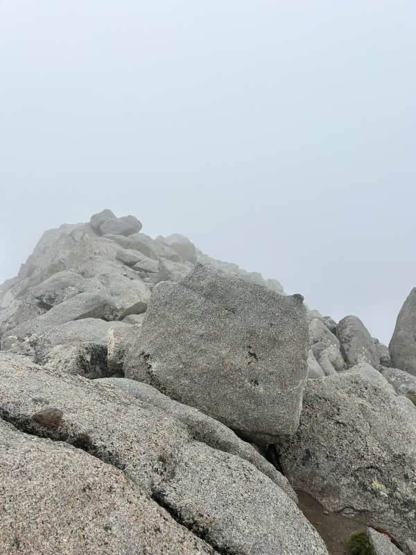
Totally water logged and with the day getting late I began the descent to browns creek, first heading down to the saddle and then making a steep traverse/descent to a lower angle spine down to treeline. Perhaps due to weather, this was by far the most heinous, scary, uncomfortable section of the entire line. The boulders were the perfect goldilocks size- not too big to stay still, and not too small to kick around, just perfect to break your ankles if they rolled on you. The number of minifridge sized boulders knocked loose was nothing short of horrifying. I would treat this upper section off the saddle with extreme caution and would not attempt in bad weather. After reaching tree line I found a mercifully easy creek crossing, got up about 100 feet to get out of the creek cold and made camp. Day 2: Antero, Princeton Began the day putting on my water logged and cold clothing, and set out for antero. Quite a few folks out in 4x4s. Stashed my bag at the bottom of the antero trail so could just run up and back. Headed down to the basin on the normal 4x4 track to alpine. The trail to Princeton is quite nice below tree line and starts behind the alpine cemetery. At the top of the creek near tree line I took a more direct route to the ridge. The weather had been bad, lots of thunder behind me, but was clearing up quickly so I figured I would continue. This ridge is probably the most serious of the few class 3 sections on the Nolans route. I actually found it quite enjoyable even with a heavy bag, but it is long and tiresome. It is scrambling but is super easy and mostly a traversal. It was getting dark and I opted for the Nolans descent north to maxwell gulch. I was tired and camped just above treeline. A mistake as ripping winds came through that night and kept me up. Day 3: Yale I initially set out to do yale, columbia, and harvard this day but upon checking my map realized it was a whole 10 miles on the CT to the base. I had a resupply on the pass road but actually didn't end up taking food because I had so overpacked. Yale was a nice mountain, and an excellent trail up. The same cannot be said for the descent. I opted for the Nolan's line looking for an exciting and fast descent but in retrospect this is the one variation I would make on the "traditional" Nolan's route. The very steep grades, loose footing, and water-logged terrain made for a crushing bushwhack through downed trees and saplings. I was beginning to realize how much my 55L pack got in the way bushwhacking. Errata from a crashed C47 was strewn along the slope. After being bested by a tricky creek crossing at the base I decided to gain about a thousand feet on Columbia and go to sleep. 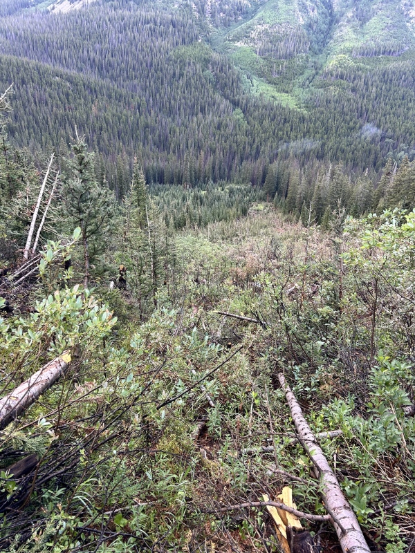
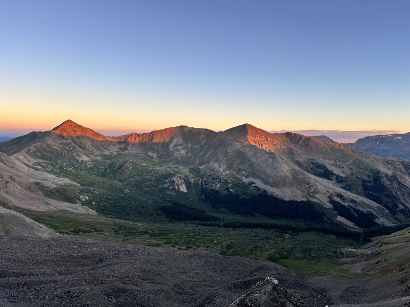
Day 4: Columbia, Harvard Was up Columbia in no time and started the arduous traverse to Harvard. With a large pack the boulder field is a real pain to pick through and the way up Harvard's backside is steep and loose. Decent chances for rockfall actually, one of the only places on the route where I would be concerned. I chugged up Harvard but by the top I was feeling very short of breath, almost asthma like symptoms (I don't have asthma). I was a bit concerned by this, and figured my stronger legs had really did a number on my weak lungs- I suppose I underestimated the elevation aspect of the route. I took an alternative way down Harvard and spent the rest of the afternoon eating, swimming in the creek, and checking out old mining cabins. Oh, I also broke my other pole and resorted to sticks. That caused problems for the skin on my hands. Day 5: Oxford, Belford, Missouri Perhaps my favorite day. Got up Oxford without issue, morning storm clouds were a little scary but cleared up over Belford as I headed out on the quick jaunt between the peaks. Heading down to Missouri was my favorite section of the whole line. The Nolan's route takes an back bowl that's totally secluded and feels very wild, with stunning views of the divide. Going up Missouri was not so bad, and quite a bit easier than Harvard. Descending on trail was a relief. I had hoped to do Huron that same afternoon (got to Clohesy around 3pm) but a raging thunderstorm rolled in and trapped me there for the night. Day 6: Huron, La Plata Chugged up Huron that morning, a laborious boulder field and tiring scree slope made it relatively difficult for the distance/gain. A few surprised hikers saw me emerge up the wrong side of Huron and had questions on my route and large bag. It was nice to get to stash my bag there and hit the summit weight free. Jogged down to Winfield, where I ate lunch and noticed all the leadville 100 streamers. Headed up La Plata in the afternoon, getting back down the other side around 4-5pm. A long walk on the highway awaited, and once finding the cairn headed up echo creek to my site for the night. I cannot stress this enough, CROSS THE CREEK EARLY. Do NOT attempt to bushwhack up the left side of the creek for any amount of time. It was dark by then and I had the worst side hilling experience ever in thick brush. Finally, after crossing the creek, I found the trail (it goes up the right side of the creek, not the left) and made a late camp. Day 7: Elbert, Massive Early wake up and saw a nice sunrise going up bull hill. A fair warning if you start at night- the bull hill trail goes right through an old mining outpost that's very spooky in the dark. Overall an awesome way up Elbert, didn't see a single other person until the summit. Headed down the crowded normal trail. By this point I was out of food, and a very generous couple that were also doing Slowlans the other direction offered me a snack after chatting about my progress. Thanks! This was the first day I really broke from the "normal" Nolans way, opting to add extra miles by doing Massive as an out and back on the usual trail so I could leave my bag at the bottom. Totally worth it, and avoided a steep descent of Elbert. Got up Massive mid afternoon as the weather again luckily cleared up, and was at the Hatchery by around 8. Takeaways: There was a perverse pleasure I took in bringing such a ridiculously heavy bag up all these 14ers, and dragging it through densely wooded forests. It was certainly cumbersome, but I think added to what is already a kind of absurd line. It was also very nice to have a real tent given it rained almost every single night, and to not have to faff with resupplies. If you're going in August, I would recommend the tent, probably just have a few more resupplies and go a bit faster to save weight. For my first time in the Sawatch and first thru hike I loved and would really recommend this line if you're into suffering and bushwhacking, just take your time with it and have fun. The Nolan's variations are awesome and worth suffering through. If you're comfortable scrambling or soloing easy alpine stuff you'll have no problem reading the weather and moving well above tree line, in my opinion. The terrain is mostly friendly, and is beautiful. Just keep in mind if you want to sleep 8-9 hours every night, you still have to move pretty fast during the day to finish in ~150hr, or at least faster than I was anticipating. Overall an awesome line to hike solo and such a memorable and challenging experience. 
Thumbnails for uploaded photos (click to open slideshow): ")
")
")
")
")
")
")
")
")
")
")
")
")
|
| Comments or Questions | ||||||
|---|---|---|---|---|---|---|
|
Caution: The information contained in this report may not be accurate and should not be the only resource used in preparation for your climb. Failure to have the necessary experience, physical conditioning, supplies or equipment can result in injury or death. 14ers.com and the author(s) of this report provide no warranties, either express or implied, that the information provided is accurate or reliable. By using the information provided, you agree to indemnify and hold harmless 14ers.com and the report author(s) with respect to any claims and demands against them, including any attorney fees and expenses. Please read the 14ers.com Safety and Disclaimer pages for more information.
Please respect private property: 14ers.com supports the rights of private landowners to determine how and by whom their land will be used. In Colorado, it is your responsibility to determine if land is private and to obtain the appropriate permission before entering the property.