| Report Type | Full |
| Peak(s) |
"S 4" - 13,256 feet |
| Date Posted | 08/19/2024 |
| Modified | 08/20/2024 |
| Date Climbed | 08/19/2024 |
| Author | WildWanderer |
| From Blue Lakes Trailhead |
|---|
|
S4 – 13,256 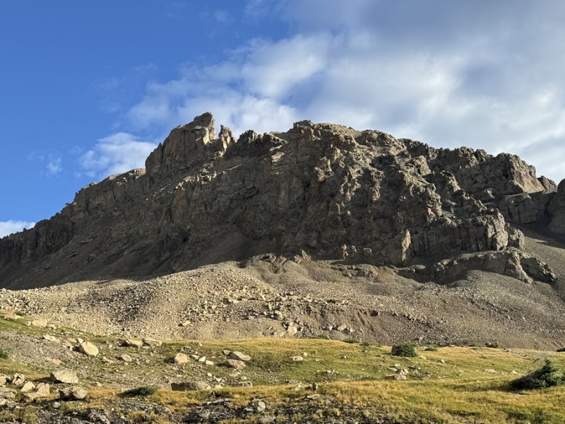
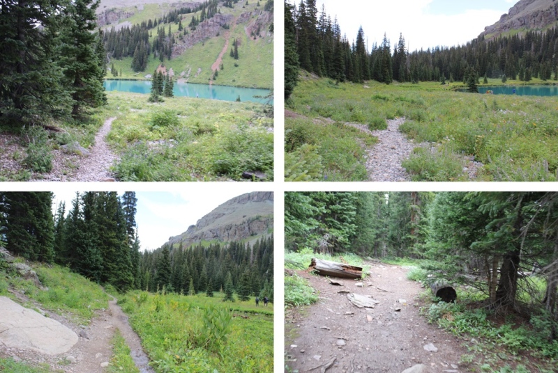
RT Length: 11.57 miles Elevation Gain: 4082’ There were only two other vehicles in the lot when I parked at the Blue Lakes Trailhead. It was raining, so I waited for the rain to stop, and was on the trail at 5am. The trailhead starts at the south end of the parking area, and is clearly marked. 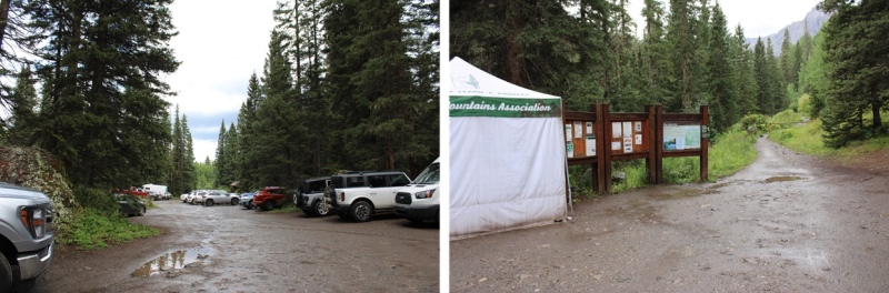
Immediately after the trailhead there’s a junction. I went right, taking the Blue Lakes Trail. 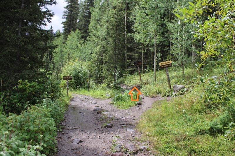
This was the only junction until I made it to Blue Lakes. I followed the trail 3.5 miles to Blue Lakes. About 2.5 miles into the hike it started raining again, and I had to take shelter for a bit under a tree. However, the trail was class 1, and easy to follow the entire way. 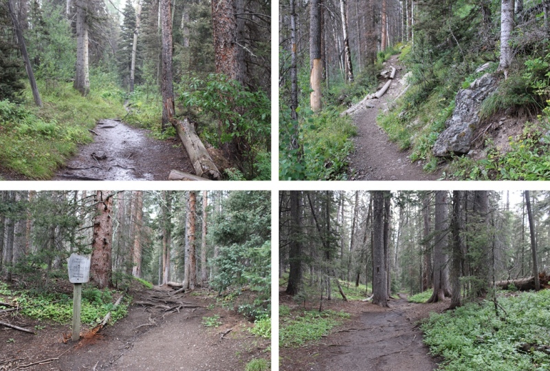
There was an easy creek crossing 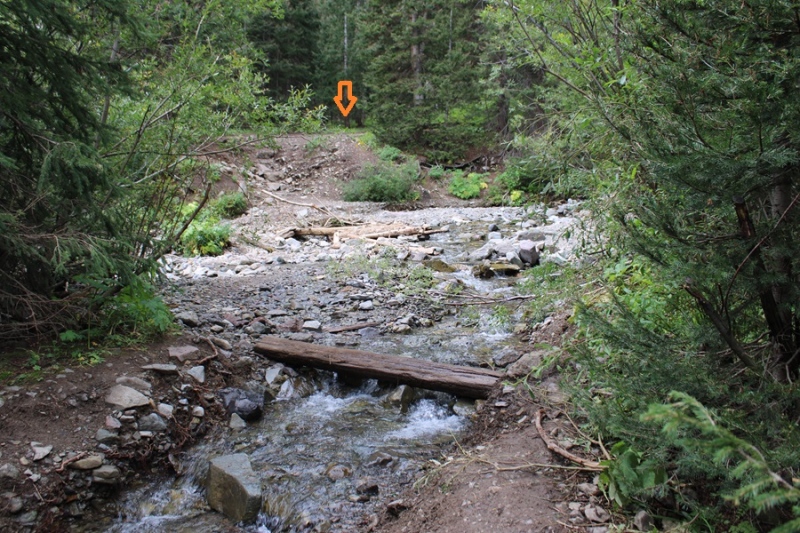
And then I continued my way up to Blue Lakes 
Once I arrived at Blue Lakes, there were several social trails to campsites. I stayed on the trail closest to the lake, skirting the west side, towards a creek flowing into Blue Lakes. 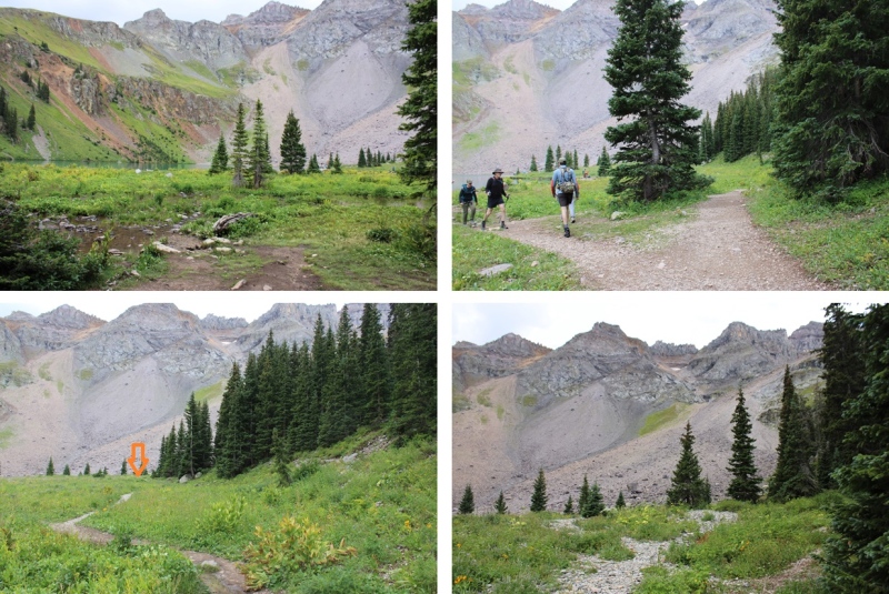
At the last campsite before the creek, I followed the drainage on the right side of the creek up to treeline. 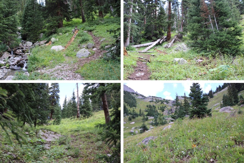
Once at treeline, or at least very close in a wide open space, I crossed the creek and headed west up the slope, keeping the creek to my right. 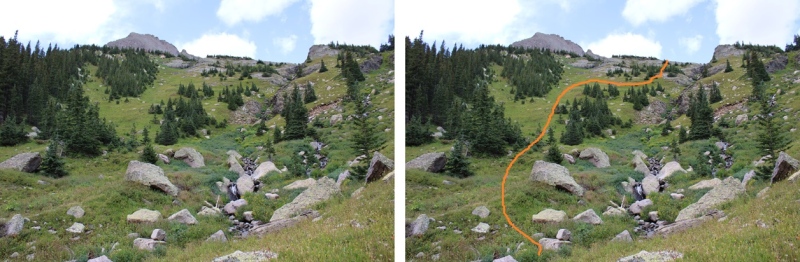

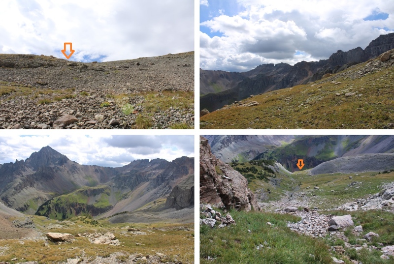
At the top of the slope I continued heading west, staying on the tundra. You can go right and use the talus, but it’s going to be a LONG day of talus, and I’d rather use the tundra when available. 
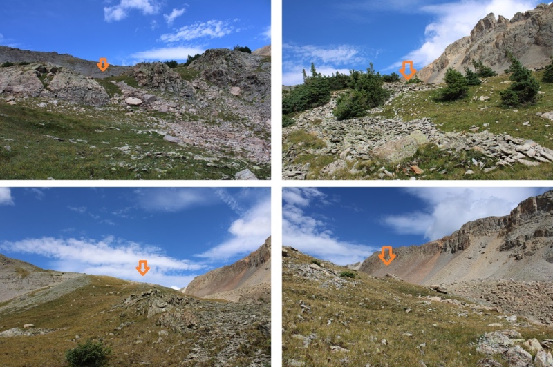
At about 12330’, I went right and dropped about 50 feet down to the talus. There is a game trail here on the talus that will bring you to the upper basin. 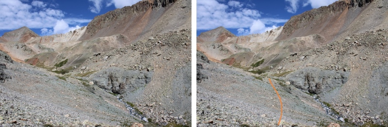

Once in the upper basin, there will be an obvious drainage to the right. I went through the drainage, rock hopped for a bit, and then ascended 600’ of the worst talus ever to a gully. I put on my helmet and started up. Here’s the overall route: 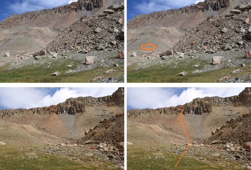
As I ascended further up the gully, the talus became looser, but there were also areas of sand mixed with scree. The rain that morning had turned the sand into a thicker substance, which gave me some much needed traction. When you enter the gully, stay to the LEFT. I tried to stay to the right because it looked more stable, but found I was unable to cross over to the left when the time came, because I was now in an hourglass, and traversing it meant rocks above and below me would give way in a rockslide towards the base of the gully, like a funnel (or an hourglass). After the first few attempts at traversing from up high and sliding several feet before stopping, I downclimbed and re-traced my steps up this part of the gully, sticking to climbers left. Also, if you’re doing this with other people (in your group or not) stay clear when someone is in the gully, and even if you don’t think anyone is below you on your descent, yell to see if anyone is there. Large rocks will fall as you ascend and descend (there’s nothing you can really do to prevent it). 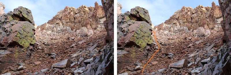
Keep heading left, until the scree ends 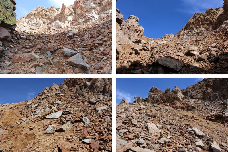
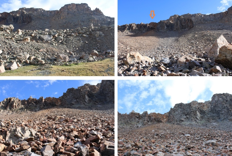
Once the scree ends, if you haven’t already, now is the time to put on your helmet. The rest of the summit is class 3 and class 4 on the loosest terrain I’ve ever experienced. NOTHING is stable. Trust nothing above, in front of, or below you without attempting holds several times to make sure they are solid. There is large kitty litter on solid rocks, loose talus, and rock slabs that look stable but are hanging precariously, especially from above. From the top of the gully I headed east, to follow the ridge. Here’s the route I took: 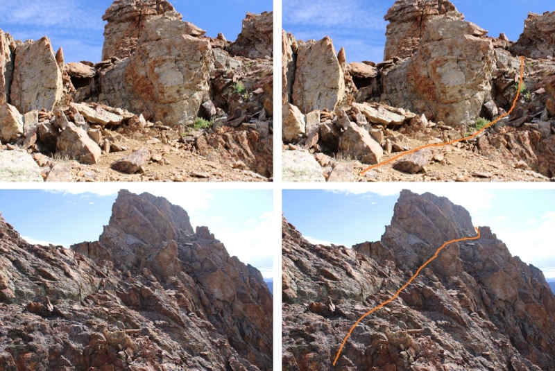
You should now have a good view of the class 4 chimney to the summit. This is a very loose chimney, and it stops halfway and starts again. Even the large boulders are loose, so be careful with hand and footholds until you’re sure it won’t move. I started out by climbing straight up the center, until I came to a “y” where both sides looked perilous. I decided the right side looked more protected. The were both loose, sometimes with just large wobbly boulders stacked on top of each other to climb, and sometimes what looked like 10 foot boulders sitting atop rocks the size of a microwave. Between the two chimneys, there’s probably 40 feet of climbing. I wouldn’t trust an anchor here: too many of the boulders are loose. (There weren’t any anchors set up). 
Here’s the overall route I took: 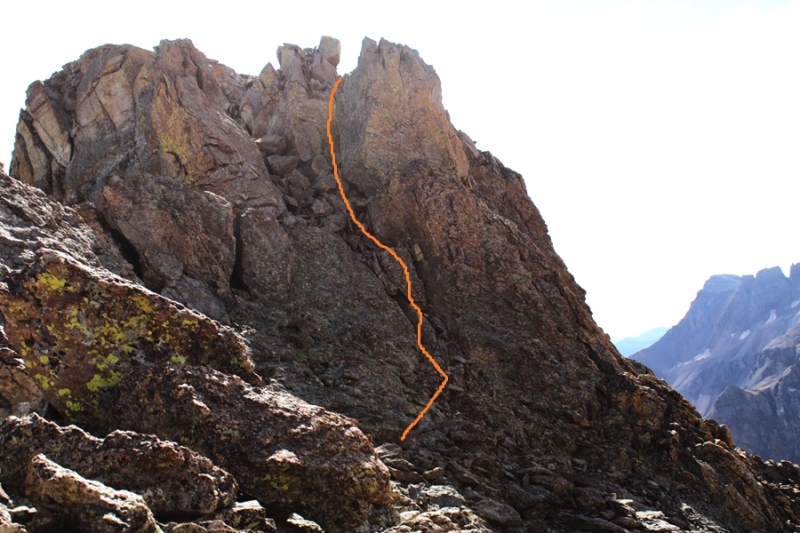
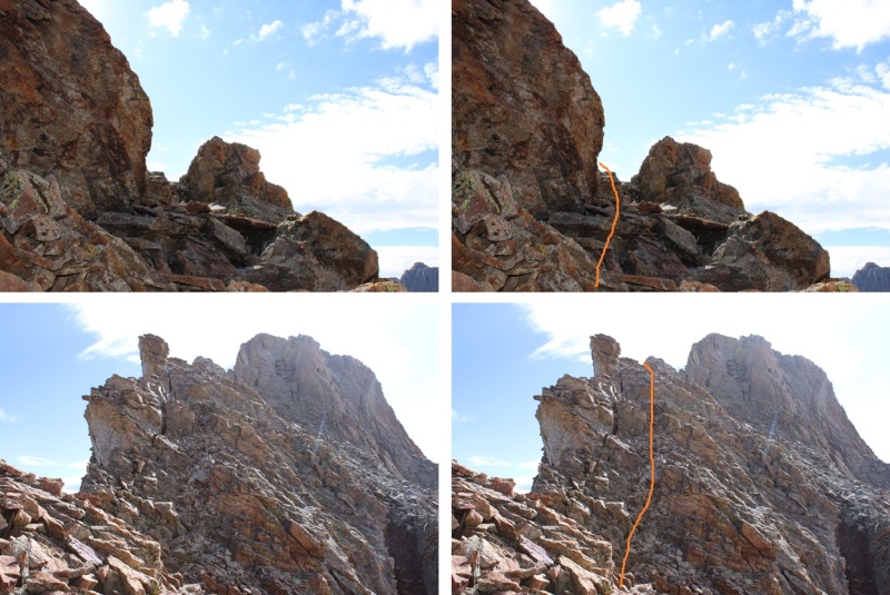
And some closer pictures of the chimney(s) Chimney 1: 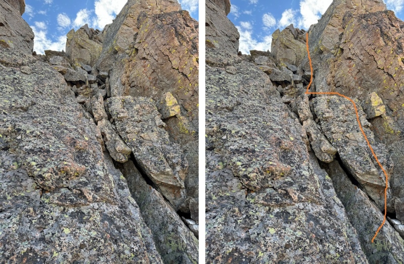
Chimney 2 
From the top of the second chimney to the east you can see the route you scramble up to the summit 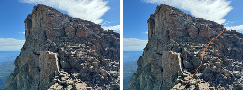
But wait! There’s more! Keep heading east, and climb down and then up this rock slab covered in kitty litter. It’s not tall, maybe 7 feet, but another fun surprise! 
And then it’s a quick walk to the actual summit, on… you guessed it, more talus! 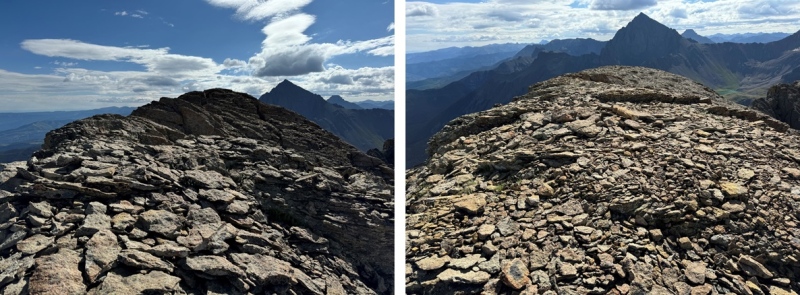
I summited S4 at 9:40am S4: 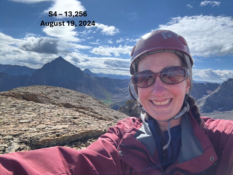
And now to head back. I re-traced my steps to the chimney(s) 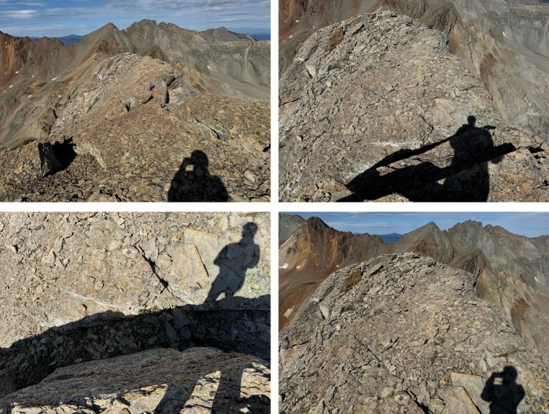

Safely down the chimney(s), I made my way back to the top of the gully. 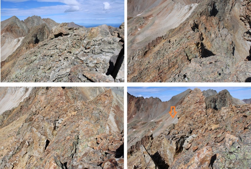
Here are some pictures of the descent down the gully 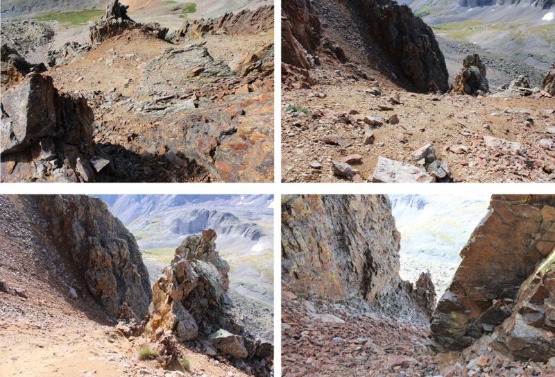
And the route down into the basin 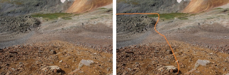
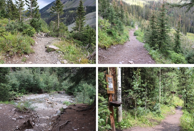
Once in the rocky basin, I stayed to the right of the creek and descended on the talus to the tundra towards Blue Lakes. 
I headed east back to treeline and crossed the creek 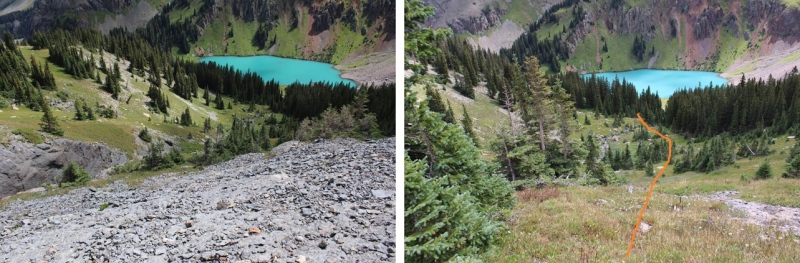
Then headed north back towards the Blue Lakes Trail 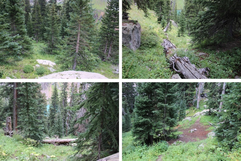
And followed the trail in the rain all the way back to the trailhead 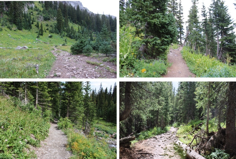

I made it back to the trailhead at 12:30pm, making this an 11.57 mile hike with 4082’ of elevation gain in 7.5 hours 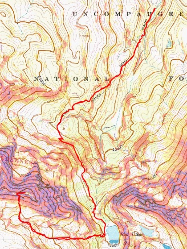
On to the next trailhead Thumbnails for uploaded photos (click to open slideshow): ")
")
")
")
")
")
")
")
")
")
")
")
")
")
")
")
")
")
")
")
")
")
")
")
")
")
")
")
")
")
")
")
")
")
")
")
")
")
")
")
")
")
|
| Comments or Questions |
|---|
|
|
Caution: The information contained in this report may not be accurate and should not be the only resource used in preparation for your climb. Failure to have the necessary experience, physical conditioning, supplies or equipment can result in injury or death. 14ers.com and the author(s) of this report provide no warranties, either express or implied, that the information provided is accurate or reliable. By using the information provided, you agree to indemnify and hold harmless 14ers.com and the report author(s) with respect to any claims and demands against them, including any attorney fees and expenses. Please read the 14ers.com Safety and Disclaimer pages for more information.
Please respect private property: 14ers.com supports the rights of private landowners to determine how and by whom their land will be used. In Colorado, it is your responsibility to determine if land is private and to obtain the appropriate permission before entering the property.

