| Report Type | Mini |
| Peak(s) |
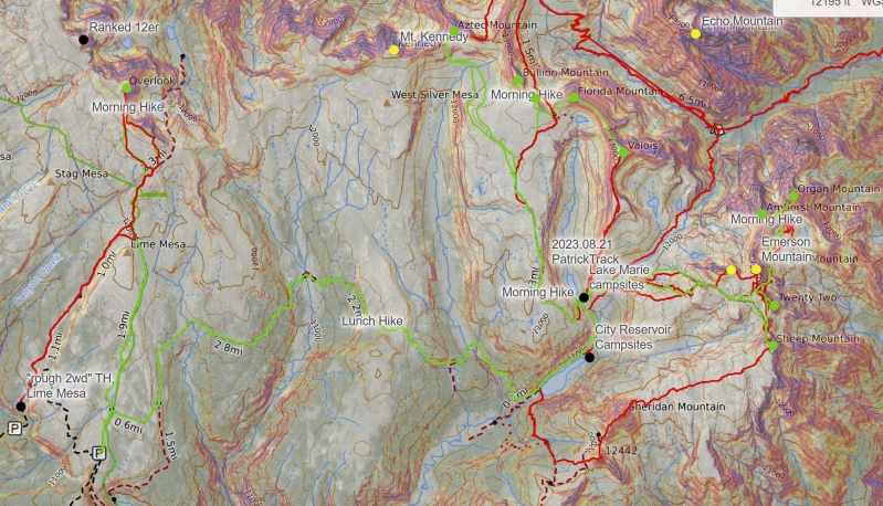
"Overlook Point" - 13,005 feet Mt. Valois - 13,173 feet Organ Mountain - 13,040 feet Amherst Mountain - 13,164 feet "Peak Twenty Two" - 13,107 feet Sheep Mountain - 13,073 feet Aztec Mountain - 13,311 feet Florida Mountain - 13,082 feet Silver Mesa - 13,059 feet Bullion Mountain - 13,190 feet |
| Date Posted | 09/17/2024 |
| Modified | 09/18/2024 |
| Date Climbed | 09/07/2024 |
| Author | k_fergie |
| Additional Members | nikonumber14, Be Wong |
| Endlich Mesa (nearly) Grand Slam |
|---|
|
Crew: myself, Breanna (we finally got around to creating her an account), and Nick Here it comes, the annual September Weminuche backpacking trip report. Its the third year in a row, so it is now, officially, a thing. This year, I was wanting to explore down in the southern Weminuche and tag all of the Endlich Mesa 13ers, including Overlook. This area is seldom visited, but I had read that it was a beautiful, empty place with many cool rocks, so I had to get myself over there to check it out. In previous trip reports on this site and LoJ (save Chicago Transplant's partial slam), this is typically done by coming in past Lemon reservoir, ascending the Endlich mesa rough 4x4 road, and then packing in to City Reservoir. However, for two reasons that I think are valuable enough to write up, we did this group a slightly different way. First, Overlook Point was recently promoted to a 13er, and it is a ways off from the rest of the Endlich group and would be a nuisance to tag from City Reservoir. Second, I have heard that the Endlich mesa road is rough and not fun at all to drive, so using a less strenuous (or even 2wd) option would be beneficial for the community. In recent months, more attention has been paid to the Lime Mesa approach for Overlook, and I was curious to see if I could make it combine with an Endlich Mesa group cleanout this September. The road from Durango to Lime Mesa TH is 95% easy 2wd dirt road, becomes rough 2wd to get to a good intermediate starting point, and eventually to get to the final the 2 miles to the TH becomes a true 4x4 road (probably a 3/6 or 4/6 on this site's grading). Chicago Transplant's road description was great, its super easy to get there from Durango/550. It took 1:15 to get to the rough 2wd TH from the Taco Bell on the north side of town, but the Missionary Ridge road was in great shape with minimal wash boarding, so that likely contributed to the fast travel time. 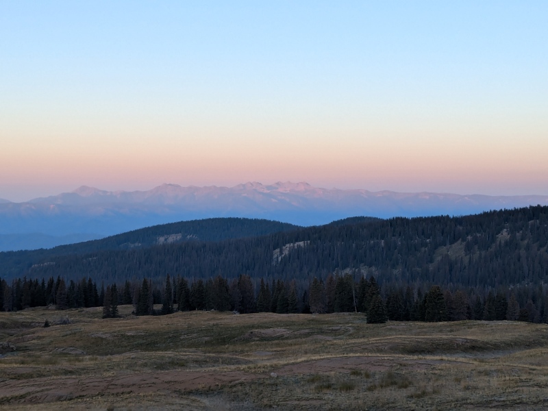
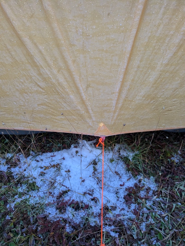
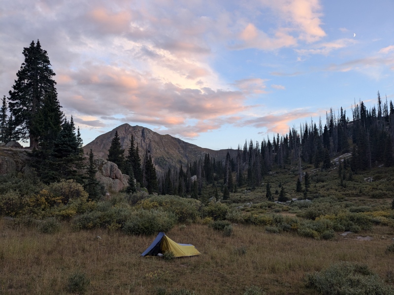
Day 1: 09/07/2024. Overlook Point and Pack in to Lake Marie. 18.5mi, 3500ft. From the Lime Mesa TH, the pack in to City Reservoir is longer than Endlich (~10 miles vs ~7), but you are only about 4 miles from Overlook Point. This makes it pretty easy to tack on to the beginning or end of your main Endlich peaks. We, being in high spirits, started our trip with a car-to-car Overlook Point day hike. It took about 4 hours and warmed us up for the pack into base camp. After tagging Overlook, we returned to the car, ate breakfast/lunch, readied our heavy overnight bags, and set off on the trail to City Reservoir at about noon. The trail is reasonably well trodden, but a bit difficult to find at first as it cuts off across a field from the Lime Mesa trail. After this grassy field, it was very easy to find/follow, albeit super braided due to 95% of its users being sheep. The trail is heavily used by sheep herders (and sheep), and we saw one man on a horse with a dog working a large herd of sheep shortly after descending off Lime Mesa. He did not speak English, and seemed quite surprised to see us. He would be the last person we saw for the next ~4 days until we reached the same point again and came across two horse packers. The Lime mesa trail was very gradual with small climbs/descents as you go up and over Limes Mesa, West Silver Mesa, and Silver Mesa on your way to City Reservoir. We elected to make a high camp up above City Reservoir at Lake Marie, at a similar location to Patrick and Lindsay. This would save us ~500 vert each morning. The pack in went smoothly, taking about 5 hours from Lime Mesa and we promptly set up camp. Right before we were going to make dinner, a large and destructive hail storm moved over the mesa and sent us retreating into our tents; this was to become an unfortunate, but objectively hilarious, theme for the trip. The rain and hail over our drainage thankfully let up after an hour or two, allowing for some time to get our affairs in order, but the lighting and thunder in the vicinity continued for many hours into the night. 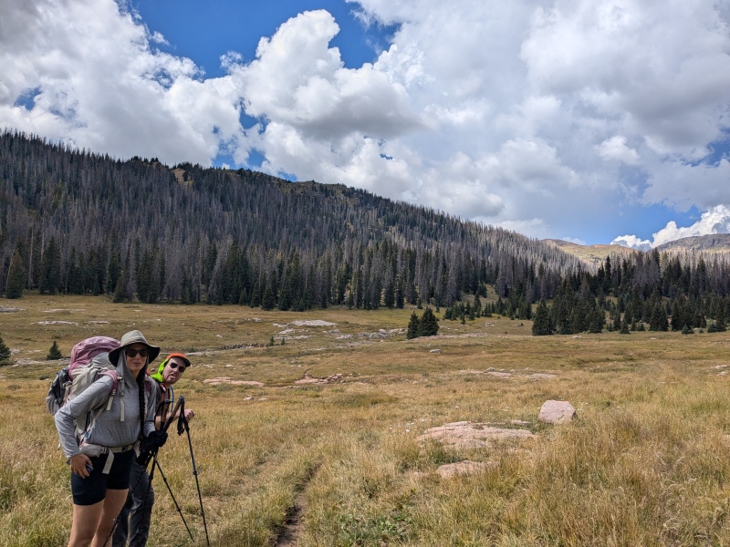
Day 2: 09/08/2024. Valois and a bunch of Unranked. 7.3mi, 2500ft. We awoke to significant hail covering the ground around our tents and got moving to warm up. We ascended the south ridge of Valois directly from camp. I noted that Ben commented on this ridge being super cool when they descended it, so I figured it must be even better to ascend. Lower down, the ridge is comprised of granite slabs that allowed for some fun movement. Hail covered the talus up high making movement a little slower than expected, but the hourglass ridge was still fun and provided great views of the surrounding area, beautiful. The cliffs off the east side looking down at Castilleja Lake were stunning. We were able to pretty easily keep things at class 2, but some light class 3 could be contrived to get to the summit of Valois. Crystal growth was abundant on the rocks. 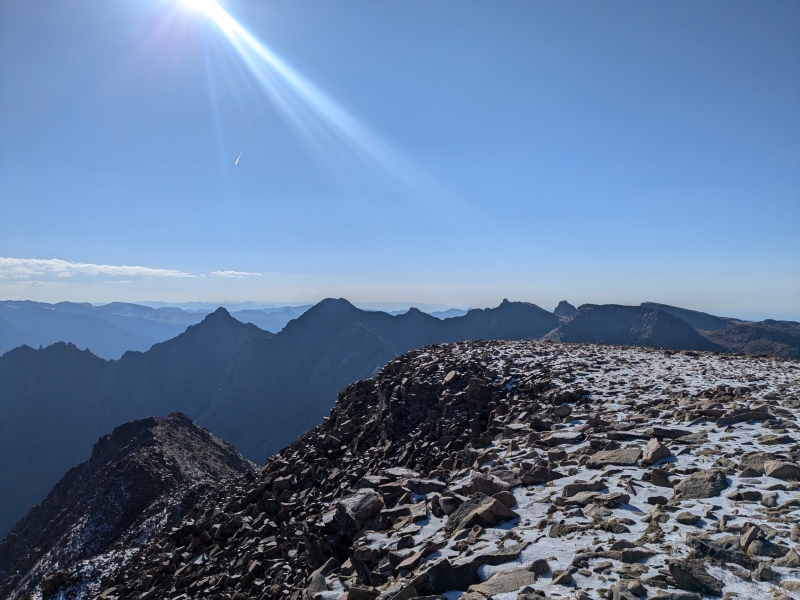
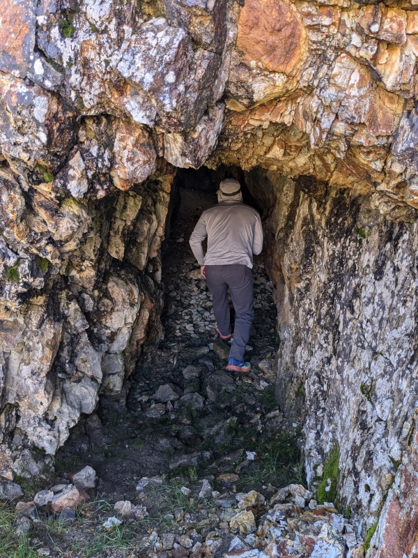
From here, we continued on the ridge to Florida, being careful with footing with the icy hail, passing some prospects along the way. After bumping over Florida, we hit Trimble pass at 9:45AM and weather was building rapidly. WTF? Its September, there aren't allowed to be thunderstorms. Someone better call the weather and let her know to check the calendar. We moved quickly over Silver Mesa to get a look at the route up Aztec. It looked quite far away, and the clouds were gaining height and volume rapidly. I made the hard call to burn our one weather day on Day 1. We ascended unranked Bullion mountain as a consolation prize, then made our way down Silver Mesa trail back to camp. We checked out the remains of the Pittsburg mine and looked at all of the cool rocks on the way down. As we rounded the last corner into camp, a crack of thunder echoed down the valley and it promptly began to rain at 12:15PM. We sat in our tents for an hour or two as the rain and hail pelted the rain fly just as it had yesterday. At least I felt good about abandoning Aztec given that the storm materialized in a very real way. The storm cleared in the early evening and we were able to cook, hang out, and dry out before heading to bed. 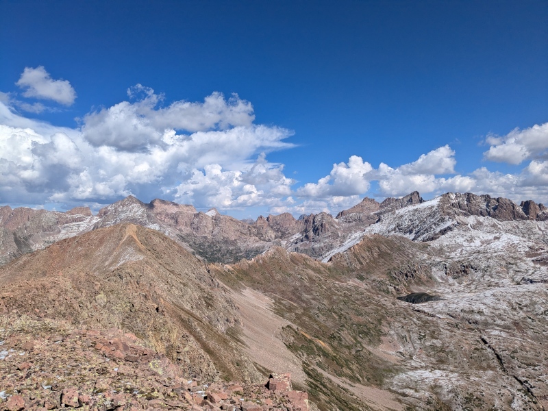
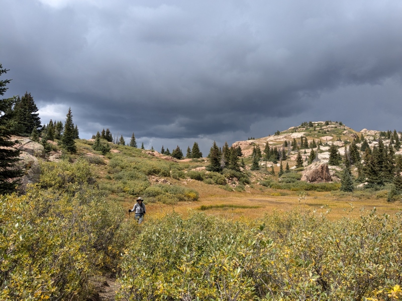
Day 3: Organ, Amherst, Twenty Two, Sheep. 9mi, 4900ft. After having burned a weather day already, we got up early and completed the mild bushwhack on sheep trails over to the Emerson/Twenty Two saddle in the dark, generally following the gpx tracks of Ben and Patrick, but there were many good ways to get there. We descended and rounded the corner into the basin east of Amherst and were treated to an excellent sunrise where we had breakfast. The ascent up Organ was super fun and we all reminisced about how the upper summit blocks were similar to those on Sunlight, but definitely a grade easier if you wanted to take the path of least resistance. The kitty litter on both Organ and Amherst was not terribly fun to climb, but afforded some relatively fun descending. The weather was looking better than the previous day, but we were all careful not to comment on it lest we anger the weather deity. The grass was slick from yesterday's rain and hail and we all fell a couple times when heading back down towards the Emerson/Twenty Two saddle. As we reached the saddle, we got a clear view west, and the sky that was cloudless 1 hour ago from the summit of Amherst was filling up with early stage thunderheads at 10AM yet again. WTF. We hustled up Twenty Two, which had some really fun blocky scrambling at the top with an epic summit block. it was now 10:45 and we decided that we would have enough time to tack on Sheep to round out the group, so we rushed back down, and hurried our way to the standard gully. This was a bit of slog, but only 500 vert and soon enough we topped out on the flat summit, out of breath. A few of the more concerning clouds had moved eastward and were depositing a large amount of rain in the Pine River/Pope's Nose region. A fire had sprung up east of Vallecito in the last day or two as well. Thankfully we were in a lull area of the early stage storm development for the time being. We rested, snacked and made our way back down to camp, abandoning the unranked summits of Twenty One and Emerson. Before reaching camp, we heard a few cracks of thunder around 1PM, but were spared from their rain. With threatening skies we made a quick lunch and then, yet again, were forced into tents for another hail storm. At this point it was just comical. 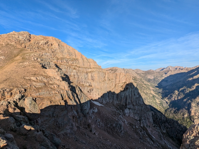
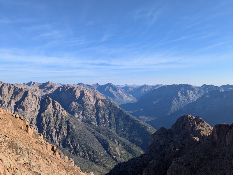

Day 4: Aztec and pack out. 18mi, 4300ft. Breanna and I had planned on staying 4 nights/5 days, but since we weren't getting quality time to hang out and relax at camp in the afternoons decided that it'd just be best to head back to the car a day early and splurge for a hotel in Durango before heading to Telluride for another 4 nights of camping at the Blues and Brews Festival. Nick had friends to visit and a pasty to eat in Durango, so the plan was set. We'd day hike Aztec, pack up camp, and then head out back to the car in the afternoon, just like we'd done with Overlook on the way in. We took Ben's descent route up and down Aztec and found it to be quite nice. The views into Chicago basin and the rest of the Weminuche were stunning, so it was hard to leave the summit and continue our long day back to the car. We packed up camp, got hailed on and serenaded by thunder, ya know, the usual by this point in the trip. Interestingly, even though we hadn't seen anyone, I found a wallet by City Reservoir from an out of state man with DEN luggage tags in it. We looked around for him, but gave up and returned the wallet to the Durango PD. He called me a couple days later saying that he luckily retrieved it there and made his flight back home. The pack out went much quicker and cheerier than any of us expected given the length and weather. Soon enough we were in Durango smashing Nepalese food and planning future mountain endeavors. 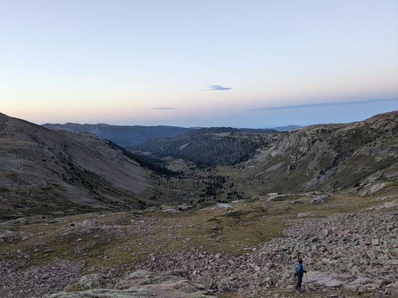

This was a great trip with tons of fun discussions and beautiful scenery. The area was completely devoid of people and so, so quiet. The shooting stars in the morning were next-level. We could here the elk beginning to bugle, the sheep bleating in the distance, and the hail pelting. The weather wasn't great, but we made the most of it, nearly completing the grand slam of the area, only missing a few unranked 13ers and some 12ers. Darn, I guess I'll have to go back some day. Thumbnails for uploaded photos (click to open slideshow): ")
")
")
")
")
")
")
")
")
")
")
")
")
")
|
| Comments or Questions | ||||||
|---|---|---|---|---|---|---|
|
Caution: The information contained in this report may not be accurate and should not be the only resource used in preparation for your climb. Failure to have the necessary experience, physical conditioning, supplies or equipment can result in injury or death. 14ers.com and the author(s) of this report provide no warranties, either express or implied, that the information provided is accurate or reliable. By using the information provided, you agree to indemnify and hold harmless 14ers.com and the report author(s) with respect to any claims and demands against them, including any attorney fees and expenses. Please read the 14ers.com Safety and Disclaimer pages for more information.
Please respect private property: 14ers.com supports the rights of private landowners to determine how and by whom their land will be used. In Colorado, it is your responsibility to determine if land is private and to obtain the appropriate permission before entering the property.

