| Report Type | Full |
| Peak(s) |
Mt. of the Holy Cross - 14,007 feet |
| Date Posted | 09/20/2024 |
| Date Climbed | 09/19/2024 |
| Author | pater |
| Holy Cross during Holy Cross |
|---|
|
Saturday, September 14 was the Orthodox feast of the Elevation of the Holy Cross. That feast period does not end until Saturday, September 21. I am an Orthodox priest, and so it seemed appropriate to me to try to climb Mt. of the Holy Cross during that festal period. My original plan had been to climb on Tuesday, September 17, but the weather report was showing thunderstorms beginning around 11am. I made the decision to postpone the trip until later in the week, still well within the period during which I wanted to summit. Wednesday and Thursday were both showing good weather all day, so I decided to make use of that window. An I-70 closure eastbound through Glenwood Canyon threatened to stop the attempt (coming from Grand Junction), but it cleared up at around 11pm Tuesday night. Got to Tigiwon Road with no difficulties on Wednesday, and began the drive up to Half Moon Trailhead. I was driving a Subaru Imprezza hatchback. The road was a bit bumpy in some places, especially right after the Tigiwon Community House, but nothing that couldn't be easily managed. Got to the trailhead at about 11:45pm. Even on a Wednesday the parking lot was nearly full. I did manage to get a parking spot. I'd imagine that this parking lot fills up completely on weekends. There is an outhouse at the trailhead; there was no TP, so bring your own if you plan on using it. Cell service was pretty good most of the way up the road, on T-Mobile. At the trailhead itself, there is enough service to send texts. I wouldn't try making a phone call. Instead, fill out a permit and get hiking! Got on the trail at around 1pm and began the hike up Half Moon Pass. As you ascend, the 12,700' false summit of Notch Mountain becomes visible to the south. 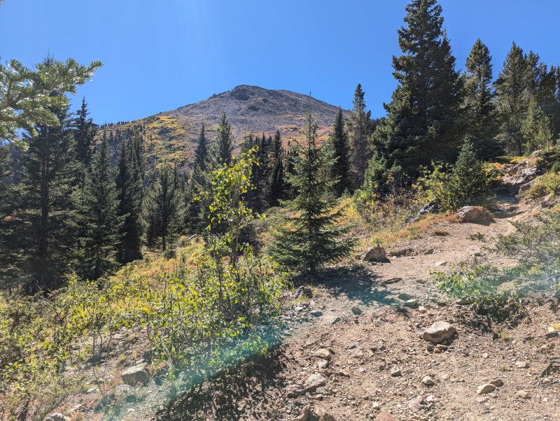
The ascent up the east side of Half Moon Pass is fairly gradual. Still, I almost always get winded during approaches at the beginning of climbs. I'm a bit of a couch potato when I'm not hiking, so my cardio is not where it should be. I'm used to this, and I know that it doesn't mean I won't be able to summit safely. When I get into more technical terrain later in my climbs, the emphasis shifts away from cardio and toward muscle and technical skill. To get to the top of Half Moon Pass means an ascent of roughly 1,280'. Towards the end of this ascent, if you look to the east you can get a view of the Climax Mine near Leadville. This molybdenum mine destroyed a beautiful bit of ridge to the north of Decalibron. Mining is an important part of Colorado history, but this type of destructive surface mining is rare. Make of this what you will. 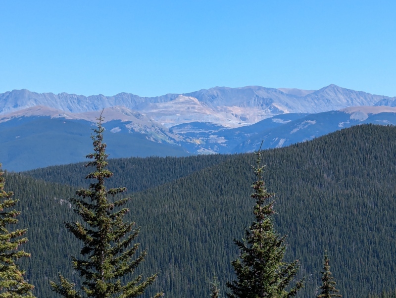
As you approach the top of Half Moon Pass, you enter a krummholz zone where the trees begin to thin out. The top of the pass is not really above treeline, but another ~100' and it would be. 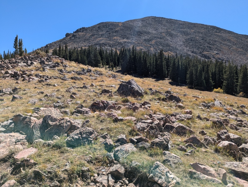
The descent down the west side of Half Moon Pass is pretty steep, but doesn't present any major issues. Encountered many climbers who were returning from their summits earlier in the day. After a few hundred feet of descent, you get your first view of Holy Cross and the ascent route. 
I reached E. Cross Creek quicker than I was expecting to. As you approach the creek, you will see the remains of an old cabin to your left. You will also see a sign marking out the camping sites in E. Cross Creek. About half of the sites were closed for rehabilitation-- I'd imagine that they rotate which are open and which are closed. E. Cross Creek is at around 10,700'. I was able to get campsite #2. This was ideal, because it meant I wouldn't have to backtrack to get water the next morning. I reached my campsite at around 3pm; I was in no hurry getting over the pass since I had all day. I was solo, but there is easily room at this campsite to set up several tents if you're with a group. There is a fire ring constructed out of rocks, but camp fires are not permitted. Cell phone service is non-existent here. Set up camp and settled in for the afternoon. 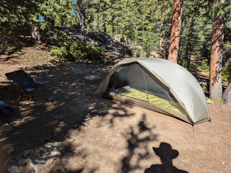
A word about gear: My backpacking gear for this first part of the hike consists of an REI Quarter-Dome 1p, Therm-a-rest NeoAir XLite, Therm-a-rest Corus 20-degree quilt, Cocoon Aircore Ultralight pillow, REI Flexlite Air Chair, and MSR PocketRocket stove, along with various other first aid and hygiene things. I used to use the Sea-to-Summit ultralight pillow, but I found that it was too small and uncomfortable for me. The Cocoon feels more like a normal pillow, so I've been happy with it. Yes, I bring a camp chair. I love being able to kick my feet up and sit down somewhere other than a rock after a day of hiking. Which is exactly what I now did for several hours, while reading JRR Tolkien's The Fall of Numenor. Dinner was cheddar-broccoli rice with tuna fish. 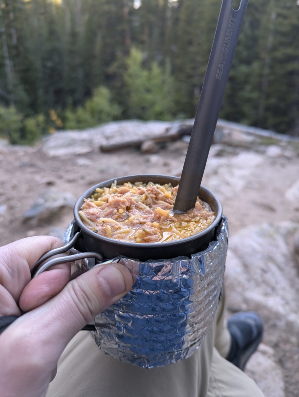
The next morning, after a cup of coffee and some oatmeal, I got on trail at about 5:30am. A few groups had started their hike earlier in the morning at the main trailhead. I ended up being behind the first summiter of the day, and just ahead of a group that summited around the same time as me. I filtered some water from E. Cross Creek, and got going. My headlamp batteries were dying and I didn't feel like stopping to change them out, so I had less illumination than would have been ideal. Still below tree line, the trail now goes through some rocky sections before reaching a more developed area with steps. I feel like steps ruin my stride, but I appreciate that they help mitigate erosion. Light starts to show up just before I leave the trees, so I turn off my headlamp. Here, the trail enters a krummholz zone mostly out of the trees, but with pockets of trees here and there. The first light hits the mountains to the NW at around this time. 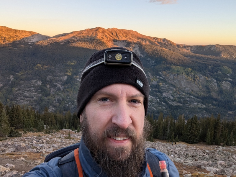
The peak of Holy Cross first becomes visible over the ridge just as you leave the Krummholz zone. 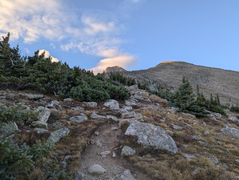
From here, you enter into more rocky territory. Keep an eye out for pika that live among these rocks. I saw several. The north ridge of Holy Cross cliffs out to the northeast of here, so the route works its way to the north of the ridge, and then ascends southerly to the ridge itself. The route to the ridge is marked with well-built large cairns, and the best path between the cairns is easily discernible. 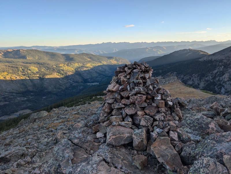
When I'm below tree line I don't like to have headphones in so that I can stay aware of wildlife. At this point in the morning, I put my headphones in and listen to music for the rest of the day. At around 13,100', the ridge flattens out for a stretch. From here, you have an excellent view of the peak and its crux to the west. 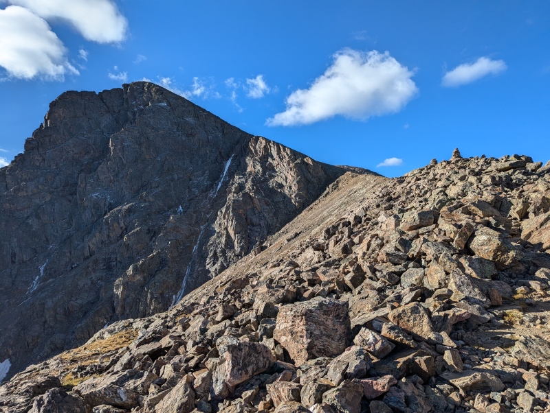
I continue following the cairns along the rest of the ridge, and come to the top of Angelica Couloir. Looking down the couloir, East Cross Creek and Half Moon Pass are visible to the northeast. 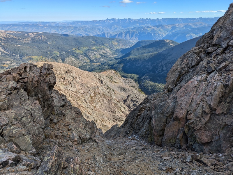
From here, the route turns easterly and gets steeper. The route remains well cairned and is easily visible. This changes at around 13,700', when the route turns into a scramble up stable rock. This is the crux of the route from a technical standpoint. To the extent that there is an 'intended route' here, it is not easily discernible. There are still cairns, but it is up to you how to get from one to the next. Mercifully, the rocks are large and not at all loose. This is not scree, but stable rock. I reached the summit at around 9:30am. Four hours from E. Cross Creek to the summit. That's not setting any speed records, but I'm perfectly happy with it. This was my first fourteener in about three years, so I'm happy just to have summited. 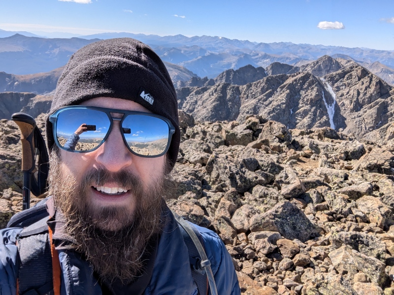
Of course, I sing Σωσον Κυριε at the peak; that was why I wanted to make this summit sometime between the 14th and the 21st of September. I stayed on the summit for about an hour. After the usual sauntering, snacking and picture taking, I begin the descent at around 10:30am. Holy Cross is a fairly easy descent since there is very little loose rock or gravel. Gravel is my worst enemy on descents. I was below tree line before noon, although there was no risk of thunderstorms that day. Got back to my campsite around 1pm, rested a bit, and packed up. Began the climb up Half Moon Pass at around 2pm. Now comes the most difficult part of this route from a fitness point of view. My calves and thighs were pumped from the descent, and my legs did not appreciate now having to reclimb a steep 1000' back up Half Moon Pass while carrying all the backpacking gear. If you have the ability to add an extra day to your trip, it might behoove you to camp another night and hike out the next day. Family and work did not permit that for me, so I struggled my way to the top of the pass. This was rough, and I had to take several breaks. On the descent back to the trailhead, I got into a rhythm and felt a little better. Reached the parking lot at around 5:30pm; a very slow time over the pass. Got into the car, and departed in peace. My takeaways: This is a long route for a fourteener, over 11 miles with around 5,600' of total elevation gain for the whole round trip. While there's nothing very technical on the route, it can be difficult from a cardiovascular point of view, especially toward the end of the day. Don't rush this route. Consider camping an extra night if you're able. For myself, the main thing I need to improve is my overall cardiovascular fitness. This is my main limiting factor, not technical or gear questions. Και του χρονου! Thumbnails for uploaded photos (click to open slideshow): ")
")
")
")
")
")
")
")
")
")
")
")
|
| Comments or Questions | |||||||||
|---|---|---|---|---|---|---|---|---|---|
|
Caution: The information contained in this report may not be accurate and should not be the only resource used in preparation for your climb. Failure to have the necessary experience, physical conditioning, supplies or equipment can result in injury or death. 14ers.com and the author(s) of this report provide no warranties, either express or implied, that the information provided is accurate or reliable. By using the information provided, you agree to indemnify and hold harmless 14ers.com and the report author(s) with respect to any claims and demands against them, including any attorney fees and expenses. Please read the 14ers.com Safety and Disclaimer pages for more information.
Please respect private property: 14ers.com supports the rights of private landowners to determine how and by whom their land will be used. In Colorado, it is your responsibility to determine if land is private and to obtain the appropriate permission before entering the property.