Download Agreement, Release, and Acknowledgement of Risk:
You (the person requesting this file download) fully understand mountain climbing ("Activity") involves risks and dangers of serious bodily injury, including permanent disability, paralysis, and death ("Risks") and you fully accept and assume all such risks and all responsibility for losses, costs, and damages you incur as a result of your participation in this Activity.
You acknowledge that information in the file you have chosen to download may not be accurate and may contain errors. You agree to assume all risks when using this information and agree to release and discharge 14ers.com, 14ers Inc. and the author(s) of such information (collectively, the "Released Parties").
You hereby discharge the Released Parties from all damages, actions, claims and liabilities of any nature, specifically including, but not limited to, damages, actions, claims and liabilities arising from or related to the negligence of the Released Parties. You further agree to indemnify, hold harmless and defend 14ers.com, 14ers Inc. and each of the other Released Parties from and against any loss, damage, liability and expense, including costs and attorney fees, incurred by 14ers.com, 14ers Inc. or any of the other Released Parties as a result of you using information provided on the 14ers.com or 14ers Inc. websites.
You have read this agreement, fully understand its terms and intend it to be a complete and unconditional release of all liability to the greatest extent allowed by law and agree that if any portion of this agreement is held to be invalid the balance, notwithstanding, shall continue in full force and effect.
By clicking "OK" you agree to these terms. If you DO NOT agree, click "Cancel"...
Decided to finally hike Eagle Peak after looking at it from Highway 50 for years and doing the Cottonwood Peak to Lakes Peak ridge at the end of August. Thanks to Mtnman200 for his 8/6/2022 trip report regarding the trail that is accessible from the southeast corner of Rainbow Lake. My main reason for filing this mini report is to attach the GPX Track of the trail from Rainbow Lake to the upper tundra of Eagle Peak. From the Rainbow Trail Lutheran Camp, which can be reached via County Road 198 (Billy Humble Road), off of Highway 69 near Hillside, it is a 7 mile hike to the summit of Eagle Peak using FS-198. As Mtnman200 noted in his report, the road becomes a high clearance 4WD road after the Rainbow Trail Lutheran Camp. Overall, it is a 14 mile hike up and down from the Rainbow Trail Lutheran Camp.
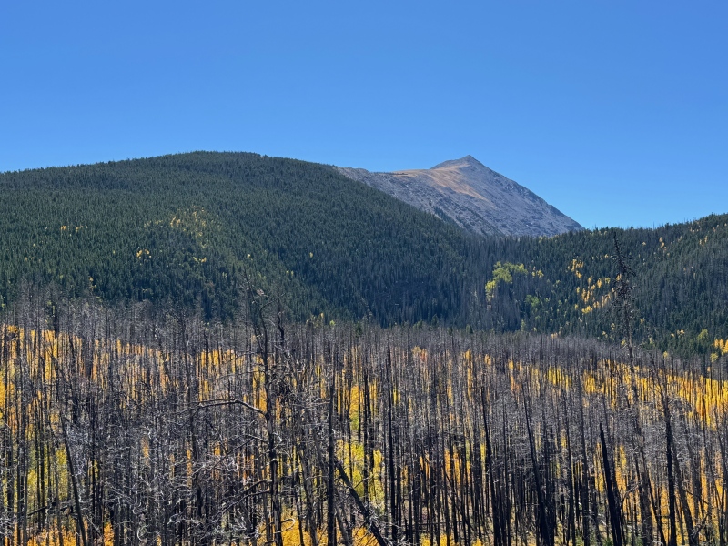
Eagle Peak from FS-198 with a view of the upper, easy class 2 ridge and summit on the left.Eagle Peak from FS-198.
The start of the approximately 0.8 mile trail from the southeast corner of Rainbow lake to the tundra ridge of Eagle Peak. Note the large rock just left of center in the trees. The trail has some short steep and somewhat eroded sections, but leads you right to the open tundra with minimal obstacles.
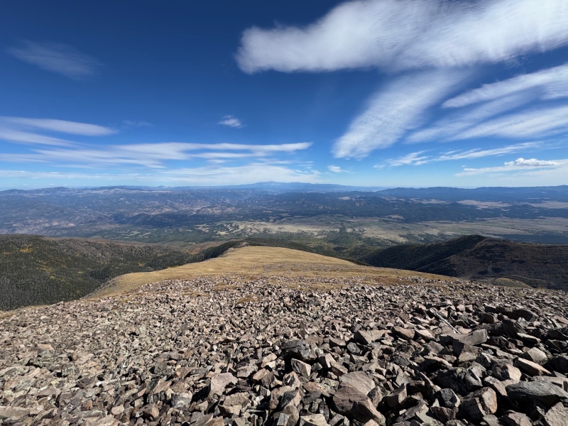
On the tundra ridge of Eagle Peak looking back towards the trees with Rainbow Lake to the left.
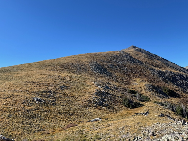
Looking up the tundra toward the upper talus portion of Eagle Peak. A leisurely hike along a wide tundra ridge that allows you to pick your line to the upper talus of Eagle Peak.
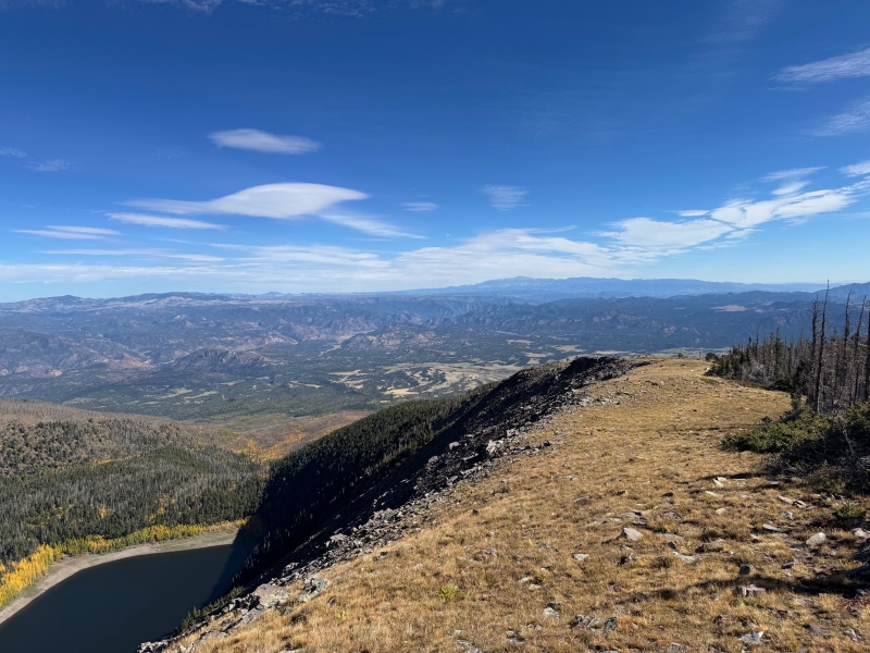
Looking down from the talus portion of Eagle Peak to the tundra ridge and Rainbow Lake.
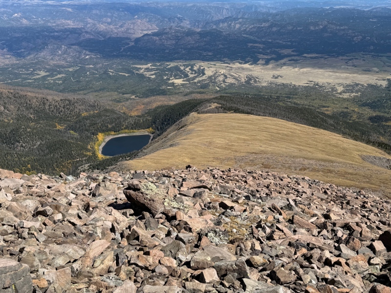
Looking down from the talus portion of Eagle Peak to the tundra ridge.
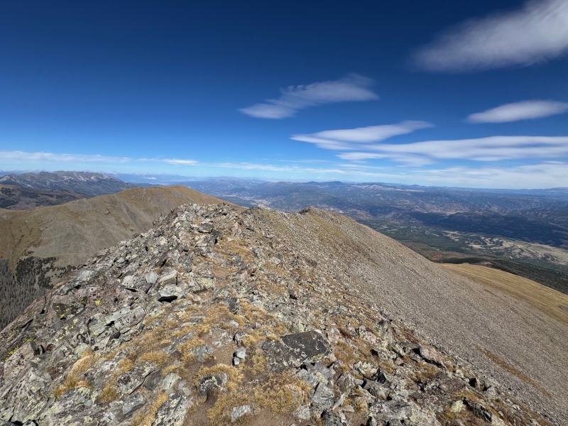
From the summit of Eagle Peak looking back on the easy class 2 ridge of Eagle Peak and the visible ridge trail. Note Wulsten Baldy is visible to the left and the tundra ridge of Eagle Peak is on the right.
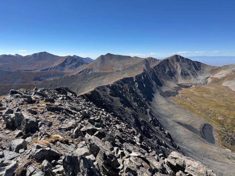
From the Eagle Peak summit looking along the ridge to Thirsty Peak.
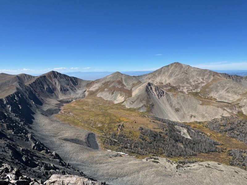
From the summit of Eagle Peak viewing Thirsty, PT13123, Cottonwood Peak, and a portion of the Cloverdale Basin.
My GPS Tracks on Google Maps (made from a .GPX file upload):
Thumbnails for uploaded photos (click to open slideshow):
Comments or Questions
Caution: The information contained in this report may not be accurate and should not be the only resource used in preparation for your climb. Failure to have the necessary experience, physical conditioning, supplies or equipment can result in injury or death. 14ers.com and the author(s) of this report provide no warranties, either express or implied, that the information provided is accurate or reliable. By using the information provided, you agree to indemnify and hold harmless 14ers.com and the report author(s) with respect to any claims and demands against them, including any attorney fees and expenses. Please read the 14ers.com Safety and Disclaimer pages for more information.
Please respect private property: 14ers.com supports the rights of private landowners to determine how and by whom their land will be used. In Colorado, it is your responsibility to determine if land is private and to obtain the appropriate permission before entering the property.


")
")
")
")
")
")
")
")
")
")

