Download Agreement, Release, and Acknowledgement of Risk:
You (the person requesting this file download) fully understand mountain climbing ("Activity") involves risks and dangers of serious bodily injury, including permanent disability, paralysis, and death ("Risks") and you fully accept and assume all such risks and all responsibility for losses, costs, and damages you incur as a result of your participation in this Activity.
You acknowledge that information in the file you have chosen to download may not be accurate and may contain errors. You agree to assume all risks when using this information and agree to release and discharge 14ers.com, 14ers Inc. and the author(s) of such information (collectively, the "Released Parties").
You hereby discharge the Released Parties from all damages, actions, claims and liabilities of any nature, specifically including, but not limited to, damages, actions, claims and liabilities arising from or related to the negligence of the Released Parties. You further agree to indemnify, hold harmless and defend 14ers.com, 14ers Inc. and each of the other Released Parties from and against any loss, damage, liability and expense, including costs and attorney fees, incurred by 14ers.com, 14ers Inc. or any of the other Released Parties as a result of you using information provided on the 14ers.com or 14ers Inc. websites.
You have read this agreement, fully understand its terms and intend it to be a complete and unconditional release of all liability to the greatest extent allowed by law and agree that if any portion of this agreement is held to be invalid the balance, notwithstanding, shall continue in full force and effect.
By clicking "OK" you agree to these terms. If you DO NOT agree, click "Cancel"...
Have had my eyes on the Blanca group for at least 3 years. Life and work made it seem like a pipe dream vs reality since I started studying the NW face of Little Bear and the traverse. With the great fall weather this year I decided to take a day off work and knock this group out. There had been only a couple of very minor snowfalls followed by very warm Autumn conditions. The conditions seemed perfect with the warmth and diminished threat of afternoon storms. Had studied and reviewed numerous trip reports and photos of the NW face. Honestly, it kept me up at night thinking about it but liked the option of solid rock vs the loose chute of the hour-glass. There was plenty of beta in many of the trip reports to give me confidence in going up the NW face of LB-Traverse-Blanca-Ellingwood. I made mental notes and downloaded relevant photos and GPX tracks to refer to if needed.
I used Jackson Cole's GPX tracks from his FKT as a guide. With an Ultra running background figured I could knock them out in a very long day (not anything close to Jackson's impressive FKT), weather permitting. Estimated 7-8 hours, depending on how far up Lake Como Road I could make it.
Was solo though did reach out to my buddy Kris but it was short notice. We have done quite a few 14ers, rock climbs, and canyons over the years. Wasn't confident taking someone else I wasn't familiar with on a route like this. Got a decent night's sleep and left the house in Monument around 0515. Found a large shoulder at just under 10,000ft and had enough of the road. Was on the trail at 0825 in the crisp cool air.
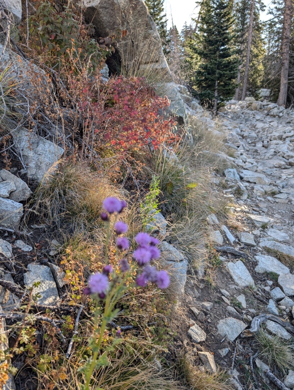
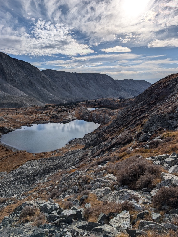
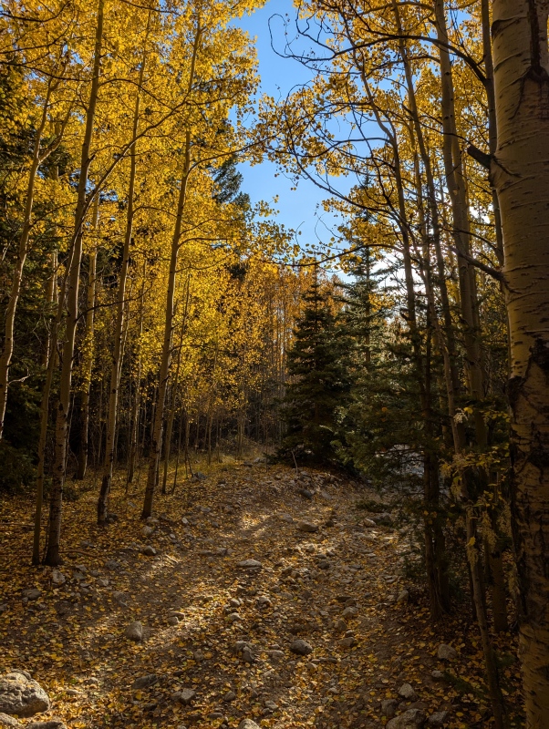
Some color still on Lake Como Road
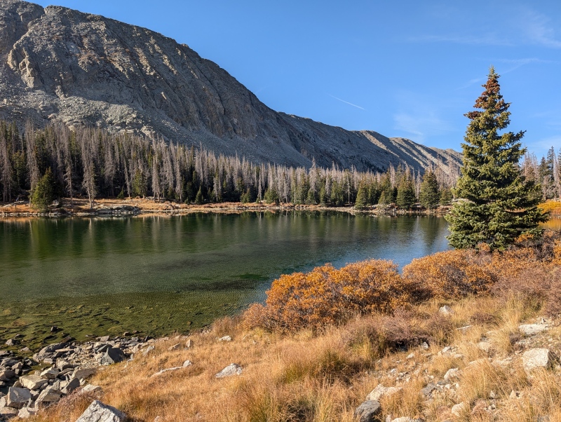
Lake Como
Alternated between a steady power hike and some jogging on the short downhills leading up to Lake Como. Made it to the Lake in 1:06 on easy to follow trail looking for the cut-off to the NW face. The cut-off is not obvious and there is no defined trail. Was glad to see there was no lingering snow from my vantage and began making progress upwards. Once on the face made my way around the "black hand" feature with some class 3-4 scrambling. Everything was fairly loose on the lower face so I kept making my way up on solid rock. Unfortunately, this made for a slightly more difficult ascent and never really found my way into the gully until just below the headwall.
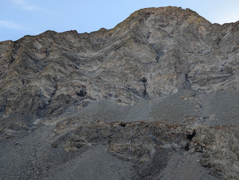
Looking up at the NW face and the black handHeadwall NW face of LB
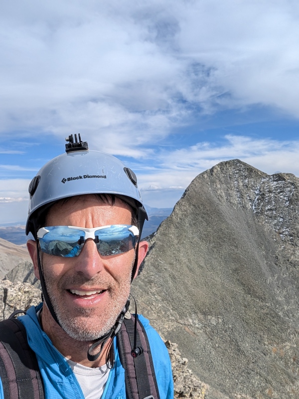
The final pitch was exposed and easily low class 5 if not higher. Foot slipped once and didn't have a good hand hold near the top of the headwall. Narrow ledges were solid but it took me a minute to refoucs on the remaining climb to the ridge. Just kept aiming for the daylight of the ridge and finally topped out lookers left of the first obstacle on the traverse. Made it to the summit of Little Bear in 3:27. Had a snack and took a few moments to gather in the traverse to Blanca. The downclimb was slightly unnerving with the smooth granite of so many before. There was also a small amount of snow in the crevasses but easily passable without traction.
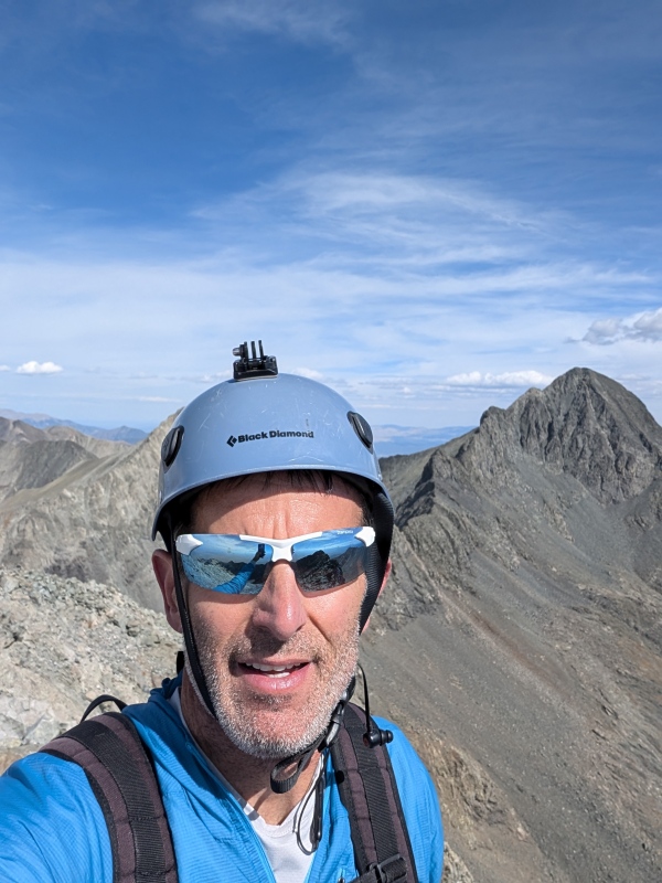
LB Summit with the traverse in the background
Found the traverse to be fairly straight forward in that there are just not a lot of options once you're on it. Stayed mostly left (or on top) in the beginning third, more on top in the middle third, and more right on the final third. Thought I had cliffed out on Capt Bivwacko but realized I had to go back on myself and around to the right to move past it. The exposure of the traverse is real in many areas but it is usually short lived and a few hundred feet down either side. Began to bonk about halfway across the traverse and my pace slowed to a crawl. Became so focused on the route and steeps that it put me in a hydration and fueling deficit. There was a portion before the final climb up Blanca where it relents and the trail drops off to the lower right. Easy to go too low but with less exposure and consequential terrain.
Exposure on the Traverse
Made the summit of Blanca in 2:28 (5:58) and it was here that I debated dropping back down to basin and skipping Ellingwood. Ate a PB&J and took in another gel and a caffeinated Bai. Got my second wind and was on my way to Ellingwood knowing I did not want to repeat Lake Como road again. The route was easy to follow and made the summit of Ellingwood in 56 min (6:54). Got off trail on the descent from Ellingwood and eventually connected back to the main trail and was back at the truck in 9:21 elapsed and meticulously made my way back down the road before sunset. Was exhausted and home just after 9PM. Long day and glad mother nature cooperated on this day! This makes 50 complete and is my first of the "Great Traverses". Epic route and day on the Blanca Group!
Ellingwood summitLate afternoon descending the lower flank of EllingwoodFading sunlight on Lake Como Road
My GPS Tracks on Google Maps (made from a .GPX file upload):
Summit021 - So crazy, I have wanted to take on this route for several years now just never pulled the trigger. So, today I decided to read some trip reports and wouldn't you know it... the first on I read was from an old friend. I would love to sit down and bend your ear on this route and many other peaks I still want to attempt. Let's try to connect sometime. Hope all is well. SS - Great report by the way. Thanks for all the detail!
Thanks, Shane! Great catching up with you again. Hard to believe our childhood in rural AR led us both to the mountains of CO.
Caution: The information contained in this report may not be accurate and should not be the only resource used in preparation for your climb. Failure to have the necessary experience, physical conditioning, supplies or equipment can result in injury or death. 14ers.com and the author(s) of this report provide no warranties, either express or implied, that the information provided is accurate or reliable. By using the information provided, you agree to indemnify and hold harmless 14ers.com and the report author(s) with respect to any claims and demands against them, including any attorney fees and expenses. Please read the 14ers.com Safety and Disclaimer pages for more information.
Please respect private property: 14ers.com supports the rights of private landowners to determine how and by whom their land will be used. In Colorado, it is your responsibility to determine if land is private and to obtain the appropriate permission before entering the property.


")
")
")
")
")
")
")
")
")
")
")
")
")
")
")
")


