| Report Type | Full |
| Peak(s) |
Vermilion Peak - 13,909 feet |
| Date Posted | 05/07/2025 |
| Date Climbed | 09/26/2024 |
| Author | PikaSteve |
| Vermilion and Other Fall Colors via Hope Lake Trail |
|---|
|
Vermilion and Other Fall Colors via Hope Lake Trail 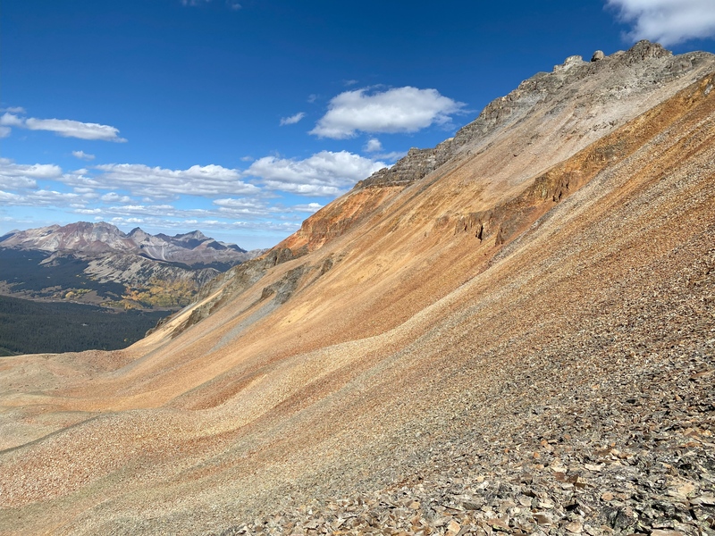
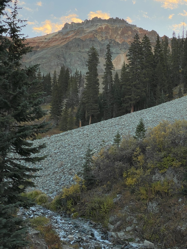
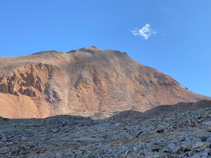
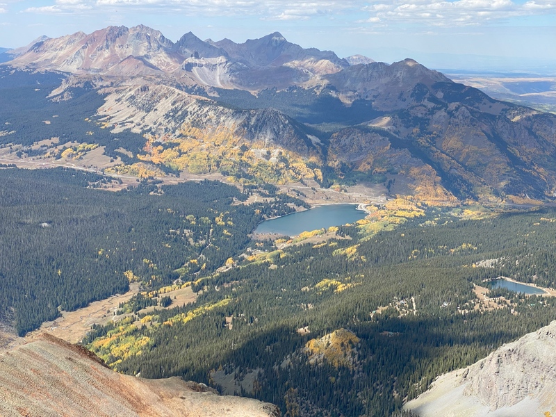
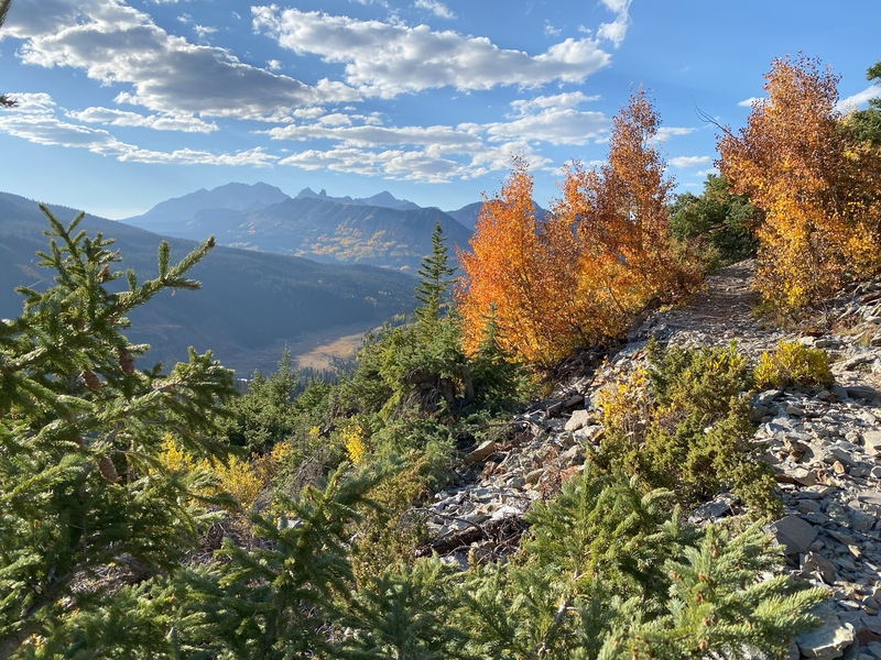
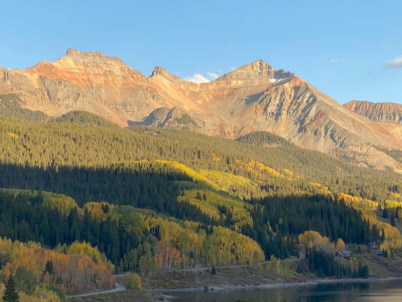
“Vermilion is a color family and pigment most often used between antiquity and the 19th century from the powdered mineral cinnabar (a form of mercury sulfide). It is synonymous with red orange, which often takes a modern form, but is 11% brighter.” – Wikipedia Autumn is my favorite season for hiking, with brisk temperatures, reliably rain-free days and colorful fall foliage. Fall is the time of year when I’ve had the most luck finding a magical feeling of awe that I get from a combination of being a small human surrounded by big nature while pushing my body to a high place. My hike up Vermilion Peak revealed more fall colors than I anticipated and allowed me to successfully find feelings of mountain awe without too much mountain climbing stress. Spoiler alert 1: mostly this trip report shares photos from a beautiful autumn day that surprised me by continuously showing new colors and mountain vistas—if you prefer uncharted discovery with limited advance information, stop reading here. On a leaf-peeping trip with my wife to southwest Colorado, I was pleased to have a day scheduled for a solo hike to hopefully climb my 82nd Centennial peak. Since I was staying in Telluride, I decided to hike up Vermilion Peak's Southwest Basin route, despite the Roaches’ warning of needing to ascend a very steep class 2+ scree slope to the summit of Fuller Peak. Spoiler alert 2: this "leg-testing ornery slope" part of the Roaches’ route can be bypassed with a very well-defined use trail that efficiently ascends across the southwest face of Fuller Peak to connect the Fuller-Beattie saddle to the Fuller-Vermilion saddle. Thursday, September 26, 2025 I left Telluride, traveled over Lizard Head Pass, turned left at Trout Lake and drove up to the 10,700' Hope Lake Trailhead which is also known as the Lake Fork San Miguel trailhead. I was on the trail at 7am—officially sunrise, but on the western side of the mountain, I would be in the shadows for a few more hours. A smooth trail led to the first creek crossing and the first glimpse of Vermilion Peak. Across the valley, sun started to shine on the golden aspen between Lizard Head Pass and Lizard Head. Switchbacks continued the elevation gain towards Hope Lake. 
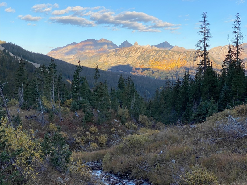
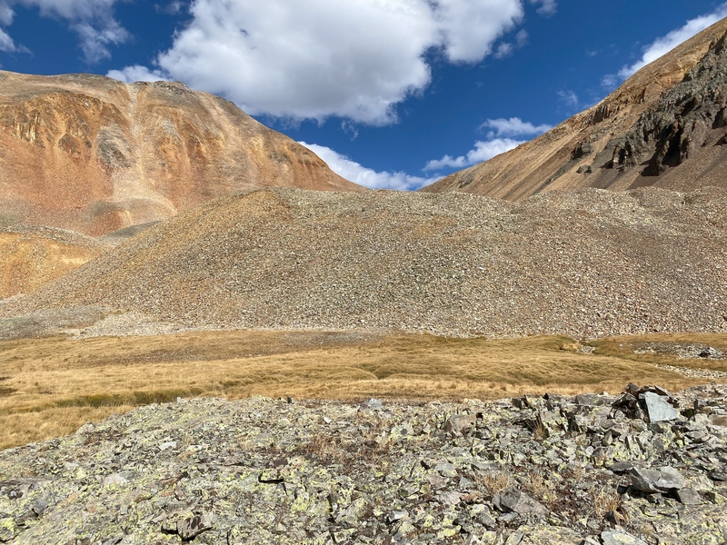
Just before reaching Hope Lake, blue skies and vermilion cliffs beckoned me to leave the trail to hike across browned grass, yellowed willows, rusty talus, gray rocks and green lichens toward the saddle between Fuller Peak and Beattie Peak. I paused often to look back to see the morning sun lighting up the aspen above Trout Lake and showing off the reds and browns of the Wilsons and the rest of the San Miguel Mountains. 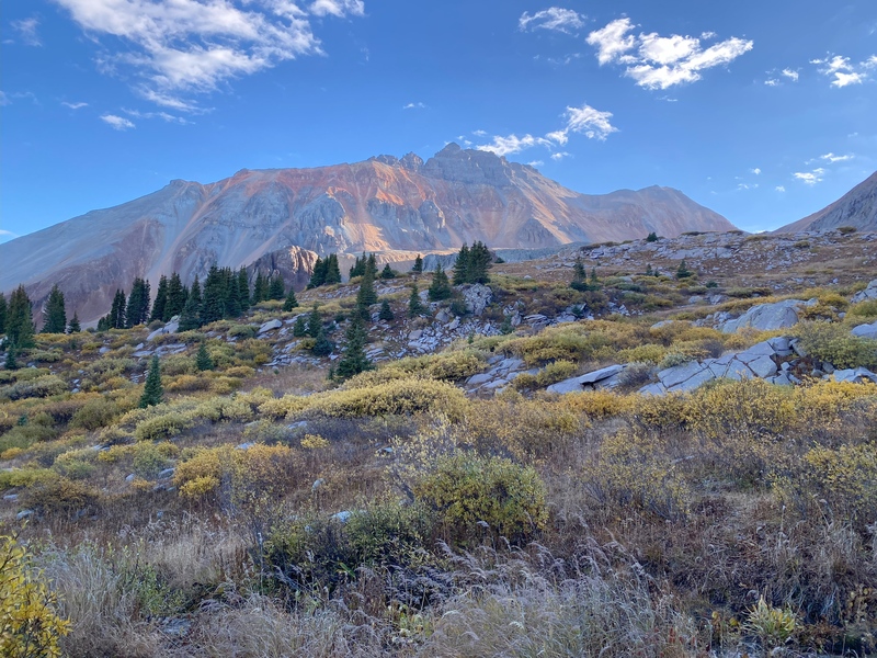
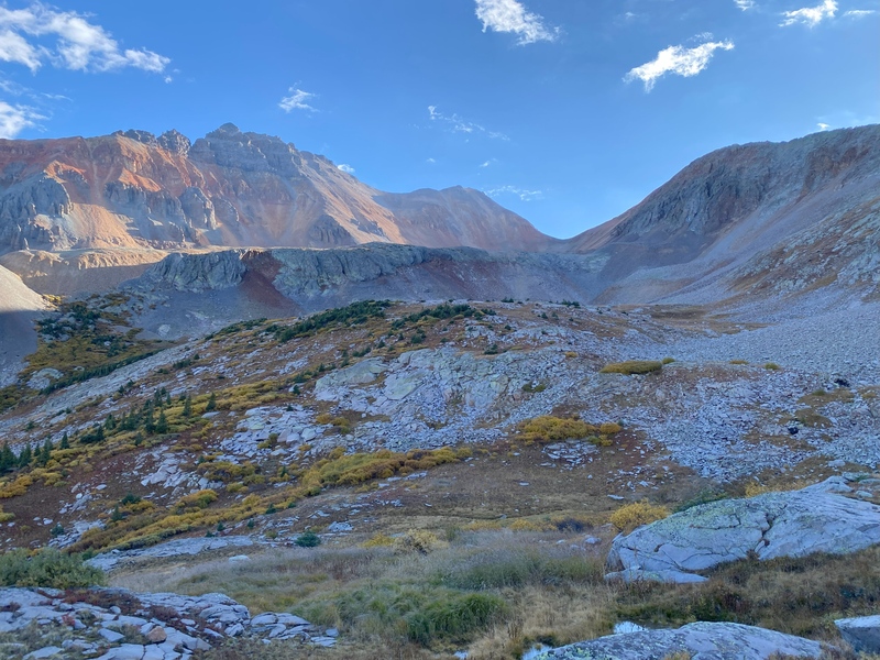
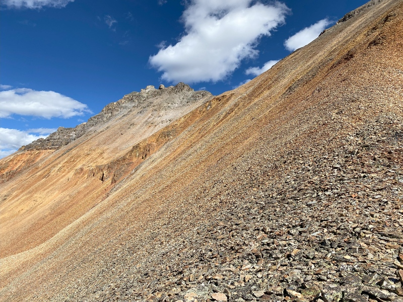
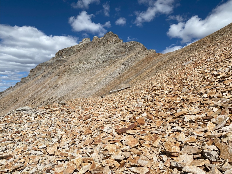
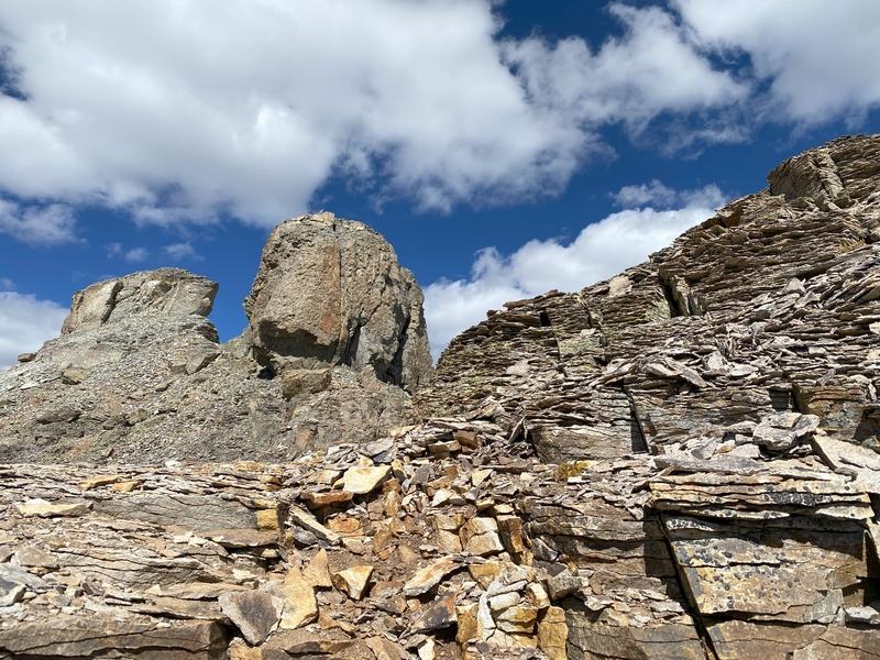
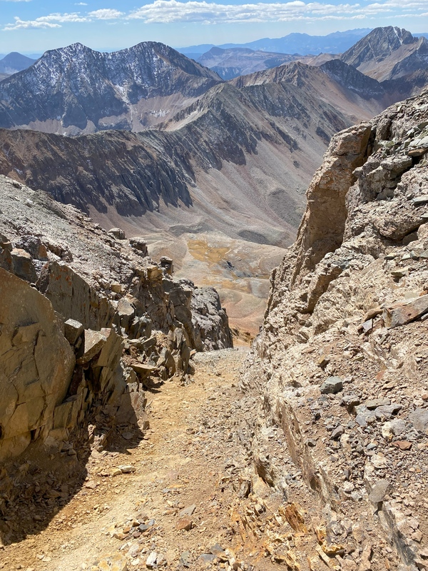
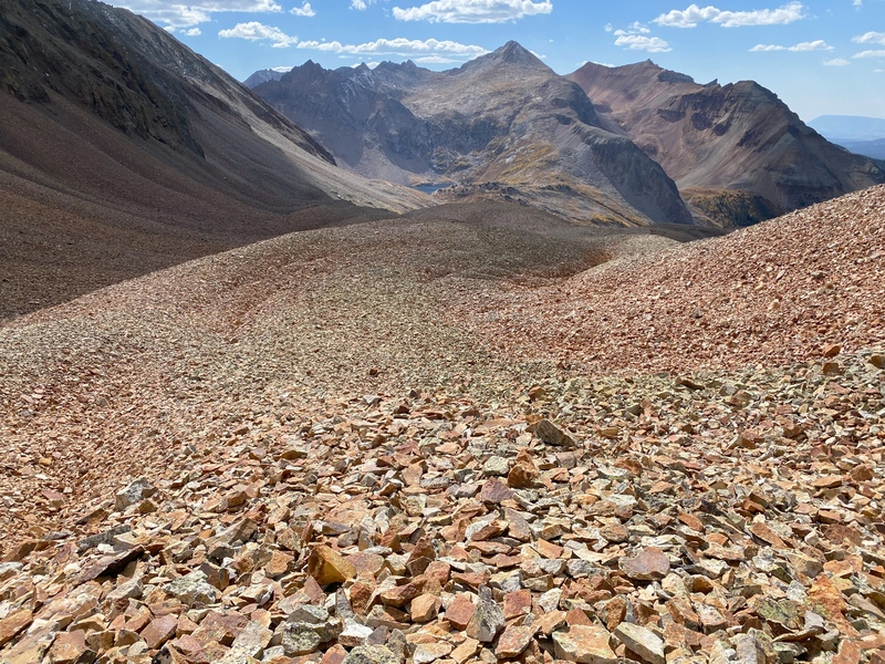
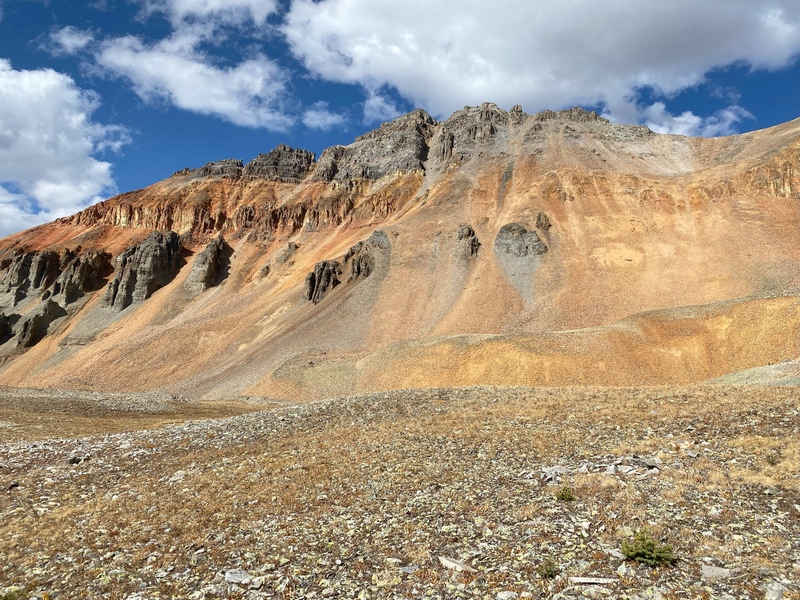
Continuing up the basin, a steep section from 12,100’ to 12,450’ featured a mix of slabs and semi-stable talus. I climbed another steep section from 12,500’ to 12,600’ where the toe of a rock glacier had some of the loosest talus I've ever ascended. Once on top of the rock glacier, the talus was less loose up to the 13,000’ Fuller-Beattie saddle. Despite talus frustrations, my mind focused on the amazing shades of red and orange on the slopes of Vermilion Peak and Fuller Peak. 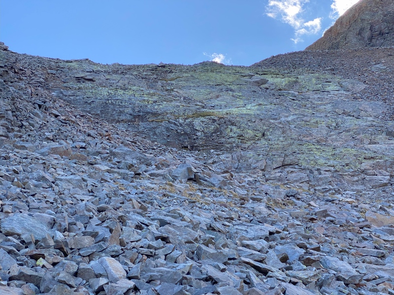
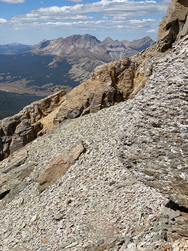
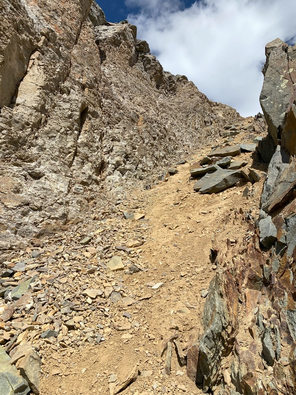
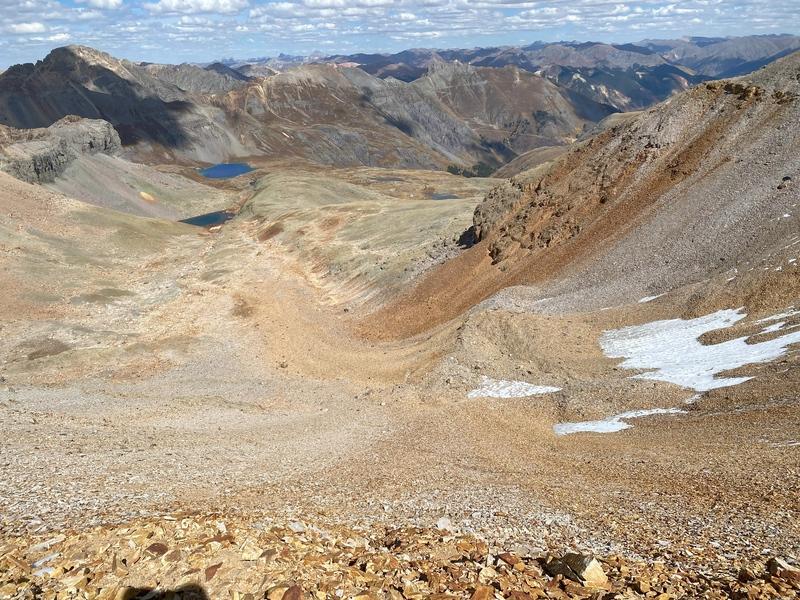
During a snack break at the saddle, I marveled at the swirls of the rock glacier I had just ascended. Based on the looseness of the toe that I ascended, I can easily imagine the rock glacier moving several inches each year. From the Fuller-Beattie saddle, the surprisingly stable use trail allowed for easy progress to the 13,500’ saddle between Fuller and Vermilion. 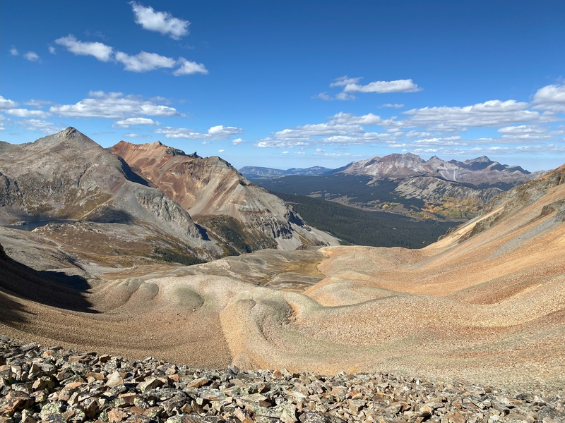
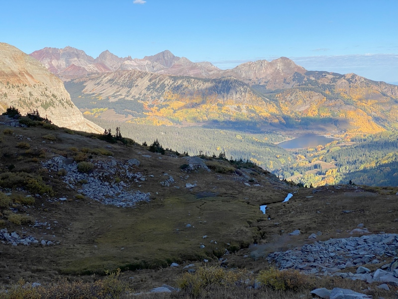
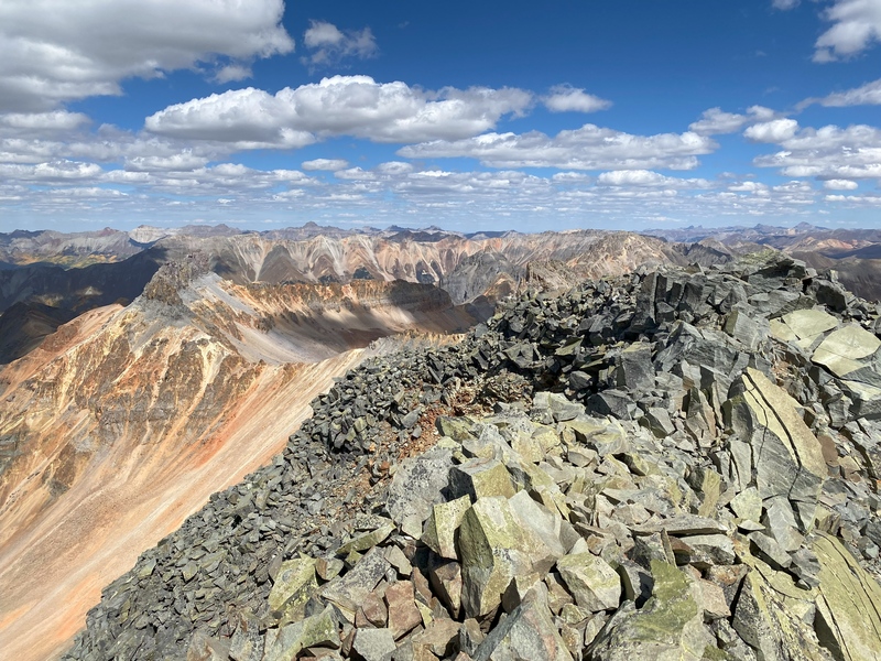
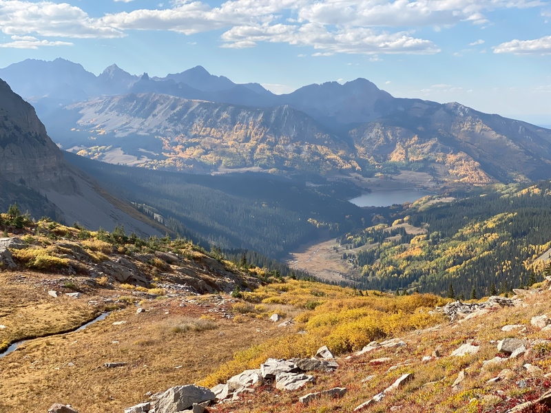
At the saddle I paused to appreciate Ice Lakes’ unique shades of teal and cyan and admire the pointy summits, rubbly ridgelines and steep cliffs stretching toward Golden Horn and Pilot Knob. 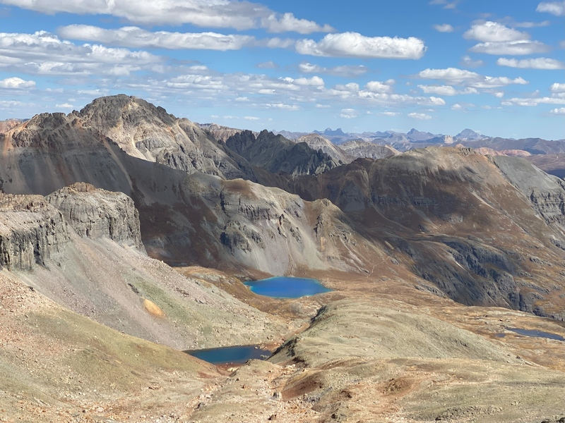
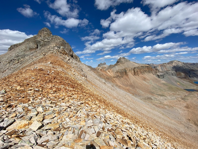

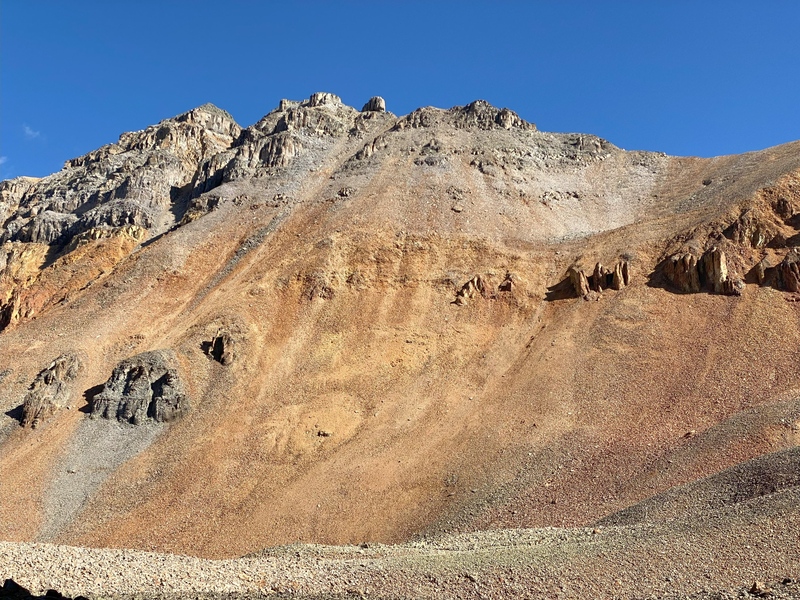
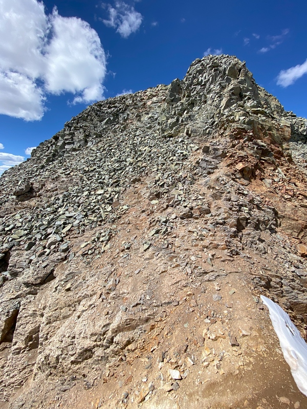
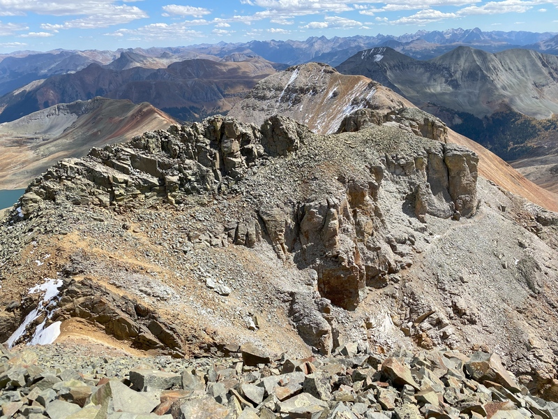
Ascending the left side of the ridge, seeing strange geologic textures, layers and shapes further dialed up my sense of awe. The last 200’ of vertical gain added spice and adrenaline to my feelings while climbing a rib, crossing the yellow rock at the top of the Vermillion Dollar Couloir, and scaling the green summit block. 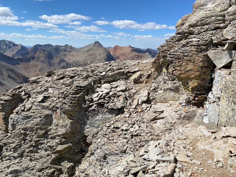


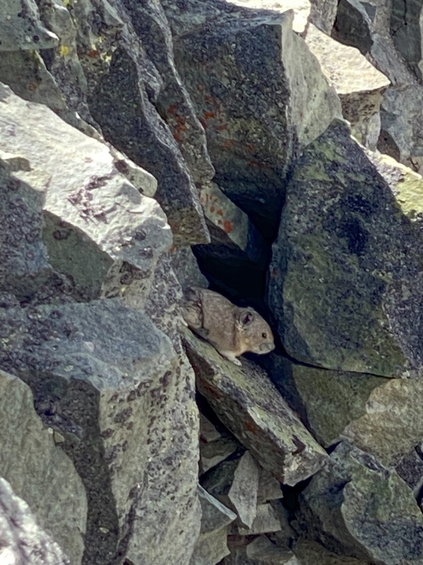
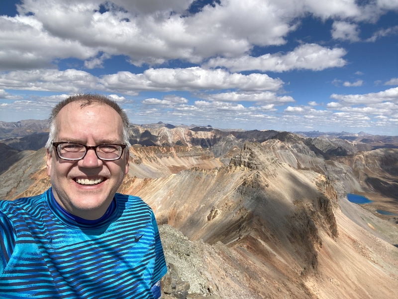
Atop Vermilion Peak at 1pm, I was greeted by a pika as I settled in for a summit rest. For 30 minutes, I snacked, took too many photos and contemplated a future hike up Gladstone Peak. Mostly, I basked in the sunshine and soaked up the rocky mountain high that I get from a challenging hike with amazing scenery. Feeling recharged, I took a deep breath and refocused my mind on safely finishing the downhill half of the journey. 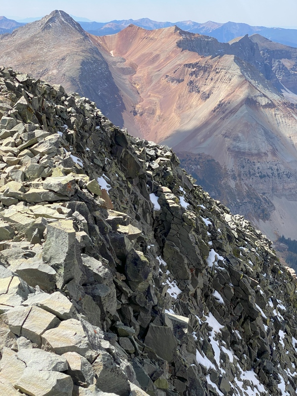
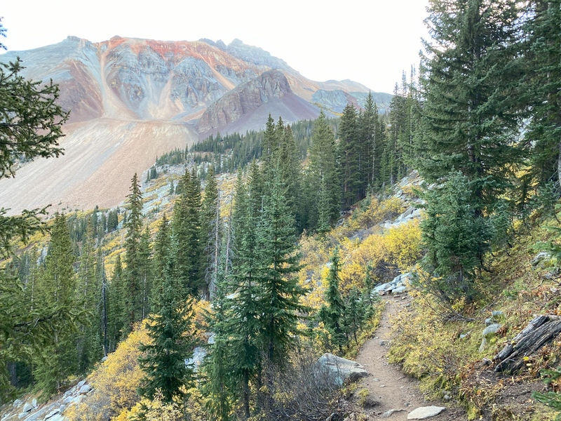
After carefully descending the first 200’, the path to the Fuller saddle was straightforward to follow and the path to the Beattie saddle was even easier. From there, I could see a few hints of use trail segments through the rock glacier below, but I only had limited success connecting the segments. During my descent, the colors continued to amaze as afternoon lighting provided subtly different views and hues. Throughout the entire hike, I saw zero people. I reached my vehicle at 6pm in time to take a few sunset photos at Trout Lake before returning for dinner in Telluride. 

References The following references were helpful in preparing for the trip from the Lake Hope Trail. Although the photos gave me some idea of what to expect, they still did not diminish the awe that I felt when I was surrounded by the mountains and their fall colors.
I’m very slow, taking 11 hours round trip to cover 9 miles and 3500' of vertical. I was impressed to see that these folks summitted Vermilion and many other mountains in less time than I climbed one summit:
Thumbnails for uploaded photos (click to open slideshow): ")
")
")
")
")
")
")
")
")
")
")
")
")
")
")
")
")
")
")
")
")
")
")
")
")
")
")
")
")
")
")
")
")
")
")
")
")
")
")
")
")
")
")
|
| Comments or Questions | |||
|---|---|---|---|
|
Caution: The information contained in this report may not be accurate and should not be the only resource used in preparation for your climb. Failure to have the necessary experience, physical conditioning, supplies or equipment can result in injury or death. 14ers.com and the author(s) of this report provide no warranties, either express or implied, that the information provided is accurate or reliable. By using the information provided, you agree to indemnify and hold harmless 14ers.com and the report author(s) with respect to any claims and demands against them, including any attorney fees and expenses. Please read the 14ers.com Safety and Disclaimer pages for more information.
Please respect private property: 14ers.com supports the rights of private landowners to determine how and by whom their land will be used. In Colorado, it is your responsibility to determine if land is private and to obtain the appropriate permission before entering the property.

