After doing Horseshoe and Huron the first two days of the trip, we chose to take a break on day 3. We went to a car show in Buena Vista, the Princeton Hot Springs, and in the evening, we went to the local county fair to watch the various rodeo events. By far the most entertaining was the "mutton busting" which is kids riding sheep. I didn't know that was a thing, but it was awesome.
Before going to the rodeo, we had decided to check out the road to Mt Princeton. It had been quite a number of years since I had been up that road, but I didn't remember it being that difficult. Well, I do NOT recommend heading up the Princeton Road in the afternoon. This road is a one lane road for the majority, and backing up can be treacherous at times. The problem with going UP in the afternoon, is this is the time that most people are going DOWN from the day hikes on Princeton. So, I won't be doing that again. In the future, I would wait until at least after 5 pm, when most people to have driven back down already. Another thing that I learned during this "road assessment" was that my rental SUV was AWD, not 4WD. This was ok for most 4WD terrain, but when passing someone on a one lane dirt road, going uphill, it was super sketchy. The AWD system has a mind of its own, and sometimes the SUV would slide sideways just a little bit. On a clear 4WD road, this was not a problem, but when passing someone the other direction with literally inches between us, that few inches of side slide was "nail biting". We made it most of the way to the trail park spots, then went back down; fortunately without incident.
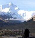
We left our campground around 5:30 am, and drove to the Princeton trailhead. In the morning, the road to the trailhead was clear, and we didn't need to pass anyone. We arrived at a good pull off parking spot around 6:30, and started our hike up the remainder of the road. We hiked 4 switchbacks of 4WD road, then made a right turn off, onto trail. The initial trail leaving the road is a bit steep, and loose, but nothing too crazy. Not longer after leaving the road, we finally were able to see Mt Princeton. The rest of our route would be to traverse the side of "Tigger Peak (13er)" on the left, then gain the Princeton/Tigger ridge, and hike the remaining ridge to the summit of Princeton. There are several ascent trails to the Princeton ridge. I generally try to gain the ridge at the point closest to the saddle (the lowest ridge point). Once on the ridge, the hike is easy class 2, with a pretty easy trail to follow. This ridge is similar to the Sherman/Sheridan ridge, rocky, but slightly steeper.
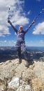
We made the summit (2.5 mi) in 3:50 hours. We spent 30 minutes on top, enjoying the blue bird day, signing the register, and eating some snacks. The descent was slower than I expected. But, the rocky terrain is just not easy to keep a fast pace. It is like hiking down and "irregular height staircase." It isn't difficult, but it is hard to gain any sort of a pace when the pattern is BIG step, SMALL, MEDIUM, BIG, BIG, etc... We made it back to the trailhead/car in 6:35 Round trip (5.22 mi, 2700 ft). Overall, this was a great trip. The kids are finally faster and stronger than Dad. I guess I need to get more serious about training.
")
")
")
")
")
")
")
")
")
")
")
")
")
")
")