| Report Type | Full |
| Peak(s) |
"South Wilson" - 14,105 feet |
| Date Posted | 07/14/2025 |
| Date Climbed | 05/25/2025 |
| Author | jfm3 |
| South Wilson: South Route |
|---|
|
South Wilson 2024: First Attempt I started tagging the 14er sub-summits while I was still working on the main 14er list (I think my first was "Northwest Lindsey" back in 2019; it has since been demoted to 13er status). I entered this year with 6 to go: North Snowmass, South Little Bear, Northeast Crestone, Pin Point, West Wilson and South Wilson. This is a detailed account of a rarely used route to climb South Wilson. Be warned: this is a long, lonely summit from any direction. I find the Wilson Group 14ers to be surprisingly isolated and difficult. South Wilson is best thought of as an entirely separate mountain from Mt. Wilson. They share a name only, and the sub-summit was harder than the regular summit for me. There are 147 different members on this website who have climbed South Wilson and recorded it on the checklist. Of these 147 people, only 3 have summited more than once. There are a few trip reports of ascents in both snow and dry conditions. Most of the snow ascents seem to be from the east; the "easiest" dry ascents are from the west. There are even a few reports of people traversing from the Mt. Wilson side on the north (not recommended unless you are Ueli Steck, Kilian Jornet or an absolute madman). I'm sure I'm not the only person who has climbed from the south, but there don't seem to be many details about my particular route. I first attempted South Wilson on Memorial Day Weekend in 2024. I camped about 1.5 miles east of the Kilpacker trailhead because the road was still blocked by a large snowdrift. I took the trail all the way into Kilpacker Basin and climbed the snow to the ridge between South Wilson and an unnamed 13er. I attempted to traverse east across this ridge, to join the south ridge of South Wilson, but had to turn around before I got across. The rock was atrociously loose. There is a narrow spot on the ridge, perhaps 50 feet end to end, that has a very steep runout on the north (left) side and big exposure above some cliffs on the south (right) side. 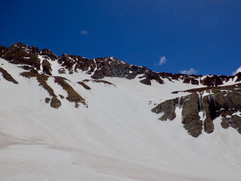
Not a single step across this ridge was solid, and in big mountaineering boots I was seriously worried I was going to step on something that would peel away from the mountain underneath me. I thought it was unsafe to continue, so I turned around and tagged the unnamed 13er instead. I considered climbing to the South Wilson ridge to the east of this ridge, but none of the small chutes had snow all the way up. I knew from previous trip reports that the rock up there is dangerously loose, and I couldn't see a way to safely ascend and descend to the east of the ridge. I reluctantly trudged back to camp. I was close enough to see the summit but it remained out of reach. 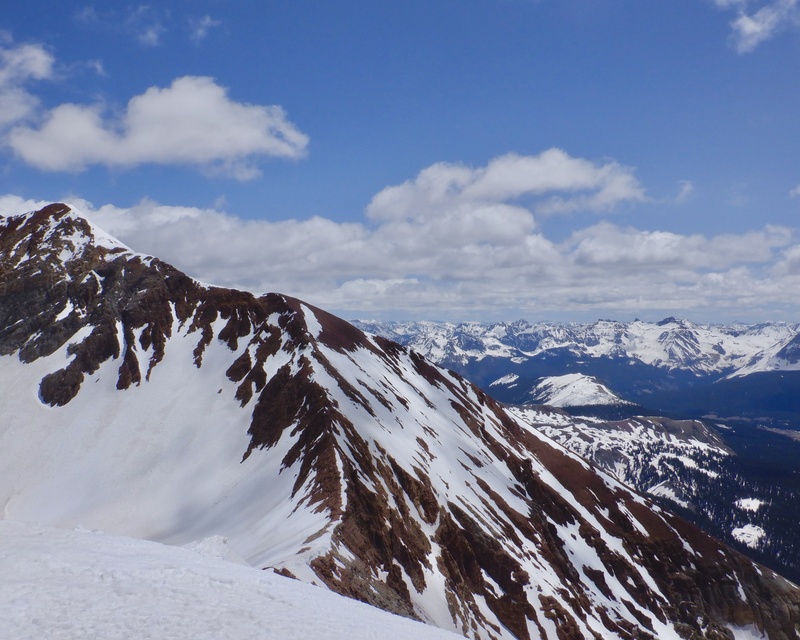

On the drive home I stopped at the Cross Mountain trailhead and studied South Wilson through the binoculars. There were 2 distinct faces with continuous snow on the south and east sides of the mountain. These did not appear to contain any exposed ridges below the summit. The south snowfield in particular looked good- it ran all the way up to the south ridge and a small bowl on the southeast side of the mountain with a direct shot to the top. Would it be possible to somehow reach the bottom of that snowfield from the south or east, then climb it? 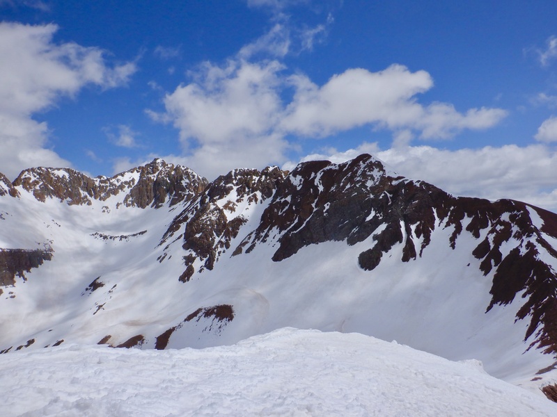
Further examination of the map showed this idea would likely work. I could approach from the east via Cross Mountain (this route has a few trip reports on this site) or from the south by starting at the Kilpacker trailhead. I liked the idea of starting at Kilpacker. That trailhead is a great place to camp and approaching from that side is a direct route to the south slope of the mountain. The only complication might be the off-trail approach between the Kilpacker road and the treeline. South Wilson is best done as a snow climb, when the majority of the rock is cemented in place. However, snow on the upper mountain would certainly mean snow in the forest on the approach. Off-trail approach through snow in possibly dense trees.......but it still seemed like the best way to get this sub-summit. 2025: Successful Attempt I drove to the Kilpacker trailhead the Saturday before Memorial Day this year. Condition reports for the Wilson Group, weather forecasts and the daily checks of the Telluride ski area webcam showed good snow coverage above treeline and (hopefully) not too much snow in the trees. I intended to take the Kilpacker road east to Coal Creek, then follow the creek as closely as I could up to the treeline. From there I would climb the snow up the south slope of the mountain, then cross the upper southeast face to the summit. There appeared to be some snow in the trees on the drive in but all the non-tree areas were clear and dry. There was one other person at the trailhead, camped in a Dodge van. He said he was going for El Diente and Mt. Wilson tomorrow via the south routes. I could see the South Wilson summit from my camp and I was excited to climb. I set the alarm for 3 AM and bundled up in the tent. 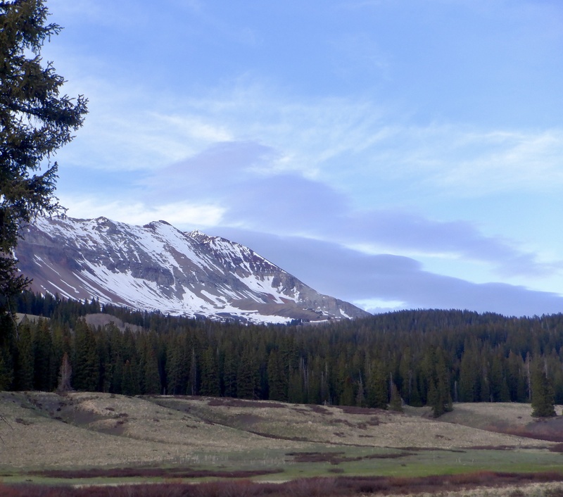
Never. Ever. Again. I’m so glad I got the summit on this attempt because this was a complete beat-down. I slept alright and stayed warm, bundled up in the tent. It took 40 minutes to get dressed and out of camp. I warmed up on the walk down the road, then turned north just after crossing the creek. I didn’t know what the crossing would be like closer to 11,000 feet, so I decided to cross the creek on the road and forge a route through the trees to the top of the hill, then go north to the treeline. Bad idea. I should have stuck to the west side of the creek, following the open areas and then going up the steeper hills to the treeline. I had no idea of the suffering that awaited by going through the forest. I entered the trees and quickly encountered drifted snow. I knew I had to go up the hill, while keeping the sound of the creek fairly close to my left, so I tried to pick a straight line through the snow and deadfall. I thrashed around for awhile and eventually reached a steeper hill. I was already aware how long it was taking to make little forward progress. I descended slightly and went back to the west, miraculously emerging into an open area. I walked up the dry ground to the next stand of trees and checked the map. I was already a few hundred feet up, and the best route looked to be straight ahead on a northeast bearing to eventually reach the treeline and the easiest access to the south slope of the mountain. There was more snow in the trees but it was mostly solid and I found some dry ground. I thought the worst was behind me. Once I crossed to the north side of the hill I encountered unimaginable horror. The snow was a slight crust, maybe 2 inches thick, atop unconsolidated and occasionally bottomless sugar. It took me 3 hours to wallow about 2 miles to the treeline. I have never, in my life, anywhere, on any mountain, experienced the debilitating, soul-breaking misery that was this forest. The snow wasn’t firm enough to support my weight. I sank in to my knees and occasionally my thighs on 2 out of every 3 steps. I was able to keep a fairly straight heading while also staying at approximately the same elevation all the way to the upper end of Coal Creek, but forward progress was absolutely excruciating. I had to thrash up and down many short, steep rollers. I occasionally found unburied logs to walk on for 10-30 feet, before plunging back into the snow. Every 15 minutes I found some bare ground, but it was crossed in just a few strides. After an hour, literally every step was agony. My shins became bruised from constant smashing into the crust. I sank in to my hips a few times on steep slopes, and even crawled on my hands and knees twice. 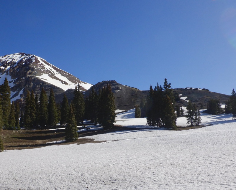
I eventually paused on every single step, waiting for the snow to break beneath me. Every step felt like I was standing on a trapdoor with a noose around my neck. I said “I can’t do it” on every single step. I consulted the map and my watch a few times, disgusted with the miniscule distance I’d covered since the last check. The sun rose and at some point I turned off my headlamp. I stopped to eat a few times, vaguely aware that I needed to keep fueling to get myself out of this place. I yelled at nothing, begging with the trees to make the snow finally go away. I didn’t bring the snowshoes, but I really don’t think they would have helped for this part of the approach. There was no trail to follow, so the path wasn’t level. The constant up and down, and all the buried logs, would have made footing difficult with the snowshoes. And, if I still sank in, extricating myself would have been all the more difficult. Once or twice I even thought I would seriously never escape the trees, doomed to wander through the snow until I wasted away. Somehow, I managed to reach 11,200’, and I turned up the hill, finally nearing the treeline. 
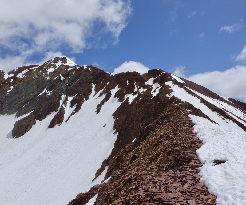
I had to endure another 15 minutes of misery in the snow before reaching dry ground. Ahead and above I could see the lower part of the south slope and no more trees. FINALLY. I still didn’t know if I would get to the top but at least I was free of the goddamn forest. I could hear Coal Creek to my left and I was concerned about the descent, but I knew there was much more open ground on the west side of the creek. Surely I could get down there and have an easier hike back to the car. I took a break to eat, then crossed one more area of snow that was mercifully frozen and supportive. I hiked up a steep slope and arrived on a short ridge adjacent to the south slope. I could see the snowfield that I wanted to follow all the way to the upper ridge at 13,700’. I continued up the ridge until it ran out, then took a break to put on all the climbing gear. Now, almost 6 hours into the day, I finally started up the actual mountain. I have a hard time judging vertical distance on these long, semi-steep snowfields. It took over an hour to climb 1,000’ to the top of the south slope. I could see all the way to the top the whole time, but there were several distinct sections to the climb. The first was an upward traverse to get to the other side of a small cliff. Then it was straight up the slope, with a steeper rollover about halfway between the cliff and the top. I moved upward in 50 and 100-step increments, pausing to drink, breathe heavily and look at the scenery. There were a few gusts of wind but I was comfortable in a light jacket and no hat. The snow was still reasonably solid despite all the sun exposure. I began thinking I might actually summit this thing. And, best of all, my hybrid boots and crampons were working very well. I think these boots will become my favorite for non-winter mountaineering. They are incredibly light and felt like running shoes on the approach/deproach, while also feeling very sturdy kicking steps with the crampons. 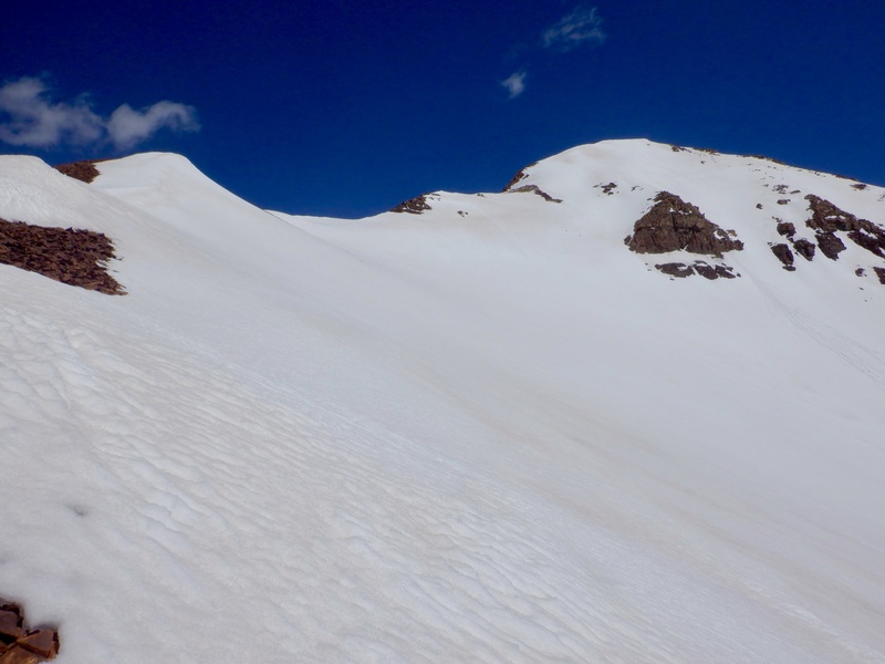
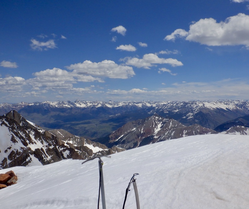
More than an hour after starting up the snow, I got to the top of the south slope. The upper southeast face was completely covered in snow, and much steeper than what I’d just ascended. I stayed on the crest of the ridge and followed the snow up to the junction with the south ridge. There was a cornice/drift a few feet high on the crest, so I stayed on the east side. I couldn’t tell where the rock ended on the west side, above all those junk gullies. El Diente loomed menacingly to the west. I wondered if anyone had ever climbed/skied the tiny couloir off the south side of the summit, and now as I write, a quick search shows that Lou Dawson (of course) did ski it. I didn’t see anyone on the traverse or in Kilpacker Basin. I traversed across the top of the southeast face, negotiating one steep section of snow and finding good plants with the axes and crampons. The ridge was fairly steep for the final 100 vertical feet. The exposure to the right felt immediate, so I stayed slightly west and chopped my way up the snow. I got to the top of the bump, walked across the final few steps of the surprisingly broad summit and planted both axes on the highest arete of snow I could find. Holy hell I actually did it. 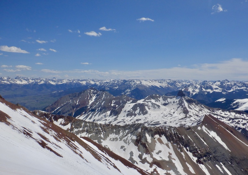
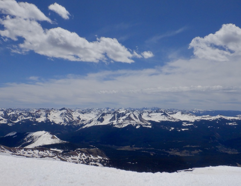
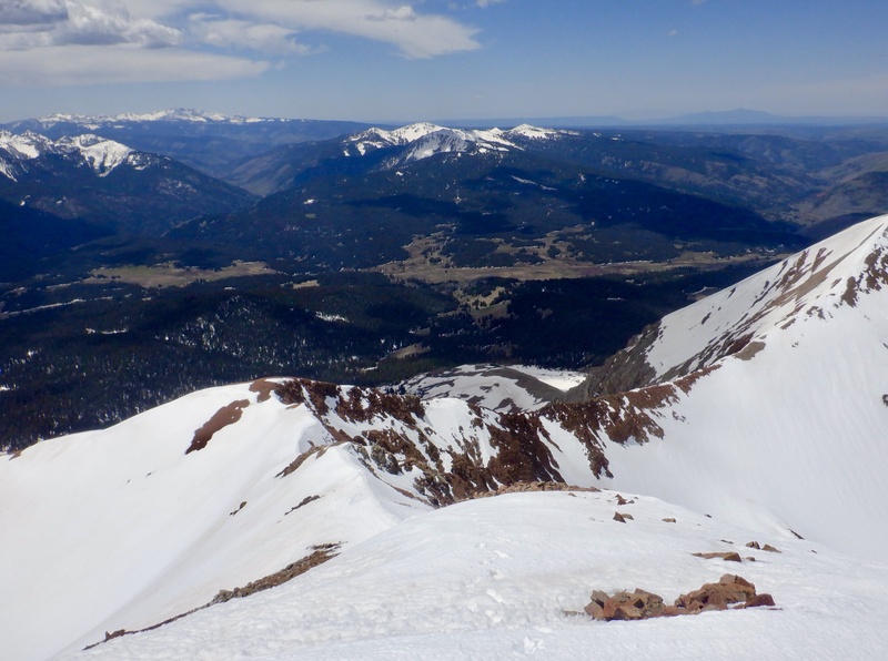
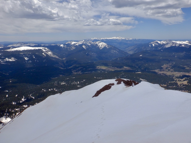
I took a break on the summit but didn’t stay long, well aware of the long-ass trek back to the car that awaited. The views of Mt. Wilson and El Diente were quite striking. There were some clouds to the south but I was still comfortable in a light jacket. I ate and put on more sunscreen before starting down. I faced in on the steep pitch just below the top, then followed my tracks back across the upper southeast face. I looked down at the Cross Mountain approach, wondering if that would have been any better than the Kilpacker approach. Probably not. It looked at least as long, with probably more distance to traverse on the snow around the treeline. I could see CO145 way below. I looked to the west and saw a single person on top of El Diente. This turned out to be the other guy camped at Kilpacker. 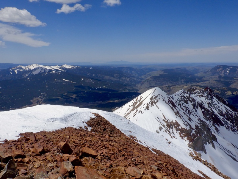
Clouds screened out the sun as I reached the top of the south slope. It looked steep from above, but not quite steep enough to face in for the whole descent. The snow was the right consistency for comfortable side stepping. I steadily lost elevation, occasionally switchbacking or rotating to alternate which leg was going downhill. I did face in for the steeper rollover section in the middle, then turned back around. There were no other boot/crampon tracks, no ski tracks, nothing. The snow was significantly worse on the traverse to the lower ridge. I sank in to my knee every other step and the crampons occasionally hit rock. Once I reached dry ground I took off the climbing gear and eyed Coal Creek, still far below. I saw a route that might lead me to the tantalizing areas of bare, dry ground. 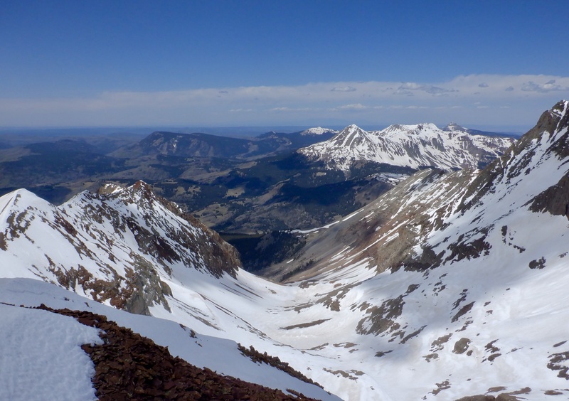
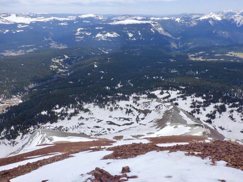
I descended the hill off the ridge, then had another slow, annoying struggle through the snowfield above the waterfall. I sank in every step and at one point I started crawling on my hands and knees, trying to disperse my weight across the snow. After I got across this area it was back into the trees, there were more areas of bare ground, and even a few trail segments, so I made some decent progress moving west. Eventually the sound of the creek wasn’t as loud, and I wasn’t getting any closer to the open areas I’d seen from above. I looked at the map and decided to just go straight downhill, directly toward the creek. This didn’t take too long but there was yet more miserable wallowing through the wretched snow. Not a single step was on a solid surface. Even going downhill the experience was completely debilitating. It was such a relief to FINALLY get out of the trees and onto dry, bare ground. I crossed a large meadow and took a long break to change to summer clothes, eat and re-load the pack. I still had a ways to go but I could see most of the descent back to the road. Anything would be easier than having to Kool-Aid Man through the snow with every single step. 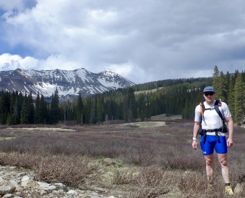
The remaining hike back to the road was really pleasant. I kept the creek on my left and took as straight a line as I could across the open meadows. There were a few tree stands with trail segments but absolutely no snow. After 40 minutes of delightful walking on level, solid ground, I reached the road. The mile+ stroll back to camp was the easiest movement I did all day. I really should have stayed west of the creek on the ascent. Even in the dark I would have been able to stay in the open areas and gotten to the shelf much faster. The steeper climb around the waterfall to the treeline might have been slow-going in the dark, but it would still be much shorter than the endless forest traverse on the east side. 
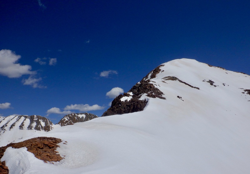
I unpacked and organized the gear in the car, then rinsed off and put on warm clothes. The wind was strong and I was cold despite the setting sun illuminating my camp. The guy in the van arrived shortly after I did. He had a similar experience in the snow below Kilpacker Basin and descended after summiting El Diente. I ate dinner and went to sleep at 8 PM, tired but satisfied with the summit after a long, grueling day. I'm going to take at least a year off before returning to the Wilson Group. I need to at least attempt West Wilson and Pin Point, and possibly Gladstone, eventually. Gladstone seems to be safe only under snow cover, and is a very long approach from the east or west. I know that West Wilson can be climbed by itself from the south/Kilpacker side, via a steep but clean snowfield, with minimal overhead hazard, just to its east, below the El Diente-Mt. Wilson traverse. Pin Point might be impossible for me. The gendarmes are completely vertical on the south and north sides, and the west side is class 5 with enormous exposure. Some reports say the east side is slightly easier, but there was a fatality in this area last year and the summit looks incredibly imposing from every angle. The obvious way to attempt both of the sub-summits is while doing the traverse, but that requires climbing and descending the main 14er summits, which are challenging enough by themselves. I have no desire to climb on these slag piles when they're dry, so that limits the best/safest climbing conditions to a 3 or 4-week window in April/May. Ideally, there will be sufficient snow on the upper mountain to lock most of the rock in place, but no/minimal snow in the trees, to avoid a miserably slow/difficult approach. This would be especially important if camping along the route, closer to the summits. Thrashing through the forest was hard enough with a large day pack; doing it with a huge multi-overnight pack would be unimaginably brutal. Add in a day of driving from Boulder on either side of the climb and the remaining summits quickly become a mini expedition. I'll work on the other sub-summits and let this group sit for awhile. It isn't going anywhere, though the summits might get a few feet shorter as all the junk rock falls down! Here is a link to my Strava entry of this climb: https://www.strava.com/activities/14606753304. The text and photos are the same as those in this report. I tried uploading the GPX data to this report but the file is too big. The route on the upper mountain is easy to see. The ascent route is the right/east variation down low, and the descent is the left/west variation. Thumbnails for uploaded photos (click to open slideshow):  South Wilson seen from my campsite at the Kilpacker trailhead")
 Finally free of the wretched snow in the trees")
 First look at the snowfield on the south slope")
 Entering the top of the southeast face")
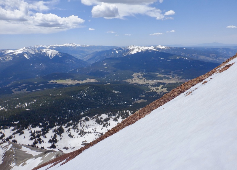
 East view from the summit")
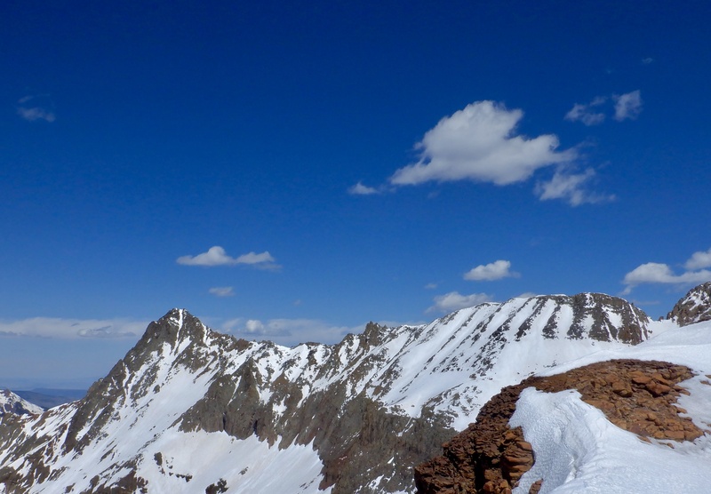
 El Diente, Pin Point and West Wilson")
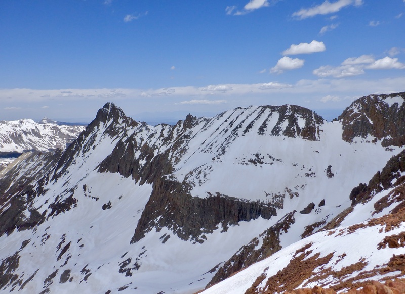
 Traversing the top of the southeast face")
 North view to Mt. Wilson from the summit")
 El Diente, Pin Point and West Wilson from the summit")
 West view from the summit")
 Southeast view from the summit. CO145 over Lizard Head Pass is visible below.")
 North view from the summit")
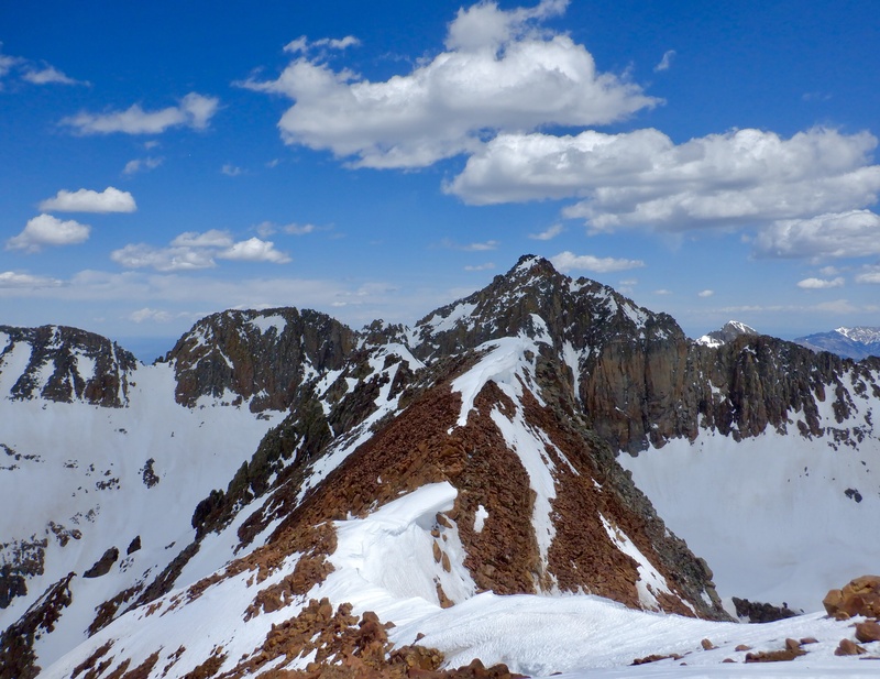
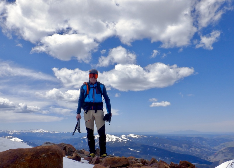
 On the summit")
 Looking down on Kilpacker Basin from the summit")
 Descending the top of the southeast face")
 Almost back to the south slope")
 Descending the south slope")
 Typical angle of the south slope")
 Back at the Kilpacker road")
 Most of the route on the upper mountain is visible from the Kilpacker road")
 The death choss on the west ridge of South Wilson")
 View of the upper ridge from the unnamed 13er to the west")
 Upper south face of South Wilson")
 West and south ridges of South Wilson")
 The snowfield leading to the west ridge of South Wilson above Kilpacker Basin")
|
| Comments or Questions | ||||||
|---|---|---|---|---|---|---|
|
Caution: The information contained in this report may not be accurate and should not be the only resource used in preparation for your climb. Failure to have the necessary experience, physical conditioning, supplies or equipment can result in injury or death. 14ers.com and the author(s) of this report provide no warranties, either express or implied, that the information provided is accurate or reliable. By using the information provided, you agree to indemnify and hold harmless 14ers.com and the report author(s) with respect to any claims and demands against them, including any attorney fees and expenses. Please read the 14ers.com Safety and Disclaimer pages for more information.
Please respect private property: 14ers.com supports the rights of private landowners to determine how and by whom their land will be used. In Colorado, it is your responsibility to determine if land is private and to obtain the appropriate permission before entering the property.


