| Report Type | Full |
| Peak(s) |
Kelso Mountain - 13,172 feet Mt. Edwards - 13,860 feet Grays Peak - 14,275 feet Torreys Peak - 14,272 feet Grizzly Peak - 13,435 feet "Cupid" - 13,126 feet |
| Date Posted | 07/04/2025 |
| Date Climbed | 06/26/2025 |
| Author | Alpine_Iris |
| Hiking 8 peaks to get back to my bike to get back to my car | |||||||||||||||||||||||||||
|---|---|---|---|---|---|---|---|---|---|---|---|---|---|---|---|---|---|---|---|---|---|---|---|---|---|---|---|
|
Stats: 21 Miles, 9920 ft of vert, 13 hours 40 minutes
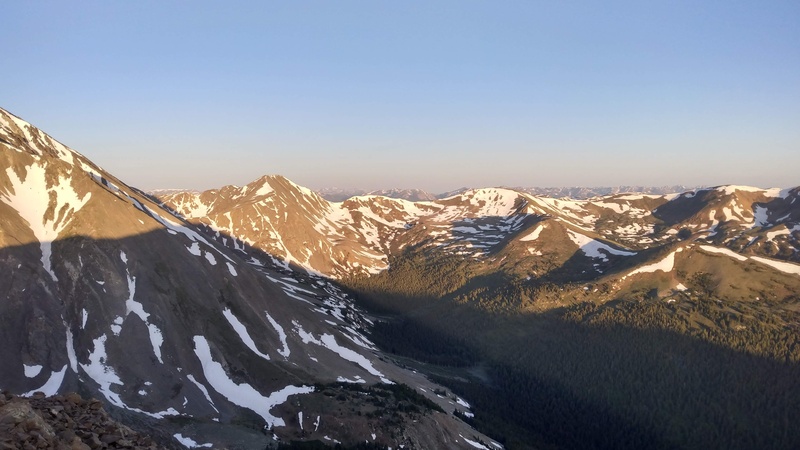
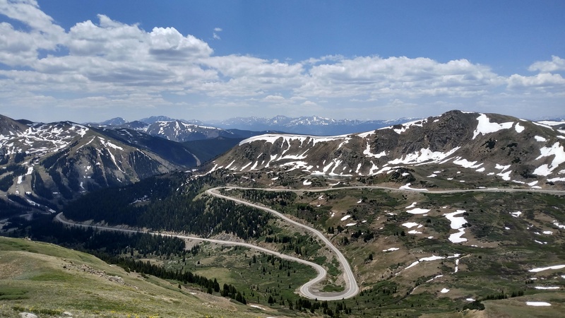
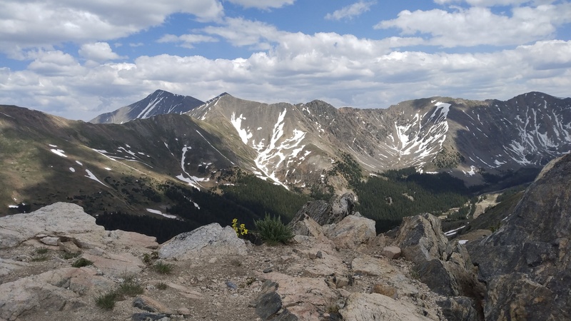
Looking at Lists of John about a week before, I had a nice little cluster of peaks around Grays and Torreys that I needed to do. Grays was one of the first 14ers I ever did, but on that day my inexperienced group was not feeling up for Torreys, and I had not been back to the area since. I felt really great on some recent hikes that were around 6k-7k feet of vert, and I wanted to try something bigger. I started messing around on Caltopo, trying to see how big of a day it would be and how many of these peaks I could fit into one hike. At first I thought that to combine all of them, I would have to do a car shuttle, but then I noticed the (paved!) Bakerville to Loveland Trail. I realized that with a properly placed bike, I could start at the grays and torreys trailhead, do all the peaks I wanted, hike down to my bike near the Loveland ski area, and ride my bike about 6 miles downhill to my car. I did some google street view scouting to make sure there was a place to hide my bike and that the path was actually paved. Caltopo was telling me that the hike would be around 18 miles and around 9600ft of vert. Everything was falling into place! On the 25th, I noticed that the weather forecast for the 26th was really good, and I started prepping for the hike. I made a cute little sign for my bike that said "Please don't move my bike! It's my transportation back to my car after a long mountain adventure" and the date. Hopefully that would be convincing enough lol. I ate a lot of pasta and went to sleep at 6pm. I woke up at 2am, ate some breakfast and started driving. Around 3:30am, I hid my bike in some trees across the road from the gate to loveland ski area, and I drove back down to the Grays and Torreys trailhead. I started hiking up the road at 4am. I don't often hike in the dark, so it was a little spooky. Fortunately I did not get eaten by a mountain lion. There were a surprising amount of people driving up the road at 4am, perhaps only surprising to me since I rarely hike 14ers. Once I was at the upper trailhead, it was light enough for me to see without my headlamp, and the steep north face of Mt. Edwards was slowly becoming visible due to the impending sunrise. 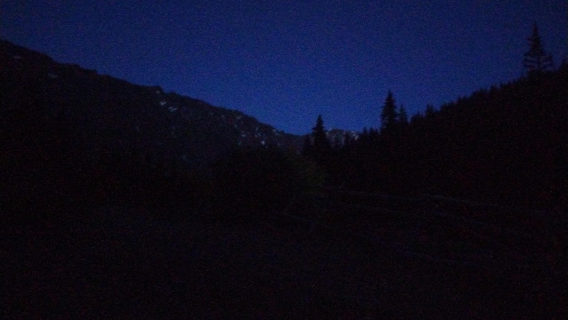
I followed the very well constructed trail through a few switchbacks, and then it was time to head up the steep grassy slopes of Kelso Mountain. The sky to the east was getting brighter, and some of the flowers were pointing towards where the sun would soon be. 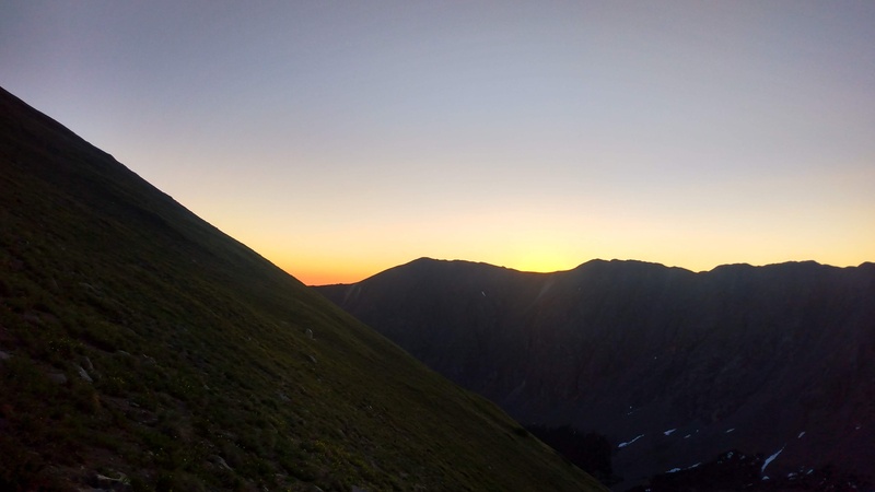
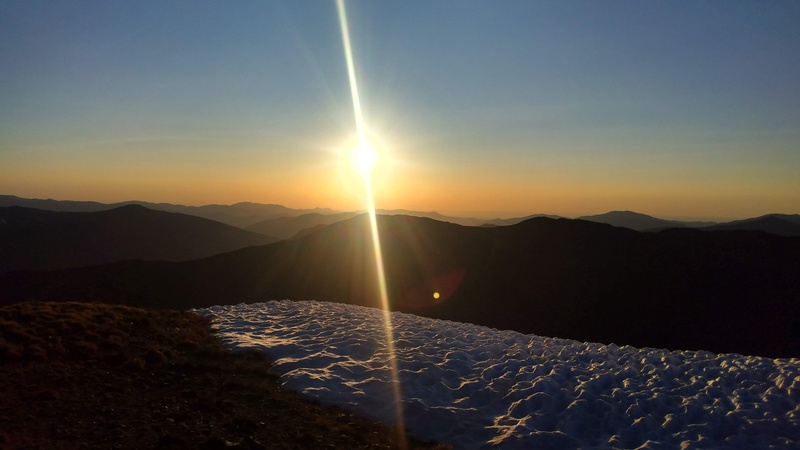
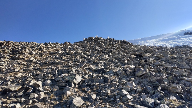
Almost exactly 2 hours after starting, I reached the summit of Kelso Mountain. The sun was now fully up, and I had pretty good views of most of the peaks on my agenda. I ate a granola bar that had so much chocolate it was basically candy, and started heading back down towards the trail. 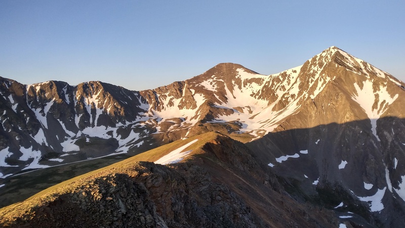
Once I was back on the trail, I followed the standard route up Grays for a while on my way to Edwards. Around here I also rolled the shit out of my ankle, always happens when you're back on a trail and not paying attention lol. Luckily my ankles are made of steel and I was fine. 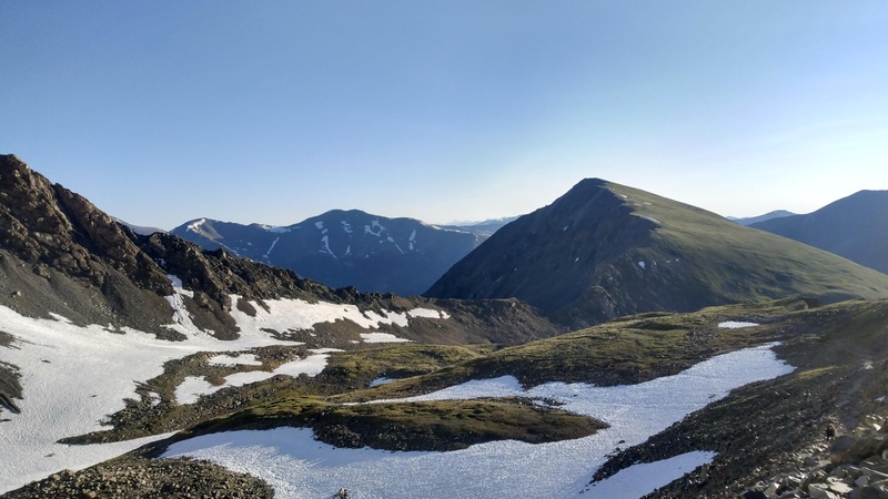
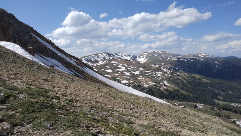
Eventually I left the trail and crossed a small patch of snow to get on the ridge. From the trip reports I read in preparation, Edwards would be the most technically difficult and unknown part of the day, with different people calling this ridge anything between class 3 and 1+. I wasn't directly on the ridge very often, and I never encountered any major exposure or anything harder than class 2. All the bad looking parts had trail beaten through them. Definitely more tedious than difficult or scary. I saw some mountain goats near the summit and I gave them some room by dropping a bit off the ridge. The summit views were nice, and I ate a bunch of gummy bears while thinking about how I had already done about half of the vert I planned to do today. How hard could it be? 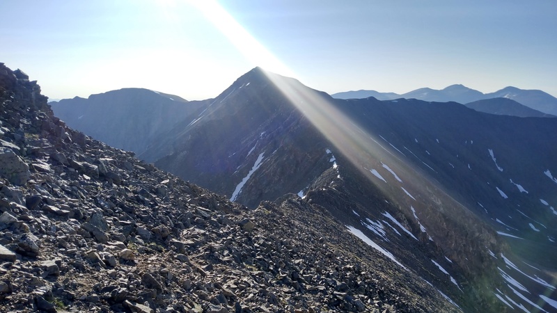

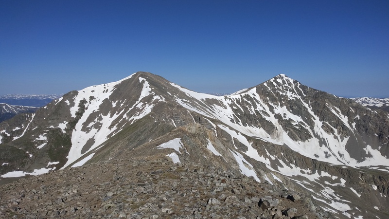
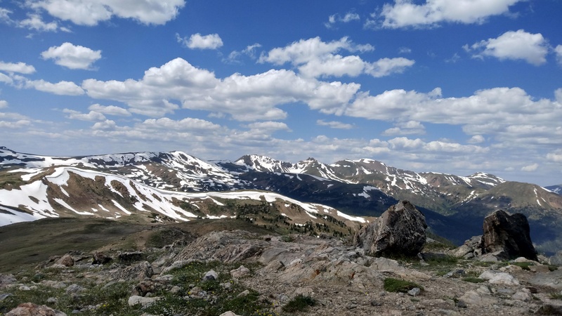
I reversed my route towards Grays Peak, and eventually made it to the summit. I was definitely a little tired at this point. There were about a billion people ontop of Grays, and as I passed a group of high school boys, one of them told me "you're locked in". Thanks I guess? I sat for a bit and ate some more gummy bears. I decided to go down to the saddle with Torreys and take a longer break, and figure out if I want to do the full hike when I'm on Torreys. 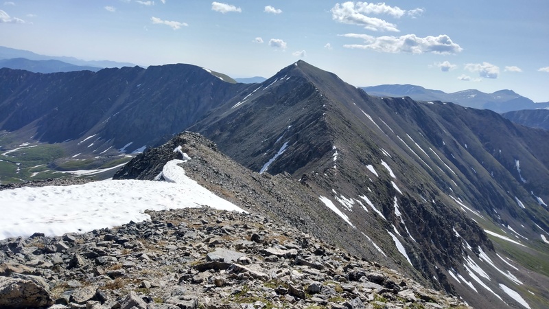

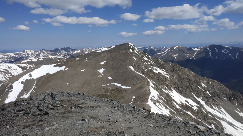
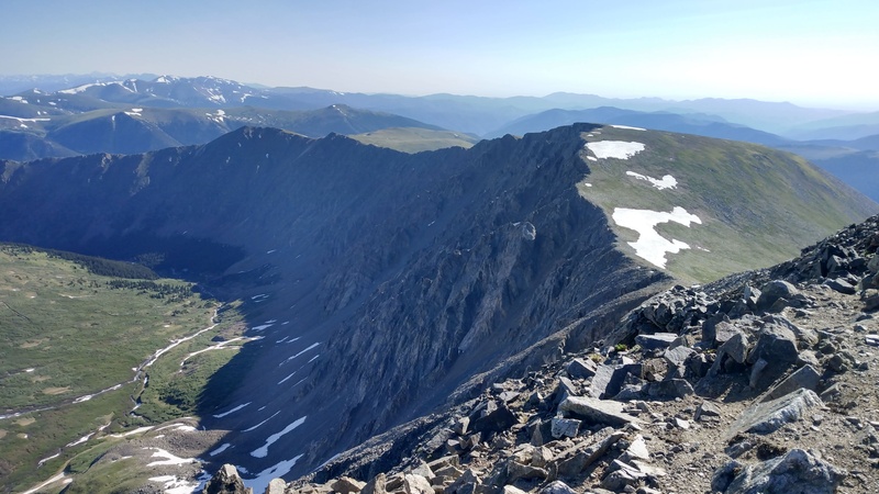
At the saddle between the two 14ers, I laid down in one of those wind shelters and covered my face with my hat. I probably was there for like 5 or 10 minutes before I started heading up Torreys. Going up Torreys was hard, but I was still feeling good. At the summit I ate a brownie. So delicious. There was also a woman coming from Grizzly and I got to ask her about a problematic looking snowfield (thanks!), which turned out to be no big deal to go around. The descent off Torreys towards Grizzly was long and loose in spots, but it felt amazing to be going downhill. 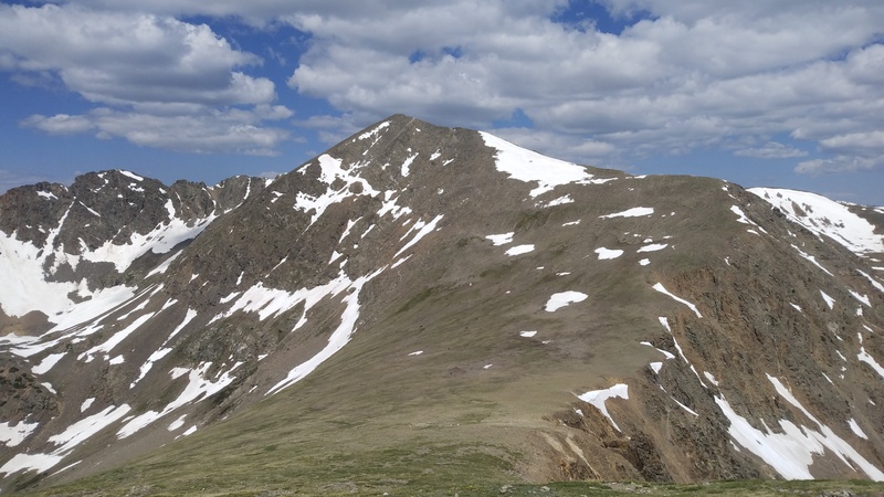
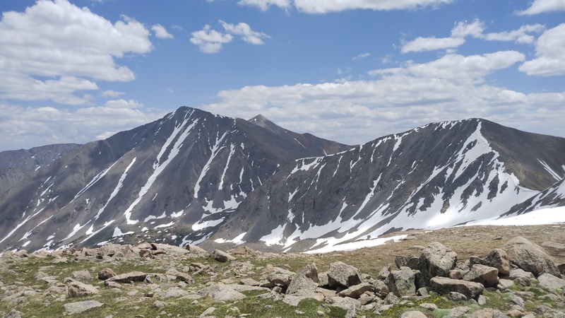
When I was planning the hike, I noted that I would be breaking my personal "vert record" on the way up Grizzly, and I expected it to feel really hard. It felt a lot easier than I was expecting, probably from the lower elevation compared to Torreys, and the fact that I had the long downhill section right before. At the summit of Grizzly, I spent some time trying to figure out which peak AS P560 Benchmark was, and I could not come to definite conclusion, a little because it is one rolling 12,000 ft bump on a ridge of many bumps, and mostly because I was getting pretty tired 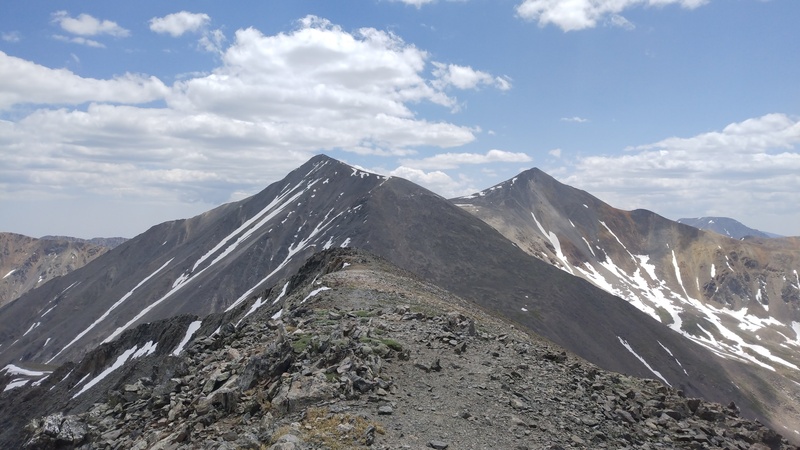
The descent off Grizzly was very similar to the descent off Torreys, and I enjoyed the easier terrain as I walked over the unranked unnamed bump before cupid. Heading up cupid there was a large patch of snow that I avoided by going through a bunch of big (microwave to fridge sized) talus. Cupid was where I was really starting to feel it. I was a little sad I had only packed one brownie, and I spent my time at the summit eating the last of my gummy bears. 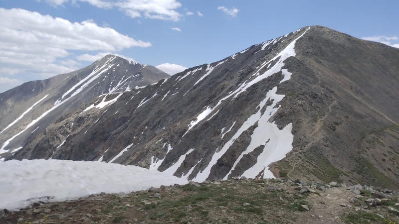
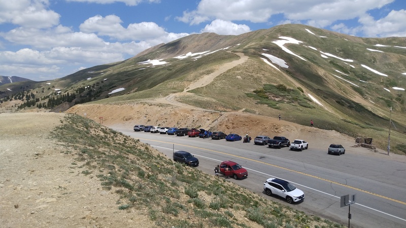
As I descended from cupid, I was considering skipping the last two peaks, but I needed to get to loveland pass either way. I was getting really tired and I took a break on the extremely braided trail just above loveland pass. 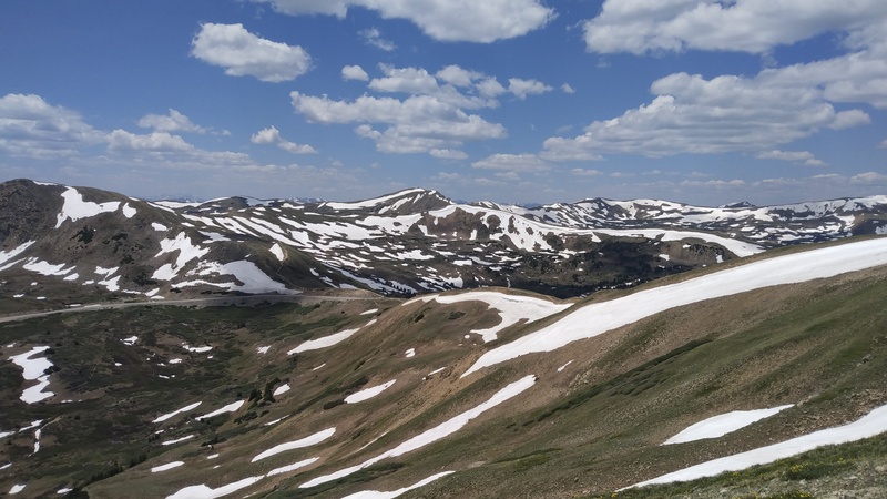
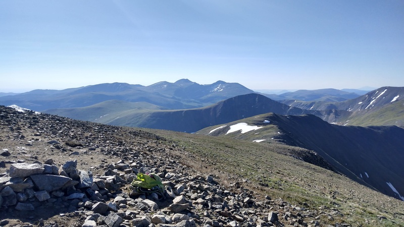
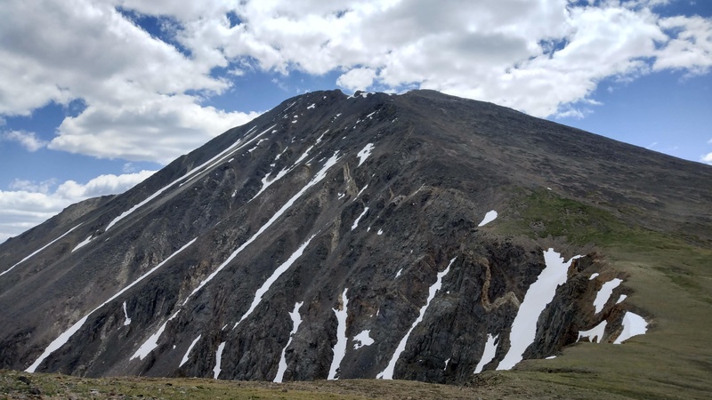
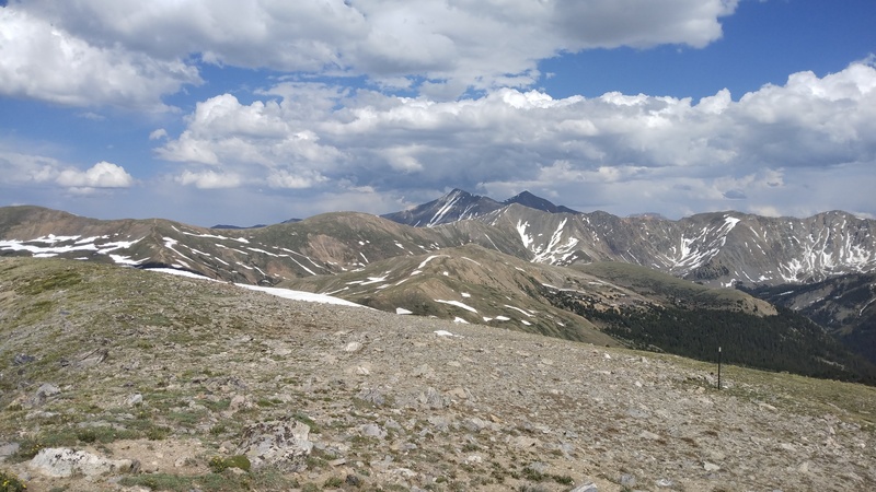
Once I reached the road, I sat in the shade of the big sign for a while and ate some more, and decided that I had plenty of time to do the last two peaks, even if I went super slow. So I started heading up the unnamed 12er above loveland pass. About 30 seconds up the trail, I needed to take another break. I was really working for each bit of progress and a bit farther up, I realized that the trail I was on was not heading towards the 12er and that I had to go farther left to get back to the ridge. I remembered that I had brought a GU gel (never tried it before), but I was worried it would make me nauseous. That thing was so fucking delicious. It was like vanilla coffee flavored, and I was determined to suck every last bit of it out of the packet. Being worried about nausea, I took a little nap with my hat over my face, probably 10 or 15 minutes. After that, I felt so much better, and I was back to moving at a workable pace (certainly not fast though). Eventually I reached the summit, and I could finally tell which bump my next peak was. 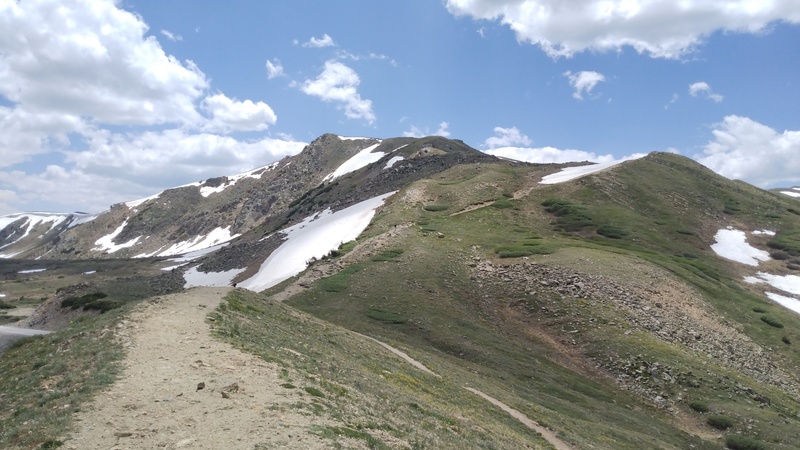

I kept following the continental divide, feeling tired, but still moving since it was mostly flat. On the last unnamed unranked bump before my last peak, I sat and talked to a guy about what I had been doing all day, mostly to give myself an excuse to rest more. It's always interesting to talk to people who are less goal oriented in the mountains. sometimes I forget that sometimes people go out to random places without a plan and just enjoy nature. Personally, I love maps and data and how much you can learn about a mountain before you've ever been there. And then once you're there you experience all of the things that you couldn't know without being there in person. Anyways, there was a bit of a descent to a saddle before the final ascent to AS P560 BM (go figure). A little annoying and loose, but not as bad as the descents on Torreys or Grizzly. The last little climb to this peak (I think it was only 600 ft) is probably the most difficult thing I have ever done physically. I kept telling myself "It's just one South Table". And I was basically just moving slowly from one seat on a rock to the next. Eventually the slope relented, and after a false summit or two, I reached the top of my 8th peak of the day. I felt so fucking good, partly because I didn't have to walk uphill anymore, and just so happy that I had done all the peaks on this crazy hike. I could also see that I had a snow free way to get off the ridge and down into the ski slopes. 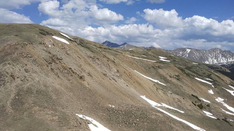
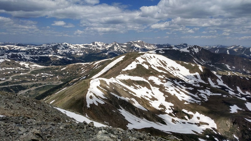
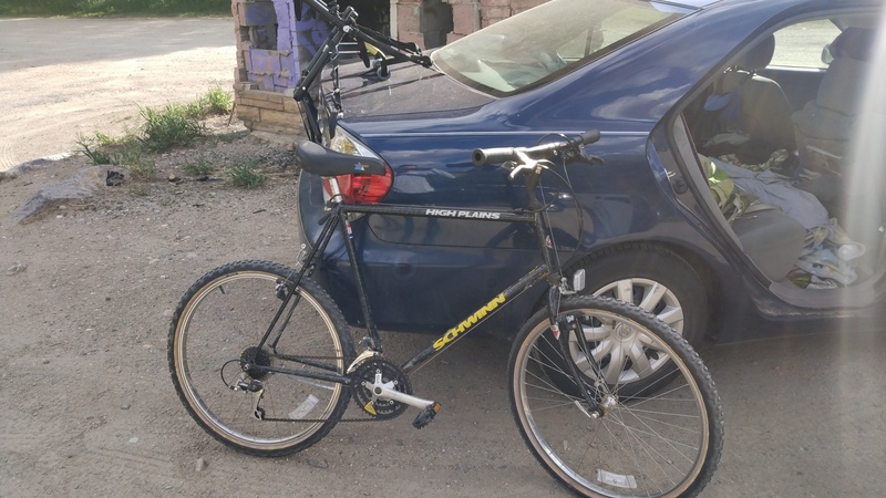
Descending through loveland ski area, there were a few annoying bits of snow to cross, but nothing horrible. I aimed for one of the lifts and then followed it down to a road. The road dumped me into a parking lot, and I made it back to my bike, which was exactly how I left it. I barely ever ride my bike, and my legs were not super functional, so the ride back to my car was a little difficult. I was mainly worried about crashing while riding on the dirt road before the path or somehow using up my breaks on the long downhill (bike people please chime in to tell me my concerns are silly). Neither of those things happened, it was pretty fun to zoom along on the bike path. After about 45 minutes of biking, I was back at my car! So efficient! 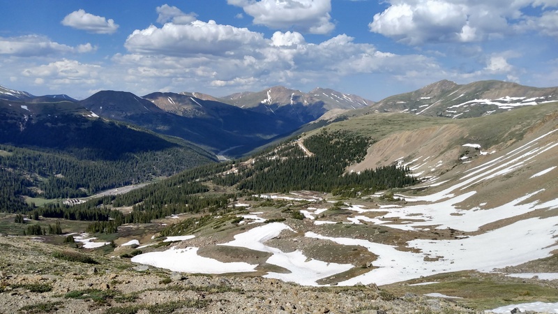
I really enjoyed this hike. It was just an amazing day out in the mountains, and it went pretty much exactly to plan. I'm super excited to do more days with insane amounts of vert, and find more ways to use a bike for peakbagging. Don't think I'll be bikepacking the centennials anytime soon, but I'd love to find another outing that is made so much more feasible with a bike like this one is. Thumbnails for uploaded photos (click to open slideshow):  Finally back at my car")
")
")
")
")
")
")
")
")
")
")
")
")
")
")
")
")
")
")
")
")
")
")
")
")
")
")
")
")
")
")
")
")
|
| Comments or Questions | |||
|---|---|---|---|
|
Caution: The information contained in this report may not be accurate and should not be the only resource used in preparation for your climb. Failure to have the necessary experience, physical conditioning, supplies or equipment can result in injury or death. 14ers.com and the author(s) of this report provide no warranties, either express or implied, that the information provided is accurate or reliable. By using the information provided, you agree to indemnify and hold harmless 14ers.com and the report author(s) with respect to any claims and demands against them, including any attorney fees and expenses. Please read the 14ers.com Safety and Disclaimer pages for more information.
Please respect private property: 14ers.com supports the rights of private landowners to determine how and by whom their land will be used. In Colorado, it is your responsibility to determine if land is private and to obtain the appropriate permission before entering the property.