| Report Type | Full |
| Peak(s) |
Beattie Peak - 13,351 feet Unnamed 13302 - 13,302 feet "V 9" - 13,244 feet Rolling Mountain - 13,697 feet Twin Sisters West - 13,382 feet Twin Sisters East - 13,441 feet "V 7" - 13,043 feet |
| Date Posted | 07/01/2025 |
| Date Climbed | 06/26/2025 |
| Author | yaktoleft13 |
| Alas! Choss! |
|---|
|
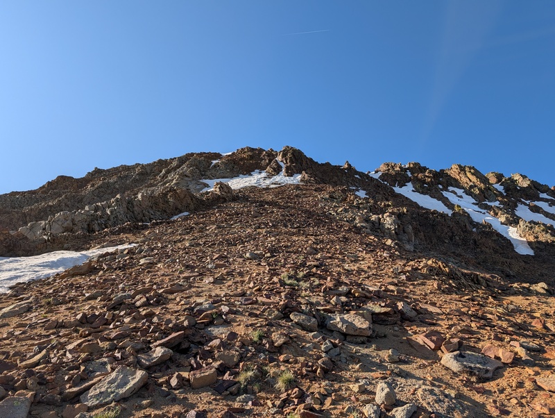
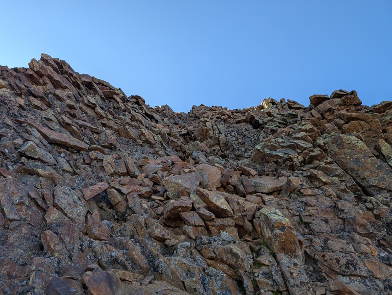
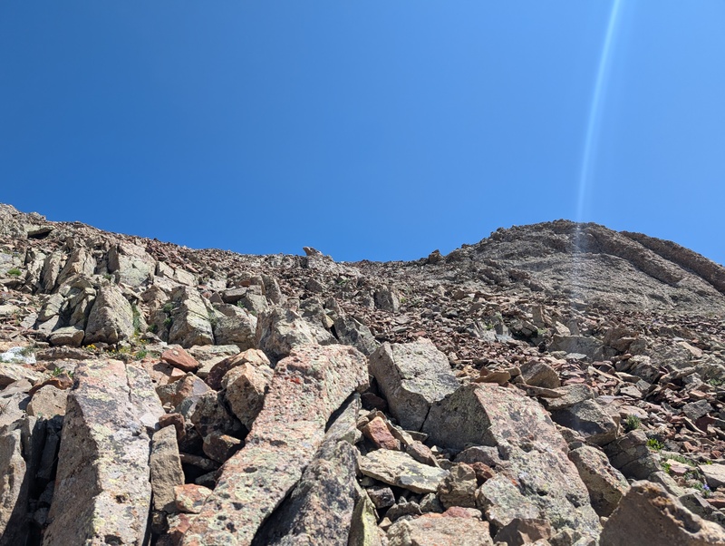
Route: Beattie E slopes - > ridge to Rolling -> E ridge and south slopes descent to TSW south slopes and ridge to TSE -> V7 west slopes (really rolls off the tongue huh) Trailhead: Bandera Mine Distance: 16-17 miles Gain: 8,400 Difficulty: Loose 3rd Time: 11:50 In my never-ending quest for efficiency in tackling the more heinous of the San Juans, I hatched an ill-conceived plan to link up two of the looser groups found in the San Miguel area: the Rolling Group and Twin Sisters group. Despite all reports confirming heinous crimes of a loose nature, I talked myself into an ambitious seven (the most magically powerful number!) peak linkup of the entire ridge above the Rico/Silverton trailhead, because the only thing thing better than loose rock is loose rock on highly fatigued legs. Unsurprisingly, this was to be a solo undertaking; my friends are smarter than me. I took the day off Thursday and Wednesday afternoon departed on the long but familiar drive to Red Mountain Pass. Arriving at the Ice Lakes Basin turnoff at around 10 PM, I was pleased to find the road empty. Past the popular trailhead, the road got a bit rougher, but still easily AWDable. I crawled into the back of the 4Runner and grabbed a few hours of sleep before the 340 alarm buzzed me awake. After some quick food and drink, I started up the now-closed 4wd road that leads to the pass between 13,302 and V9. A mile later, I veered up into the trees, leaving the comfort of the wide old road, and began the bushwhack into the basin between Fuller and Beattie. The bushwhack was intermittently tough; most of the sections that had trees were fine, but beware any area that appeared clear, as they were chocked with willows. I eventually navigated east of Beattie's prominent SE ridge and settled into the basin as first light appeared. As I approached the saddle, it became clear that at least some short amount of angled snow travel would be necessary. I could either drop to the bottom of the basin and climb the ~100 feet of snow up to the saddle, or I could save myself the elevation and sidehill on semi-steep snow (for trail runners). I elected to stay high and sidehill to avoid extra gain, and while I carried crampons and an axe (I was NOT about to be shut down by a short steep snowfield somewhere up there for lack of carrying the right gear), I was also not about to pull them out this early and for such low-consequence terrain (I hoped). Fortunately, shoes and poles proved to be sufficient, as I didn't tumble downhill, and I was quickly across and on the respite of....choss! 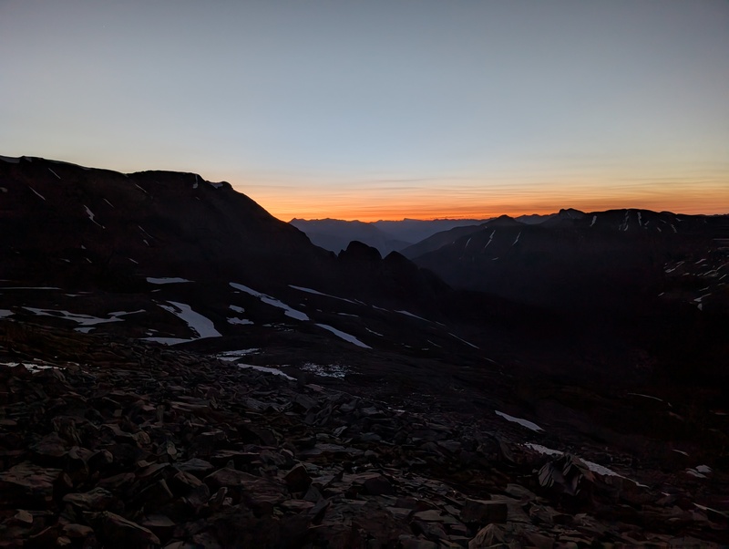
Beattie ended up only being a taste of what was to come. Rather than backtrack to the saddle and take the whole ridge up, I climbed up the small, rocky talus, traversing toward the ridge while gaining elevation. No step was completely solid; there was always at least one rock that decided down was better than up and would find a new place to call home. But I was mentally prepared (Otina warned this was a 9/10 looseness route) and figured up was the way to go. It was a short slope, and once on the crest of the ridge, a use trail appeared and proved to be much more solid, though I could have done without the surprisingly consistent and chilly wind. A short walk to the top of Beattie put me on top of summit #1! 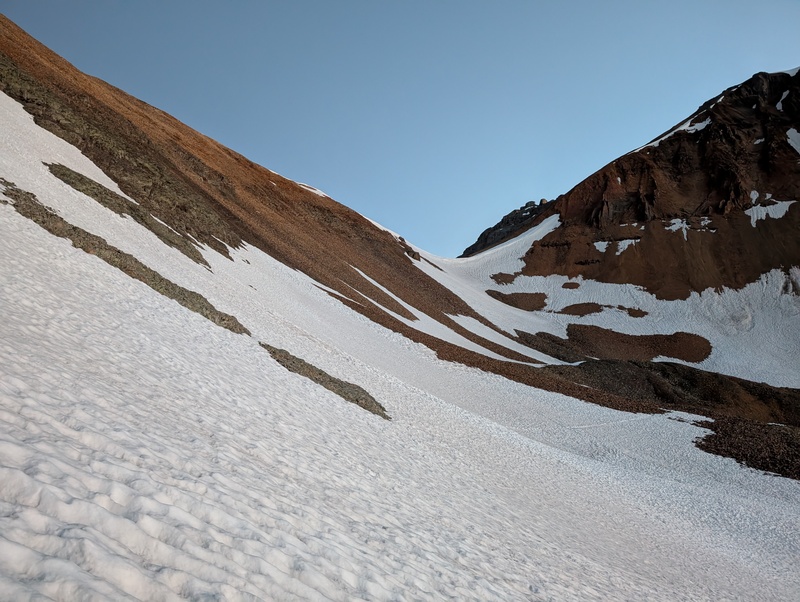
A couple minutes after topping out on Beattie, I saddled up and headed down the ridge toward 13,302. The ridge was somewhat narrow in spots (a couple of feet) and, of course, loose in nature, but there wasn't much else to it. Views the whole way down the ridge informed me that things would change on the way up 302 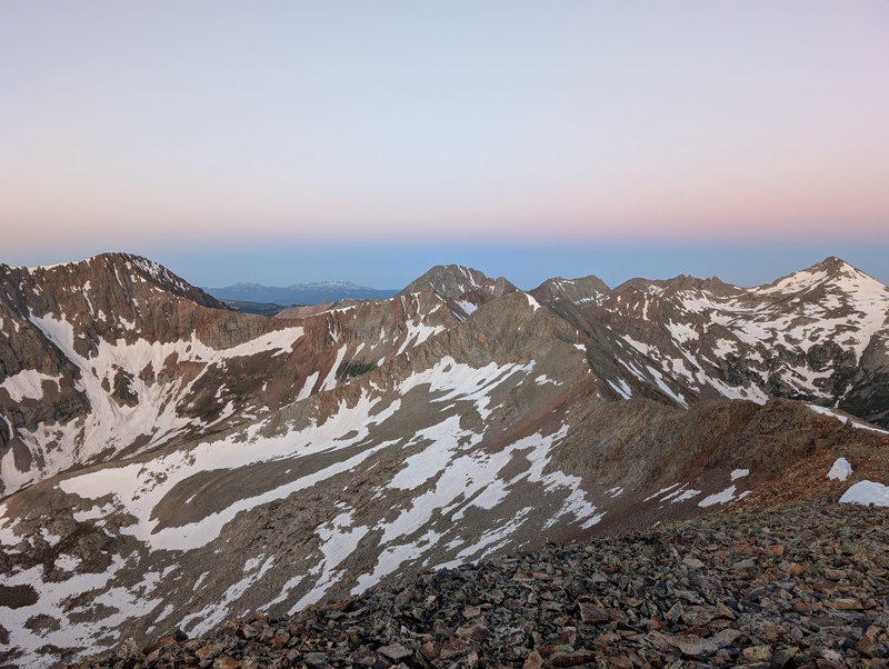
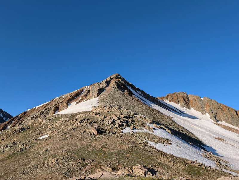
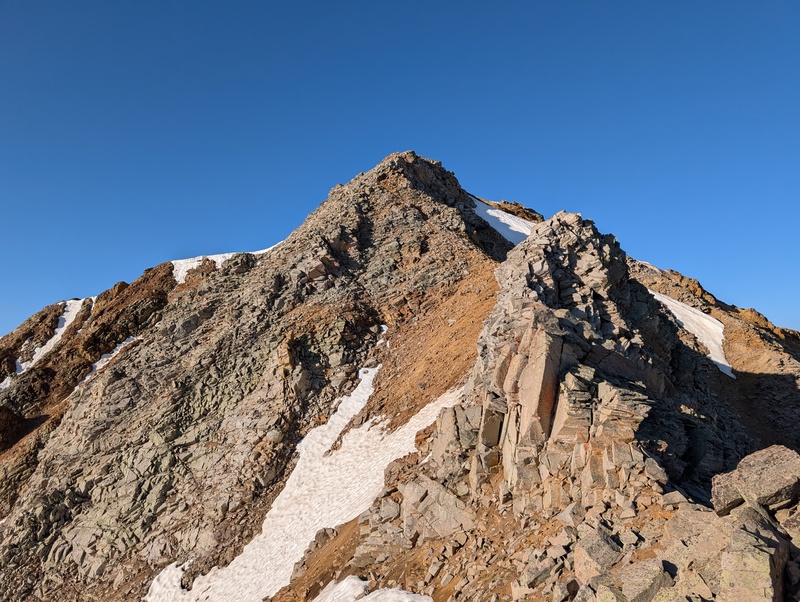
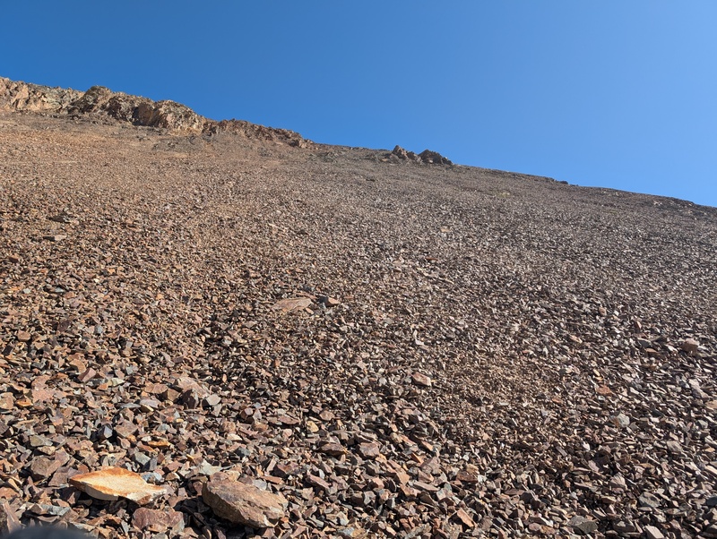
As expected, things ramped up a bit as I plodded up 302. The ridge steepened and ultimately came to a crest that appeared to be held up by magic (which, I reminded myself, it probably was). I dodged around a point on the ridge and was faced with either a stiff scramble up the ridge crest of death, or a crawl up a gully of death. I went ridge, and it ended up being not as bad as it looked. Sure, care was still required on the steep 3rd class moves, but my weight didn't knock the whole thing down, so that's a win. After tiptoeing over the precariously placed piles of pumice (I know it's not pumice but give me the alliteration), I topped out on 302, less than 2 1/2 hours after leaving the car. It was still too early to send any texts, so I ate a bit of food and took off for V9. 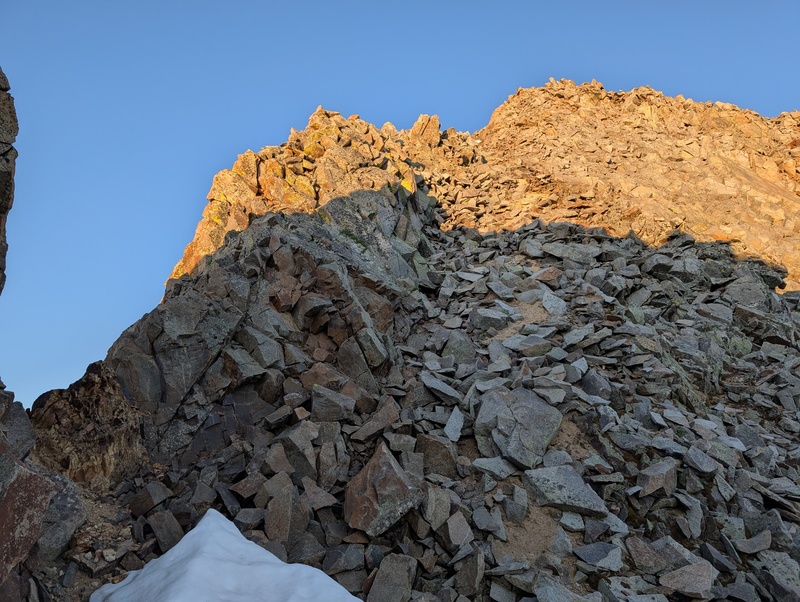

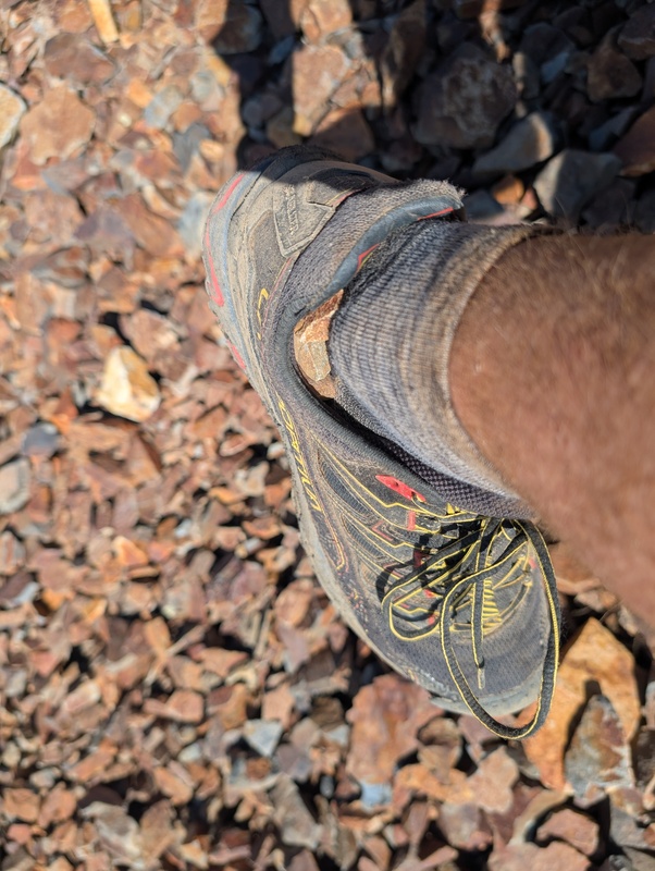
Alright, these peaks had flexed their looseness. I get it. Time to bomb down the south ridge of 302 to the low pass, then tackle V9. Straightforward, right? Uh, nah. The south ridge/slopes/whatever you want to call it of 302 were, uh, let's just say not what I was hoping. It was 800 feet of the nastiest talus you'll ever encounter. Every single step caused rock to move, and these weren't the friendly, baseball sized talus pieces I encountered heading up Beattie. No, these were big boy talus: football, microwave, and sled sized talus whose only mission in life was to shift in the most awkward way possible and bang your ankles. This slope gave me my first painful talus-caused ankle bonk of the year, and followed it up 5 steps later with #2 (right on the bone and right in the same place! It's always in the exact same place). Because of these rocks' size and fascination with relocating, this descent was quite slow and tedious. But eventually I made it to the bottom, and, after dumping some scree out of my shoes, I was ready to head up. 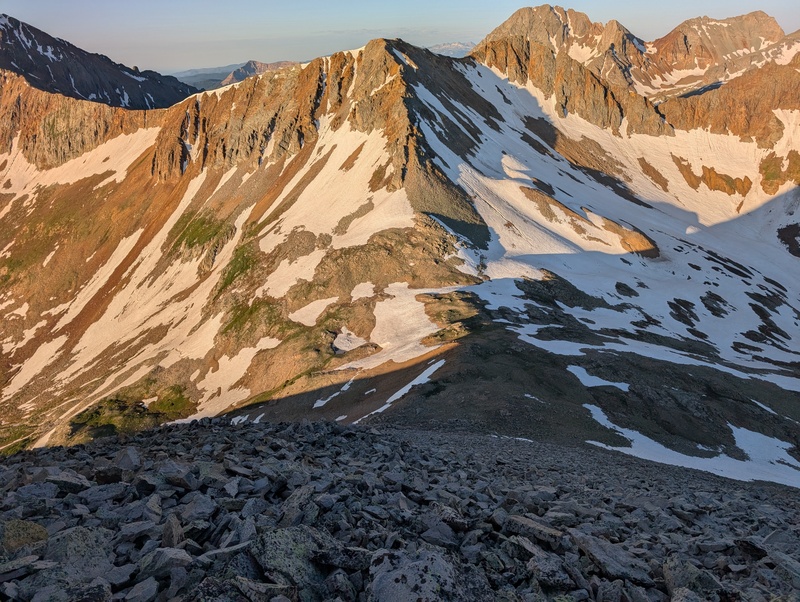
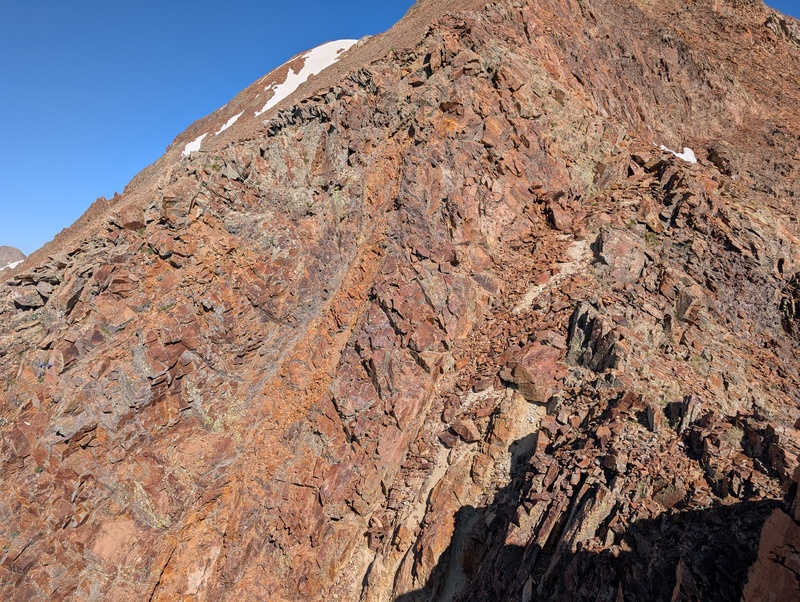
My hope for better rock was soon dashed. The gentle lower slopes of V9's north ridge led to steeper talus/scree slopes, then to a ridge that narrowed to a point, but a point you half expected to fall sideways into the abyss. It didn't though, and I clung to the mini ridge right of the main ridge crest in hope of better rock. This worked relatively well, and once above the first section I hopped left to scamper up the main ridge. That 3rd class scrambling spit me out at a saddle just below the last push to the summit, and after dodging a tower, I worked up the still loose ridge to reach the summit of V9. 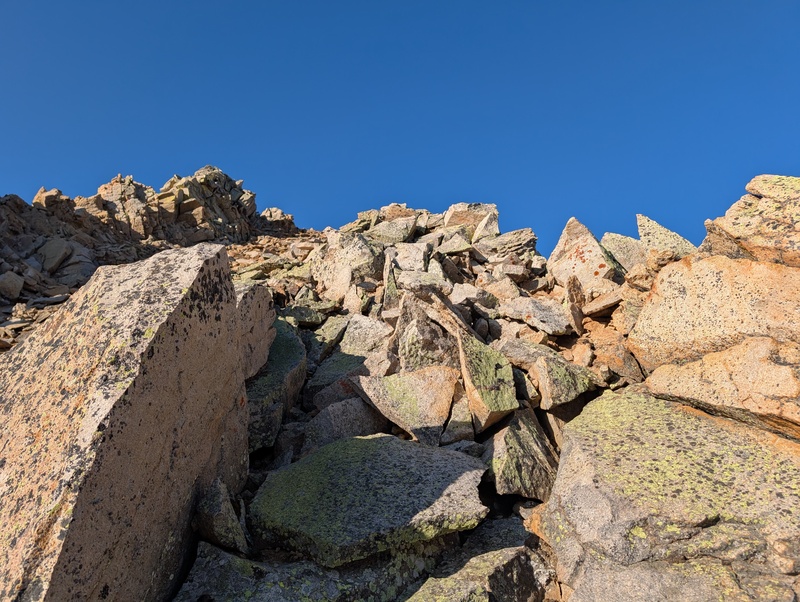
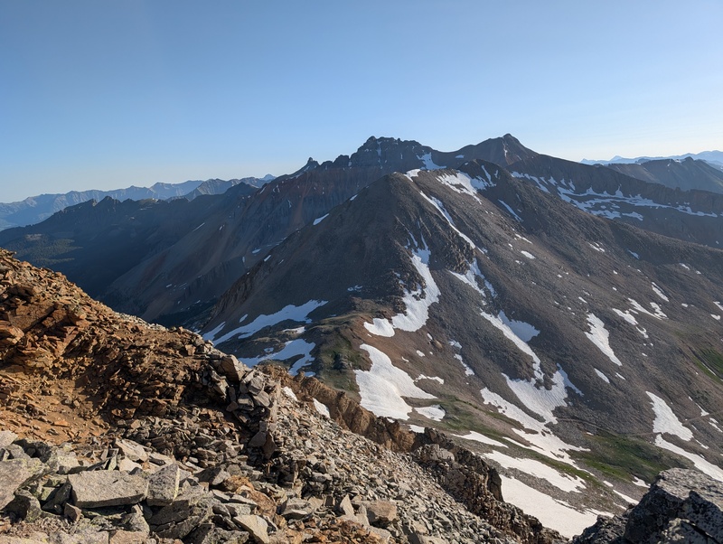
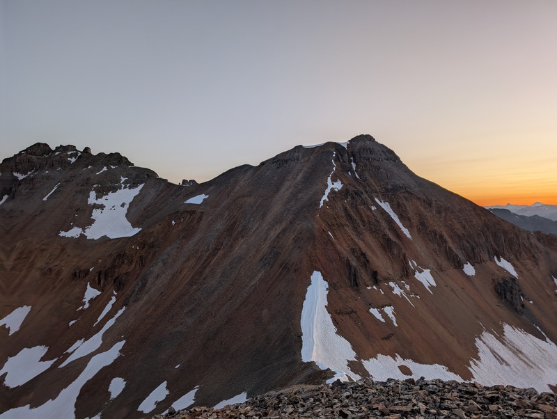
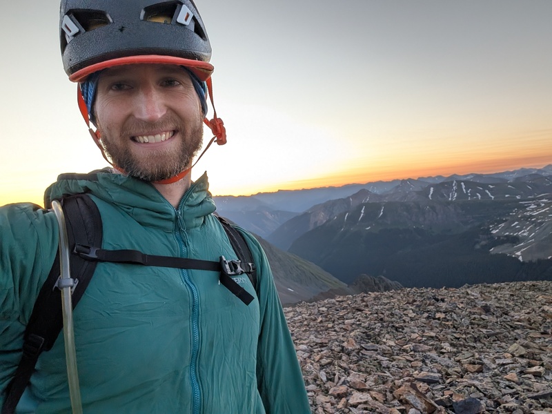
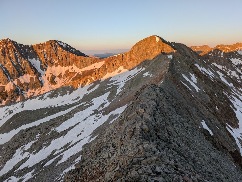
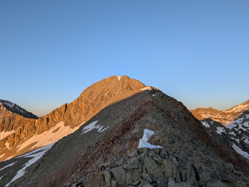
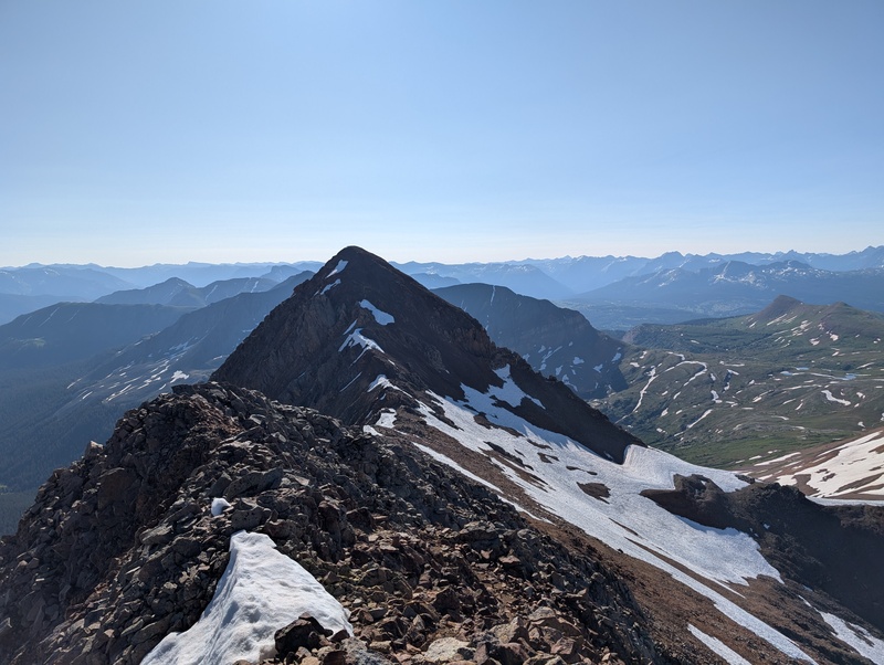
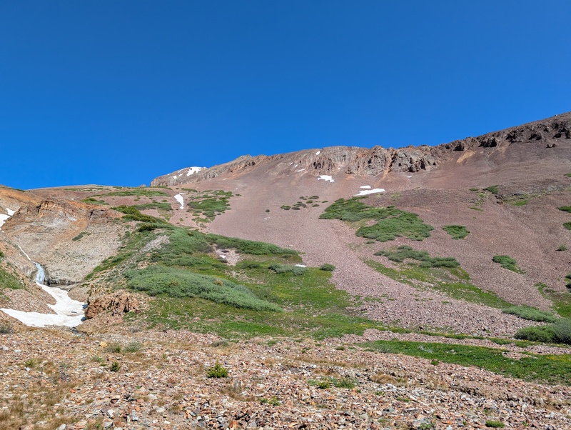
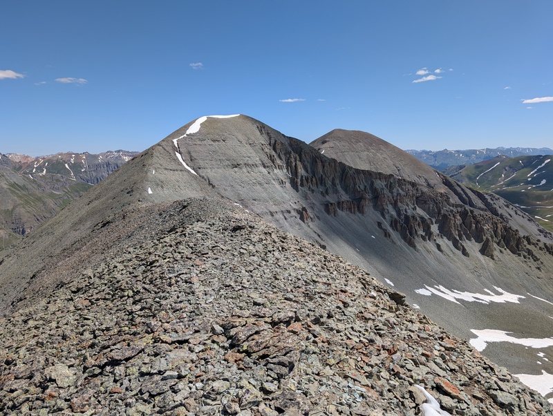
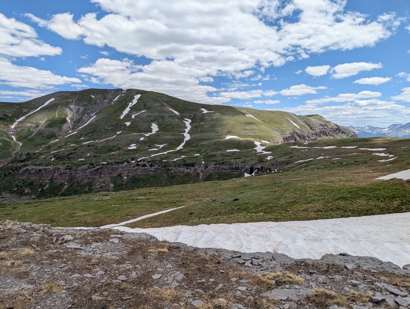
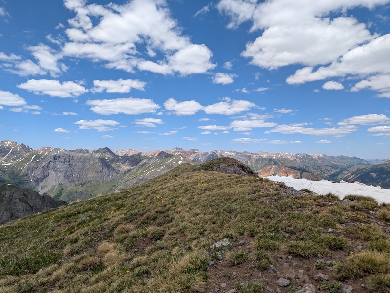
Finally past the ungodly early hours of no texting. I took a bit of a break, sent some texts to my wife, and ate a bit more food. In my mind, I just needed to get down/up/down the next peak, then the day would get easier. Stay tuned to see if that's true! The south ridge descent of V9 seemed like only went down about 50 feet, but I guess the long and gentle ridge got down low enough to make V9 ranked (and bless it for it!). The north ridge up to Rolling's fake summit was imposing, to say the least, especially from a distance. The last hundred or so feet looked vertical, and the rest of it looked like more of the same choss. Of the lower part, I wasn't wrong, but this section had the added bonus of some sandy undersoil mixed in with the rock, just for variety's sake. There was still a lingering snowfield on the ridge crest, so as I approached the upper portion of the ridge, I chose to go right and scramble up some loose but easy 3rd class, which took me up to the summit ridge. From there, the true summit of Rolling was just 10 or 15 minutes away, and on largely easy (though loose) terrain. I topped out peak #4 a little less than 5 hours after leaving the car and got massive views of part 2 of the day. 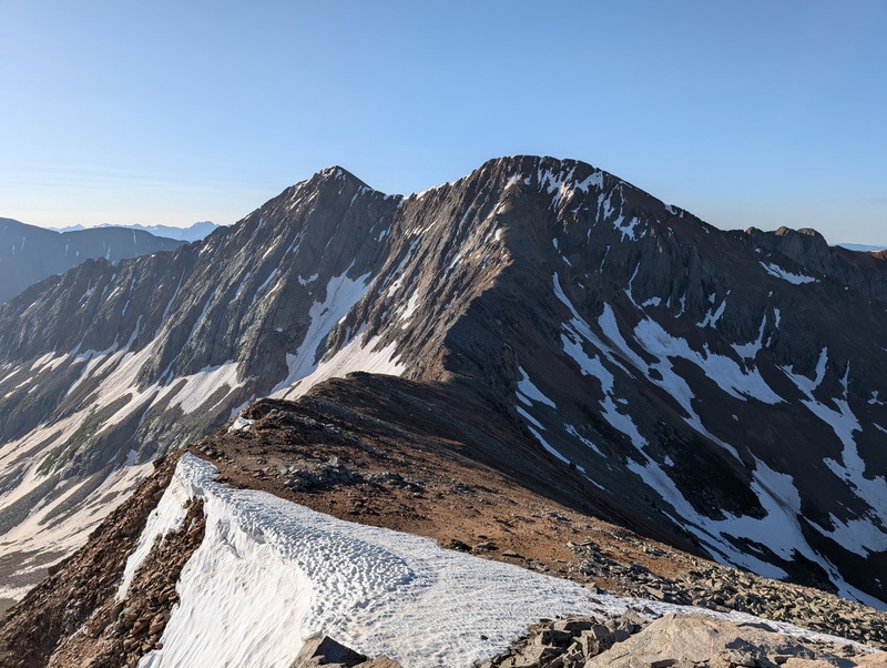
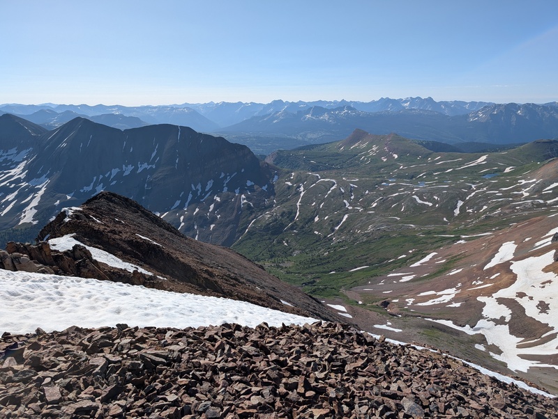
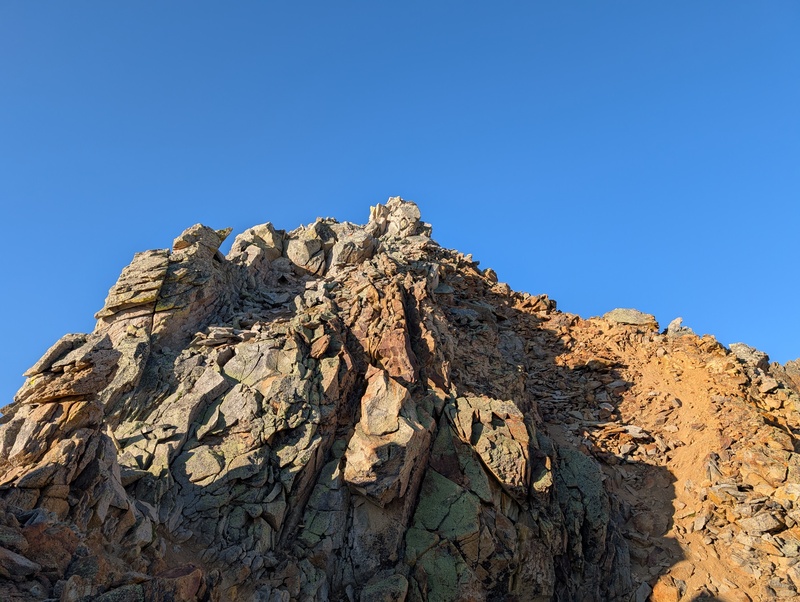
I knew Rolling's east ridge held some surprises, so I wasted no time in setting off. Not long after leaving the summit, I encountered a few towers that required a bit of scrambling to overcome. That led to loose talus, which led to a steeper cliff band of easy 3rd class on garbage rock. I crabwalked and lowered myself through the section, which went surprisingly easily, and thought I was done with the fun on the ridge. But a hidden red cliff suddenly appeared out of nowhere, and after finding an entry point a bit down the slope, I traversed across the cliffs at stiff 3rd class and finally ended up on easier terrain, which was just more junky baseball-sized talus. 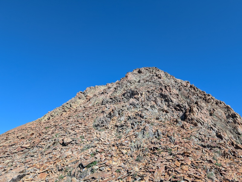
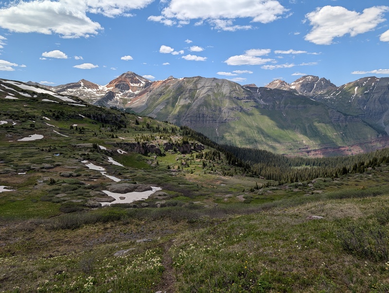
But I wasn't down yet. There was still the very real question of how I was going to get to the grassy slopes of the basin separating Rolling from the sisters. The whole time I descended the ridge, I had one eye to the right to see if there was a spot that looked manageable to head down. But everything seemed to have a nasty layer of cliffs guarding access, and on top of that looked steep and loose. 2 out of 3 I could deal with, 3 out of 3 was a no-go. However, a way down finally appeared, although still steep and covered in baseball-sized talus. But no cliffs! So I took it. This ended up an adventure. I'll spoil some points: the route went and never felt unsafe, but every step sent a cascade of talus slowly down the slope, almost perfectly matched with the pace at which I was moving. This led to me essentially walking on a moving escalator of rocks, in which if I failed to keep pace, my foot would rapidly begin to get buried. Several times I had to make a quick move out of the way of the slide, as my feet were getting buried too deep each step and I was worried one would get stuck. I got in a rhythm after a few hundred feet and sort of surf-walked my way down this slope until I reached the edge of the stream below. Crossing the stream required a few hundred feet more to drop due to its inset nature, and once there marked the end of the nasty red rock. 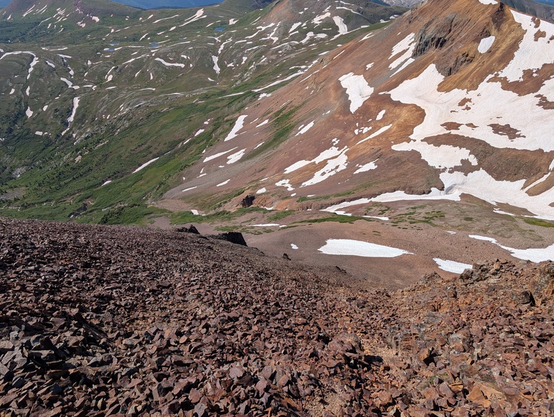
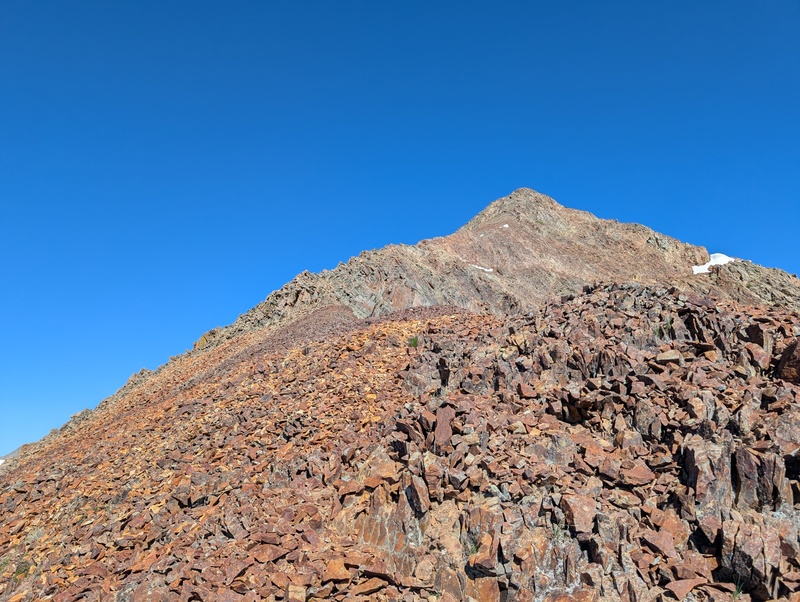
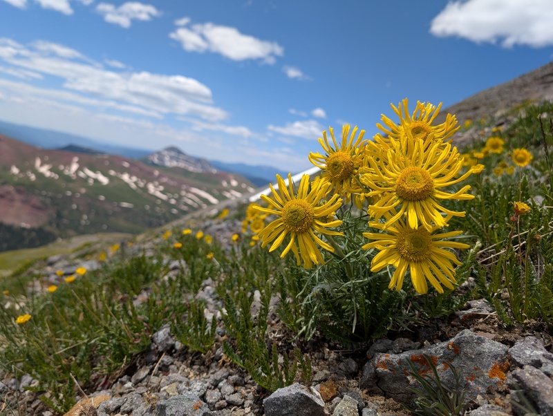
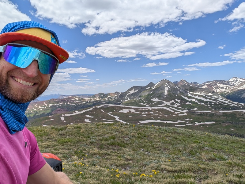
Now down on the grassy slopes, I found myself facing mental crux #1 for the day. A well-used trail bisected this basin and, if taken, would bring me to my car in just a couple short miles. A little part of me wanted to hang a left at that trail, but the prospect of three more ranked peaks kept me heading straight across. I popped on a podcast to pass the time and cut across the gently undulating knolls, keeping a consistent elevation and thanking the San Miguel gods that they haven't figured out how to make gentle grassy slopes loose death traps yet. Eventually, it was time to go up again. I had done very little research on these next peaks (just downloaded a gpx track), and it was becoming readily apparent that a direct assault on TSW's SE ridge was not the 3rd class route I was seeking (though it looks like it may go). Instead, I consulted the gpx and wrapped around to the south, which revealed a loose and semi grassy 3rd class gully. I took it, and once above it, a sea of more loose talus appeared. This was probably the most soul-crushing talus of the day, as I had to crawl up it on all 4s and still struggled to make progress. To make matters worse, my headphones died here, so I couldn't even distract myself with Dax Shepard's inanity as I suffered. But all tunnels have a light at the end, and this one's was a chossy ridgecrest that was low enough angle to masquerade as solid. This led to the false summit of TSW, and the real summit was only a couple hundred vertical feet beyond. The climb up was inconsequential, and I had arrived on summit #5! 


The down and up from TSW to TSE was mercifully short and uneventful. Not a whole lot to be said about it, other than that it held the only other snowfield I had to engage this day, on the ridge down TSW. it took me less than 30 minutes from arriving on the summit of TSW to reach the summit of TSE. No surprises thankfully. 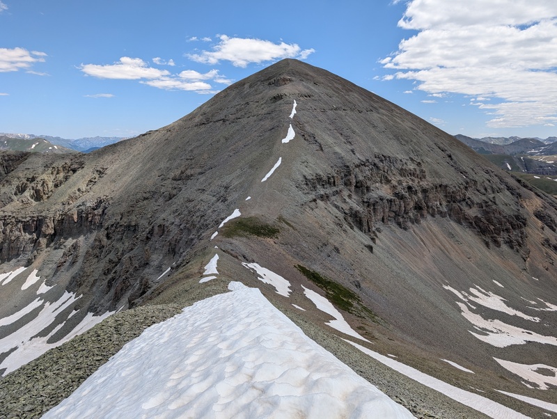
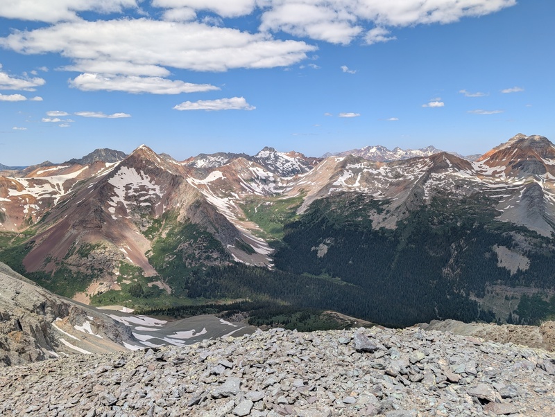
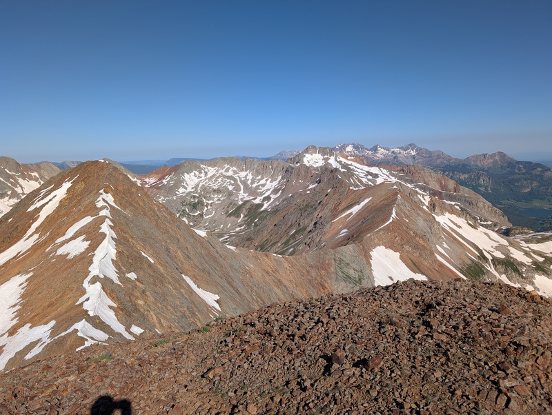
At last came the final peak of the day, V7. The good news is I was essentially done with talus: the views toward V7 showed nothing but grassy tundra between TSE and V7. However, the bad news is that there was a long drop off TSE, a short pass between two 12ers, a big regain up to V7, and a reascent of the pass to go before I was done. This was mental crux #2: once down TSE, a left turn would put me on my exit trail and shave off the long out and back to V7. The prospect of orphaning such a solitary peak kept me pushing on, and after descending the half rock/half grass east slopes of TSE, a short regain put me at the saddle between the 12ers. 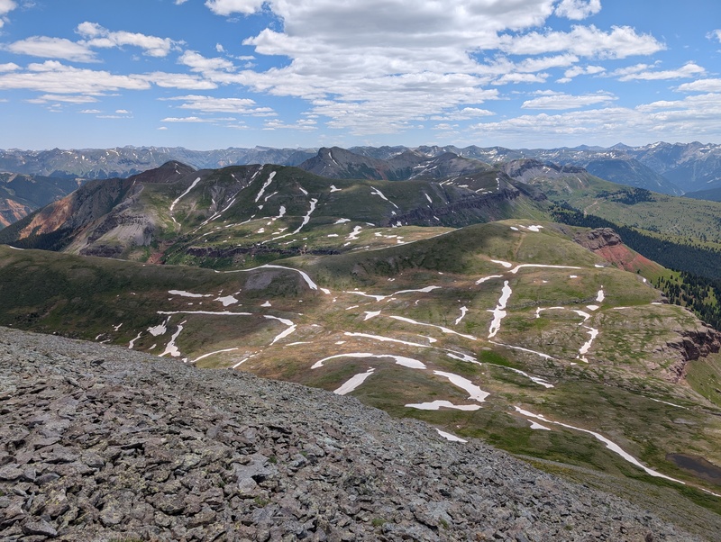
At the pass, there were some faint trails to follow which generally took me in the right direction. I eventually decided to leave those and take a more direct route to the base of the western slopes of V7. The grassy terrain was fairly shallow and solid, and though I had a lot of vertical gain on the legs already today, I felt pretty good heading up, traversing slightly left as I went up. V7 also held no surprises, other than two similarly tall summits, and I topped out on peak #7 for the day about an hour and forty minutes after leaving TSE. I was done with up for the day! (kind of) 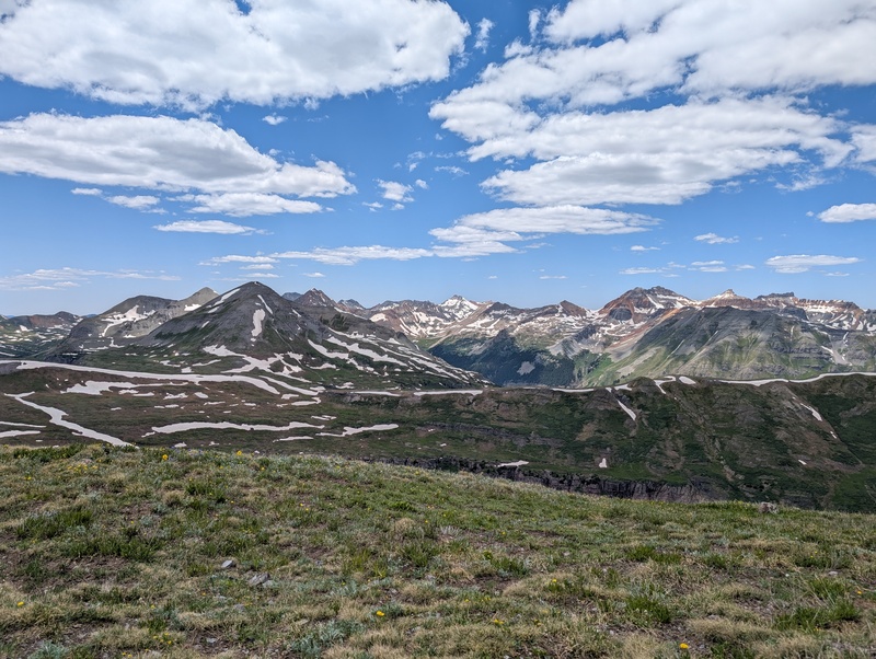

After tagging both subsummits and sending some texts, it was time to head down. I was very ready to be back on a real trail, which I understood existed in the basin between the 12ers and TSE. I retraced my steps down V7 and followed some of the faint trails in the basin for a bit until snowfields covered them, then just picked my way back up to the pass. There felt like more gain on the way to the pass from this side than the other, but that may just be me tricking myself. I was excited to see that right from the top of the pass, there was an obvious trail that turned right and headed down the drainage to where I wanted to go! It may have been more of a river than a trail at some points, but it was well-marked and I'm not one to complain (ignore all the complaining I did earlier in this report...and in any prior reports). 

The trail only grew in strength, and pretty soon it felt like I was on a CFI maintained trail in this obscure 13er drainage. The trail did hit me with about 400 ft of regain on the way back, but after having been off-trail for 10 hours, I was just happy to have any trail at all. I meandered downward until I came to the crossing of South Fork Mineral Creek, which I just waded across. It was up to about mid-calf at its deepest point and honestly felt so good that I stood in there for a minute, just soaking in the cold water. A trail through the most densely populated meadow of dandelions (which all got attached to my now wet legs) took me to the road, and a quarter of a mile later I arrived at the car, sneaking in just before the 12 hour mark. 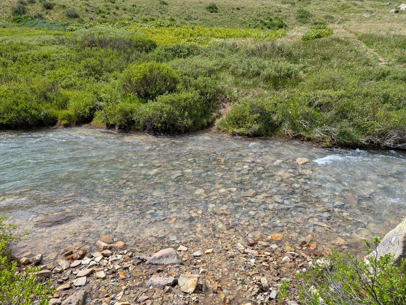
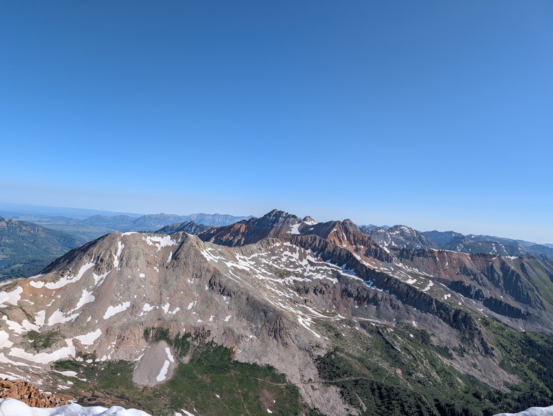
I can't say this was my favorite route I've ever done. Or top 10, for that matter. Any time loose rock is the defining characteristic of a route and not its scrambling, aesthetics, or experience, it's hard to label it a classic. But I'd set myself a goal to link up these groups and I got it done, for an efficient 7 ranked summits. And while the actual locomotion across the peaks was more type-2 fun, the views and position cannot be beat. And for those reasons, this was as great of a day in the mountains as any. Thumbnails for uploaded photos (click to open slideshow): ")
")
")
")
")
")
")
")
")
")
")
")
")
")
")
")
")
")
")
")
")
")
")
")
")
")
")
")
")
")
")
")
")
")
")
")
")
")
")
")
")
")
")
")
")
")
")
")
")
|
| Comments or Questions | |||||||||||||||||||||
|---|---|---|---|---|---|---|---|---|---|---|---|---|---|---|---|---|---|---|---|---|---|
|
Caution: The information contained in this report may not be accurate and should not be the only resource used in preparation for your climb. Failure to have the necessary experience, physical conditioning, supplies or equipment can result in injury or death. 14ers.com and the author(s) of this report provide no warranties, either express or implied, that the information provided is accurate or reliable. By using the information provided, you agree to indemnify and hold harmless 14ers.com and the report author(s) with respect to any claims and demands against them, including any attorney fees and expenses. Please read the 14ers.com Safety and Disclaimer pages for more information.
Please respect private property: 14ers.com supports the rights of private landowners to determine how and by whom their land will be used. In Colorado, it is your responsibility to determine if land is private and to obtain the appropriate permission before entering the property.