Download Agreement, Release, and Acknowledgement of Risk:
You (the person requesting this file download) fully understand mountain climbing ("Activity") involves risks and dangers of serious bodily injury, including permanent disability, paralysis, and death ("Risks") and you fully accept and assume all such risks and all responsibility for losses, costs, and damages you incur as a result of your participation in this Activity.
You acknowledge that information in the file you have chosen to download may not be accurate and may contain errors. You agree to assume all risks when using this information and agree to release and discharge 14ers.com, 14ers Inc. and the author(s) of such information (collectively, the "Released Parties").
You hereby discharge the Released Parties from all damages, actions, claims and liabilities of any nature, specifically including, but not limited to, damages, actions, claims and liabilities arising from or related to the negligence of the Released Parties. You further agree to indemnify, hold harmless and defend 14ers.com, 14ers Inc. and each of the other Released Parties from and against any loss, damage, liability and expense, including costs and attorney fees, incurred by 14ers.com, 14ers Inc. or any of the other Released Parties as a result of you using information provided on the 14ers.com or 14ers Inc. websites.
You have read this agreement, fully understand its terms and intend it to be a complete and unconditional release of all liability to the greatest extent allowed by law and agree that if any portion of this agreement is held to be invalid the balance, notwithstanding, shall continue in full force and effect.
By clicking "OK" you agree to these terms. If you DO NOT agree, click "Cancel"...
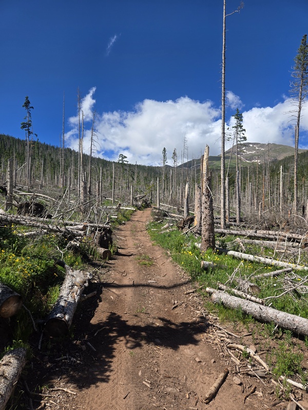
Started at about 10:30am right outside of blue lakes campground. The 4wd drive road is open only about 300 yards until you reach a barrier that says only vehicles 50 inches wide may proceed. All the trees have been removed from the road after the wind storm a couple years ago, and it looked like my Xterra could make it to the top but no big deal there is about 4 parking spots right in front of barrier.
The start of the 4wd road
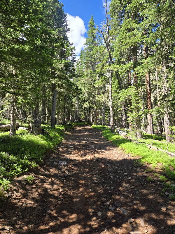
After you get past the area of fallen trees it turns into a beautiful forest full of campsites. With the road closed to full size vehicles it is keeping most people down at the lower campsites near the lakes. I didn't see anybody the whole entire hike, I think I might come back and camp here this summer, maybe even hit the other 13ers I missed in the area
The road higher up past the fallen trees
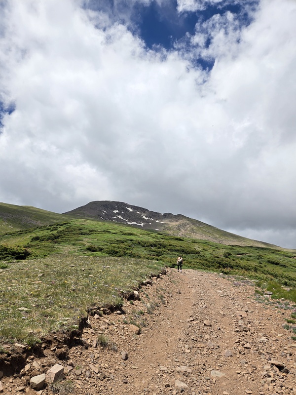
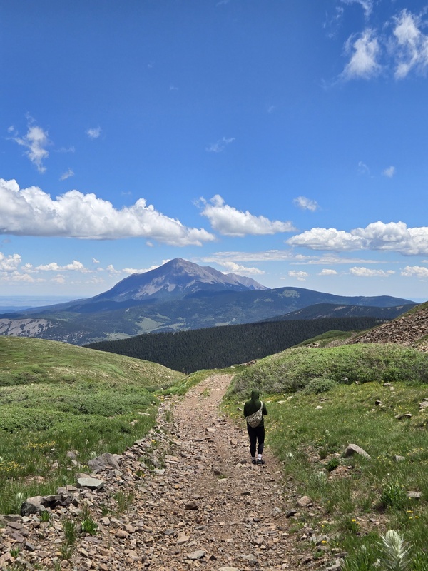
Making our way up the 4wd road that leads to the saddle between Trinchera Peak and a smaller mountain to the south. Unsure of the name. I read in previous posts that some people ditch the 4wd road and head up towards the SE slopes of Trinchera but we decided to stay on the road.
Heading towards the peak
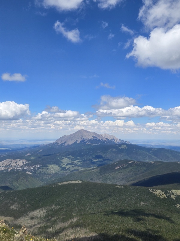
Looking back to one of my favorite mountains in the state, West Spanish Peak. I love this mountain; people often mention the amazement that settlers must have had when they first laid eyes on Pikes Peak after walking through the plain of Kansas, but I imagine for the lucky ones that came a little further south the prominence of the Spanish Peaks would be unmatched.
Looking back at west Spanish peak
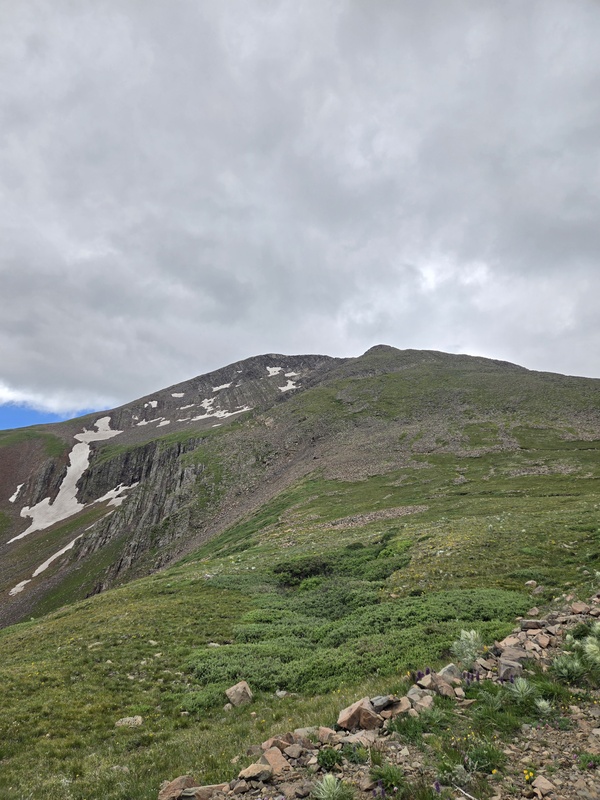
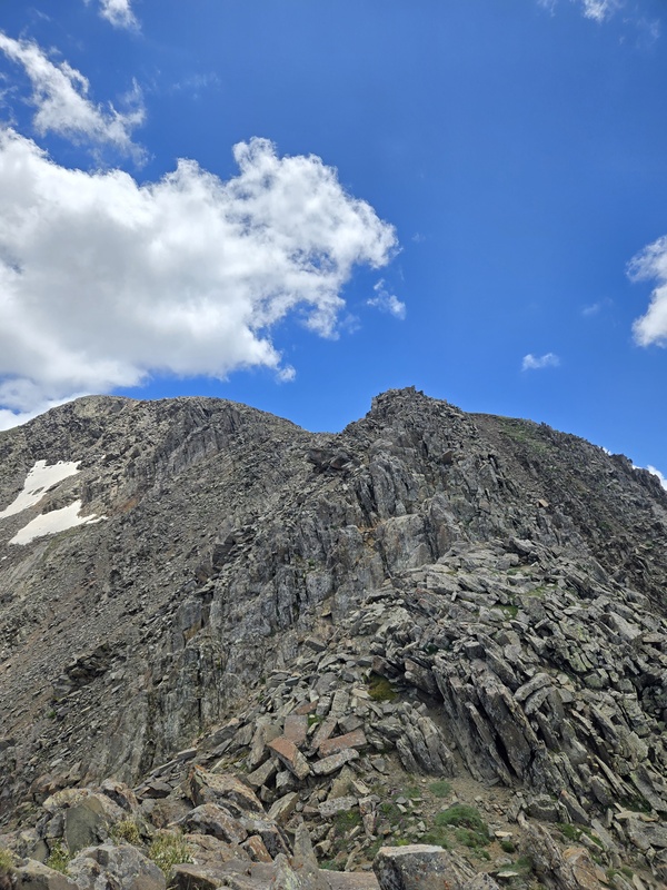
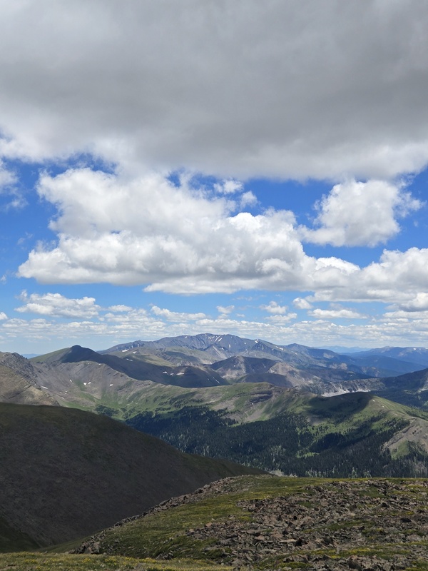
Looking toward the summit of Trinchera after reaching the top of the saddle and the end of the road. From here there is no trail. Don't let the gentle slopes fool you it was actually a decent scramble.
Trinchera Peak
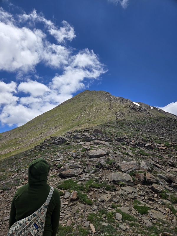
Looking towards the false summit and the steeper than we thought route ahead of us.
About to begin the ascent
Making our way up it was very windy. The forecast only called for 15mph, but I'd say it was about 50, I was struggling to stand up right. Also, it was colder than I excepted, about 50 degrees plus the winds chill had me wishing I brought my gloves. Haven't done a 13er or 14er in a while and forgot how cold it gets up there even when its 90 degrees down in the city.
Looking towards the false summit
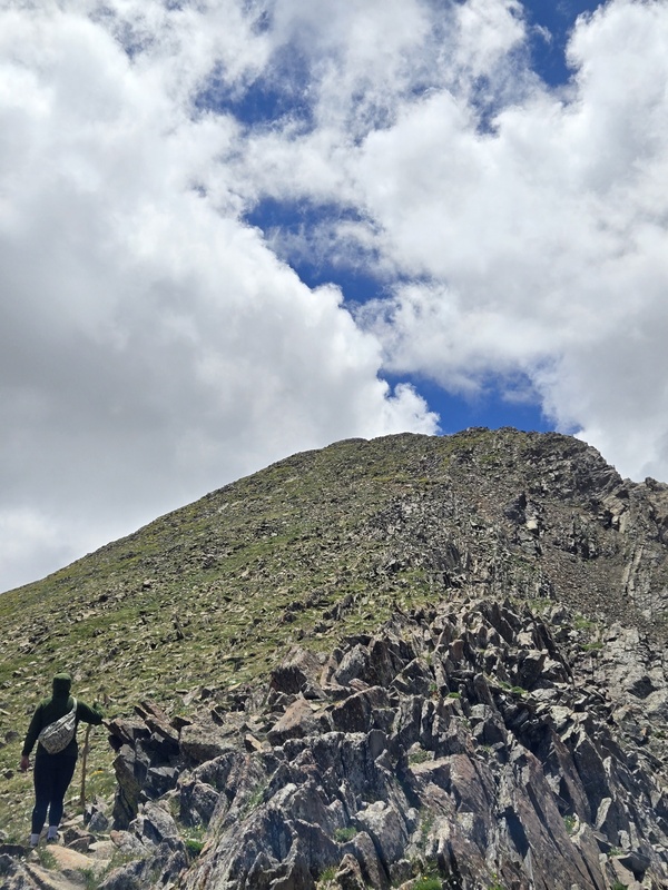
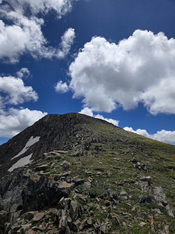
There was one section that required a little bit of scrambling. I'd say almost class 3 but it only lasts for one tiny section then levels back out to flat easy-going slopes.
Little bit of climbing
After the scramble it's a nice peaceful walk to the top. The views up here are amazing, and the flowers were popping. Lots of Butterflys, ladybugs and marmots.
The final push
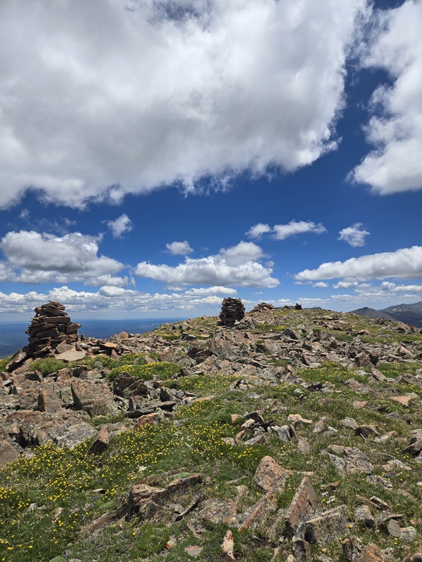
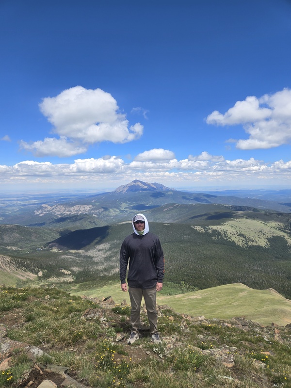
Made it to the summit and was greeted by some massive cairns. A very flat summit perfect for relaxing and having a snack, not to mention the wind finally died down when we reached the top. There is a directory up there and to my surprise it looks like 6 or 7 people have made the journey this year. These 13ers rarely are climbed so I was hoping to be the first name of the season. There is also a stone craved up there from a summit party in 1925 lead by Rev Ramme. It was cool knowing that we were climbing exactly 100 years after what might have been the first summit of this mountain.
The summit
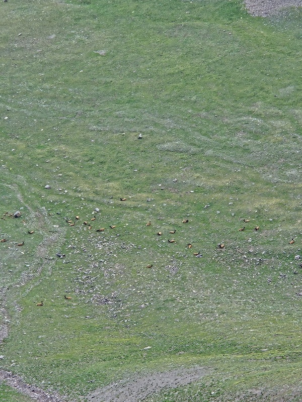
I read in previous trip reports that a herd of elk hang around these mountains and we were lucky enough to see them. On the way up the road, we saw a couple walking above on the saddle, so I knew the herd had to be close. When we reached the summit, we spotted them down below on the south side of Trinchera between us and Leaning south Peak.
A herd of elk in the valley below between Trinchera and leaning south peak
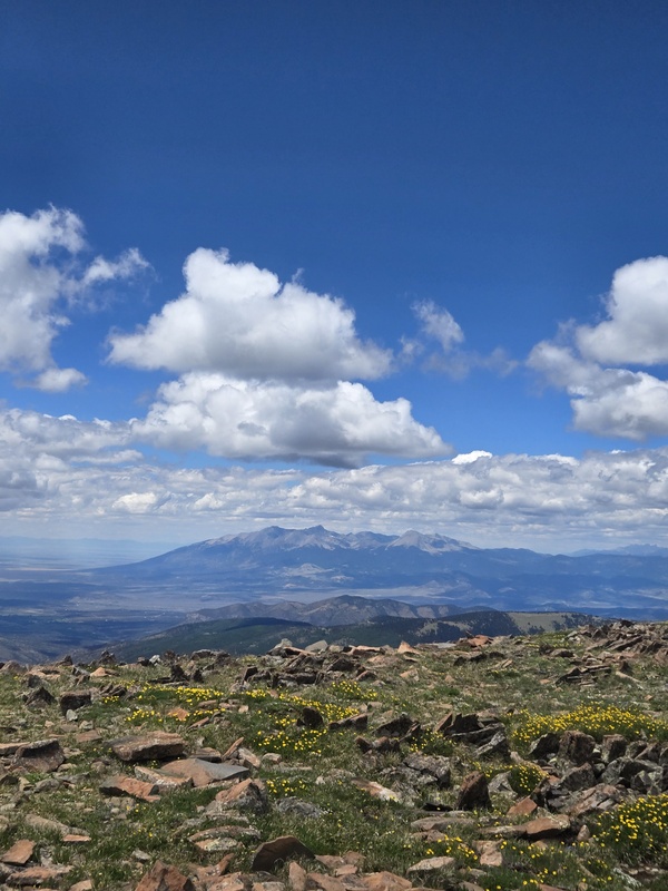
West Spanish peak from the summit, I never get tired of looking at this mountain. I probably took 50 pictures of it on the way up.
West Spanish peak
Another beautiful mountain conquered, I love 13ers because of the seclusion. Don't get me wrong I also love 14ers but there is something magical about being the only people on the mountain, all alone in the remote mountains without another human in sight. A vastly different feeling compared to hiking in a single file line up Mount bierstadt on a summer day.
Howdy
Amazing views of Blanca Peak, Mt Lindsey and Little bear. You also had a great view of the Crestones but my phone camera didn't do it justice.
Blanca Peak and friends
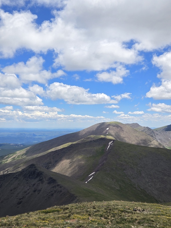
Looking towards leaning south, Leaning north and Cuatro Peak. You could definitely bag all 4 of these mountains in a day I just wasn't prepared enough and after a long layoff from hiking my legs were cooked. I think when I come back, I will try and find another entry point so I can skip Trinchera and just do the leaning Peaks and Cuatro. I couldn't find much info on these mountains so if anyone knows another trailhead I could start from to avoid summiting Trinchera again I would very much appreciate it.
Leaning south, Leaning north And Cuatro Peak I believe
Looking south towards Culebra. I love this area of Colorado, the forgotten front range. The New Mexico/Colorado border is one of the strangest places I've been to in this country. It feels ancient and mysterious; I can't help but thinking this would be the prime place to see some sort of unexplainable phenomenon like UFOs or bigfoot. I'm really debating about sleeping on one of these 13ers next time I come (don't know if that's legal) to hopefully get abducted or maybe learn the secrets of the universe from a wise old bigfoot.
Culebra Peak?
After eating some chips and admiring the view we headed down the southeast ridge instead of the way we previously came. There is a very faint trail that leads towards the 4wd road near the tree line. I wouldn't suggest this way even though it probably saves 1 mile roundtrip. It is very steep, loose rock and rough on the knees. Also, wouldn't recommend this route on the way up. When we got back down the road, I saw a cairn that directed you when to leave the road and head up the grassy southeast slopes toward the summit, the trail is very faint and easy to miss. If you want to save 1 mile then go for it but honestly the north ridge is a lot more enjoyable.
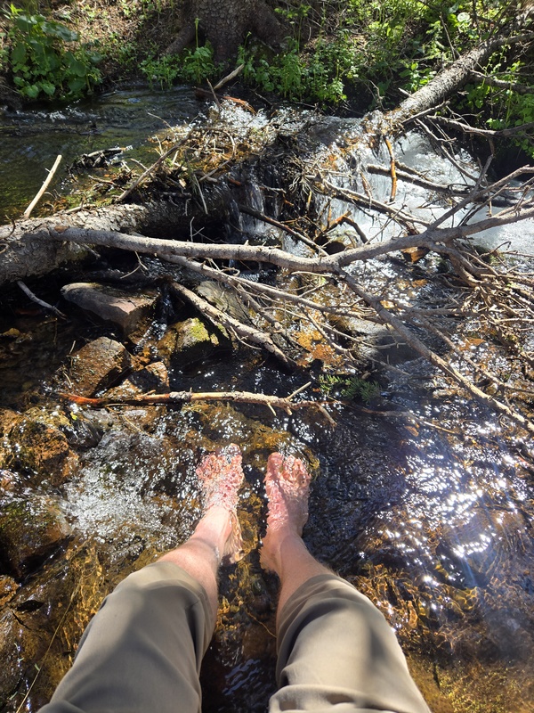
Free feet pic
All in all, it was about 8 miles, 3100 feet elevation gain and 6 hours round trip. A good 4th of July spent above tree line. Thank you mother nature
Thumbnails for uploaded photos (click to open slideshow):
I hiked Trinchera with a friend two days before you. We did the full Trinchera-Maxwell hike and we didn't see anyone else but elk and sheep.
There's a road going from Purgatoire Campground (south of Cuchara Pass) up to treeline on Mt Maxwell. That's pretty much the only other good access point to this ridge on public land. Everything south of Maxwell is private property, as well as everything west of the ridge. The road to Maxwell is longer, rougher, and steeper than the one to Trinchera, but it's open to full-size vehicles if you want to chance it. I have an Xterra too and I'd rather hike it than risk changing a flat tire on a steep slope.
The toughest part of the traverse is the ridge between Maxwell and Cuatro. It's Class 3 at most, but the rock quality is poor and it gets steep. The views of the Spanish Peaks (both of them!) are great from the Cuatro area.
Caution: The information contained in this report may not be accurate and should not be the only resource used in preparation for your climb. Failure to have the necessary experience, physical conditioning, supplies or equipment can result in injury or death. 14ers.com and the author(s) of this report provide no warranties, either express or implied, that the information provided is accurate or reliable. By using the information provided, you agree to indemnify and hold harmless 14ers.com and the report author(s) with respect to any claims and demands against them, including any attorney fees and expenses. Please read the 14ers.com Safety and Disclaimer pages for more information.
Please respect private property: 14ers.com supports the rights of private landowners to determine how and by whom their land will be used. In Colorado, it is your responsibility to determine if land is private and to obtain the appropriate permission before entering the property.
 The start of the 4wd road")
 The road higher up past the fallen trees")
 Heading towards the peak")
 Looking back at west Spanish peak")
 Trinchera Peak")
 About to begin the ascent")
 Looking towards the false summit")
 Little bit of climbing")
 The final push")
 The summit")
 A herd of elk in the valley below between Trinchera and leaning south peak")
 West Spanish peak")
 Howdy")
 Blanca Peak and friends")
 Leaning south, Leaning north And Cuatro Peak I believe")
 Culebra Peak?")
 Free feet pic")