| Report Type | Full |
| Peak(s) |
Quandary Peak - 14,272 feet Fletcher Mountain - 13,943 feet Atlantic Peak - 13,856 feet Pacific Peak - 13,965 feet Crystal Peak - 13,860 feet |
| Date Posted | 07/07/2025 |
| Date Climbed | 07/05/2025 |
| Author | F0rgott |
| TenCent Traverse |
|---|
|
The TenCent traverse - all 5 ranked centennials (including Quandary) in the Tenmile range in one loop! I've had my eyes on this line for a while, and I was feeling crazy strong after sending Emmons on Rainier last weekend, so I decided the day before that it was time. I leaned on beta from the well travelled Mayflower traverse and Geckser's Crypacatflift trip report - this line is a little derivative, and I didn't exactly break any new ground. Still, I thought this loop was fun and unique enough to warrant a trip report and it's own little name. I started at 03:00 from my campsite high on McCullough Gulch Rd. Right away, I had some internal debate on whether to start lower for the easy finish or start high to lessen my afternoon time in the high alpine. With the weather report uncertain on the day, I chose the latter, although it made for one hell of a slog at the end. I would highly recommend either a car shuttle, or locking a mountain bike up near the Quandary trail/road junction. I almost immediately lost the trail (if there was one to begin with) as I worked my way around Pacific's East shoulder and into Mohawk basin. If you follow my gpx, I do highly recommend making your own route through here - mine involved much unnecessary bushwhacking and scrambling - the roving of my 3am brain. Soon though, I entered into Mohawk basin and got my first view of the journey to come 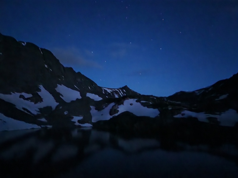
From here, the route really is straight forward. I spent most of my time picking around the lakes and marshes, and managed to keep my feet relatively dry. The most challenging part of this stretch was getting around the snowbanks that crested many of the hills - I didn't bring spikes or an axe, so I either went around these or painstakingly chopped steps with the handle of my trekking pole. I spent a fair chunk of this basin hike admiring the lakes and salivating at Pacific's N couloir (someone should come climb that with me!) 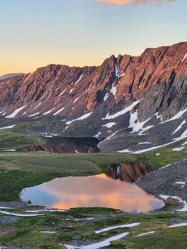
I summitted Crystal at 06:15, and got a solid view of the rest of route. The ridge to Pacific had looked mighty spicy from down in the basin, but kept to a moderate class 2. 

I would summit Pacific at 07:30. It was by far the most vert from saddle, and by the summit, I'd already reached 4.2k vert on the day. Caltopo had given me an estimate of 5k total, so I began to realize I was in for the long haul. I made good time over to Atlantic though, summitting at 08:20. Nothing about this section really sticks out to me. The trail was intuitive and gentle. Warming me up for the crux. 
Now for the good part - Atlantic -> Fletcher. I'd read that this could be kept to 5.2 using a bypass of the gendarmes. This was based on Geckser's Crypacatflift trip report. However, I was feeling pretty confident, and the little worm in my brain was already directing me towards the gendarme traverse. Humorously, after every single gendarme I dropped down, I said to myself "I bet that was the crux. All easy from here". I probably said that 4 or 5 times during this process. The gendarme traverse is intuitive though. You get clear visuals of almost every single difficult line, and I found myself switching between East and West sides of the ridge as the route demanded. My only advice here - take the easy path. I intentionally stayed ridge direct for the first couple of gendarmes, and I cliffed out a couple of times and had to backtrack as a result. If you can't see the downclimb line, just go around. There is a line of solid and safe rock that keeps you above the talus and scree but below the dramatic and sheer drops of the gendarmes. 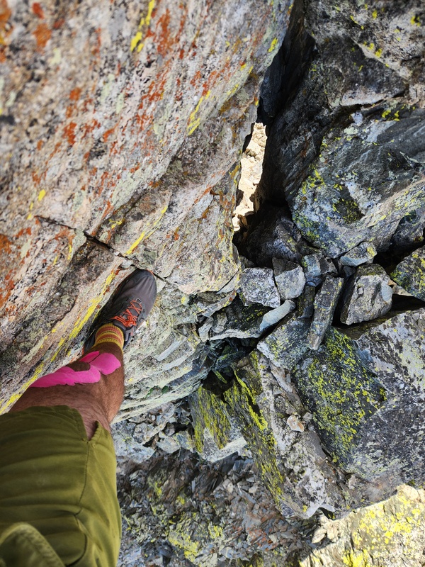

At long last, I made it to the final crux. The decision of whether to take Geckser's bypass actually eluded me - I missed the turn off and felt no inclination to backtrack for it. The crux is undeniable once you see it. It is the final and most dramatic gendarme on the ridge. A splitter crack rises directly up and to the right 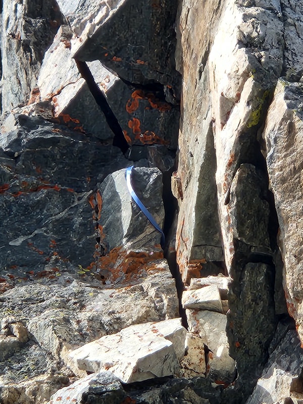
I imagine that crack goes at 5.8 or 9. It looked like an incredible climb. 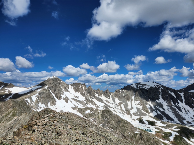
It was very strange getting on Quandary after my full day of solitude. The mountain was crowded, obviously, and probably made even worse by the holiday weekend. I won't provide much beta on Quandary's west ridge. The trail is well defined, and I found myself wondering where the "class 3" was (it came eventually - there were a few fun and airy moves towards the top). I topped out on Quandary at 11:20, surrounded by dozens of people. After a cigarette and a phone call to my partner, I ran the East trail down (mostly was just ready to be off the mountain, but it conveniently justified my marking it a "trail run" on Strava). The road from the trail junction back up to my car was, of course, a brutal slog. Again, I cannot recommend a bike or car shuttle enough. But it was satisfying to create that perfect loop on the gpx track. All told, this was a pretty solid, exciting, and satifying. I climbed Clinton the day after, and got a nice view back on the peaks (though largely blocked by the unclimbed Drift) 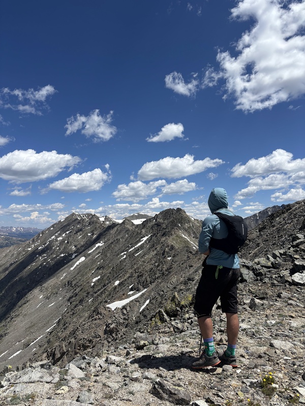
Stats on the day: Thumbnails for uploaded photos (click to open slideshow):  Some tat left on the crux of Fletcher")
 Looking up one of the gendarmes. Spiky!!")
")
 Looking out to Pacific from Crystal")
 Another view from Crystal with all remaining peaks in view")
 Looking up the Tenmile range")
 Mohawk Lakes at sunrise")
 First view of Pacific")
 Looking back on the traverse from Quandary")
 Looking back at the traverse from Clinton, the day after")
")
|
| Comments or Questions |
|---|
|
|
Caution: The information contained in this report may not be accurate and should not be the only resource used in preparation for your climb. Failure to have the necessary experience, physical conditioning, supplies or equipment can result in injury or death. 14ers.com and the author(s) of this report provide no warranties, either express or implied, that the information provided is accurate or reliable. By using the information provided, you agree to indemnify and hold harmless 14ers.com and the report author(s) with respect to any claims and demands against them, including any attorney fees and expenses. Please read the 14ers.com Safety and Disclaimer pages for more information.
Please respect private property: 14ers.com supports the rights of private landowners to determine how and by whom their land will be used. In Colorado, it is your responsibility to determine if land is private and to obtain the appropriate permission before entering the property.

