| Report Type | Full |
| Peak(s) |
Mt. Lincoln - 14,293 feet Mt. Democrat - 14,154 feet Mt. Cameron - 14,248 feet Mt. Bross - 14,178 feet |
| Date Posted | 07/08/2025 |
| Date Climbed | 07/07/2025 |
| Author | skippyville |
| DeCaLiBron in July |
|---|
|
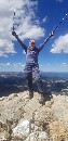
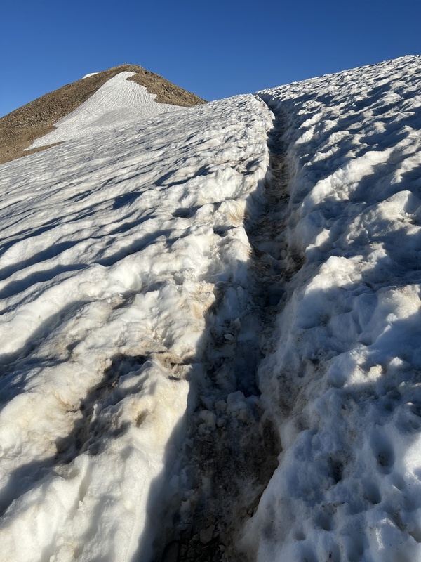
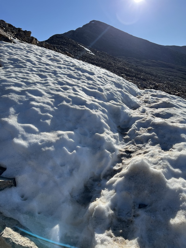
Overview and Summary Being the third time I've done the DeCaLiBron, much was familiar but, as always with me, each time produces some new observations. Before I begin my report, I should also note that there is water available, but unless you're camping, it is not that helpful because it occurs so low on the route. This time of year, the last available water is short of 500 feet up on the route. So you're either filling very early or very late on the route. I left Estes at 2:00AM on a Monday, and was on the trail at 5:30. The road to the Kite Lake trailhead seemed unchanged to me; easy until the fee signs. I saw all kind of vehicle at the trailhead, including a large passenger van. The trailhead was probably 2/3 full at that time, though some of these vehicles were CFI crews. Those with low clearance or especially concerned about their vehicles may wish to park lower on the road. There are some 'alcoves' to do that. The weather was perfect -- cool temperatures and light wind throughout the morning which, in my experience, is a bit atypical. There was an interesting cloud inversion East of the mountains. I hiked the route clockwise [more on that issue shortly]. CFI crews were working on improving the trail up to the Democrat-Cameron saddle. Watch out stepping on the huge log steps they have installed; I found them quite slick. I reached the summit of Democrat around 7:00AM and felt good. After the false summit, there is the usual snowfield to cross that lasts well into the summer. It's quite easy to cross as it is flat and not exposed. The photo I've attached makes it seem much steeper than it is. The real crux of Democrat is between the Democrat-Cameron saddle and the Democrat false summit, where you are alternately negotiating steeping on large talus blocks and some steeper stretches of scree and dirt. It doesn't last that long going up or coming down, but it is a good time to pay attention and choose steps carefully. 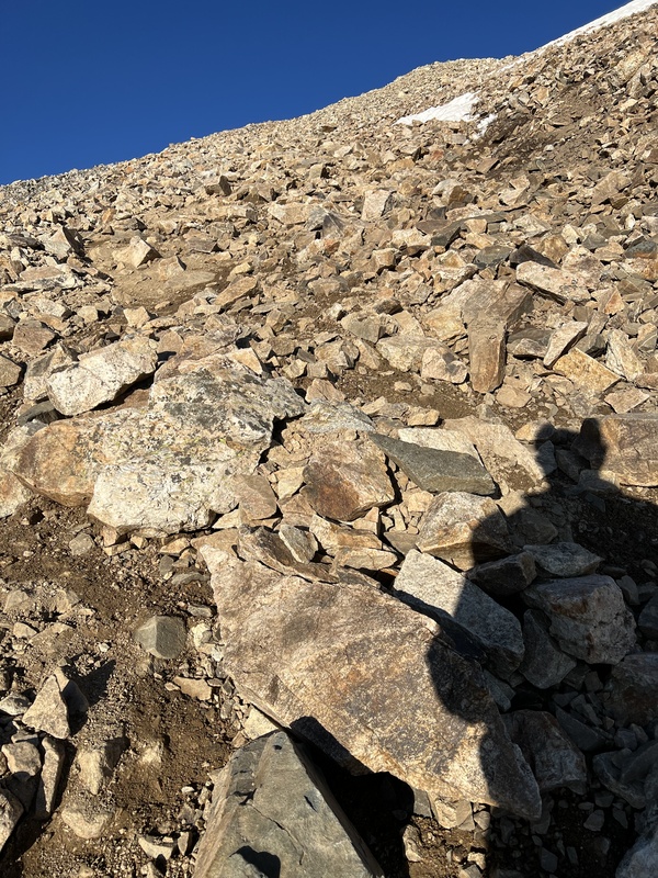
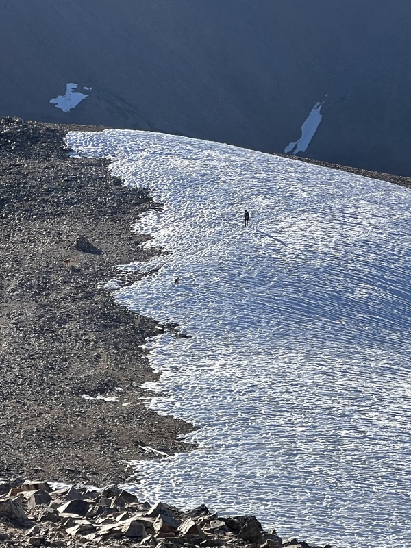
I didn't spend long on the Democrat summit as the party is just getting started at that point. I made my way back to the Democrat-Cameron saddle, immediately crossed a short and relatively easy snowfield, and started the slog up to Cameron's summit. Cameron is among the the most improbable 14er summits as it essentially is a waypoint on the way to Lincoln. Yet, as I will note, getting to Cameron takes some work, and the surrounding views are lovely. I hardly stopped at Cameron at around 8:30AM, and made the easy descent down to the Lincoln-Cameron saddle. For some reason, I really like that saddle. It's just so expansive looking. 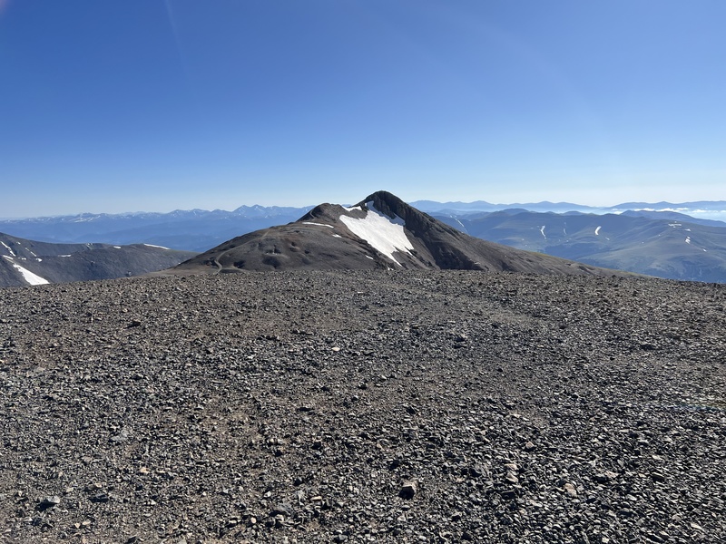
Lincoln is easily gained and I was on the summit around 9:00AM. Lincoln is not only the highest of the DeCaLiBron's peaks, it is the most distinctive summit in my view. The views of Quandary Peak from Cameron and Lincoln are wonderful, and you have a great view of the way to Bross from Lincoln, as well as the Montgomery Reservoir below. Many 14ers loom on the horizon, and the view of Grays/Torreys is surprisingly close as well. Getting down Lincoln, to the turnoff to Bross, and then path over to the Bross area, is easy. The Bross path is quite good. The main issue here is making sure to make note of the turnoff, as the trail is pretty light. There is an early cairn which is helpful. In going up Bross, I did something different this time. I went straight at the sign and followed the road up to North side until a trail broke off. I do not know if this is approved but I was never off the road or a trail, and liked going this way. 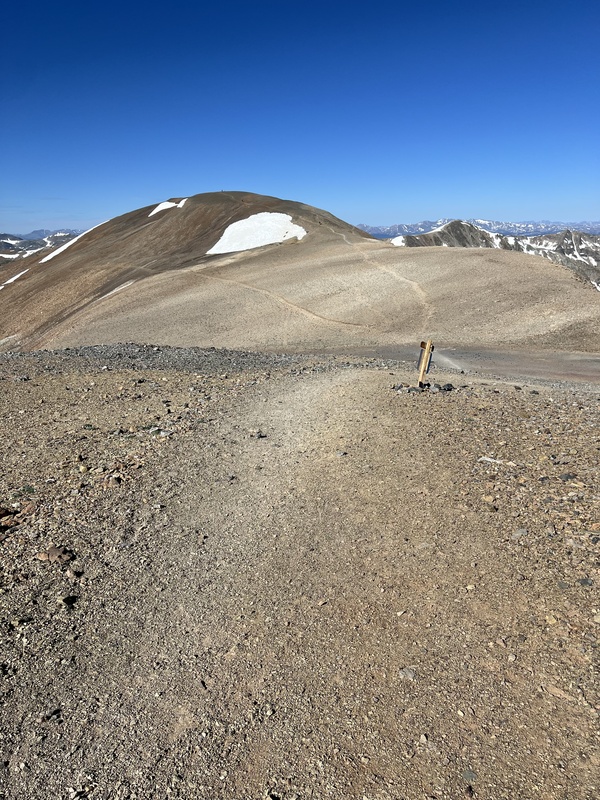
After Bross, I started my descent, and was back to my Jeep around 10:45AM, for a trip time of 5h:15m. 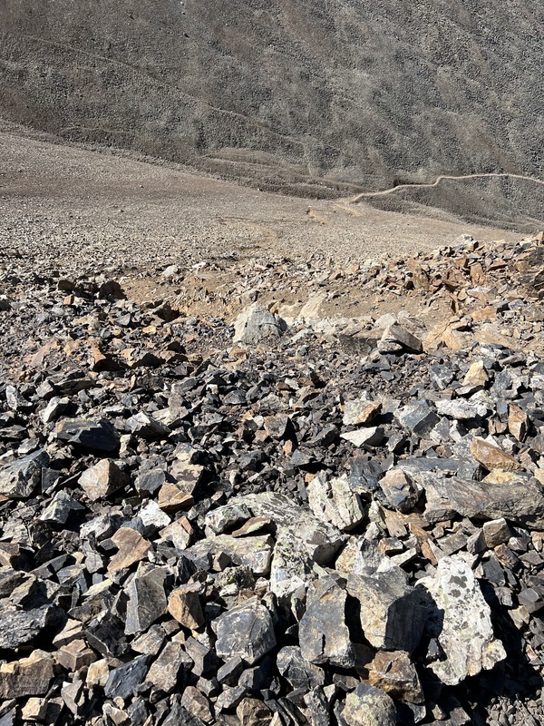
With my summary out of the way, below I discuss two issues with this route worth analyzing: 1: Whether one hikes clockwise or counter-clockwise and 2: The cruxes of the hike. 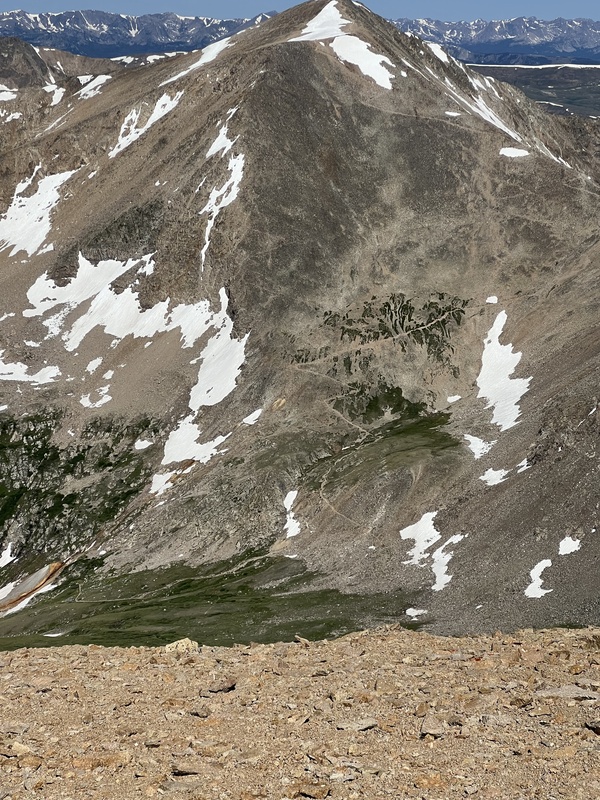
Clockwise or Counterclockwise? Folks certainly differ in recommending direction, some favoring clockwise [Democrat first, Bross last], and some favor counter-clockwise [Bross first, Democrat last]. As is human nature, most people seem to recommend what they did. It's a disadvantagous perspective unless you've done it both ways. Most of the reasoning seems to revolve around Bross, particularly the undesirable descent. I've done it both ways and broadly, I would say "pick your poison" or, to put it more optimistically, I think either way works pretty well. Below I provide one way of analyzing this, which is the ascent vs. descent of each peak. Bross Ascent vs. Descent This is aspect that receives the most discussion, and I won't lie, the descent down Bross is not particularly pleasant until you reach the lower part of the trail. There are just a lot of steep, loose steps. It's never terrifying, at least to me, but it isn't much fun either. I've seen a lot of people take spills there, though I have not witnessed anything severe. If I had to fall, I'd certainly rather fall there than the loose part of coming down the false summit to Democrat. And I've also seen a lot worse stretches in 14er-land. Still, if there was a costless way to avoid descending Bross, I'd be all for it. The counter-clockwise direction does have that advantage. Cameron Ascent vs. Descent One factor that doesn't get discussed much is Cameron. The part of the route between Cameron and the Democrat-Cameron saddle is not without its loose steps either. True, I think descending Bross is a bit more tedious and certainly longer than descending Cameron, but the Cameron descent in the counter-clockwise direction is not a piece of cake. Democrat Ascent vs. Descent Ascending vs. descending to the Democrat-Cameron saddle is a non-issue in the sense you have to do both no matter which direction you take. The difference is whether descending from the Democrat-Cameron saddle to the trailhead is easier than descending from Bross to the trailhead. Here again, I think the counter-clockwise people have a point -- I'd rather go down from the Democrat-Cameron saddle than from Bross. Lincoln Ascent vs. Descent This is a non-factor since the Lincoln ascent and descent occur in the same way [up, then down] regardless of which way you tackle the DeCaLiBron. The only difference is how early in the total hike it appears, the third summit in the clockwise direction, or the second summit in the counter-clockwise direction. So Why Do It Clockwise? My discussion thus far would seem to support doing the DeCaLiBron counter-clockwise. But I do not think the decision is that clear, for a couple of reasons. First, getting to the top of Democrat first means you will have gained more elevation early than if you do Bross first. Second, and I think more importantly, if you have to retreat and have to skip the last summit, I'd much rather skip Bross than Democrat. Lincoln and Democrat are the stars of this show, and foregoing Bross [either due to weather or wanting to avoid 'trespassing'] I think is a bit more straightforward/easier going clockwise. Indeed, the first time I attempted to DeCaLiBron, extreme weather poured in, and I skipped Bross by regaining Cameron after Lincoln, and then descending via the Democrat-Cameron saddle. It is true that if one had to skip a last summit, skipping Democrat going counter-clockwise probably is the fastest but, again, trading Democrat for Bross is, in the words of Nathaniel Hawthorne, "poor business, indeed." This extended discussion is meant to inform something that seems to concern a lot of DeCaLiBron aspirants. While I do tend to favor the clockwise direction for reasons I have noted, I think it can work well either way. The Cruxes I find four parts of the DeCaLiBron especially difficult and I always like to know these in advance as it helps me deal with them. This analysis is somewhat direction-specific.
Summary The DeCaLiBron is a great experience. Nowhere else can you bag four 14ers in one moderate route. The views are remarkable in all directions. There are some prices to be paid for this glory, but that's always the case. It remains one of my favorite 14er standard routes. 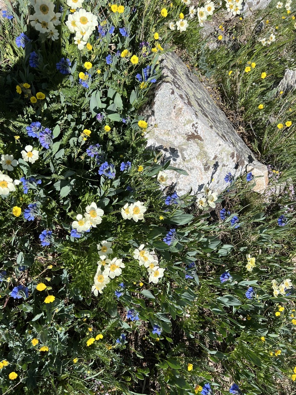

Thumbnails for uploaded photos (click to open slideshow):  Climber on the snowfield")
 Snowfield below Democrat")
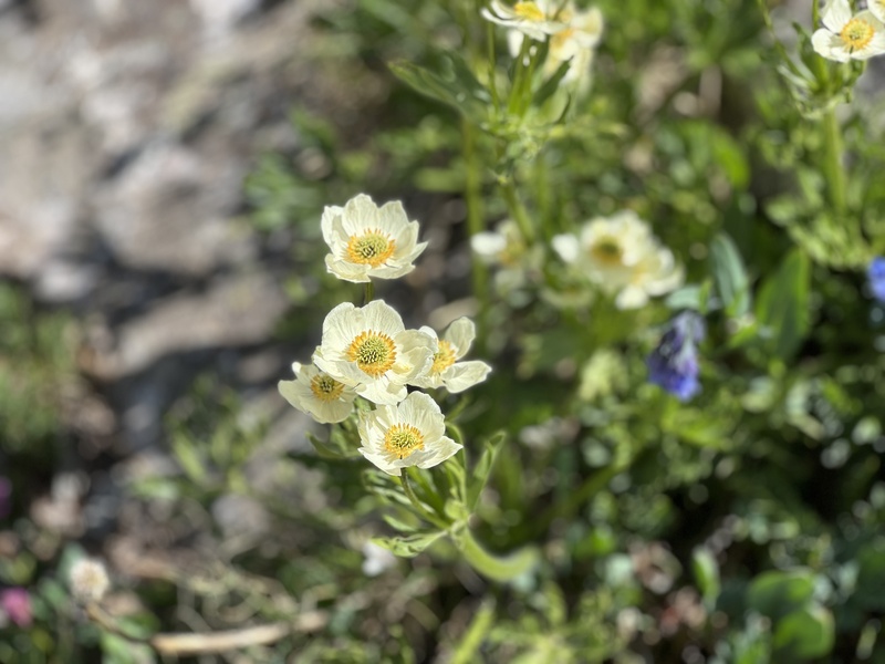
 Wildflowers")
 Democrat-Cameron minor snowfield")
")
")
")
 The Bross descent trail")
 View of Democrat from near Bross")
 Kite Lake cirque is beautiful")
 More wildflowers")
|
| Comments or Questions | |||
|---|---|---|---|
|
Caution: The information contained in this report may not be accurate and should not be the only resource used in preparation for your climb. Failure to have the necessary experience, physical conditioning, supplies or equipment can result in injury or death. 14ers.com and the author(s) of this report provide no warranties, either express or implied, that the information provided is accurate or reliable. By using the information provided, you agree to indemnify and hold harmless 14ers.com and the report author(s) with respect to any claims and demands against them, including any attorney fees and expenses. Please read the 14ers.com Safety and Disclaimer pages for more information.
Please respect private property: 14ers.com supports the rights of private landowners to determine how and by whom their land will be used. In Colorado, it is your responsibility to determine if land is private and to obtain the appropriate permission before entering the property.