| Report Type | Mini |
| Peak(s) |
Ute Ridge - 13,466 feet Unnamed 13318 - 13,318 feet Unnamed 13351 - 13,351 feet Unnamed 13121 - 13,121 feet Mt. Nebo - 13,209 feet Unnamed 13232 - 13,232 feet |
| Date Posted | 07/12/2025 |
| Date Climbed | 07/04/2025 |
| Author | k_fergie |
| Additional Members | Be Wong |
| Bea-Ute-iful July 4th in the Weminuche |
|---|
|
Coming back at you for the 4th annual Wemi multiday trip, except this time it was July instead of September. Given our streak of poor weather in September (hail, rain, lightning, and snow, oh my!) and some scheduling constraints later this summer, we figured that a July trip would be worth a try. Spoiler alert, we did not completely avoid bad weather, but were able to enjoy some great weather as well. The Ute Ridge and Nebo groups are most commonly done as day trips or shorter overnight trips from Beartown. Having traveled to this trailhead several times, I was not really up for the long 4x4 drive this go around. Creede is a significantly shorter drive, so I selected to check out the Ute Creek/West Ute Creek trail that travels far up the long valley/basin that drains from the east side of these peaks. Even if it is not the most efficient, I enjoy taking the time to backpack in an climb peaks from a base camp rather than a death march. This route has not been described exactly as we did it on either this site or LoJ, so here comes a mini trip report, though I was able to use the trip reports available to not have any route finding issues or nasty surprises. The Ute Creek TH is on an easy 2wd dirt road that is not far out of Creede, just a few miles past the Weminuche Creek TH that is commonly used to access Rio Grande Pyramid. For future planning, Beartown is usually about 10-hours from my house in the Denver area, including gas and food stops. Ute Creek was more like 6 or so. A significantly shorter drive than Silverton --> Stony Pass --> Beartown, since I am still afraid of taking Creede --> Timber Hill --> Beartown in my stock vehicle. The crew this time around was myself, Breanna, Lance, and my dad. Lance was in town to explore Boulder as a future home and to go out to watch the Hardrock 100. My dad joined in after a long drive from California on a whim after we called him about 3 days before starting the trip, what a sport! We were looking forward to some nice backpacking and simple peaks, at least compared to others in the Wemi. 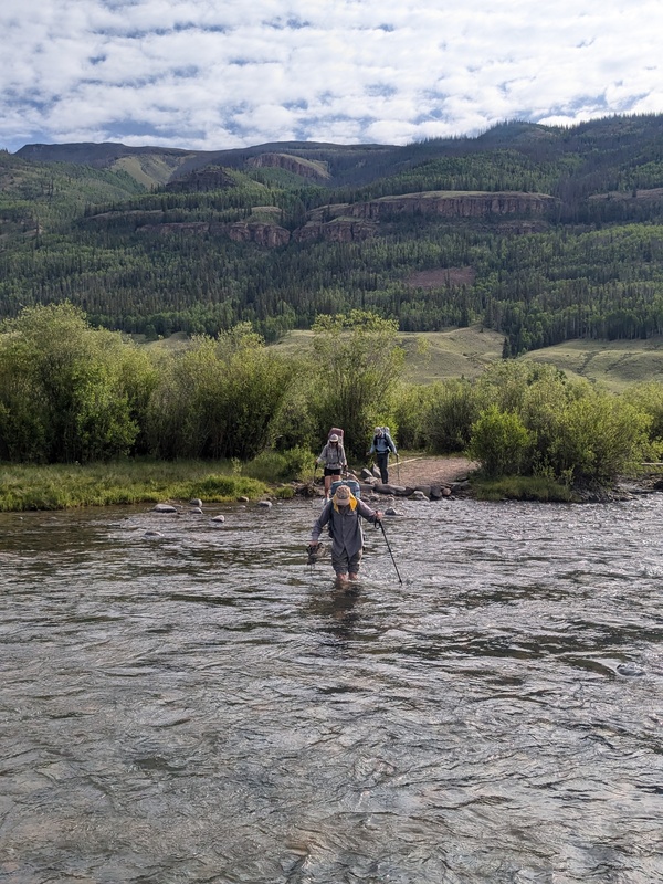
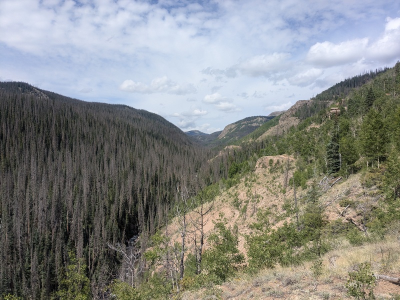
Thursday 07/03/2025: ~13.4 mi, 2800ft gain, caltopo, includes some mileage looking for a camp spot. The trail starts off with a nice and refreshing ford of the Rio Grande, so pack those sandals, before traversing through a meadow and some aspen forest towards Ute Creek. The ford was about knee deep this July 4th weekend. The banks did not look particularly swollen, so I would assume this is a pretty normal water height. I can't picture it ever being a low enough water level to rock-hop across, the river was about 30 feet wide. For the first ~7 miles the trail was of good quality and grade, with minimal deafall, as it traverses above Ute Creek as you make your way up the long valley. After the first ~7 miles, there is a junction where the main trail heads up Middle/East Ute Creek, but we split off towards West Ute Creek with the goal of camping at West Ute Lake where the trail crosses the CDT. The West Ute Creek trail was in significantly less good shape than the main Ute trail. It was never too difficult to follow, but it looked significantly more like a game trail than a maintained trail. The trail is also very exposed to the sun the whole way, plan accordingly. It was at this point in our journey that we hit rain and hail. The next 5 miles up to West Ute Lake were enjoyed in intermittent showers, hail, and thunder. The trail, at least under these conditions was a complete bog, our feet were soaked and would remain that way for the whole next day. Less than ideal. On the hike out, on a nice sunny morning, the trail was less boggy, but there were still some significant mud sections that required careful navigation to keep feet dry. We set up camp in the rain and Breanna and I had to move our tent because we set up in what would soon become a large puddle. Not feeling like sleeping on a luxury water-bed, we moved our tent. A break in the rain allowed for a nice dinner and some time watching fish jump in the lake. A majority of those that had signed into the TH booklet indicated that they were using the trail for fishing. 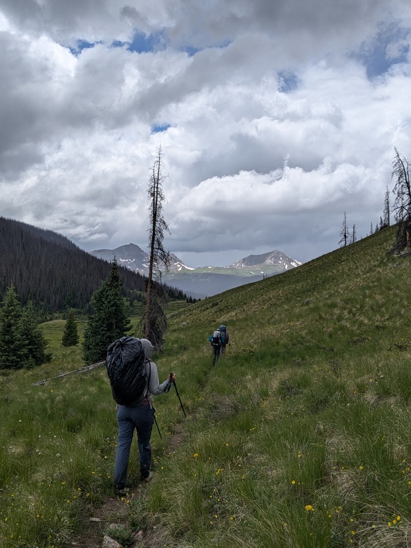
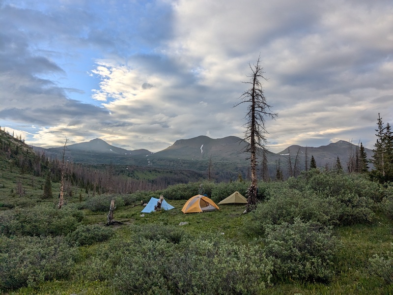
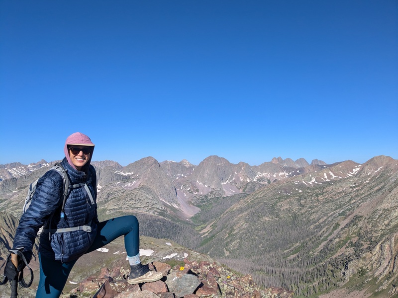
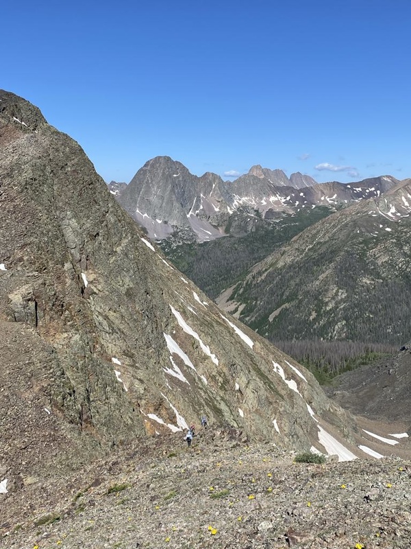
Friday 07/04/2025: ~11 mi, 4250ft gain, caltopo. Ute Ridge group. The lake camp spot was not the most ideal for accessing these peaks, but it was pretty good. A camp lower down in W. Ute Creek or towards Starvation Pass would also make sense. We awoke to a cold morning and ice on our tents. We hopped on the CDT heading northbound. After a short distance, near treeline, we decided that we would head off trail and contour our way across the basin to the slopes below UN 13318, the western most summit in the Ute Ridge trio. This was a grave mistake. Our feet, still wet from the day prior would continue to be wet. The basin is chocked full of willows, which were loaded with cold water and ice from the previous night. And to top it off, the ground was basically just 3 inches to 3 feet of mud. Many shoes were nearly lost in this 2 mile, but felt like 200 mile, boondoggle. It would have been easier to follow the CDT and climb over UN13121 to get to UN13318 than what we did, hindsight 20/20. Mercifully, we eventually reached the slopes under UN13318 and were afforded the privilege of crawling up mixed grass and kitty litter 1000 vert to its summit. It was steep, but nothing crazy, class 2. Here we got some great views north and west into the San Juan. Unfortunately, we also got some views into a large bank of dark clouds pouring through the interior Weminuche and heading straight for us. WTF, today was supposed to be sunny, 20% chance of storms in the mid-afternoon, not 8am rain showers, classic Weminuche trip so far. Discouraged, we rested a bit, then plunge stepped through scree and grass down to the saddle with UN13351. We contoured underneath the cliffs in its West ridge and eventually beelined up its south face, in mixed kitty litter scree and grass. Class 2. We reached the top with a dark cloud sitting right over us. No electric buzzing, but not great prospects for continuing on to Ute Ridge. There was a large heard of Elk grazing in the basin just to the northeast of the peak near Starvation Pass. We decided that we'd descend down the south slopes towards the Starvation Pass trail to evaluate our options. It was an excellent 1000 vertical scree ski, full of whoops, hoots, and hollers. After finally taking the time to dry out our feet and eat some well-deserved lunch, the weather was showing signs that the morning storms were dissipating. Lance and I elected to make a run at Ute Ridge while my dad and Breanna elected to bushwhack back to camp to preserve their feet and strength for tomorrow. We contoured back around towards the UN13351/Ute Ridge Saddle from our lunch spot, following great game trails. On that note, this whole peak grouping was littered with game trails above treeline. We took the ridge all the way to the summit. There were two class 3 cliff bands towards the summit, but they were easily navigable. The weather held, and we got our summit. We returned to the saddle and took an elk super-highway down towards treeline, following the drainage down to West Ute Creek. There was a short, mild bushwhack down to the main trail, which we took up and back to camp at West Ute Lake. The reclimb at the end of the day was mentally tough for what I would normally consider only a mid-sized day. I'll blame it on the middling weather and soaked feet. We enjoyed a nice afternoon at the lake as the storms continued clearing throughout the afternoon. Breanna and I chowed down on a copious amount of food, determined to win the newly-formed competition of who could reduce their pack weight the most from start to finish on the trip. We won, mostly because we carried in a silly amount of heavy food; like 1.5 lbs of sausage, 1 lb of cheese, 2lbs of tortillas, while the wiser folks brought lighter weight food. 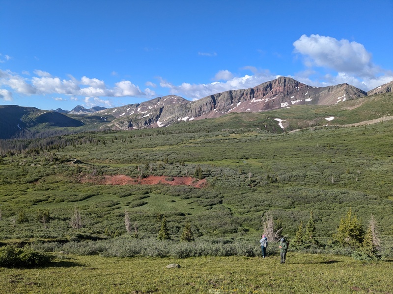
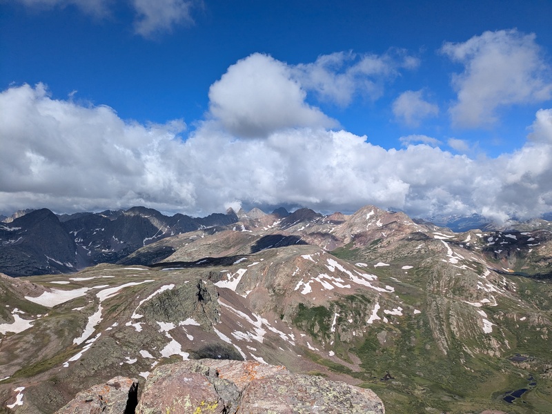
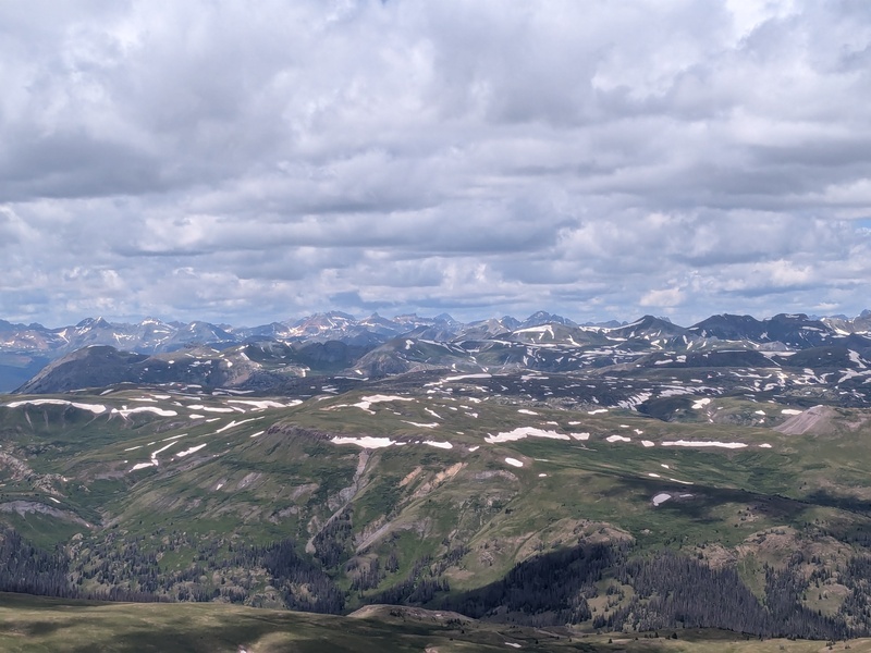
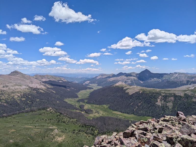
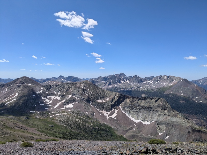
Saturday 07/05/2025: ~5.8mi, 2900ft gain, caltopo. Nebo group. Today, the weather was fantastic, as good as it gets. Sunny all day with a very mild wind. We plodded down the now-familiar CDT to Nebo pass. First, we climbed up the talus-covered south slopes of UN13121. The views on the summit were fantastic, so we took a long break. We retraced our steps to Nebo pass and began climbing the north ridge to the point between Nebo and UN13232. There are two difficulties in this climb. The first is about halfway up and is bypassed on the climber's right. Kept at class 2+ pretty easily. The second is right before topping out on the ridge between Nebo and UN13232. This one we bypassed on the climber's left, also class 2+. There was a bypass on the right that looked easier, but significantly looser with a potential large fall if you slipped in the scree, I would strongly suggest not using it. We headed towards Nebo first, climbing the ridge. This was some fun, blocky talus scrambling. Class 2+/3- to the summit. Lots of spiders in the talus. The views into the Weminuche were outstanding and we took a long break again. To descend, we scree skied down the main SE face of Nebo then contoured back to the saddle. We climbed the ridge (up past **** rock) to the summit of UN13232 (class 2) and took a long break on the summit. We descended the SE ridge towards West Ute Lake and were back to camp. Some of the talus on this ridge was pretty shifty, heads up. This group would combine well with UN13171, but I had done it with my dad as a side trip from Rock Creek already. Another afternoon back at camp, enjoying the views, and soaking in the sun. 

Sunday 07/06/2025: ~12.8mi, 400ft gain, caltopo. Pack out. We slept in, packed up camp, and then walked the 12-13 miles back out to the trailhead. It was hot. The trail gets very little shade. We were very excited to wade back across the Rio Grande and cool off once we got there. Second most important priority was to smash burritos in Alamosa on the drive home. 
Summary: This was a good way to do these peaks and stretch out a long weekend with some hiking, some peaks, and some leisure. I would definitely consider it the best 2wd way to them. With some good weather and willingness to walk further, the trip could be compressed into just a night or two rather than the three we did. However, it was a beautiful place to camp, take in the fresh air, and enjoy our Public Lands while climbing some rare Colorado 13ers. This group of peaks brought me to my post-lidar Weminuche 13k+ halfway point (technically a half peak short, 39/79), hopefully they'll start to feel downhill from here…. Thumbnails for uploaded photos (click to open slideshow):  Rio Grande Ford")
 Looking up Ute Ck. after passing through the aspen forest")
 Typical West Ute trail quality. Impending rain and hail incoming. UN13121 and UN13232 in background.")
 Camp with Ute Ridge group in background")
 Celebrating getting through the willow bog hell")
 Grenadiers getting swallowed by clouds early this morning")
 Ice Lakes group from afar after storms (mostly) cleared out")
 A marmot observing his/her territory, the Grenadiers")
 Be Wong, showing off her dry feet today on UN13121")
")
 Looking down Ute Creek to the TH")
 Excited to hit the river after a hot pack out")
 Rock Creek group from Nebo")
 Sunlight basin still pretty snowy. Looking down the mighty Vallecito from Nebo")
|
| Comments or Questions | |||
|---|---|---|---|
|
Caution: The information contained in this report may not be accurate and should not be the only resource used in preparation for your climb. Failure to have the necessary experience, physical conditioning, supplies or equipment can result in injury or death. 14ers.com and the author(s) of this report provide no warranties, either express or implied, that the information provided is accurate or reliable. By using the information provided, you agree to indemnify and hold harmless 14ers.com and the report author(s) with respect to any claims and demands against them, including any attorney fees and expenses. Please read the 14ers.com Safety and Disclaimer pages for more information.
Please respect private property: 14ers.com supports the rights of private landowners to determine how and by whom their land will be used. In Colorado, it is your responsibility to determine if land is private and to obtain the appropriate permission before entering the property.


