| Report Type | Full |
| Peak(s) |
Jacque Peak - 13,212 feet |
| Date Posted | 07/11/2025 |
| Date Climbed | 07/10/2025 |
| Author | mountain_guy |
| Jacque Peak and Friends - A Day in the Southern Gore Range |
|---|
|
I intended to do some scrambling over in the Tenmile Range but changed my plans due to some questionable weather hanging around early in the morning. Instead, I decided to go summit some of the peaks around and behind Copper Mountain, including the prominent Jacque Peak. Notable Peaks Climbed: Jacque Peak (13,212), Elk Mountain (12,693), Sugarloaf Peak (12,543), Tucker Mountain (12,208) Stats: Distance 18.75 miles, Time 8h 12m, Elevation Gain 4836 ft, Class 1/2 I left from the Union Creek parking lot at Copper around 7:30 am, just as some morning rain showers cleared up. The first section of the hike and majority of the climbing is done on Copper Mountain service roads. 3 miles of pretty mellow grade switchbacks until you pass the top of the Timberline Express lift. 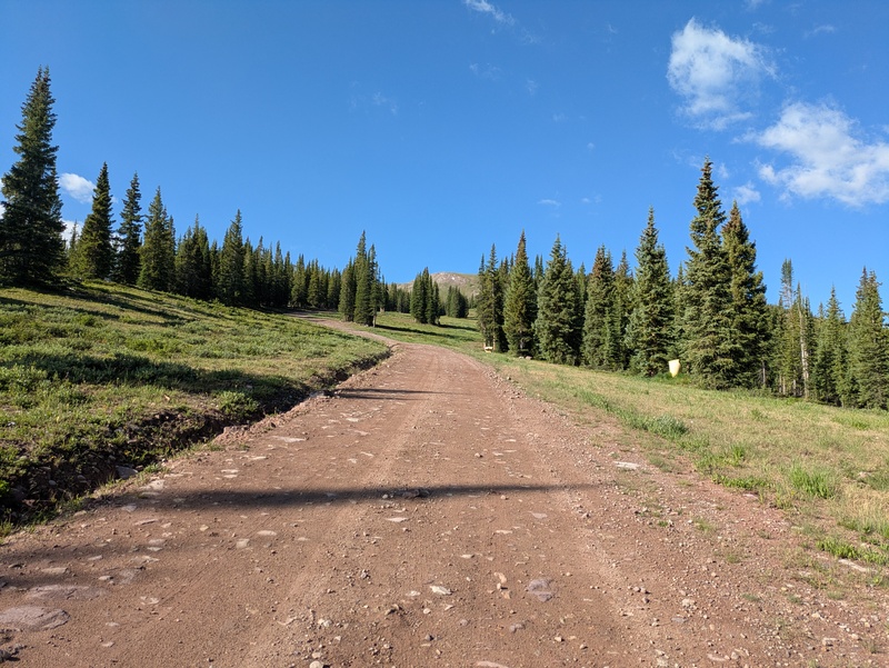
After this I turned onto a lesser used road which was much steeper. 
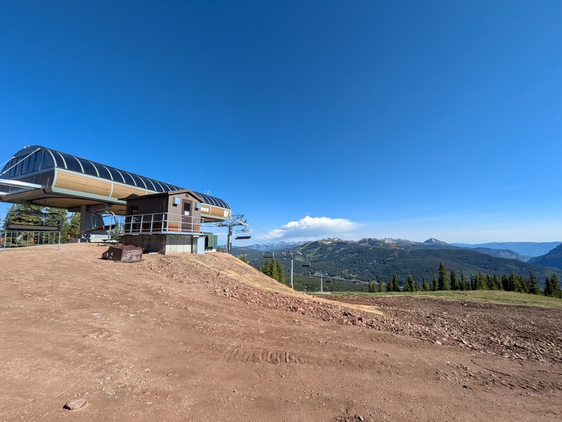
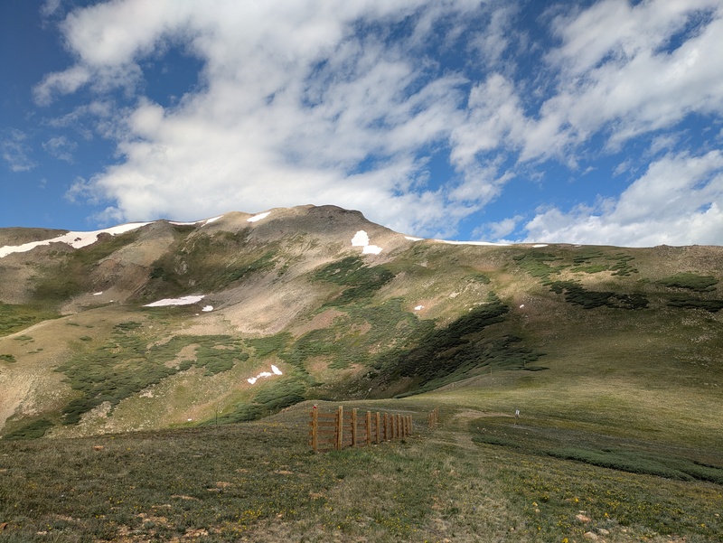
I topped out on the ridge by Union Peak and Mountain Chief lift after 4.9 miles. The road up through Copper was a bit of a slog at times but the views were nice, and it was fun to hike through runs that I've skied in the winter. 

From here I followed the ridgeline southwest towards Jacque, then turned and traversed across the meadow to head towards Tucker Mountain. This side trip probably could have been skipped but I wanted to take a look at Copper Bowl in the summertime, and it was a good spot for a quick snack. Straightforward hike along the ridge to Tucker, other than a determined pheasant protecting her nest that I gave a wide berth to. 1.5 miles from the top of the ridge around to Tucker Mountain. 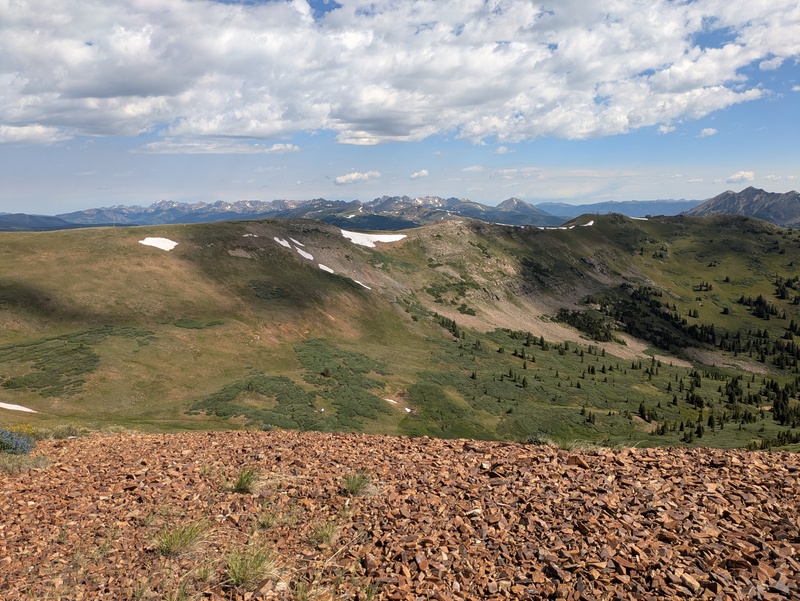
After walking back down to the saddle from the Tucker summit, I opted to take a direct route up to the Jacque Peak ridge rather than retracing my steps for a longer but less steep route. I found a pretty stable talus field to ascend up to the ridge. From there, a bit of walking up the grassy ridge led to a steep summit talus field up to the summit. The rock was pretty stable, and it didn't take as long as I expected. Beware the false summit! 1 mile from Tucker to Jacque. 
The summit of Jacque was fantastic with clear views of the Sawatch, Mosquito, and Tenmile ranges, as well as Holy Cross and Grays + Torreys. Even got a glimpse of what must be Snowmass Peak in the distance. It felt much higher than it is due to the prominence. 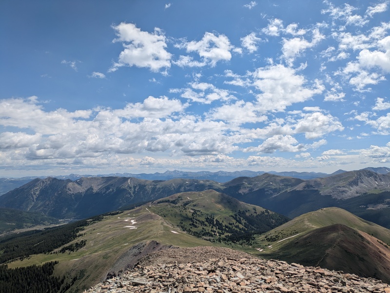
I then traversed down the ridgeline to the West towards Searle Pass and the Colorado Trail. The first few steps off the peak were a bit steep but it was mellow after that, including a vague trail that followed the ridge in some sections. I went up and over each little summit on the ridge, but these could be skipped for a more direct approach. I just love local maxima. 2.2 miles from Jacque Peak to Searle Pass. 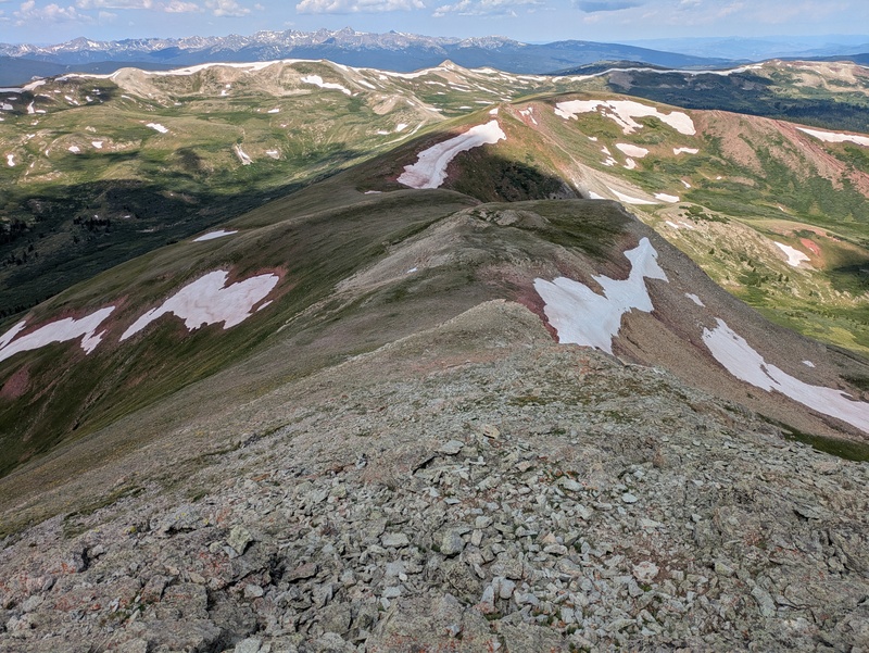
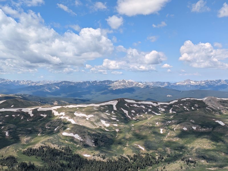
I stopped on Searle Pass for a few minutes at noon to eat some snacks and check the radar (cell service is abundant throughout this route). I decided I had about a 90 minute window before afternoon thunderstorms would roll in and that I would attempt to summit some of the 12ers on the opposite side of the CT. I knew it was a bit risky but figured I'd hustle, and knew that treeline was no more than a mile away. I reached the summit of Elk Mountain (0.8 miles) quickly, but the wind was picking up and the clouds were approaching fast. I decided to skip Corbett Peak to the south and try to jog over and tag Sugarloaf before getting out of there (0.7 miles). There was a ~100ft talus scramble to the top of Sugarloaf, which would have been fun if I was hurrying less. 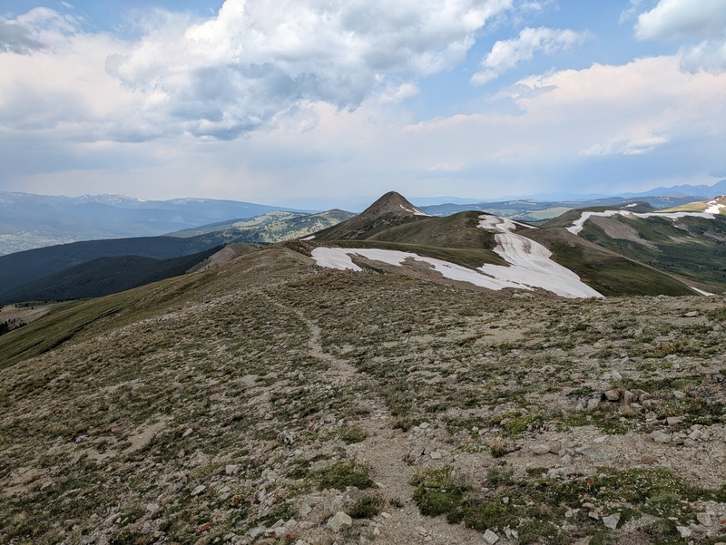
By the time I was off of Sugarloaf and heading down the ridge, the storm was at my heels. I jogged down the slopes towards treeline as rain began to spit. I would have made it into the trees just in time to stay mostly dry if I hadn't stopped to watch a mighty herd of elk on a nearby slope. There were well over a hundred of them, and they flowed like a liquid over the hills as they ran for cover from the storm. Super cool and worth getting hailed on for. 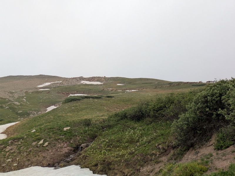
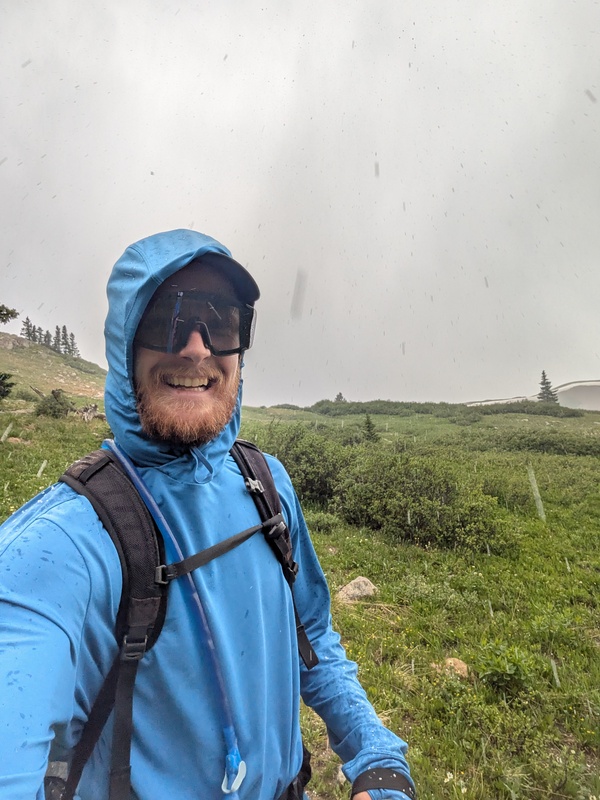
The thunderstorm passed pretty quickly but left a slippery layer of hailstones across the entire ground. My intention was to head straight back to the Colorado Trail to return to the trailhead, but in my haste and distractions I ended up on the opposite side of a ridge to the northwest of the trail. This earned me a slippery talus field crossing and a 2 mile bushwack to traverse the ridge and reach the trail. Didn't take any pictures of this bit as I was not a happy guy at the time. 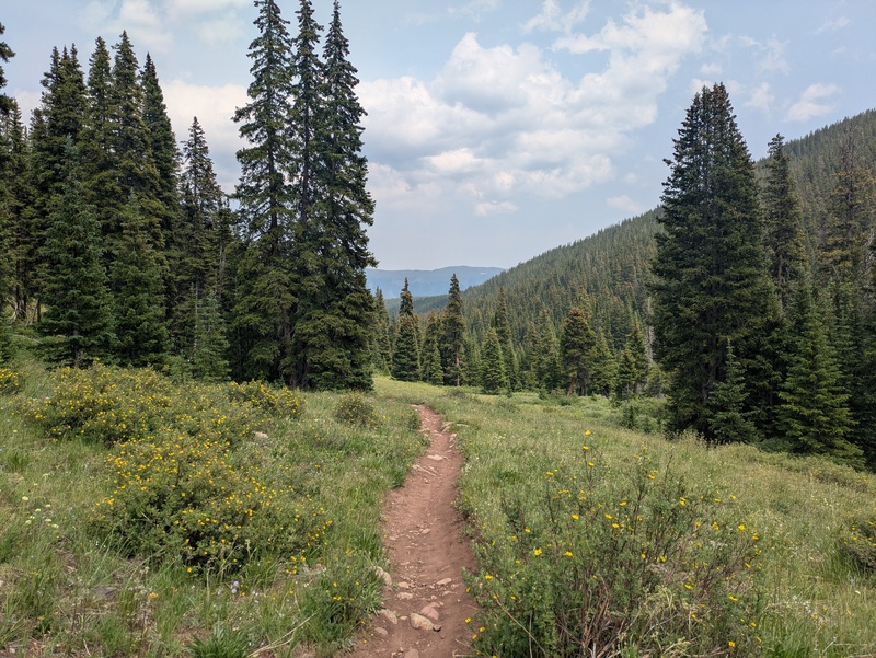
Eventually I made it back to the CT (3.0 miles from Sugarloaf summit) and followed the wide, mellow, easy trail until it met back up with the service road I started on in the morning. Back at the car I took a moment to stretch then headed straight in the direction of the nearest Baconator. Funny how my "easier" backup plan was almost double the mileage of my original goal for the day. Thanks to @Peaks4Days for the trip report that was the inspiration for this route. Thumbnails for uploaded photos (click to open slideshow):  The sort of mellow climb that began the day")
 Top of Timberline Express Lift looking picturesque")
 The steeper road towards the top of Copper")
 Mountain Chief Lift in the morning sun")
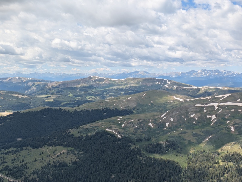
 Looking towards Jacque Peak from Copper")
 A view back along the ridge and into Copper Bowl from the traverse to Tucker Mountain")
 Heading back down Tucker toward Jacque")
 The rocky summit push up Jacque")
 Tenmile Range and Tucker Mountain to the east from the Jacque Peak summit")
 Mount Snowmass (?) peaking up in the distance")
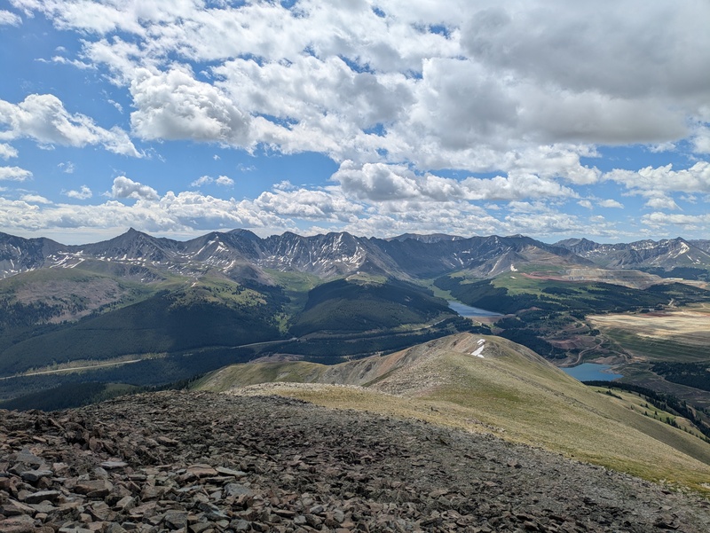
 The Sawatch range to the southwest")
 Climax mine, Tenmile Range, and Mosquito Range all visible to the south")
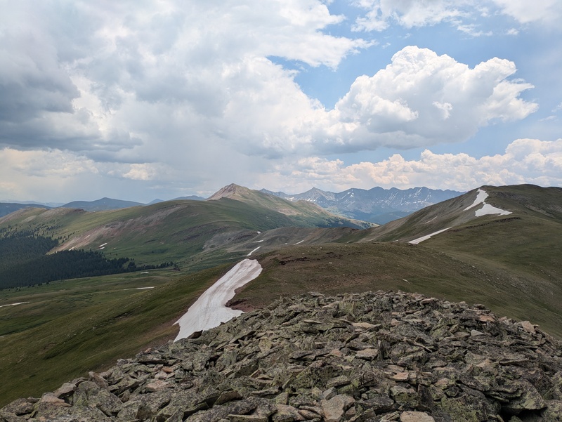
 West ridge down to the Colorado trail. Elk Mountain and Sugarloaf Peak in the near background")
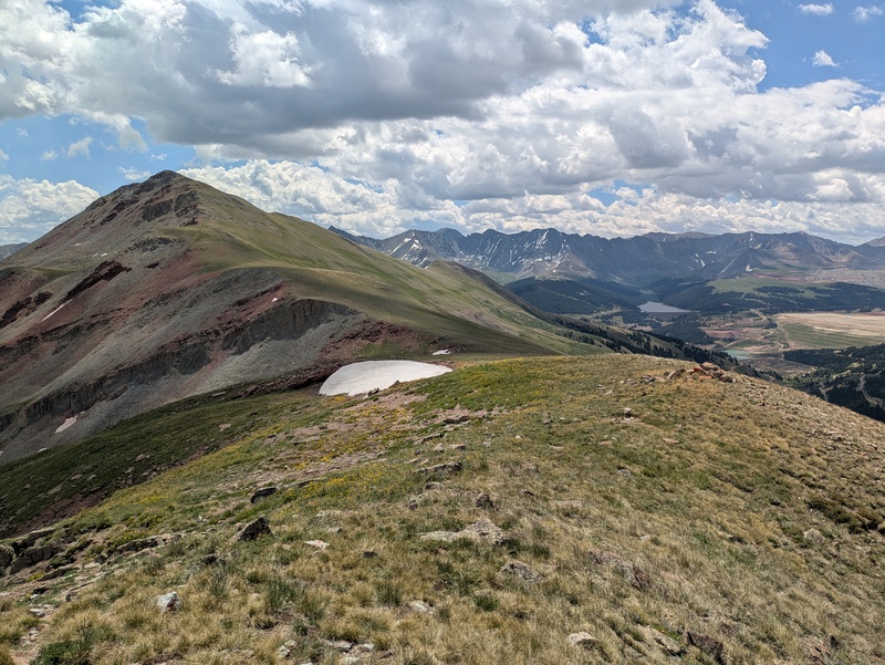
 A look back up the ridge towards Jacque")
 The ridgeline between Elk and Sugarloaf")
 Elk Mountain and Jacque Peak seen from Sugarloaf")
 The elk herd dashing across the slopes")
")
 Never been so happy to see a trail")
|
| Comments or Questions |
|---|
|
|
Caution: The information contained in this report may not be accurate and should not be the only resource used in preparation for your climb. Failure to have the necessary experience, physical conditioning, supplies or equipment can result in injury or death. 14ers.com and the author(s) of this report provide no warranties, either express or implied, that the information provided is accurate or reliable. By using the information provided, you agree to indemnify and hold harmless 14ers.com and the report author(s) with respect to any claims and demands against them, including any attorney fees and expenses. Please read the 14ers.com Safety and Disclaimer pages for more information.
Please respect private property: 14ers.com supports the rights of private landowners to determine how and by whom their land will be used. In Colorado, it is your responsibility to determine if land is private and to obtain the appropriate permission before entering the property.

