| Report Type | Full |
| Peak(s) |
Summit Peak - 13,304 feet "The Unicorn" - 13,030 feet Sheepshead 12,267' Bonito Mountain 12,191' Grayback Mountain 12,635' |
| Date Posted | 07/12/2025 |
| Date Climbed | 07/05/2025 |
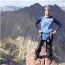
| Author | ReginaThomas |
| Additional Members | Kiefer |
| Treasures of the South San Juans |
|---|
|
07/04/25-07/05/25 Peaks Hiked: Sheepshead: 12,267' Grayback Mountain: 12,635' Bonito Mountain: 12,191' Summit Peak: 13,304' "The Unicorn": 13,030' 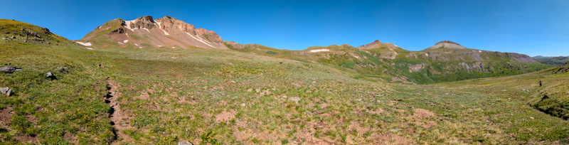
Kiefer is sitting at the wheel of our Tacoma as we drive eastbound from Montrose. It’s July 3rd and as we cruise along the familiar road toward Gunnison, there is a steady stream of westbound traffic headed toward the San Juan towns of Ouray, Silverton, and Telluride. We pass the bridge (state highway 149) to Lake City and continue through Gunnison, only stopping at Safeway to grab a sandwich for the road. We still have a long way to go, and our destination is a magical place, known as the South San Juan Wilderness Area. With no 14ers, few 13ers and only one seasonal encampment (Platoro), it is one of the areas in Colorado that has the least traffic. Because of this isolation, it retains a special beauty and old-world charm. Our first foray into the South San Juans was for my 37th birthday in 2022. We took Kaiah with us, and hiked 13ers Bennett Peak, Conejos Peak, and Montezuma Peak. I also tacked on 12er Sheep Mountain, and Kiefer tagged on 12er Windy Mountain. Unfortunately, due to threatening weather we only were able to hike Montezuma Peak and left behind Summit and ‘The Unicorn’ for another day. This also meant that we knew what was to come on the descent from Montezuma on our next trip… but more on that later. Our trip had left us with some familiarity with the area. We learned that A: black flies will bite and lay larvae in your dogs eye, and B: there are a ton of wasps at Stunner campground; so this time we A: got a dog sitter, and B: brought our sunshade with mosquito netting, and a can of Raid in case the wasps decided to make the bathroom home base again. It took three years, but finally, we were headed back with a plan to stay Thursday, and Friday at Stunner Campground before moving to Rio Grande reservoir and hiking 13er, Chief Mtn on Sunday. There are multiple ways to access the South San Juans. Our first trip in we entered via Blowout Pass from Del Norte, and left along the Conejos River, exiting outside of Antonito, by La Manga Pass. On this trip, we were planning to arrive at Stunner Campground first. So, we planned to enter south of Monte Vista on County Road 250. As we reached Monte Vista it was substantially downpouring. So, at the last minute we booked a room in town and vowed to get an early start the next morning. By “early,” we left the hotel about 8:00 AM after having breakfast and headed south towards Platoro. We had a perfect forecast, and our only plans were to set up camp and hike a few 12ers near the Summitville mine/ghost town and saving our larger day for Saturday. We met our first delay on the drive south from Monte Vista to catch County Road 250 as a Cowboy was herding his sheep up the road on horseback. After enjoying the brief detour and marveling at how cute the lambs were, we continued south and turned right to head west into the wilderness. 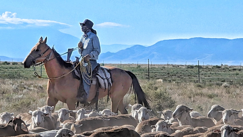
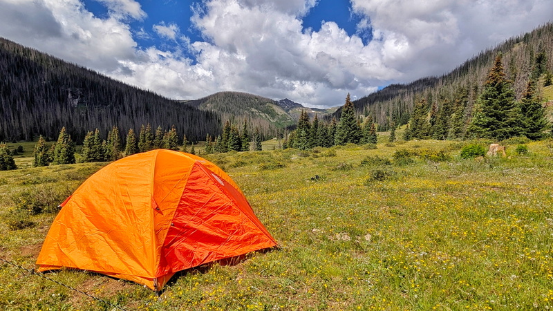
The drive in along the Alamosa River is truly a Stunner and the campground is aptly named. After MANY stops for photos, and at the little public library in the summer encampment of Jasper to grab Yahtzee, we finally arrived at Stunner Campground. We shouldn’t have been surprised to find it full, since it was a holiday weekend after all, but after our last trip down we were both shocked to find all the campsites taken. We decided to continue up the road toward the Treasure Creek Trailhead for Summit Peak, and to try to find a campsite there. After a few miles we were rewarded with a narrow road, curving sharply to the left into an open meadow, called Horsethief Park. We chose a campsite nearest to the main road where we had some tree cover and set up our home for what would be the next two nights. The view of Summit Peak from camp was truly amazing, and the river running below in the meadow added to the tranquility we were already feeling being so far away from the mainstream. 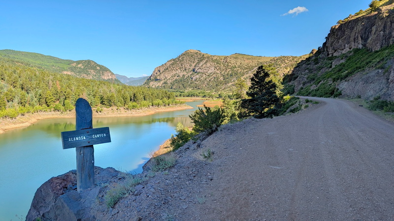
We hopped back into the truck, and headed toward our first objective, Sheepshead Peak. I will note that the Sheepshead Peak summit is NOT private, however much of the land around it is. Using private land layers on an app like GAIA or Cal Topo should allow you to find an approach to the Southwest side of the peak. We quickly identified the class 4+/5 access gully, as well as the class 5.2 chimney that John Kirk soloed. 
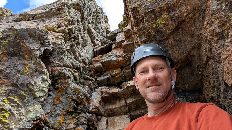
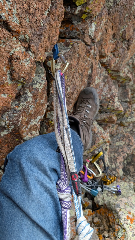
After starting up the class 4+/5 gully we backed off at a smooth crux that while I could easily climb up, gave me pause for the downclimb. After briefly exploring the class 5.2 chimney, we returned to the class 4+/5 gully and took out our harnesses and ropes. At this point we had wasted a lot of time, so ropes it was. 
I belayed Kiefer up, which took the full length of our 30-meter rope. He was able to plug a smaller nut, as well as a .25 cam on the way up to secure the lead climb. Thankfully as we reached the last few feet of rope, he found an anchor and protected his position with a BD 4 cam. I quickly joined him at the anchor, only being slowed down to wriggle the firmly placed nut out of a crack in the rock. From the anchor it was probably a 2-minute, class 2+ scramble to the true summit. 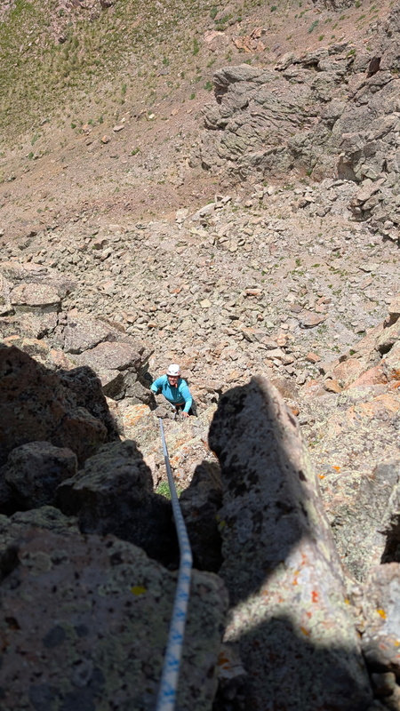
While on the summit, Kiefer mentioned that lowering me down the gully off an anchor consisting of one cam concerned him, and rightfully so. I asked if he could just have me on belay instead while I downclimbed, and we both agreed that it was a much safer alternative. Kiefer clipped back into the anchor, set a solid hip belay and I slithered over the edge. 
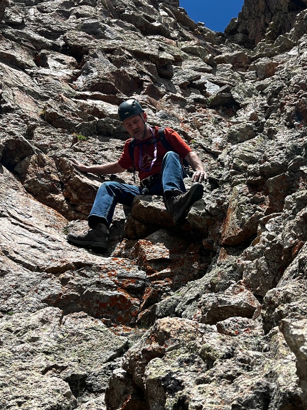

The climbing was not hard, but the gully is 80-90 degrees and would be a bad place to slip. Downclimbing the crux did require some fancy footwork on my part and using some questionable foot placements and would take all of Kiefer’s 6’ tall frame to reach the bottom of when he joined me on the ground minutes later. Sheepshead was an enjoyable summit, with a spicy climb to the top, and it was the most challenging peak (technically speaking) of the weekend. 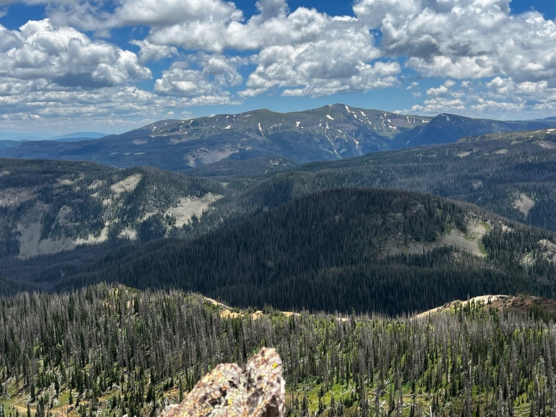
After our enjoyable summit of Sheepshead, it was much later than we had expected, both due to our later start, and our route-finding delays. We continued up the road toward Summitville, and conversely tackled our easiest 12er of the weekend, Grayback Mountain. A 4x4 road reaches the summit, and after 10 steps across the gray talus, we were at the GIGANTIC summit cairn. Kiefer said it could rival Phoenix’s, but I wouldn’t know since I keep procrastinating hiking Phoenix Peak. We started a trend, as shortly after arriving 4 additional vehicles headed up to the top of Grayback. We waited briefly at the top before heading back down the road and parking at the Dry Creek Trailhead for our next 12er, Bonito Peak. 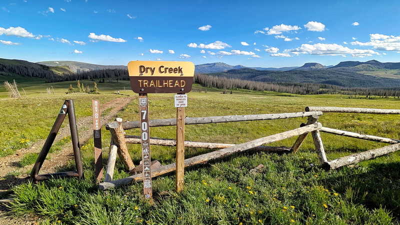
The hike to Bonito Peak was uneventful, most of the hike consists of an ATV trail through a boggy meadow. We left the road upon reaching the grassy Northeast Ridge of Bonito Peak and after a short stroll through the tundra and a quick talus hop we arrived on the rocky summit. Just as we summitted I realized on 07/04/2024, we had hiked 13er Bonita Peak and today we were on Bonito Peak a year later! I must have been hungry at this point, because instead of thinking of Bonito meaning “beautiful” I was thinking of Bonito flakes and the Good To Go Chicken Pho waiting to be rehydrated once we reached our campsite. The return hike to the truck went quickly, and soon enough we were back at camp preparing dinner. While preparing dinner we were serenaded by multiple volleys of gunshots, some sounding like cannons up the valley from us. Thankfully, none of the new fires were caused that night. After devouring our Pho, we played a round of Yahtzee, a game I simply cannot seem to win, and retired to the tent by 9 PM to enjoy a good night’s rest before hiking Summit and Unicorn the following morning. 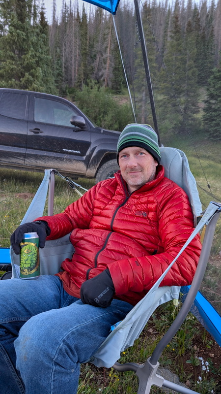
Morning came far too quickly, but knowing we had an excellent forecast on our side we left camp at 7:30 AM and were headed up the Treasure Creek trail by 8:00 AM. The trail leaves the trailhead downhill to the left, where you will cross Treasure Creek on a 3-log bridge. 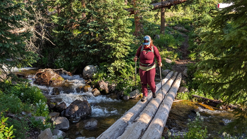
The trail is quite overgrown and was challenging to follow in areas, but soon we were on a lonnnngggg switchback which took us into a gorgeous meadow ringed by cliffs. After walking through the meadow, the trail hangs a sharp right and heads steeply up the flanks of Summit Peak through the forest. 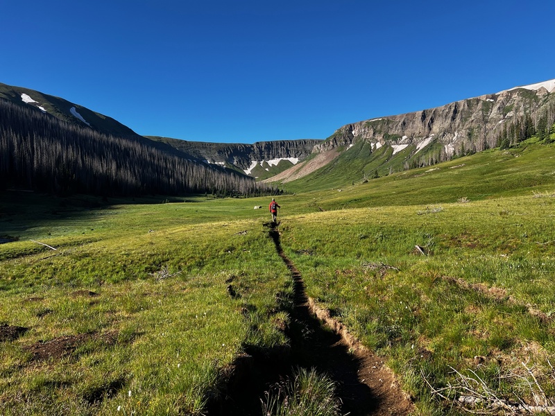
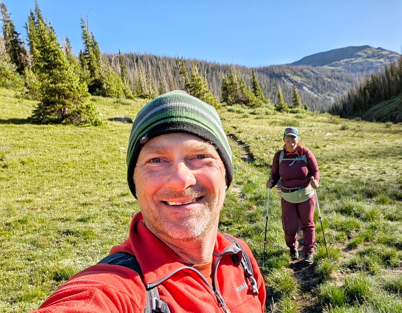
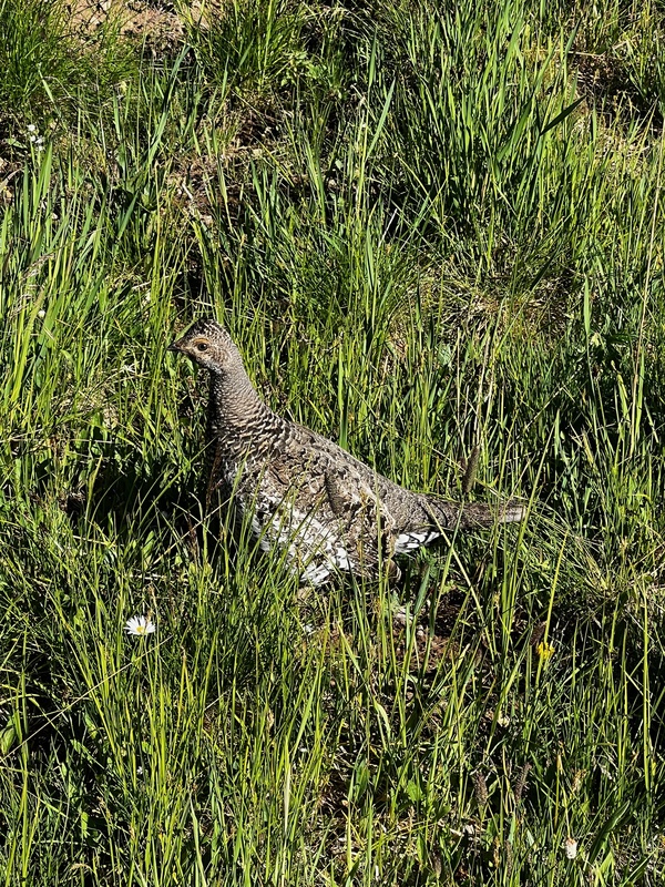
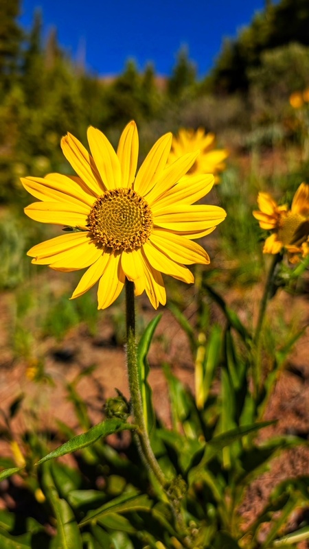
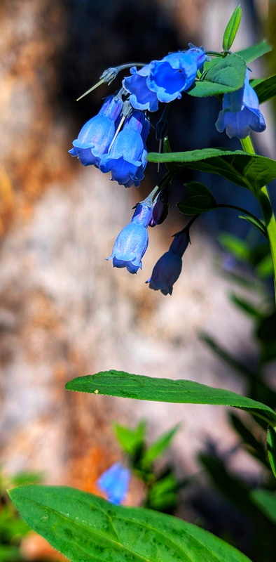
We briefly lost the trail and came upon a grouse who must have been protecting babies as she was only about 4 feet from me, which made for some great pictures. Thankfully as we were taking pictures of the grouse a solo hiker came by and pointed out where the missing trail continued. The wildflowers were gorgeous and we enjoyed the smorgasbord of color as we continued our ascent. 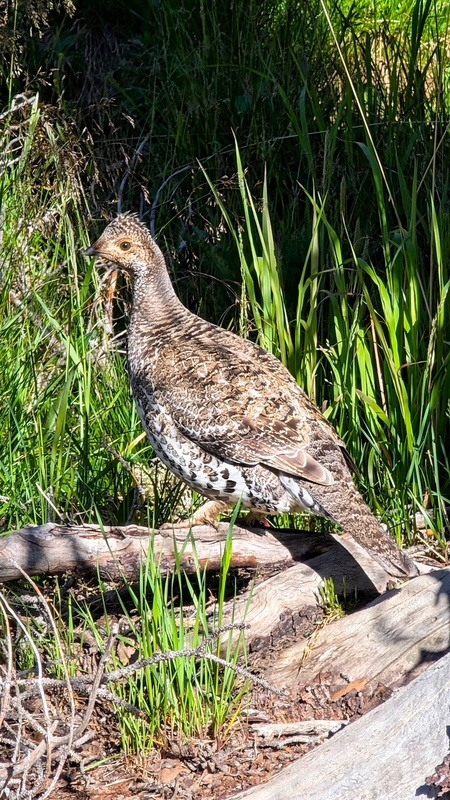

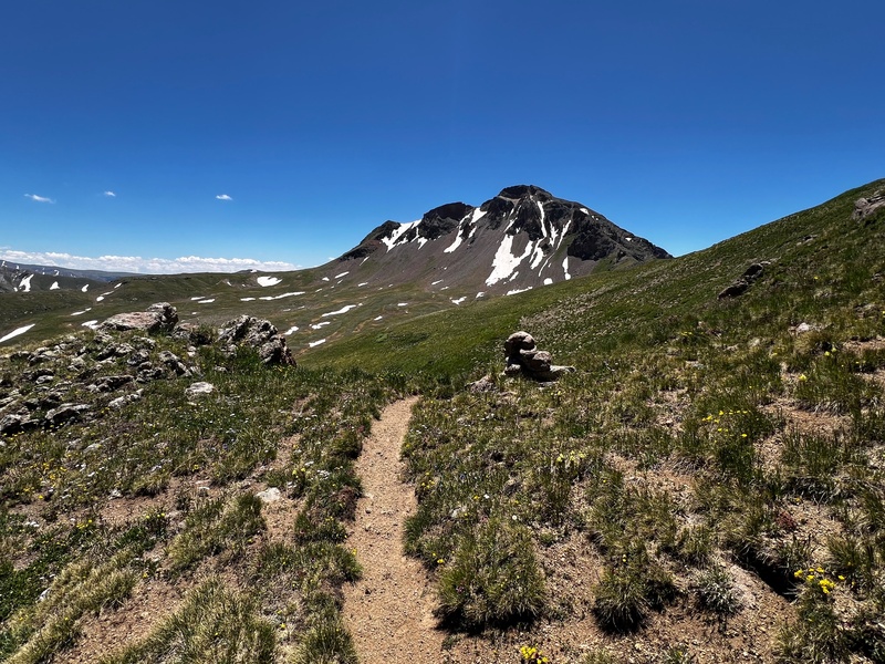
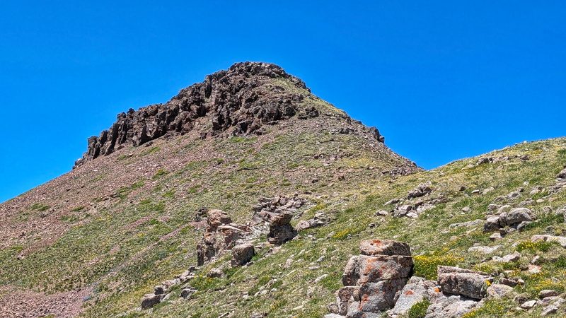
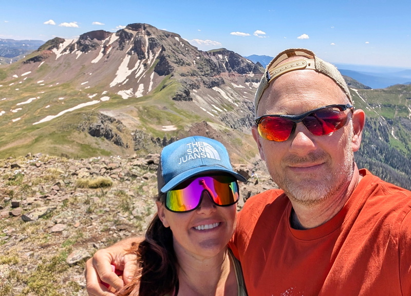
After rejoining the trail, we continued the steep trek to treeline, where we promptly lost the overgrown trail again in another meadow. The trail ahead from the meadow was obvious, and after hiking up an old drainage we rejoined the now apparent trail above treeline. From treeline, the trail traverses and eventually intersects the Continental Divide Trail below the final slope to Summit Peak. Once we were on the CDNST, the trail quickly wrapped us behind Summit Peak where we saw the steep tundra slope that would lead us to the summit of Summit Peak after 800’ of gain. The slope was quite reminiscent of the tundra slope up 13er Wildhorse Peak. After pushing up the tundra slope to Summit Peak we hit the ridge just below the true summit and enjoyed the sheer views of Summit’s North Face Cliffs. The summit itself is rocky, but we took a long break to rehydrate and snack prior to descending down the tundra slope back to the CDNST. 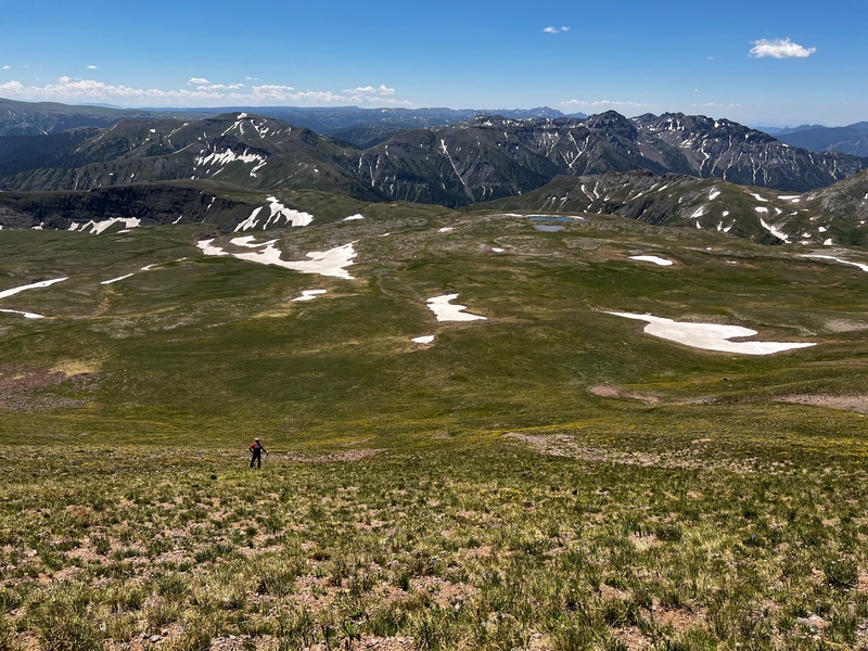
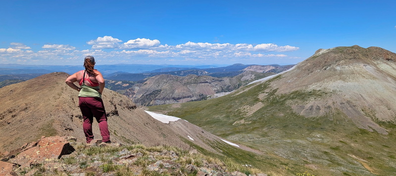
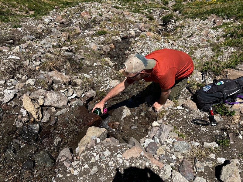
Wrapping around Summit Peak on the CDNST was longer than taking the North Ridge direct, but was incredibly efficient and as we hiked along the level trail, easily crossing a few short remaining snowfields, and even grabbing some fresh snowmelt water to refill our Nalgenes, we soon found ourselves at the base of our second and final peak of the day “The Unicorn”. 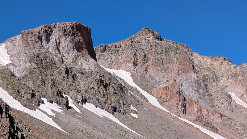
Upon reaching the base of “The Unicorn” the wind kicked up, but neither of us complained as the cool breeze felt amazing as we ascended the tundra slope toward the summit. Just below the summit the terrain shifted to rocky, but nothing above class-2 travel was required to reach the summit. 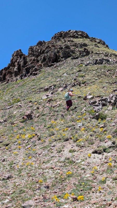
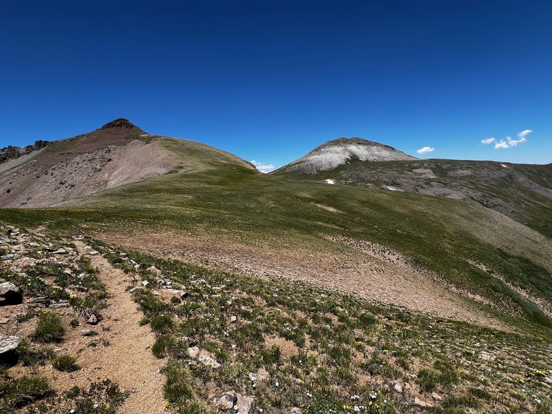
We didn’t spend long on the summit as it was swarming with black flies, so we quickly descended back along our ascent route and intersected the CDNST again, this time trekking toward Montezuma Peak. Neither of us wanted to ascend the scree slopes of Montezuma Peak a second time, and quite frankly pie in Platoro was sounding amazing. So, after quickly sketching a track on GAIA across an upper bench we were off for our final challenge of the day, the lovely descent back to the trailhead. 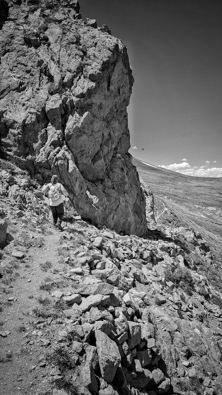
Most trip reports here start with Montezuma Peak and end on Summit Peak. I would recommend ending on Montezuma Peak. The hike to Summit is much longer (and easier), but you are above treeline longer as the CDNST wraps around the back of Summit Peak, and unless you take the class-3 North Ridge, you have to complete the same wraparound to traverse to “The Unicorn.” After summitting “The Unicorn,” Montezuma is quite close, and has the ‘benefit’ of a very steep and direct descent back to treeline, which is helpful in the event you have a less than perfect forecast. Had we reversed our route, we likely would have summitted all 3 peaks in 2022. I would also recommend downloading a GPX track for the ascent/descent from Montezuma Peak through the basin. The upper basin is inviting tundra, but as you descend toward treeline, you will cross multiple fields of corn lilies and get to hop over/crawl under multiple downed trees prior to descending to the creek. 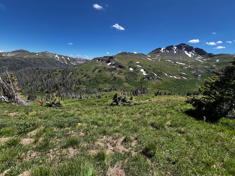
Unfortunately, even in such a remote area we found an empty Bud Light can and a “Happy Birthday” mylar balloon in the creek which we packed out with us. Please do better when enjoying our wild places and leave no trace. It is important to stay to the left side of Treasure Creek when descending to the trailhead as the creek descends steeply into a gorge. Once you reach the gorge, there is a faint social trail that will take you (steeply) to the trailhead. 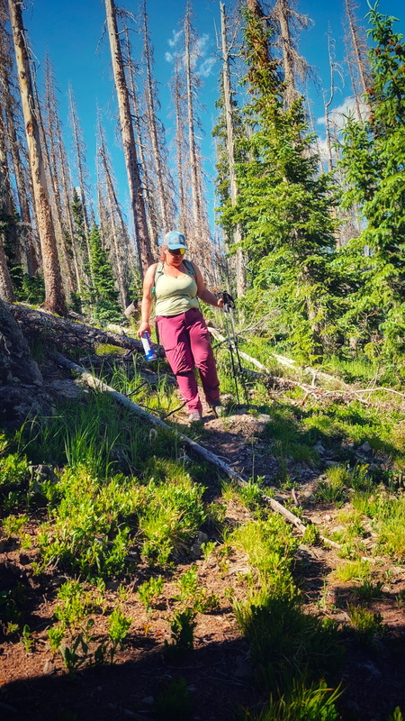
After we reached the truck, we made the short drive into Platoro and, while we didn’t order pie, the chicken tender basket with fries, and the running water were a fantastic way to end the day. We returned to camp and after another round of the game I cannot win (Yahtzee) retired to the tent, tired from a satisfying day in the mountains. We are already planning our next trip back… this area may not be popular due to the few 13ers, and the remoteness of the wilderness, but it is a special place, and I highly recommend exploring the South San Juans. 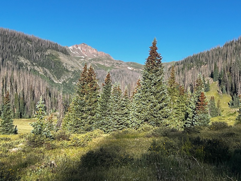
We even saw more sheep on the drive out via the Lake City Cutoff as a perfect bookend to a great weekend! 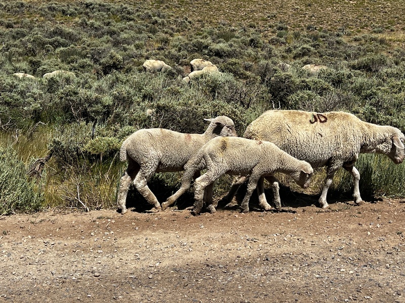
Thumbnails for uploaded photos (click to open slideshow):  On the CDNST towards Montezuma - Kiefer pic")
 Summit of")
 Ascending")
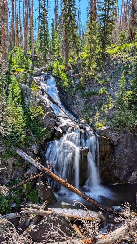
 Waterfall on Treasure Creek - Kiefer pic")
 Grouse - Kiefer pic")
")
 Looking at")
")
 Descending the social trail - Kiefer pic")
 Panorama of the upper basin")
")
 Wildflowers - Kiefer pic")
 Old Man of the Mountain - Kiefer pic")
 Paintbrush - Kiefer pic")
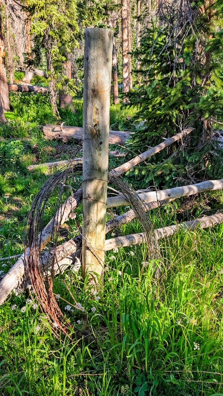
 Old fenceline - Kiefer pic")
 Cowboy and sheep - Kiefer pic")
 View of Conejos Peak")
 Kiefer descending Sheepshead")
 Kiefer descending Sheepshead")
 Kiefer descending Sheepshead")
 Kiefer descending Sheepshead")
 Upper Valley on Treasure Creek Trail")
 Grouse")
 Kiefer descending Summit Peak")
 Looking across the CDNST toward")
")
 Looking back at Summit Peak")
 Kiefer refilling our water bottles")
 Summit Peak from Camp")
 Sheep on the drive out")
 Kiefer beginning the bushwhack")
 Kiefer relaxing at camp")
 Route up Sheepshead - Kiefer pic")
 Sheepshead route options - Kiefer pic")
")
 Alamosa River - Kiefer pic")
 Downclimbing Sheepshead - Kiefer Pic")
 Crossing Treasure Creek - Kiefer pic")
 The 5.2 Chimney - Kiefer Pic")
 Dry Creek Trailhead - Kiefer pic")
 Climbing Sheepshead - Kiefer pic")
 Campsite - Kiefer pic")
")
|
| Comments or Questions | ||||||
|---|---|---|---|---|---|---|
|
Caution: The information contained in this report may not be accurate and should not be the only resource used in preparation for your climb. Failure to have the necessary experience, physical conditioning, supplies or equipment can result in injury or death. 14ers.com and the author(s) of this report provide no warranties, either express or implied, that the information provided is accurate or reliable. By using the information provided, you agree to indemnify and hold harmless 14ers.com and the report author(s) with respect to any claims and demands against them, including any attorney fees and expenses. Please read the 14ers.com Safety and Disclaimer pages for more information.
Please respect private property: 14ers.com supports the rights of private landowners to determine how and by whom their land will be used. In Colorado, it is your responsibility to determine if land is private and to obtain the appropriate permission before entering the property.