| Report Type | Full |
| Peak(s) |
San Luis Peak - 14,023 feet Baldy Alto - 13,703 feet Stewart Peak - 13,988 feet |
| Date Posted | 07/14/2025 |
| Date Climbed | 07/12/2025 |
| Author | hootenatty |
| Beautiful Day in the La Garitas |
|---|
|
Stewart Creek/Nutras Creek Loop: San Luis Peak - Baldy Alto - Stewart Peak 16.25 mi - 5,400' Saturday 7/12/25 One of these days, I'll finish standing on top of all the 14ers in this state. I've rounded the halfway mark, with a heavy emphasis on the peaks closer to Denver. This weekend I had the option to head out a little earlier on a Friday, and wanted to avoid the fires near Buena Vista and Gunnison, so I set out from Denver to hike San Luis Peak. The weather forecast was pretty promising. I was coming off of a pretty active week, with a solid training hike on Thursday and a good mountain bike ride on Friday morning. Having heard so many good reports of the easy trail up San Luis, I thought I'd assess how it's going on the summit and consider tacking on Baldy Alto and Stewart. The drive down from Denver (including over Cottonwood Pass) was pleasant but uneventful. I motored through the Nutras Creek crossing in my stock Outback with ease. After a quick pit stop at the Eddiesville South Trailhead, I pulled into a dispersed camping spot 0.3 miles up from the Stewart Creek Trailhead just ahead of another hiker. There was plenty of space to share, so I said hello to Kelsey and her energetic Good Boy Jack. Luckily the bug spray kept the mosquitoes away while I wolfed down a quick dinner and bedded down for an early departure. I find it hard to avoid hitting the snooze button on solo hikes, and this Saturday morning was no exception. So I got started about half an hour later than I had planned, at 4:40. The 0.3 miles down the road to the trailhead went easy by moonlight, and the canyon looked pretty empty as I started on the well-maintained trail. But after about 20 minutes, Kelsey and Jack passed me motoring up the easy trail. After an hour or so the headlamp became unnecessary and the wildflowers started to appear along the creek. 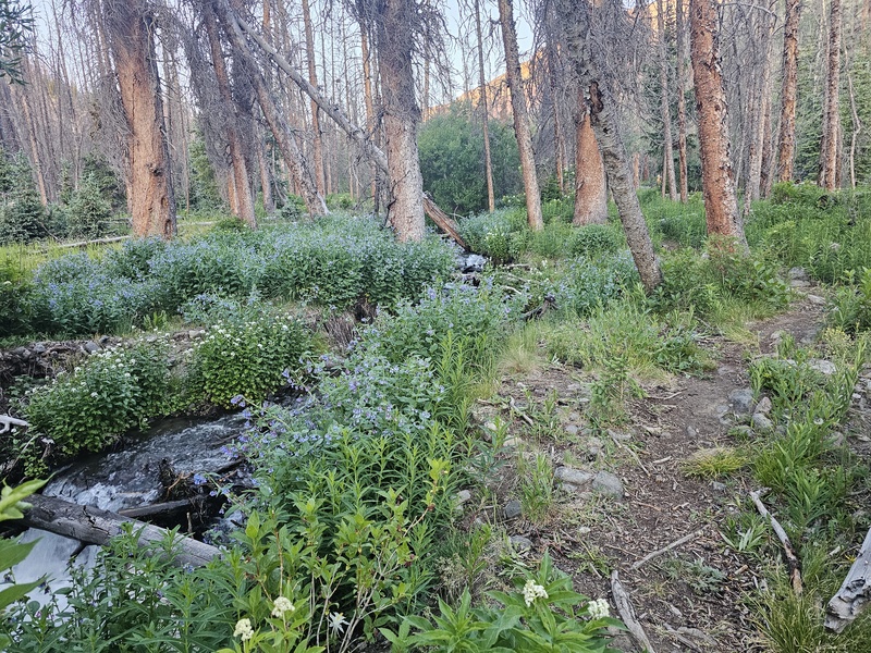
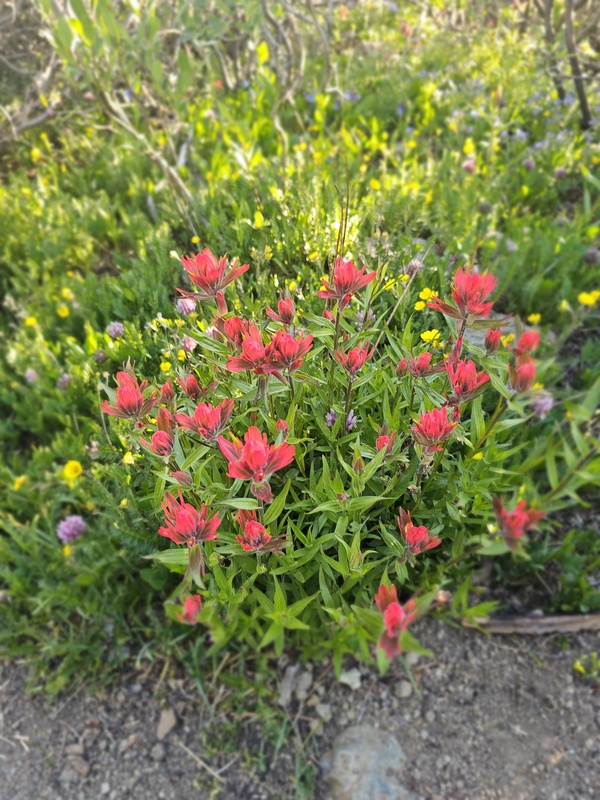
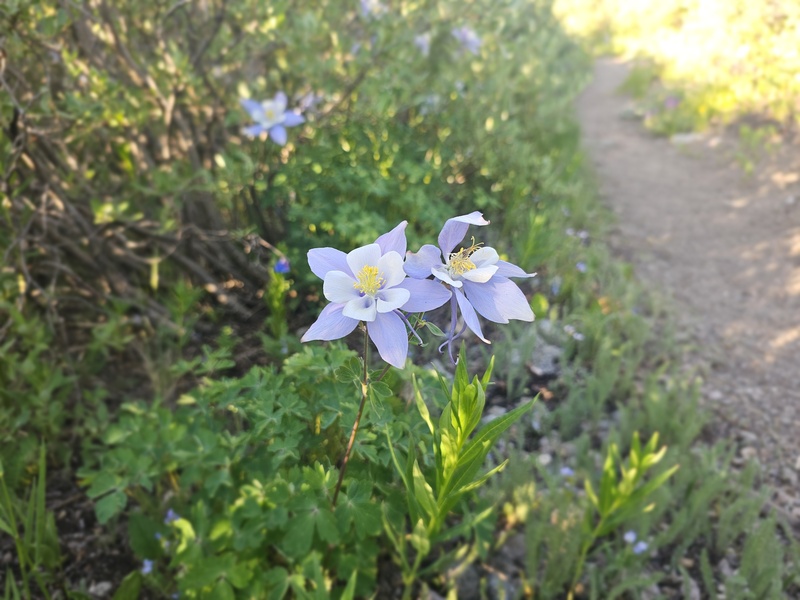
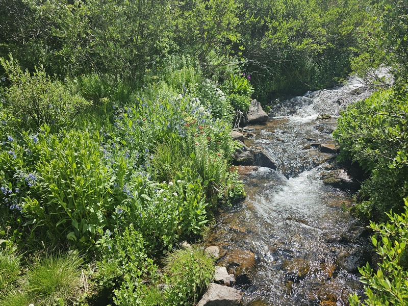
I had heard it wasn't uncommon to encounter moose in the area so I was keeping an eye out as the easy mileage went by. Sadly (but perhaps fortunately) none appeared. The trail was proving to be very well-maintained and easy to follow. It's been such a great year so far for precipitation, so as the daylight illuminated more and more of the canyon around me, I kept giving in to the temptation to stop for photos of the wildflowers. 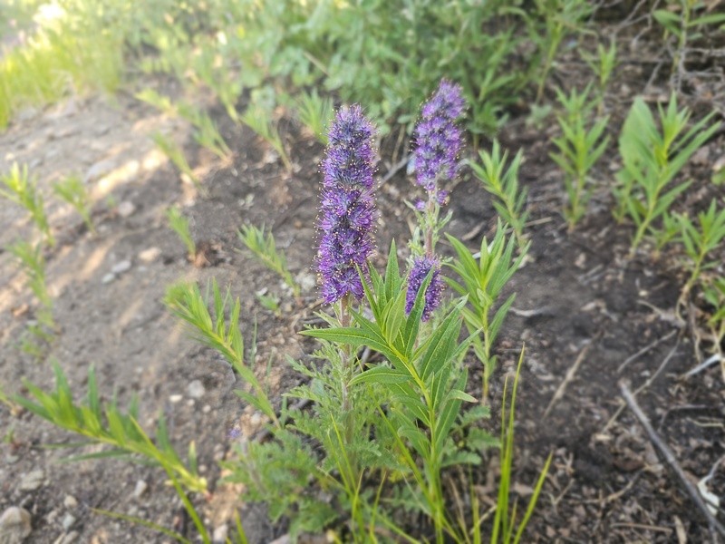
As I approached treeline I discovered I had forgotten to calibrate the altimeter in my smartwatch. After spending 10 minutes trying to remember how, I gave up and continued on. After all, the 14ers.com app was working great and I had a couple of trip reports saved for reference. Before turning up the slope to gain the Northeast Ridge I encountered the last two hikers I'd see before the San Luis summit... I love how uncrowded it typically is in the southern Colorado high country. 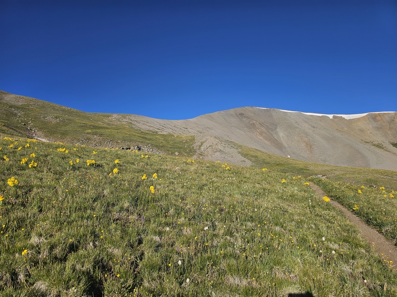
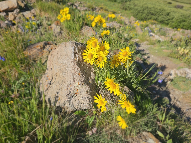
Once on the ridge proper, the summit of San Luis Peak came into view and pulled me onward. Though the ground was getting more and more bare, there were still plenty of wildflowers on the rockier slopes and it was hard not to smile at my good fortune. 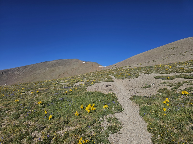
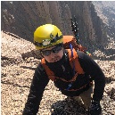
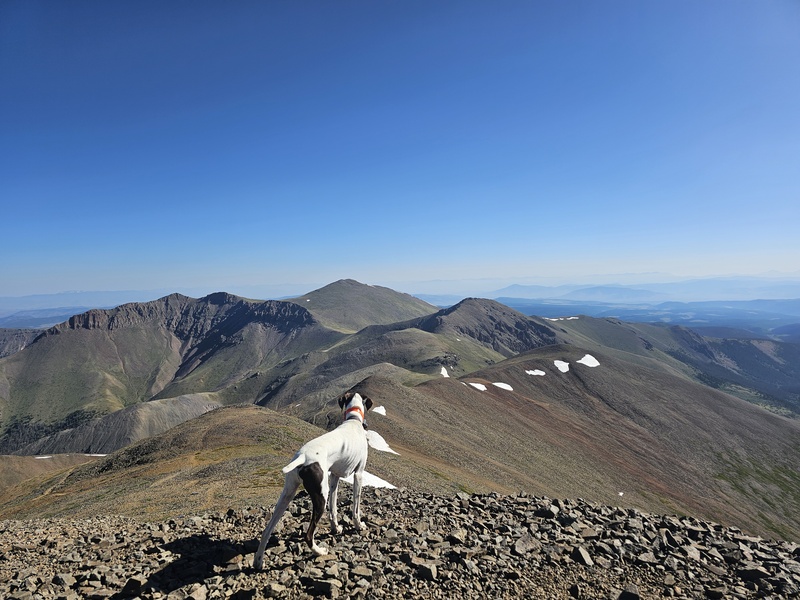
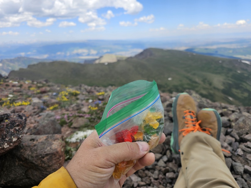
As I got past the false summit, I saw my faster peers on top and pretty quickly joined them. Stephen, Kelsey, and Jack made a nice low-key welcoming party. Though I'd started a little later and was taking my time, the day was going very well and I felt great. The weather looked to be holding up well, with plenty of sunshine and very little wind, so we took our time and enjoyed the views. I shared my tradition of Haribo gummy bears on the summit and watched Jack curiously take in our expansive surroundings. As Stephen, Kelsey, and Jack departed, another group of two hikers summited from their camp in the willows below. The path to Baldy Alto and Stewart beyond looked promising, so after taking a few summit photos I set out for the add-ons. 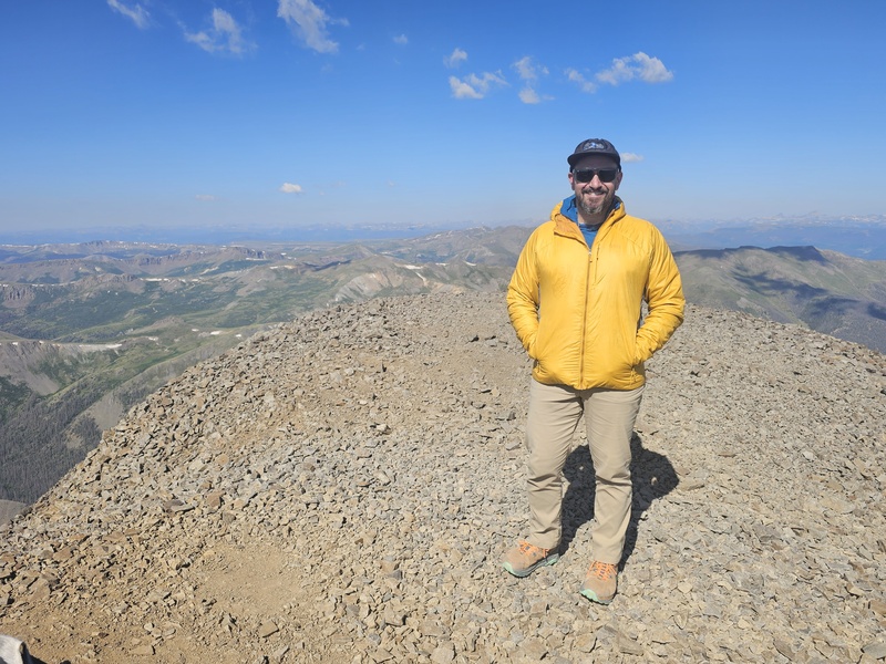
The saddle between San Luis and Baldy Alto came easily after skirting the west side of the false summit. But a narrow band of snow held along the lower portion of the ridge above, so I hiked above it and skirted around the north side toward the chunky lump perched between the saddle and the summit of Baldy Alto. 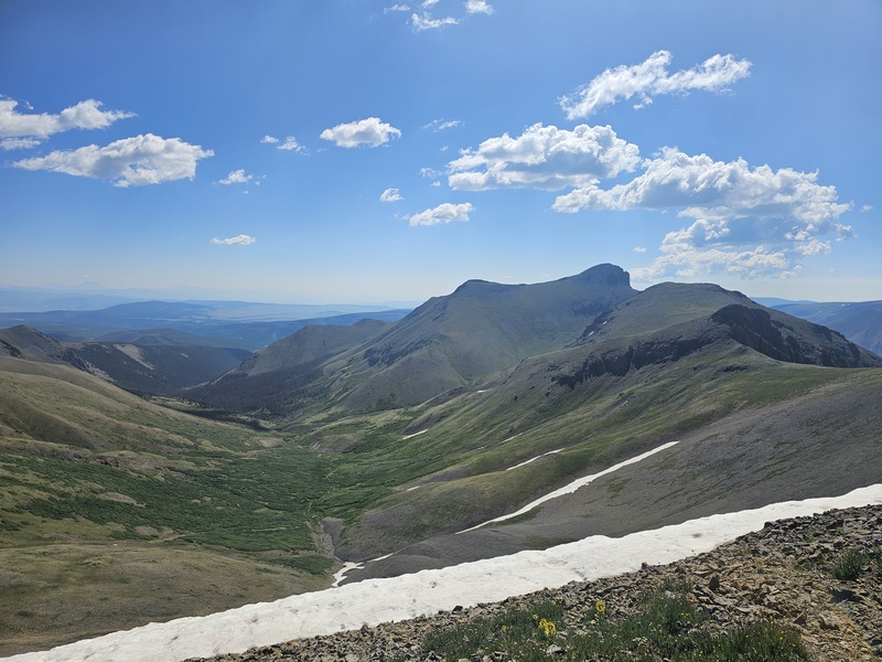
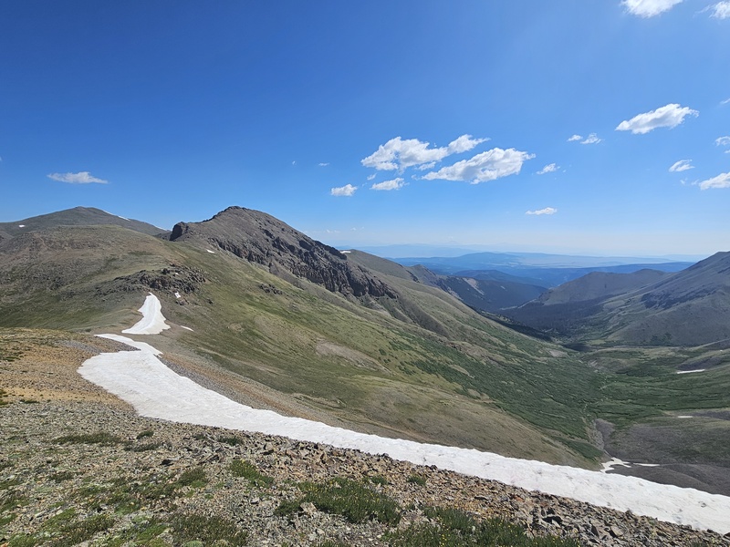
Since I was hiking alone, I opted not to do the short 3rd-class chimney right through the middle of this rocky lump, and hiked around the west side instead. I was following the routes shown on the trip reports I had saved on my phone, with steps alternating between grass and rock on the slope up to Baldy Alto. At times it was hard to avoid stepping on all the wildflowers everywhere. A very pleasant stroll along the ridge above the south-facing slope led to my second summit of the day, Baldy Alto. 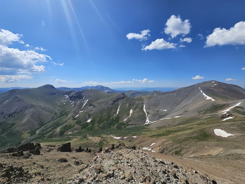
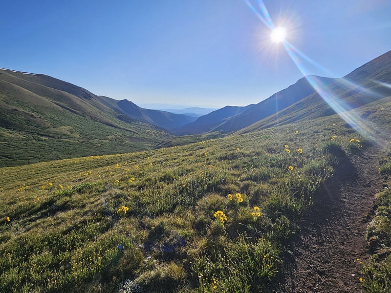
After taking a few minutes to enjoy the views and get a little more food in me, I noticed the clouds overhead were increasing and starting to get a little gray, so I wasted no time heading north toward the saddle between Baldy Alto and Stewart. My intent was to skirt the east side of the talus field that was perched along the ridge ahead of me to avoid some unnecessary elevation gain... a decision that led to some of the least enjoyable hiking of the day. Hopping the talus along the northeast side of that mini-summit was tedious! But the far side led to another pleasant stroll up the west side of Stewart Peak. Looking back at Baldy Alto from below Stewart, I really didn't want to have to regain that ground to hike back along the Stewart Creek trail and decided at that point to take the Nutras Creek trail out (which I later learned is the Stewart Peak East Ridge route) instead. The day was starting to stretch, and though I'd brought 2.5L of water it was starting to get low. I resolved to ration the rest as I topped out on Stewart Peak. After a bit more food and gummy bears, I consulted the reference trip report and started to head east. 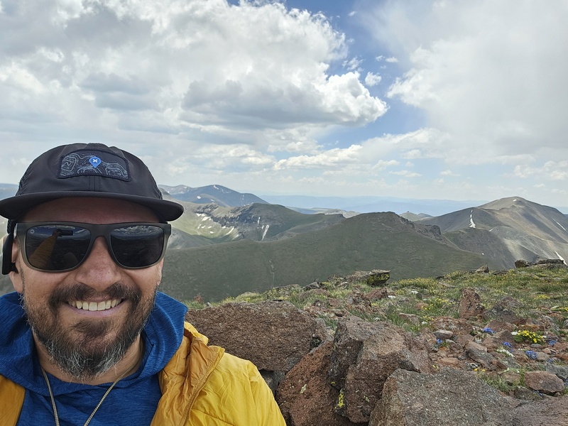
Descending the northeast ridge to the point where you turn east/southeast required a good amount of talus-hopping. Near the bottom of this stretch it does cliff out, and I chose to skirt around the north side of those cliffs down a fairly steep talus/scree field to the flatter slopes below. I knew there was no discernible trail until picking up the thin trail down at Nutras Creek, so I carefully headed downhill, aiming to roll over the east-facing shoulder and down to the creek. I consulted the GPS on my phone repeatedly, ultimately heading down through the thin forest and tundra towards the willows... which would prove to be the second unenjoyable part of the day. I could not find any discernible easy way down this south-facing slope, so I zig-zagged through the thin forest and deadfall towards the willows, with my head on a swivel for the thin trail that apparently begins somewhere down there. This slope does get pretty steep at times. After getting closer to the creek, I ultimately spent close to half an hour picking my way through the willows downhill and along the creek, with several dead-ends requiring me to backtrack... ugh. I finally found the thin trail along the creek and started hiking more steadily to the east. There is a fair amount of deadfall along this trail, and staying on it required a good amount of vigilance. Shortly along this trail it crosses a significant stretch of rock fall. The start of the trail through the rock fall was marked with a cairn, and I added another, but the trail was a bit hard to follow all the way through the rock fall. I would caution anyone reading this to not go low all the way to the bottom - stay in the middle, don't go lower than about 20' up from the creek. I unfortunately did not take any photos between the summit of Stewart and after the rock fall section. Further along the thin trail - which does gradually get more obvious as you follow the creek downhill - I spotted a herd of elk across the valley. It was a welcome sight after not seeing anyone (let alone being close enough to speak to anyone) since the summit of San Luis! I wished I had brought my binoculars to get a closer look. After spooking a doe half an hour later among the forest along the creek, I found a spot leading to the water and took the opportunity to dunk my head and cool off a bit. 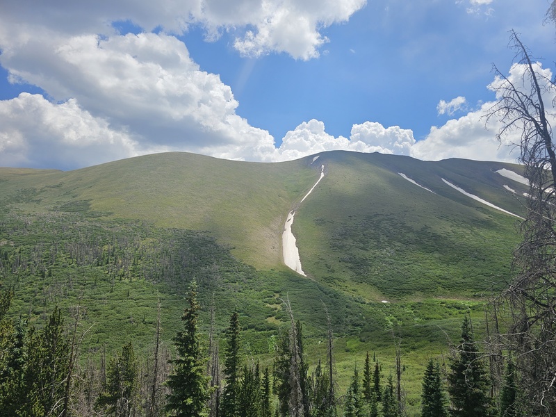
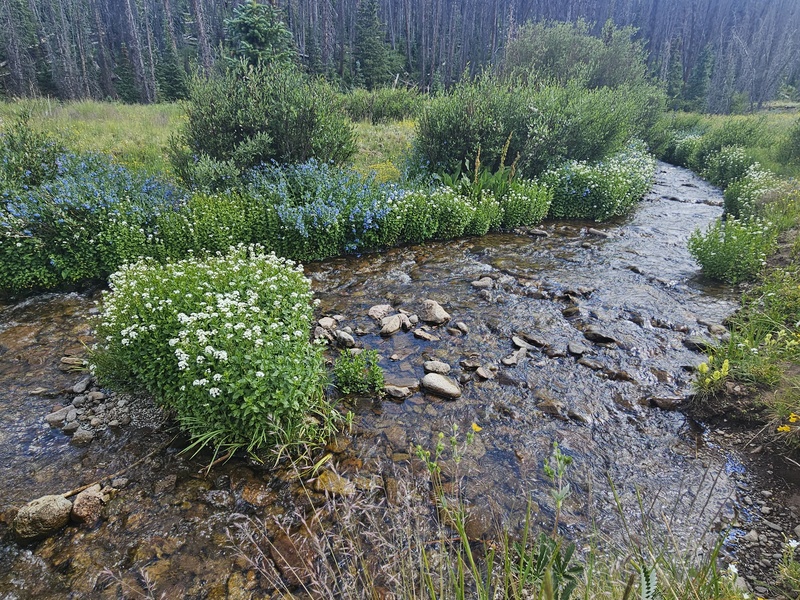
The trail leads in and out through thin forest until you reach a wider clearing where Nutras Creek splits. It became hard to follow here and I mistakenly headed diagonally east across the meadow, before realizing the trail hugs the slope about 10' above the north edge of this meadow. Heading back diagonally northeast across the meadow to find it again was pretty pleasant, and I downed the last of my water while enjoying the flowery meadow. 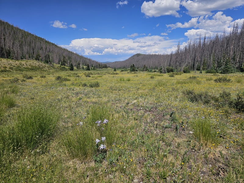
The rest of the trail to the Nutras Creek crossing at CR 14D is mostly unshaded rolling hillside. Shortly after meeting the road, the cumulative effect of my active week started to take hold, and the last mile or so along the road felt pretty tedious. My cellphone died right before I hit CR 14D, and I jokingly cursed every left turn that turned out to not be the bend in the road before my campsite. Thankfully my cooler with Gatorade and chocolate milk was there to greet me when I finally got there at 4:38pm - almost exactly 12 hours after starting. I included a map below of the route I took. Special thanks to Carl_Healy for his excellent write-up of the same route he took in 2021. 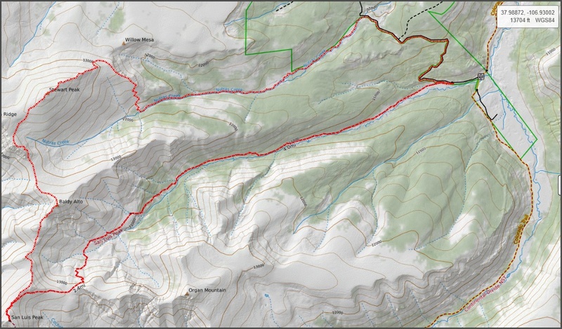
Thumbnails for uploaded photos (click to open slideshow):  Early Light")
 Wildflowers")
 Columbines")
 More Wildflowers")
 Even More Wildflowers")
 Approaching The NE Ridge")
 Looking Back Down Stewart Creek")
 After Gaining NE Ridge (San Luis Summit In The Distance)")
 Jack Taking In Baldy Alto, Column Ridge, and Stewart Peak (Center),")
 San Luis Summit, Looking West")
 Looking East from Saddle, 13,400 ft (Stewart Creek, Organ, and NE Ridge)")
 Looking Northeast from Saddle, 13,400 ft (Stewart, Baldy Alto, Stewart Creek)")
 Organ, NE Ridge from Baldy Alto")
 Summit of Stewart Peak")
 Haribo Tradition on Stewart Peak")
 Elk!")
 Upper Nutras Creek")
 Nutras Creek at Split")
 Nutras Creek at Split")
 Total Route")
|
| Comments or Questions | ||||||
|---|---|---|---|---|---|---|
|
Caution: The information contained in this report may not be accurate and should not be the only resource used in preparation for your climb. Failure to have the necessary experience, physical conditioning, supplies or equipment can result in injury or death. 14ers.com and the author(s) of this report provide no warranties, either express or implied, that the information provided is accurate or reliable. By using the information provided, you agree to indemnify and hold harmless 14ers.com and the report author(s) with respect to any claims and demands against them, including any attorney fees and expenses. Please read the 14ers.com Safety and Disclaimer pages for more information.
Please respect private property: 14ers.com supports the rights of private landowners to determine how and by whom their land will be used. In Colorado, it is your responsibility to determine if land is private and to obtain the appropriate permission before entering the property.