| Report Type | Full |
| Peak(s) |
Miriam Peak 13,136' Mount Koven 13,293' Gannett Peak 13,811' "Spearhead Pinnacle" 13,225' Mount Warren 13,743' |
| Date Posted | 07/14/2025 |
| Date Climbed | 07/08/2025 |
| Author | Furthermore |
| Introduction to the Wind River Range |
|---|
|
Miriam Peak 13,136' Mount Koven 13,293' Gannett Peak 13,811' “Spearhead Pinnacle” 13,225' Mount Warren 13,743' July 07-10, 2025 ~52.8 Miles, ~15,500 Gain TH: Sacred Rim/Pole Creek Trailhead (~7 hours from Denver) Max difficulty: Class 5.6 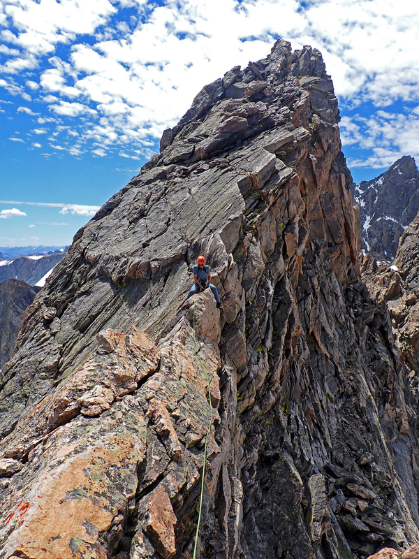
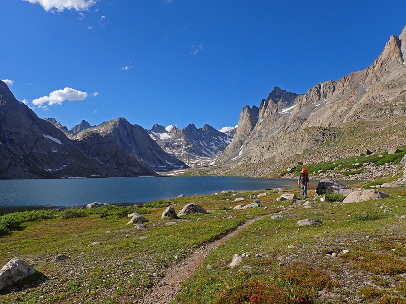
Introduction: A Long Approach With Wyoming 13er beta being as scarce as breathable air at 13,000 feet, I figured it's worth adding some. Gerod and I rolled out of Denver late on July 6th and crashed that night at the Sacred Rim/Pole Creek Trailhead. The next morning, July 7th, we hit the trail at 7:20 AM and settled in for the long, scenic slog to Titcomb Basin. 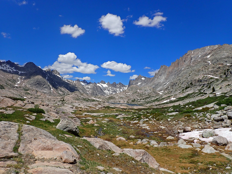

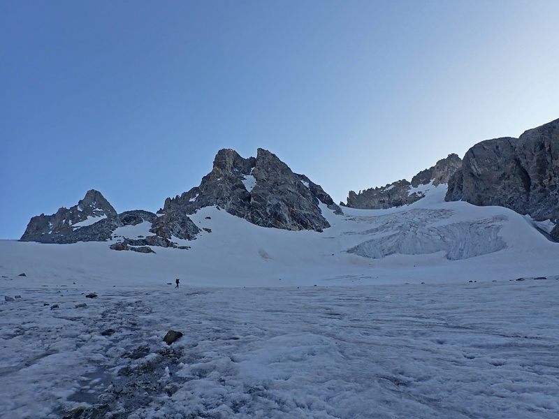
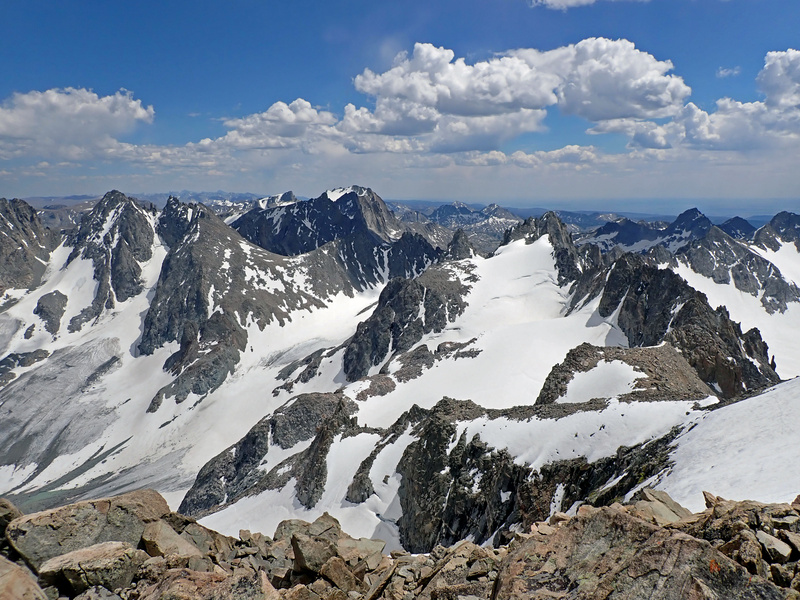
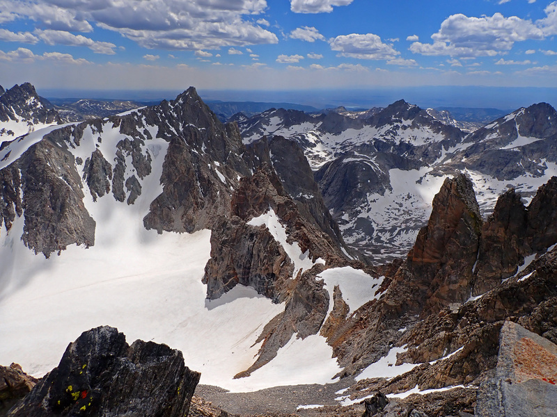
First Stop: Miriam Peak Our warm-up peak was Miriam, a newly ranked Wyoming LiDAR 13er. From Bonney Pass, we scrambled southwest up class 2 talus to the jagged summit ridge just shy of the high point. The ridge crest was a no-go so we skirted the right (northwest) side, navigating class 2-3 ledges to Miriam's southwest ridge. An interesting class 4 move got us up to the ridge proper, and from there, it was a class 3-4 scramble to the summit. We topped out at 7 PM just in time to catch a jaw-dropping view of Gannett and the surrounding peaks: a proper “welcome to the Winds” moment. After soaking in the view, we descended back to Bonney Pass and dropped to the base of Dinwoody Glacier to set up camp before dark. 
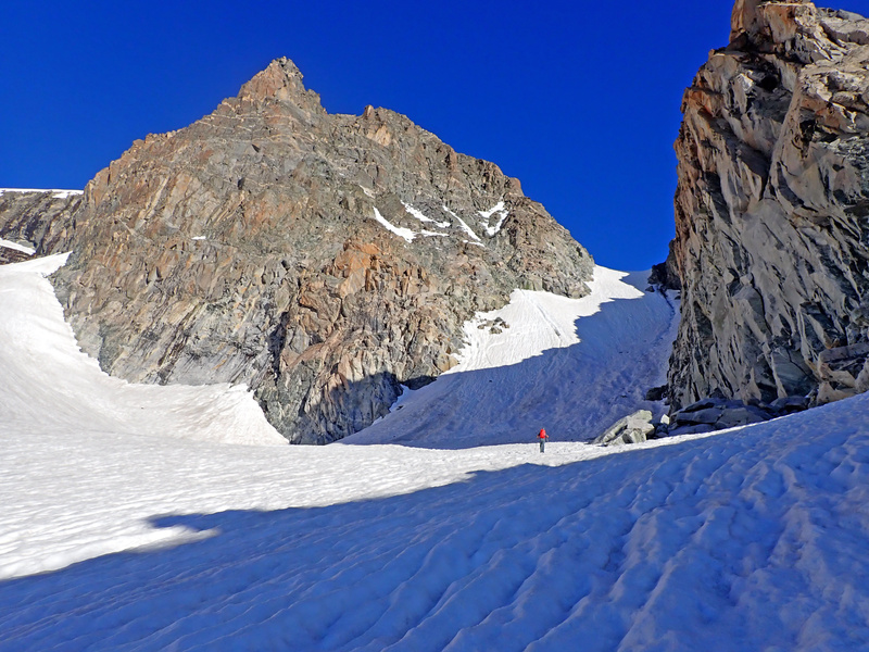
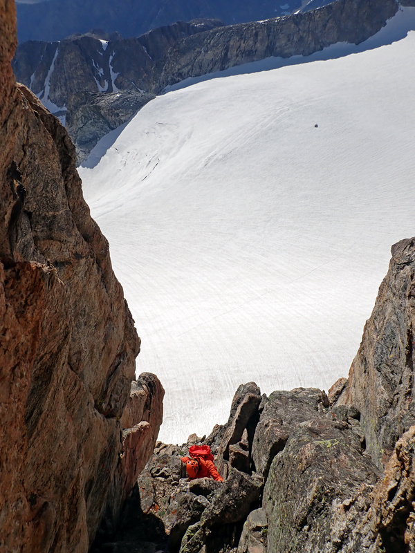
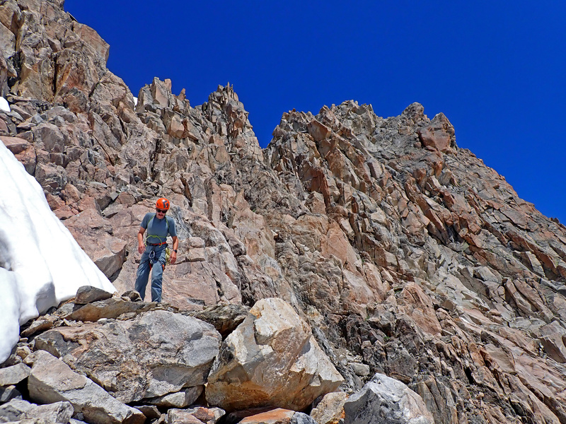
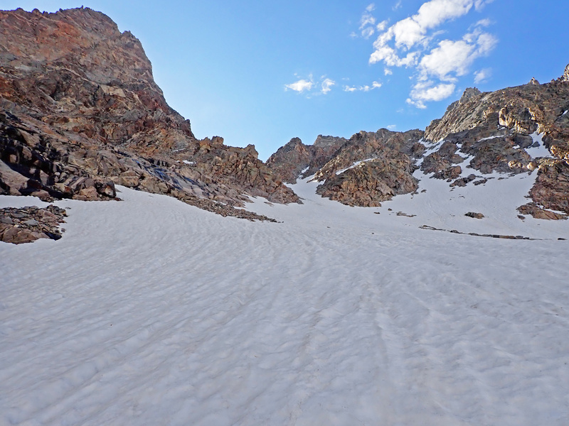
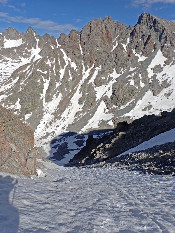
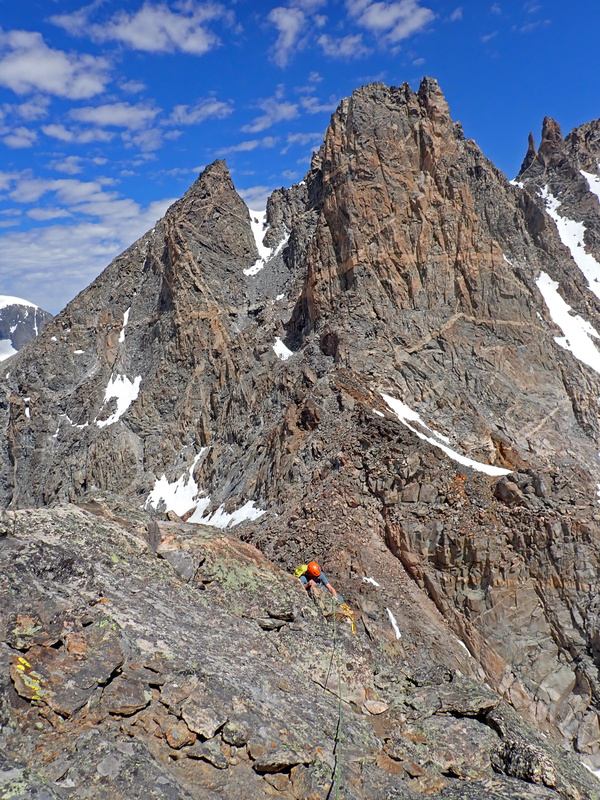
Next Up: Mount Koven With Koven's remote location, we figured it made sense to knock it out early. We left camp a bit before 6 AM, followed the Gannett Peak Trail towards Gooseneck Pinnacle, and then broke off at 11,900 feet at a glacial moraine to cross the base of Gooseneck Glacier. The snow was in great shape and a mellow snow climb put us at a col below Gannett's east shoulder. From there, we aimed for Koven's south ridge. Originally, I thought we were taking the easier east face couloir, but nope, I didn't read the fine print. We ended up on the south ridge (I thought it went at a moderate grade), thinking we might simul-climb it. The ridge immediately gave us a reality check: boots on slick rock, exposed moves, and route-finding galore. I swore it was 5.2, but then I found myself scratching up a 5.6 chimney. "Wyoming 5.2 is legit," I muttered. 


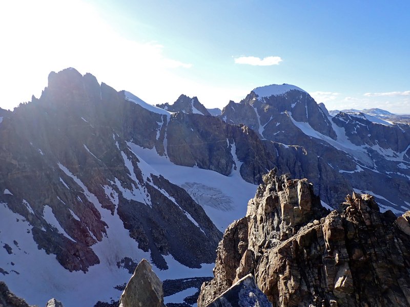
Gannett: Gerod's Only Desire We made it back to our packs at the base of Koven's south ridge around 12:15 PM, refueled on snacks, and started the familiar shuffle back up to the col on Gannett's east shoulder. From there, we dropped down our ascent couloir, cruised across Gooseneck Glacier, and made our final push up Gannett's standard route. The snow was softening under the afternoon sun but conditions were nearly perfect, just mellow snow plodding and a bit of mixed talus. By 2:50 PM, we were standing on Wyoming's tallest peak. The views were wild but our legs? Less so. My original plan had been to keep pushing southward to climb Pinnacle Ridge and Woodrow Wilson, but both of us were dragging from the long Day 1 approach and the altitude wasn't doing us any favors. So instead of heroics, we turned back and recharged at camp for the next day's climb. 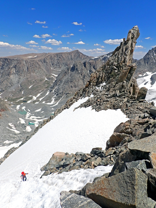
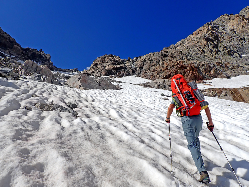
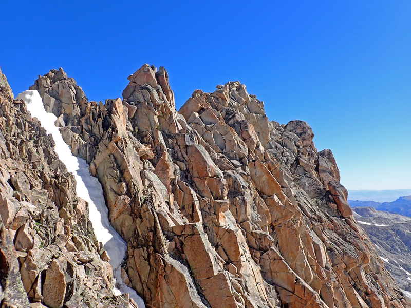
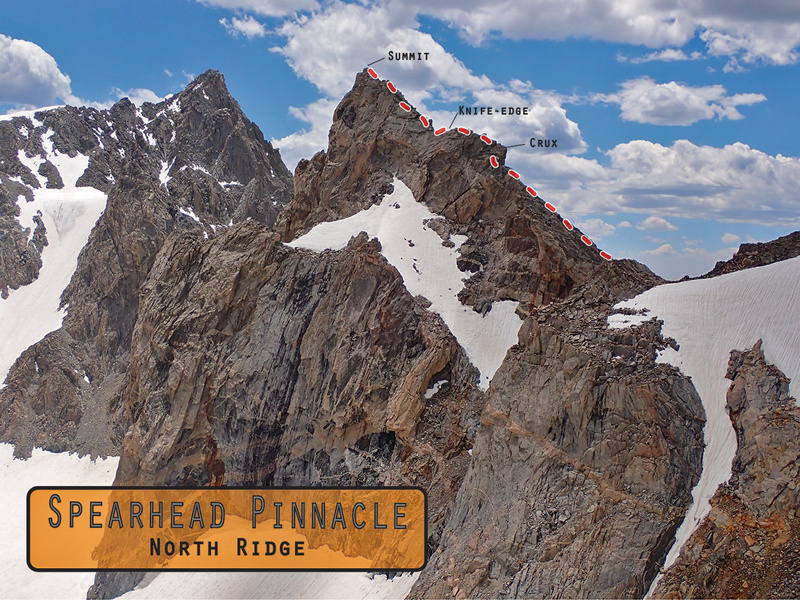
Spearhead Pinnacle: The Gem Stiff but determined, we rolled out of camp around 6:00 AM and slogged back up Dinwoody Glacier toward Bonney Pass. Surprisingly, the ascent didn't suck as much as expected and we were soon back on the south side where we ditched our overnight gear around 11,600 feet. We climbed an enjoyable moderate snow couloir (soon to be hideous scree once melted) to a col just south of Spearhead Pinnacle. From there, we hugged the upper Helen Glacier and then found another moderate snow couloir that led us to the base of Spearhead's north ridge. If there hadn't been snow, this climb would be top-notch awful. 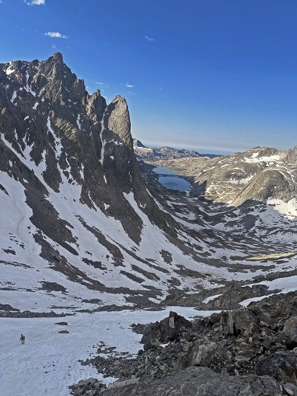

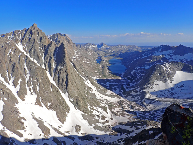
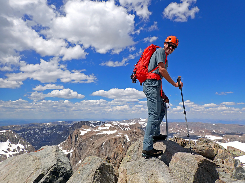
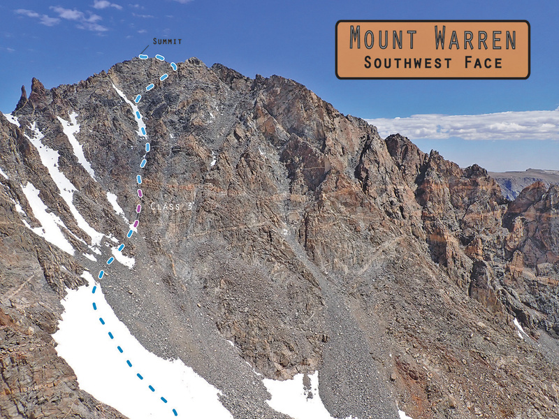
One More for the Road: Mount Warren Gerod was content and ready to start the long journey out but I couldn't leave Mount Warren sitting right there so we split at the col below Spearhead Pinnacle's north ridge and I dropped down onto Helen Glacier once more to tackle Warren's southwest face. A 300-foot snow climb got me to the one obvious weakness in the cliffy face. I crossed some talus and started scrambling up a water-slicked class 3 gully. After about 200 feet, the scrambling eased into a classic class 2 talus grind. I hit an upper snowfield, curved right below some cliffs guarding the summit, and gained Warren's east ridge. From there, it was a short final jaunt to Warren's summit, arriving at 2:20 PM. The descent was swift and uneventful, and I met back up with Gerod at the col south of Spearhead Pinnacle. We dropped back down the couloir to our stashed camp gear and began the long, astonishingly mosquito-saturated march out. That evening, we camped near Little Seneca Lake, and the next morning, we knocked out the final 10 miles back to the trailhead. The trip was a fantastic introduction to the Winds. Now, I'm excited to work on the Wyoming 13ers. Partners anyone? 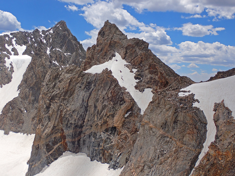


Thumbnails for uploaded photos (click to open slideshow):  Working toward Titcomb Basin")
 Higher in Titcomb Basin")
 Start of Bonney Pass")
")
 Views from Miriam")
 Views from Miriam")
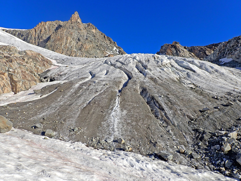
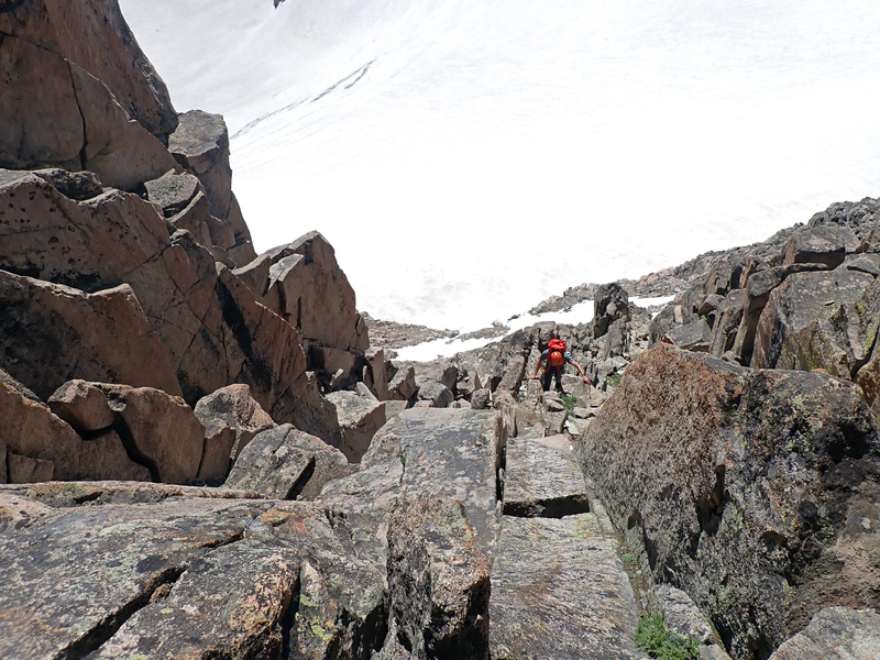
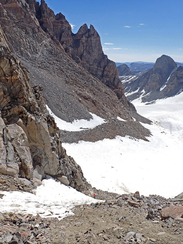
 Working down Dinwoody Glacier")
 Walking the base of Gooseneck Glacier")
 Gooseneck Glacier")
")
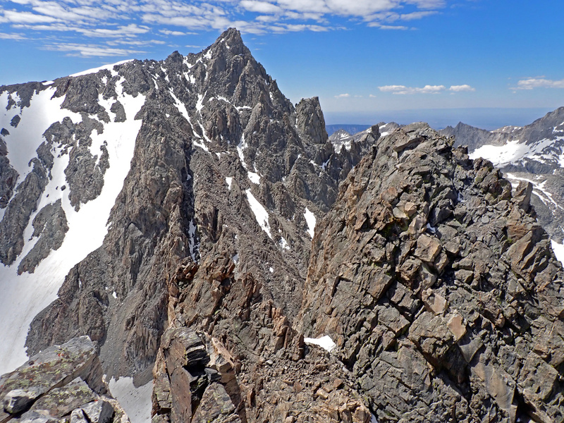
 Gannett Glacier towards Koven")
")
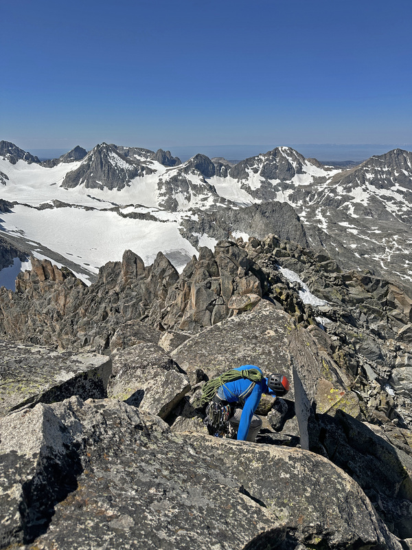
 The top of the 5.6 Chimney to Gain the Ridge")
")
")
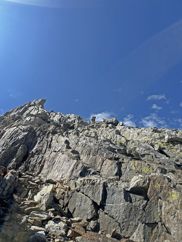
 Class 4 to regain the ridge")
 Just below the summit")
 Gannett from Koven")
")
 Dealing with the bergschrund on Koven")
 Snow below Gooseneck Pinnacle on Gannett")
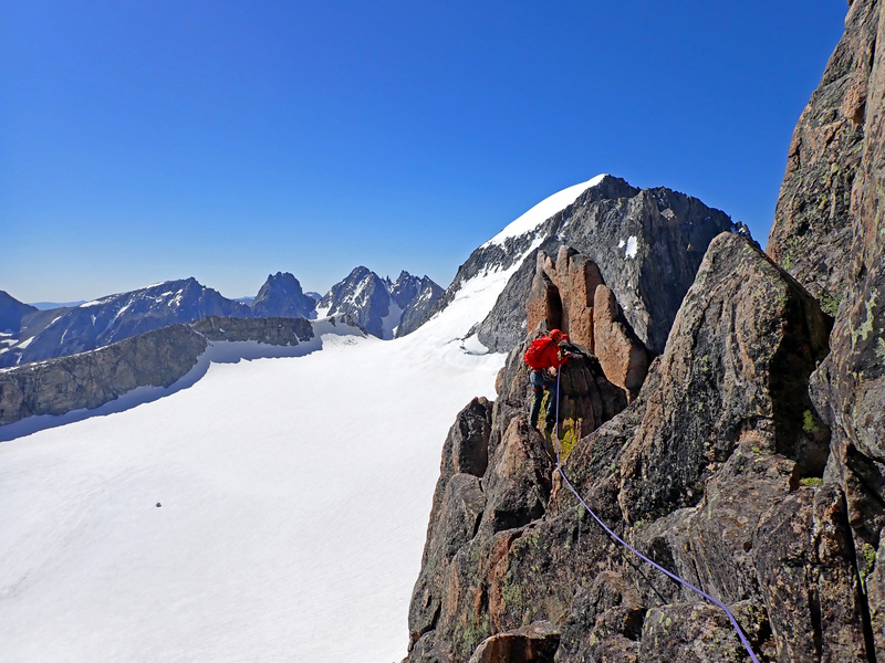
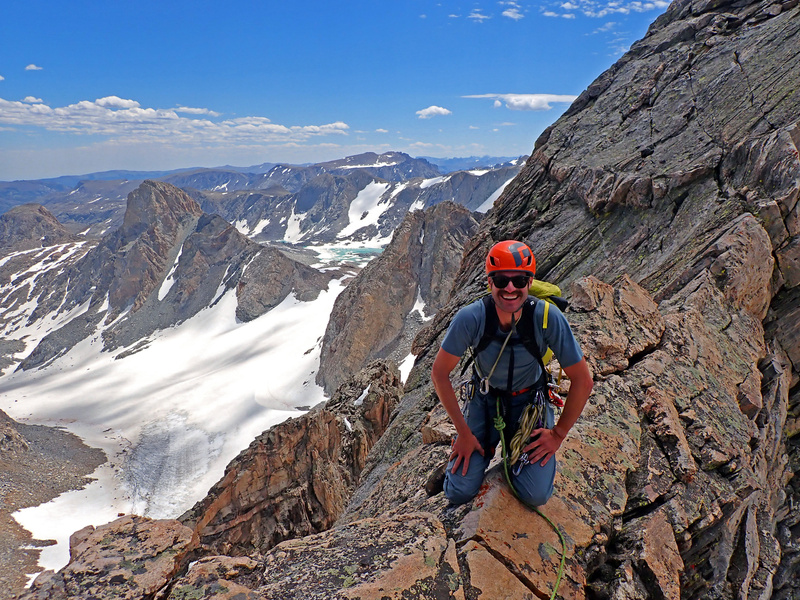
 Gerod on the summit of Gannett")
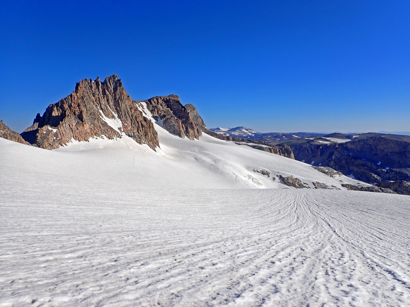
 Views from Gannet")
 Descending Bonney Pass towards Titcomb Basin")
 Couloir used to gain the south side of Spearhead Pinnacle")
 Gerod climbing the couloir")
 Couloir to gain north col on Spearhead Pinnacle")
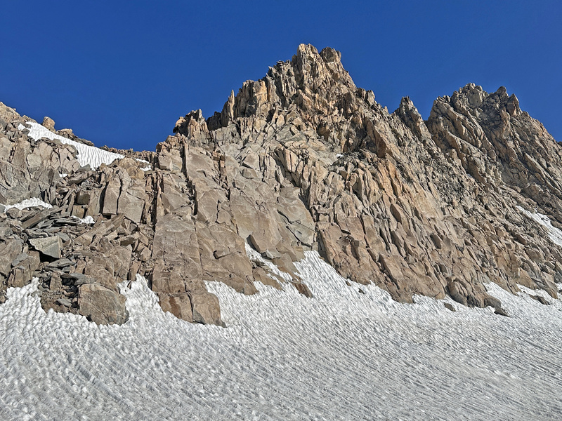
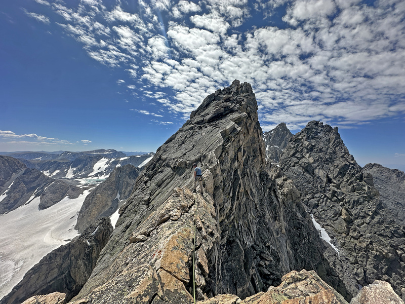
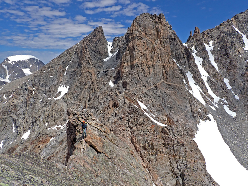
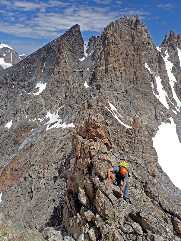
 Climbing the steep ridge after the Gendarme")
 Gerod topping the crux")
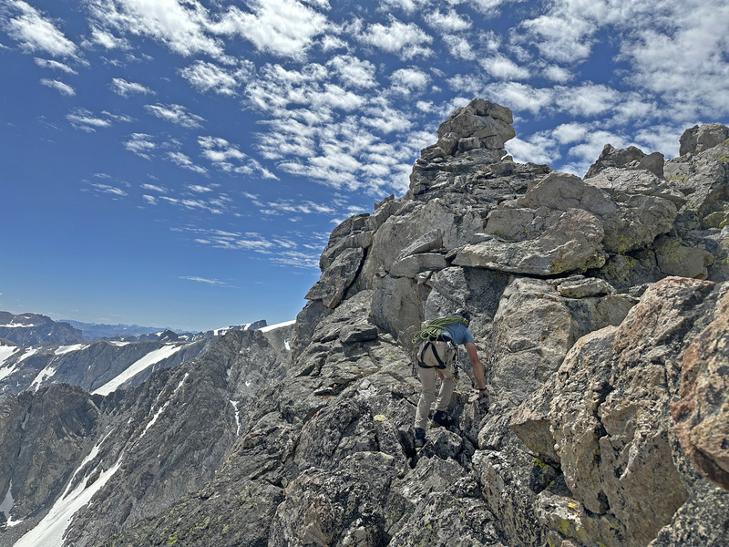
 Leading the knife-edge")
 Gerod following the knife-edge")
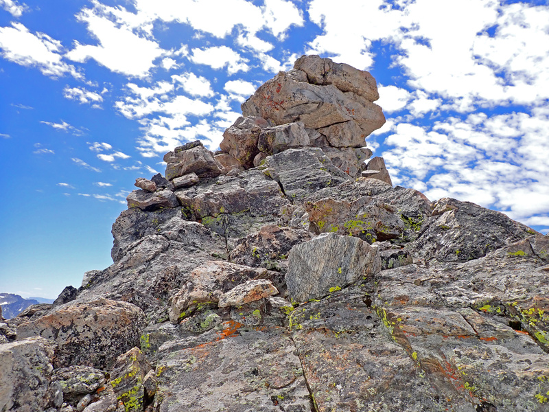
 Summit scramble")
 Summit of Spearhead Pinnacle")
 The")
 Helen from Spearhead Pinnacle")
 Warren From Spearhead Pinnacle")
 Knife-edge back.")
 Spearhead Pinnacle from Warren")
 Views climbing Warren")
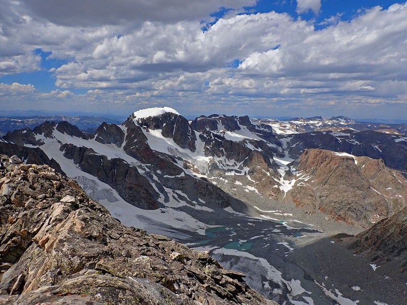
 Summit view from Warren looking towards Gannett")
 Summit view from Warren")
 Upper Titcomb")
 Upper Titcomb")
 Friendly Marmot")
 MF will certainly eat our gear if he had the chance")
")
 Route up Spearhead")
 Route up Warren")
|
| Comments or Questions | ||||||
|---|---|---|---|---|---|---|
|
Caution: The information contained in this report may not be accurate and should not be the only resource used in preparation for your climb. Failure to have the necessary experience, physical conditioning, supplies or equipment can result in injury or death. 14ers.com and the author(s) of this report provide no warranties, either express or implied, that the information provided is accurate or reliable. By using the information provided, you agree to indemnify and hold harmless 14ers.com and the report author(s) with respect to any claims and demands against them, including any attorney fees and expenses. Please read the 14ers.com Safety and Disclaimer pages for more information.
Please respect private property: 14ers.com supports the rights of private landowners to determine how and by whom their land will be used. In Colorado, it is your responsibility to determine if land is private and to obtain the appropriate permission before entering the property.