| Report Type | Full |
| Peak(s) |
Little Bear Peak - 14,041 feet Blanca Peak - 14,350 feet |
| Date Posted | 07/15/2025 |
| Date Climbed | 02/06/2025 |
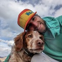
| Author | bthulick |
| Solo Winter LB-Blanca Traverse |
|---|
|
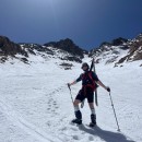
The following is a brief-ish recount of my successful solo winter traverse of the classic Little Bear - Blanca ridge traverse, completed 02/06/2025 - 02/07/2025. I ended up completing the entire ridge portion in the dark overnight (due to a much more difficult, and therefore time consumptive than expected approach). The entire trip ended up becoming a single 31 hour push. I want way over predicted time, ran out of water, and I think I may now hold the record for slowest ridge traverse ever, but I completed the route as planned and made it back to the car without any close calls or injuries. The outing definitely was heavy in type 2 fun, and I don't have much interest in ever repeating it, but it was quite a memorable adventure regardless. Anyone who might be interested in reading something like this is likely much more knowledgeable and experienced than myself, and probably doesn't need to hear it, but just to say it out loud: Hiking in the mountains is dangerous and risky. Hiking in the winter is dangerous and risky. Hiking alone is dangerous and risky. Moving in the dark can be dangerous and risky. All of these potential hazards must be well understood before embarking on a hike similar to what I am describing here. Please do not take anything you read here as advise or recommendation and always be sure to adventure within your own abilities. This is an anecdote, not a trip guide. Rescue is difficult, expensive, and sometimes impossible in these conditions. Certain risks are unavoidable and the threat of injury or death is very real. Please adventure at your own risk and know when to turn around. This hike was both my first winter 14er, and my first of the four classic CO ridge traverses. I have spent a lot of time in the mountains previously, and am no stranger to winter conditions. However, being from the eastern US, I had never had the opportunity to hike in the rockies during the colder months up to this point. I had originally planned on starting on one of the "easier" mountains/traverses, but avalanche conditions during the time I had available this winter ended up giving me the option of going big or going home. There is not really a true trail head for the approach trail. Once turning off of route 150, you begin on Lake Como road which eventually gets rougher and rougher as it climbs to the lake. It is possible/legal to take a vehicle all the way up to the lake, but this would require a true off-road rig and summertime conditions. The first mile or so is a reasonable dirt road which is navigable by a normal passenger vehicle. I traveled to CO with my toy hauler and therefore didn't want to push it with driving up too far. I decided to set up base camp at the last large pull off, which was right before the first big ruts. There were a few other vans/RVs along the road but the area was generally quiet. Even in February, the weather at low elevation was warm and in the 50s during the day. Camping here was quite comfortable and allowed me to get an early start the next day. 
I began the hike the next morning at 4:30am. The first mile or two up the road is a pretty uneventful trek over dirt, and I didn't feel as though I was missing much by traveling in the dark. Intermittent snow began around a mile in and became a constant 6-12 inch base by mile 3. This was around the time that the sun was coming up and where I stopped to swap out my hiking boots for mountaineering boots. I was making pretty good time, covering the first 4 miles and almost 3,000ft elevation in under 2 hours. 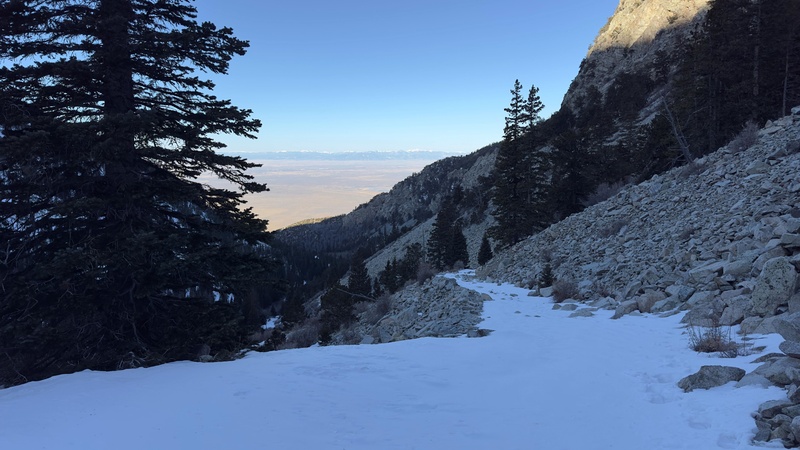
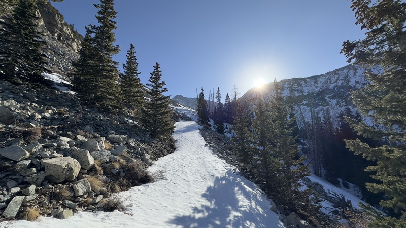
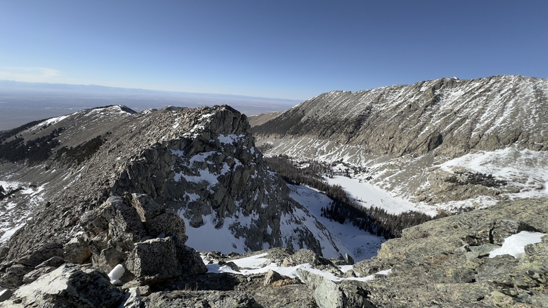
About 5 miles in, at ~11,000 feet is where my progress first slowed. The snow was getting deeper and the morning sun was loosening the top layer. I began to regret deciding to leave my snowshoes in the truck. I had expected that there would be a somewhat broken trail at least up to the lake and with the conditions being how they were, was not expecting to need the flotation. However, it did not seem that anyone else had been up the trail since at least the last major storm and I was stuck breaking trail. My 2ish mph pace slowed to barely 1 with the amount of snow I was pushing through. By the time I reached the lake, at around 10:00am, I was basically kicking a trench through about 2 feet of loose but heavy snow. Progress was painstakingly slow but I also was getting my first clear views of the summits and excitement was building. 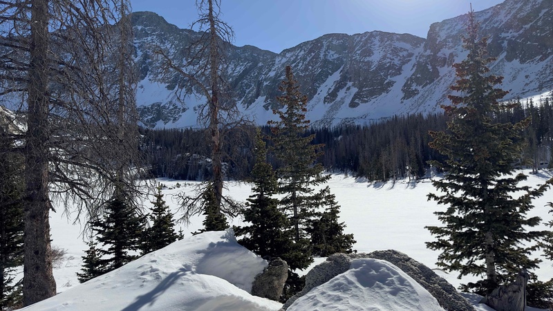
On the far side of the lake, the trail climbs a hill though the trees and reaches a clearing at the base of the chute which I planned to use to ascend the ridge. It was here that I took my first short break to eat some real food and melt snow for water. I was beginning the loop portion of the yo-yo, and decided to leave my big bag and heavier gear that wouldn't be needed on the summits. It is also where I left my stove, figuring that would have enough water for what I planned to be a few hour summit push. It was now 12pm and I had already covered 6.5 miles and 3,600ft of gain. I was a few hours behind schedule but still had about 7-8 hours of day light which I though would be enough to at least make it back below tree line before dark. After filling my water bottles, I packed my smaller alpine bag, put on my spikey shoes, and started up the chute. 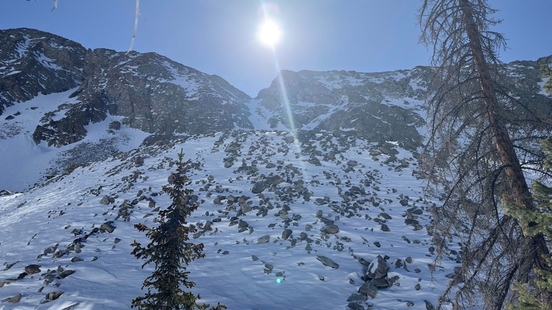
The climb to the ridge was slow but uneventful. Snow conditions were pretty good but with the mid day sun I was extra careful to plan my route and avoid any potential slide areas. Toward the top I elected to take an off route rock face to avoid the steepest part of the snow and ended up in some pretty fun class 5 rock. I was having a lot of fun but again moving slower than expected. By the time I reached the top it was already around 4pm. I followed the ridge for a bit before dropping down the back side to reach the base of the hourglass on little bear. The sun was getting low in the sky and I realized that I was going to run out of daylight much sooner than I was hoping. Nothing up to this point was too technical, and I felt comfortable retracing my steps down the chute in the dark, so I decided to at least summit little bear and then re-evaluate at the top. 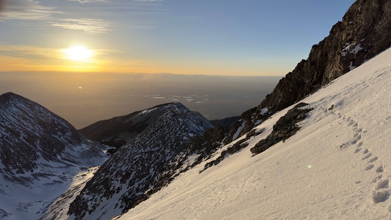
The hourglass is where things got technical. The face became much steeper and was quite icy. The fixed rope which is usually accessible in the summer was frozen into the mountain and therefore useless. I was able to get good enough traction with my front points and axe but the going was slow. The sunset was pretty awesome and I spent some time taking in the views toward the top of the hourglass. 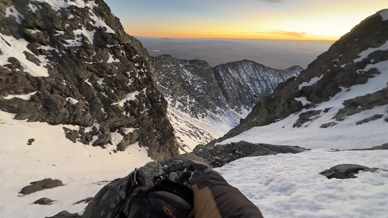
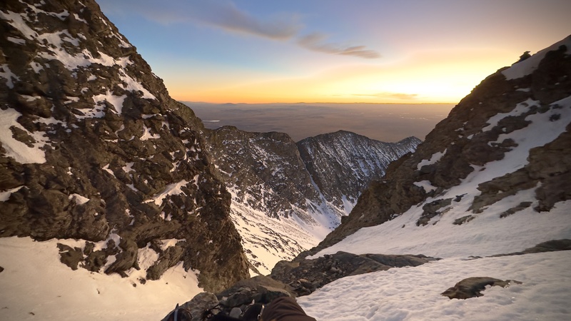
From here, the rest of the climb up little bear was mostly class 3-4 stuff. By the time I reached the summit around 8:30pm, it was fully dark out and I knew it was decision time. I would never had planned to be on the traverse in the dark, adding another variable to an already intense hike. I was also already 16 hours into the hike and had done some fairly technical and tiring climbing. It certainly didn't help that I was running low on water either. However, the only other option was to double back and decent the hourglass in the dark, which wasn't my favorite idea. Luckily, conditions had been perfect all day and were showing no signs of deteriorating. The sky was clear in every direction and the moon light was spectacular. Wind was minimal and temps were keeping just above zero. I knew that if I could make the traverse and reach blanca, the hike down from there would be much easier. I found a protected area behind some rocks and refueled on food, caffeine, and advil. With my energy reserves slightly restored, I decided to go for it and complete the traverse as planned. The next few hours were borderline surreal. I spent most of the traverse focused on the few feet in front of me which were lit by my head lamp. I was moving slowly and carefully, remaining well aware that I was tired but also well into the "no mistakes" part of the hike. It was the ultimate test of remaining dialed in through the exhaustion. There was one spot in particular that I probably spent 20 minutes to move 10 feet. The best route was completely iced over and the alternates were technical beyond what I was comfortable doing without a rope. It was almost a turn around moment but I was eventually able to collect myself enough to find a save set of moves to keep going. Somewhere along the traverse, on a less exposed section, I took a minute to absorb everything and for the only time all night remembered to take out my phone and snap a few photos. I only got 2 before the cold made the screen stop working, but those 2 were special enough to speak for the whole experience. 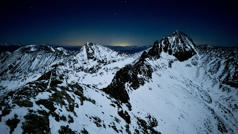
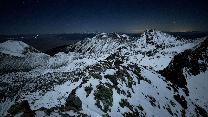
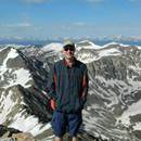
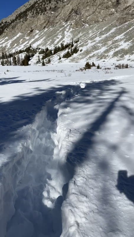
From peak to peak, it ended up taking me 5 hours to cover the 1 mile traverse - embarrassingly slow but safe. Overall, there really isn't anything that, at least in the summer, would be what I would consider "rope only" terrain. However, the exposure on the route is legit and there are numerous places on the route that are truly no fall zones. If I remember correctly, the route always either went directly over the top of the ridge or around to the left side. That is, until the very end where it drops off to the right for the final ascent up blanca peak. I reached the second summit at 2am with more of a sense of relief than accomplishment. I was honestly just happy to be off the ridge. I drank my last bit of water here and began the decent down the front side of blanca. Route finding was somewhat difficult on the decent. Snow covered most of the face and in the dark it was difficult to stay on route. Luckily the cold temps overnight had firmed up the snow and so I felt avy danger was pretty low. I used my phone's gps map and a compass to stay roughly on route and avoid cliffing out. I don't have any more time stamped photos on the way down, but by the time I finished the loop and made it back to where I had left my bag, it was getting light out. Finally I was able to make water again. From here, there was nothing left to do but retrace my steps back down toward the truck. I "only" had 7 miles left to complete the hike. Luckily, 20 some hours ago me had broken the trail so the decent was a bit easier than it was on the way up. As the sun came up and I hiked down, the temperature went from near 0 to almost 60 and I finished the hike in a t shirt. Finally, at 1pm, 30.5 hours from when I started, I made it back to my base camp. I fell asleep shortly after and didn't get out of bed until the following morning. According to the GPS, the trip was 17.9 miles, 6,923ft gain, and 7222 calories of fun. 
P.S. Here is a bonus pic from my trip up the Crestones about a week later 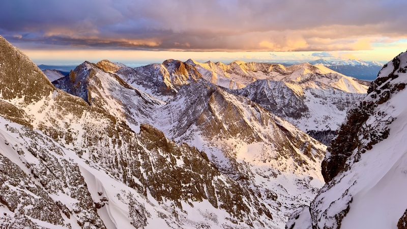
Thumbnails for uploaded photos (click to open slideshow): ")
")
")
")
")
")
")
")
")
")
")
")
")
")
")
")
")
")
 Crestones Sunset")
|
| Comments or Questions | ||||||||||||
|---|---|---|---|---|---|---|---|---|---|---|---|---|
|
Caution: The information contained in this report may not be accurate and should not be the only resource used in preparation for your climb. Failure to have the necessary experience, physical conditioning, supplies or equipment can result in injury or death. 14ers.com and the author(s) of this report provide no warranties, either express or implied, that the information provided is accurate or reliable. By using the information provided, you agree to indemnify and hold harmless 14ers.com and the report author(s) with respect to any claims and demands against them, including any attorney fees and expenses. Please read the 14ers.com Safety and Disclaimer pages for more information.
Please respect private property: 14ers.com supports the rights of private landowners to determine how and by whom their land will be used. In Colorado, it is your responsibility to determine if land is private and to obtain the appropriate permission before entering the property.