| Report Type | Full |
| Peak(s) |
Broken Hand Peak - 13,575 feet "Crestolita" - 13,264 feet Unnamed 13028 - 13,028 feet Pico Aislado - 13,621 feet Milwaukee Peak - 13,526 feet Marble Mountain - 13,272 feet |
| Date Posted | 07/21/2025 |
| Date Climbed | 07/12/2025 |
| Author | VeraUndertow |
| Additional Members | SasMaster22 |
| Broken, Isolated and loosing my Marbles in Milwaukee |
|---|
|
I wanted to share this trip report, in case anyone else is interested in linking these peaks up. There is good beta on most of these routes in smaller link ups, with a variety of different approaches, so this is mainly just to share our version.
It started with Sarah, who doesn't really like the Sangres and almost never goes out to them, asking me if I wanted to join her for a hike of Broken Hand and Crestolita. If Sarah has learned anything about me by now, it's that I will take any reasonable day suggestion and add to it until it becomes a much bigger and less reasonable day, but she keeps asking me to do things so I guess she doesn't mind?
We met up at the intersection of Rainbow Trail on S Colony Rd at 8:30 PM and planned to start moving at the lovely time of 3 AM with early afternoon storms looming the next day, then promptly got into our respective vehicles for a short but sweet night's rest. In the morning I drove my truck up to the upper S Colony Lake trailhead and we set off on a long dark walk up to Broken Hand Pass, at the trail split we stayed to the south following the old road as long as possible instead of the climbers trail that is more direct toward the lakes. 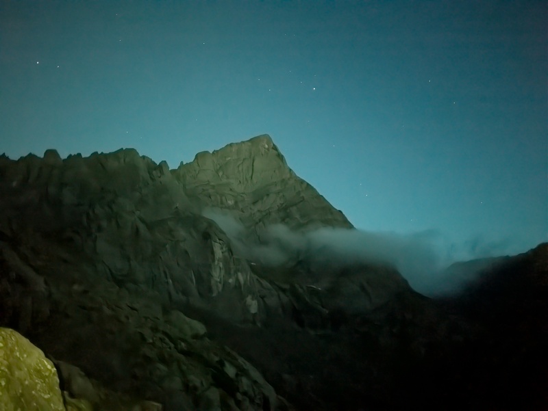
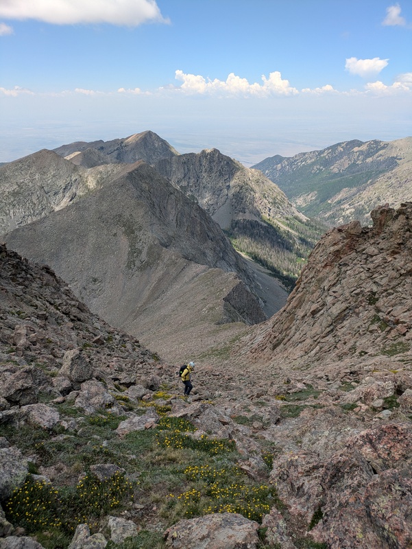
Once we got to the actual climb up BHP I found the trail had been improved quite a bit since the last time I was up here doing the 14ers, which was a pleasant surprise since I remembered it being rather loose. As we ascended higher, the sun started to rise over a beautiful inversion down in the valley below us, always a treat to be above a sea of clouds especially as the sun rises. BHP looks rather intimidating from a distance but ends up being pretty chill class 3 for a very short scramble then some looser gravel and sand with flowers interspersed between as you gain the top of the pass. 

After taking in the view of the sunrise over the inversion briefly we followed the trail down from the top of the pass for a couple hundred feet to bypass the initial cliff bands of Broken Hand, then traversed out onto the moderate angle northwest slopes and headed up and south. Once I intersected another cliff band that was running down to the valley floor I scrambled up it to around 13k (easy to bypass on class 2, I just like to scramble) where there was a break in the band. I waited for Sarah for a while, then a while longer, I am usually faster than her but was surprised I had put this much distance between us in such a short space, I figured something was going on. When she finally crested up the rib she said her tummy was not feeling well and she may have to turn back but for now she was going to push through to the summit of Broken Hand, so I continued on at my pace pausing periodically to wait. Near the top of BH there is some available scrambling that stays at class 3 or below for the last 100 vertical feet or so, I assume this can also be easily bypassed. The view from the top was glorious as the full inversion was in view and the Crestones were basked in golden early morning light. 

Sarah and I talked about our pace and she said she was feeling slightly better and wanted to at least get Crestolita since that was the other peak she initially intended to climb. We discussed routes, as I was hoping to climb the beautifully named “Analemma” NE ridge and Sarah was initially planning on climbing a gully then traversing across, but she decided my route seemed more fun. 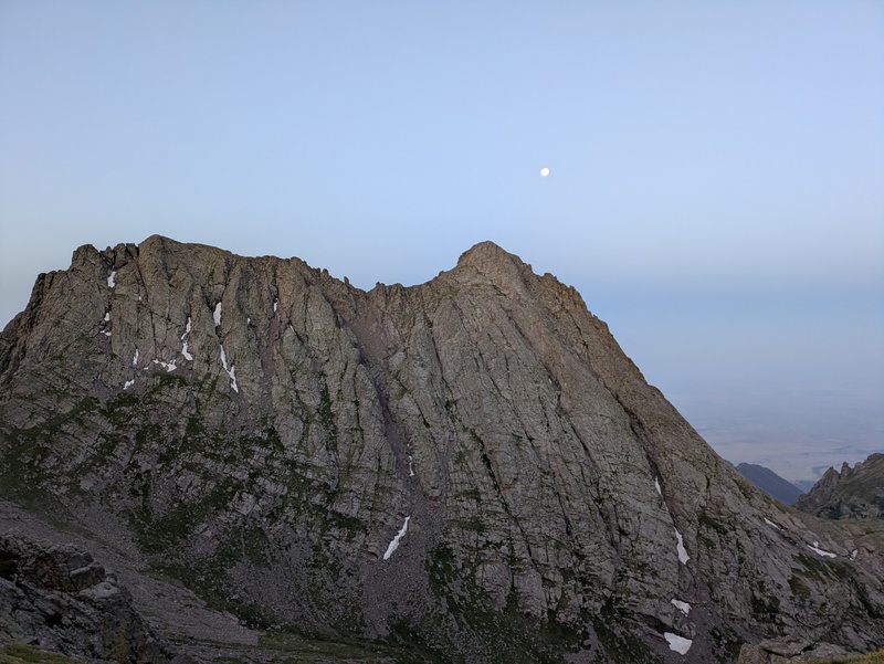
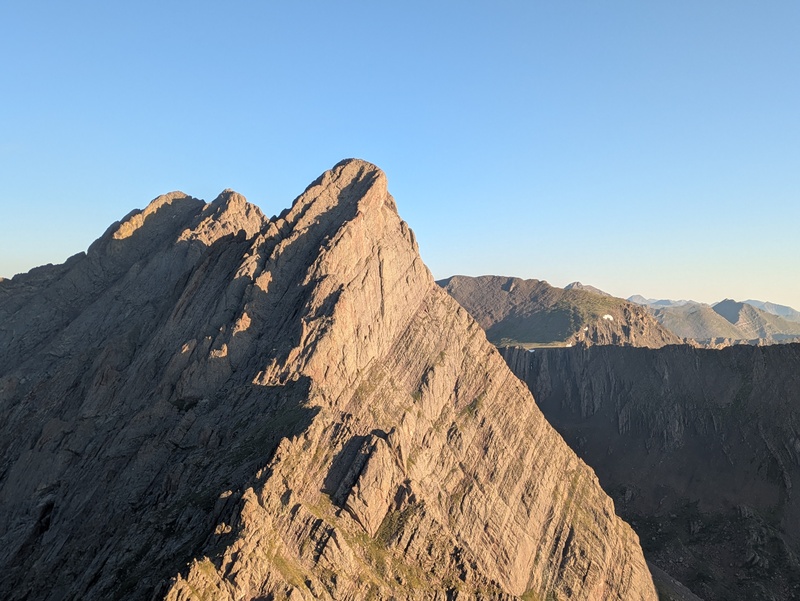
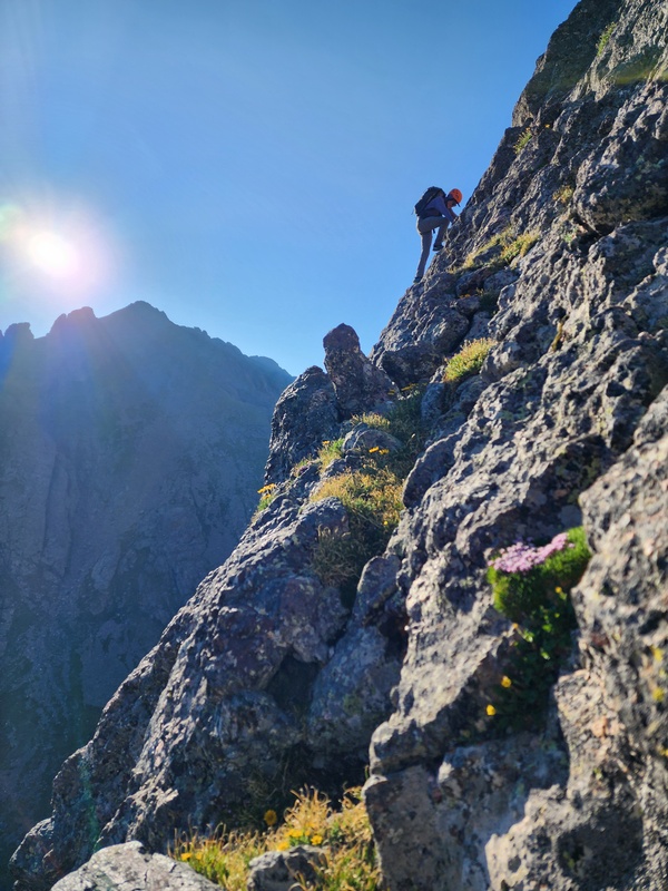
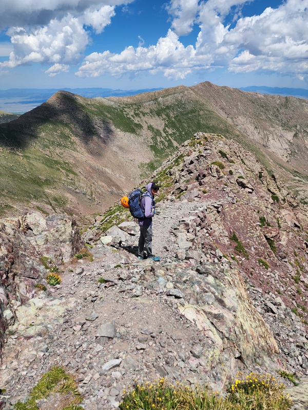
We headed down Broken Hand Peak towards Crestolita, aiming for the large overhanging rock roof that helps identify the start of the “Analemma” route. Once we got there we headed just left of the rock roof, and climbed onto some slabbier rock as we headed up, the route is decently steep and moderately featured for this slabby bit, but as we headed up and to the climbers right slightly we found more typical Crestone conglomerate with features galore and super solid holds. I love scrambling on this area's rock, as the holds almost feel like climbing gym holds and are usually super bomber (always double check still before committing). This ridge feels less like a specific ridge and more just choose your own adventure, but off slightly to the right was lower angle and to the left was steeper, I was having a blast scrambling up and chose some slightly harder sections, while Sarah was still not feeling the best and stayed slightly further to the right. We came to a spot where the ridge intersected a gully a few hundred feet below the summit, which we crossed over then jumped back on the ridge crest for the final summit push, which had a few more short sections of fun scrambling before relenting just before the summit. Overall this scramble rates very highly as it's around 900 feet of sustained class 3 and 4 on solid rock and the views of the Crestones from here were hard to beat. 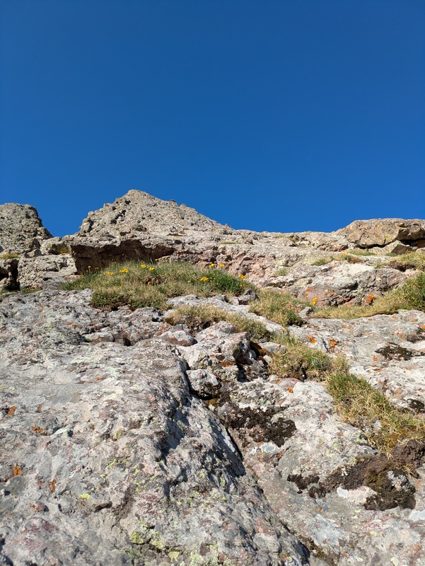


Once we reached the summit we could see the rest of our peaks for the day and we discussed if Sarah wanted to bail or keep going as she had been moving faster heading up Crestolita than Broken Hand, and she decided to continue on, which I was quite happy to hear. We headed down the obvious south gully toward the Cottonwood Creek drainage and Un 13,028. This gully was mostly straightforward with a little scrambling towards the bottom as it descended across 2 or 3 short cliff bands that are all less than 10’ tall. 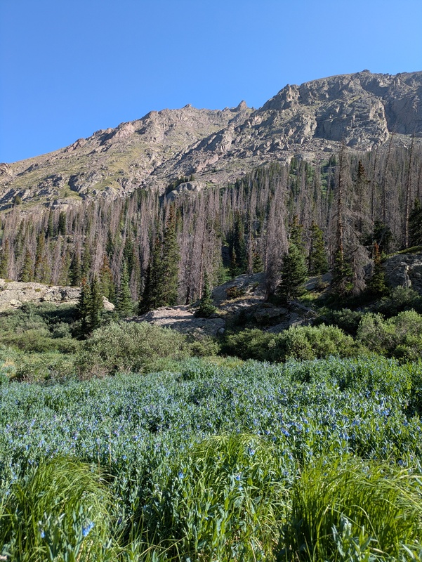
Once down in the valley, we tried to find the trail but didn't see any obvious trails, so eventually just took a short willow bash and hopped the small stream. The south side of the creek had a decent willow free area and Sarah filtered some water before we headed up towards a small lake to the south of us. We climbed up to a higher point east of the lake to scope out what options were available to gain the ridge west of 13028 from this basin. The best route we found was a grassy looking ramp directly south of us, with a small initial scramble to gain the ramp. 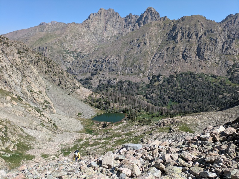
This ramp ended up having a fair amount more short little scramble sections and less walking up steep grass than I expected which was a pleasant surprise, since the 1600 feet of regain from the valley floor to the ridge was a lot. We topped out just west of a ~12,990’ bump in the saddle, then followed the class 2 ridge over to the true summit of 13,028 which is the furthest east point on the ridge, tho Sarah seemed to think every bump including the 12er to the west were higher than 13,028. 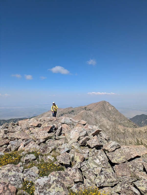

The view of Pico Aislado is very impressive from here, though the obvious route doesn't actually look intimidating as it is just a large gully to gain the ridge. We headed off the summit of UN 13028 heading east following the ridge towards Pico. The gully up Pico’s west face is relatively easy class 2 but damn was it a grind, having just gained the 1600 feet from the valley floor, and now gaining another almost 1000 feet up to Pico Aislado’s summit, I felt like I was dragging. 
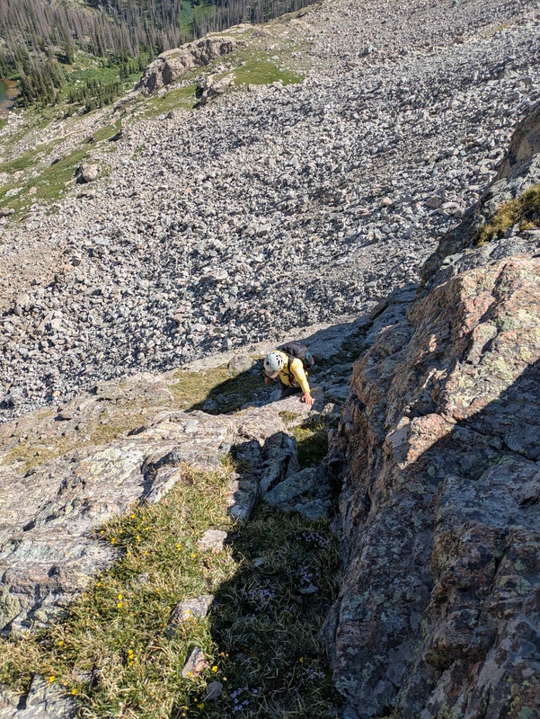
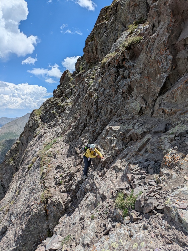
We gained the ridge around 13400 ft, then followed the ridge briefly north east and traversed just below the ridge crest on the south face to gain the summit. Pico Aislado has given Sarah and I some trepidation ever since Bryan Ludwig (Bludwig) died attempting the summit a few years back. I have never met Bryan, but I have only heard great things about him, and his trip reports on here still share his great sense of humor. I was relieved to reach the summit but I knew the hard part was yet to come. There are a few routes off the summit that allow you to gain the ridge between Pico and Milwaukee. “The Wedgie” is a gully that heads down the south east face, but seemed a little more route finding heavy having to head down and across the face without having been able to really scope it out from the east. Instead we followed the north east ridge directly till it dead ended in a pretty sheer cliff at a cleft in the ridge, we looked around on the south side till I found a series of rocks that looked like a “staircase” to me from above. There was one slightly awkward move to access the series of rocks, but once on the staircase, I found the holds readily available as I headed down. It was pretty steep and properly spicy exposed climbing but I had a lot of fun scrambling this quick pitch of difficult class 4. Sarah did not love this section as much as I did, but successfully made it down without any drama. From the bottom of the staircase there is still a little bit of scrambling to find a weakness on the cleft that allows you to pass further east. We found a pretty obvious crack in the cliff band that allowed us to head further east, then we regained the ridge crest toward Milwaukee. 


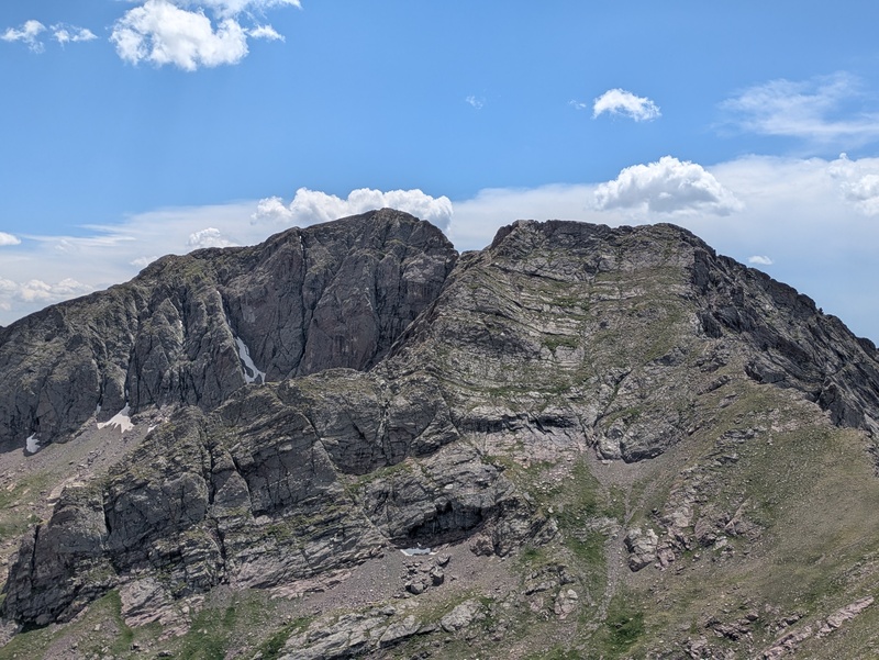
There is a little bit of class 3 scrambling along the ridge towards Milwaukee as we headed over a few bumps, before it relents to an easy class 2 walk up to the summit of Milwaukee, which was sadly reduced to an unranked by LiDAR by 3’. We made it to the summit of Milwaukee around 1:10 PM which was great because storm clouds were gradually starting to build. I felt confident we would be over to the summit of Marble and heading down before the 4PM storms would roll through. Still we didn't linger as the way off Milwaukee was the last spicy bit of climbing for the day. There is a ledge that allows you to bypass the spiciest bit of climbing, as the ridge itself ends in a section of very loose and seriously exposed cliff section, there was even a rope slung in this area. We turned south quickly and found the correct ledge which was about 50 feet below where the upper ledge cliffs out. This ledge is mostly wide enough that the 5-600 ft cliff to the east didn't bother me, but there was a 5 ft long section with tiny sand covered ledges for feet that was mentally a crux for me. After that there was one more little scramble move into the actual notch and one small section out of the notch. 


From this point there is actually a beautiful trail that heads north and east towards Marble for a bit, before it disappears with a sign that says to follow cairns down towards the Sand Lake Basin I assume. We did not follow the cairns, we kept following the ridge which was a lovely class 2 grass and some small sections of class 2 talus, at this point in the hike I was grateful for the nice easy walking, even though this ridge felt like it went on forever. We eventually made the summit of Marble, and sat down to eat some food, Sarah busted out an avocado which was quite a summit snack to have carried all the way to the 6th peak of the day. The storm had continued to build and it was around 3:45 PM when we heard a distance boom of thunder which reminded us it was time to head down, and with a little bit of pace.
We headed down the north east ridge of Marble aiming toward the rainbow trail, hoping to run into a climbers trail, which we found a few small sections of right around treeline, before they all came together into one solid trail. The trail below treeline stays right on the crest of the ridge, the going was pretty quick at this point but we were not really pushing the pace, around 4:30 PM or so it started to rain, which slowly became hail, I was quite happy we were well below treeline at this point, getting hailed on isn't fun and a few stung pretty bad even through my rain shell, but I felt relatively safe from lightning strikes. We eventually reached the rainbow trail and had like 1/10th of a mile to go back to Sarah's Jeep, which we reached 5 minutes later right at 5PM. The total stats of the day were 16.9 miles and 9.3k ft of vert, but we were able to hit some classic scrambles and climb 5 ranked and 1 unranked 13er with beautiful views of the Crestones and surrounding areas all day. Stoked we were able to make it happen and mostly beat the weather. We undid our car shuttle which definitely isn't necessary to make this day work as it probably saved .5 miles of road walking and less than 100 feet of gain, but it was nice to not have to walk the last bit of road in the rain. Thumbnails for uploaded photos (click to open slideshow):  Heading down the east face of Milwaukee, trying to find the right ledge.")
 Sarah gaining the")
 Looking up the")
 Crestones in the morning light")
 Grinding up the west gully on Pico Aislado")
 Nearing the summit of 13028 with a tall 12er in the background")
 View of Pico from Un 13028")
")
 Alpenglow on Crestone Needle")
 Sarah climbing down the")
 Inversion in the valley to the east from the summit of Broken Hand")
 Safely off Pico Aislado, scrambling over some bumps on the ridge to Milwaukee")
 Sarah scrambling up Crestolita")
 Little sandy ledges for feet, with a large cliff below, Sarah made it look easy")
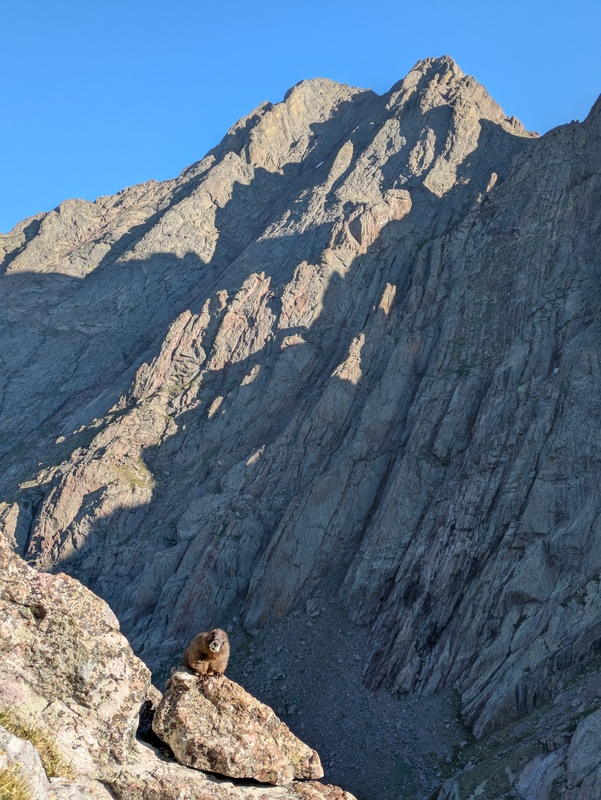
 Just a little Marmolita")
 Pre Dawn Crestone Needle")
 View of the upper east face of Milwaukee, the correct ledge ends at just about the same elevation as the notch in the ridge")
 Great view of the south gully down Crestolita as we make out way up to the ridge on 13028")
 Almost finished with spicy staircase section")
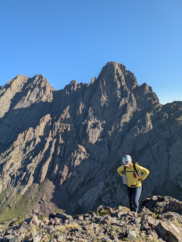
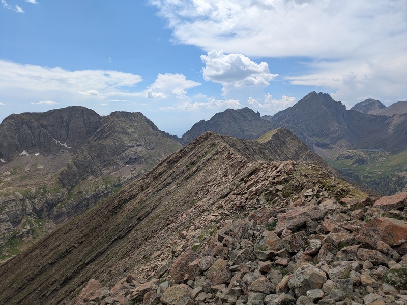
 Long ridge to Marble, Milwaukee on the left, Broken Hand in the middle and the Crestones and Kit Carson on the right")
")
 Milwaukee from the West ridge of Marble")
 Sarah, not feeling it, in the early morning light")
 Milwaukee from the west")
 Down in the valley south of Crestolita")
 Sunrise over a sweet inversion from Broken Hand Pass")
 Great shot of me scrambling up Crestolita (pc Sarah)")
 Me heading down the spicy staircase (pc Sarah)")
 Figuring out my path up Crestolita (pc Sarah)")
")
 Frig yeah, done scrambling and we have a trail in sight (pc Sarah)")
 Almost at Marble, this ridge do be persisting tho (pc Sarah)")
 Crestolita from BHP")
 Map of the route")
|
| Comments or Questions | |||
|---|---|---|---|
|
Caution: The information contained in this report may not be accurate and should not be the only resource used in preparation for your climb. Failure to have the necessary experience, physical conditioning, supplies or equipment can result in injury or death. 14ers.com and the author(s) of this report provide no warranties, either express or implied, that the information provided is accurate or reliable. By using the information provided, you agree to indemnify and hold harmless 14ers.com and the report author(s) with respect to any claims and demands against them, including any attorney fees and expenses. Please read the 14ers.com Safety and Disclaimer pages for more information.
Please respect private property: 14ers.com supports the rights of private landowners to determine how and by whom their land will be used. In Colorado, it is your responsibility to determine if land is private and to obtain the appropriate permission before entering the property.