Download Agreement, Release, and Acknowledgement of Risk:
You (the person requesting this file download) fully understand mountain climbing ("Activity") involves risks and dangers of serious bodily injury, including permanent disability, paralysis, and death ("Risks") and you fully accept and assume all such risks and all responsibility for losses, costs, and damages you incur as a result of your participation in this Activity.
You acknowledge that information in the file you have chosen to download may not be accurate and may contain errors. You agree to assume all risks when using this information and agree to release and discharge 14ers.com, 14ers Inc. and the author(s) of such information (collectively, the "Released Parties").
You hereby discharge the Released Parties from all damages, actions, claims and liabilities of any nature, specifically including, but not limited to, damages, actions, claims and liabilities arising from or related to the negligence of the Released Parties. You further agree to indemnify, hold harmless and defend 14ers.com, 14ers Inc. and each of the other Released Parties from and against any loss, damage, liability and expense, including costs and attorney fees, incurred by 14ers.com, 14ers Inc. or any of the other Released Parties as a result of you using information provided on the 14ers.com or 14ers Inc. websites.
You have read this agreement, fully understand its terms and intend it to be a complete and unconditional release of all liability to the greatest extent allowed by law and agree that if any portion of this agreement is held to be invalid the balance, notwithstanding, shall continue in full force and effect.
By clicking "OK" you agree to these terms. If you DO NOT agree, click "Cancel"...
| Report Type |
Full |
| Peak(s) |
Savage Peak - 13,135 feet
|
| Date Posted |
05/07/2007 |
| Date Climbed |
05/04/2007 |
| Author |
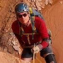
dsunwall |
| Savage Peak NE ridge |
Northern Sawatch
Holy Cross Wilderness Area
White River National Forrest
Eagle County
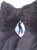
4.5 miles and 2900', must have been casual Friday.
A fine early spring Gore like peak with relatively easy close access.
Another so so forecast, another Friday, another 13er, SarahT and I left TRex PnR at 4:30, and were hiking by 7:05 up the last one half mile of the Missouri Creek road 704. From Minturn we took highway 24 south to the Homestake Road, then teed right onto Missouri creek road. We had learned from Teresa Gergen that these roads are plowed open early for access to the diversion dams which feed water to the massive Homestake water system that supplies the cities of Aurora and Colorado Springs. If you have ever wondered why the east border of the Holy Cross Wilderness has this huge weird indentation its for these roads and the water project.
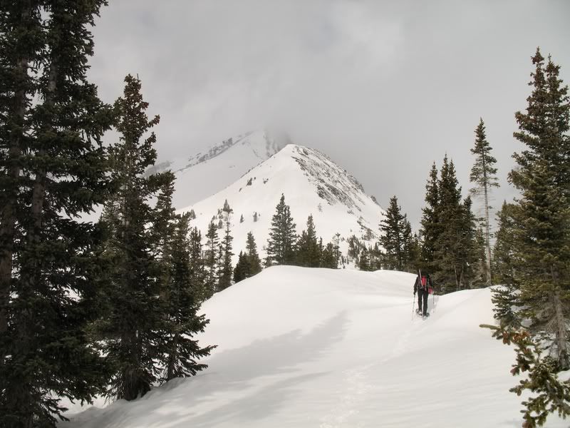
The upper part of the road was icy and muddy with 6' cuts through the snow, Sarah was not in her normal gungho 4wd mode and pulled over about a half mile before the diversion dam, below a narly looking muddy uphill section of the road. We walked the road to its end, then snowshoed due west up a fairly steep ridge on relatively good snow, just a few minor post holing areas. Once clear of most of the trees the ridge went easy, a couple of humps and we were on the final pitch to the summit, I measured 35 degrees here, the snow was perfect, so the MSR's with heel elevators were just the ticket to make it a stairway. The views weren't the best because of the clouds but we could see a few miles, and for a few minutes here and there the sun popped clear. The wind was there and felt a little winter like at times, a change from last weekends blast furnace.
The north face of Savage has a great looking couloir, the snow face may be 6 or 7 hundred feet tall, probably not in perfect shape yet but its gotta be close. The rock of this rugged summit did remind me a lot of the Gore peaks. Summit Post has a few better photos and information on the peak and couloir.
We knew Teresa was attempting Holy Cross from somewhere near where we started, that had to be a long day, hope it all went well. She was somewhere north of Missouri Pass. Looked a little foggy up there.
We took a slightly different route down to facilitate a nice glissade, the new wet snow really kicked up and plastered me in the face, I had to stop and put my goggles on. The rest of the hike was fairly uneventful, even on this cool day though the snow had softened some but still no serious post holing. We were back at the car by 12:15, nice to have an easy one for a change.
|
Caution: The information contained in this report may not be accurate and should not be the only resource used in preparation for your climb. Failure to have the necessary experience, physical conditioning, supplies or equipment can result in injury or death. 14ers.com and the author(s) of this report provide no warranties, either express or implied, that the information provided is accurate or reliable. By using the information provided, you agree to indemnify and hold harmless 14ers.com and the report author(s) with respect to any claims and demands against them, including any attorney fees and expenses. Please read the 14ers.com Safety and Disclaimer pages for more information.
Please respect private property: 14ers.com supports the rights of private landowners to determine how and by whom their land will be used. In Colorado, it is your responsibility to determine if land is private and to obtain the appropriate permission before entering the property.