Download Agreement, Release, and Acknowledgement of Risk:
You (the person requesting this file download) fully understand mountain climbing ("Activity") involves risks and dangers of serious bodily injury, including permanent disability, paralysis, and death ("Risks") and you fully accept and assume all such risks and all responsibility for losses, costs, and damages you incur as a result of your participation in this Activity.
You acknowledge that information in the file you have chosen to download may not be accurate and may contain errors. You agree to assume all risks when using this information and agree to release and discharge 14ers.com, 14ers Inc. and the author(s) of such information (collectively, the "Released Parties").
You hereby discharge the Released Parties from all damages, actions, claims and liabilities of any nature, specifically including, but not limited to, damages, actions, claims and liabilities arising from or related to the negligence of the Released Parties. You further agree to indemnify, hold harmless and defend 14ers.com, 14ers Inc. and each of the other Released Parties from and against any loss, damage, liability and expense, including costs and attorney fees, incurred by 14ers.com, 14ers Inc. or any of the other Released Parties as a result of you using information provided on the 14ers.com or 14ers Inc. websites.
You have read this agreement, fully understand its terms and intend it to be a complete and unconditional release of all liability to the greatest extent allowed by law and agree that if any portion of this agreement is held to be invalid the balance, notwithstanding, shall continue in full force and effect.
By clicking "OK" you agree to these terms. If you DO NOT agree, click "Cancel"...
Mountain: Mt. Sherman
Summit Elevation: 14,036 ft
TH Elevation: 12,100 ft
Elevation Gain: 2,000 ft
Round-Trip: 5.25 miles
TH Name: Fourmile Creek
Date: 6/3/2007
Climbing Partner: None - Solo
Howdy,
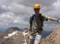
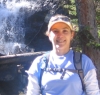
First off, thanks to heather14 for the pictures I‘ve included. She climbed the day before, but offered for me to use her pictures since my camera was taking a vacation with my lady friend.
The day started off at 3am in Denver, when my alarm woke me up. Leaving at 3:45am, I arrived at the trailhead at around 5:45am. First one there, so I parked next to the gate. The road is snow-free and mostly dry. A Subaru later parked next to me, and that was the closest to a "passenger car" I saw on the road. I probably wouldn‘t have taken a Camry up it, but some people say they‘ve seen passenger cars up there.
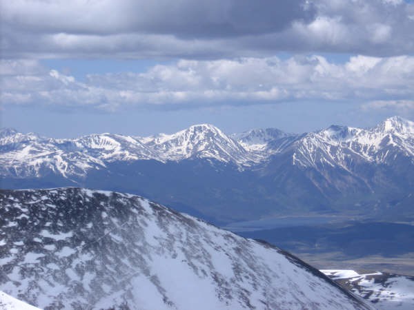
6:30am had me starting up the road beyond the gate. Of course, it is locked. After a bit of hiking and coming up on some interesting mining ruins, Sherman came into view:
I‘d say avoid going in these buildings, but they are always fun to look at. I thought back to what it would have been like when this was a full-time mining operation:
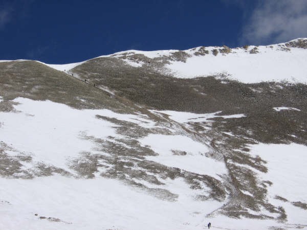
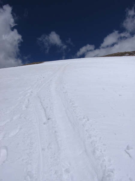
After one steep snow slope that I went straight up following glissade tracks (gotta keep in shape), more snow came into view. Here shows one path to take up. I, again, went straight up the snow slope just to the left of this picture where there were some glissade tracks and a withering cornice:
Throughout my upper climb, I noticed a building number of cars, and eventually some people starting to climb up the road past the gate.
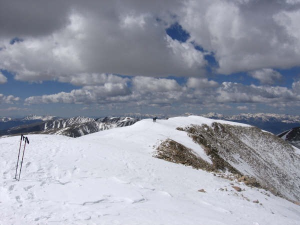
After a relaxing jaunt up the ridge, I discovered lots of snow up top and a lot of cold wind. I wish I had taken my gloves. The next two pictures show that there is still a good amount of snow up top, but it is all windblown and hard (at least at 8:15 in the morning):
And a great view:
I spent a good hour at the summit. I ate my bagel with peanut butter and smoked ham, had some water, and got to work on the register. The previous register tube was missing a top, but was still attached to the metal pole. There was no register and just a few scraps of paper. I removed the old register tube, wire and all, and replaced it with a new register tube, CMC register, and 6 pens. Of course, a tribute to the TalusMonkey made it on the outside of the tube and on the register itself. I left the summit at about 9:20am just as the next person was arriving and enjoying the scenery.
Granted I have only glissaded the Angel‘s left arm on Shavano this season, but this was the best glissading of the season so far. Perfect snow conditions (slightly wet and slippery). Got up some great speed, especially on the lower snow slope. The upper one was steep and a great ride down. No ice axe for me, just the handle of one of my poles to use as a brake. Didn‘t really need it, though, since I came to a calm stop at the bottom of both slopes (what did I say... perfect conditions):
Back at my Jeep around 10:30am. There were about 7 other vehicles parked on the road when I got back, and as I discovered on the down-climb they were all friendly.
What a fun climb with great weather (other than the persistent wind on the ridge and summit).
Kojones
Thumbnails for uploaded photos (click to open slideshow):
Nice report and great work with register---that wind blew me off 5/25 (60mph) however glissading was fun 8)
Craig
Caution: The information contained in this report may not be accurate and should not be the only resource used in preparation for your climb. Failure to have the necessary experience, physical conditioning, supplies or equipment can result in injury or death. 14ers.com and the author(s) of this report provide no warranties, either express or implied, that the information provided is accurate or reliable. By using the information provided, you agree to indemnify and hold harmless 14ers.com and the report author(s) with respect to any claims and demands against them, including any attorney fees and expenses. Please read the 14ers.com Safety and Disclaimer pages for more information.
Please respect private property: 14ers.com supports the rights of private landowners to determine how and by whom their land will be used. In Colorado, it is your responsibility to determine if land is private and to obtain the appropriate permission before entering the property.


")
")
")
")
")
")
")
")
")