Download Agreement, Release, and Acknowledgement of Risk:
You (the person requesting this file download) fully understand mountain climbing ("Activity") involves risks and dangers of serious bodily injury, including permanent disability, paralysis, and death ("Risks") and you fully accept and assume all such risks and all responsibility for losses, costs, and damages you incur as a result of your participation in this Activity.
You acknowledge that information in the file you have chosen to download may not be accurate and may contain errors. You agree to assume all risks when using this information and agree to release and discharge 14ers.com, 14ers Inc. and the author(s) of such information (collectively, the "Released Parties").
You hereby discharge the Released Parties from all damages, actions, claims and liabilities of any nature, specifically including, but not limited to, damages, actions, claims and liabilities arising from or related to the negligence of the Released Parties. You further agree to indemnify, hold harmless and defend 14ers.com, 14ers Inc. and each of the other Released Parties from and against any loss, damage, liability and expense, including costs and attorney fees, incurred by 14ers.com, 14ers Inc. or any of the other Released Parties as a result of you using information provided on the 14ers.com or 14ers Inc. websites.
You have read this agreement, fully understand its terms and intend it to be a complete and unconditional release of all liability to the greatest extent allowed by law and agree that if any portion of this agreement is held to be invalid the balance, notwithstanding, shall continue in full force and effect.
By clicking "OK" you agree to these terms. If you DO NOT agree, click "Cancel"...
After climbing Little Bear 2 weeks ago and not being able to finish what I started I was a little annoyed, I didn't want to put this climb off until next season or any longer. This season has been bangin' for me and this climb was yet another test of my conditioning. 2 weeks ago I had forgotten my sleeping bag and had to sleep in my Tacoma, not this time as it was the first piece of gear in my truck. I felt this climb would be much better than the last time I was up here, it had to be!
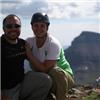
I left immediately after work at 2pm and hit the Como Lake Road around six to a little bit of rain. As I was driving up the road I ran into a group of I believe six guys, and told them they could throw their gear in the back as I was too nervous to put all those dudes in the back of my 15 year old Tacoma going up the infamous Como road. The road didn't seem nearly as bad as the first time for some reason and I made it up to where I parked last time and started to set up camp. (Roughly 9500-9900ft) The guys made it up to the truck, I took their pictures, spoke our thanks and they were off, I hope I helped them out enough as I felt guilty not being able to drive them up. I listened to the Broncos preseason game, ate dinner, called the wifey and was off to bed. That night I heard some spooky animal noise that actually freaked me out a little. (googled when I got home- it may have been a mountain lion in heat??) I woke up at 430am and was off.
I was feeling awesome! I actually kept up with a beastly jeep all the way up to the lake which was cool but the smell of the exhaust was unpleasant. I was greeted with my final destination-
Ellingwood/Blanca traverse
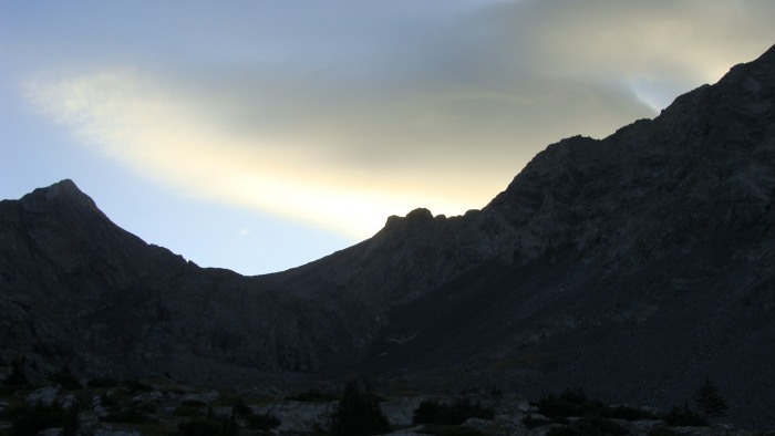
The trail actually goes to the left of the falls, and crosses near the top. Ellingwood in aplenglow
The basin below these peaks is awesome! Nearing the top of the falls I was given a warm welcome
Wondering what the heck I was doing up here with him!
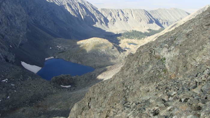
Upon reaching the top of the falls you are greeted with even more lakes, this basin has a ton of lakes. Follow the trail around the north side of the lake, there are plenty of cairns.
Go around the north side of the lake. (To the climbers left)
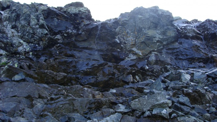
After passing the lake you are greeted with your next challenge. The cliff bands are not too bad except for the fact that water is rushing down the majority of the area, which is why those bands are so green. I would've liked to have challenged my self a little and gone straight up them, but due to the water and my goal of hitting Ellingwood first I wanted to go to the left of the bands.
If you look closely you can see some hikers. I went to the left of the cliffs.
Looking back at the last lake taken from the same spot as above
Up close look at the cliff bands
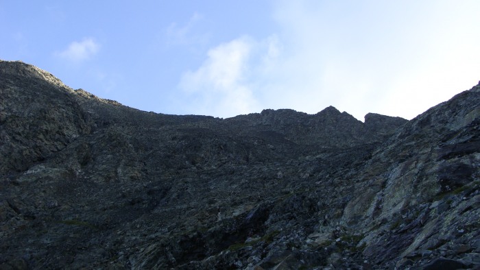
The trail here gets a little fuzzy but if you studied your route you know to go below the mine hole, which is easily noticed as the rock is a lighter color in front of the mine. It would be a pain to bring all that mining equipment up here!
After traversing left underneath the mine shaft I was trying to figure out when to start heading up, I didn't notice a cairn but after studying the route I thought maybe I was far enough below the ridgeline which was well past the easily distinguishable notch/gulley on the traverse.
Slightly out of sequence but this picture shows how distinguishable the notch in the ridge is, I aimed for the flat area to left of the notch while ascending.
Crater lake as seen from near the ridge line on Ellingwood
I slowly grinded my way up Ellingwood, and before I ascended too high I ran into a hiker who told me not to go all the way to the top of the ridge line but to traverse slightly below and he pointed out some cairns to follow.
Nearing the summit
Little Bear to my left
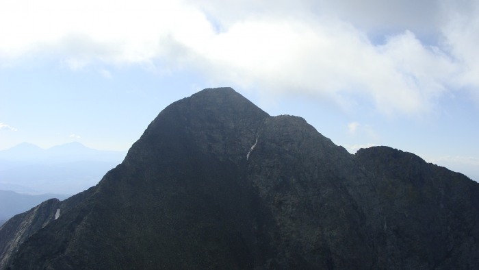
Even though I was standing over 14,000 feet Mt. Blanca looked formidable. My day was obviously just beginning. I planned to traverse over to Blanca instead of climbing back down to the trail split. Honestly, even if I wanted to go back down I don't think I could've found the trail split!
Blanca looking like it wants to spank me!
Shortly after summiting I decide to get moving. Actually, the more I looked at Blanca the more intimidated I grew so I just wanted to get to my next summit and try to beat the impending bad weather.
The beginning of the traverse
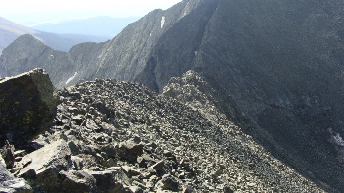
I tried sticking to the top of the ridge line for most of the way
Keeping to the top of the ridge line I quickly arrived at the large notch
Looking back at Ellingwood from near the notch
Looking at Mt. Blanca from the notch
I wanted to throw in some spice to this traverse so I decided to stay high and do some harder down climbing into the the gulley from high on the notch. I don't really know what it would be classified as, but I would say high class 3 or maybe more, but it was very short. My apologies for the blurry shot
Looking up at the down climb into the gulley from the notch in the traverse
Looking down the gulley
After getting down from the top of the notch I descended maybe a hundred feet to get back onto the standard traverse route. Once past the notch all I focused on was getting back up to the Blanca ridge.
Just past the notch looking at Blanca's ridge
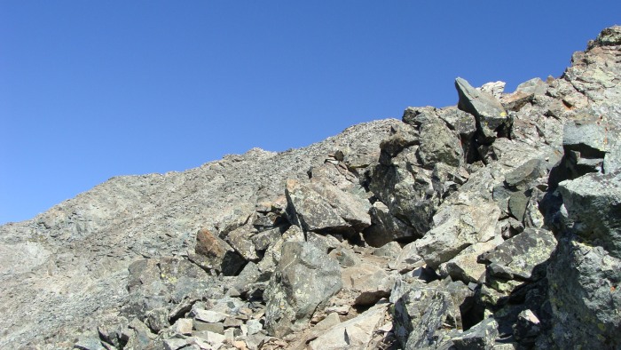
After a quick ascending traverse up to the ridge I was pleasantly surprised at how much energy and time it saved, I was keeping an eye on some other climbers and where they were when I started, and noticed how much further ahead I was by the time I reached Blanca's ridge. Just about now my excitement began to grow, for the summit was at hand. I stuck to the ridge and had a blast because of the occasional class 3 move, plus certain parts of Blanca's ridge are pretty airy.
Slowly moving up Blanca's ridge
Looking down the steep ridge. The climbers present gives an idea of how steep it is
Just as I neared the summit a bank of clouds rolled in and I wasn't able to check out the Little Bear/Blanca traverse from the Blanca side which bummed me out, oh well maybe next time.
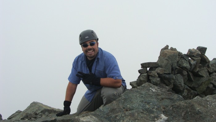
Summit shrouded in fog
Looking down the Ellingwood/Blanca ridge from the summit
The memorial was very nice and gave me a quiet moment of reflection up there
Ellingwood as seen through the clouds
This combo from 9,500 ft was a pretty tough hike and it took me about 8 hours round trip but was well worth it. The basin is beautiful, and Como lake seems very friendly to backpackers. Next time I come up here it will be for a backpacking trip, but the memories of the tough road leading up to it will have to fade a bit before I come here again. Besides Culebra I am done with the Sangres and have enjoyed them immensely, I am also proud that I finished some very tough climbs up here. Thank you all for the company on the trail, I hope everyone made it down safely. Thanks for reading
Thumbnails for uploaded photos (click to open slideshow):
Great trip report. I have seen many big horn sheep in several reports. We did not see any up there when we climbed. Must be a seasonal thing. Thanks for taking a pic of the plaque. Still looks good and secure?? Brings back some great memories of the climb we made. Best to you and all your climbs.
Your report will help me to prepare for Blanca and Ellingwood in the Summer of 2010.
Caution: The information contained in this report may not be accurate and should not be the only resource used in preparation for your climb. Failure to have the necessary experience, physical conditioning, supplies or equipment can result in injury or death. 14ers.com and the author(s) of this report provide no warranties, either express or implied, that the information provided is accurate or reliable. By using the information provided, you agree to indemnify and hold harmless 14ers.com and the report author(s) with respect to any claims and demands against them, including any attorney fees and expenses. Please read the 14ers.com Safety and Disclaimer pages for more information.
Please respect private property: 14ers.com supports the rights of private landowners to determine how and by whom their land will be used. In Colorado, it is your responsibility to determine if land is private and to obtain the appropriate permission before entering the property.


")
")
")
")
")
")
")
")
")
")
")
")
")
")
")
")
")
")
")
")
")
")
")
")
")