Download Agreement, Release, and Acknowledgement of Risk:
You (the person requesting this file download) fully understand mountain climbing ("Activity") involves risks and dangers of serious bodily injury, including permanent disability, paralysis, and death ("Risks") and you fully accept and assume all such risks and all responsibility for losses, costs, and damages you incur as a result of your participation in this Activity.
You acknowledge that information in the file you have chosen to download may not be accurate and may contain errors. You agree to assume all risks when using this information and agree to release and discharge 14ers.com, 14ers Inc. and the author(s) of such information (collectively, the "Released Parties").
You hereby discharge the Released Parties from all damages, actions, claims and liabilities of any nature, specifically including, but not limited to, damages, actions, claims and liabilities arising from or related to the negligence of the Released Parties. You further agree to indemnify, hold harmless and defend 14ers.com, 14ers Inc. and each of the other Released Parties from and against any loss, damage, liability and expense, including costs and attorney fees, incurred by 14ers.com, 14ers Inc. or any of the other Released Parties as a result of you using information provided on the 14ers.com or 14ers Inc. websites.
You have read this agreement, fully understand its terms and intend it to be a complete and unconditional release of all liability to the greatest extent allowed by law and agree that if any portion of this agreement is held to be invalid the balance, notwithstanding, shall continue in full force and effect.
By clicking "OK" you agree to these terms. If you DO NOT agree, click "Cancel"...
One of my hiking buddies invited me on an attempt of Snowmass for the 19th. I had scheduled an attempt from Snowmass Lake on the 5th, but was turned around due to soft snow. The timing was right for the (shorter=easier?) west slopes route with the group.
We all gathered in Glenwood Springs, and loaded up on too much food. Car camping does have some benefits. Shortly we were in Marble and heading up the lower Lead King Basin road in a Forerunner, and rental Jeep Commander and rental Ford Escape. It seemed to take about 1.5 hours to get from Marble up to the trailhead. The road is narrow; lot's of scraping branches on the side of the cars, but otherwise not terribly difficult.
I parked at the parking lot, while the rest of the group camped in some trees just to the north. Their spot was about 100 yards away by trail. We planned for a 4am start, so after a quick dinner, I went to bed early.
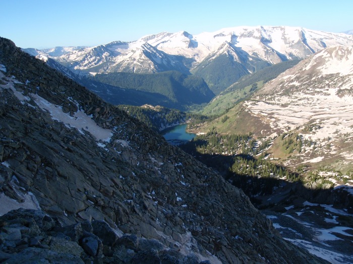
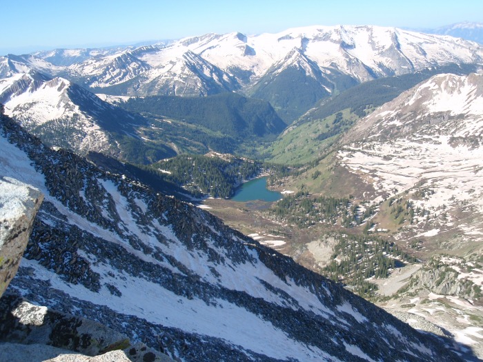
We got off right at 4am and headed up the trail with headlamps. This early in the year, the trail wasn't that lush, but I can imagine a very tight hike later in the summer. Up to Geneva Lake, there wasn't much snow on the trail. Snowfields started above the lake and bedeviled our route finding, but the trail cleared up again toward the upper headwall. Above the upper headwall, there was much snow, but it was firm. Still many firm snowbridges, but they are going fast.
We stopped below Gem Lake to chat with two other guys attempting the route. The west slopes looked intimidating to me. The route and conditions did not look good to me, but I mentioned that I would climb until we all agreed to turn around.
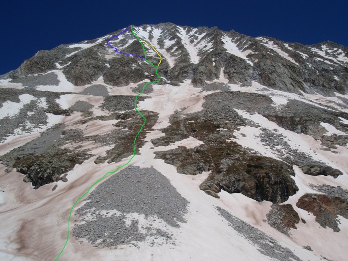
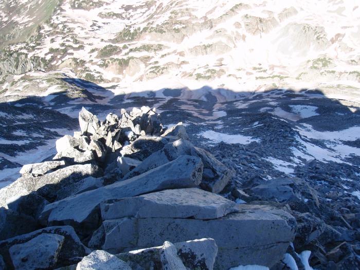
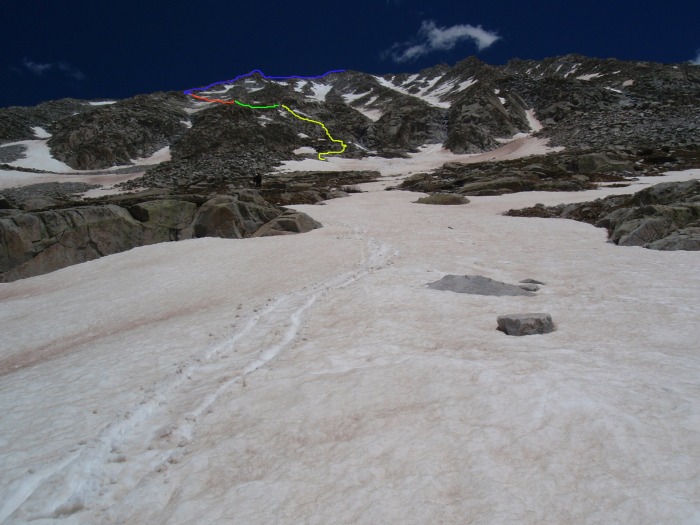
For reference, our ascent route(s) in green and my detour in yellow, and descent in blue. Once on the ridge, we had to head right to the summit proper.
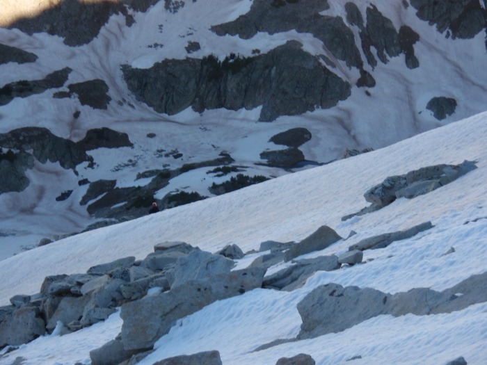
We crossed the easy snow fields, and began to work our way up the grass slopes above the talus field. The two guys, wearing crampons, quickly passed us, and stayed ahead the whole way.
The green patch was mostly snow and ice covered. One of the guys ahead of us is right of center. Since I had microspikes, I followed up the snow and traversed to the right on grass; the others traversed right much lower on some rock ledges. Shortly we were back together, swapping gear and getting ready to head up.
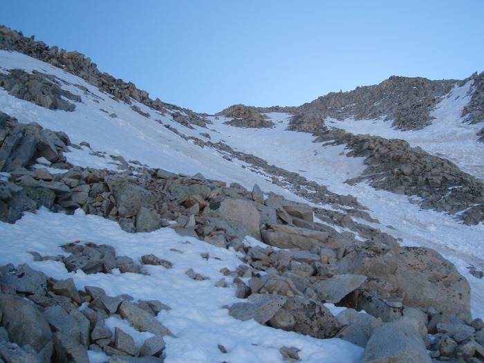
Above the jog back to the right to enter the gully, I liked the area to the left of the gully, while the rest of the group wanted to traverse back to the left to gain the rib. The group heading back to the left, after I had gained some precious altitude on my scouting.
Heading up to the left of the main gully was fairly nice climbing. I don't know if the rocks were frozen or that area is not as "tippy", but I may have only stepped on or pulled 1-2 loose rocks out of maybe 50.
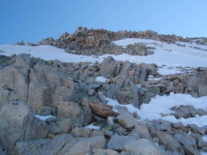
Gaining altitude, with a good view of the steepness
Looking up the main gully, I was staying on the rocks between the snow, the rib off to the left where the rest of the group ascended.
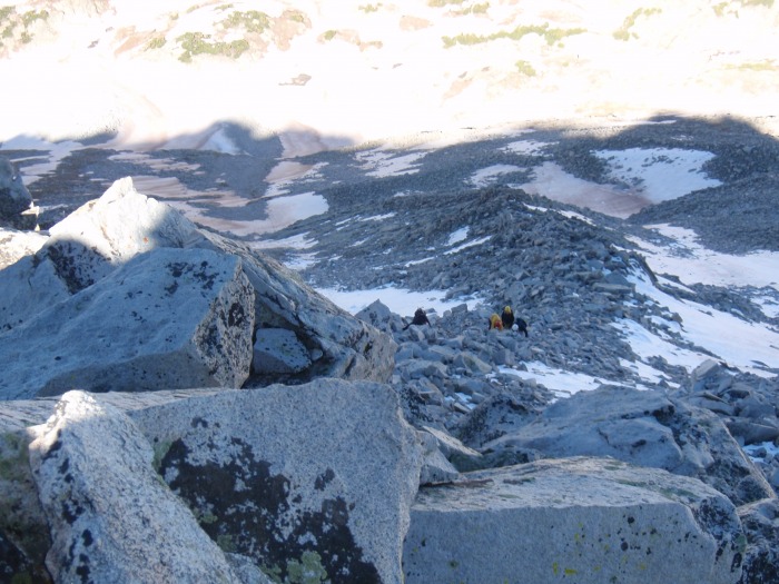
Occasionally, I could see the rest of the group, waiving/shouting to let them know I was OK. The irony was not lost on me that although I was hesitant to attempt this route, and was looking for group support and comfort, I was solo for about half the slope.
Higher up, I am heading toward that rock island in the snow on the left to regain the rib and join the crew. From their voices, I am above them a little bit.
On the island, looking up at the rib, looks fun
And back down the way I came up. The snow on the right of the picture, blocking easy access to the rib, doesn't look like much in the photo, but it was an effective barrier for me.
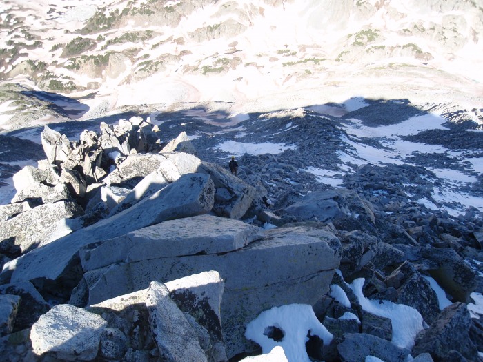
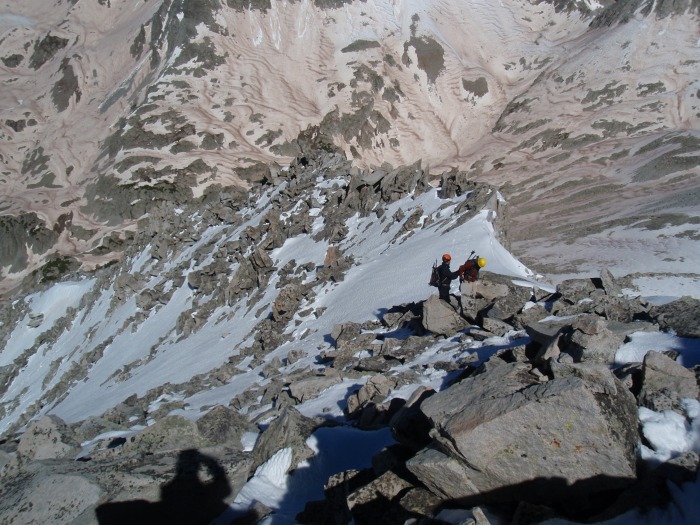
Finally back on the rib, where is the rest of the crew?
There they are, making their way up the rib
The route on the rib was generally working back and forth across the prominent points, with some areas of direct climbing. There was some steep stuff at places, with the rocks leaning out precariously, but still mostly solid.
The crew is heading up. I think at times my apprehension on hikes manifests itself with impatience. Most of the day I was scouting ahead of the group.
The views keep getting better as we got higher, but we knew the best was yet to come.
A steeper area. Sorry for the shadow, I can't control where the sun is, and my feet placements were limited.
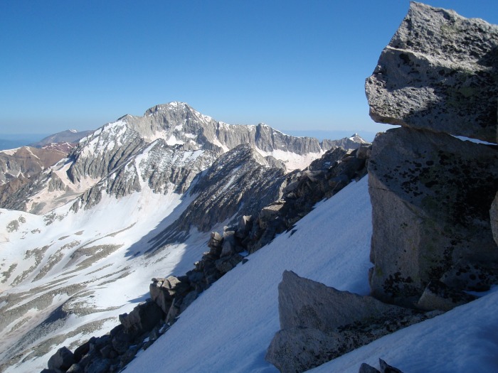
Getting a good view of Capitol
And to North Snowmass. One of the two other guys is on the ridge.
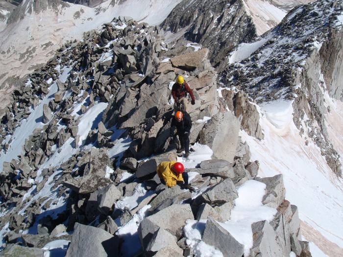
The rib joined the ridge just above a small snow saddle. It was mostly flat, but with nasty run outs. I was the only one with spikes, so I chopped some steps for the rest.
Just about to the ridge proper; the climbing was getting really fun
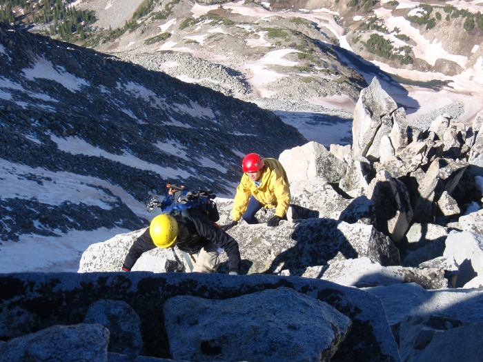
The other two guys; impressively fast climbers. They are on their way down
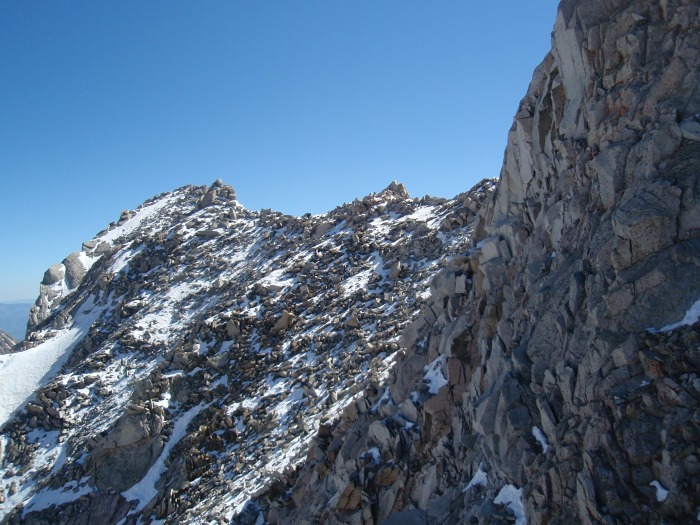
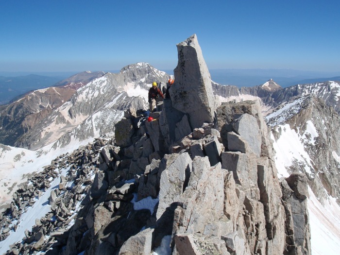
A little bit of traffic on the ridge.
And the way up....things are about to get good.
Coming up the ridge
Part II
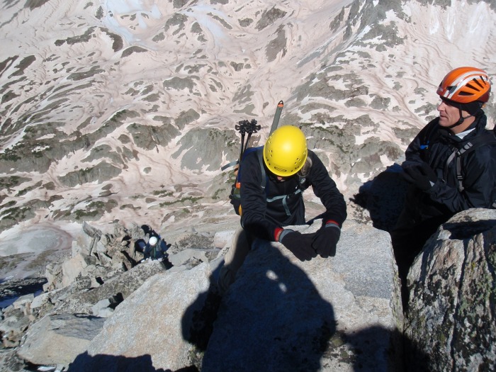
The crew on the summit. I think it was Debbie's (gal in red helmet) first class 3. She was a hard charger on a tough route.
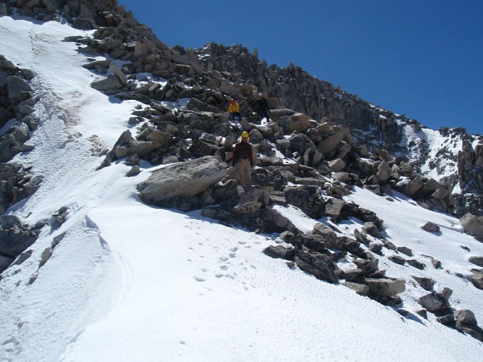
Coming back down, you can see some of the steps in the snow. After the sun hit, the snow softened considerably in just about 1 hour.
We decided to come down one of the more northern ribs, as it looked less steep. This was a mistake as the rock was very loose. Much more so than on the route up.
At one point, instead of "rock", which we had heard occasionally, somebody shouted "Oh S#!t" as a mini fridge sized rock decided to let go. It passed harmlessly about 6 feet from everybody and settled a little farther down. I guess it was one of those "tippy" things that we heard about.
So we agreed to traverse back to the standard route, and that was difficult as well. This gully was loose, steep, and everything wanted to slide.
Finishing the traverse across the loose gully (red), still with one more small, but solid gully to get back to the rib (green). Back to the rib, bypassing the green area to the left as viewed on the way down (yellow), and back on the snow. Still a bit firm, but good enough for a glissade.
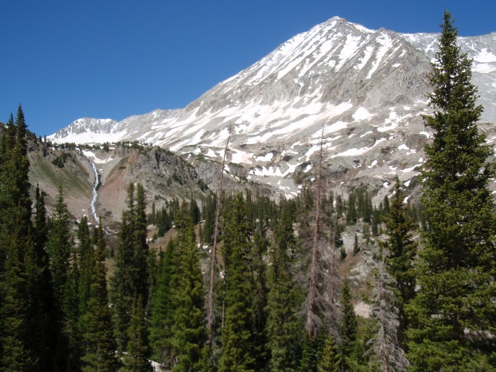
The trail was long on the way out; we were all tired. A last look at the west slopes. Back to the cars, 12 hours round trip.
We all agreed that the west slopes was a long time to be "on". Everbody was tired, legs were shaky, and we had 3 minor injuries. A pulled leg muscle, and two bruises on legs. I didn't notice mine until we got back to the car, and I couldn't wiggle my right foot without pain.
I am glad to have completed Snowmass, and liked seeing most of it from both sides. Roach is not kidding when he says it is shorter, but not necessarily easier. My legs were more tired from this 9 miles than the 18 miles on the failed trip a few weeks back. However, there was a lot of good scrambling on the rib, the scrambling on the ridge was "spicy", and it felt good to push past my hesitations on this route.
Thumbnails for uploaded photos (click to open slideshow):
That looked like a blast! Awesome scrambling route. It looked harder than a Class 3.
I hiked Belford/Oxford with a friend yesterday and am feeling it today :( Deb couldn‘t go with us because she was rafting with her family. We are getting excited about 14ers this summer. Maybe we can hook up for a mountain on one of your trips in town.
Sounds like we all had one! You and your group made solid work of that route. It was nice meeting you.
Really like the pic of us with crampons on the slope; thanks for sharing. Also like the one of your descent route. We wondered where you had gone. I have a few of you and that avalanche runout I can send.
Sounds like a long enjoyable day. Thank you for the route detail and many pictures. A group of us are planning on climbing Snowmass either in mid-July or September and have not settled on which approach to take. Your report is good input and thanks for sharing.
Sure enjoyed our hike together; and thanks for putting together such a great trip report. Glad you didn't include a pic of someone (hehe) struggling with the 1st-time glissade. Looking forward to our next hike in a few short weeks. (BTW, TerryLiv, although I was not driving it, my friend who was said that the Fird did surprisingly well; no bottom-drags on the way up and only 1 or 2 on the way back down. Summary, a cakewalk compared to taking 2 Escapes up S. Colony Lakes road years ago before that road was improved!)
Way to stay with it and summit! That‘s definitely a sporty route with a correctly labeled spicy ridge run to the finish. Thanks for including that shot of me heading to N Snowmass - it looks awesome. Congrats to the group on making the summit. I look forward to seeing you up high again sometime.
Caution: The information contained in this report may not be accurate and should not be the only resource used in preparation for your climb. Failure to have the necessary experience, physical conditioning, supplies or equipment can result in injury or death. 14ers.com and the author(s) of this report provide no warranties, either express or implied, that the information provided is accurate or reliable. By using the information provided, you agree to indemnify and hold harmless 14ers.com and the report author(s) with respect to any claims and demands against them, including any attorney fees and expenses. Please read the 14ers.com Safety and Disclaimer pages for more information.
Please respect private property: 14ers.com supports the rights of private landowners to determine how and by whom their land will be used. In Colorado, it is your responsibility to determine if land is private and to obtain the appropriate permission before entering the property.


")
")
")
")
")
")
")
")
")
")
")
")
")
")
")
")
")
")
")
")
")
")
")
")
")
")
")
")
")
")