Download Agreement, Release, and Acknowledgement of Risk:
You (the person requesting this file download) fully understand mountain climbing ("Activity") involves risks and dangers of serious bodily injury, including permanent disability, paralysis, and death ("Risks") and you fully accept and assume all such risks and all responsibility for losses, costs, and damages you incur as a result of your participation in this Activity.
You acknowledge that information in the file you have chosen to download may not be accurate and may contain errors. You agree to assume all risks when using this information and agree to release and discharge 14ers.com, 14ers Inc. and the author(s) of such information (collectively, the "Released Parties").
You hereby discharge the Released Parties from all damages, actions, claims and liabilities of any nature, specifically including, but not limited to, damages, actions, claims and liabilities arising from or related to the negligence of the Released Parties. You further agree to indemnify, hold harmless and defend 14ers.com, 14ers Inc. and each of the other Released Parties from and against any loss, damage, liability and expense, including costs and attorney fees, incurred by 14ers.com, 14ers Inc. or any of the other Released Parties as a result of you using information provided on the 14ers.com or 14ers Inc. websites.
You have read this agreement, fully understand its terms and intend it to be a complete and unconditional release of all liability to the greatest extent allowed by law and agree that if any portion of this agreement is held to be invalid the balance, notwithstanding, shall continue in full force and effect.
By clicking "OK" you agree to these terms. If you DO NOT agree, click "Cancel"...
How to Make Culebra Hard Without Really Trying
Culebra Peak 7/10/2010
The simple answer to making Culebra challenging is to hike in a dense fog and to never consult a map, guidebook, or printed route, all conveniently left in the car because the hike would be "obvious". This is after we had read that there really is no trail to follow. We all felt foolish.
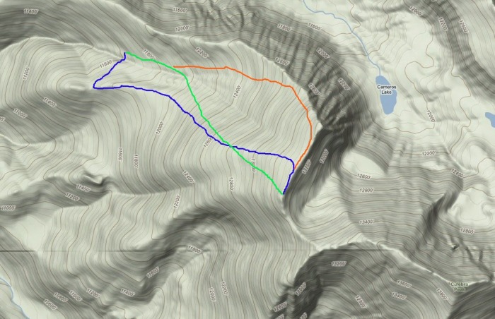
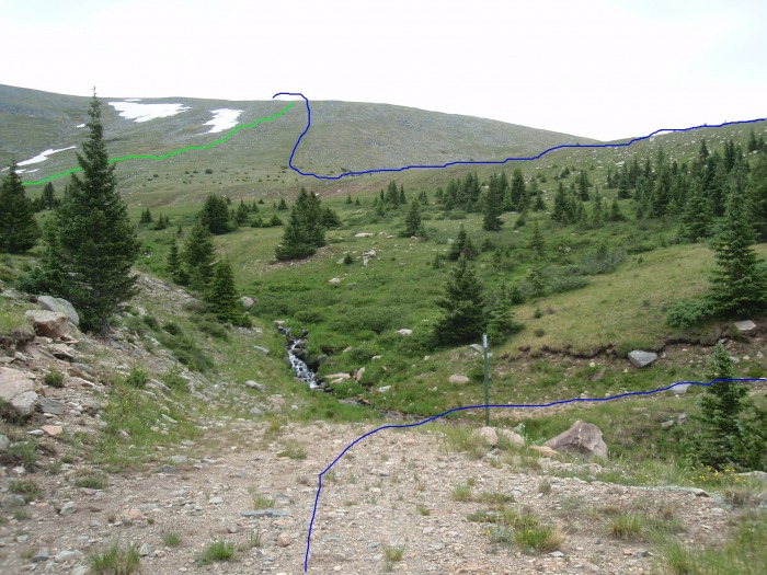
We ended up on the "Roach Route" by accident and route description memory (blue) and came down a shortcut traverse (green) to the correct route (red). I wish we could say we planned it, as it was pleasant and avoided a long sidehill traverse on the ascent, but it was by accident. Once on the ridge, we were on the correct route to the summit.
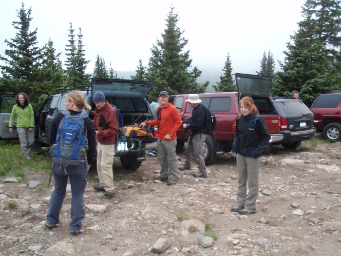
A group of hiking buddies from Missouri and Oklahoma invited me on their Culebra trip and I quickly said yes. We met up in San Luis on Friday night, had dinner, and then sat in the hallway of the San Luis Inn drinking beer and reading over the information before heading to bed. Side note: The San Luis Inn is much larger and nicer than I ever would have expected.
We woke up Saturday morning and left the hotel at about 5:15am, arriving at the gate at probably 5:40am. We chatted a bit with other hikers, met Otina (bergsteigen) and Darrin (kansas) and waited for 6am for the gate to open. Once inside, we paid our money, waited for the shotgun start and had a great hoody discussion with Otina and Darrin.
Most folks drove up to the upper trailhead, parked and readied for the hike.
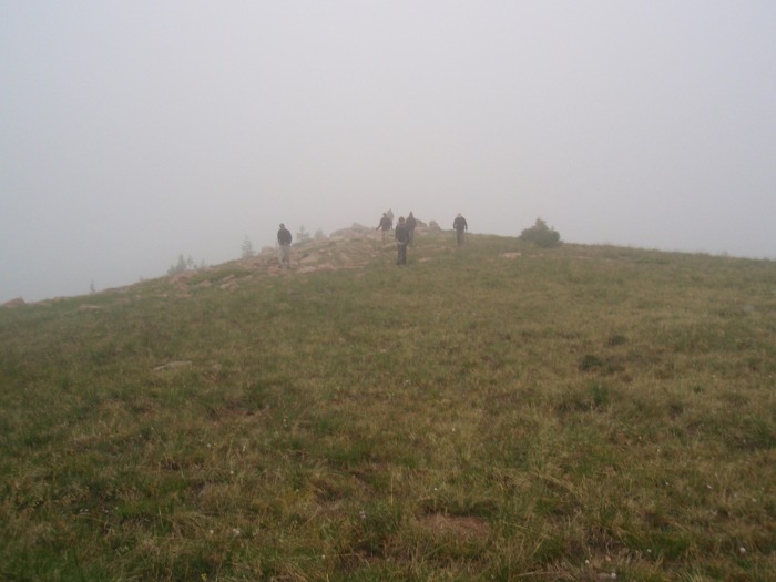
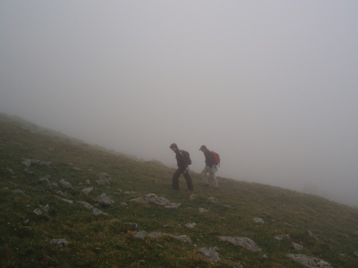
We were the first ones out of the gate, and we so confidently walked downhill to the creek and then up the road to the south, that nobody yelled to us that we were not on the right trail. After reaching a small saddle, the road turns left and drops down below tree line. We realized our mistake, and traversed up and to the left to gain a ridge/bump and took that all the way to the upper correct ridge.
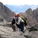
Just starting out on the faint ridge before joining the Roach Route
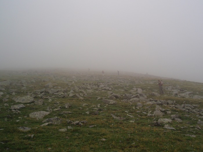
A few other folks had followed us; we hoped we weren't leading them astray
Taking a break, with no clue how much farther up to the ridge
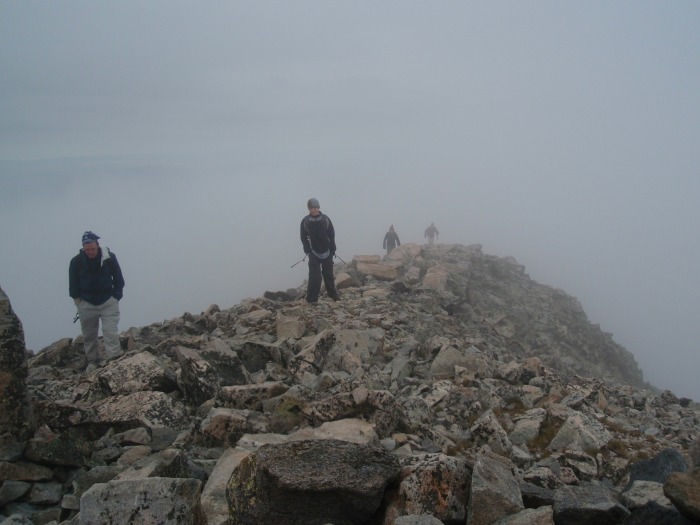
Here the fog lifted a bit and we could see a ways up the slope
Finally we topped out on the ridge, not much to the left (north) of the cairn. It was nice to see that we were back on route.
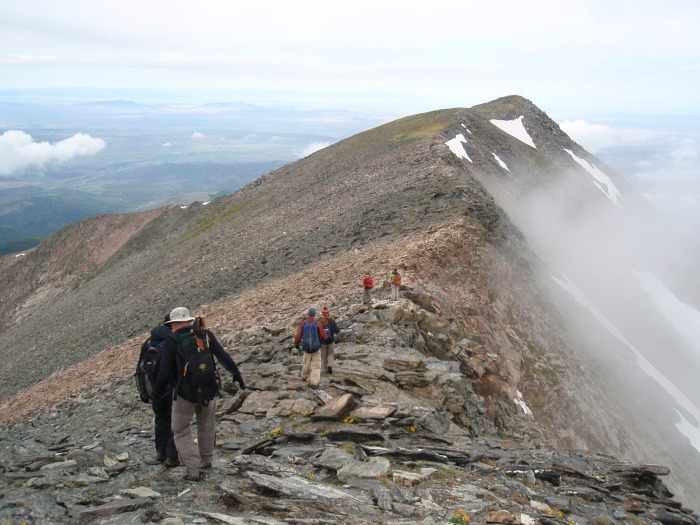
Looking across the saddle toward the false summit pitch
And heading up
I like this shot looking back on a portion of the narrow ridgeline
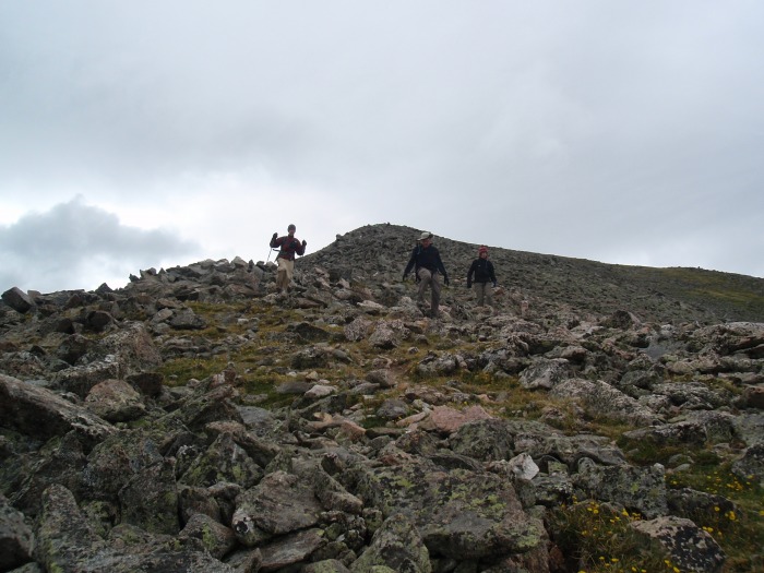
We had passed several humps on the way up, and by the time we got here, folks were resting and we thought it was the summit. Again, the route description would have helped. So we are resting/snacking....
...and snapping photos. You can see the dark mass forming behind (and ABOVE) Andrew. Just after snapping this, I informed everyone we were not on the summit.
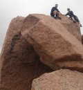
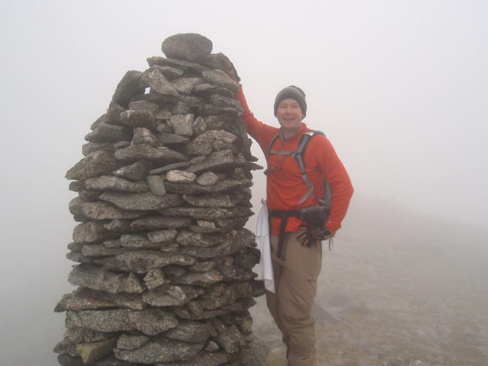
So we all packed up and made good time to the true summit.
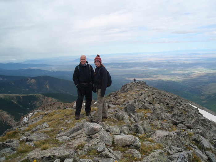
The early summit crew. Those tall thin rocks around the summit looked in the fog like people from the false summit. We were first up, but it looked like everyone was waiting on us.
As the clouds blew off, we started back down. It was interesting to see how curvy the ridge is. It is hard to appreciate when wandering in the fog
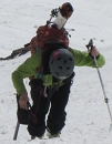
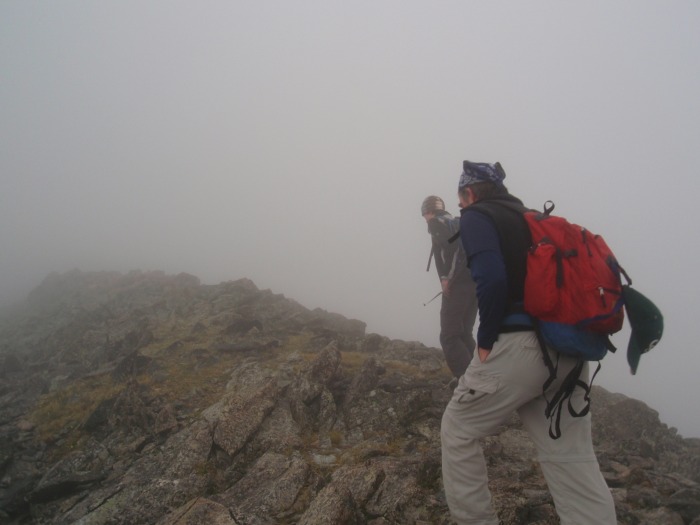
Catching up to Darrin and Otina
The way back to the false summit had some really easy walking
Nice view of the valley
And working our way down the rocky/grassy sections
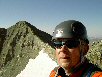
Not quite victory yet
This shot shows our ascent in blue, descent in green, and the approximate standard route.
And back at the cars, we could see our route up (blue) and down (green). The standard route would be off to the left.
It took us a little over 4 hours round trip from the upper parking area, including about 20 minutes at the false summit and 20 minutes at the real summit. It was a very easy hike up to the ridge and following the ridge line around was very fun. Hiking in the fog added to the excitement, and made some of the photos a little better, some a little worse.
My thought is that the $100, in the overall amount of money spent on gear, gas, hotels, etc for the 14er quest is a small amount. It was a good time, with good friends and I was glad to be there.
Thumbnails for uploaded photos (click to open slideshow):
Hey, great trip report! We didn‘t know whether we were exactly on route either, so thanks for leading the way! (We were the ones right behind you - great pic, thanks for including my friend and I in the one of the ”few other folks who followed us up.”)
It was fun to have the added challenge of the fog, and great to meet some people from my fellow hometown of Broken Arrow, OK...small world!
Great to meet you and your crew on Saturday! Too bad I still had to put my boots on, or else we would have hiked with you. You missed some glorious sunny weather by hiking too fast. :wink: It was clear by the time we returned from Red Mountain.
I think I read in the rules no dogs, no guns. The thing that was interesting is that I think that kids under 18 were $50 versus $100. So if you have a teen that is interested, get them out there quick.
I think the way you came down is the way we used both ways last year - but we didn‘t have the adventure of hiking in fog. So you started higher up than Four-Way?
Caution: The information contained in this report may not be accurate and should not be the only resource used in preparation for your climb. Failure to have the necessary experience, physical conditioning, supplies or equipment can result in injury or death. 14ers.com and the author(s) of this report provide no warranties, either express or implied, that the information provided is accurate or reliable. By using the information provided, you agree to indemnify and hold harmless 14ers.com and the report author(s) with respect to any claims and demands against them, including any attorney fees and expenses. Please read the 14ers.com Safety and Disclaimer pages for more information.
Please respect private property: 14ers.com supports the rights of private landowners to determine how and by whom their land will be used. In Colorado, it is your responsibility to determine if land is private and to obtain the appropriate permission before entering the property.


")
")
")
")
")
")
")
")
")
")
")
")
")
")
")
")
")
")
")
")
")
")