Download Agreement, Release, and Acknowledgement of Risk:
You (the person requesting this file download) fully understand mountain climbing ("Activity") involves risks and dangers of serious bodily injury, including permanent disability, paralysis, and death ("Risks") and you fully accept and assume all such risks and all responsibility for losses, costs, and damages you incur as a result of your participation in this Activity.
You acknowledge that information in the file you have chosen to download may not be accurate and may contain errors. You agree to assume all risks when using this information and agree to release and discharge 14ers.com, 14ers Inc. and the author(s) of such information (collectively, the "Released Parties").
You hereby discharge the Released Parties from all damages, actions, claims and liabilities of any nature, specifically including, but not limited to, damages, actions, claims and liabilities arising from or related to the negligence of the Released Parties. You further agree to indemnify, hold harmless and defend 14ers.com, 14ers Inc. and each of the other Released Parties from and against any loss, damage, liability and expense, including costs and attorney fees, incurred by 14ers.com, 14ers Inc. or any of the other Released Parties as a result of you using information provided on the 14ers.com or 14ers Inc. websites.
You have read this agreement, fully understand its terms and intend it to be a complete and unconditional release of all liability to the greatest extent allowed by law and agree that if any portion of this agreement is held to be invalid the balance, notwithstanding, shall continue in full force and effect.
By clicking "OK" you agree to these terms. If you DO NOT agree, click "Cancel"...
Note: I was focused quite a bit on the traverse, so the report is lacking some photos.
A few of my friends were working to finish the 14ers this week, with the Wilson group as the last three. It seems that a summer traverse via the "safest" routes leaves interesting decisions about camping, timing, etc. We decided to attempt as a day trip from the Kilpacker trailhead. We agreed on a 2:30am start.
The approach into Kilpacker basin was straightforward. There was quite a bit of moisture on the plants, and they pressed into the trail, getting our legs wet. I was trying to go light, so I planned to filter water above the first waterfall. There is a second waterfall up there, and I left the trail to filter a bit below there. I probably walked 1/8 mile over to the creek (traversing) and had to gain a few hundred feet back to the trail (straight up). Turns out that very near the exit from the basin, the creek is quite close and I could have filtered there with much less hassle.
The trail thus far was relatively easy to keep, and the cairns were visible with a good headlamp. The left exit up the slopes is at a smallish flat area, probably the area filled with snow in Bill's photo #15.
The initial trail up the east slope was pretty well marked and traveled. I was glad to have a good headlamp, as there was some searching for cairns, but they were there. It also helped to have a full moon, as we could see many of the features all the way up the mountain.
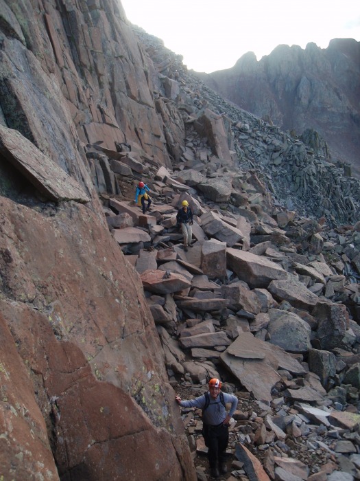
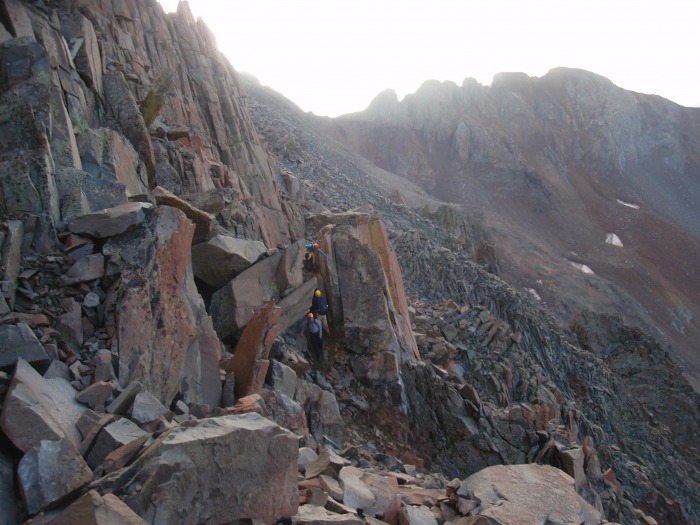
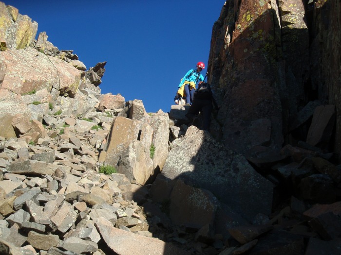
We wound our way up, left, right, and left around the rock features and over to the red rib prior to the gray gulley. Up to this point, the trail was rocky and a bit loose, but no different than many other 14er trails and not difficult at all. After rounding the red rib, we began to ascend into the gray gulley. Here is was steeper and looser, and we all felt this was the first real place to mind rockfall. We spread out across the slope and all ascended semi solid ribs.
Climbing the gray gulley gave us a preview of the next few hours of our day. Mostly solid rock, with some loose pullers and loose rock on top. We called out loose rock often, but made our way up under the cliffs with no problems. We saw somebody coming off El Diente, so we were quick to get up to the route.
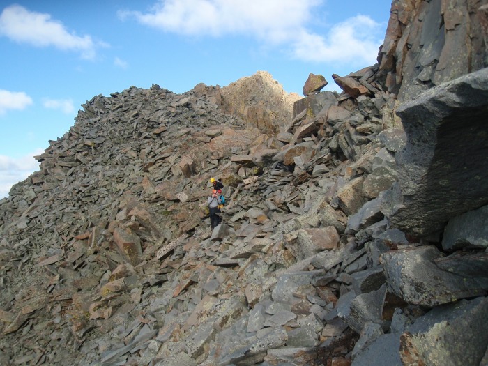
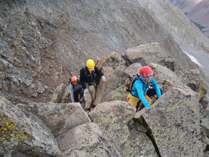
Traversing across the south side toward El Diente was mostly fun. There was some scrambling, but mostly just carefully making way across the loose rock
We all thought the gully back to the ridge was loose, and we all stayed very near the right edge where the rocks seemed a little more locked. Here we are coming out of the top of the gully onto the ridge.
There was a lot of wet dirt on the north side, and I thought that this was the toughest part of the climb to El Diente, just because of the loose nature and no real way to avoid it.
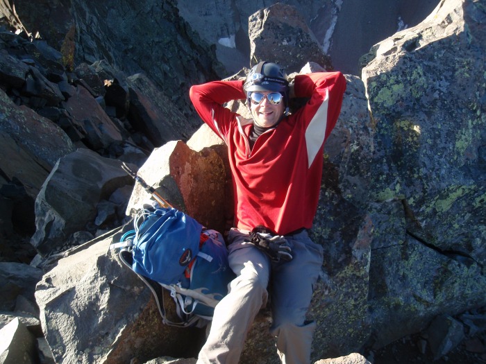
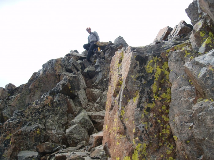
Above this area, we were at the top, arriving at about 7:30 am. We quickly rested, and were on our way in about 15 minutes. Here is me relaxing just off the summit
So now officially on the traverse, we made our way back down the north side, and here we are dropping into the gully back down the south side.
Some of the loose stuff we were crossing on the south side; I believe before crossing the gendarmes
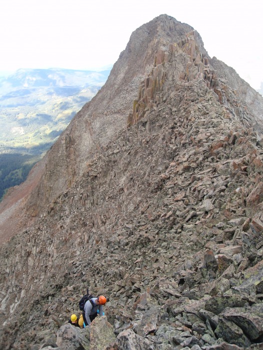
I didn't get any photos from the gendarme crossing, as my hands were full. There were cairns marking a route; I presume the route, but there was plenty of exposure. We made our way around and were soon on our way back to the ridge.
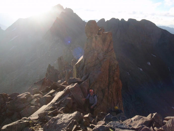
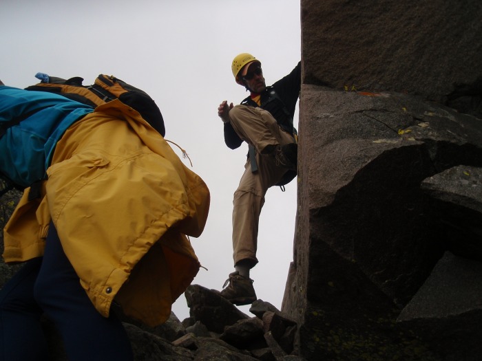
The long easy stretch of ridge was a welcome relief; it was easy and wide enough that mostly I didn't need to put a hand down. We came to the downclimb before the crux.
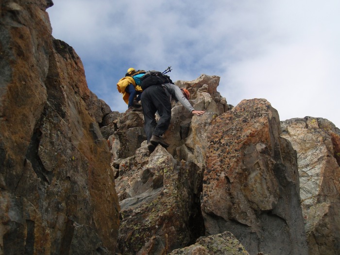
Again, no photos from climbing up the crux, but we stayed in the gray rock depicted in Bill's photo. The next few shots are us topping out on the ridge and climbing the ridge to the top. The left exit depicted in Bill's route seemed pretty key.
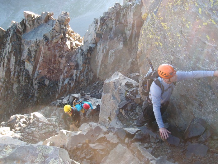
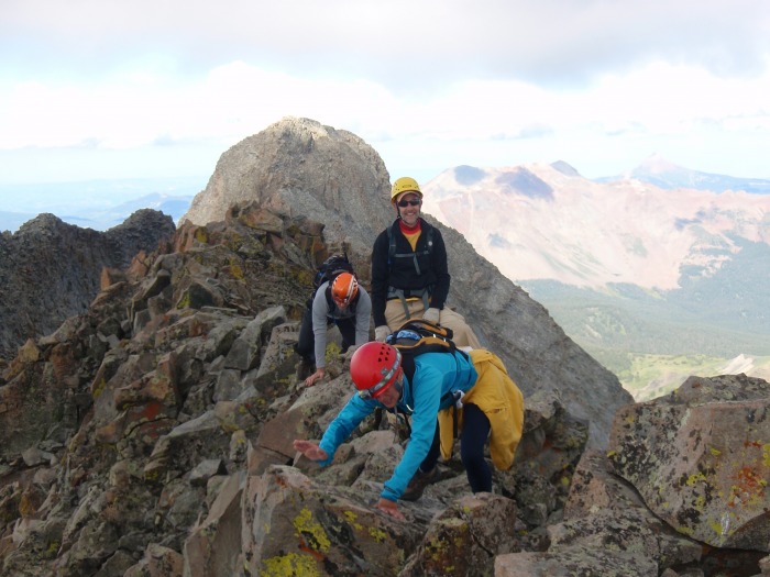
Up on top, and now across the narrow area. Some of the rock on top was loose (surprise), and the exposure was considerable. Most of my way across this area was using all fours, except for Dan, at least for the photo.
To me, all of the downclimbs on the traverse were challenging. It seemed that we would walk up to the end of the ridge and it would drop away into nothing. Without climbing up, we were guessing on the easiest way down. All of the ways that seemed right were doable. Here is Dan coming off the narrow ridge.
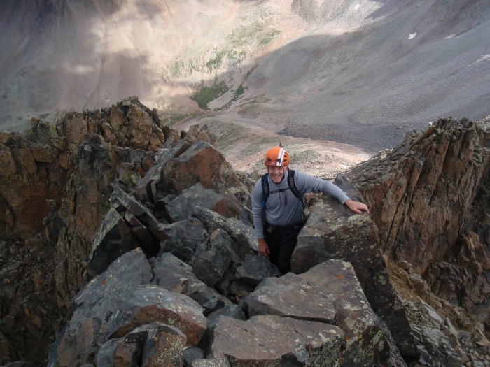
Looking back on the area where you drop to the north of the steep rock
From here, you could cross steep dirt, as shown in Bill's photo #38. Since the dirt was wet, we went high and right back up to the ridge line, then dropped down into the saddle. This seemed a bit more secure.
The gully up to the summit ride was uneventful and we soon found ourselves climbing the final bit of ridge. The ridge was narrow and steep, but anticlimactic after the traverse.
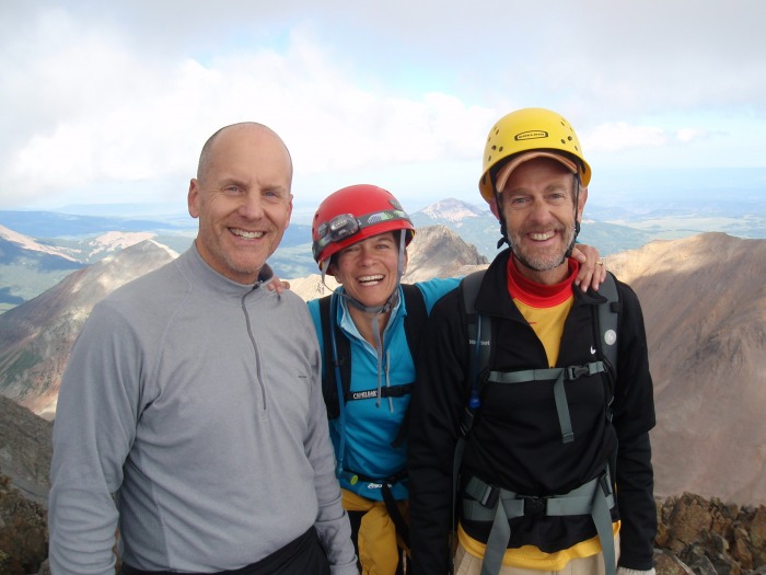
We went through the crux without recognizing what we were on. We all went left. Finally on the Summit of Mt. Wilson, Andrew (left), Debbie, and Dan. Andrew and Dan only lack Wilson Peak to finish.
We traversed in about 2 - 2.5 hrs. We didn't say on Mt. Wilson long as we were hoping for the trifecta. Coming back down the summit ridge.
The downclimb sort of along Mt. Wilsons NE ridge route was nasty. We were all spread out, which was good due to loose rock, but we never really found the trail until we were on the green headwall. This took us a long time, and by the time we got up to the Rock of Ages saddle, weather was coming in so we had to turn around.
This was a LONG day; we were all somewhat dazed when we got back to the car, 15 hours after beginning. I am not sure a camp would have been worth it given the route we chose. I am glad to have these two peaks behind me; they were probably the top on my worry list after completing Little Bear earlier this summer. All that I heard about the loose rock was true; we took great care to identify and avoid the pullers and spread out when the loose rock was unavoidable.
Thumbnails for uploaded photos (click to open slideshow):
We did the exact same thing: no camp, day-trip from Kilpacker. Much more enjoyable. That's a fun traverse, isn't it? Too bad El Diente's such a crumbly mountian. Only a few more for you!
Wasn't aware the traverse had cairns! Aren't the views from El Diente just awesome!? Good shots of Kilpacker to El Diente. I've always wondered what the rock looked like.
Nice work getting this done in a single push but wow, 2:30am. That's brutal! :P
I did the traverse on Aug 21 from camp at Navajo Lake. We went up the Northeast Ridge Route and did Mt. Wilson first and then traversed over to El Diente. Route finding was problematic if not difficult - obvious where to go, but not not so obvious on how to get there safely, given the loose rock. You were 110% correct to stop with weather concerns - these peaks are no place to be in weather. I think Mt. Wilson and the traverse is underestimated by many - not me, having done it!
Congratulations!
Caution: The information contained in this report may not be accurate and should not be the only resource used in preparation for your climb. Failure to have the necessary experience, physical conditioning, supplies or equipment can result in injury or death. 14ers.com and the author(s) of this report provide no warranties, either express or implied, that the information provided is accurate or reliable. By using the information provided, you agree to indemnify and hold harmless 14ers.com and the report author(s) with respect to any claims and demands against them, including any attorney fees and expenses. Please read the 14ers.com Safety and Disclaimer pages for more information.
Please respect private property: 14ers.com supports the rights of private landowners to determine how and by whom their land will be used. In Colorado, it is your responsibility to determine if land is private and to obtain the appropriate permission before entering the property.


")
")
")
")
")
")
")
")
")
")
")
")
")
")
")
")
")
")
")
")