| Report Type | Full |
| Peak(s) |
Mount Peale - 12721 |
| Date Posted | 09/08/2010 |
| Modified | 09/10/2010 |
| Date Climbed | 09/05/2010 |
| Author | kaiman |
| Labor Day In The La Sals Day 1 - Blown Around On Mount Peale |
|---|
|
Mount Peale Elevation - 12,721 feet Route - Southwest Ridge Total Trip Time - 6 hours Round-Trip Distance - 6 miles Elevation Gain - 2,600 feet Maps Used - Trails Illustrated #703 - Manti La Sal Introduction Located near Moab, Mount Peale is the high point of San Juan County and the La Sal mountain range. The La Sals are the second highest mountain range in Utah after the Uintas and rise over 8,000 feet above the surrounding desert. La Sal means "The Salt" in Spanish and the mountains were named by the Dominguez/Escalante Expedition in 1776. Mount Peale was named for Albert Peale, a mineralogist on Ferdinand Hayden's survey team between 1871-1877. I had been eying the La Sal mountains for years as I hiked/biked in the Moab area. During a visit to Arches and Canyonlands last October, however, I decided it was time to attempt to climb some of these peaks. Originally I had intended to climb Mount Peale as a warm-up snow climb this spring. Unfortunately due to the heavy winter and downed trees blocking the La Sal Pass road, the Forest Service didn't have the trail head open until mid-July by which time I was already well into the swing of climbing here in Colorado. So I put the idea on that back burner for awhile and focused on bigger peaks closer to home. A Plan Is Hatched However, when the idea of going to Moab over Labor Day arose during a discussion with my wife, I jumped at the opportunity suggesting we should do some climbing. Fast forward a month or so and Saturday found us driving through stands of aspens up the beautiful La Sal Pass Road. Arriving around 7 PM we quickly found a spot to pitch the tent, set up camp, ate some dinner, and settled in for the night. With a forecast of sunny and 92 degrees with 0% chance of precipitation in Moab I decided we could set back our usual "alpine start" time a bit and set the alarm for 5:30 hoping for a 7 AM departure. Around 1 AM I woke up from a deep sleep to the sound of the wind blowing the tent and trees pretty hard. I realized I had forgotten about the wind warning I had seen in the forecast and wondered whether this would affect our climb. Beginning The Ascent The next morning we woke to crystal clear skies, but as the sun rose, it was evident that the wind was definitely picking up. "Oh well" I thought "we'll just have to deal with it..." Right on schedule we left the La Sal Pass Trailhead (10,125 feet) just after 7 AM. Aiming for the long south facing gully to the west of Mount Peale's summit, we began hiking northeast through the lower meadows above La Sal Pass.   After about a quarter mile, we reached the ridge crest, entered the trees and searched for an obvious pathway. After traversing east for a couple of minutes, we soon discovered one, and began to follow a game/climbers trail as we wound our way through a flat area in the evergreens stepping over numerous downed trees along the way as the trail began to descend through aspens towards the base of the mountain.   In another quarter mile we broke out of the aspens into the upper meadows and had our first look at the remainder of the route up Mount Peale: 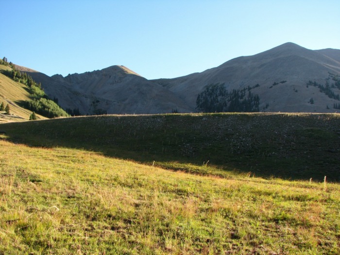  Climbing The Gully Here we continued to follow game/climbers trails, descending northwest across a large meadow before entering the trees and beginning to climb steeply through the rocks up the hillside towards the base of the gully.  At around 10,700 feet we reached the base of coulior and began our ascent. The first 300-400 feet of the gully were the steepest with an approximate angle of 30-35 degrees. Around 11,000 feet the angle began to ease as we climbed the upper half of the gully for an additional 1,000 feet to reach the ridge around 12,000 feet.   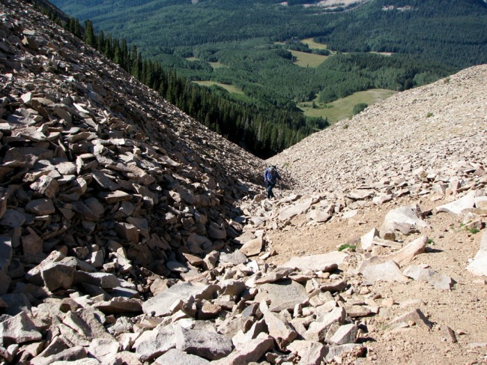 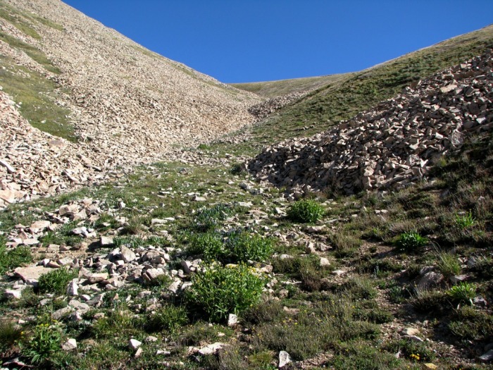 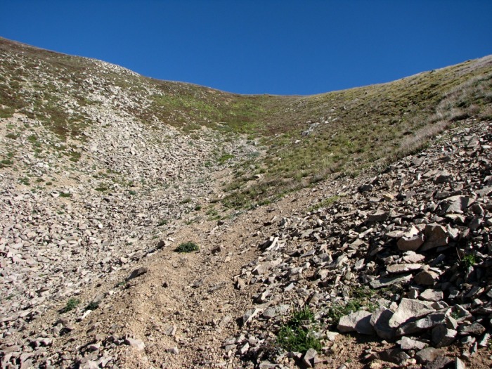 Word to the wise: DON'T LEAVE THE GULLY UNTIL JUST BELOW THE RIDGE. IT MAY LOOK QUICKER, BUT IT'S NOT! Although we had several opportunities to leave the gully before it reaches the saddle (on faint trails that climbed steeply towards the summit ridge), our two attempts to do so led us straight into steep pancake stacked talus and steep scree covered grass where we were forced to retreat to the lower part of the gully and continue climbing toward the ridge. Finally around 11,900 feet, we reached an area where the slope was stable enough that we could leave the trail and head towards the summit ridge.  The Wind Picks Up During this time, however, the wind had begun to pick up steadily and as we ascended the coulior it became stronger and stronger until the point where we reached the grassy slopes just below the ridge we were facing strong gusts of around 40-50 miles per hour. Unable to move very far without losing our balance, we finally sat down just below the summit ridge, and braced ourselves while we donned our hats, gloves, and jackets and contemplated our future. Headed For The Summit After a few minutes of discussion my wife decided to turn around because she was getting chilled and didn't feel like fighting the wind anymore. I couldn't blame her, but felt like I was up to the challenge. So as she headed back down, I continued to climb along the ridge at a fast pace, pausing only to brace myself against the wind and quickly snap pictures. With the wind was blowing up valley I felt fairly safe as long as I didn't get to close to the ridge crest. Had it been blowing down valley I might have been inclined to turn around for fear of being blown off the south side of the mountain. As it was, however, with my gear strapped down and my extremities covered, I decided it was safe to go on. Soon I had traversed around the narrowest part of the ridge and was headed toward Mount Peale's false summit. From here I continued on a well-worn trail to the south of the false summit, and 20 minutes later I was looking at the final slope.   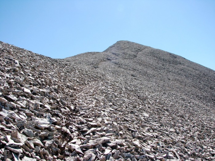 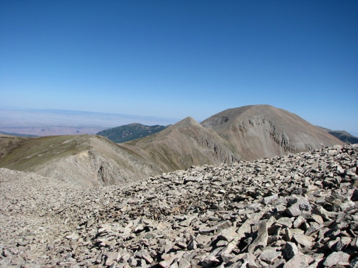 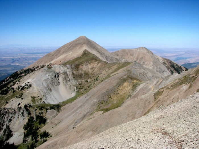  After another 5 minutes of climbing over talus and around large rocks I reached the summit proper. Luckily it had a 3/4 wind shelter where I was able to sit for a couple of minutes, snap a few photos, and get a quick drink while I watched summit rocks shift and buzz as the wind pounded them. A summit photo:  The Descent Not wanting to stay on the summit too long (and with the wind encouraging me to leave), I stowed my camera, cinched down my gear and was soon beginning my descent, pausing frequently to brace myself against the gusts and keep my balance on the loose talus. After about 15 minutes, I arrived at the place where we had stopped earlier and began to zigzag steeply down the scree covered grass slope into the gully below. By the time I was halfway down the coulior, the wind had died down quite a bit and I was able to slow my pace down and enjoy the rest of the descent to the base of the gully where my wife was waiting. Here we spent a few minutes chatting and eating lunch before heading back to camp to relax and prepare for our second climb the next day... Notes All in all this was a great climb and good introduction to the La Sal Mountains. Had the wind not been present, our ascent would not have taken on such epic proportions and been much more enjoyable. I would like to come back and attempt the gully as a snow climb as it seems like it would make the route easier (especially the scree/grass covered upper half). For anyone interested at making a first climb in the La Sals I think the Southwest Ridge route on Mount Peale is a great option. Thumbnails for uploaded photos (click to open slideshow):  Mount Peale catches some early morning sun")
 The lower meadows above La Sal Pass with South Mountain (11,817 feet) in the background")
 Reaching the entrance to the trees")
 Descending through the trees towards the bottom of Mount Peale")
 Breaking out of the trees with Mount Peale on the right and the famous")
 A closer look at our lower route from the upper meadows (we ascended the obvious gully in the center of this picture)")
 Nearing the base of the gully on Mount Peale")
 The beginning of our ascent up the western gully on Mount Peale")
 A view of the gully from about half way up")
 Another perspective. Looking back down the lower half of the coulior")
 The upper end of the end of the gulley on Mount Peale")
 Reaching the end of the gully")
 Leaving the trail just below the saddle on Mount Peale")
 Looking back down the gully from the summit ridge")
 Traversing around a rugged narrow section of the summit ridge")
 Climbing towards Mount Peale's false summit")
 Mount Mellenthin (12,646 feet) to the north (taken from the false summit)")
 Mount Tukuhnikivatz (12,489 feet) to the west")
 The summit appears")
 The La Sal Mountains to the north, from left to right: Mount Mellenthin, Haystack Mountain, Mount Waas, Manns Peak, and Mount")
|
| Comments or Questions | ||||||
|---|---|---|---|---|---|---|
|
Caution: The information contained in this report may not be accurate and should not be the only resource used in preparation for your climb. Failure to have the necessary experience, physical conditioning, supplies or equipment can result in injury or death. 14ers.com and the author(s) of this report provide no warranties, either express or implied, that the information provided is accurate or reliable. By using the information provided, you agree to indemnify and hold harmless 14ers.com and the report author(s) with respect to any claims and demands against them, including any attorney fees and expenses. Please read the 14ers.com Safety and Disclaimer pages for more information.
Please respect private property: 14ers.com supports the rights of private landowners to determine how and by whom their land will be used. In Colorado, it is your responsibility to determine if land is private and to obtain the appropriate permission before entering the property.